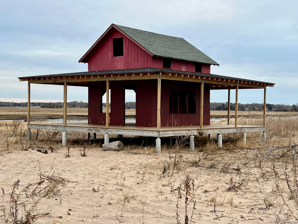
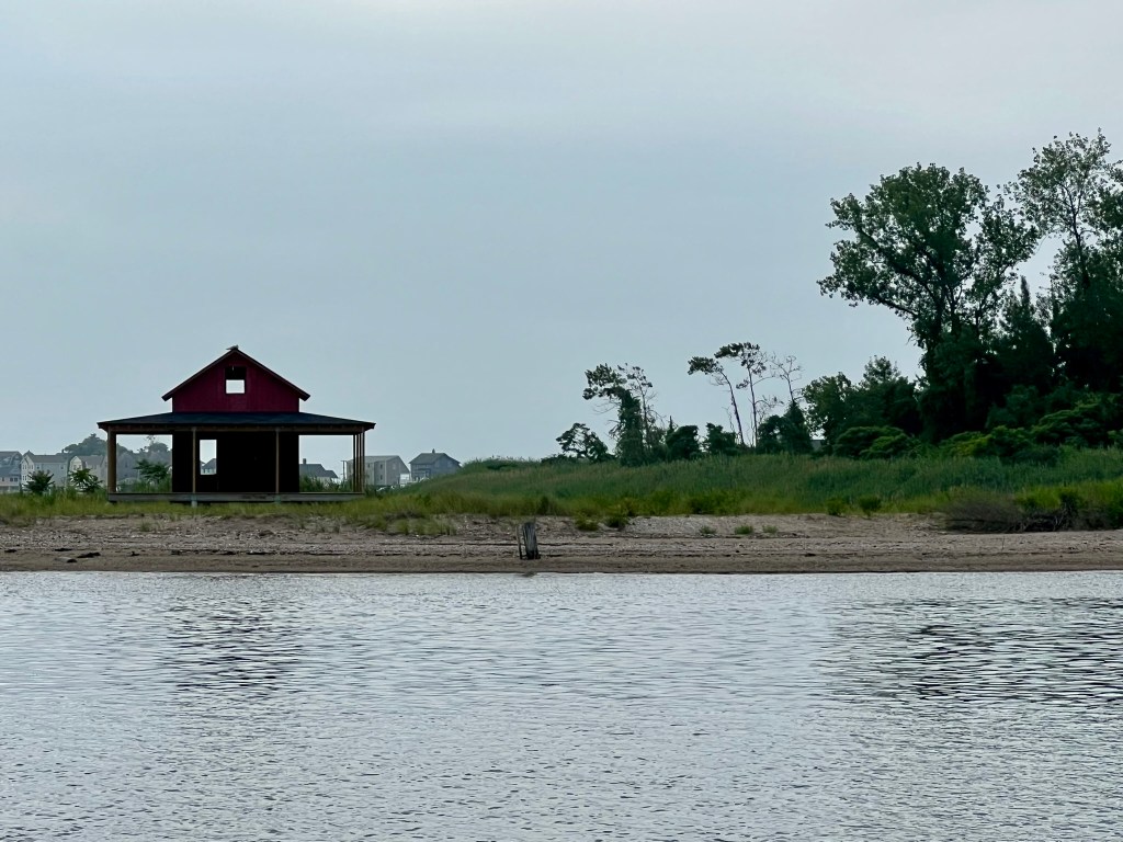
The iconic “Little Red Shack” on Grass Island in Guilford
Summer hiking can be unbearable in the Connecticut woods, with the unsavory combination of heat, humidity, ticks and mosquitoes, so I frequently seek alternate locations for walks in July and August. After the fun I had exploring Chester and Deep River, I felt summer would be the perfect time to explore some shoreline towns, so last summer I set my sights on Clinton and Guilford. While I often research a place before I visit, I enjoy experimenting with the more carefree approach of simply picking a path and seeing what it yields. I often think that with the proliferation of technology we have let slip away the feeling of discovery. We rarely drive down a road to see where it leads without the GPS, for example. Or try a restaurant without first checking the reviews. It is fun to reclaim that exhilarating feeling of discovery. The feeling is real, even if intellectually I know I’m not truly discovering something new. I had this idea in mind when I set out to explore Clinton and Guilford. Along with the town walks I share some lesser known trails in each town.
Clinton, CT
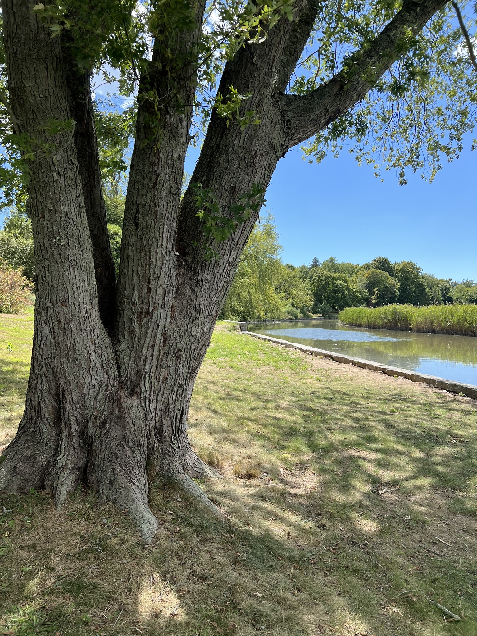
I know Clinton fairly well, so it was easy to plan a walk without consulting the map first. I had already written about the 5 mile Osprey Trail in my Osprey Season Trail Talk in June 2023, so I had a rough idea of the areas I wanted to explore. Last summer I visited Clinton twice, completing similar loops, one of 3.25 miles and another of almost 4 miles.
Clinton Center to Clinton Beach, 3.25 miles.
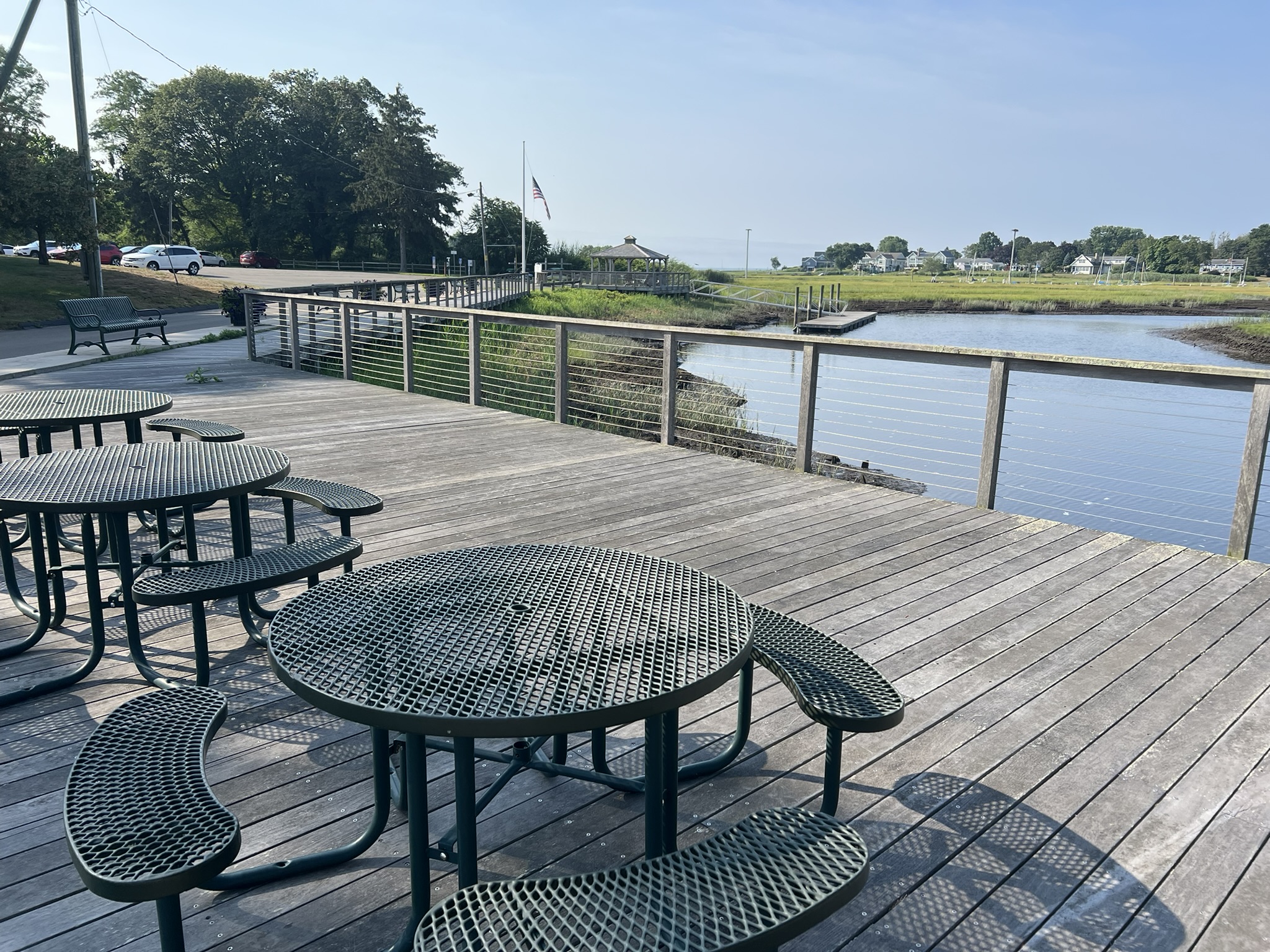
For my first visit I parked on Commerce Street across from the Post Office at the corner with Main Street. Walking east on Main Street, I crossed the bridge where the Indian River flows into Clinton Harbor and took note of some amusing statues on the front lawn of the brick “Civil Preparedness” building. In front of the next building, the Clinton Chamber of Commerce, I spotted a signboard with a street map labeled “A Walk Through Historic Clinton”. Such serendipity! Seeing some picnic tables along the river, I detoured down the driveway between these two building to check them out. Further along the walkway I spotted a boat launch and gazebo at McCusker Landing, a pavilion dedicated in 2014 to the former First Selectman. Along the walkway there is a signboard on the history of Clinton seafaring, which notes that “the first shipyard was built in 1710”, and that by 1876 around 182 merchant ships had launched from town. (The first English settlement in 1663 was called Killingworth. In 1838 the southern portion of Killingworth split off and became Clinton.)
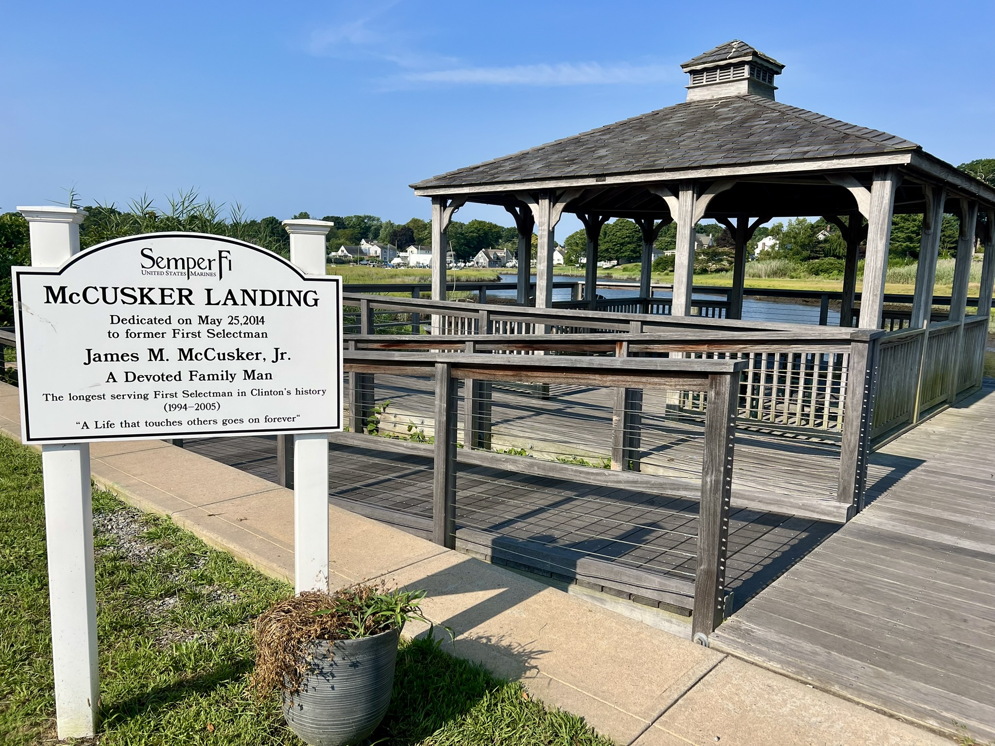
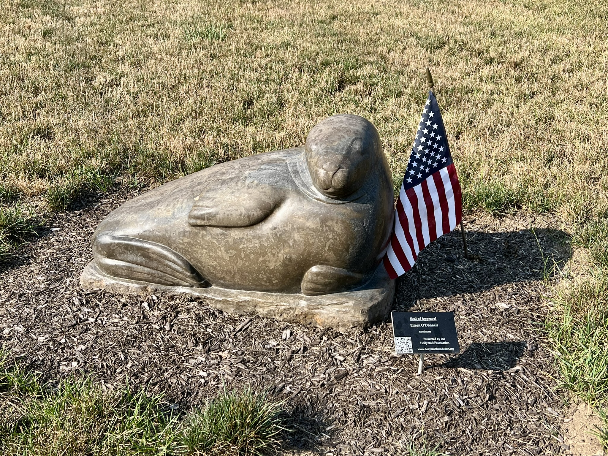
Clockwise from left: The gazebo and dock at McCusker Landing; the “Seal of Approval” sculpture; picnic tables along the walkway near town hall
Turning to cross the Town Hall parking lot I noticed a sign in the southeast corner for the Elliot Preserve.
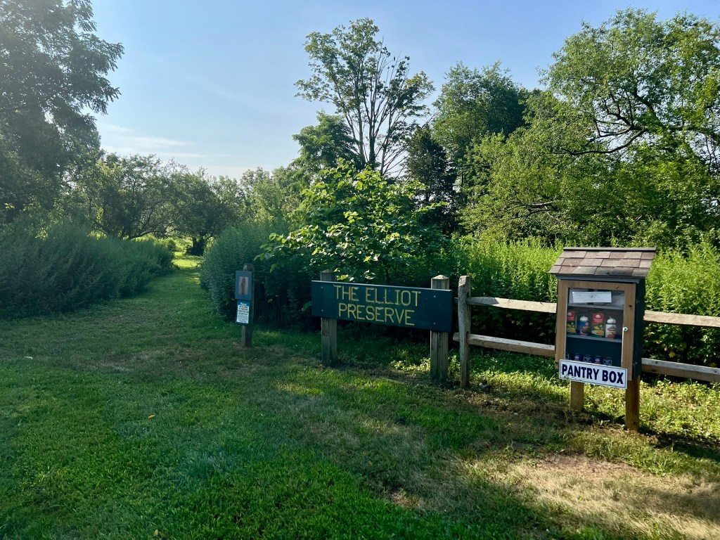
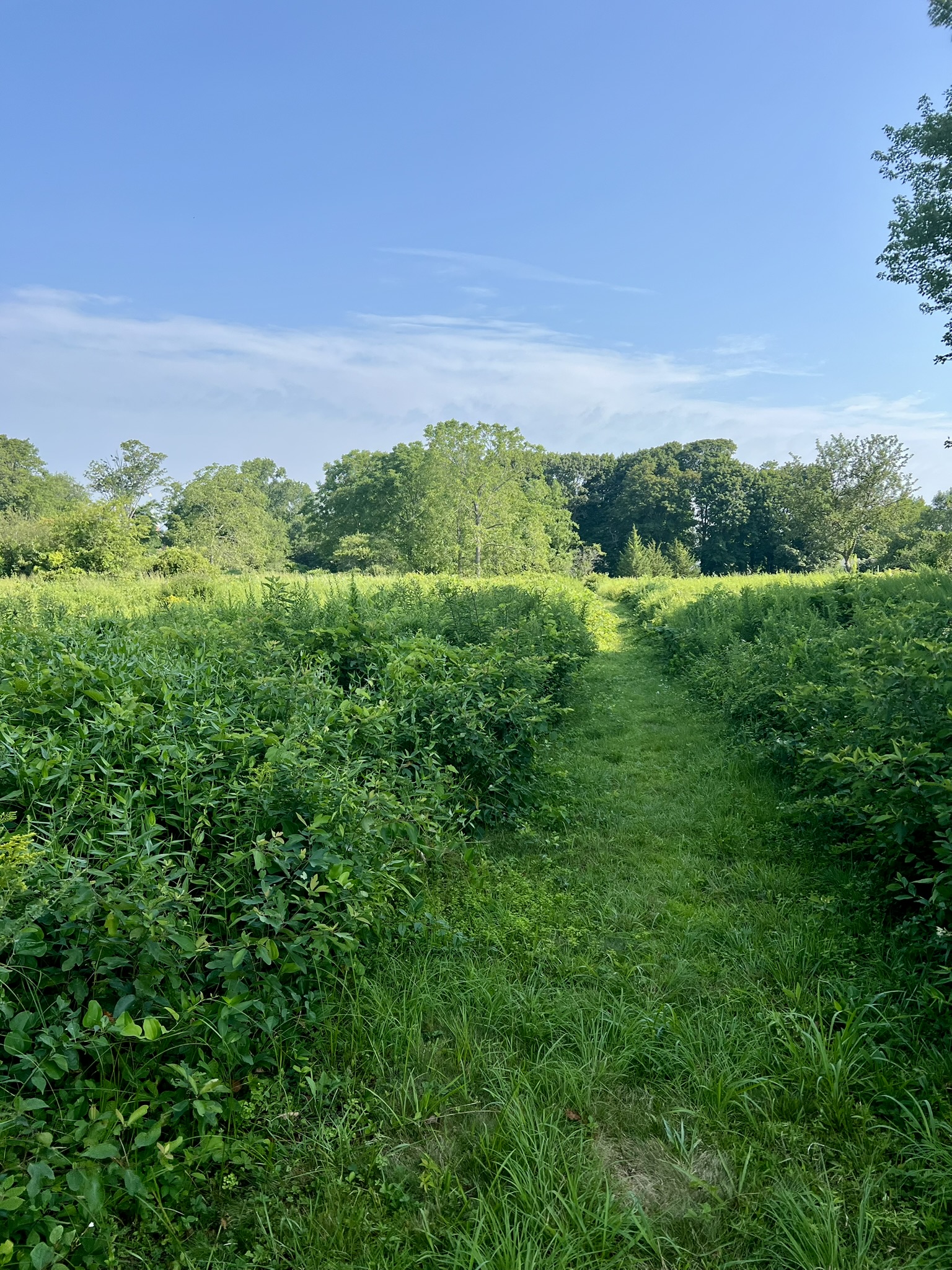
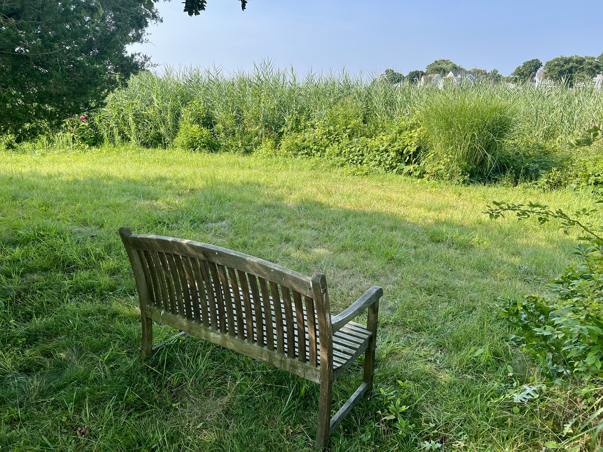
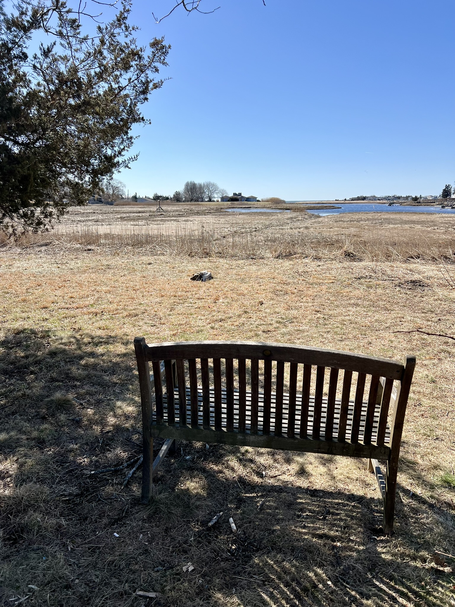
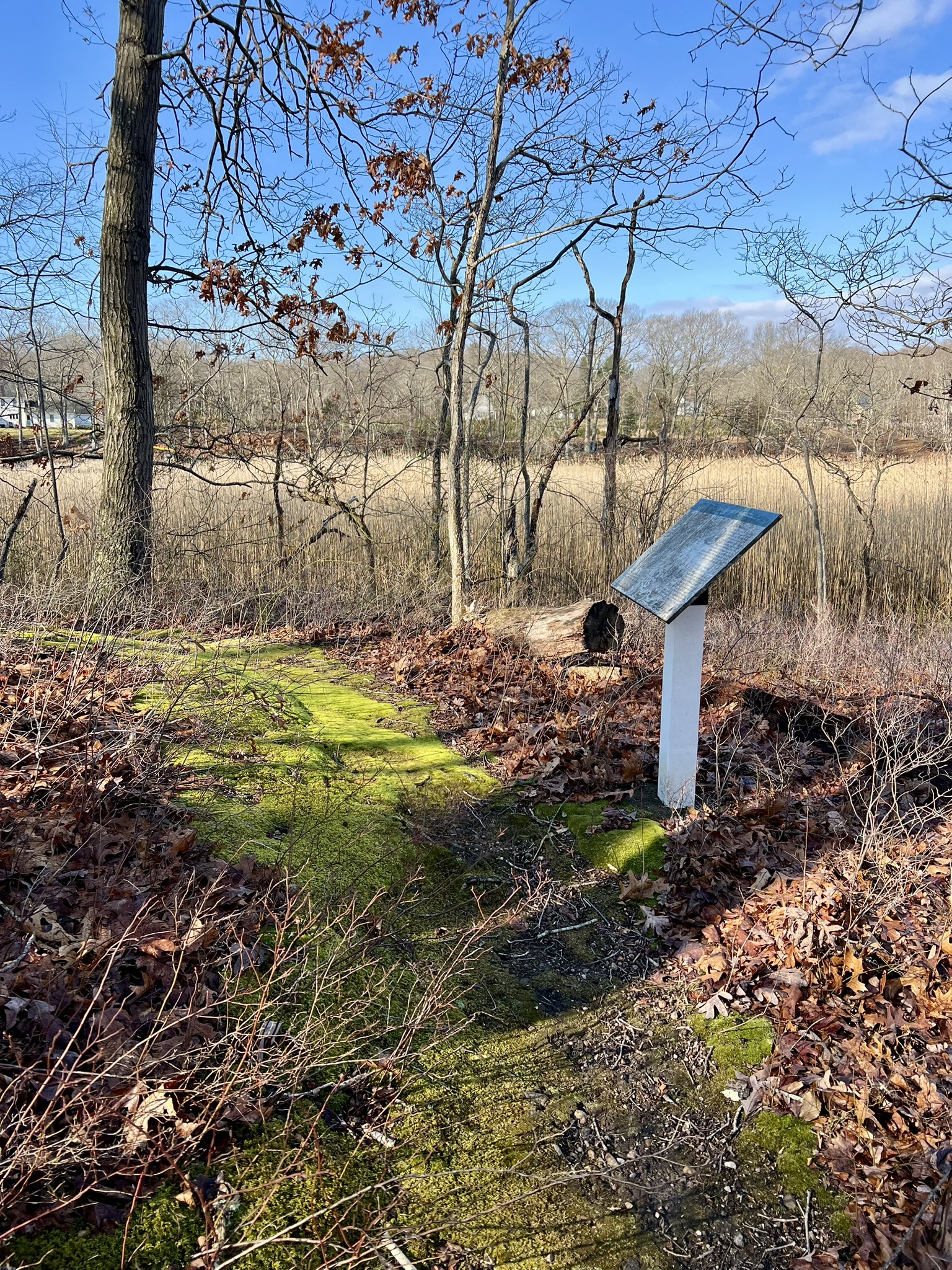
There was a 1/3 mile mowed loop path through the lush August greenery with a contemplation bench at the far point. Reading about the preserve later on, I learned it is 17 acres of open meadow and touts views of the Indian River and Long Island Sound. With the summer foliage the preserve feels more enclosed and there aren’t any views. I returned in early spring of 2026 and it was completely different, with views of the river and sound, and at least three osprey nest platforms, still awaiting the season’s visitors.
The Elliot Preserve in August and in March.
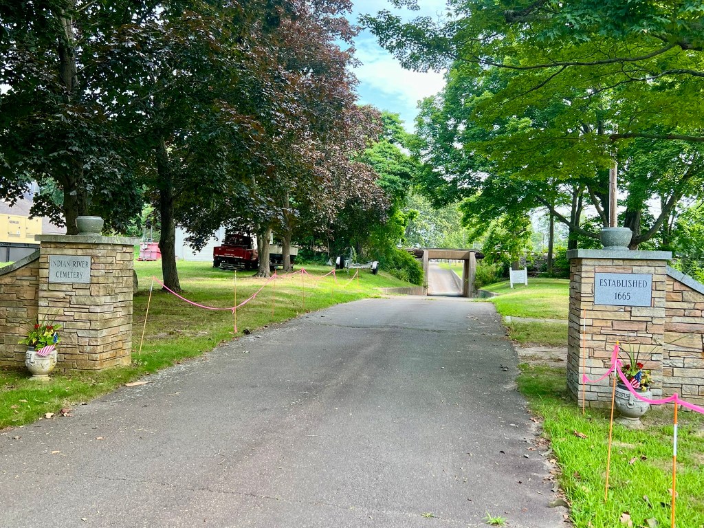
After my nature walk, I continued east on Main Street, taking time to refer to the photo I had taken of the “historic walk” signboard before taking a right on Waterside Lane towards Clinton Beach. Where the road curves upon reaching the harbor there is a small park with benches and a cannon before the bridge. Crossing the bridge, the sign listing the non-resident parking fees reminded me of another benefit of pedestrian travel. I passed the main beach, playground, and restroom facilities before encountering a Nature Preserve with a sign for a Coastal Nature Walk. Saving that for another day, I retraced my steps to Main Street and continued east as far as the Liberty Street green to visit the Civil War Monument. From there, I headed west on Main Street, stopping to read the sign heralding a visit from the Marquis de Lafayette in 1824. In front of the First Congregational Church I paused to admire a massive tree, where there is a resting bench. Further on I noticed the entrance to the Indian River Cemetery, established in 1665, and made a mental note to visit at a later date. As I headed toward my car, I noticed a duplicate signboard for the Historic Walking Tour in front of the “1630 House – Tourist Information” hut.
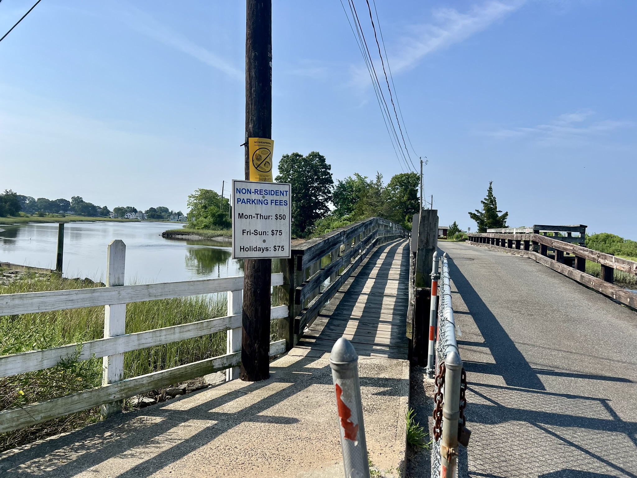
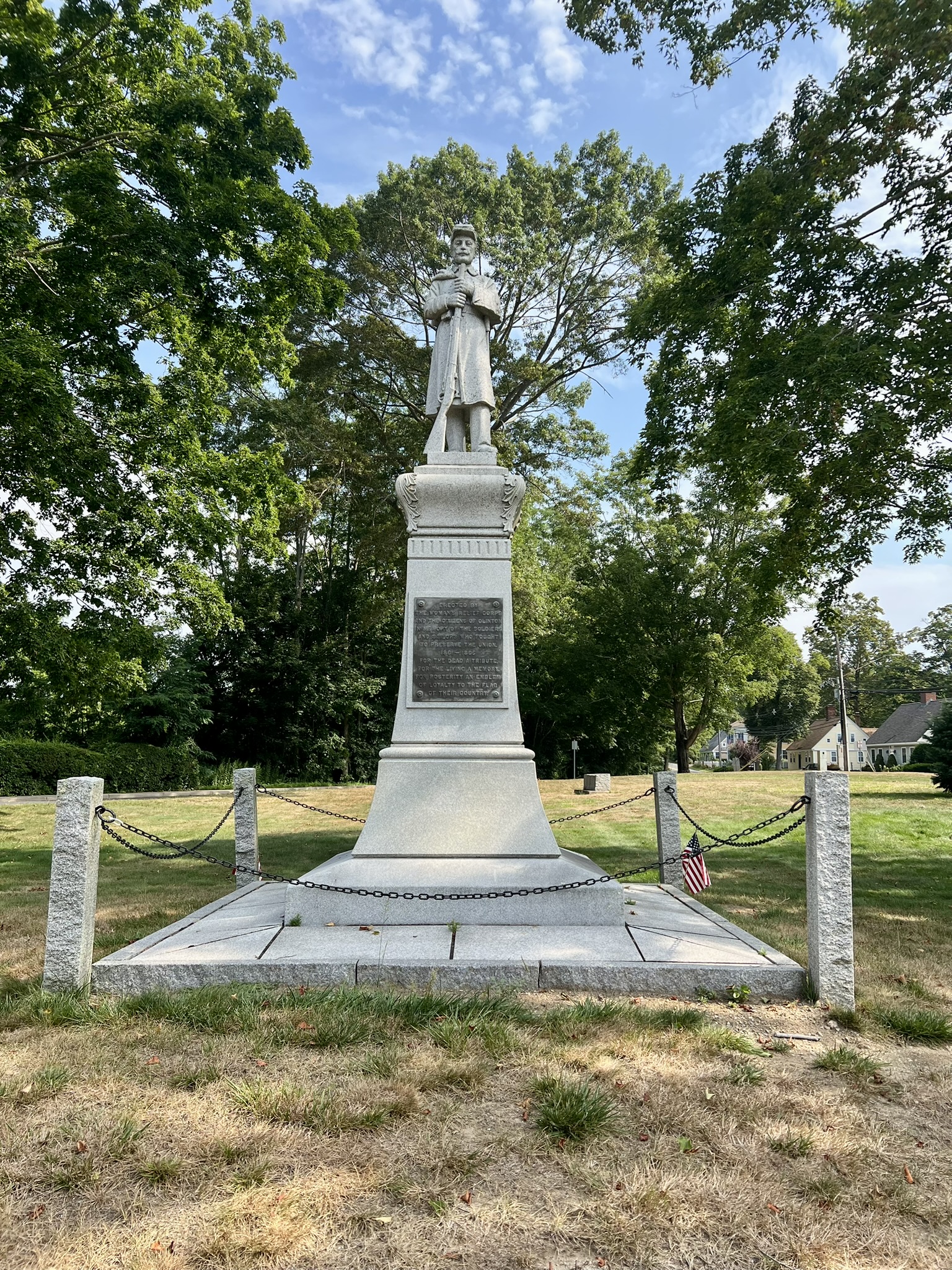
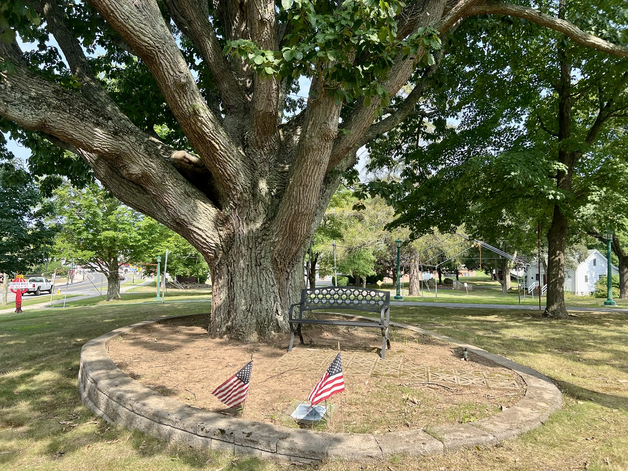
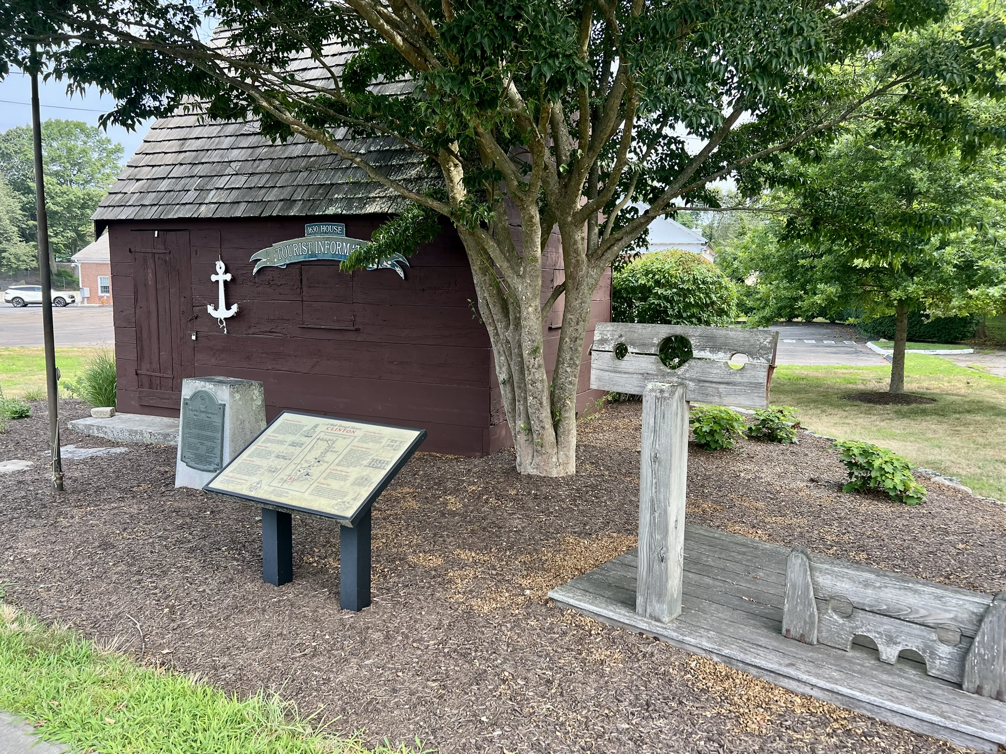
From left to right: the bridge crossing to Clinton Town Beach; Liberty Green Civil War Monument; giant tree with bench; the Historic Walking Tour sign at the information hut
Clinton Town Hall to Clinton Beach and Cemetery loop. 4 miles.
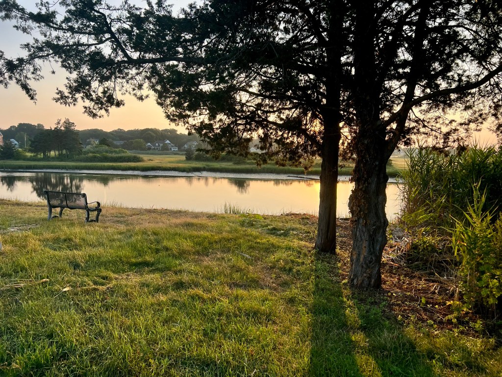
I returned in the early morning a week later for a loop walk incorporating the Coastal Nature Walk and the Indian River Cemetery. This time I parked behind Town Hall and spent a few minutes enjoying the dawn sky over the Indian River and Long Island Sound. From there, I walked back to Clinton Town Beach, just in time for sunrise. On this visit I continued into the Nature Preserve, stopping to read the signboard about the history of the War of 1812 in Clinton, which recounts several of the attacks made by the British over the course of a year.
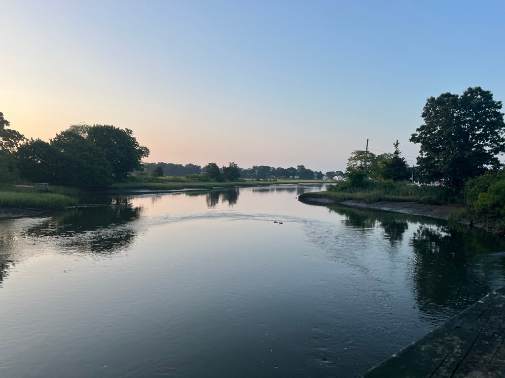
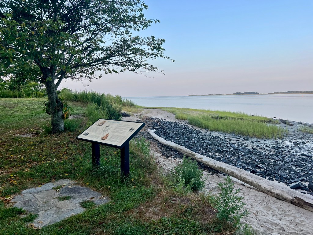
From left to right: View from the bridge; looking east to the sunrise from the nature preserve; the War of 1812 signboard with the sound in the distance
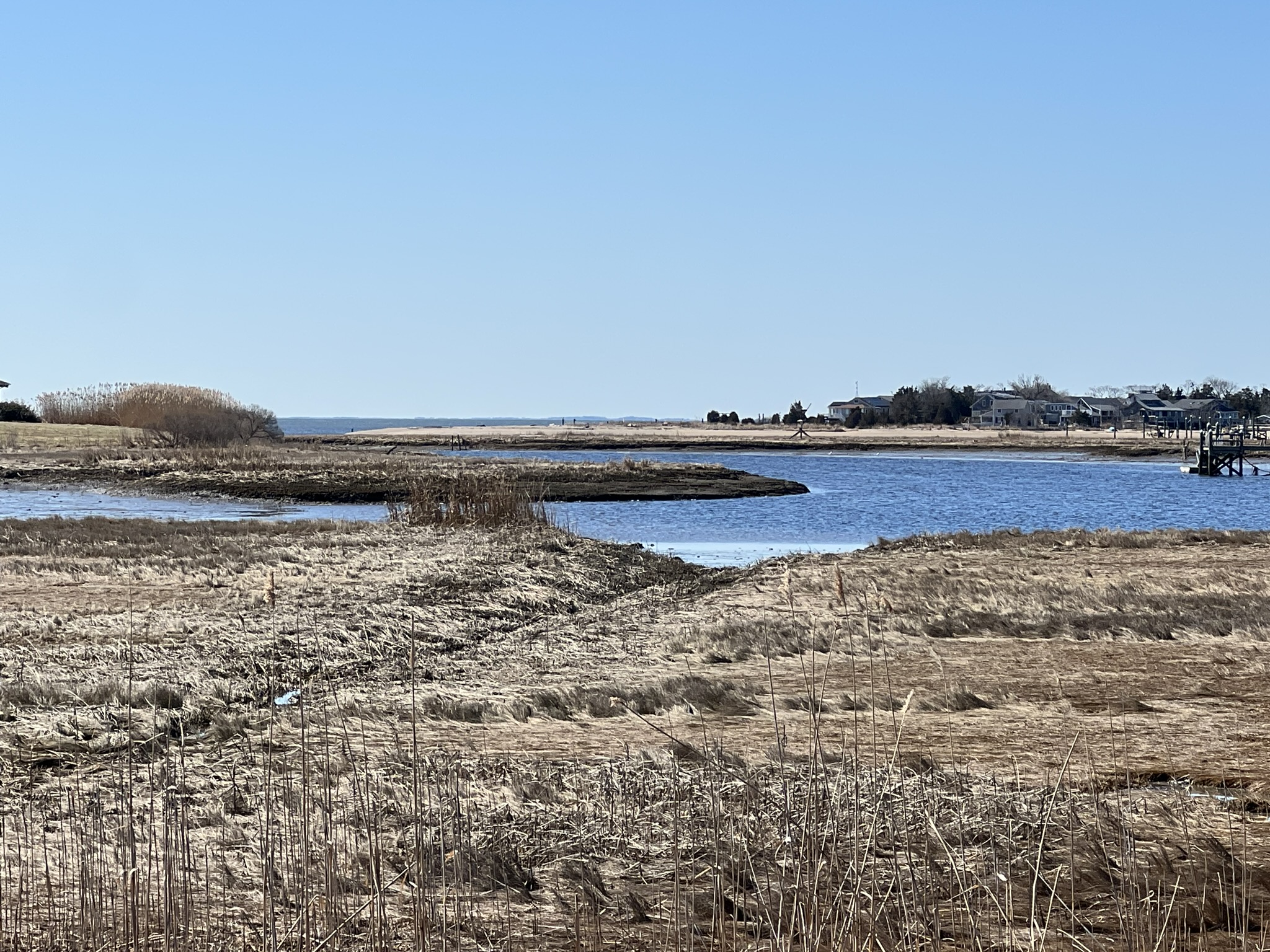
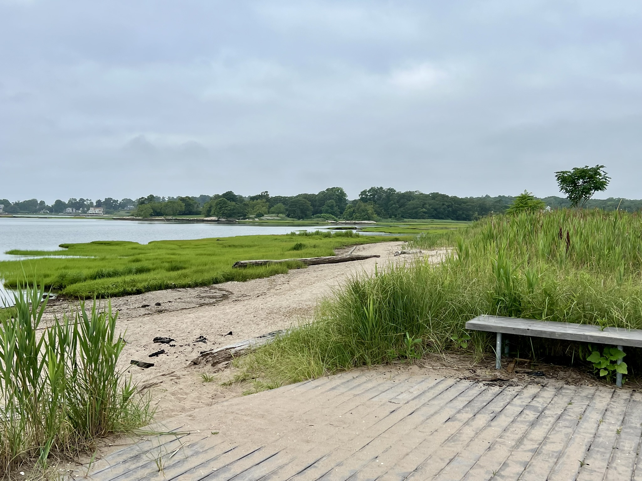
I planned this visit to coincide with low tide so I could walk south along the beach on the narrow spit of land that separates the cove from the marsh to where it pops out on Kelsey Road. Last summer, Beach Park Road was closed for construction, but when it reopens late this year or next year you will be able to walk a longer loop. Instead I turned and took the interior path through the reeds back to the park. This was overgrown and not very pleasant in summer. The wildflowers were pretty but beware the poison ivy! On the plus side, there are many osprey nests.
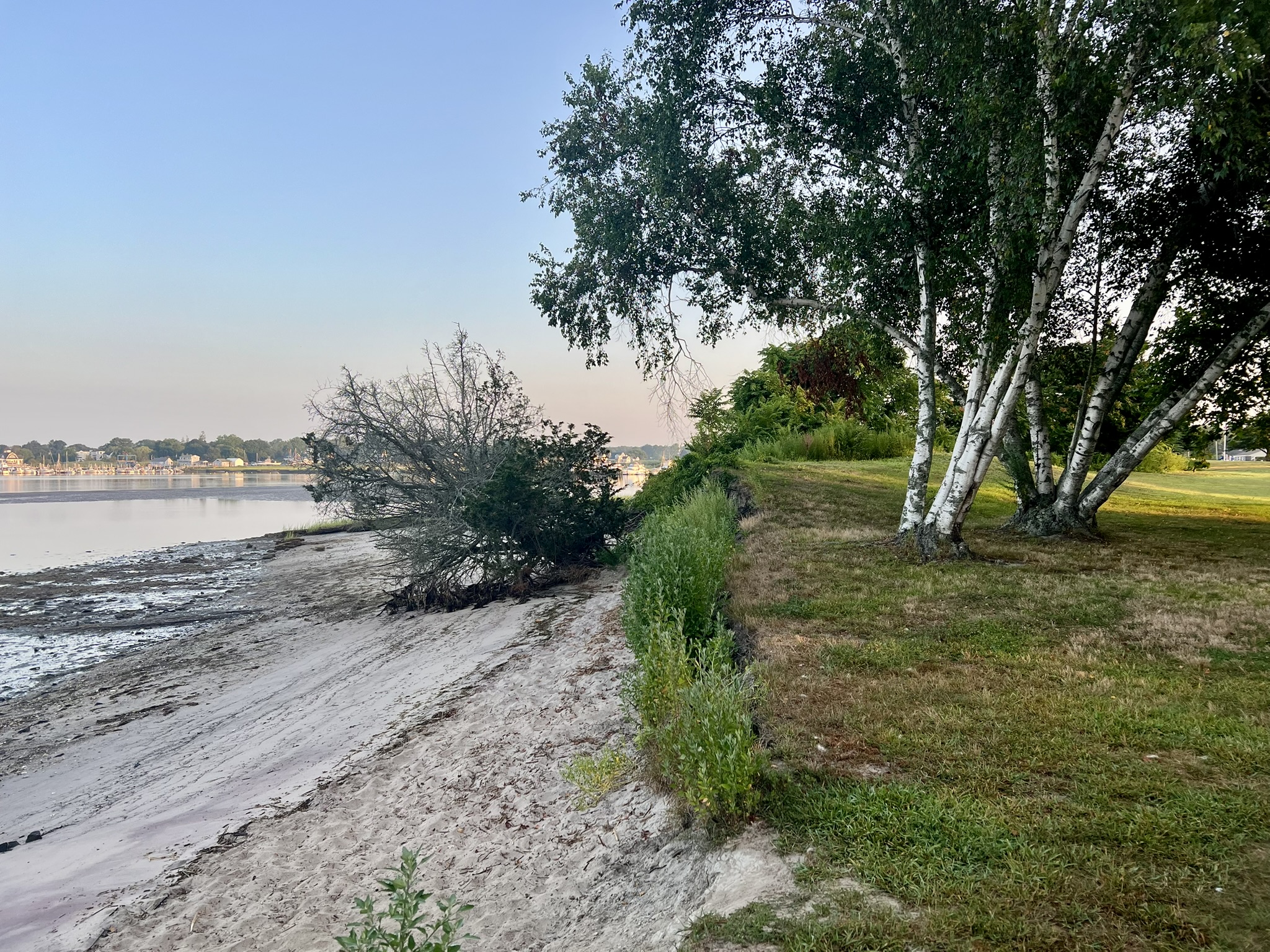
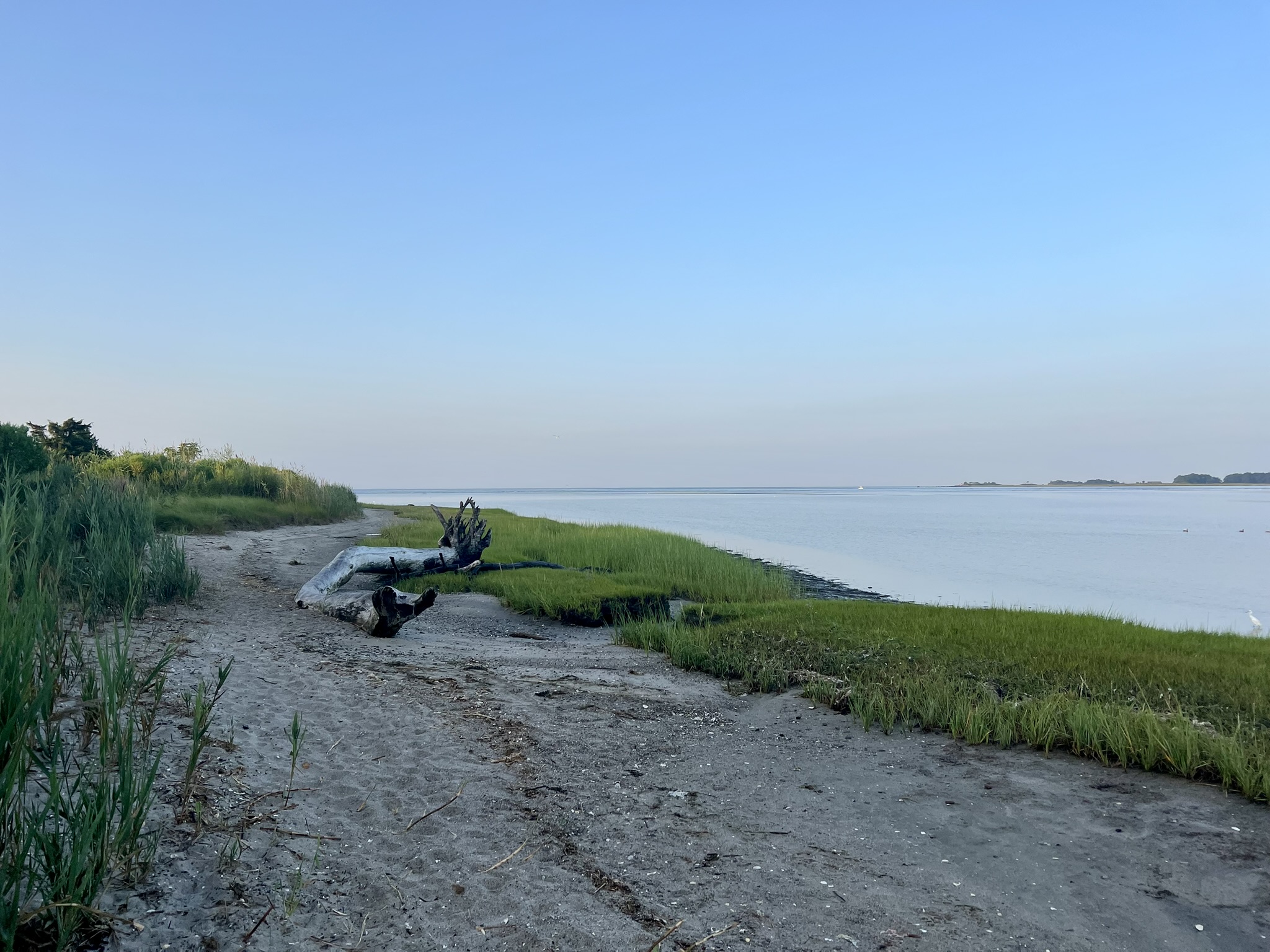
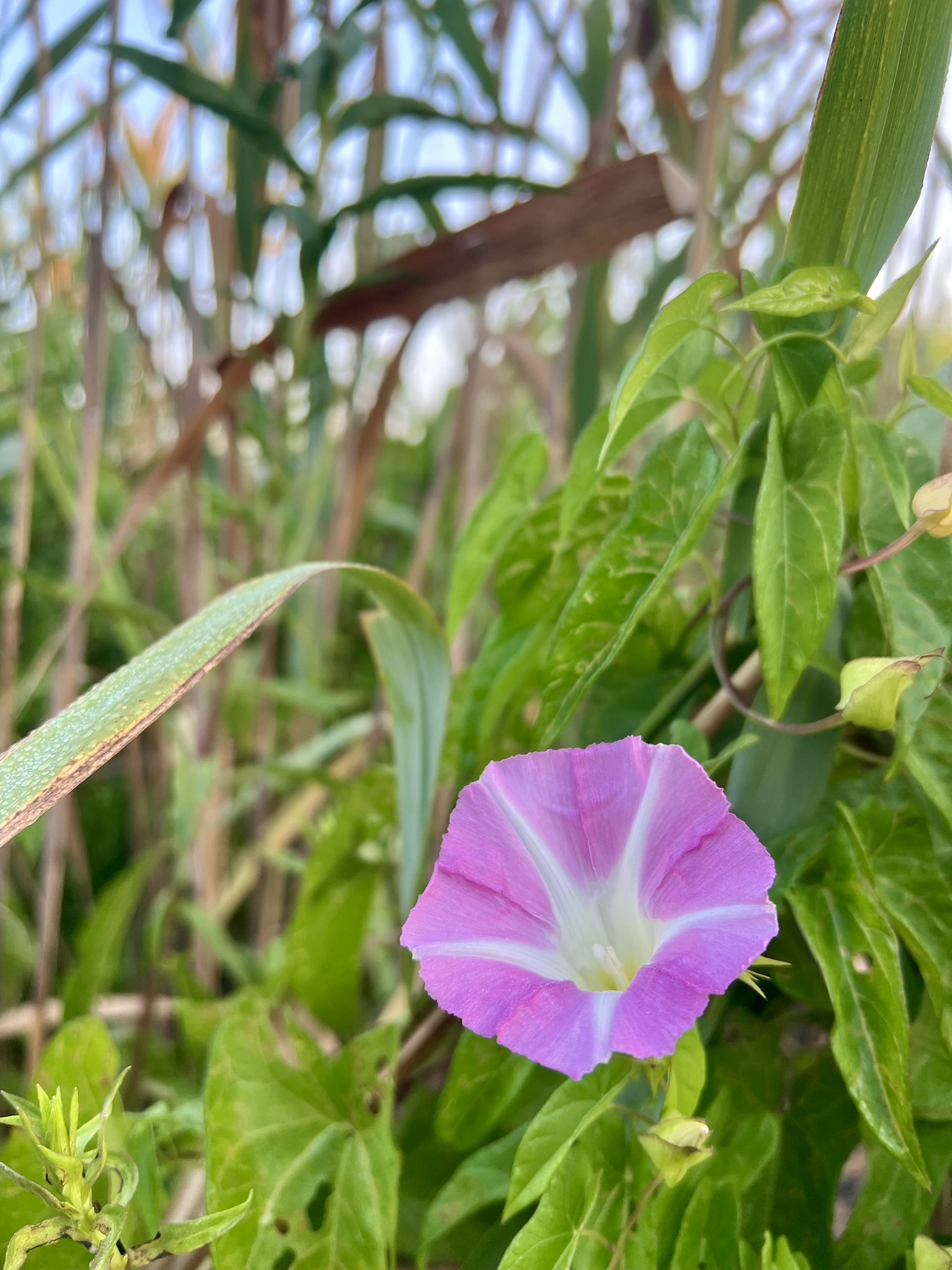
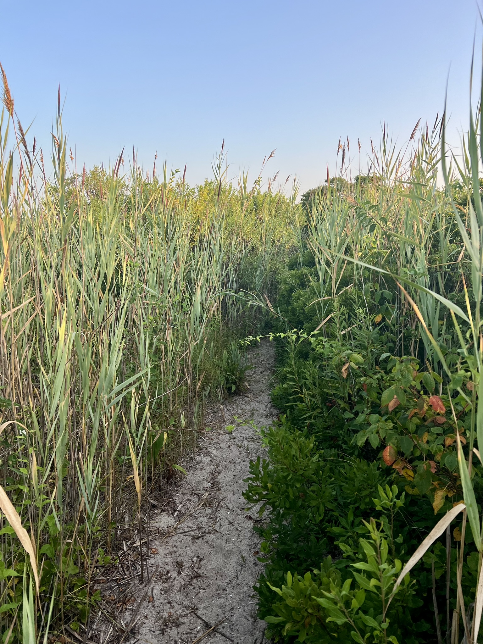
From left to right: Scenes of the beach in both directions; wildflowers and the overgrown path
Retracing my steps to town hall I took a detour to visit the Indian Hill Cemetery, walking a clockwise loop along the cemetery road. At the rear of the cemetery building along the river I paused, spotting a glint of white. When I zoomed in with my small handheld Canon I saw an osprey sitting with its back to me along the river bank. I didn’t notice until reviewing my photo later that a kingfisher was perched nearby. The photo is a bit blurry, but I sacrifice perfect quality for the convenience of carrying my camera clipped to my belt.
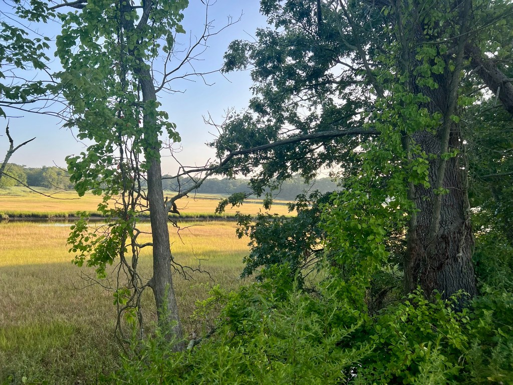
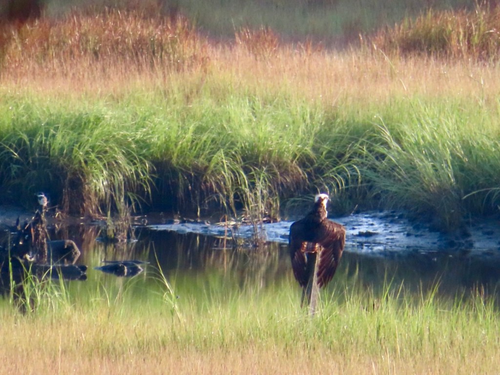
From left to right: Entrance to the Indian River Cemetery; the view of the marsh at a distance; the osprey with a kingfisher perched to the left.
Weiss Loveday Watershed, Clinton. 1.9 miles.
The Clinton Land Trust website describes the Weiss Loveday Watershed as a “combination of four Clinton Land Trust properties that surround a 12.8 acre parcel of Cockaponset State Forest called The Dudley Lot. Together these properties create a 65.79 acre preserve with almost three miles of trails.” This network of trails has parking along River Road. There is a map carved in wood at the trailhead that is more a work of art than a useful navigation guide. Please note that this rendering is not oriented with north at the top, so it will look different from the map on the Clinton Land Trust website. When I visited in the fall of 2024 the trail blazes were sporadic, so AllTrails came in handy as a reference guide. I did a clockwise loop from River Road. If you are comfortable on trails with minimal blazing and using a GPS app to help, this is a pleasant place for a short hike. Along the trail I encountered a sign that read “WEETAMOO’S PATH”. I found this curious, as I had learned about Weetamoo while doing research for my Trail Talk on King Philip’s War. Weetamoo was the female sachem of the Pocasset branch of the Wampanoag tribe in what is now Rhode Island. I reached out to the Clinton Land Trust and learned the delightful story behind this sign. I spoke with Mike Houde, who had been the President of the CLT for fourteen years. He explained that, as a send-off upon his retirement as President, the CLT offered to make a trail sign in his honor with the trail name of his liking. He had just finished a book by Ned Blackhawk entitled The Rediscovery of America: Native Peoples and the Unmaking of U.S. History, and was very moved by Weetamoo’s story. Houde asked that the trail be named after her, with the idea that hikers passing by may wonder about the name and seek out her history. Blackhawk won the National Book award for this 2023 book. I was so glad I asked!
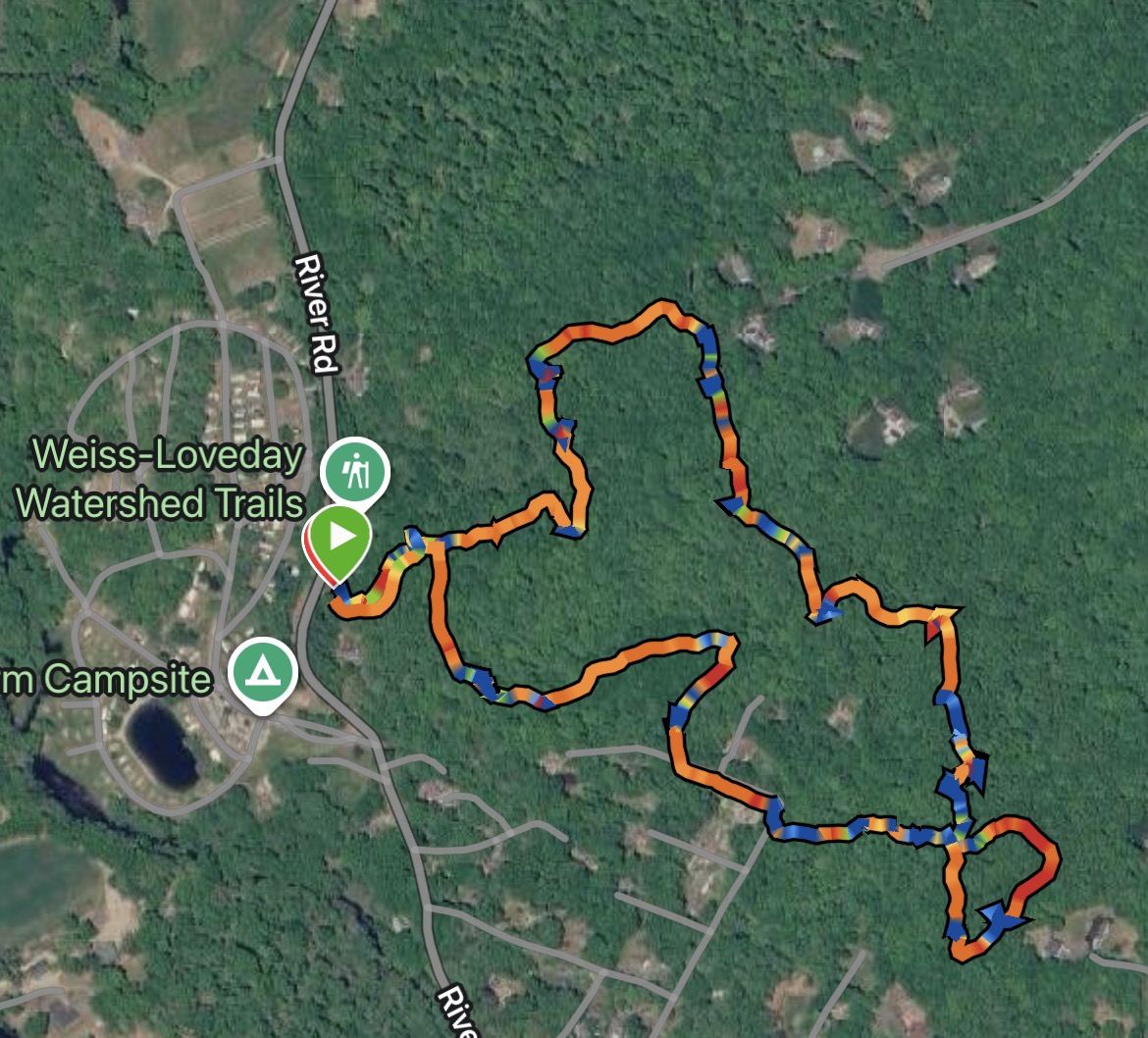
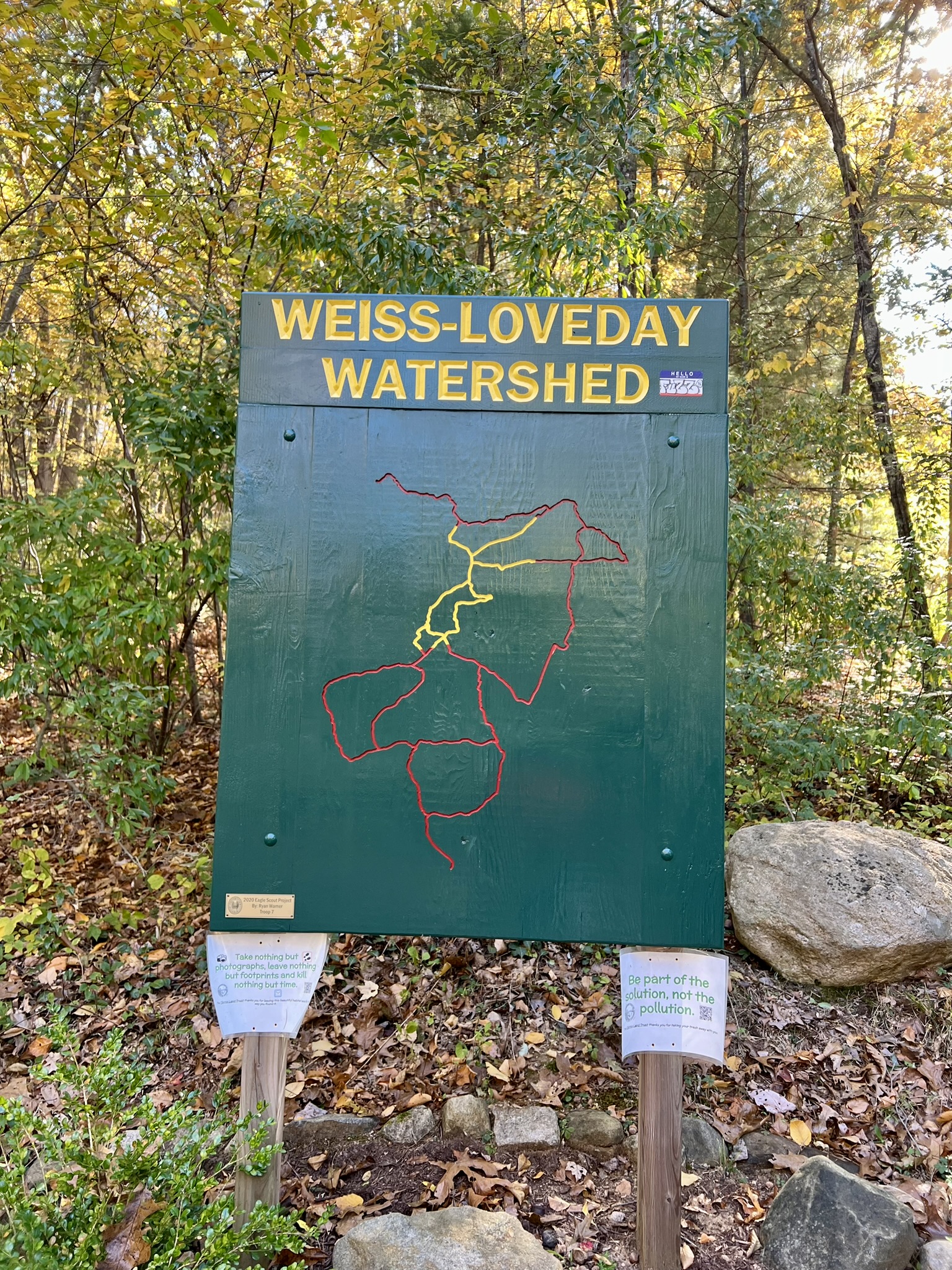
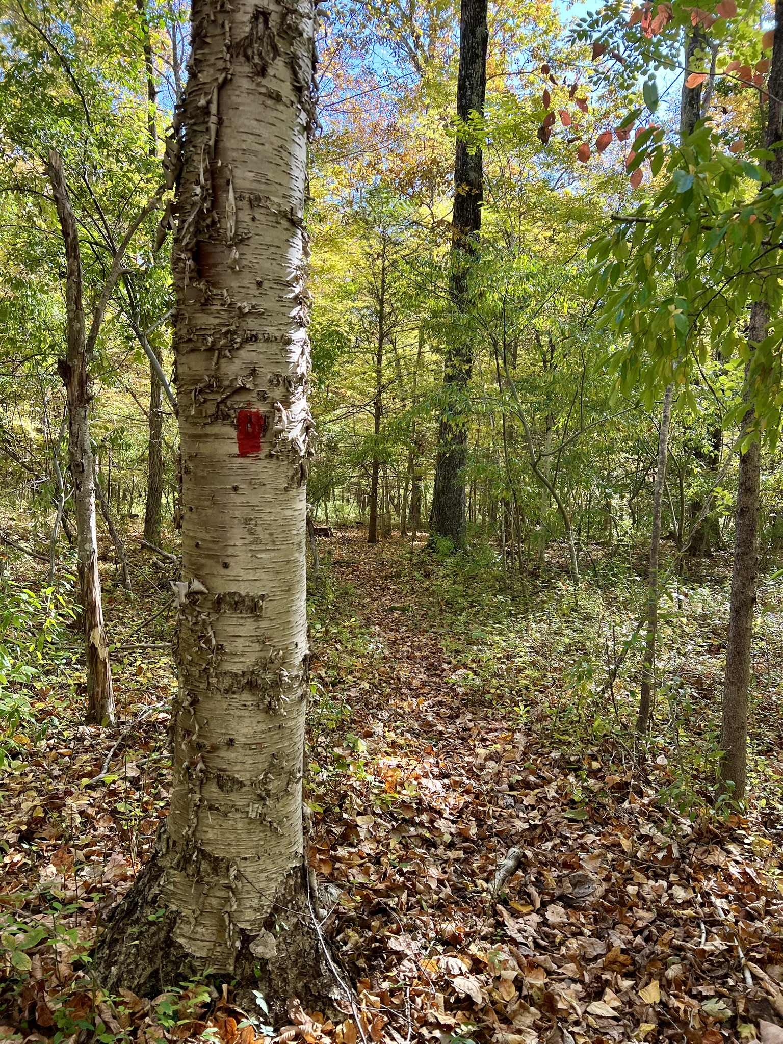
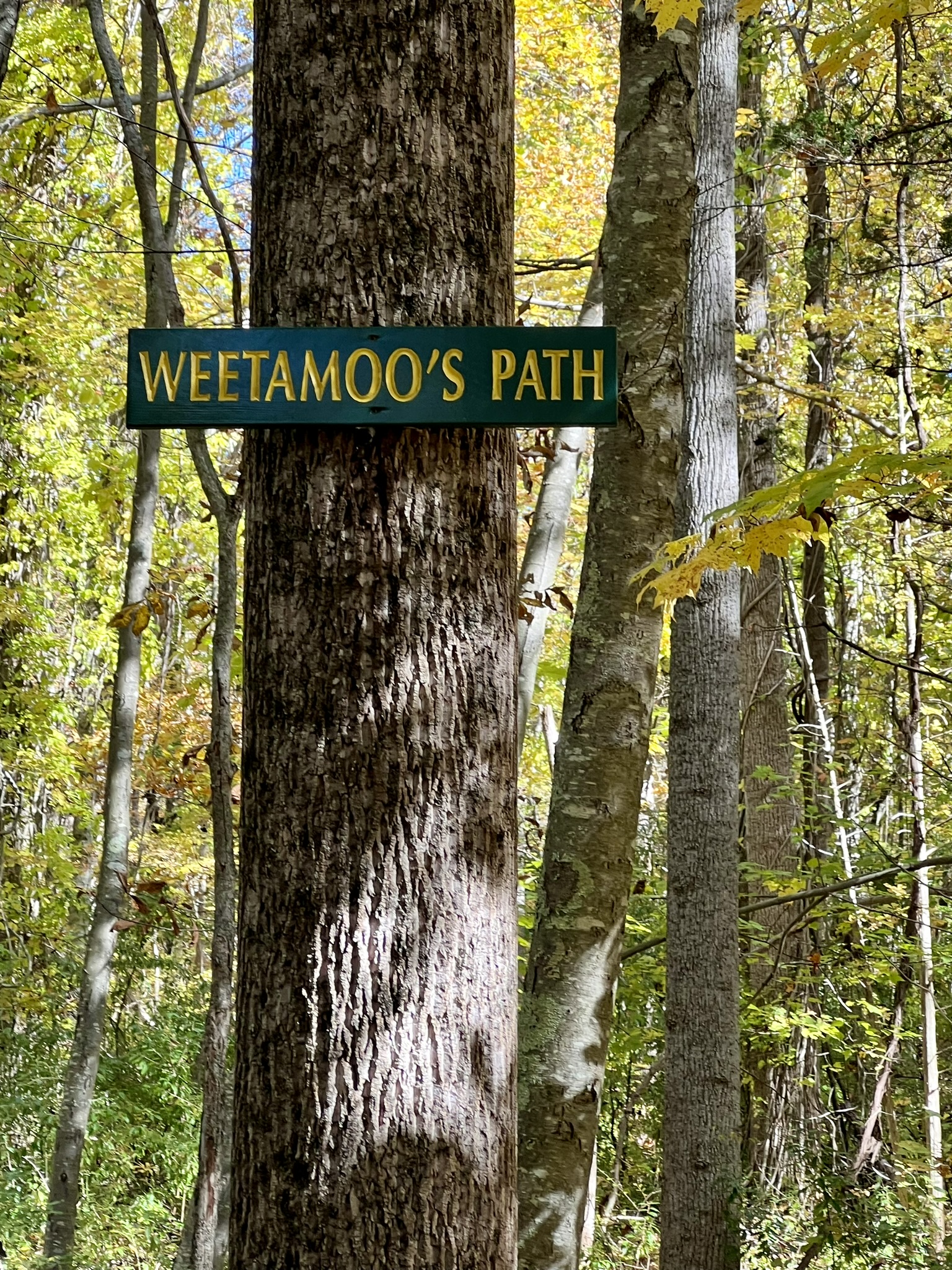
From left to right: The Garmin track from my hike; the map at the trailhead — note the different orientation; a red blaze along the trail; Weetamoo’s Path
This is a pleasant woods walk. At one point the trail pops out on Watrous Road and you have to follow it onto Westwood Road before reentering the woods. A fun landmark along the way is an old, abandoned tree fort worthy of the Swiss Family Robinson.
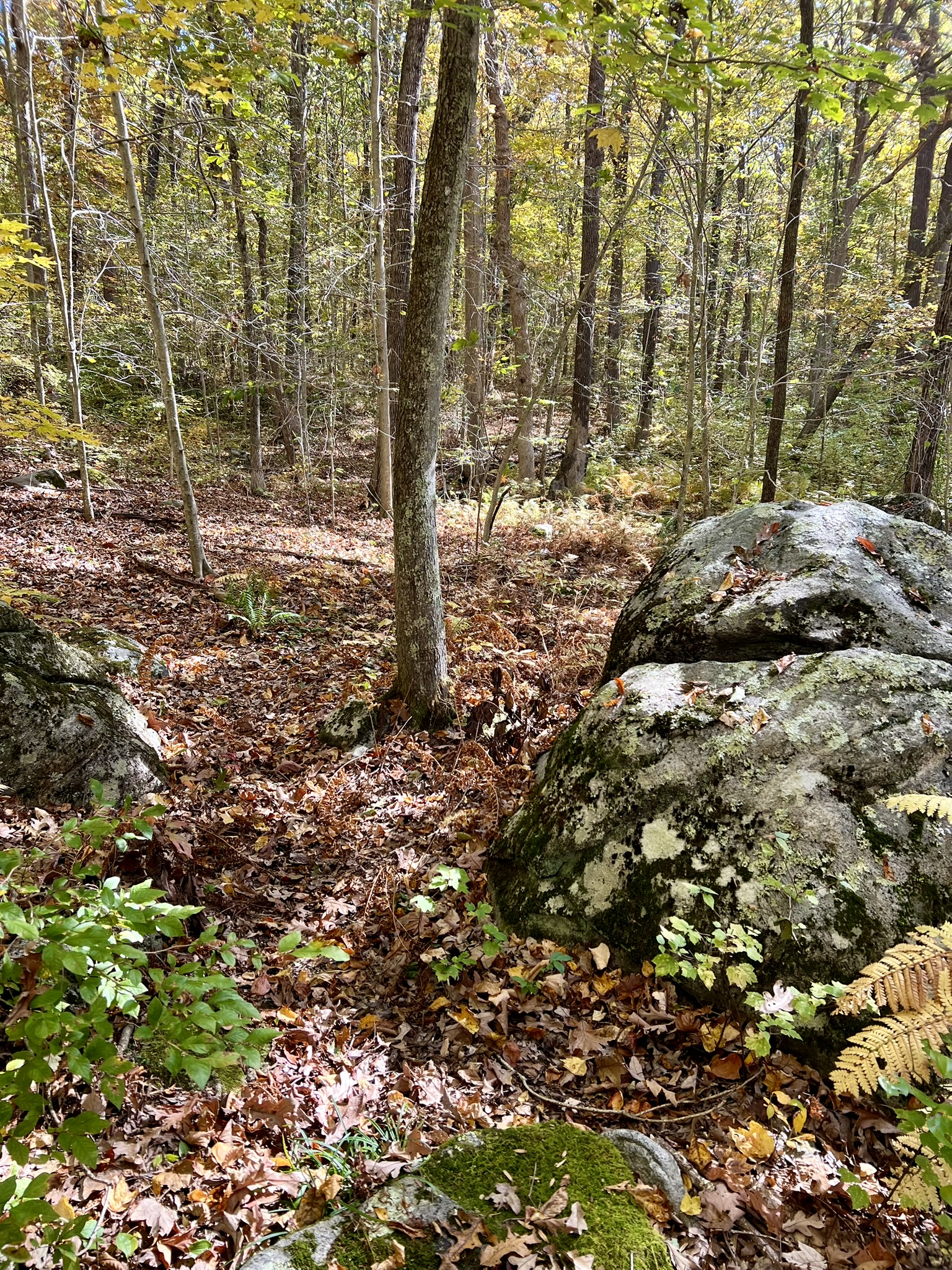
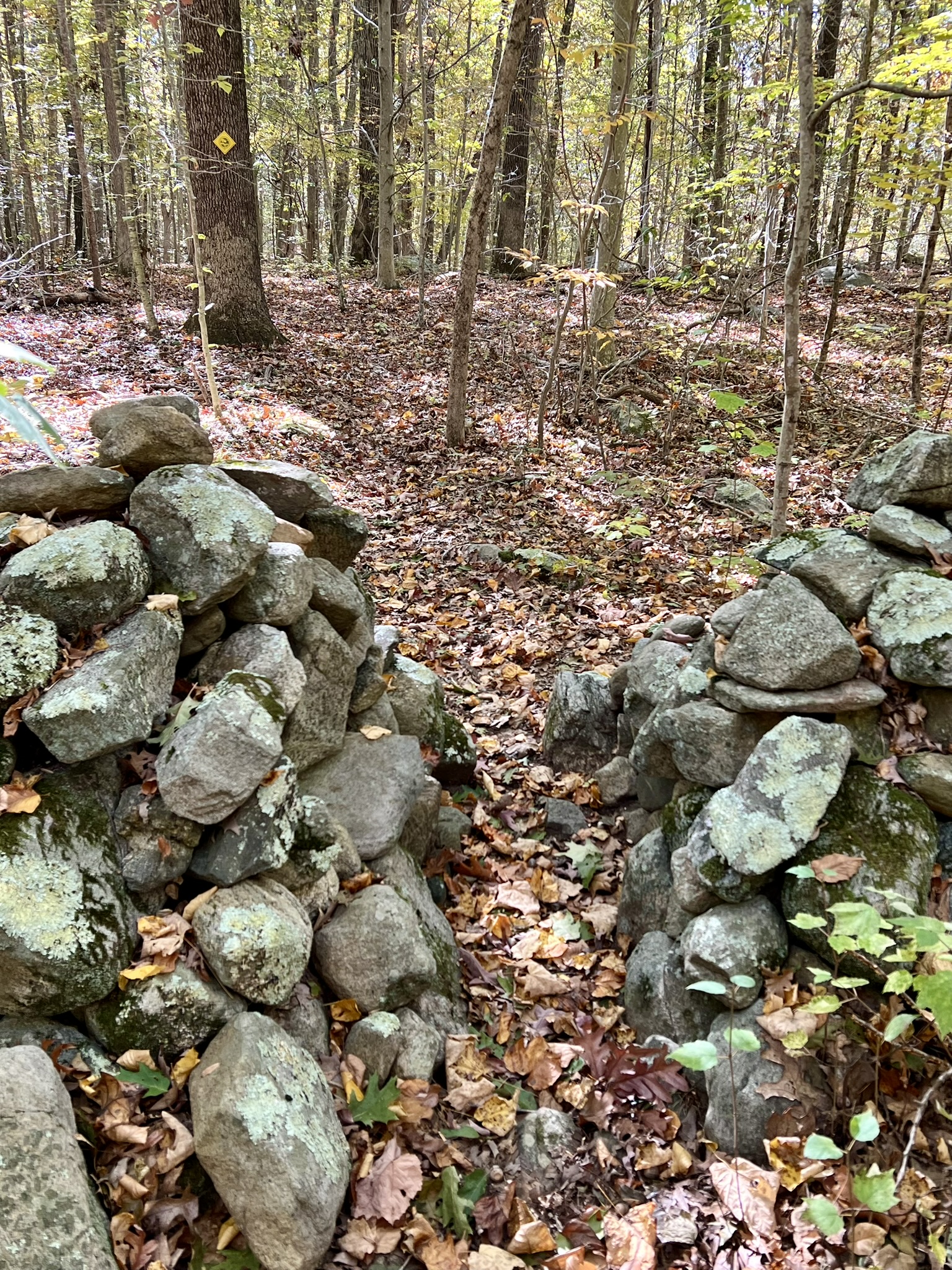
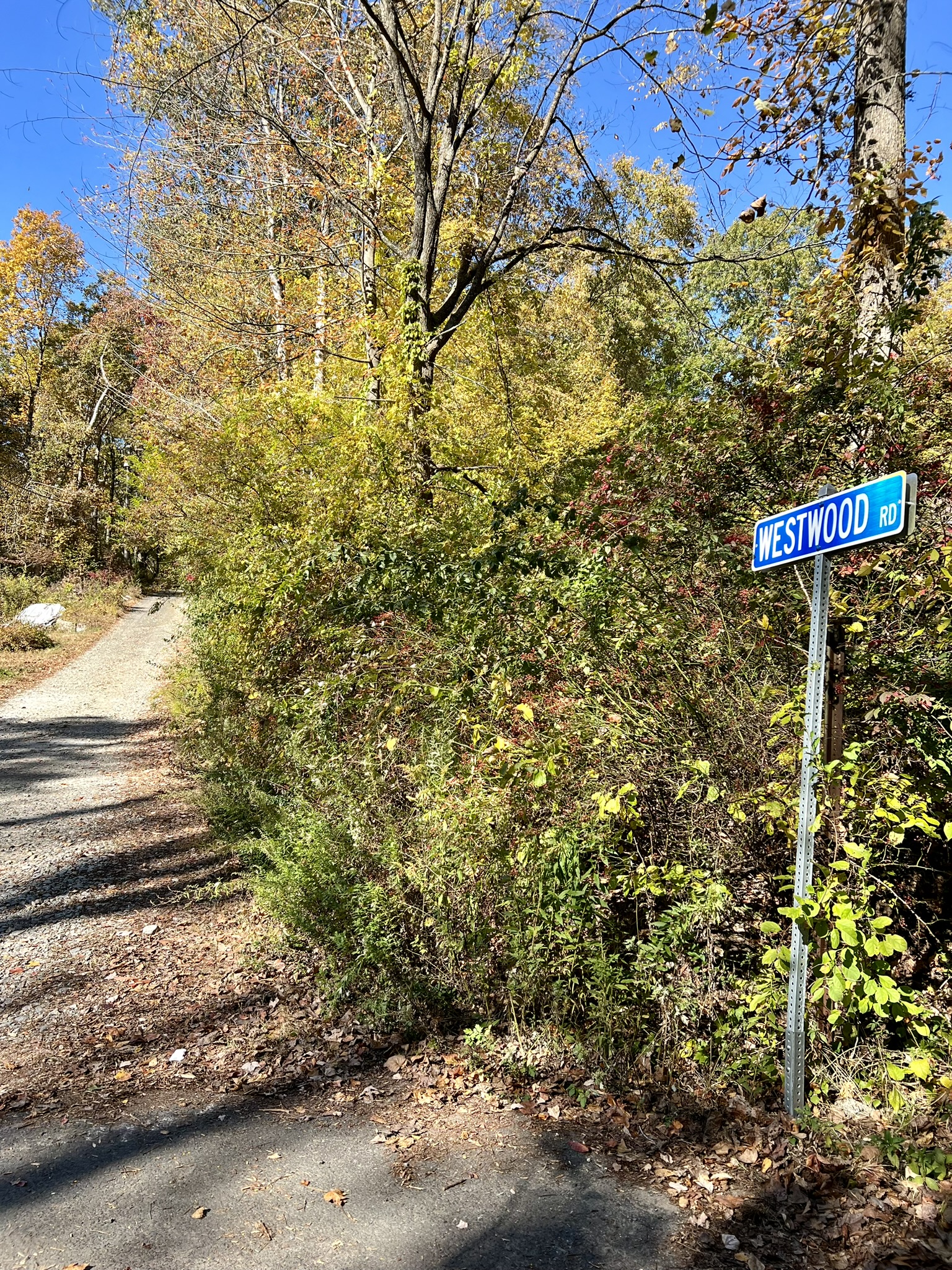
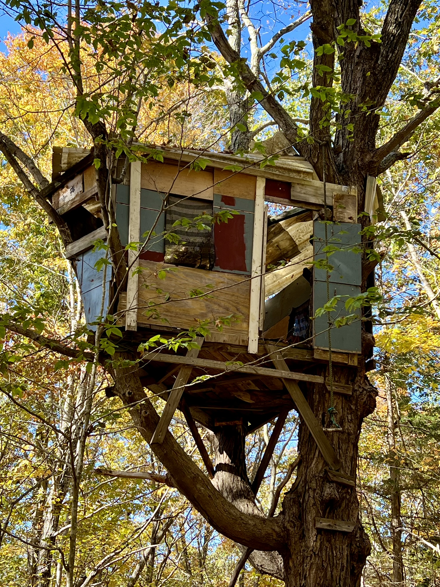
From left to right: boulders and stone walls along the trail; the trail goes along Westwood Rd. before turning back into the woods; the abandoned tree house
Guilford, CT
Guilford Town Walk from the Green to the Harbor and back. 5.5 miles.
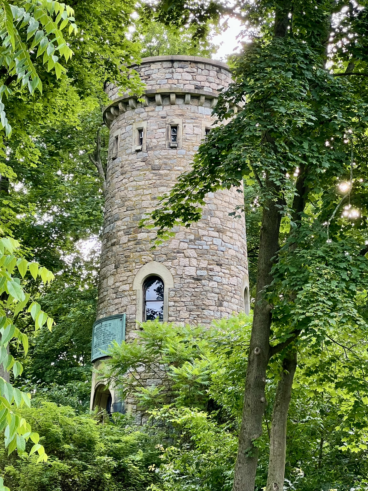
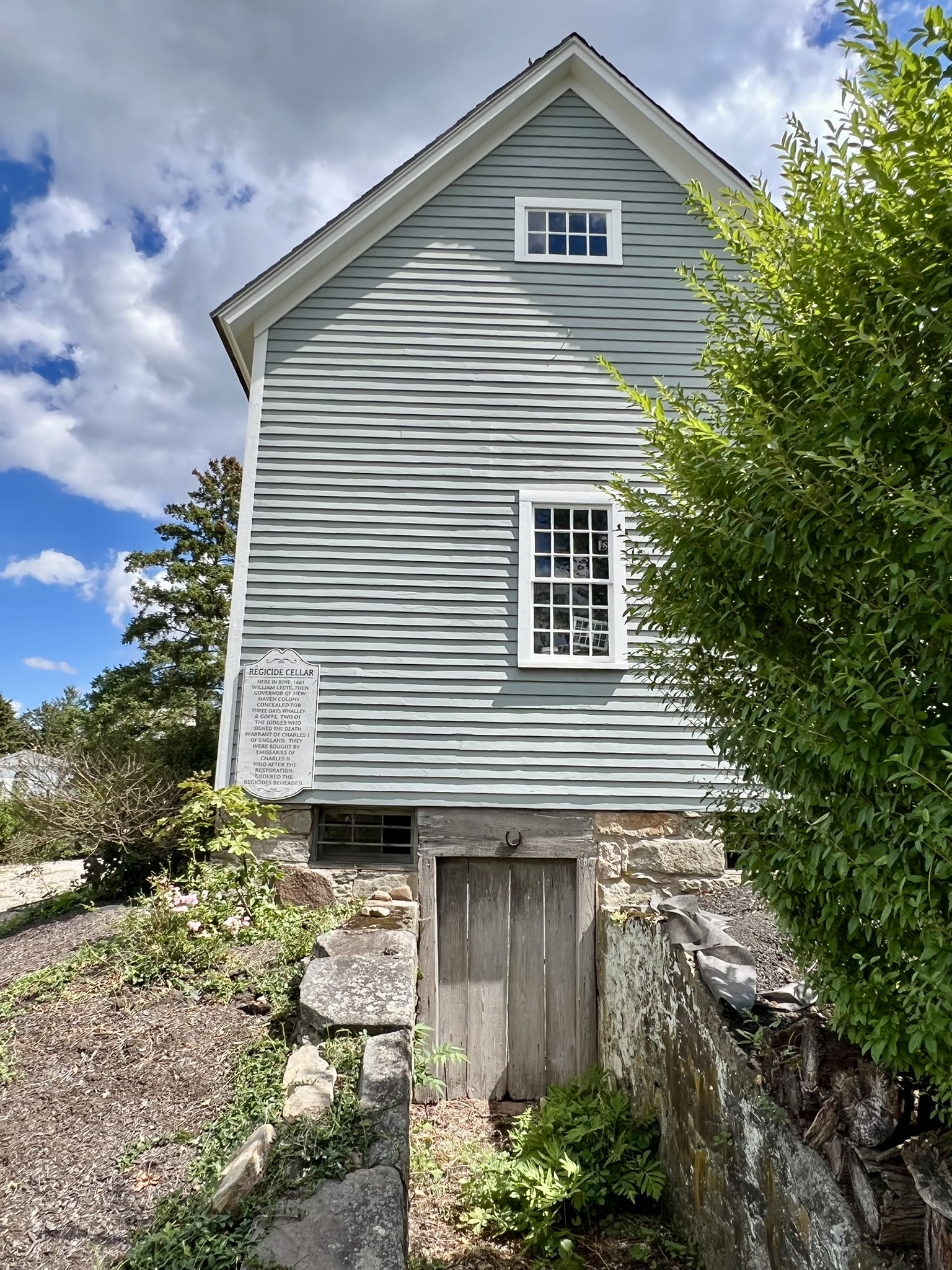
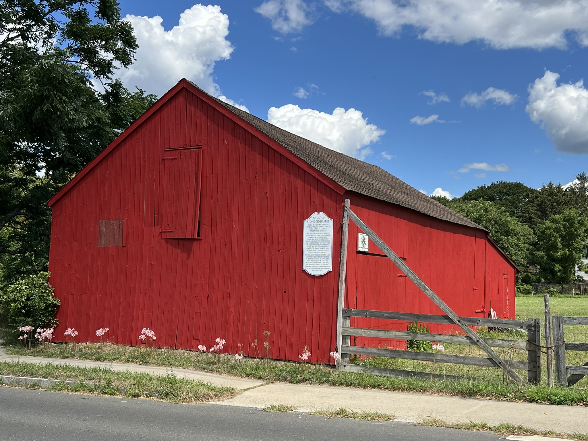
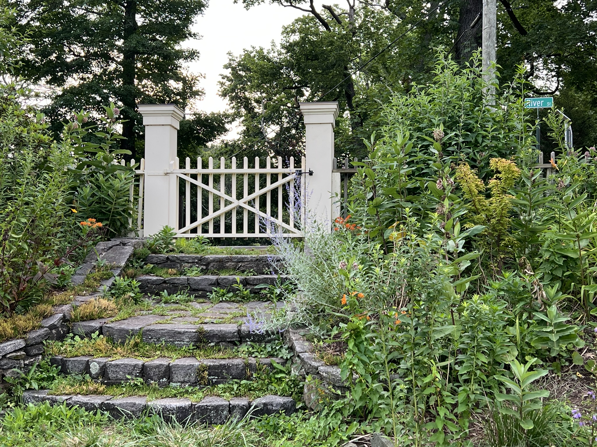
For Guilford, I took a different approach. I started by poring over Google Maps to look for specific places of interest. Living farther away, I planned a longer route to cover more ground in a single visit. After my visit I discovered an informative publication entitled Guilford: A Walking Guide, by Sarah Brown McCullough, first published in 1989 and now available online. This would be a handy guide to have while you walk. I visited last summer in early July, parking alongside the green across from Page Hardware which has expanded into the old Guilford Trust Company building. I was intrigued by a landmark on Google Maps called the Cranbrook Tower on River Street, so decided to start my walk heading west on Water Street to River Street. I missed the tower on my first pass and had to double back. The tower sits on private property on a rise behind a free-standing two-car garage and was partially obscured by the summer foliage. The Guilford Walking Guide (scroll to Abel Chittenden, 1 Broad Street) describes the tower as follows: “Out back he built a granite water tower and windmill to supply water for the fountain….The water tower, known as Cranbrook Tower, is best seen from River Street where the stone gate still stands. A Romanesque doorway opens to an iron stair that winds up around a 4000-gallon, hand-riveted tank. The windmill was removed after the town established its own water system. During World War II and in 1955 the tower was again in use as an aircraft warning Station, manned day and night by volunteers. Now closed and unused, the high stone tower remains a Guilford landmark.” I found a photo available through the New Haven Free Library of an old postcard of the tower with the windmill on top of it, which says the tower was constructed in 1869 by Henry Rolf. The construction date is confirmed on the copper plaque mounted to the tower, which you can see on the Historical Marker Database, along with a transcription. Continuing along River Street I crossed Broad Street and a short distance further looked to my right to see the Regicides Cellar marker. I wrote about the Regicides in my November/December 2025 Trail Talk post on West Rock Ridge State Park. The Guilford Walking Guide notes that “[t]he barn behind the house facing River Street bears a plaque which, according to legend, commemorates a brave deed in a time of danger. ‘Here in June 1661, William Leete, then Governor of New Haven Colony concealed for three days Whalley and Goffe, two of the judges who signed the death warrant of Charles I of England. They were sought by emissaries of Charles II who after the Restoration ordered the regicides beheaded.’ It is thought that the cellar under the barn is the site of Governor Leete’s house.” Just beyond the Regicides Cellar is a bright red barn with a plaque marking the site of the Stone Cider Mill, Stone Cider Mill “[b]uilt in 1820 by Timothy Stone. Operated as a cider mill until it ceased operations in 1910.”
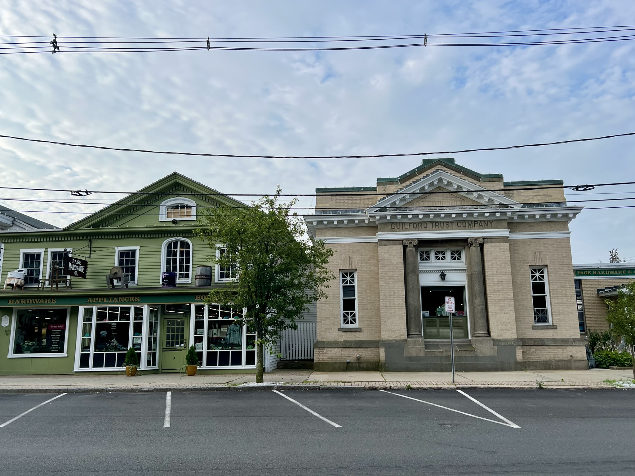
From left to right: Page Hardware; the Cranbrook Tower; the Regicides Cellar; the Stone Cider Mill
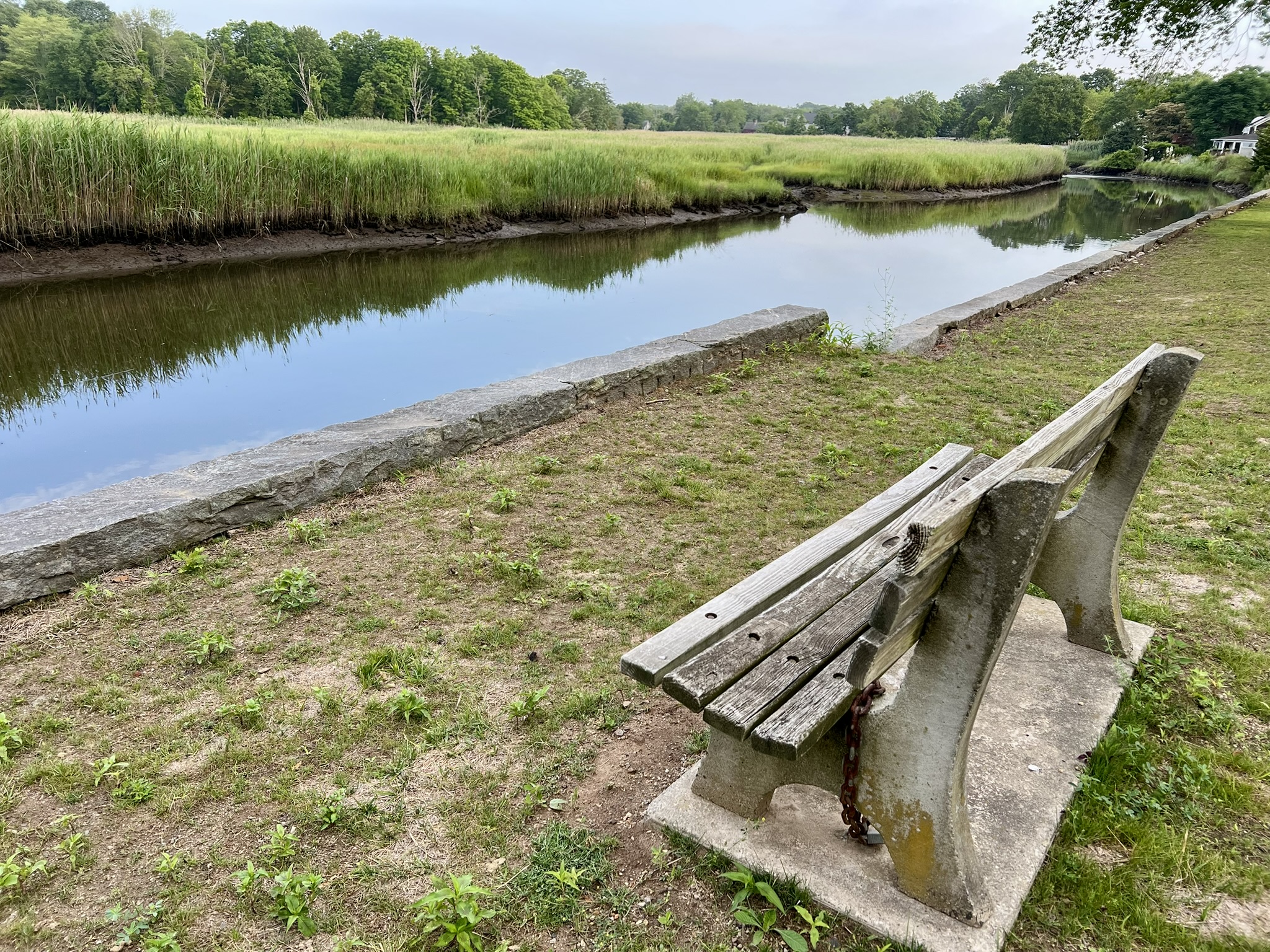
Here I crossed River Street to walk through the Guilford Land Trust property Olmsted Outlook. This property is a half-acre parcel maintained as a park, with flower gardens and a bench overlooking the West River and the marsh beyond. The parcel was donated to the Guilford Land Trust in 1981 by Howard and Deborah Weaver, and according to the description on the website, it was the donors’ wish that the park be named after Frederick Law Olmsted. The website explains that it was “150 years ago that Frederick Law Olmsted, the famous landscape architect, first visited Guilford. Views such as this influenced his thinking when designing parks such as Manhattan’s Central Park.” After a brief rest to admire the view, I exited through the gate and headed down Broad Street to the town green, stopping to view the Civil War monument and statue.
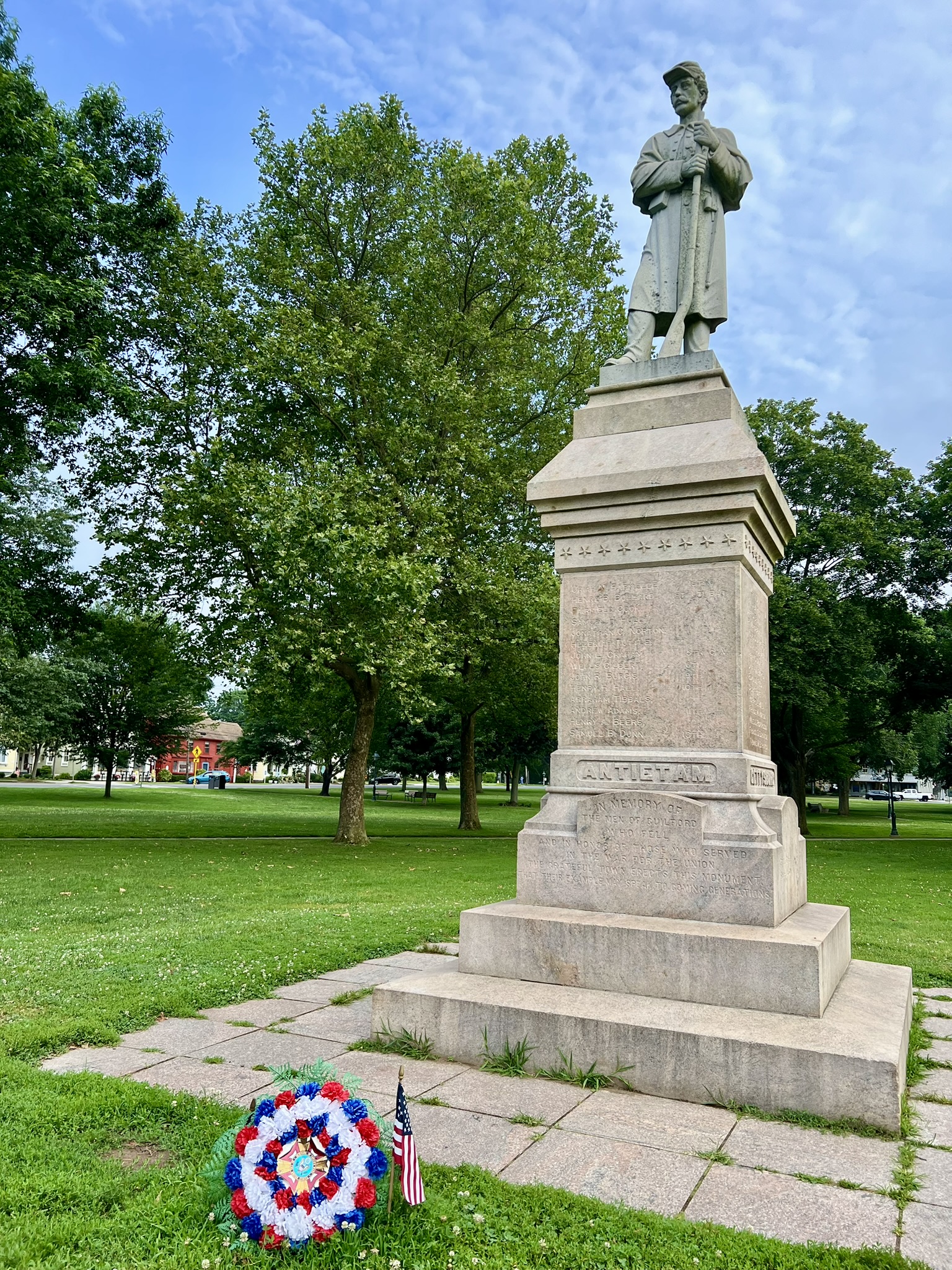
From left to right: The Olmsted Outlook bench and shade tree; garden gate from the Olmsted Outlook to River Street; the Civil War monument on the Town Green
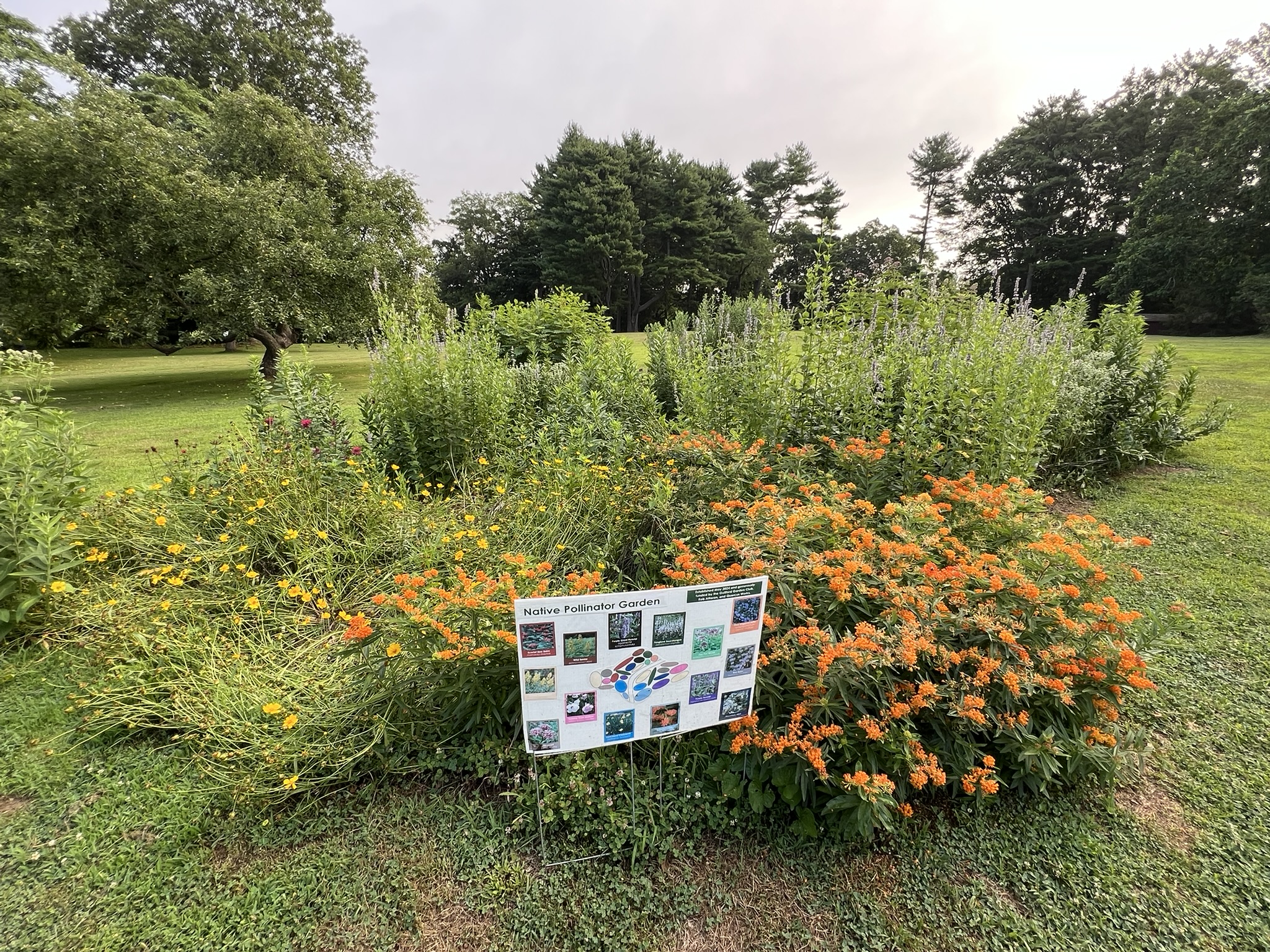
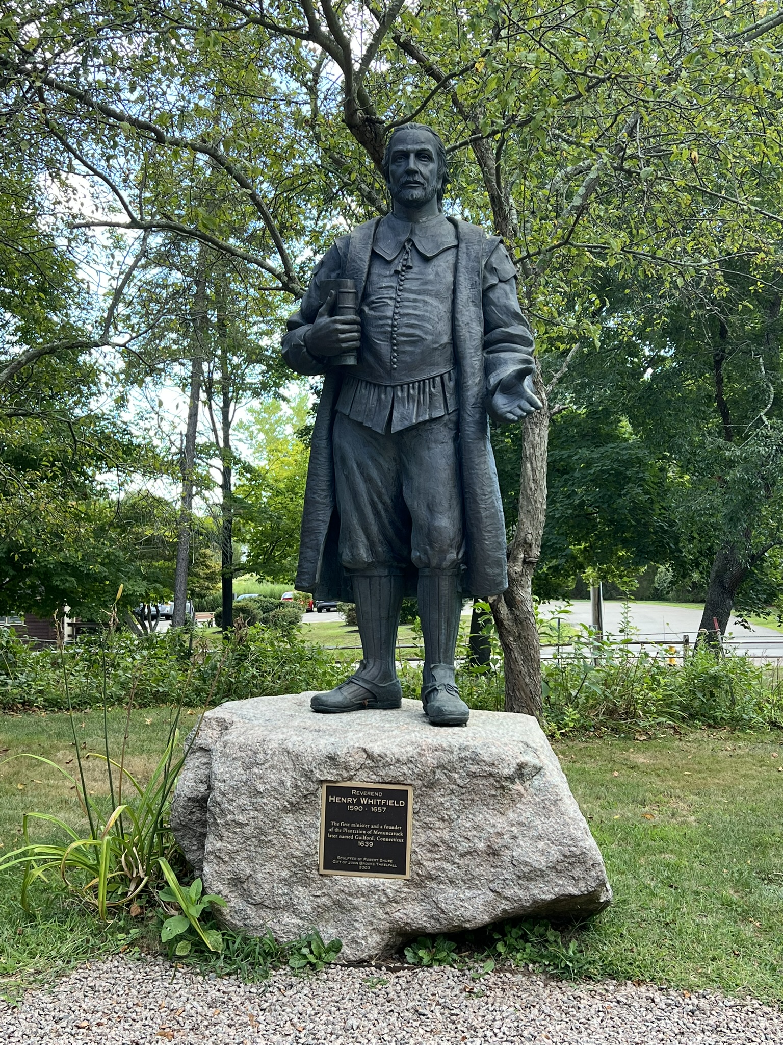
I then headed southeast on Whitfield Street, and at the fork, stayed left to follow Old Whitfield Street. I noticed a cut in the stone wall and blue blazes so passed through to check out the pollinator garden and take a shortcut to my next destination – the Henry Whitfield State Museum. At that hour the museum was closed, but I returned at a later date for a museum tour, which was very informative. The only original thing about the Whitfield house is the stone. The home had many owners and additions/changes. When acquired by the State, the house was completely stripped and additions removed. It was rebuilt with the intent to replicate as closely as possible the original structure while also making it suitable as a museum. The spaces are full of artifacts from various historical time periods and there are numerous signs reiterating that the original floor plan is unknown, and that no one family would have owned this many possessions. The house was built as one of 4 garrison houses, meant to be used as a combination shelter/fort in times of trouble. The home was built in 1639, just two years after the hostilities of the 1637 Pequot War ended, and defense was a concern (I wrote a Trail Talk about the Pequot War in April of 2024). It was meant to hold about 80 citizens plus animals. One of the artifacts on display is Governor Leete’s chair – a white oak chair with its original red stain. One room displays information about the Native Americans that had been living on this land prior to the arrival of the English settlers – the Menunkatuck band related to the Quinnipiacs that populated the area that is now Greater New Haven. An image of the 1639 treaty (along with a typed translation) shows the details of the agreement to sell “all the Lands lyinge with in the foresayed limits of Kuttawo and Oiockcommoke river”, and is signed by the female sachem, Shaumpishuh, and Henry Whitfield, on behalf of the English Planters. In the Visitor’s Center there is an archaeology exhibit which highlights the methodology used by Southern Connecticut University in their past and current archaeological excavations.
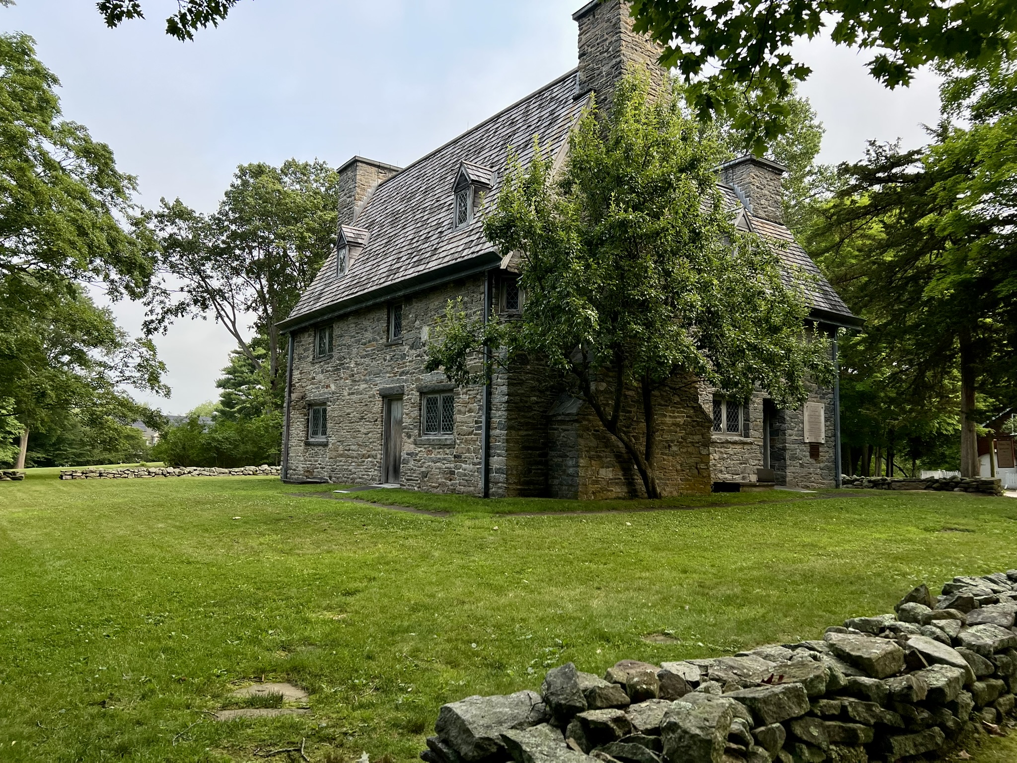
From left to right: the pollinator garden on the museum grounds; statue of Henry Whitfield; the Whitfield House and State Museum
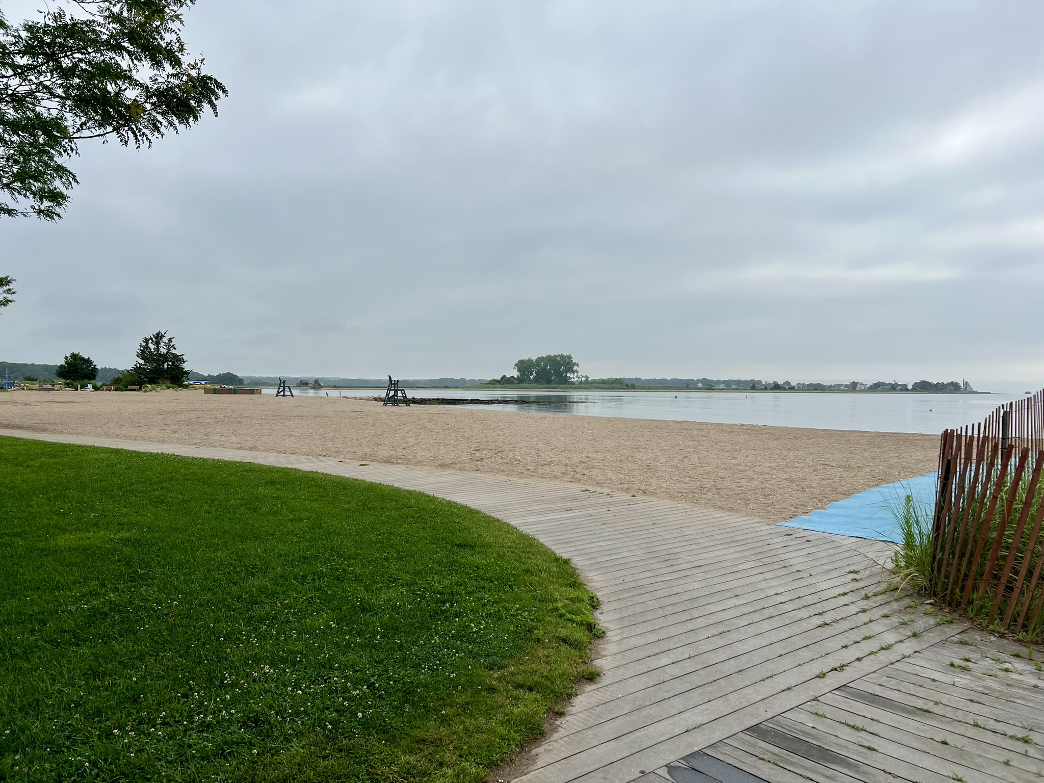
I crossed the street to Rollwood Park, a one acre park with a picnic table. There is no information about the park at the site, but I later learned at the Whitfield Museum Visitor Center that the ruins are “all that remain of the 1903 Adirondack-style house called Rollwood, built by New Haven residents Rollin S. Woodruff and his wife Kaomeo (named for a Native American ancestor) as a country estate and gentleman’s farm”. It later became their full time residence. The main house burned down in 2000. “The town purchased the property for agricultural, recreational and other municipal uses.” From the park I took the next block back to Whitfield Street continuing southeast. I turned right on Seaside Avenue and walked as far as Jacobs Beach which has very nice facilities for town residents. I backtracked to Field Road off Seaside to visit Chittenden Park. Chittenden Park is the Southern Terminus for the New England Trail and has a viewing platform and osprey nests. I wrote about the park in detail in my Seas and Trees Trail Talk, September 2023.
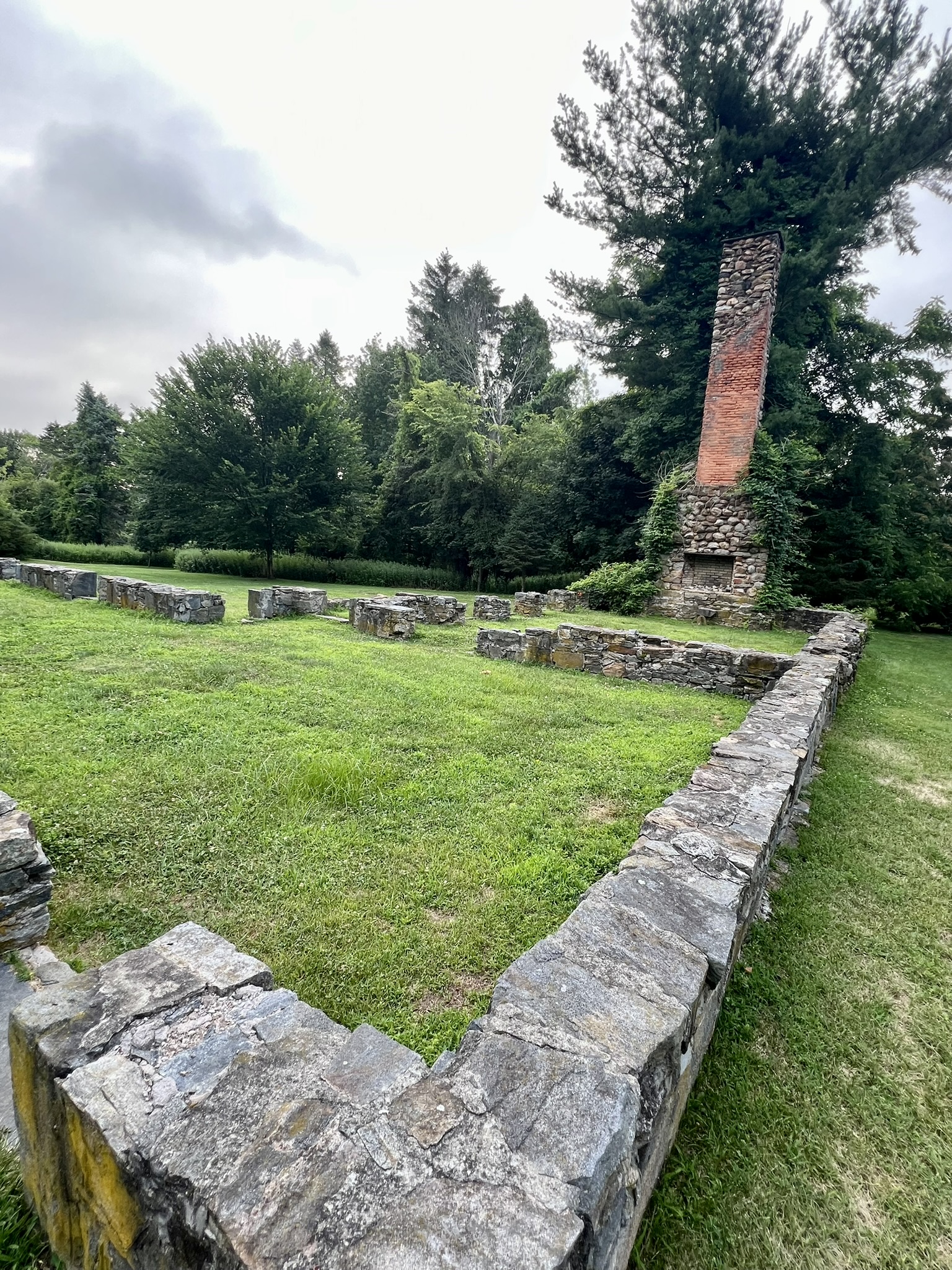
Clockwise from left: the foundation ruins at Rollwood Park; Jacobs Beach; the beach at Chittenden Park
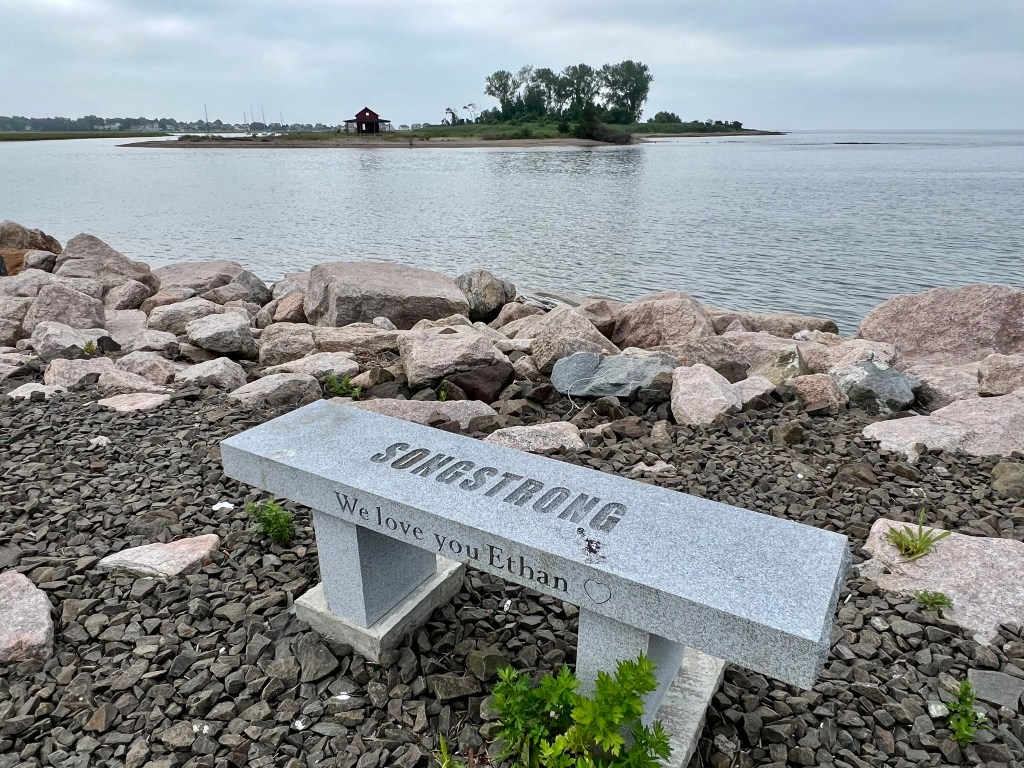
I then retraced my steps to Whitfield Street and continued southeast. At the bridge, I took the pedestrian walkway on the left to Pa’s Place (if you are driving, parking is off Seaview Terrace), and stopped for breakfast on their patio, a nice break at the 4 mile mark. There is a public boat ramp (for canoes/kayaks) in the back. After eating, I continued to the end of Whitfield, passing through the Guilford Town Marina parking area (permit required to park) to visit what is called the “Guilford Sea Nook” on Google. This is a large stony shorefront with two granite benches overlooking where the East River empties into Long Island Sound at Grass Island. Grass Island is best known for the iconic “little red shack” that sits at the end of the point across from the Town Marina. A kiosk at the marina describes the shack as a summer cottage built by local druggist Harrison Monroe in 1914. That structure burned down in 1936 and was rebuilt in 1940. The cottage was moved to its current location in 1950 and acquired by the town in 1965. The shack was most recently renovated in 2016 with the Save the Shack project spearheaded by Eagle Scout candidate, John Markoswki, with help from the Guilford Foundation. You can find more information about the Grass Island Fund HERE. From there, I retraced my steps to my car.
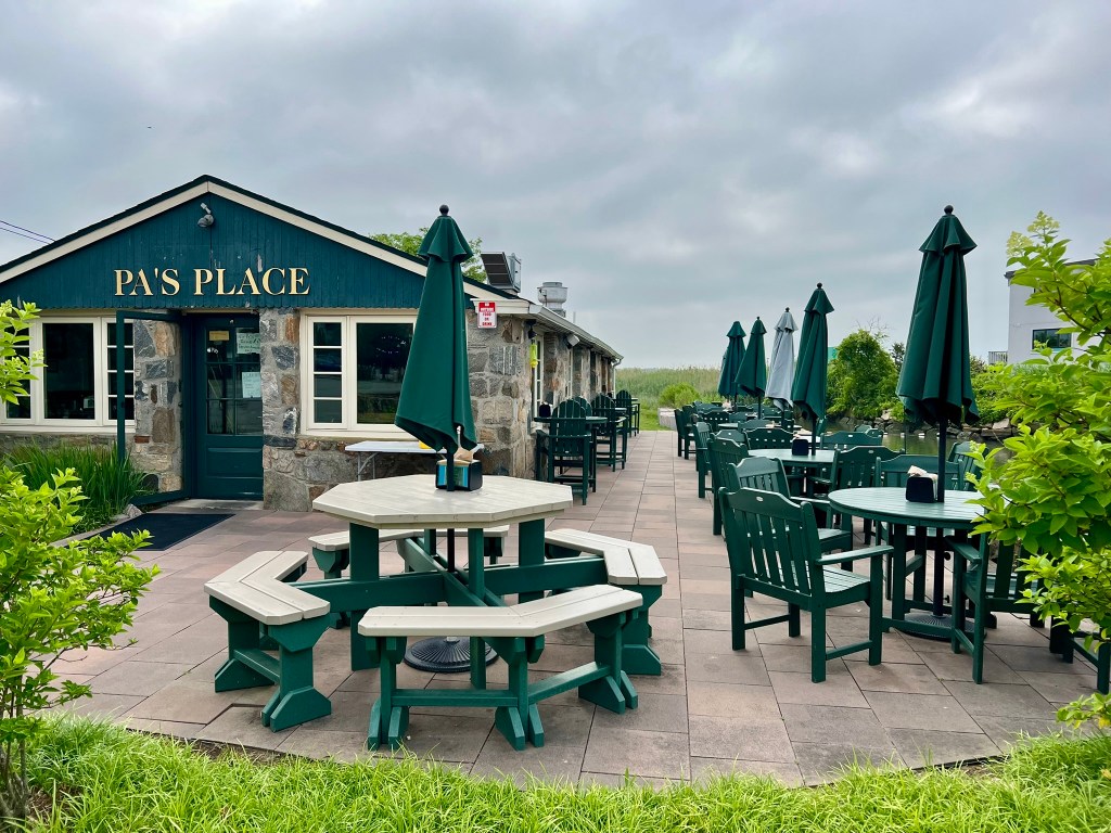
From left to right: Pa’s Place; the Guilford Sea Nook; view of the Little Red Shack from the Town Marina
Grass Island Hike. 1.75 miles out and back.
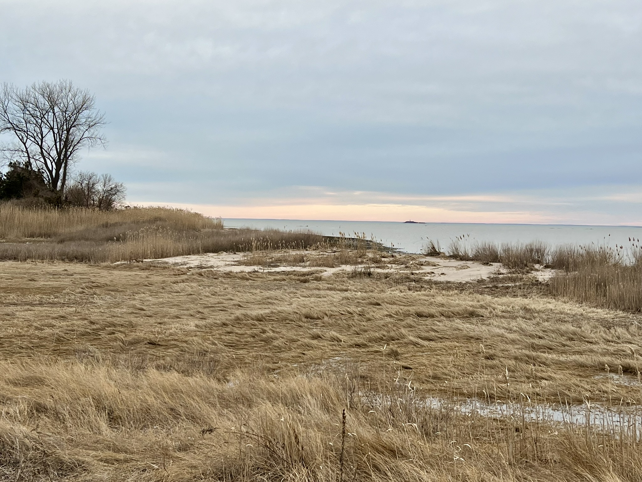
After seeing the red shack from the marina, I wondered how I could get closer, so consulted Google Maps. The key is knowing that Grass Island isn’t an island at all, but rather a peninsula. The best way to access the shack on foot is to park at the East River Boat Launch, located at the end of a long gravel driveway near the end of Circle Beach Road (which is at the end of Neck Road). I had read in some reviews that the parking lot floods at high tide, so I timed my visit for a sunset low tide in late March. While the shack is close to the boat launch as the crow flies, you have to go the long way around to reach it. We walked back down the gravel access road, noting the still empty osprey nest platforms awaiting the arrival of this season’s birds, then turned right onto Circle Beach Road, which dead ends at the rocky shore. There is a sign at the shore entrance regarding shell-fishing and leashing your dog, and another sign by the high tide line saying the area is open from sunrise to sunset. The easiest route is to stick close to the high tide line as you make your way to the end of the point. I was surprised by the number of large shells littering the beach. I picked up a mostly intact large whelk shell along the way.
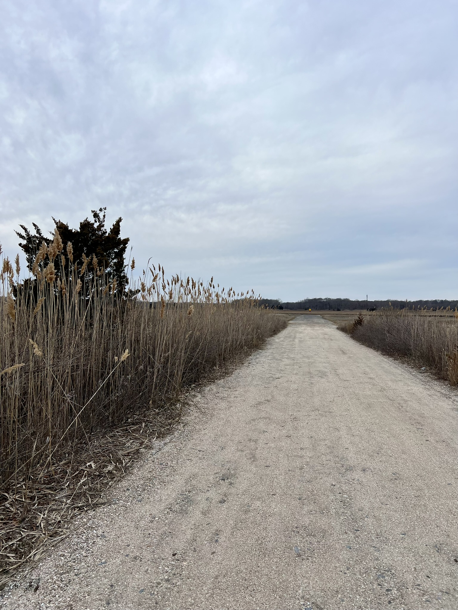
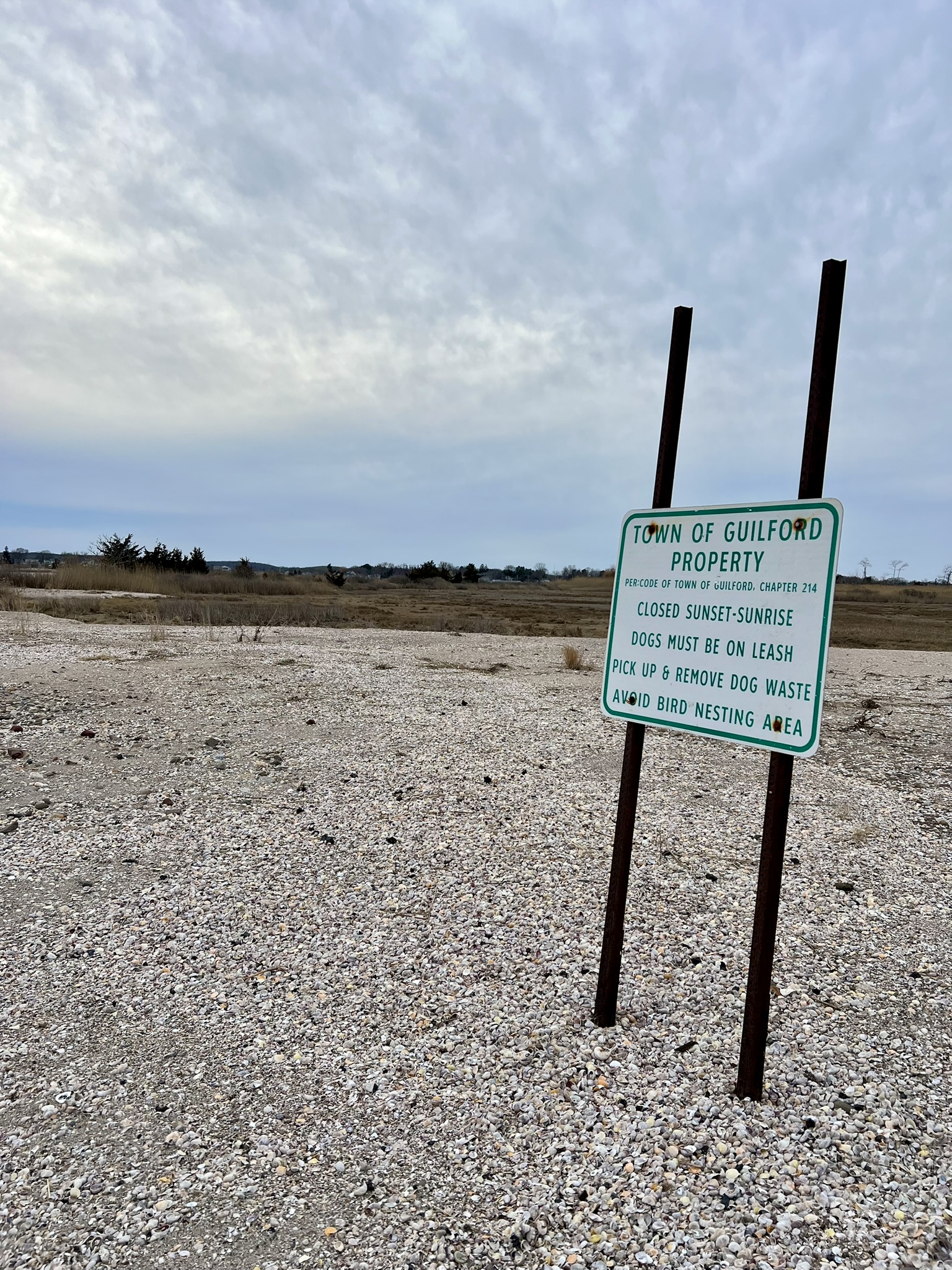
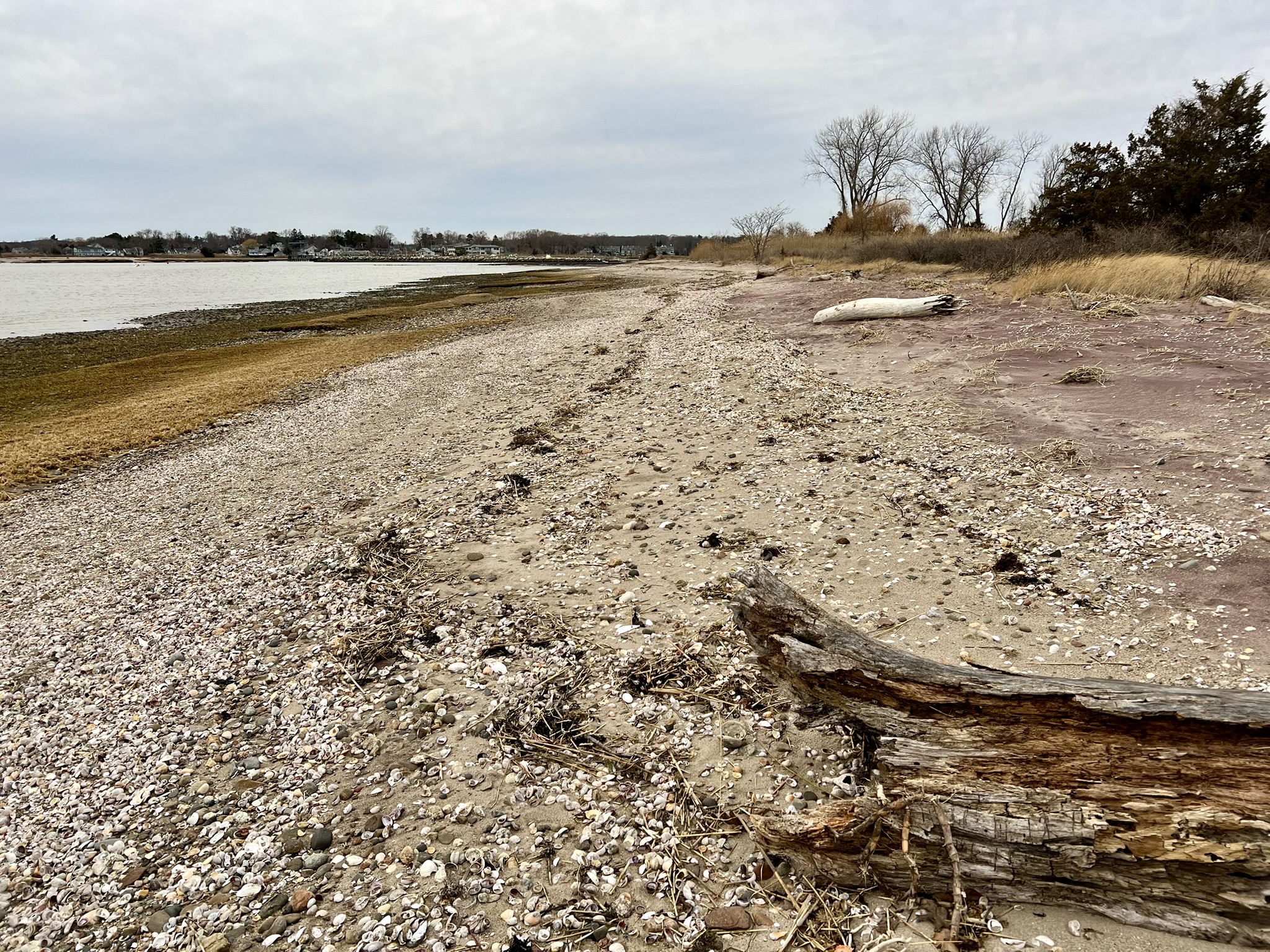
From left to right: the gravel access road to the State Boat Launch; the property rules; the beach and the grass, for which the “island” gets its name
We reached the shack, and admired the new decking on the wrap-around veranda and all the hurricane clips. Climbing up to enter the shack I noticed a number of shells on the shelf of framing, so added my whelk shell as an offering. While the clouds were too numerous for a beautiful sunset, it was still a fun adventure, even bundled up in our winter gear. This will be a nice destination for a picnic in warmer weather.
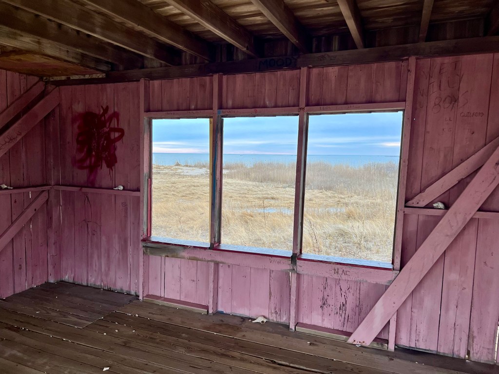
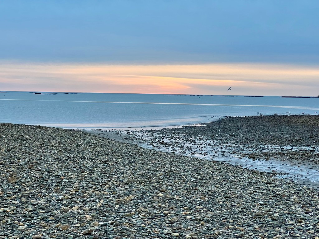
The “Little Red Shack” exterior and interior, and the rocky beach at sunset.
Guilford Salt Meadows Sanctuary, 1 mile.
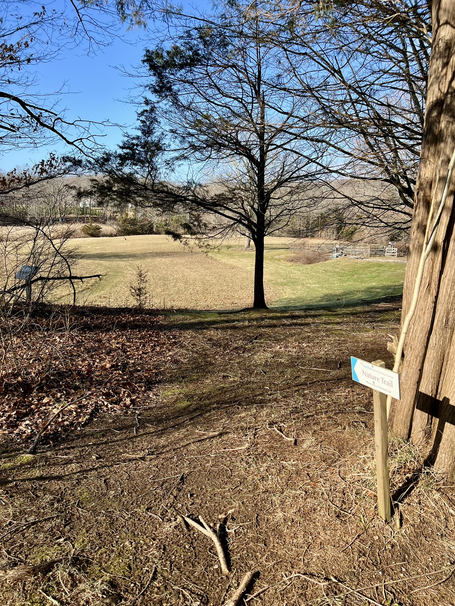
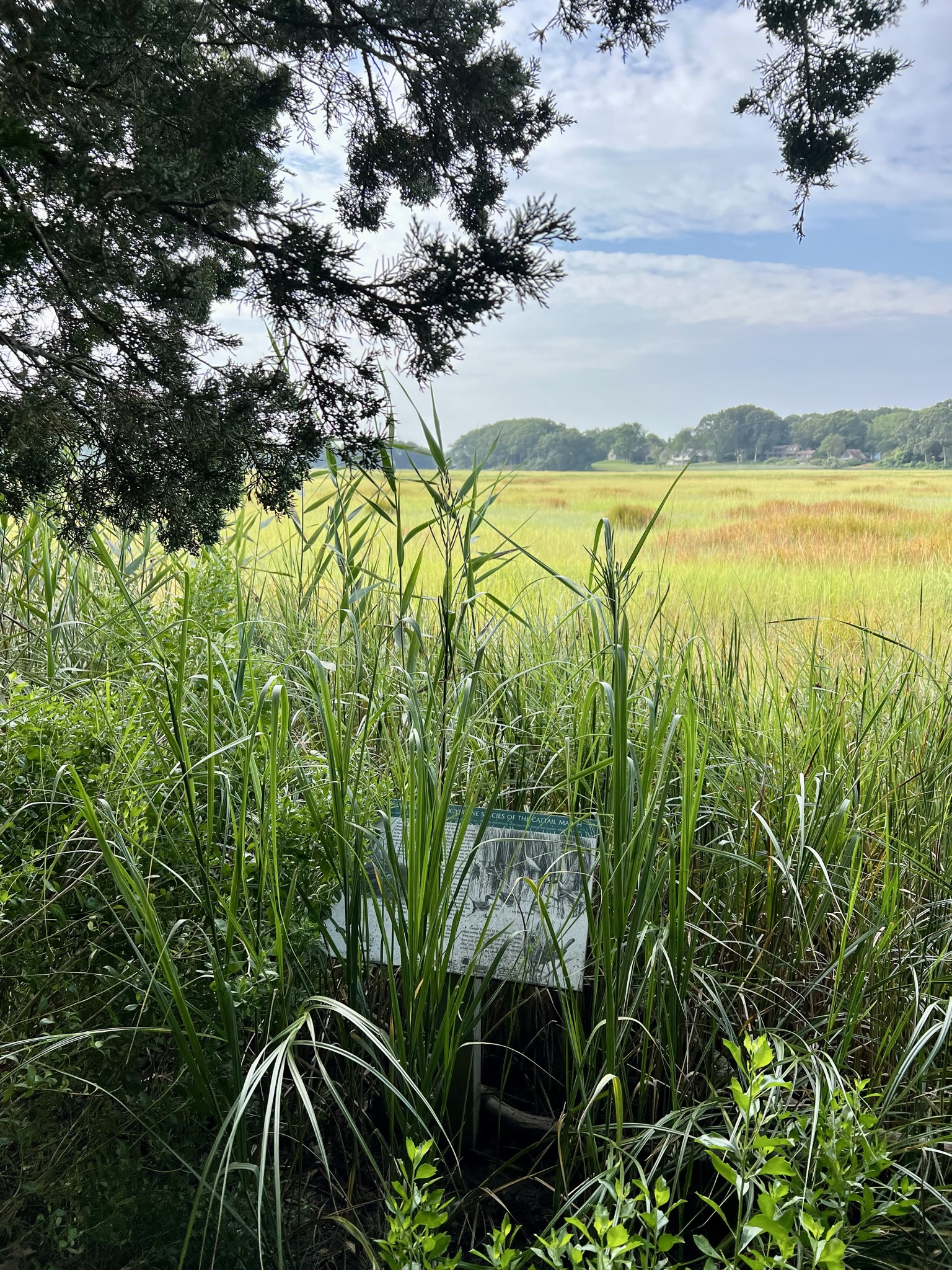
The parking area for the sanctuary is on Meadowlands, a private road off Clapboard Hill Road. After you pass the red barn you may notice a small sign facing the other way: this is one end of the Anne Conover Nature Education Trail, a one mile loop trail. Continue driving another .2 miles and look for a gravel drive on your right. This leads to the parking area where there is a large kiosk and box with trail brochures. CLICK HERE for a street view of the driveway (NOTE: putting Guilford Salt Meadows Sanctuary in Google Maps leads to a house). I visited most recently this past March, The Sanctuary was established in 1964 when Anne Conover, for whom the trail is named, convinced neighbors to band together and donate tidal wetlands to the National Audubon Society. Much of the nature trail crosses private property, skirting the edges of the neighbors’ fields and back yards following the perimeter of the marsh. Please obey all rules and stay on the marked trail. Dogs are not allowed on this trail. I like to do a counterclockwise loop to get the road walk out of the way early, but you can go in either direction. Heading back up the road for .2 miles, I descended into a field at the “Nature Trail sign”, stopping at a signboard to read about the history of harvesting hay from the salt meadows. There are a total of 13 signboards along the trail focusing on different aspects of the marsh ecology. The trail is mostly easy, although there is one steeper section which can be slippery if the leaves are wet.
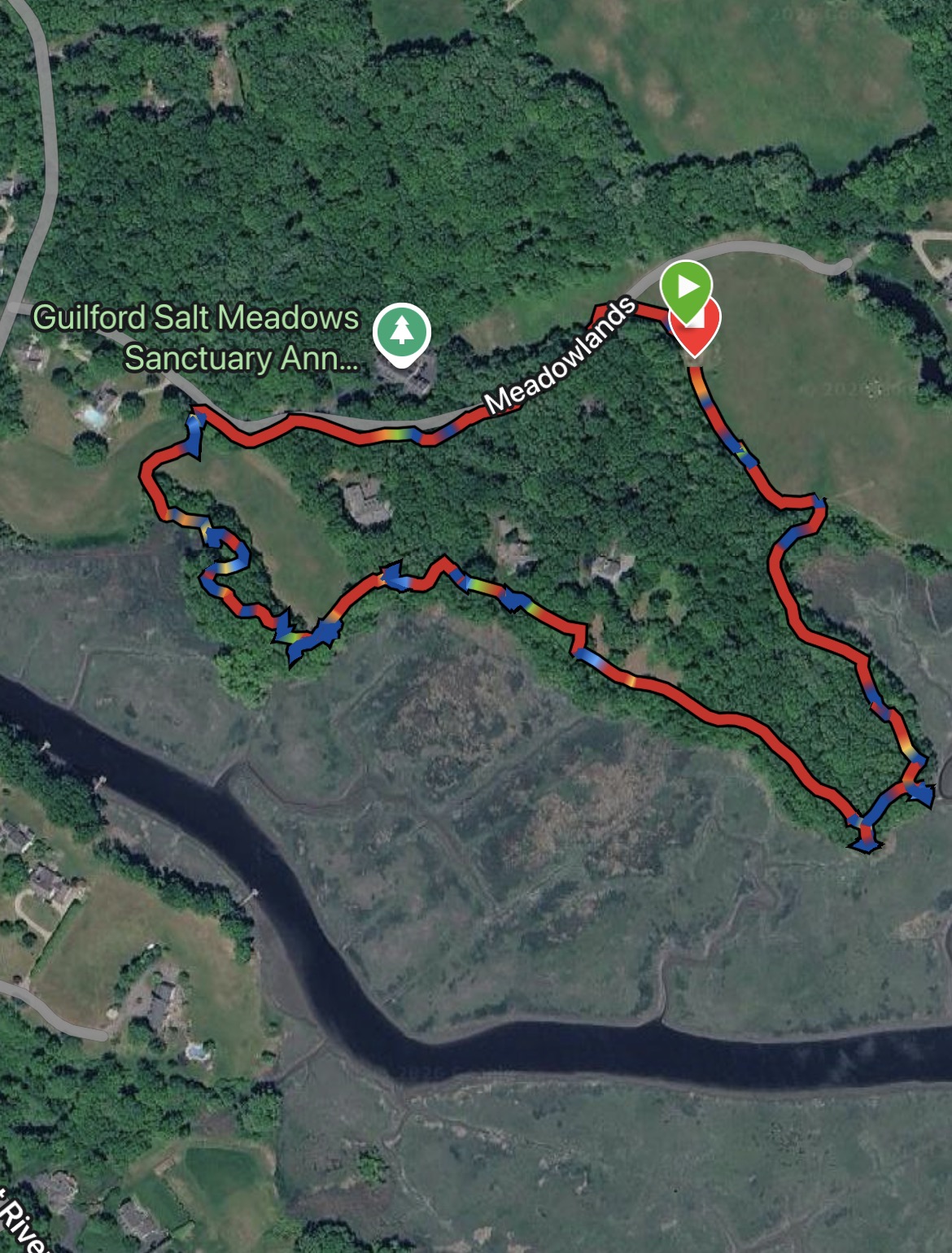
From left to right: My track – note that the Sanctuary marker is erroneously on a private home, NOT the parking lot; the trail entrance by the road; signboard; short steep section to a bridge
At several points there are good views to an osprey platform. As the trail enters the woods it passes a rack of boats that is marked as private property. On my most recent visit there was a small rowboat blocking the path, but it was easy enough to get around. The entire loop is one mile, and can be combined with a longer hike on the blue-blazed Menunkatunk Trail, which has a trailhead on Clapboard Hill Road about a half mile away.
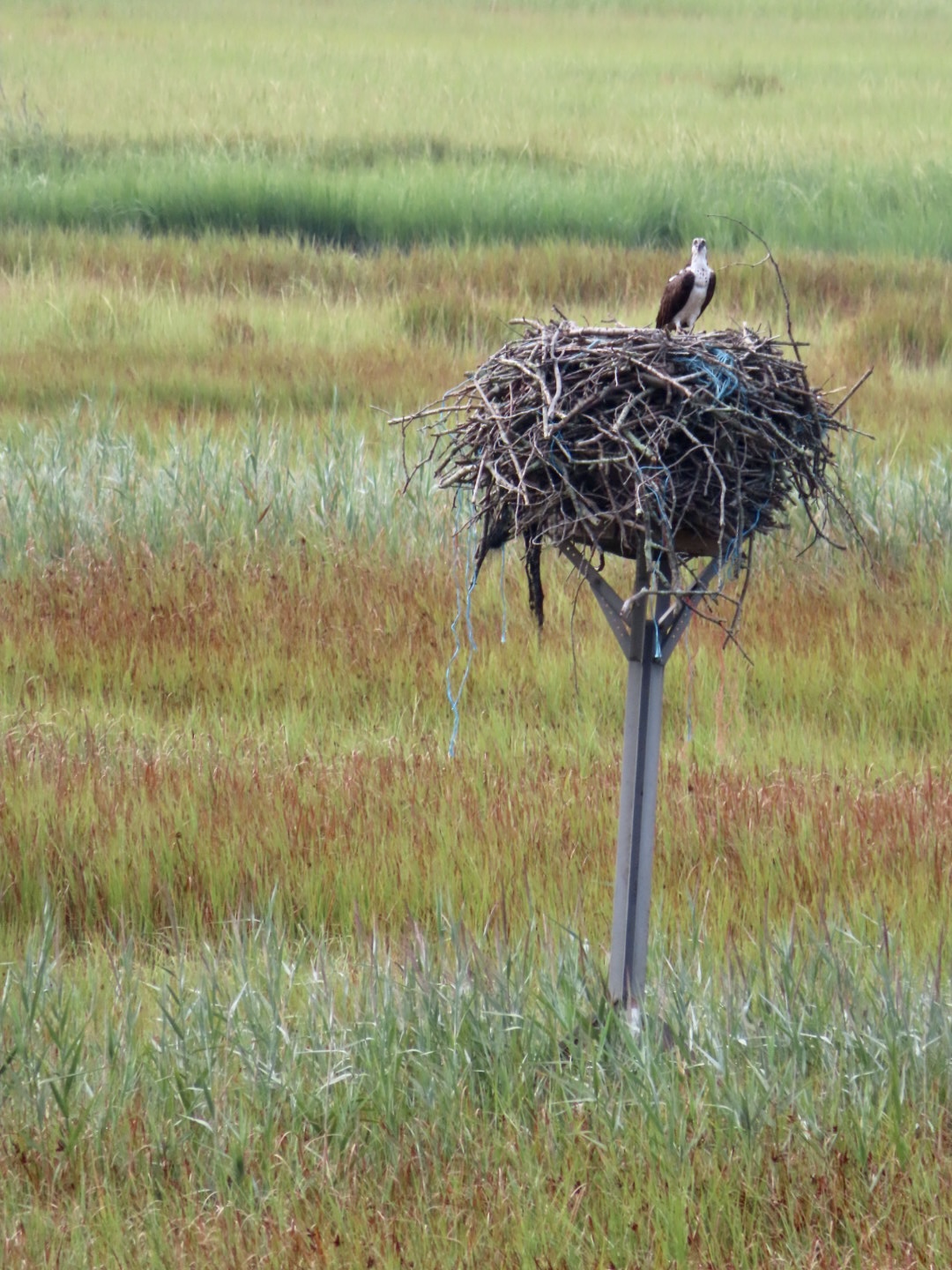
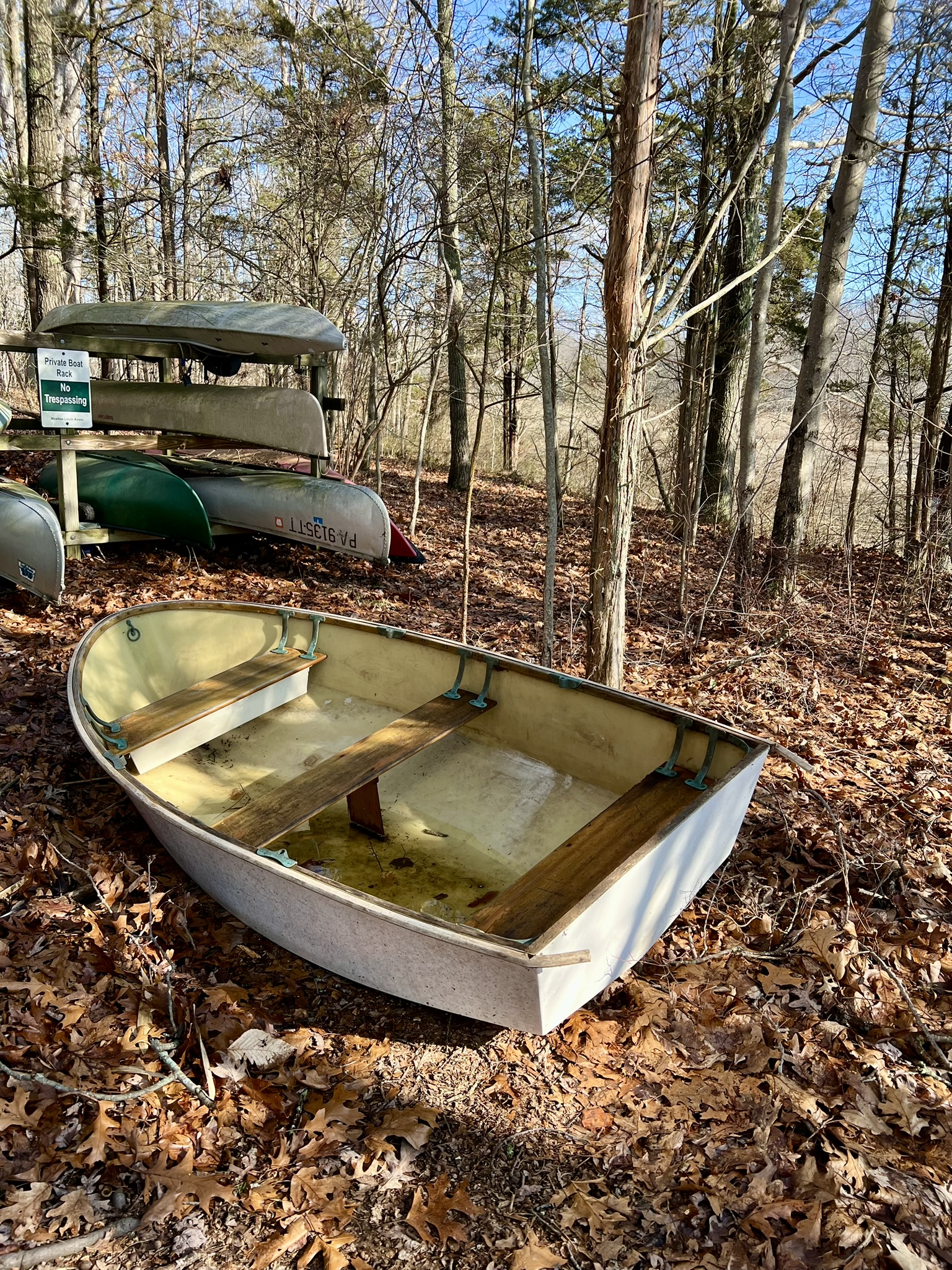
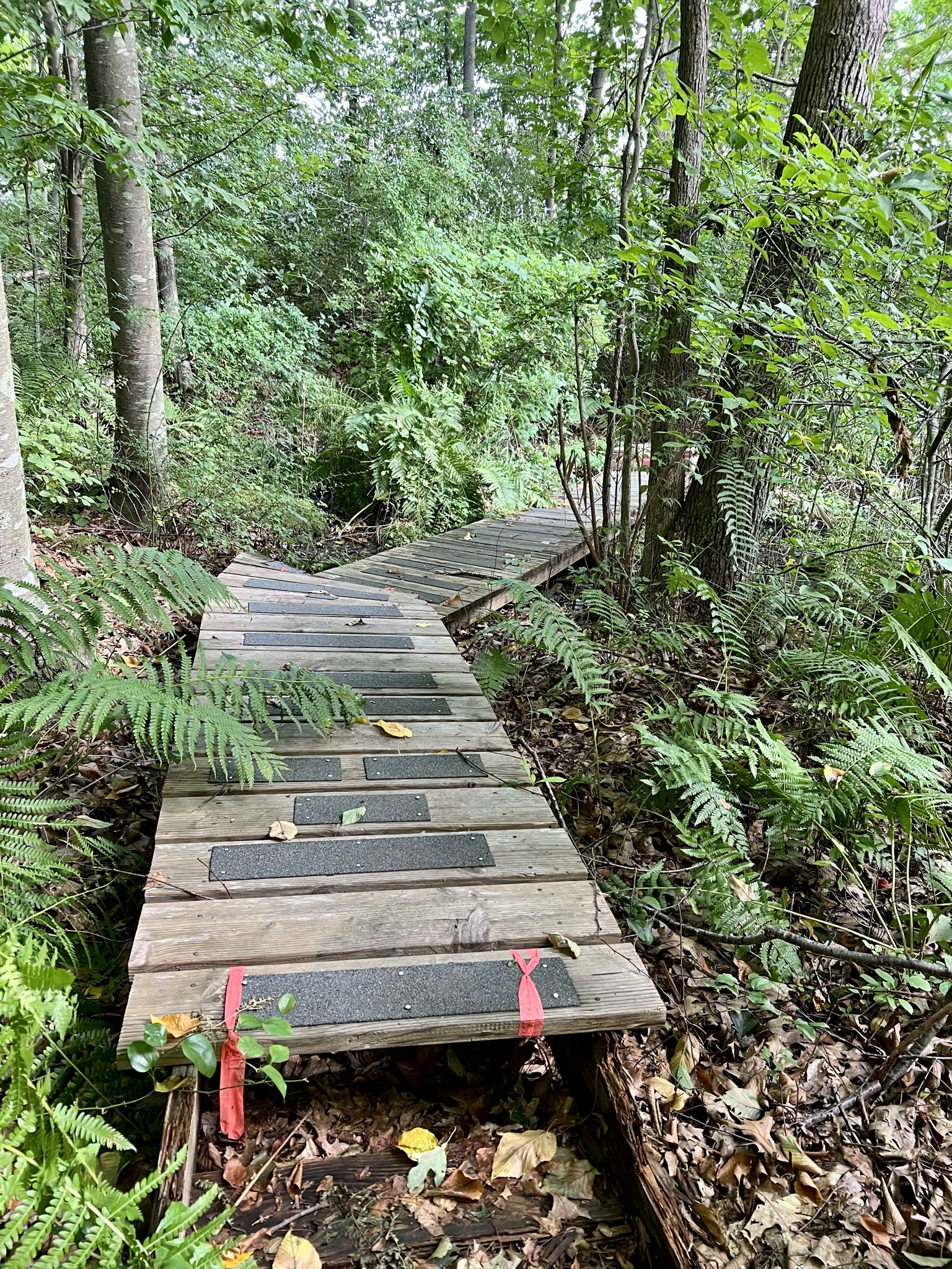
From left to right: In summer the signboards can get overgrown; osprey in summer; a rowboat blocking the trail in March; a boardwalk in summer
Subscribe to Trail Talk
your next adventure awaits
Questions? Email me at naturenerdsramble@gmail.com or find me on Instagram @the_real_nature_renee.