“El que lee mucho y anda mucho,
vee mucho y sabe mucho.”

(He who reads much and walks much,
sees much and knows much.)

Don Quijote de la Mancha, Part II, Chapter 25
 Miguel de Cervantes (1615)
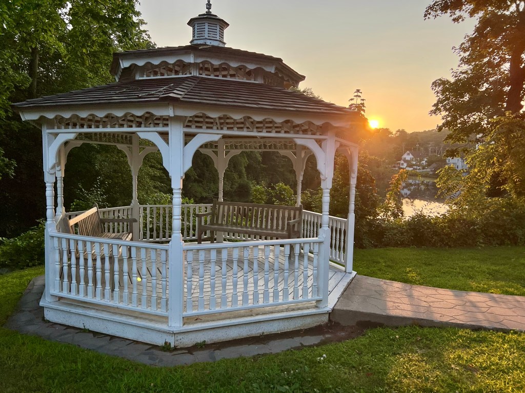
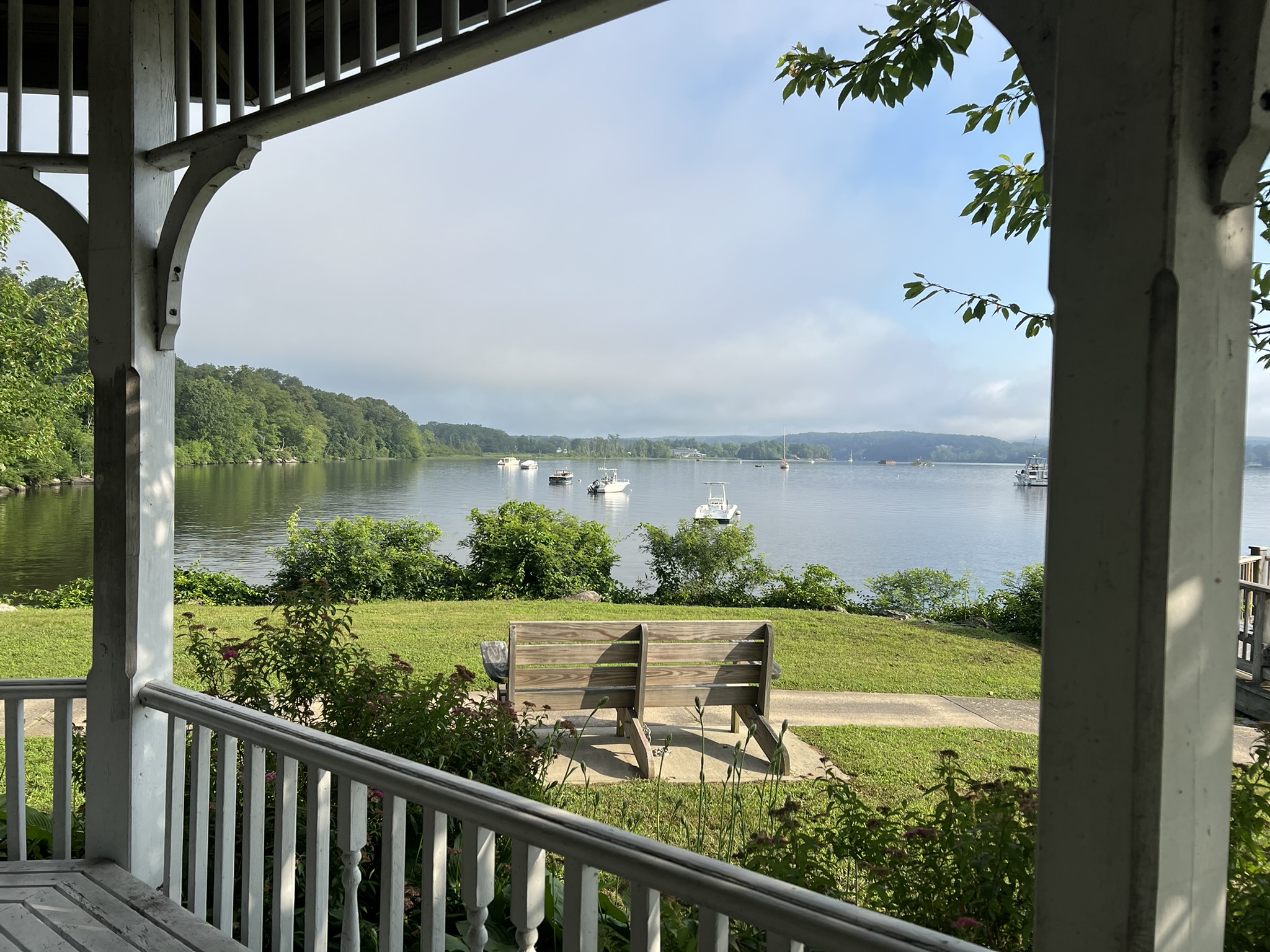
Deep River Gazebo at sunset
The genesis for this Trail Talk was an online course I took in early 2025 with the Rhode Island School of Design (RISD) entitled Mapping and Drawing Your World in an Art Journal. For my subject location I chose my hometown of Chester, Connecticut, which I studiously explored for six weeks, following prompts to examine my surroundings from various vantage points (industry, art, food etc.) Leaning into my love of walking/hiking and nature, I did many of my explorations on foot, incorporating detours to trails and parks. I felt I knew Chester fairly well, having been an official resident for nine years and a neighbor for almost 30 years before that, so I was intrigued and surprised at how much more there was to learn, and how fun it was to do so in the context of walking. From there, I explored the neighboring towns of Deep River, Clinton and Guilford through walking. There is so much to share that I am writing in two parts. This Trail Talk focuses on Chester and Deep River, and includes town walks and nearby traditional trails. I hope this post inspires you to do your own explorations.
Chester
Chester Cove Walk, 3 miles.
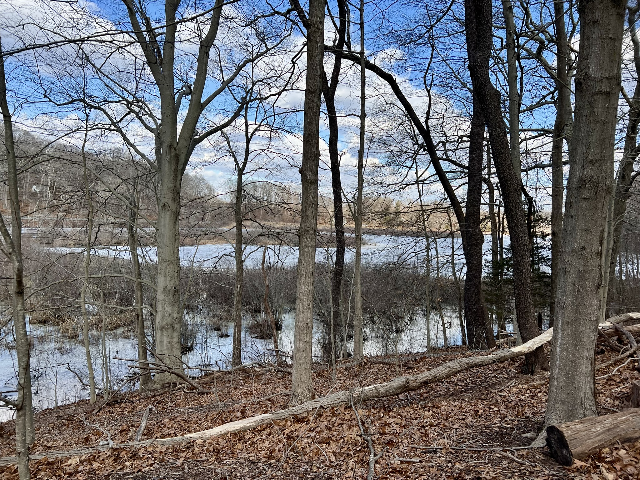
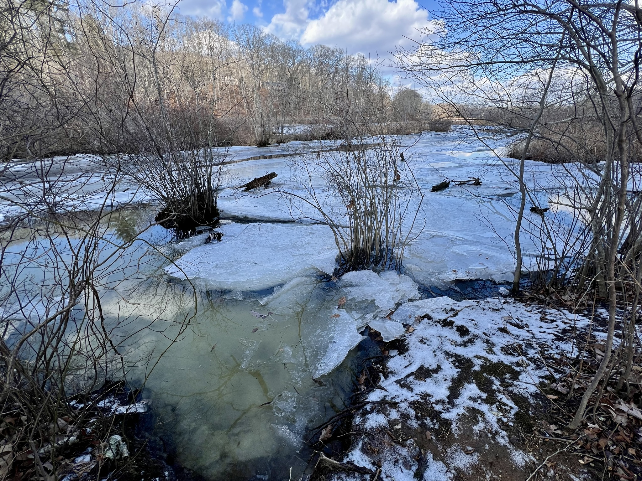
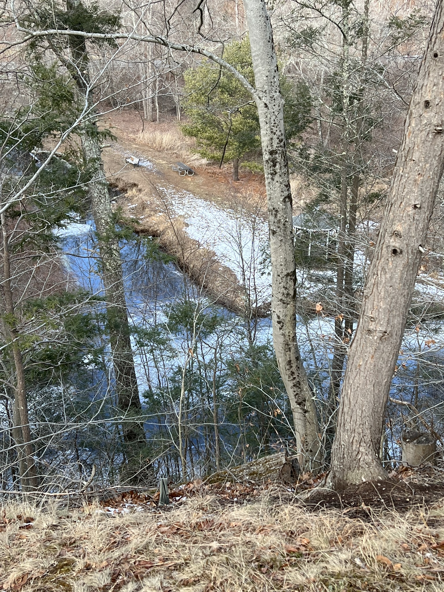
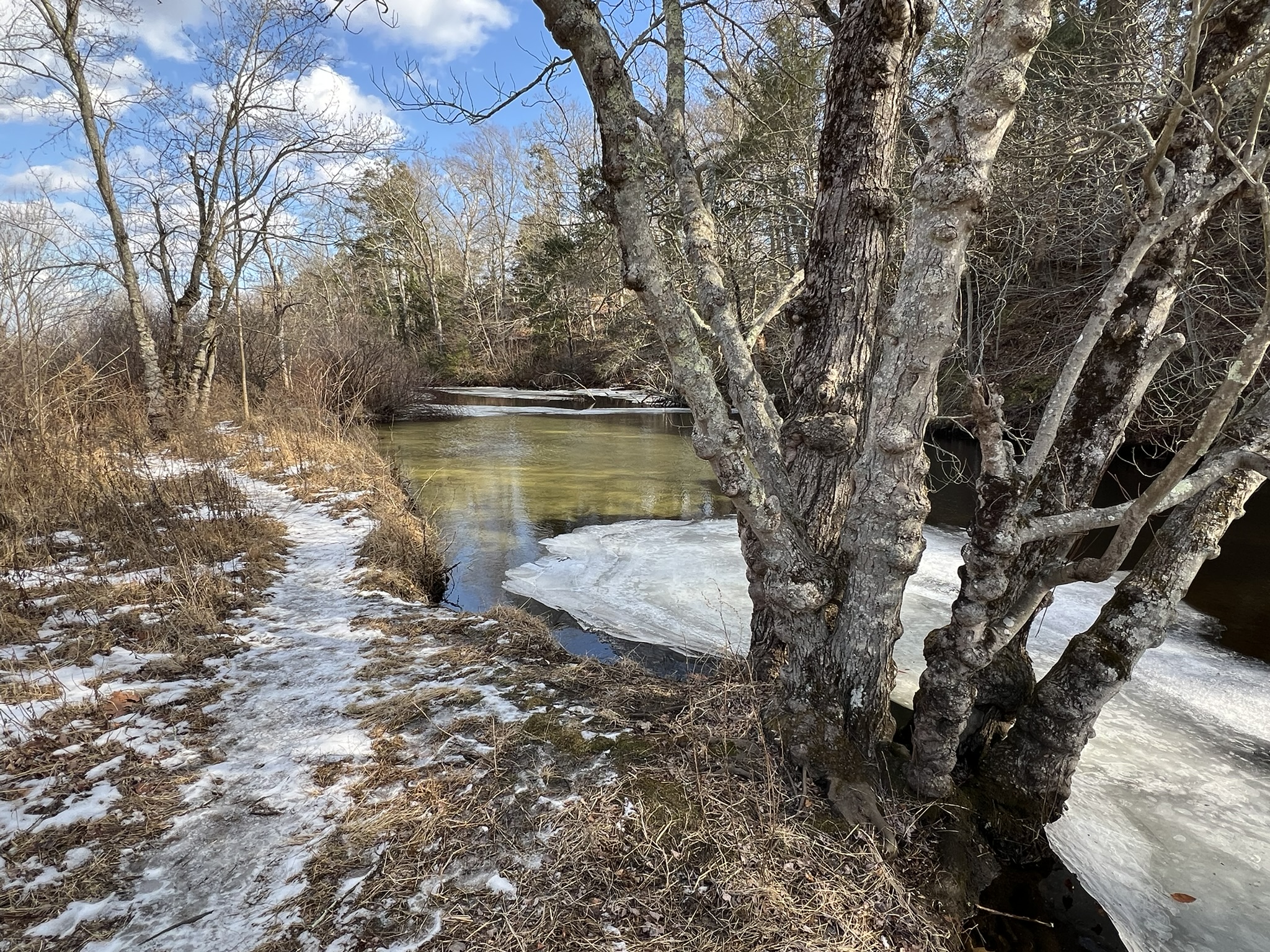
I was intrigued to learn that Chester Center was at one time the head of a navigable cove off the Connecticut River that supported a shipbuilding industry and booming maritime trade, which had its heyday between 1790 and 1840. I decided to explore the southern perimeter of this once grand cove, starting my walk at North Quarter Park at the corner of Route 154 and Main Street. The park’s name is a reference to Chester’s prior designation as the “North Quarter” of Saybrook before it became its own town in 1836. On my most recent visit in early 2026 I was excited to see several new additions – specifically a picnic pavilion and a Story Walk Project (details in these Meeting Minutes). Heading across the wide expanse of lawn I approached a sign marking the start of the Nature Trail. This is also the starting point of the Story Walk, which currently has a winter-themed picture book aimed at young children. The featured book will be swapped out periodically. This .5 mile nature trail crosses a brook, which can be tricky at high water, although an Eagle Scout project is in the works to build a bridge for easier access. The trail then enters the Anna Shubik Sweeney Preserve, following a lollipop loop, with seasonal views into Chester Cove. As I looked out onto the marshy cove I tried to imagine what it looked like with sailing ships entering from the river. NOTE: On March 22 at 1:00pm the Chester Park & Rec Department is holding a group event to tackle invasive species in the Anna Shubik Sweeney Preserve. CLICK HERE for details.
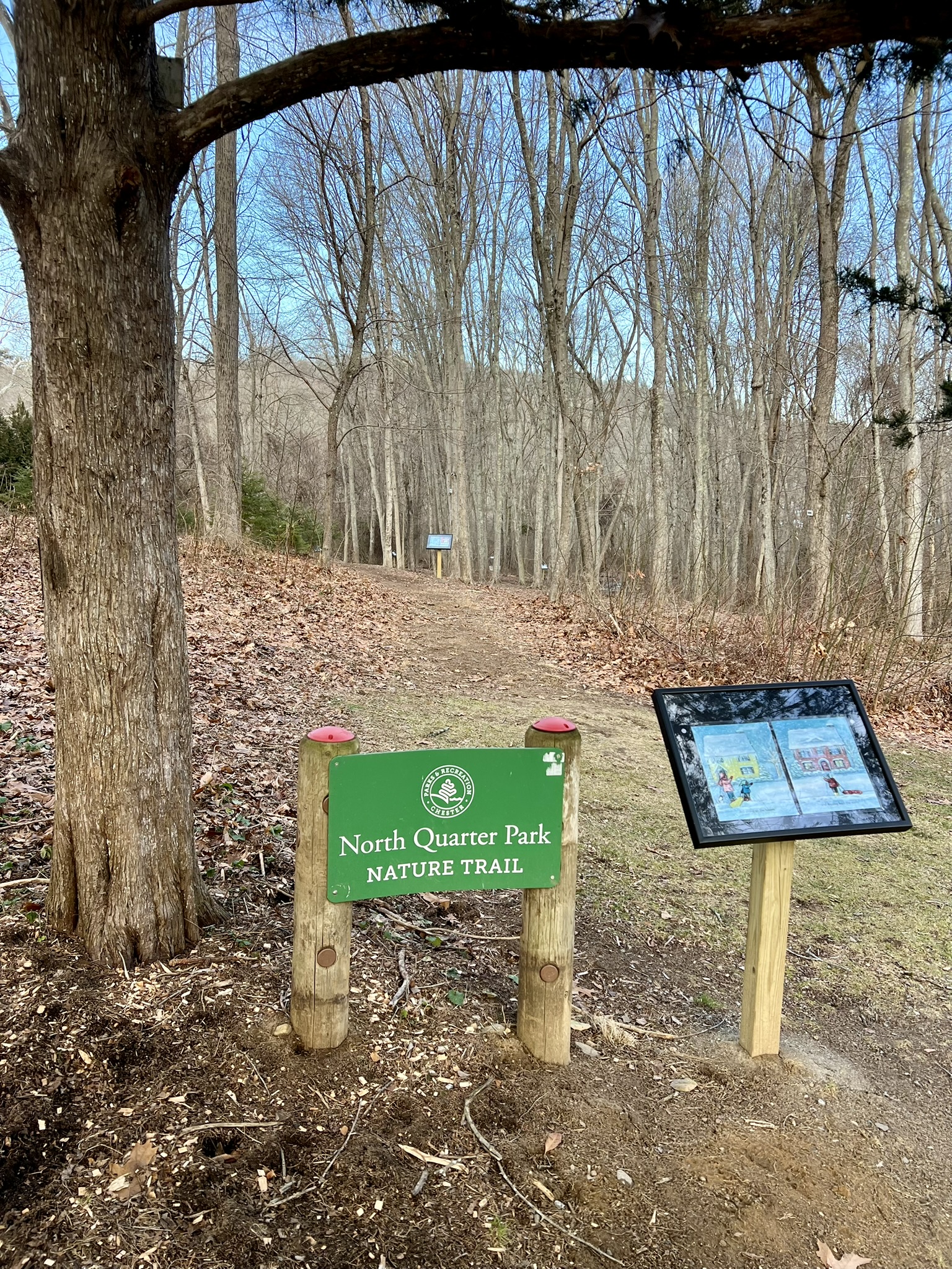
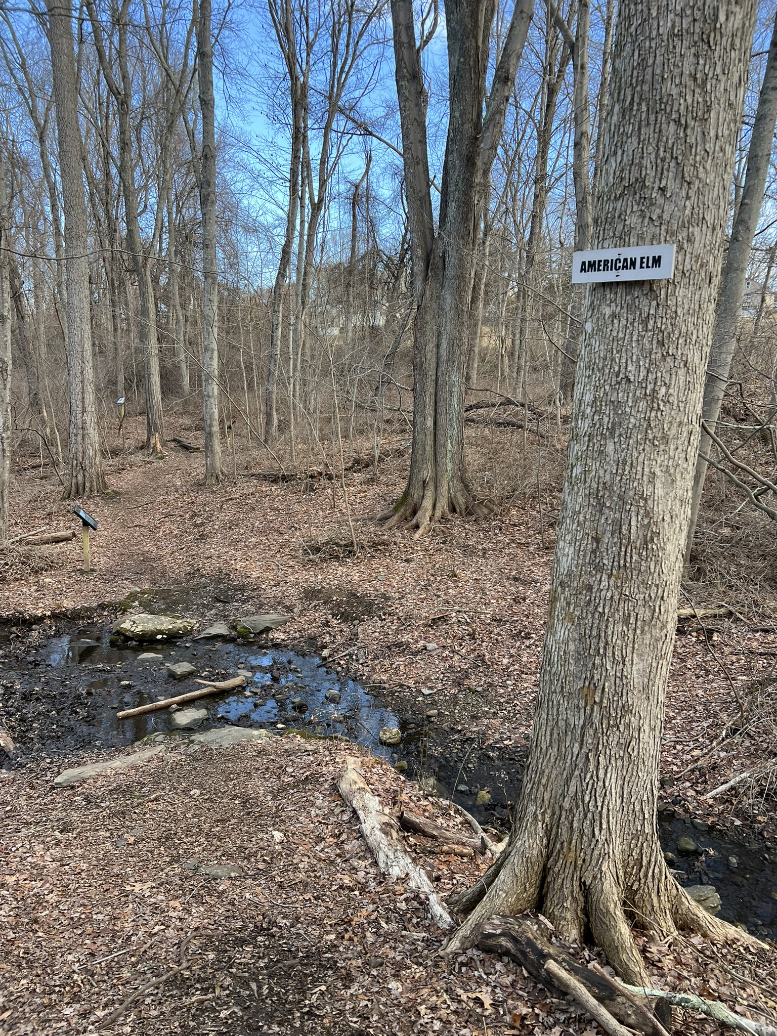
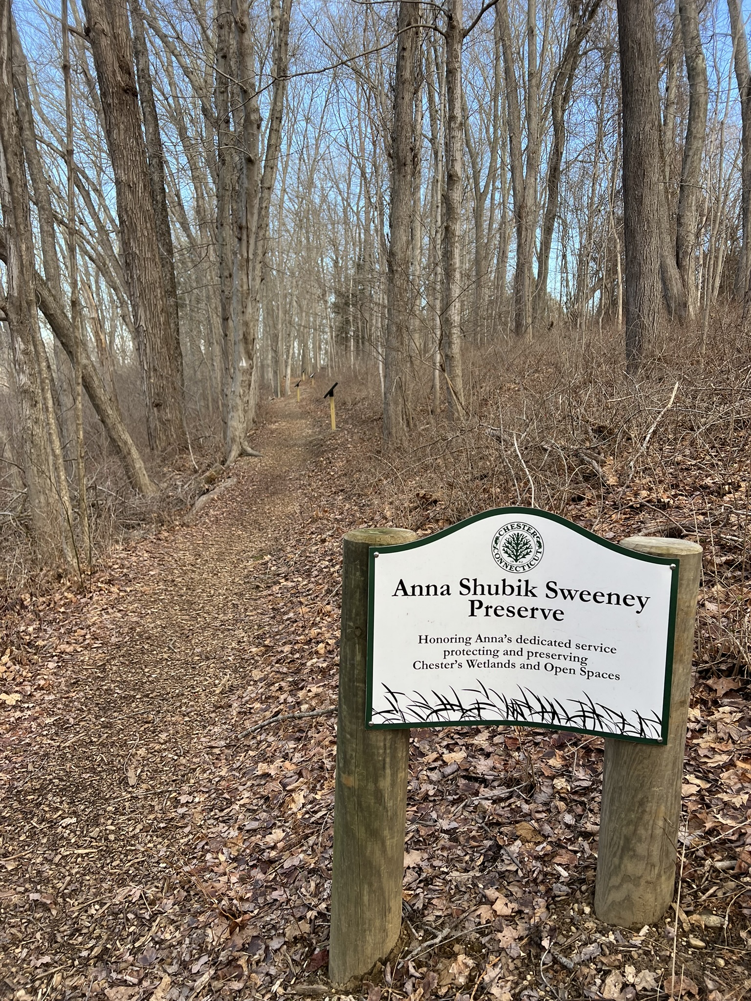
From left to right: Entrance to the Nature Trail and start of the Story Walk; an American Elm tree at the stream crossing; entering the Anna Shubik Sweeney Preserve; view of the cove
Finishing my nature walk, I continued along Main Street toward downtown Chester, detouring into Laurel Hill Cemetery, where I followed steps up to the top of the hill, before descending the cemetery road. From the edge of the steep embankment at the top there are seasonal views down to Pattaconk Brook as it flows through the Carini Preserve into the Cove. As the cemetery road curved around at the bottom of the hill I detoured to the edge to view the marshy cove from a different vantage point. Leaving the cemetery, I continued along Main Street, thinking how different the landscape looked from John W. Barber’s 1836 engraving in his Connecticut Historical Collection (scroll to page 521 and 522 of the original manuscript).
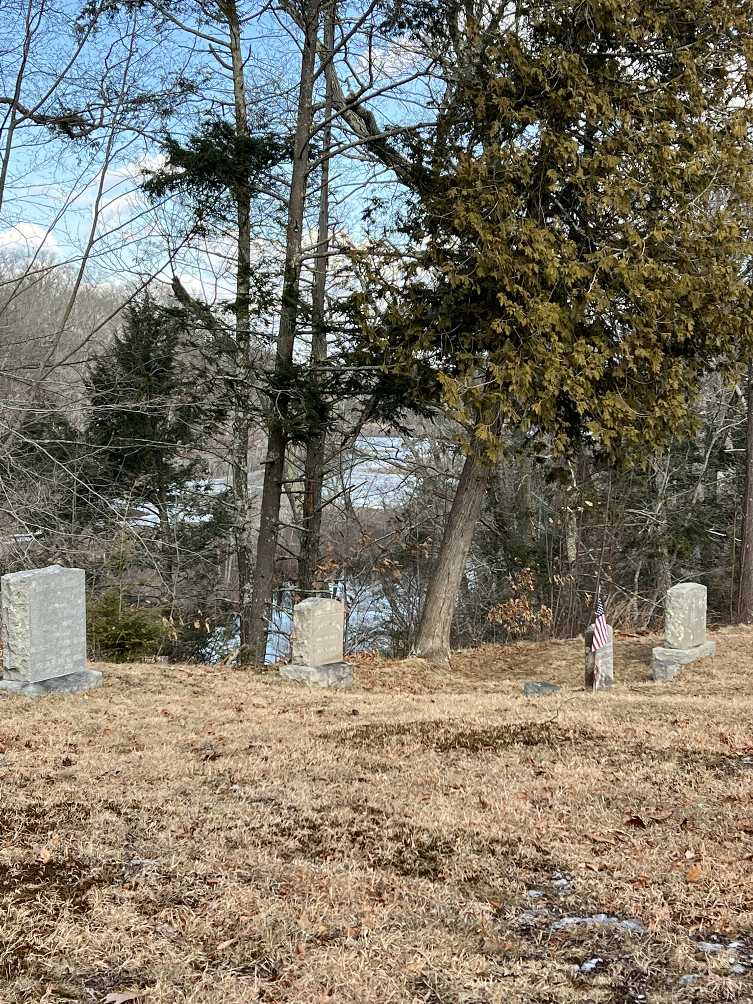
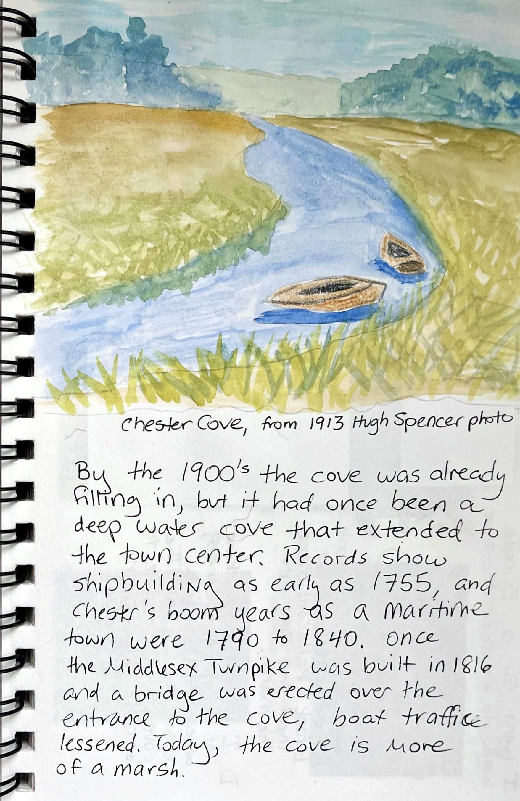
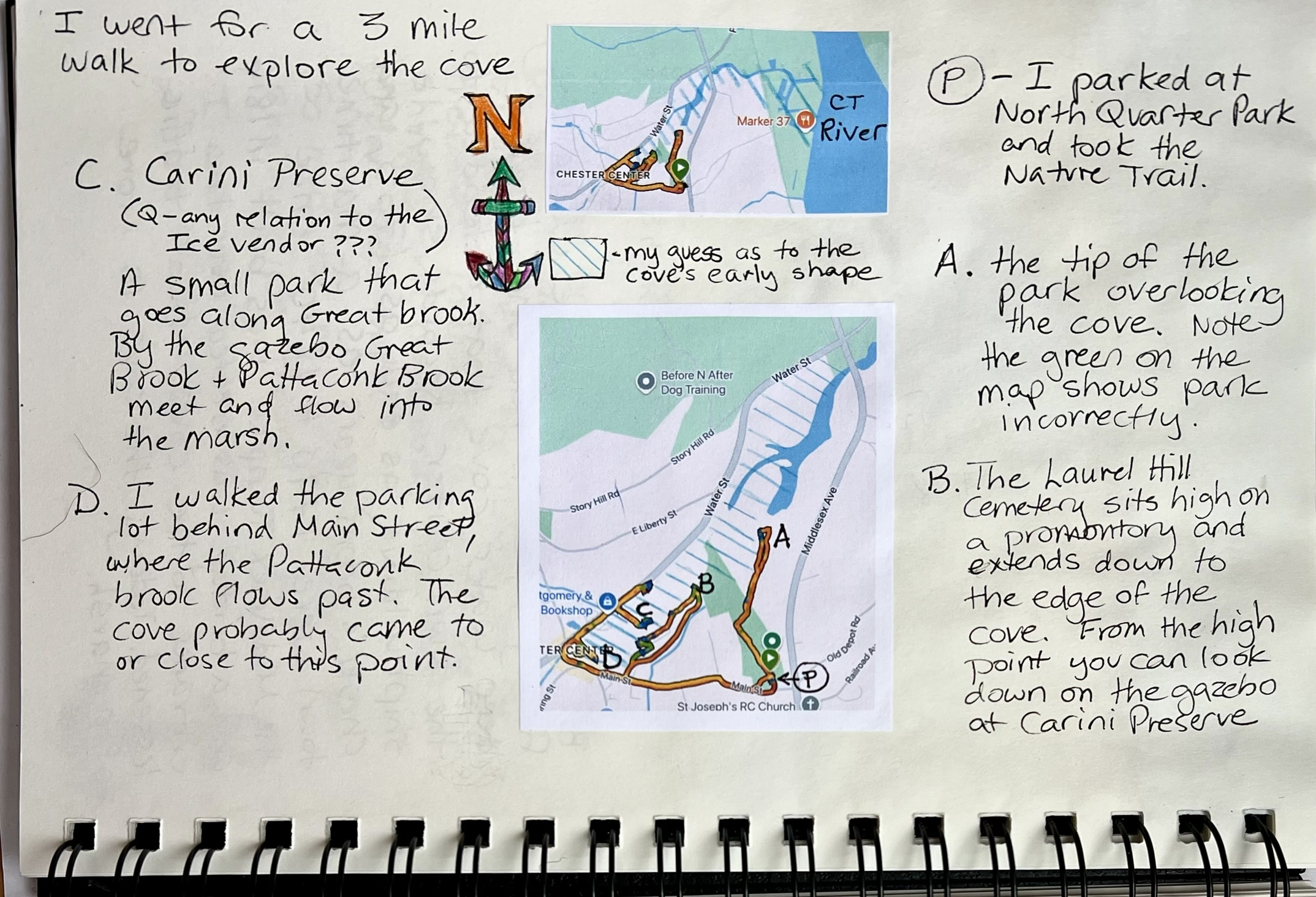
From left to right: View of the cove from the Laurel Hill Cemetery; the edge of the cove; my journal pages about the cove
At the four way stop I turned right on Water Street, stopping to watch the south branch of the Pattaconk Brook flow out from under Main Street toward the Cove. Just past the Water Street Parking lot I paused at another bridge to see where the north branch, or Great Brook, flows under the street toward the confluence with Pattaconk Brook. On the east bank is Carini Preserve, a 6.5 acre land trust property with benches, a picnic table, and a gazebo. There is a trail that continues a short distance along the creek before petering out at the marsh. In 2023 the Chester Land Trust initiated a project to remove invasive Japanese Knotweed that was choking out native plants along the banks. On my walk back through town, I had a good view of the Stone Store, built in 1809 by William Buck, which was constructed at an angle to face the head of the cove. Kate Silliman’s Chester Scrapbook describes Buck as “a merchant engaged in the West Indies trade”, and says that the “stone for the building is believed to have come from the Chester quarry near the present location of the Catholic cemetery.”
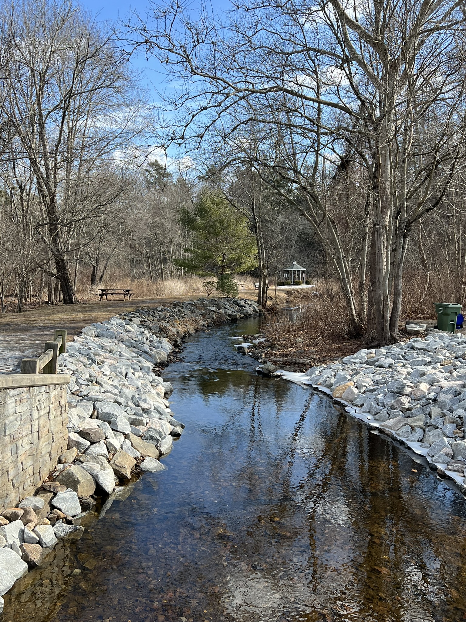
From left to right: View of the gazebo and confluence of Pattaconk Brook and Great Brook from the cemetery; Great Brook from the bridge; path along the cove; the Stone Store
Chester Mills Walk, 2.5 miles.
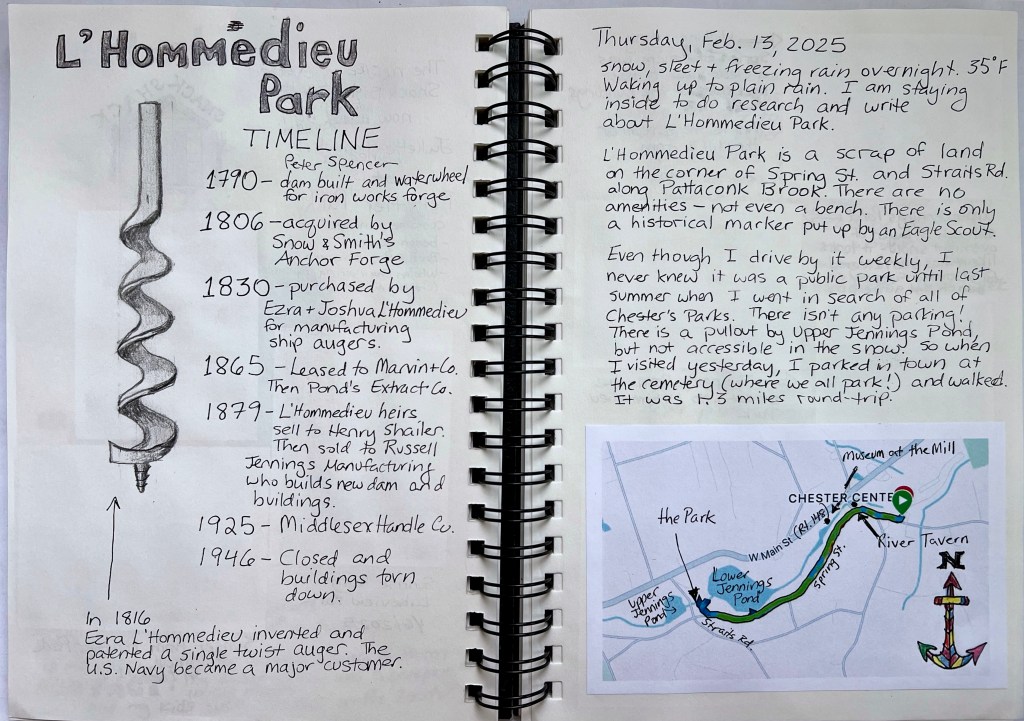
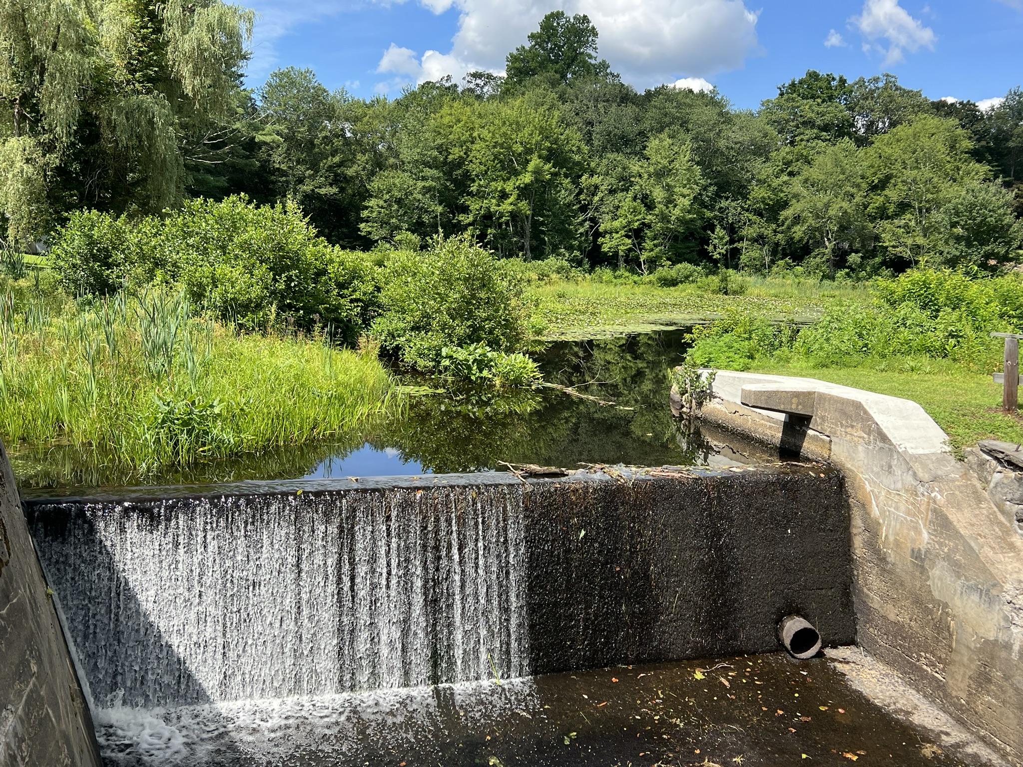
While shipbuilding and maritime trade shaped much of Chester’s early history, water-powered manufacturing made Chester a “quintessential small New England mill town,” as Nathan L. Jacobson writes in his 2023 book, “The Streams, Mill Dams and Mills of Chester.” According to Jacobson, there are 28 dams in Chester currently under the purview of the CT DEEP (Department of Energy & Environmental Protection), twenty of which “were built or used for waterpower purposes, though none is still in use for waterpower.” This 2.5 mile loop walk goes past four dams and mill ponds, and two former mills. Parking in downtown Chester, head up Spring Street, which rises between the Nilsson Studio and Art Gallery and the Little House Brewing Company. I recommend visiting one or both of these establishments, although the brewing company is perhaps best visited at the end of your walk. Nilsson’s home and studio is in a beautiful historic building constructed around 1840 as a hotel and tavern. As you walk up Spring Street you first pass Griswold Pond on your right, with a view to Chester’s Museum at the Mill on the opposite bank (more on that later). Then you reach Jennings Pond Dam and behind it, Jennings Pond, named after Russell Jennings who took over the dam and manufacturing site in 1865. The original dam was built by George G. Griswold c. 1842 to provide power to his mill where he manufactured augers and bits. As you pass the dam and descend to the level of the pond, you can have a rest at the parking pullout where there is a bench and fire pit. Depending on the season, you may see locals ice skating and ice fishing. Take a lingering look at the pond and surrounding homes, then seek out the delightful 1950’s Doris Day/Jack Lemmon movie “It Happened to Jane”. The movie was filmed in Chester, and Jennings Pond plays the part of a seaside cove in Maine where Jane has her lobster business. Continue along Spring Street to the intersection with Straits Road. Here you will find tiny L’Hommedieu Park. Enter by way of the wooden bridge, which crosses the old sluiceway. While there are no amenities at this park, there is a small history sign alongside Pattaconk Brook with views to the Upper Jennings Pond Dam above and Jennings Pond below. The original dam was constructed in 1790. The park is named after Ezra L’Hommedieu, who, with his brother Joshua, operated a ship auger manufacturing company there from 1830 to 1865. Russell Jennings Manufacturing acquired the property in 1879 and built a new dam and buildings. After a few more ownership changes the buildings were torn down in 1946.
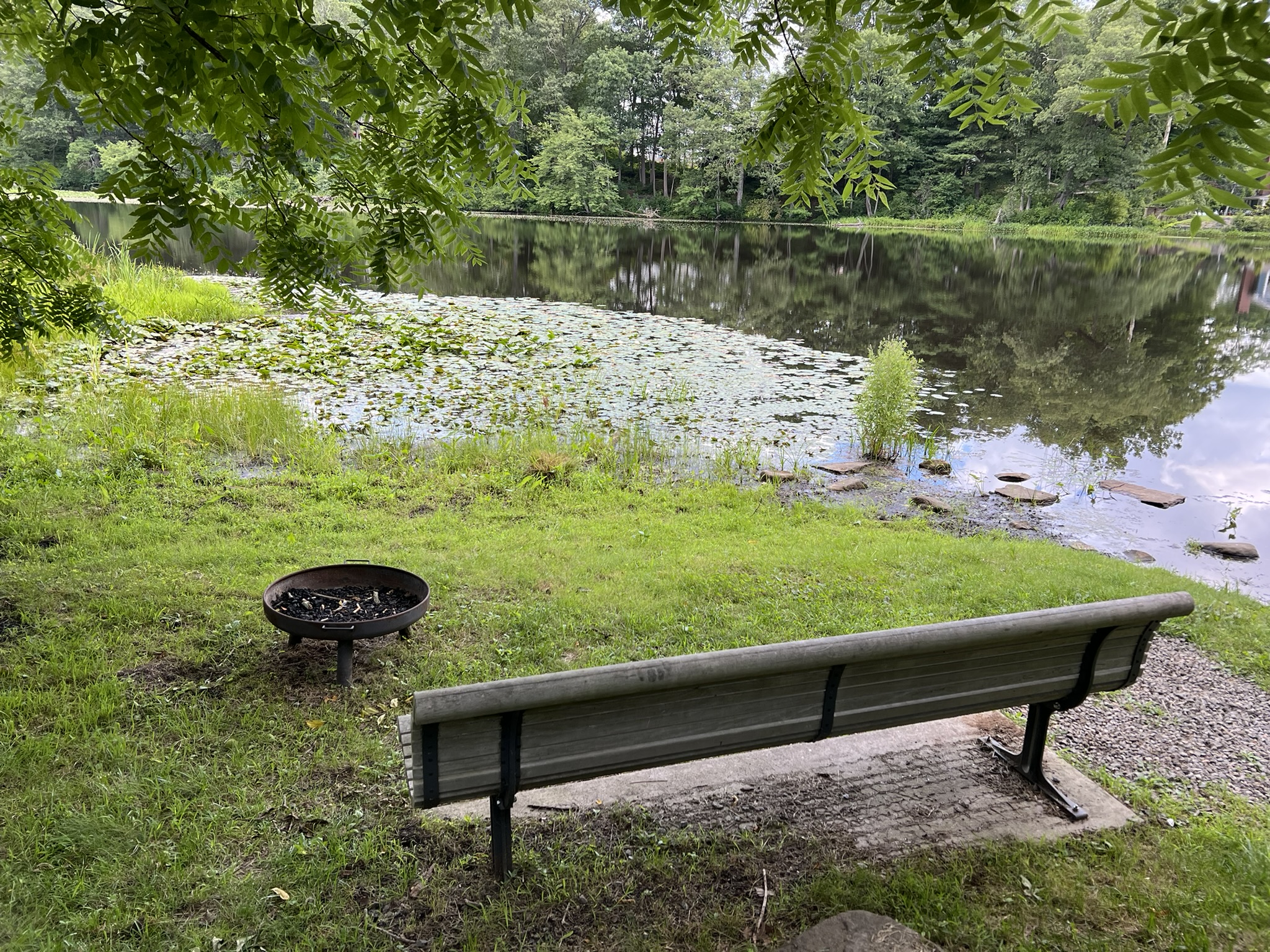

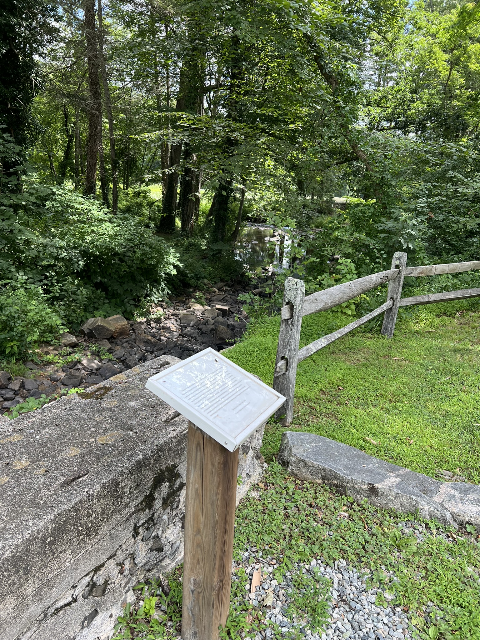
From left to right: Bench and firepit at Jennings Pond; the bridge across the sluiceway to L’Hommedieu Park; interpretive sign along the brook; view of the park from Straits Road
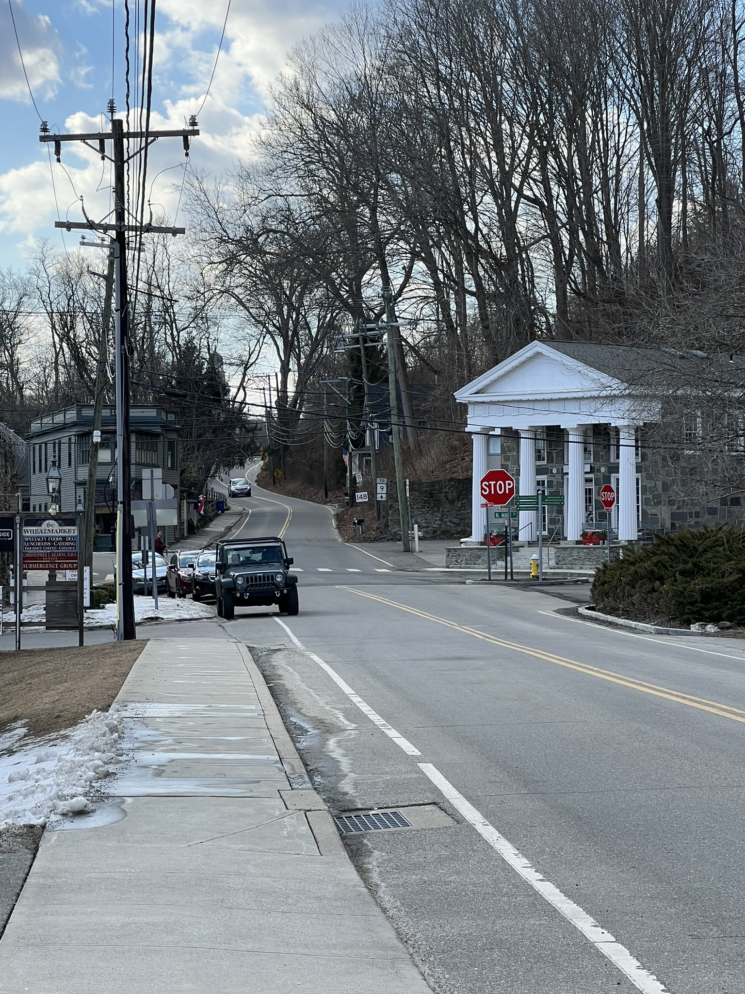
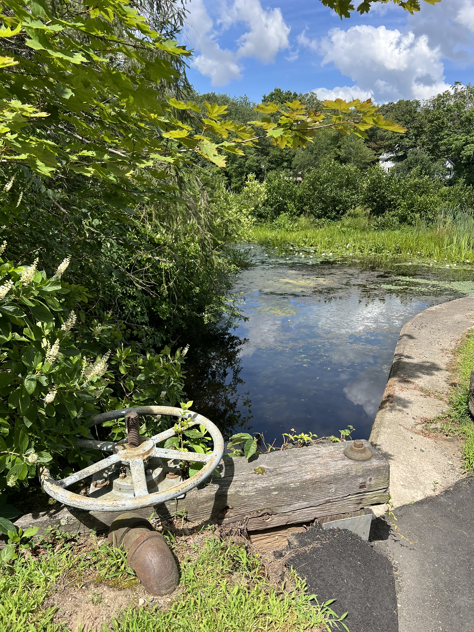
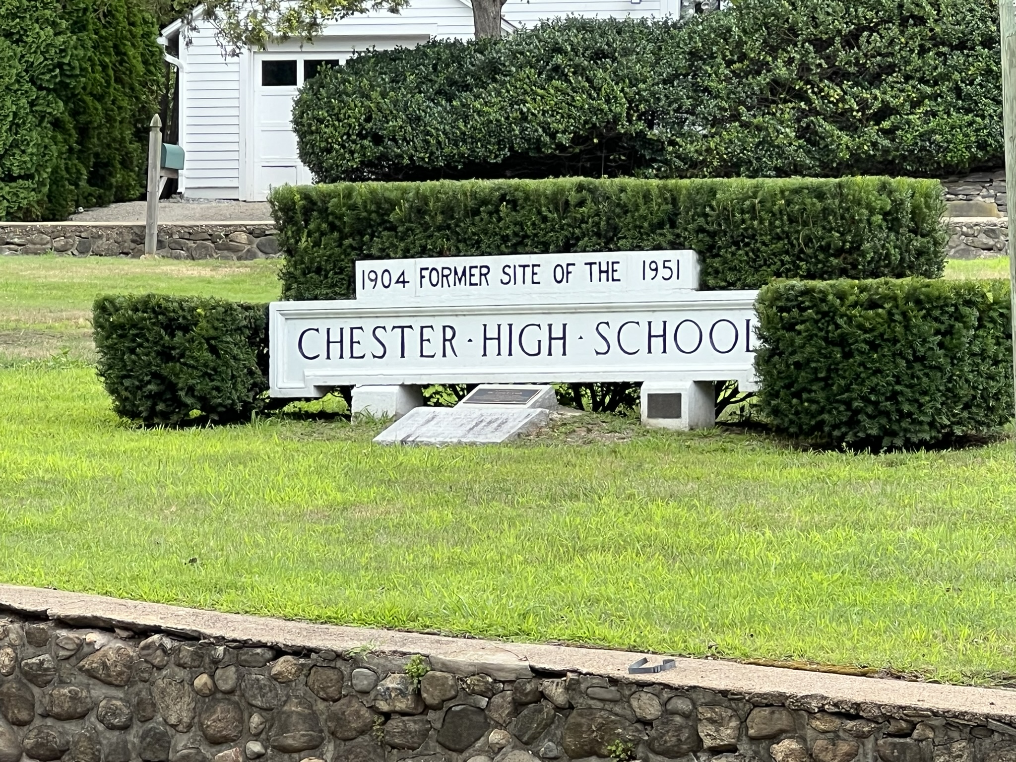
Turning right onto Straits Road, you will see the Upper Jennings Pond and dam, where you can often find herons and ducks, turtles and other pond creatures. To the left of the dam, look for the wheel that controls the sluice gate (rebuilt after the 1982 flood). This gate controlled the flow of water from the mill pond under Straits Road into a wooden stave penstock and turbine shed of the Middlesex Handle Company (the ax handle shop), the last manufacturer at this site. Continue on Straits Road to the intersection with Route 148 and turn right. There is no sidewalk along this section so I recommend crossing the street and walking against traffic, where there is a wider shoulder and grass. Cross back over when the road curves and a sidewalk appears. After passing High Street on the left and reaching the Chester Library, notice the grass triangle across the street with the stone wall, steps to nowhere and the Chester High School sign. A stone engraving under the sign reads “The Wall of Memories. The low masonry wall (circa 1925) surrounding this former playground now harboring fond memories of many schoolmates, was restored in 2003 by the town of Chester and the Chester High School Alumni Association and its friends…”
From left to right: the Upper Jennings Pond dam; the sluice gate controls; former site of Chester High School; the old steps to the playground
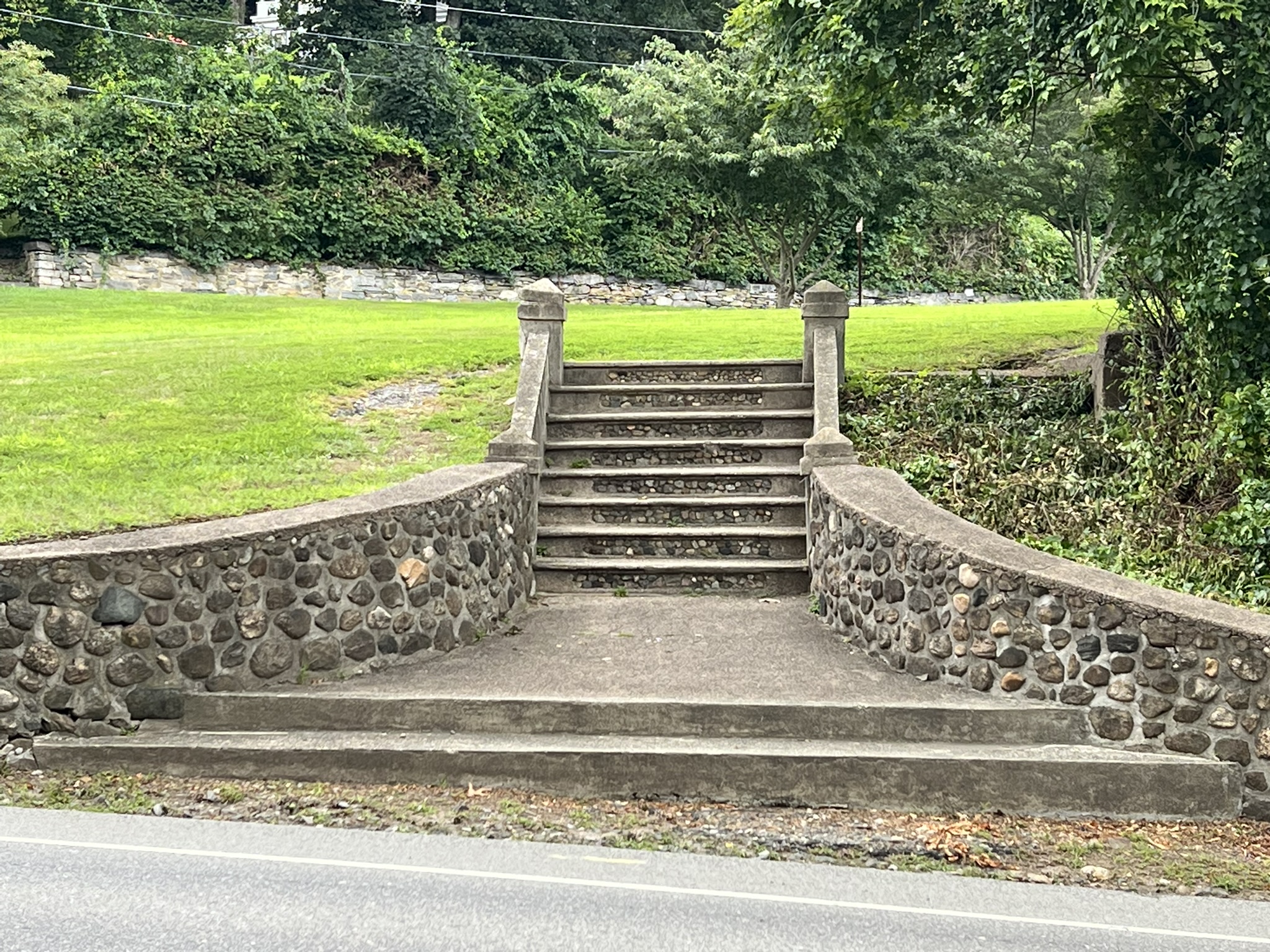
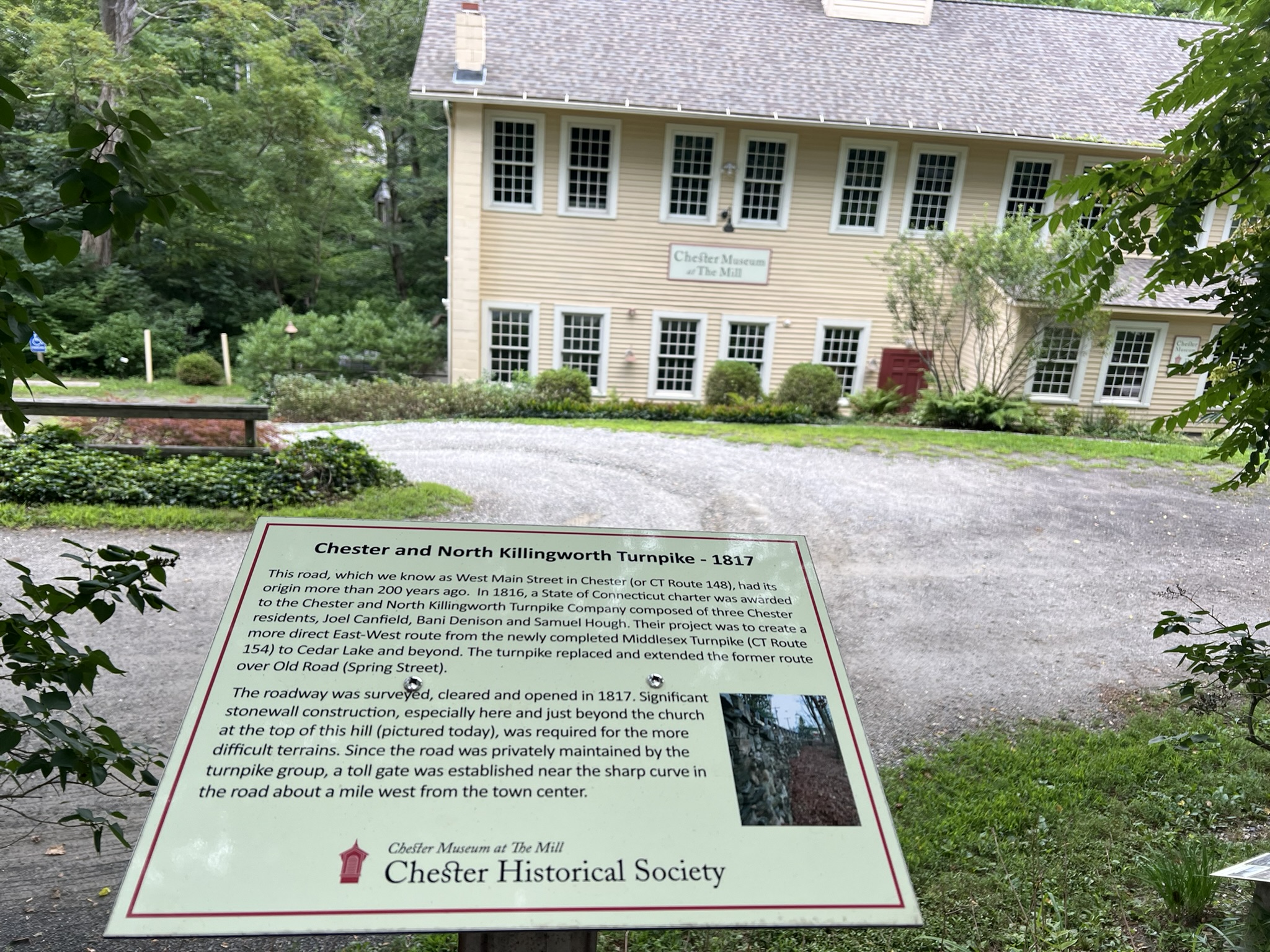
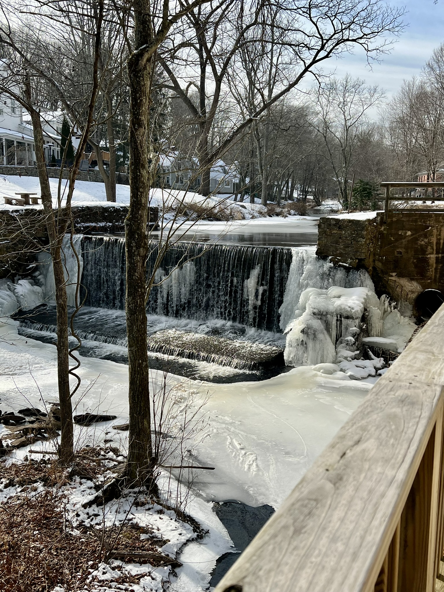
Heading down the hill into town, take a moment to stop at the Chester Museum at the Mill, housed in a former mill building alongside the Griswold Pond Dam #2. According to Jacobson, “[t]he dam and original mill building was constructed circa 1825 by Abel Snow to produce iron ship anchors, which he sold primarily to shipbuilders in Chester Cove.” In 1850, Charles L. Griswold and partners bought the dam and mill site, rebuilding both for an auger bit business. Over the years the building housed a Masonic Lodge and the National Theater of the Deaf. In 2001 the Chester Historical Society bought the building and opened the museum. Open from June to October, with hours Friday to Sunday, the museum has a superb permanent exhibit as well as temporary exhibits. A highlight is the interactive display showing the history of all the dams and mills. Even when the museum is closed you can walk the grounds and read several signboards on different aspects of Chester’s history, and get a glimpse of the dam and mill pond. Continue to the intersection with Main Street and turn left at the old Stone Store onto North Main Street. As you walk, watch for 16 North Main Street on your right, which has the honor of being the oldest standing home in Chester. It has a plaque reading “Thomas Dunk House – 1672”. At the fork, stay right on Goose Hill Road and continue to where Goose Hill meets Liberty Street/East Liberty Street and Story Hill Road by the Village Green. The old burial grounds (dating to 1736) will be on the left and the Old Cemetery(dating to 1804) on the right. Before taking a left on Liberty Street, walk around the grounds of the Chester Meeting House, built in 1793. It has served many purposes and undergone several improvements, and is “one of a very few buildings in New England that has been in continual use for 200 years,” according to the Town website. Continue on Liberty Street, taking the next left onto North Main Street, then pause before the junction with High Street. On your right you will see Great Brook Dam #1, which was constructed circa 1875 by S. Silliman & Company (the original dam in this location was built around 1837). According to Jacobson, “[i]t has gone through several iterations, with the latest improvements in the 1930’s by C.J. Bates & Company.”
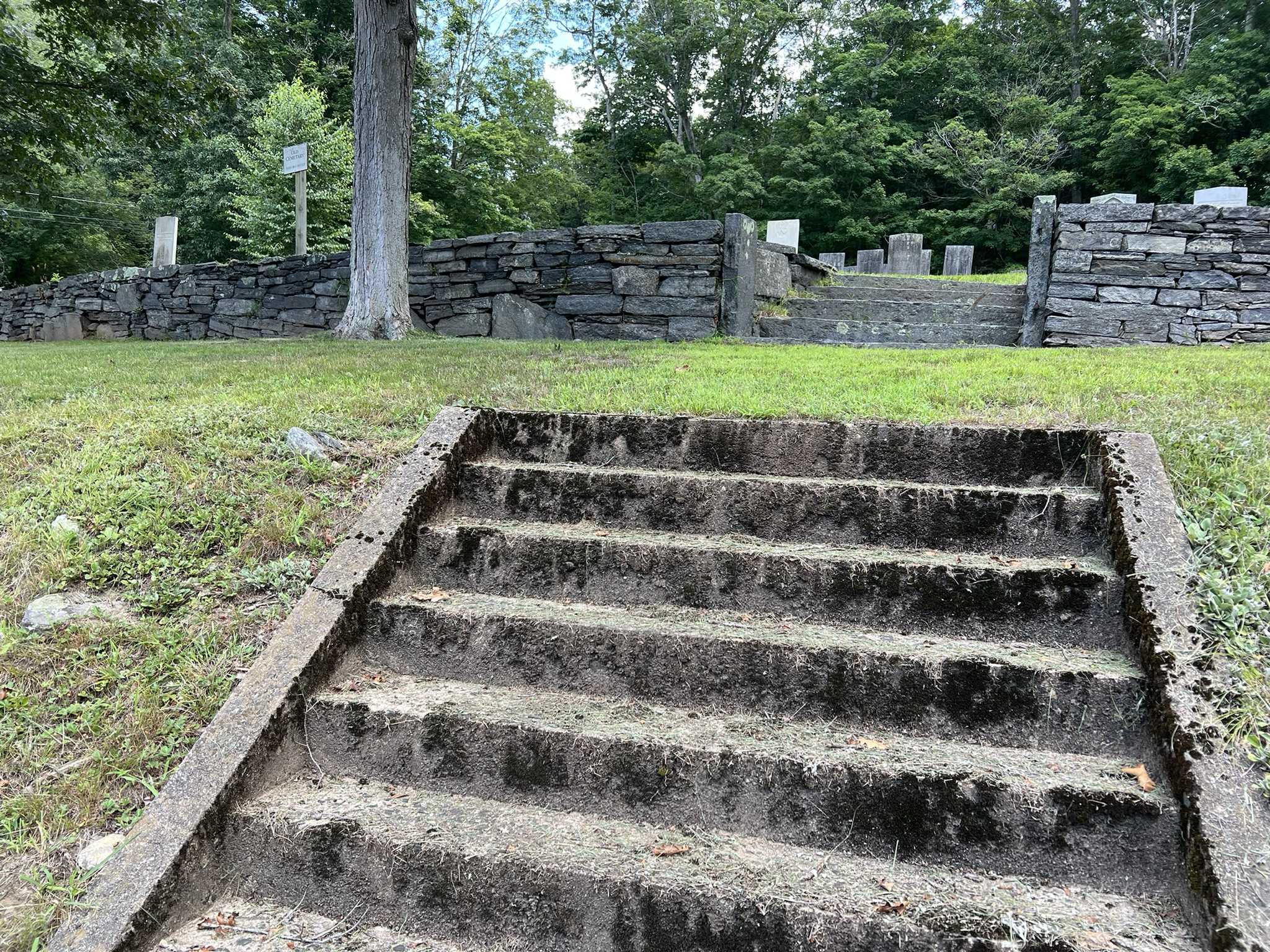
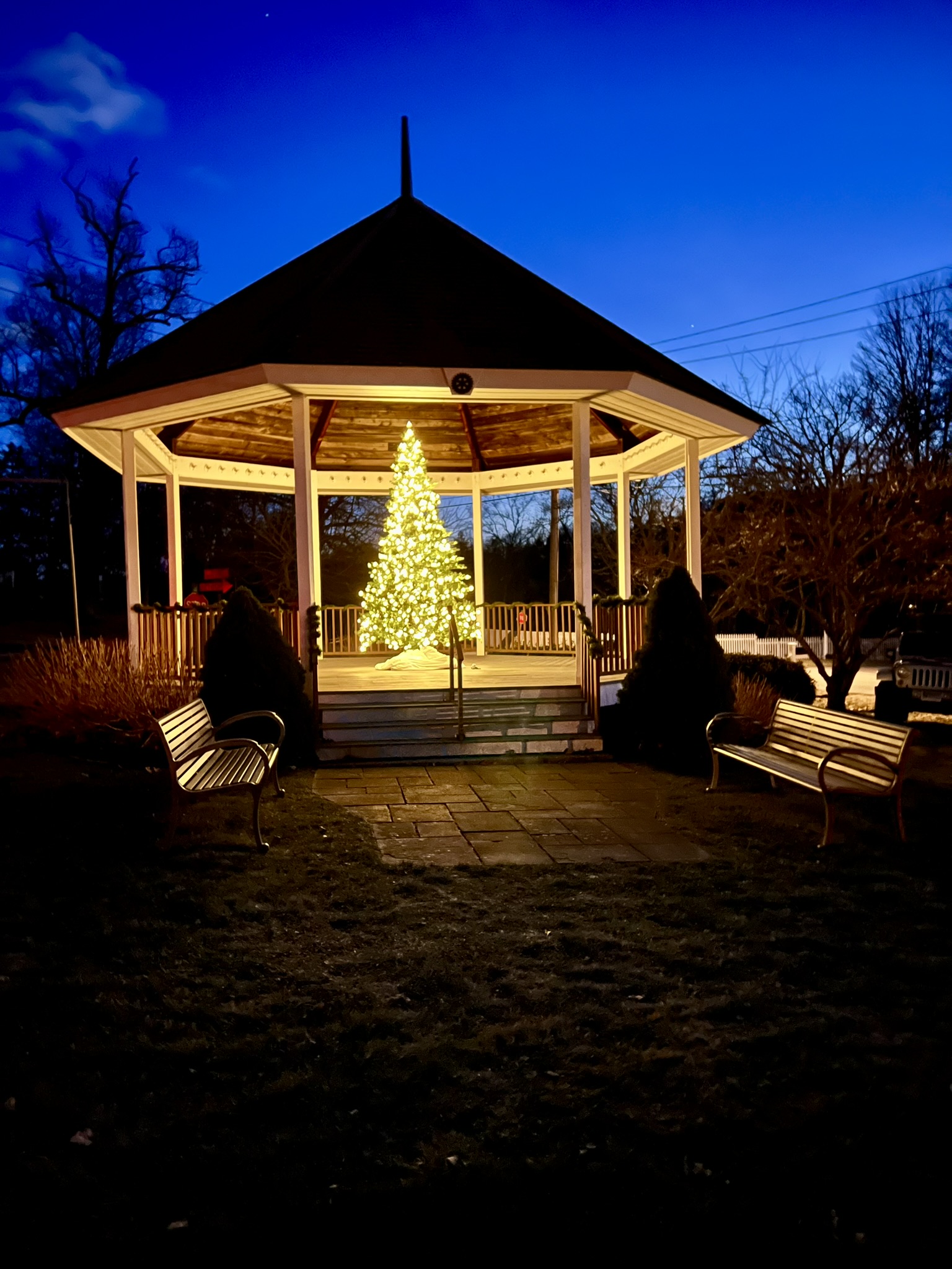
From left to right: Interpretative sign along Route 148 above the Chester Museum at the Mill; Griswold Pond Dam #2 behind the museum; steps to the Old Cemetery; Meeting House gazebo on a winter night
Continue down North Main Street, stopping to view the Goodspeed-at-Chester Norma Terris Theater. The theater is housed in the old C.J. Bates factory building, which was gifted, along with the dam, to the Goodspeed Opera House Foundation in 1971. Returning to the town center, treat yourself to a meal at one of Chester’s many establishments, such as the iconic Villager (my favorite breakfast spot) or River Tavern, housed in the old F. E. White & Company building, which later operated as “Robbie’s Store”, built in 1899. According to Kate Silliman’s Chester Scrapbook, the second floor apartment was used during the filming of “It Happened to Jane” and the name WHITE still appears above the third floor Palladian window, something I had never noticed in all my years of frequenting River Tavern.
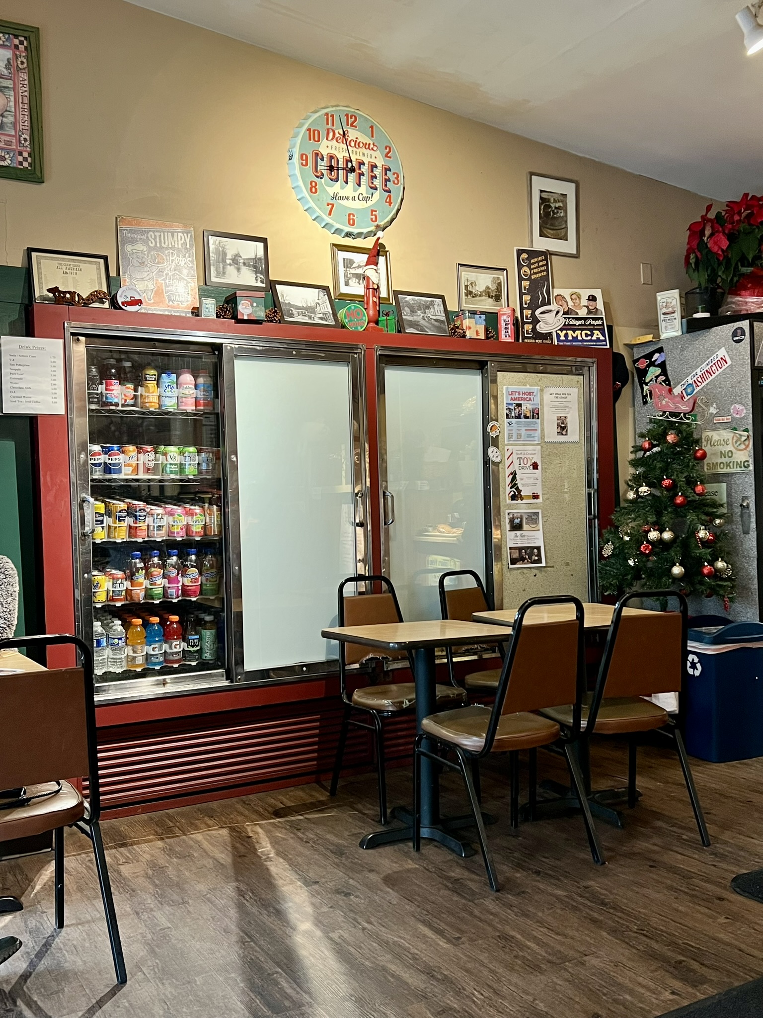
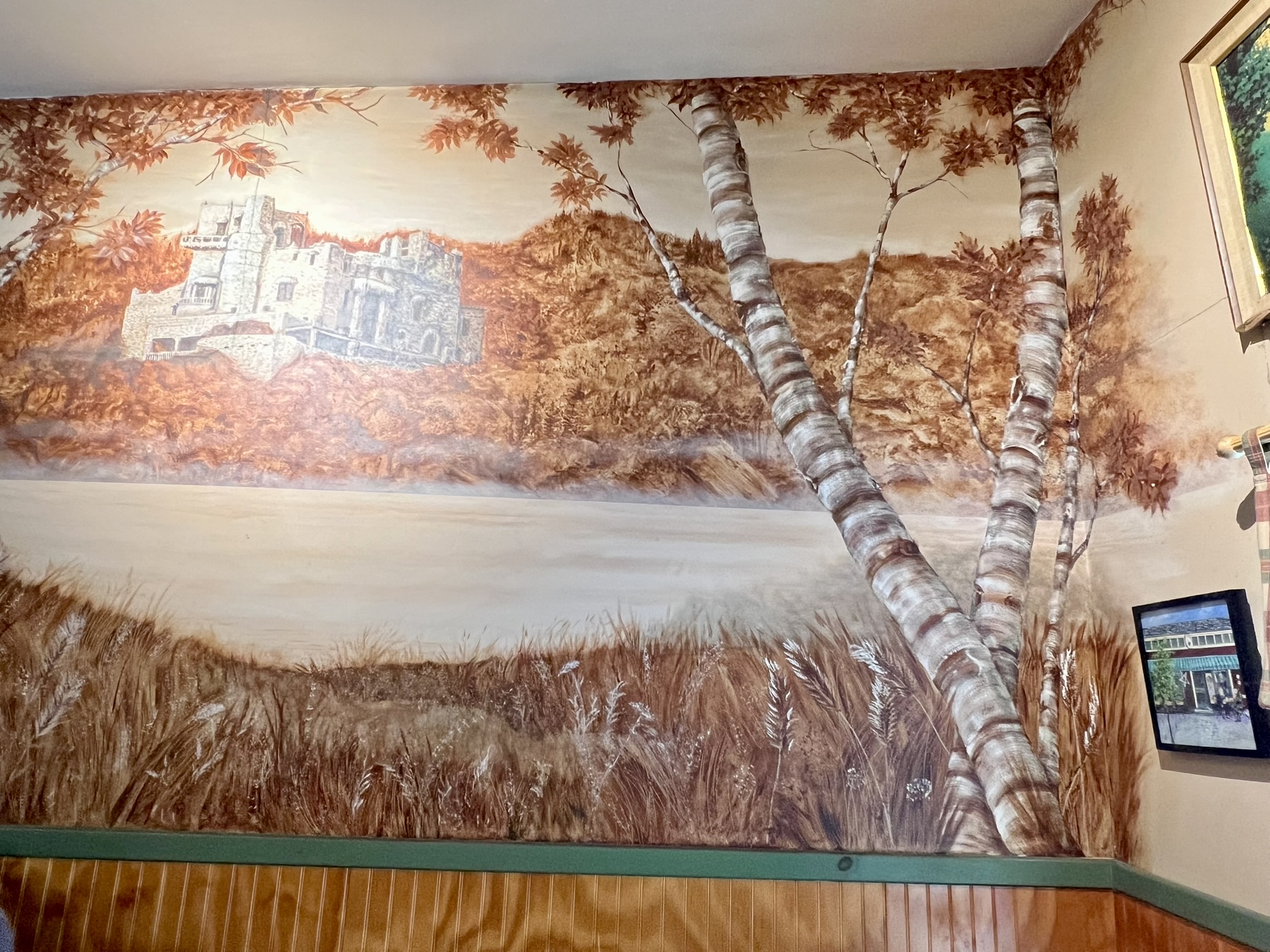
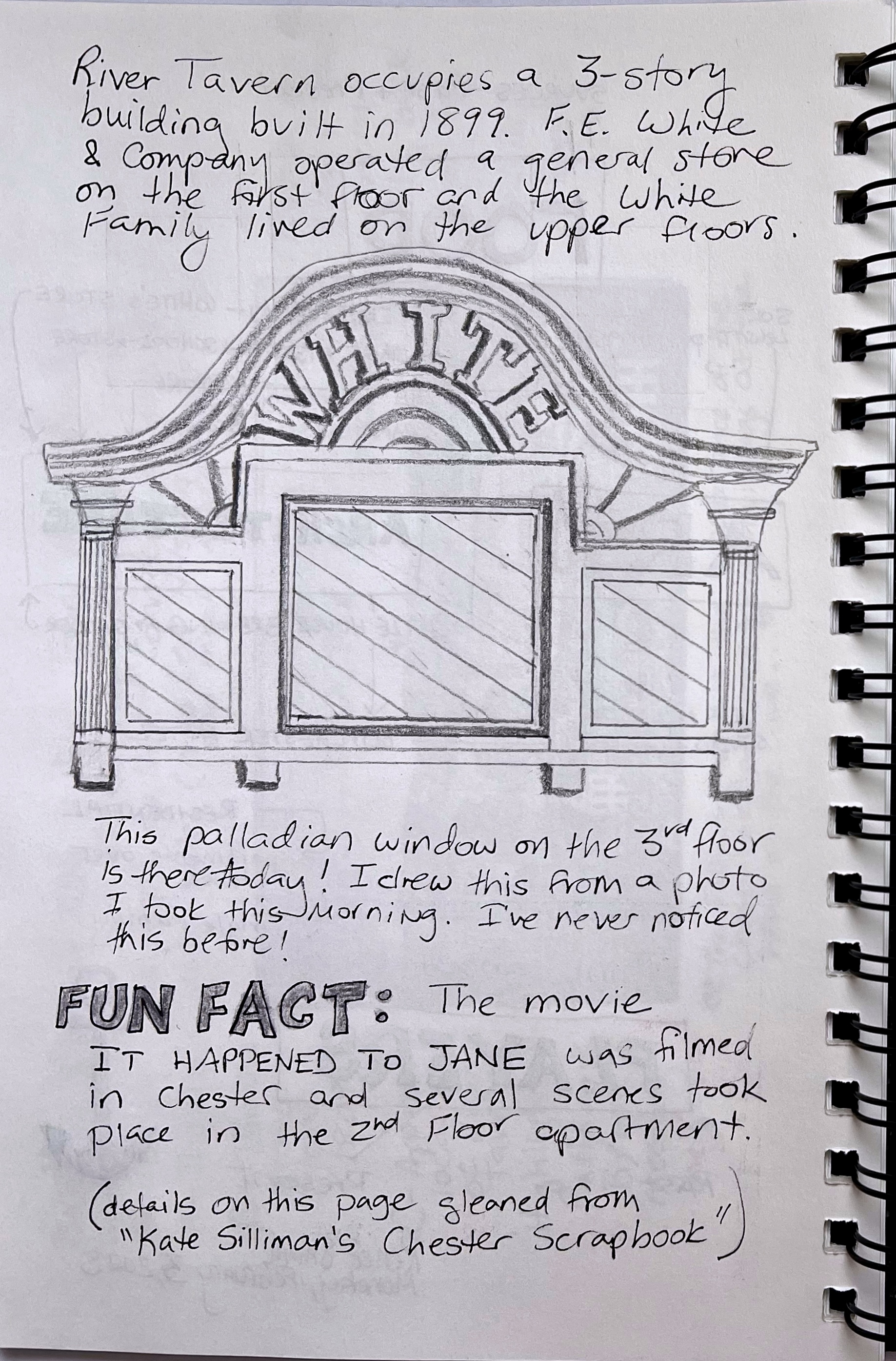
From left to right: Interior of The Villager, with a mural of Gillette castle adorning one wall; journal entry about the F.E. White Building (now the River Tavern Restaurant)
For a deeper dive into Chester’s History, I recommend two Walking Tours on the Chester Historical Society’s website. These walks were developed in the COVID era to encourage folks to get out and explore on their own. The North Walk highlights buildings along North Main Street, and the West Walk focuses on Route 148, also known as West Main Street. These guides take a much deeper dive into several of the buildings I mention in my walks, have interesting old photos, and talk about many buildings I have omitted, such as the United Church of Christ and the Chester Library.
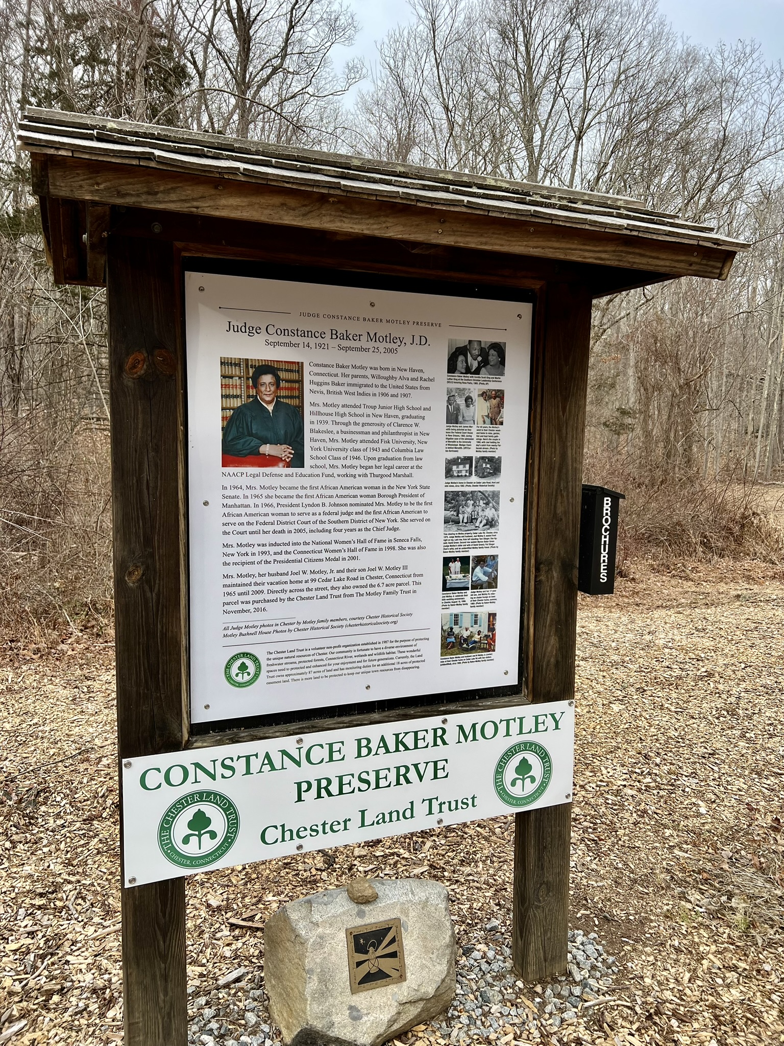
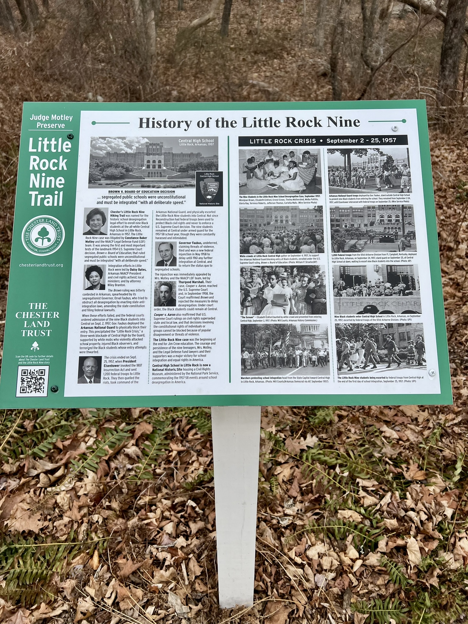
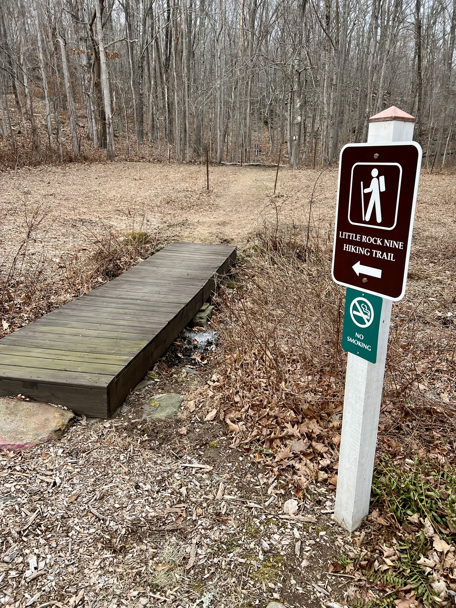
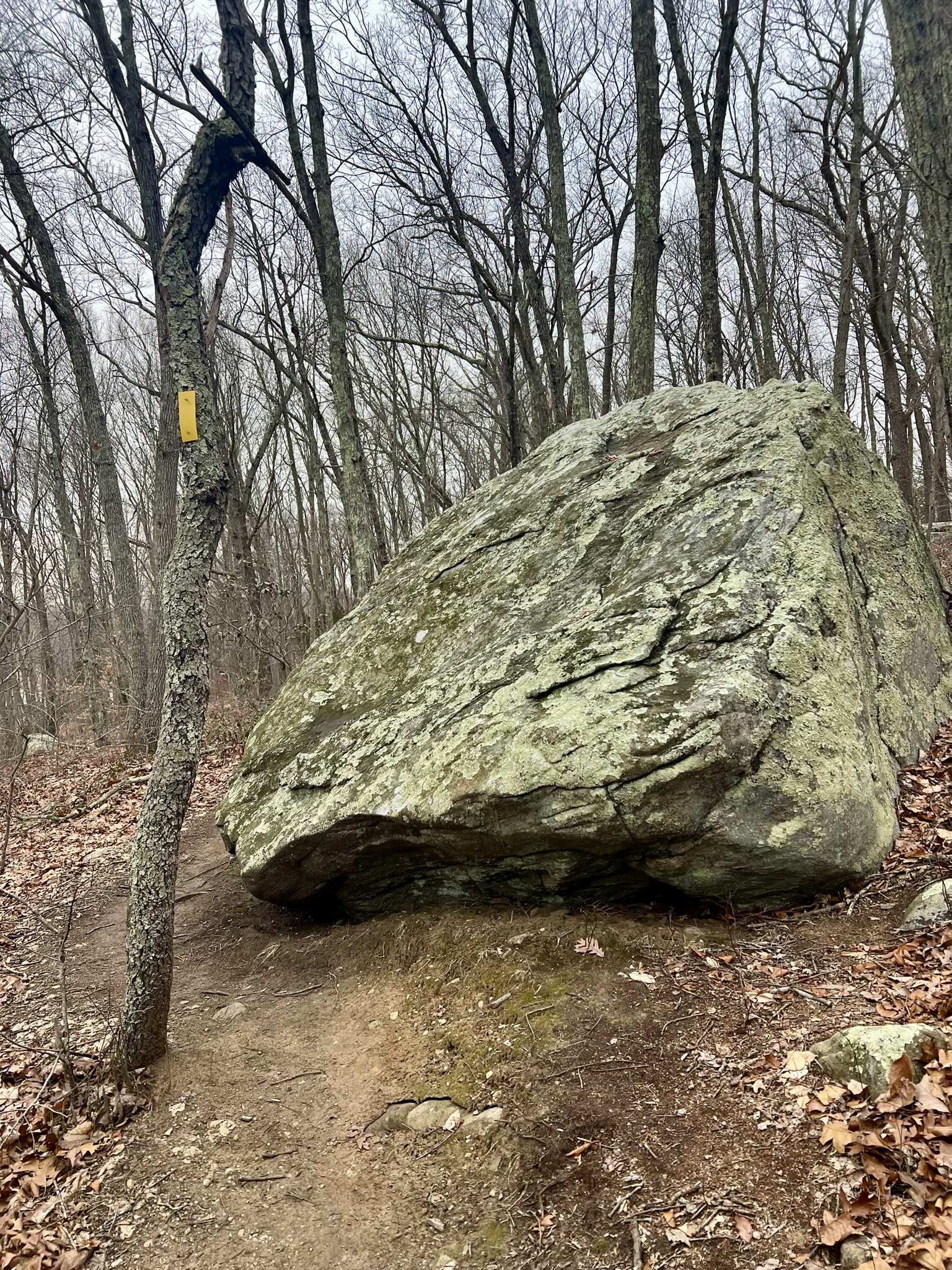
Constance Baker Motley Preserve and the Little Rock Nine Trail, .5 miles.
Constance Baker Motley and her family owned a vacation home and some acreage along Cedar Lake Road. According to the kiosk at the parking pullout, “[i]n 1966, President Lyndon B. Johnson nominated Mrs. Motley to be the first African American woman to serve as a federal judge and the first African American to serve on the Federal District Court of the Southern District of New York. She served on the Court until her death in 2005, including four years as the Chief Judge.” Prior to that, she litigated the Little Rock Nine case in 1957 along with the NAACP Legal Defense Fund, hence the name for the trail. In 2016 the Chester Land Trust purchased a 6.7 acre parcel from the Motley estate across from the old family home, and in 2020, built a short but challenging loop trail.
Interpretive signs and the entrance to the trail
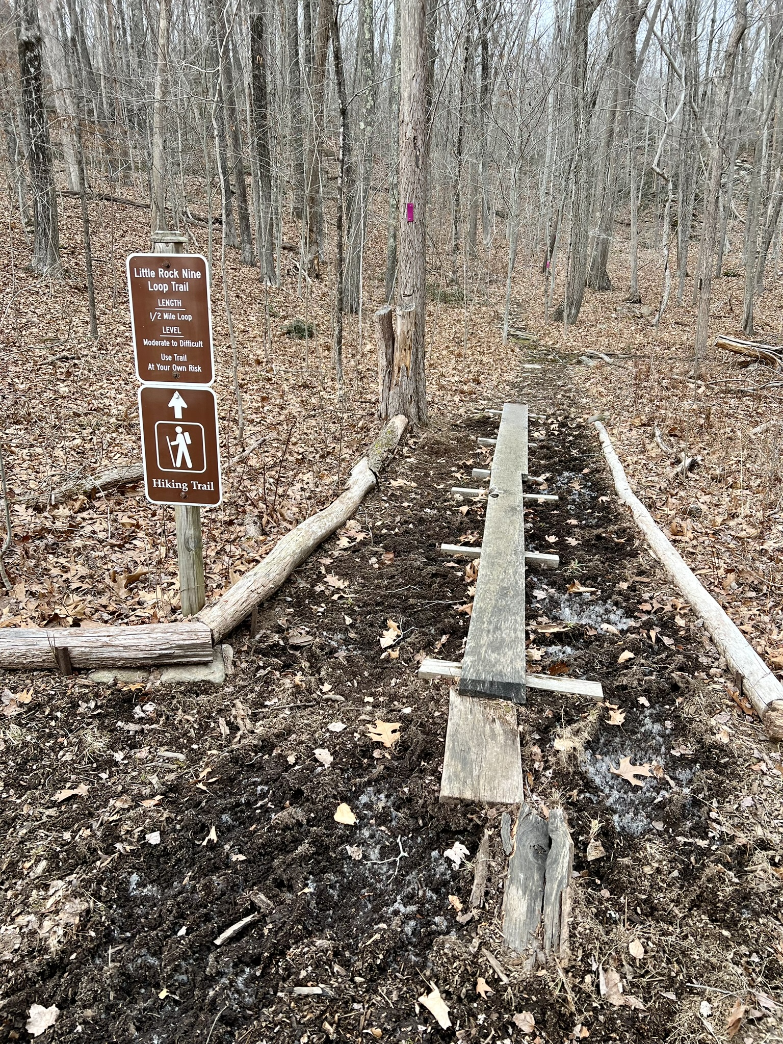
The trail is very steep at times. There are two contemplation benches on the ridge and the trail features 14 tree identification signs with detailed information about each species. This preserve has been designated as a stop on the Connecticut Freedom Trail.
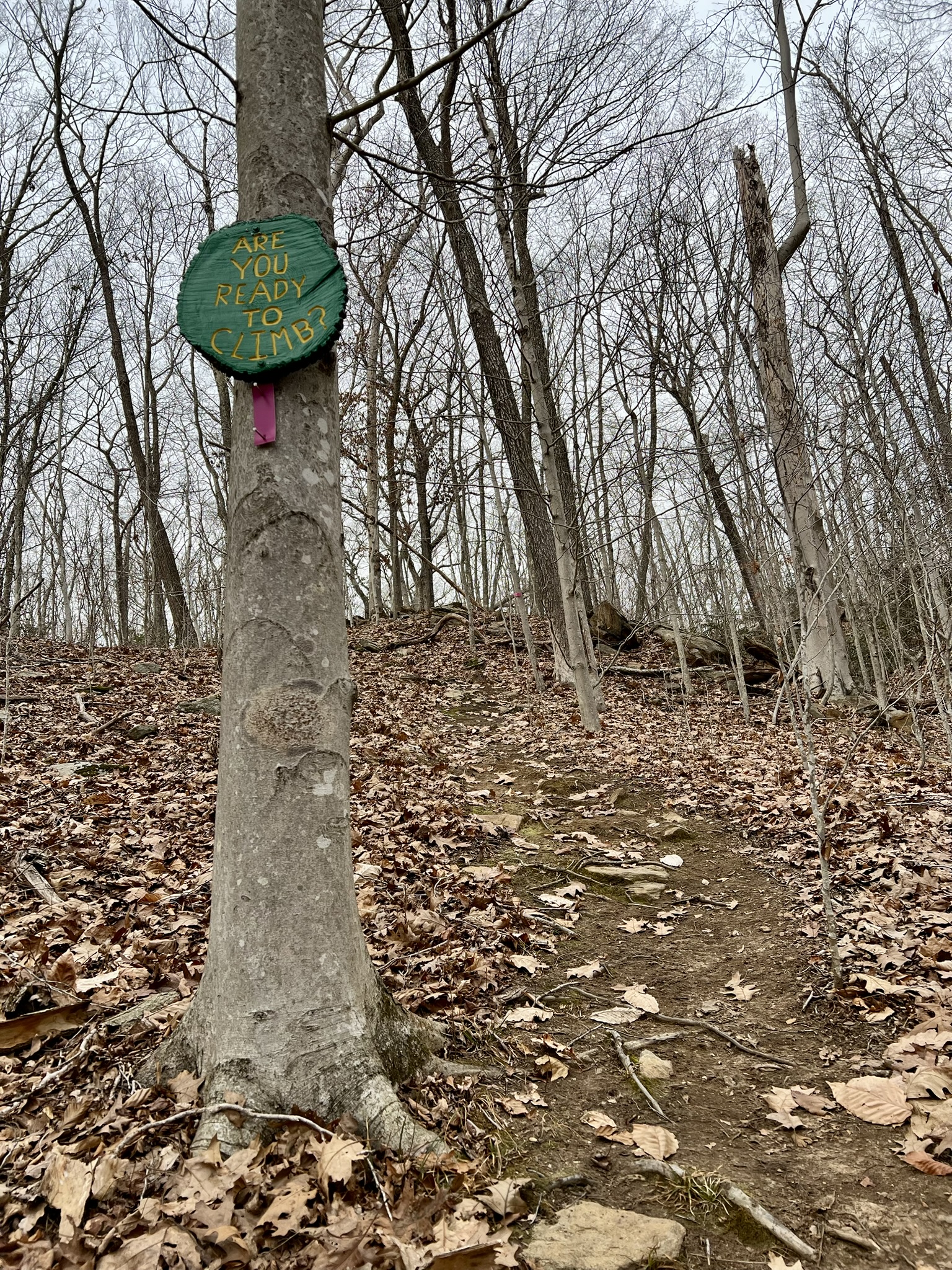
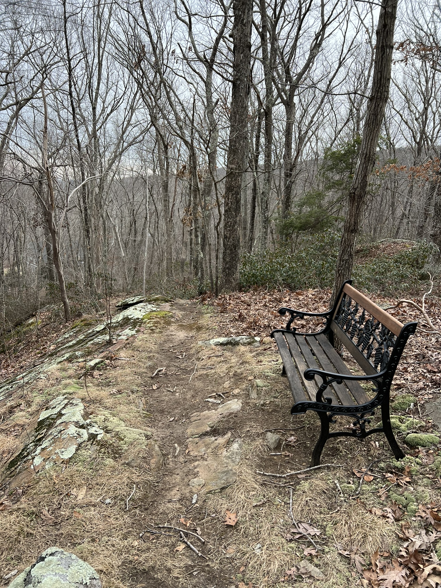
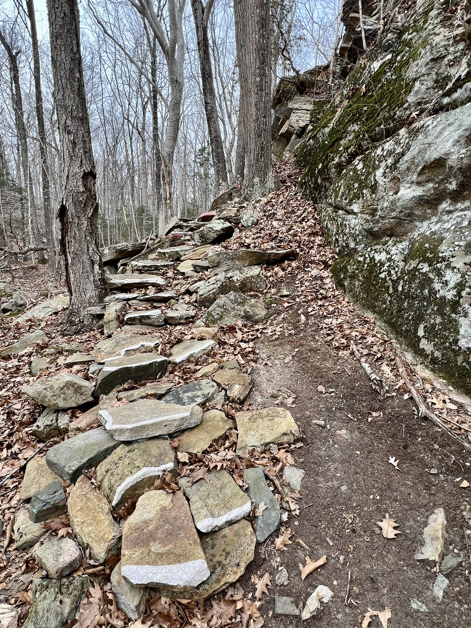
From left to right: A steep uphill: “Are You Ready to Climb?”; one of two benches along the trail; stone steps; rock face along the path
Deep River
Deep River and Chester have many similarities, including being part of Saybrook Colony in the early colonial days, and sharing a history of shipbuilding and water-powered manufacturing. Both are situated along the Connecticut River. When it came to a vote in the mid 1990’s, the proposed motto “Scruffy but Proud” did not get adopted, but I will always remember this debate and think fondly of Deep River by that moniker. I visit Deep River several times a week to grocery shop at Adams or run other errands, but I am always driving, so it was so much fun to explore the town on foot.
Main Street Loop to Deep River Landing, 2.3 miles.
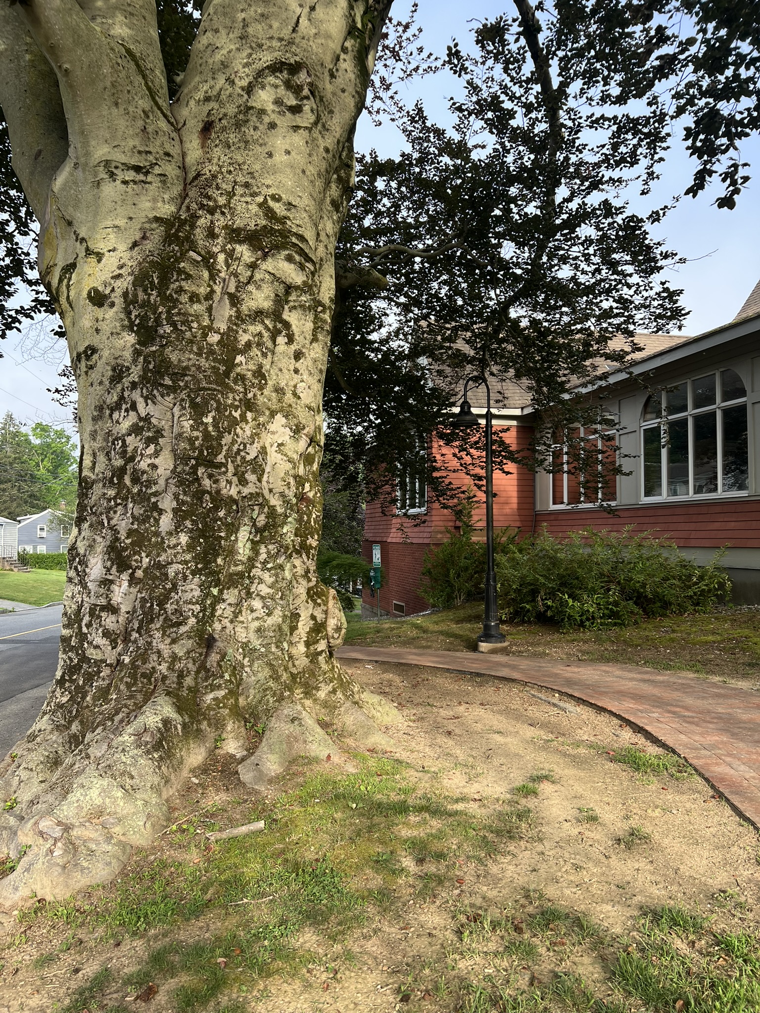
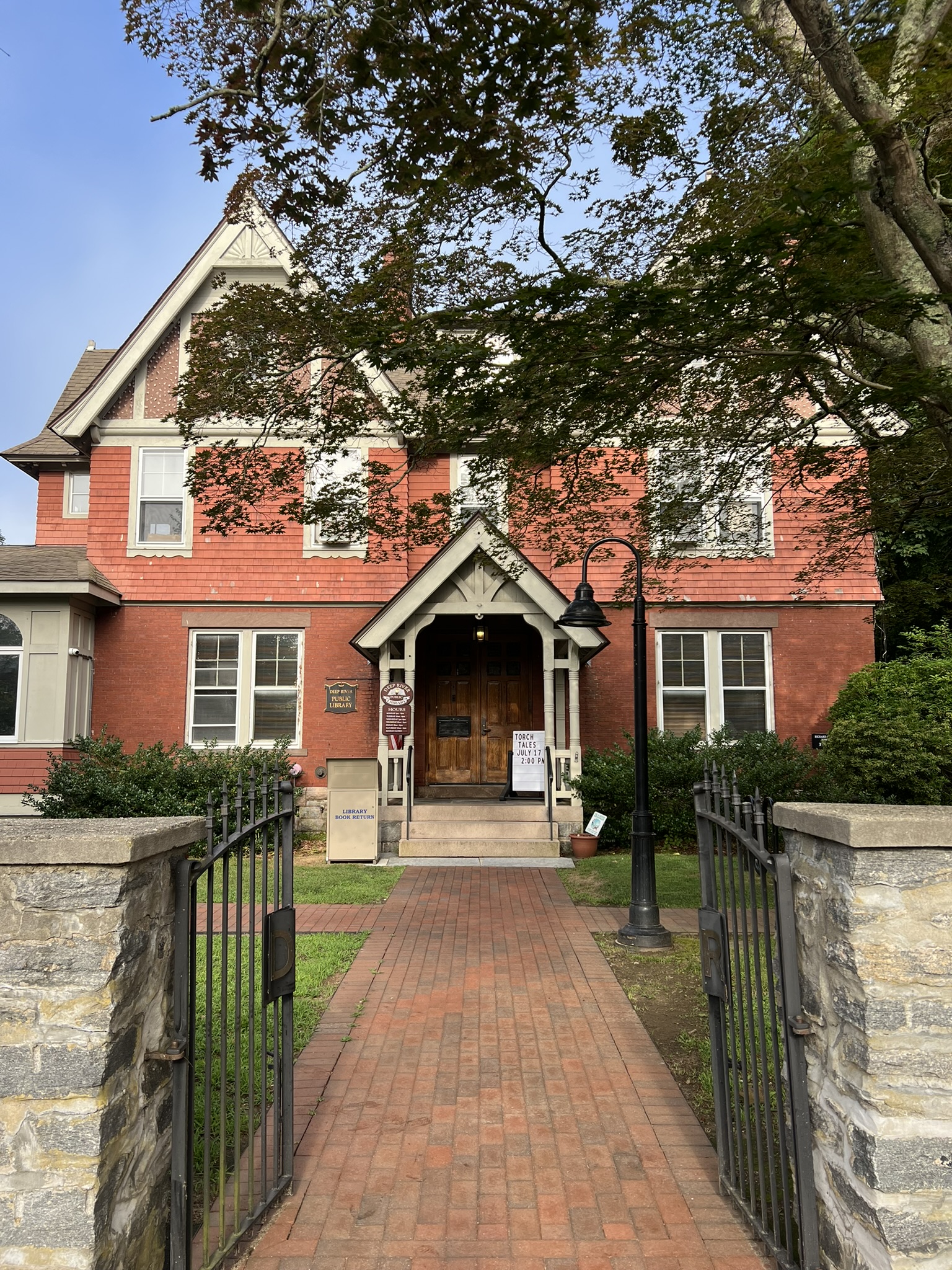
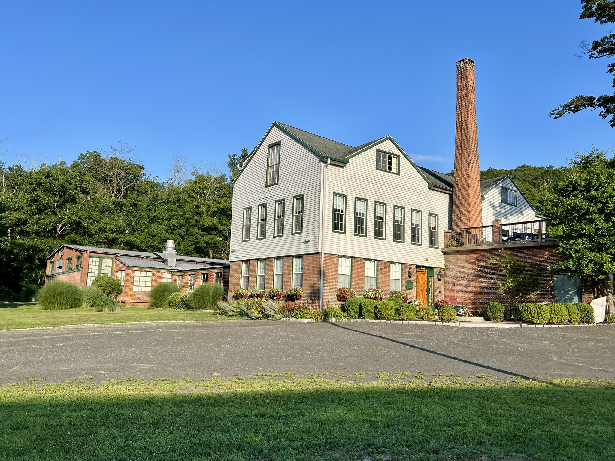
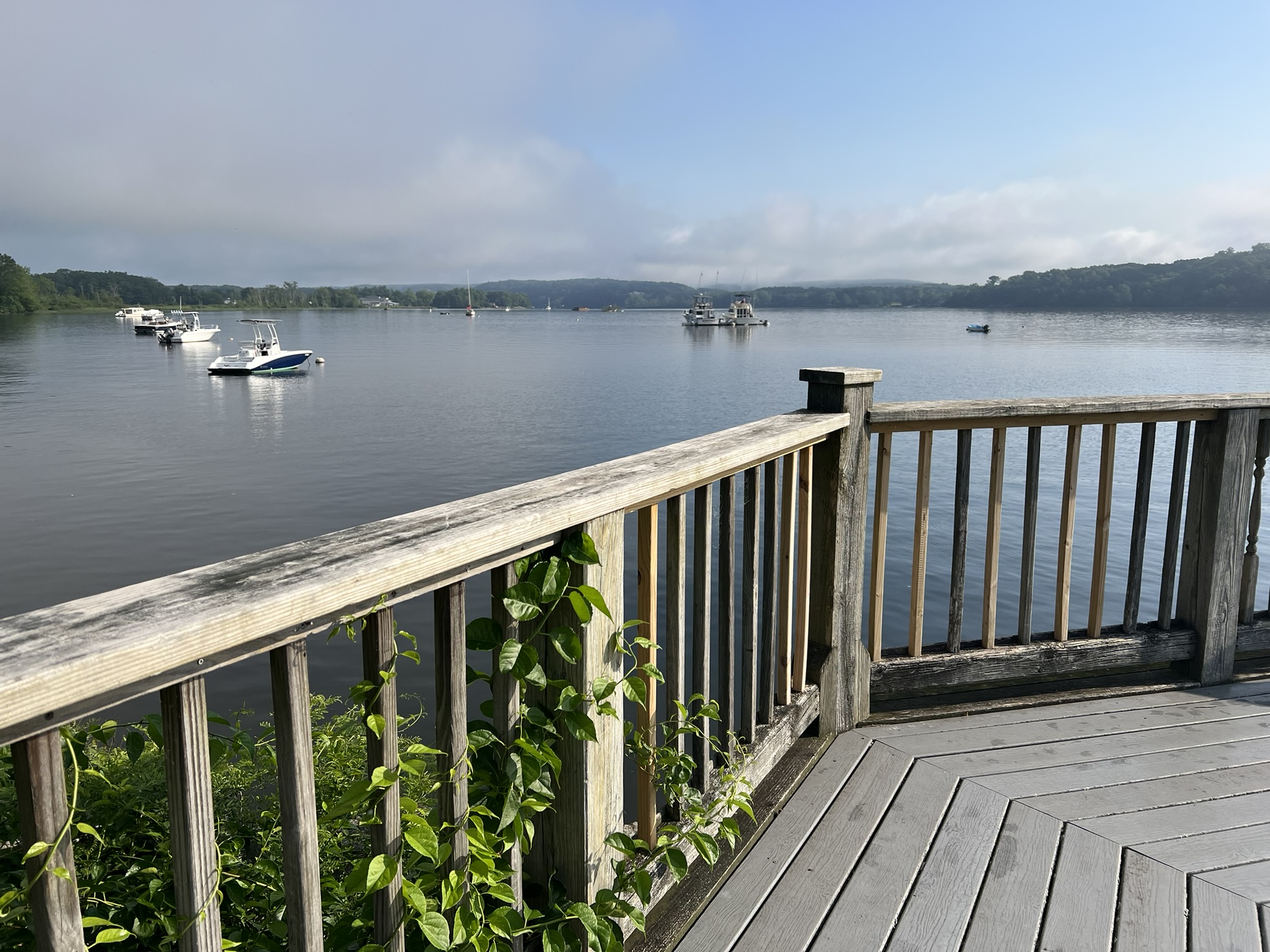
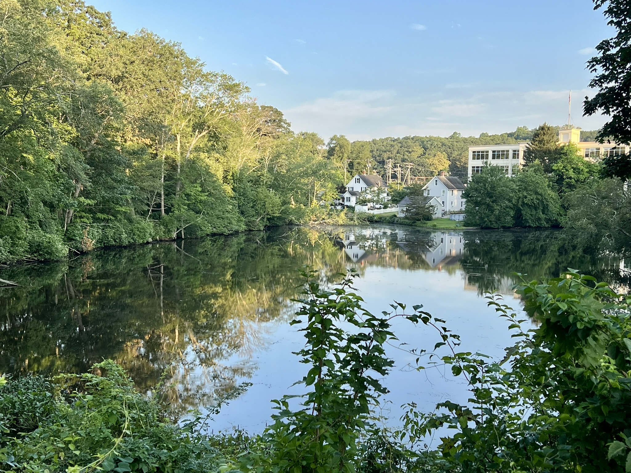
While I often visit Deep River Landing along the Connecticut River (it’s a beautiful sunrise spot) I have never walked there from town, so thought it would be fun to plot a walk that included the Landing. I did variations of this loop on two different occasions. Both times I parked behind the Deep River Public Library, a Queen Anne Victorian era building that was built as a private home for local businessman Richard Pratt Spencer in 1881. The town acquired the home from the Saybrook Library Association, which had purchased it in 1932, to convert it into a library. The town expanded it in 1995. The library is rumored to have much paranormal activity, and has capitalized on that folklore, described in this American Library Association article, Tales from a Haunted Library. As you walk along Village Street be sure to notice the impressive beech tree next to the library. For my first walk, I crossed Main Street, headed south, and turned left at the traffic light onto River Street, a quiet street with sidewalks that goes through the Landing Neighborhood and leads to Deep River Landing. As I approached the river, I noticed the Lace Factory across from the old train depot. Despite my many visits to Deep River Landing, I had never noticed this building until I was on foot. Intrigued, I looked up its history. According to Connecticut Mills, “J. A. Smith and Co. built the factory in 1875 and manufactured crochet needles, button hooks, wire and metal novelties, and employed about 30 men.” Most recently it operated as the Deep River Lace Factory where “[l]ace was made on British Leaver lace machines until 1990; each machine weighed 16 tons, was about 9 feet tall, and had 4,600 bobbins.” When I visited the Deep River Historical Society at a later date, I enjoyed watching a short video of a Sunday Today interview with Peter DeCarli, the former Lace Factory owner, and his wife. Today, The Lace Factory is a wedding and events venue, and from the photos on their website, the current owners appear to have worked hard to incorporate the building’s history into the current space.
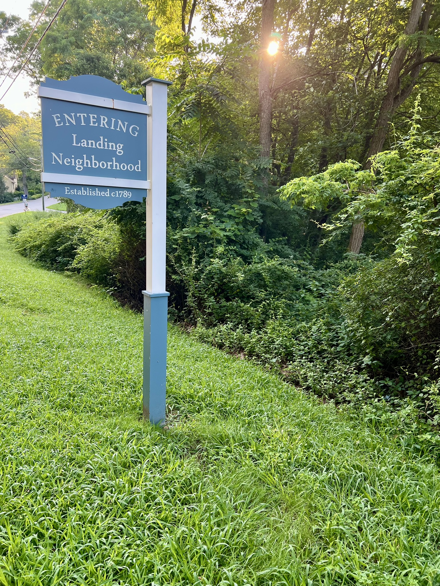
From left to right: the sidewalk beech tree next to the library; the front entrance to the library; Street sign denoting the entrance to the Landing Neighborhood; the Lace Factory
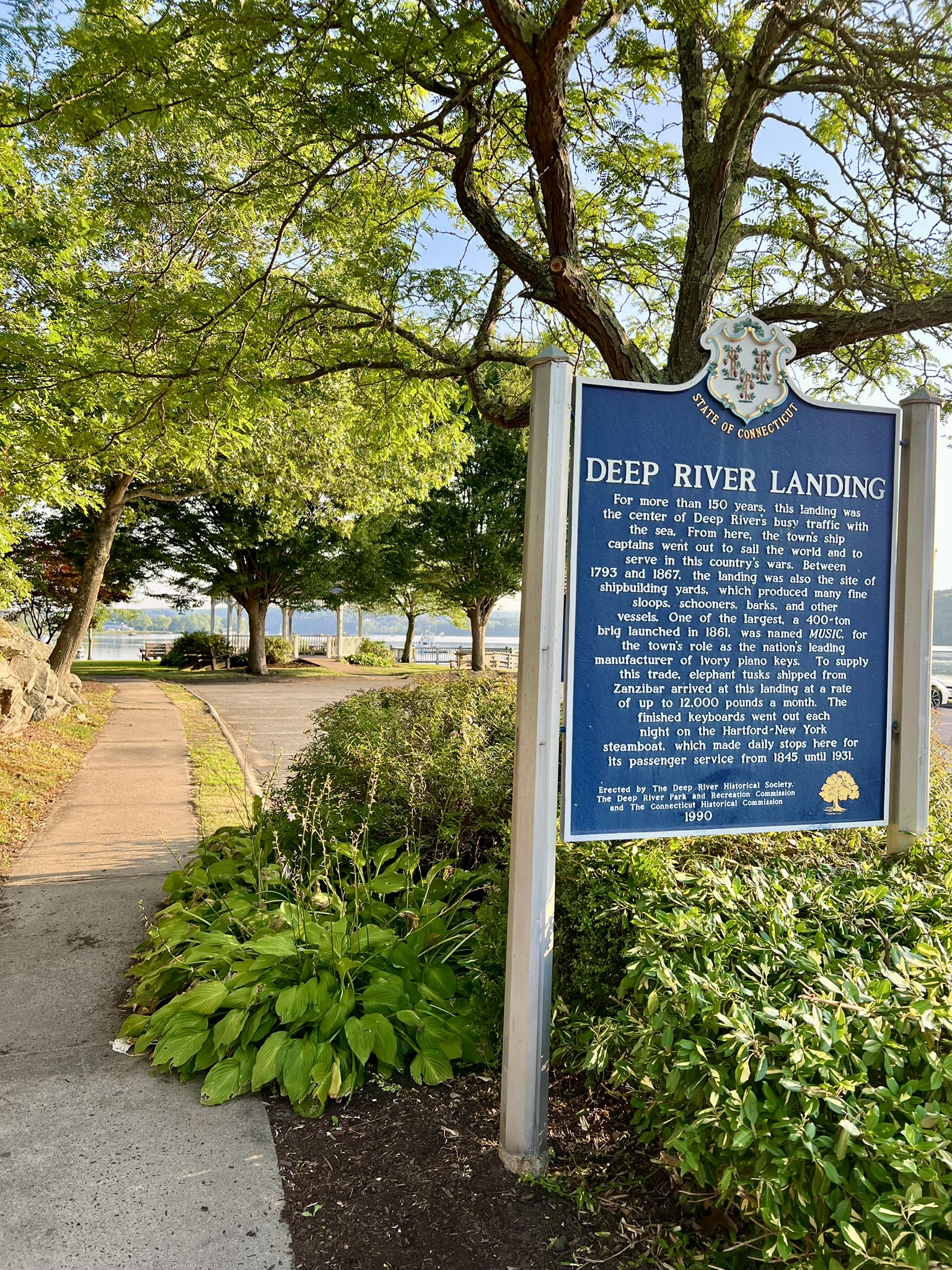
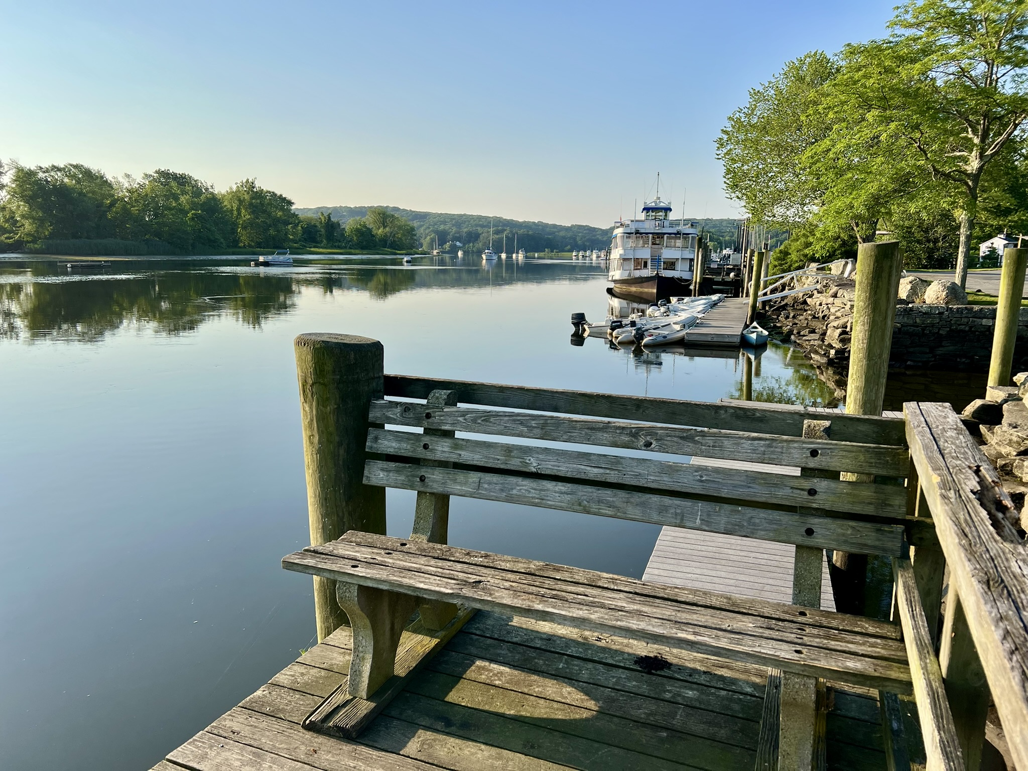
I spent some time walking the paths of Deep River Landing, where there is a gazebo, dock, and numerous benches. At one time, this site was the pulse of the town. As the sign explains, “[f]or more than 150 years, the landing was the center of Deep River’s busy traffic with the sea.” The riverboat portion of the Essex Steam Train and Riverboat cruise leaves from the dock next to the town park and cruises upriver as far as the East Haddam Swing Bridge.
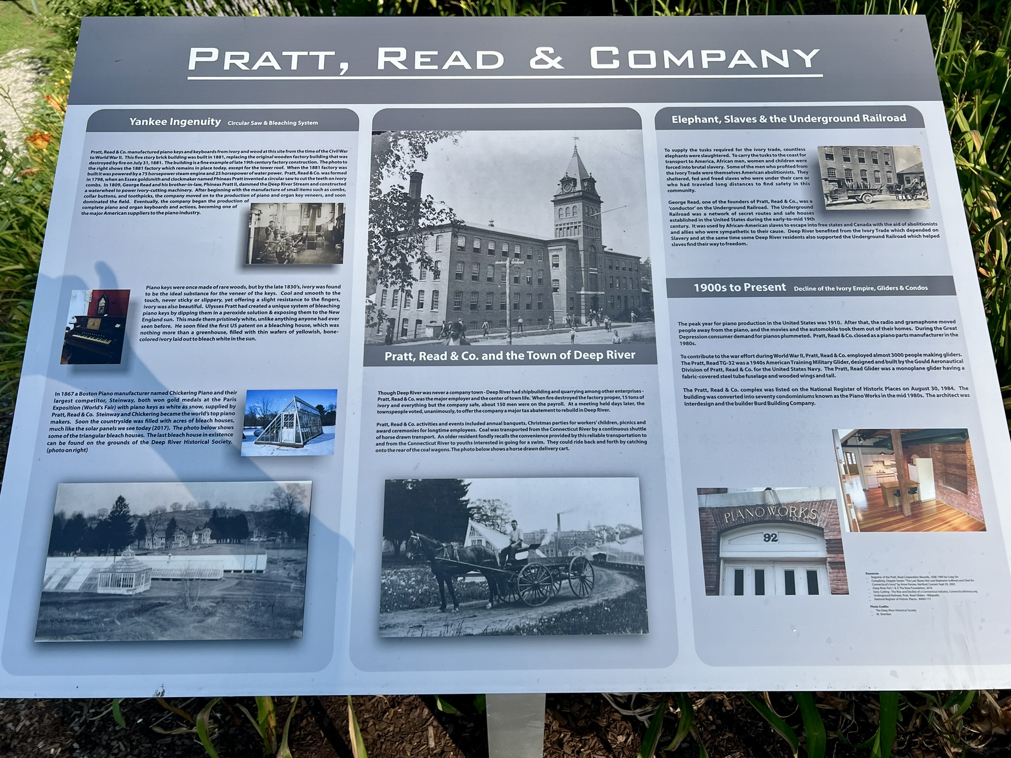
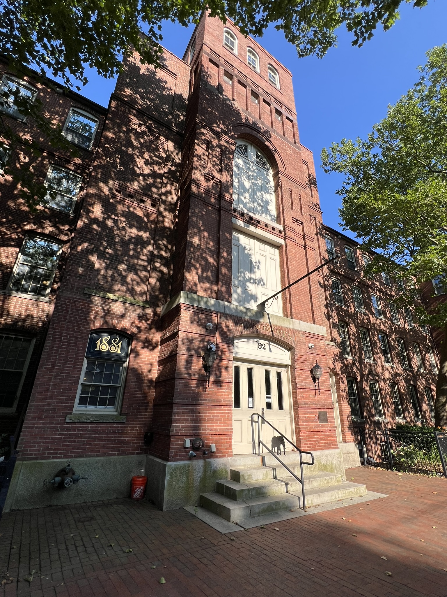
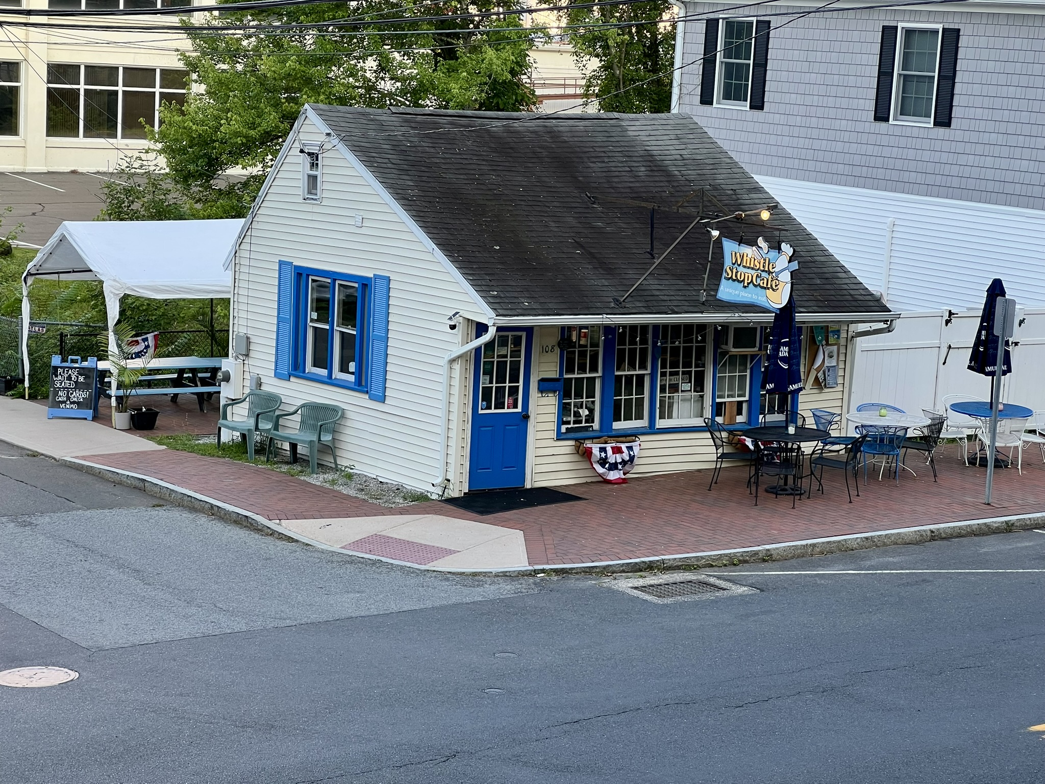
After leaving the landing, I turned right onto Kirtland Street to head back to town. At a fork with Read Street, I stayed right and arrived back at Main Street (Route 154) by the Landing Restaurant. Crossing the street, I admired the old Piano Works building. To the left of the building there is a large signboard sharing the history of the building, which was turned into condos in the 1980’s. As the signboard explains, “Pratt, Read & Co. manufactured piano keys and keyboards from ivory and wood at this site from the time of the Civil War to World War II.” Continuing along Main Street, I stopped at the Whistle Stop Café for breakfast. Adorable! I ordered the corned beef hash and a raspberry lemonade. Back at the library parking lot I spoke with a member of the garden club who was weeding the rain garden they maintain there. She pointed out the free seed library at the center of the lot.
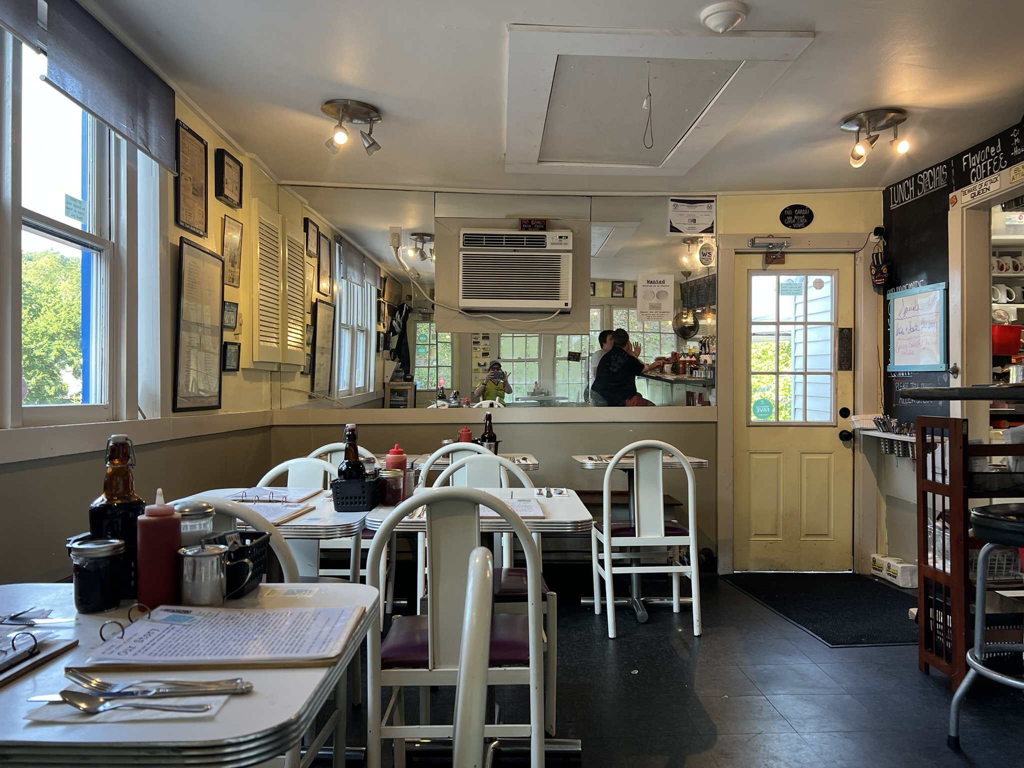
From left to right: sign outside the Piano Works building; entrance to the Piano Works condos; the Whistle Stop Cafe (outdoor sidewalk seating and a rear patio overlooking Deep River; Whistle Stop Cafe interior
The next day I visited the Deep River Historical Society museum which is located in the Stone House at 245 Main Street. The museum is open from June until September on Thursdays from 10:00am to 12:00pm and Sundays from 2:00pm to 4:00pm. When I visited, they had a new exhibit called Made in Deep River. On the second floor they have a permanent exhibit called From Wharf to Waterfall (this is where I saw the video about the Lace Factory). Deep River has a rich history of shipbuilding to manufacturing and I highly recommend a visit to this exhibit. A few weeks later I returned to do a similar loop, but in the opposite direction, exploring a few of the back roads that I skipped on my previous walk. I also visited the gazebo on Main Street, which overlooks Keyboard Pond.
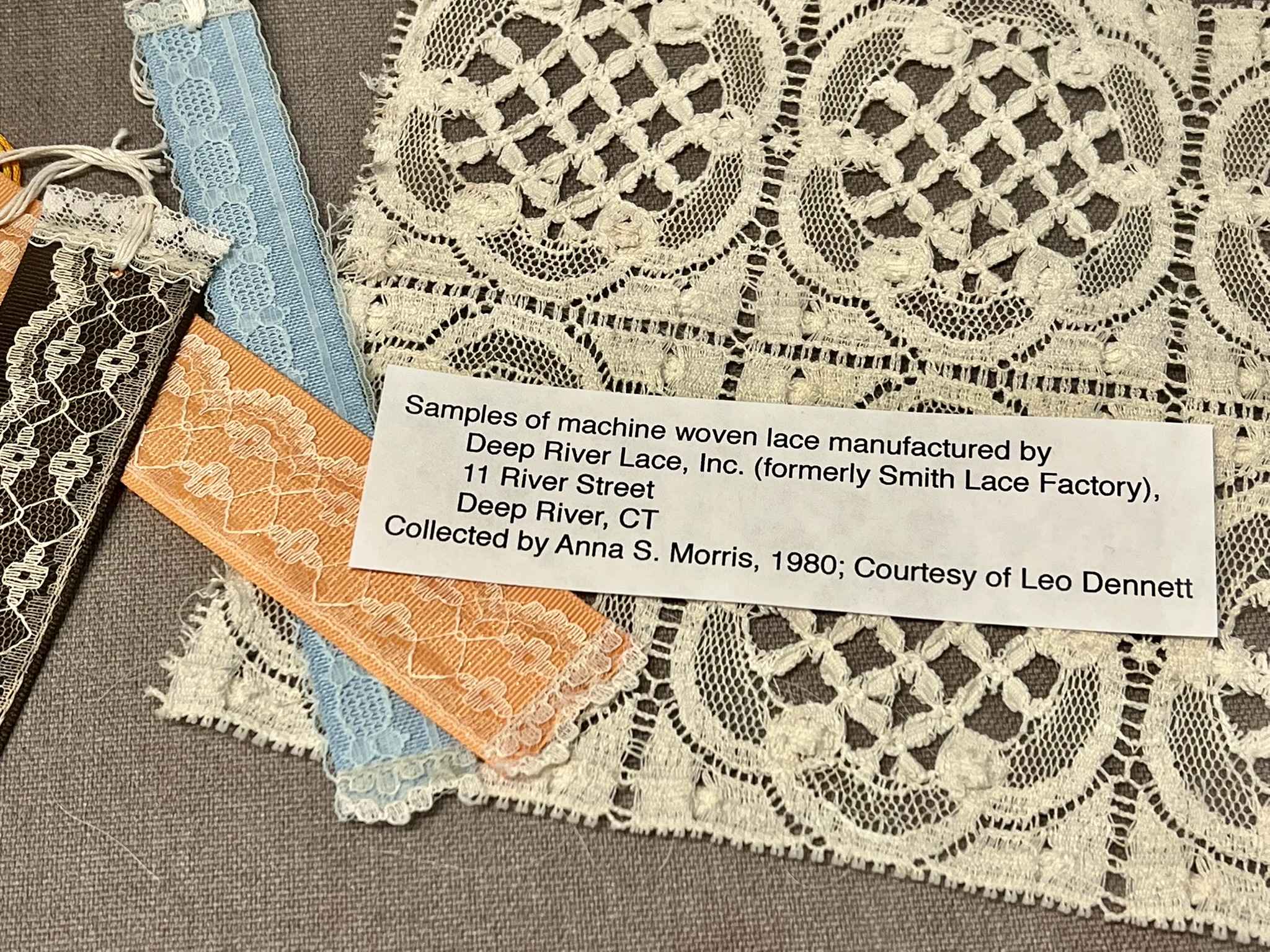
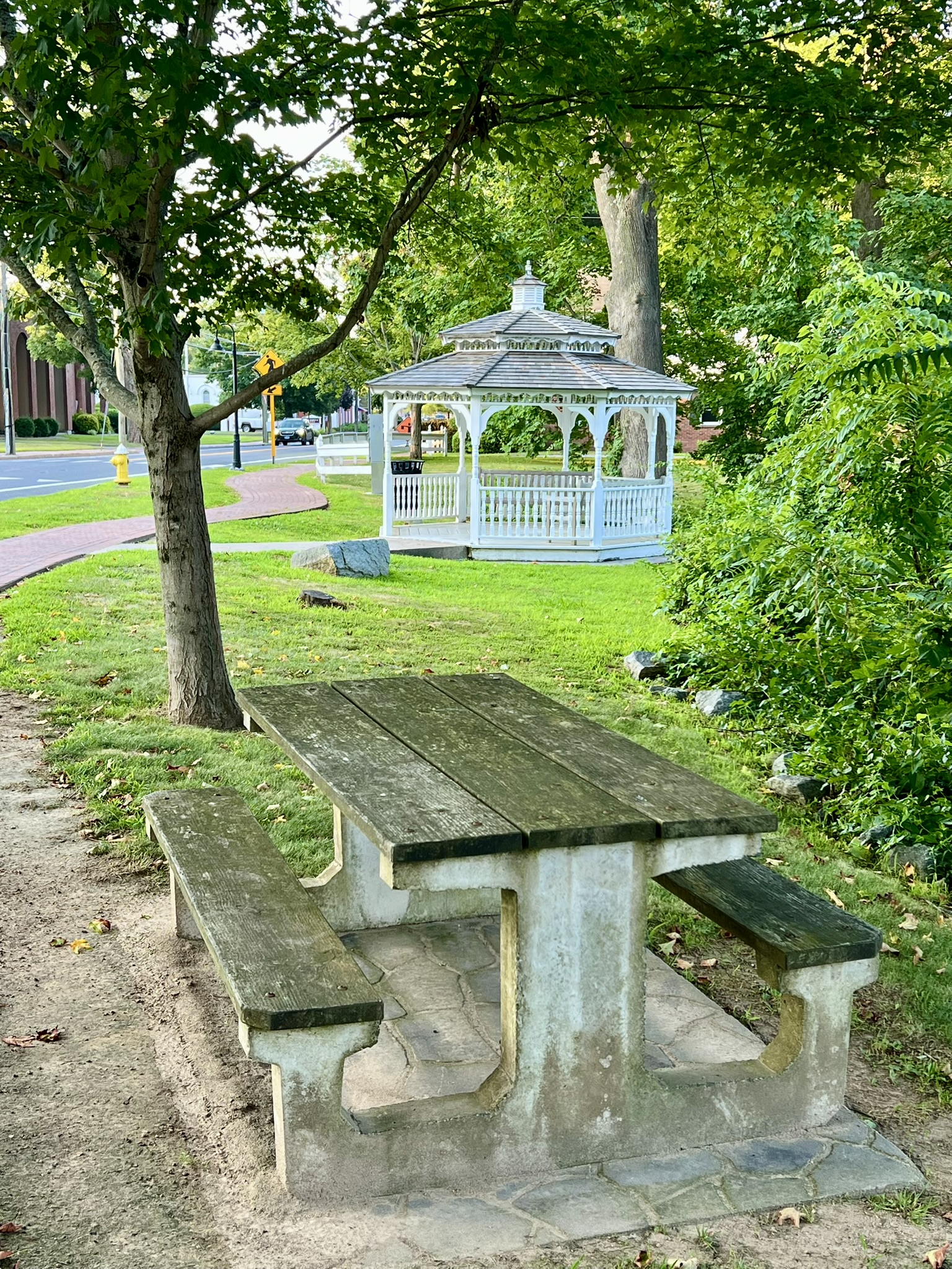
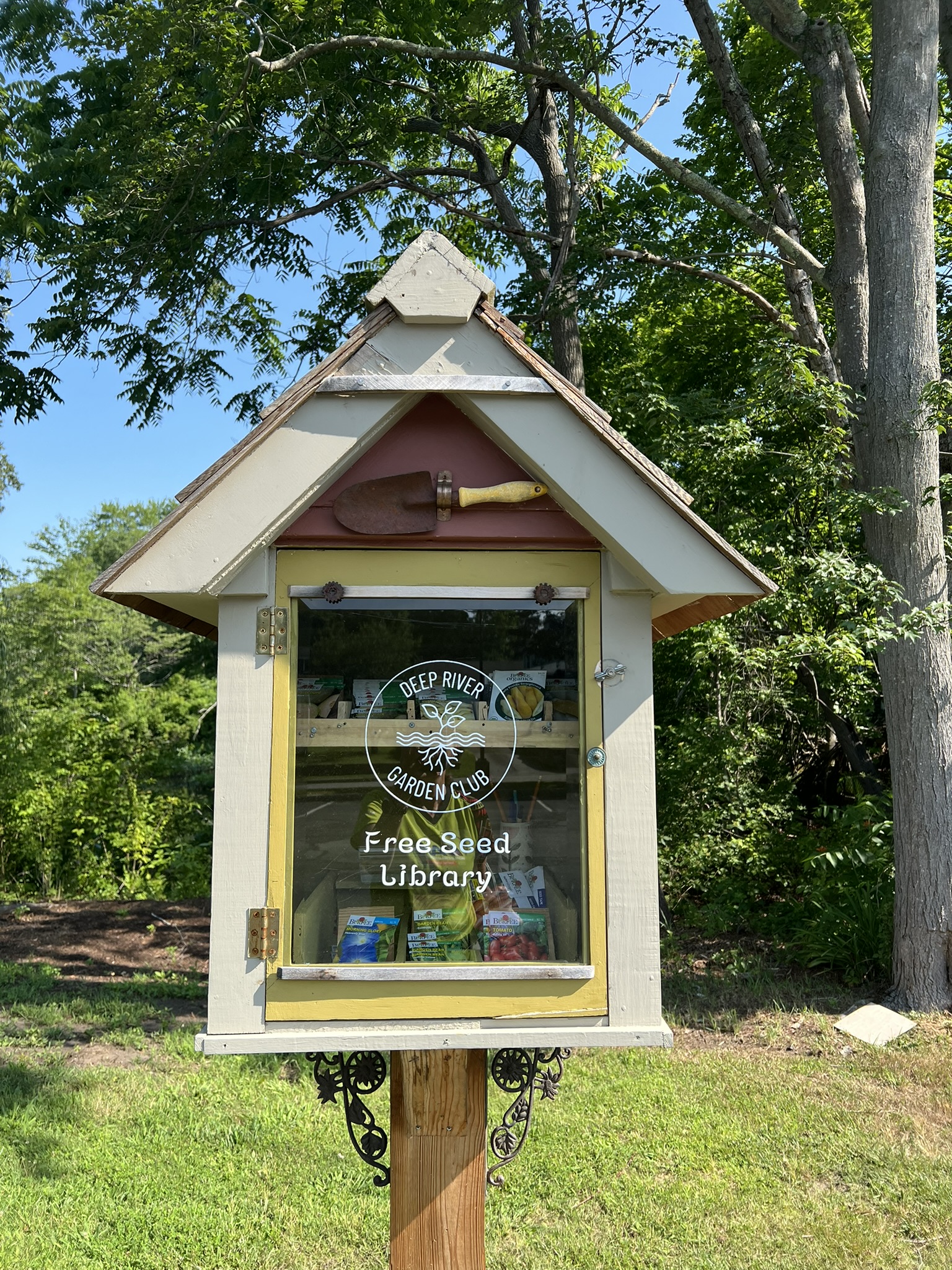
From left to right: Lace Factory samples at the Historical Society exhibit; the gazebo and picnic table; Keyboard Pond; the Free Seed Library in the library parking lot
Union Street Preserve, .75 miles
After completing my loop I continued down Village Street to the Deep River Land Trust’s Union Street Preserve. Where Village Street T’s into Union Street there is a narrow access strip on the lawn. The trail winds uphill on a gentle switchback to a short loop. The trail borders some houses, which are less obvious in summer, and there is a contemplation bench. It is ½ mile round trip from the library, plus .3 miles of trail.
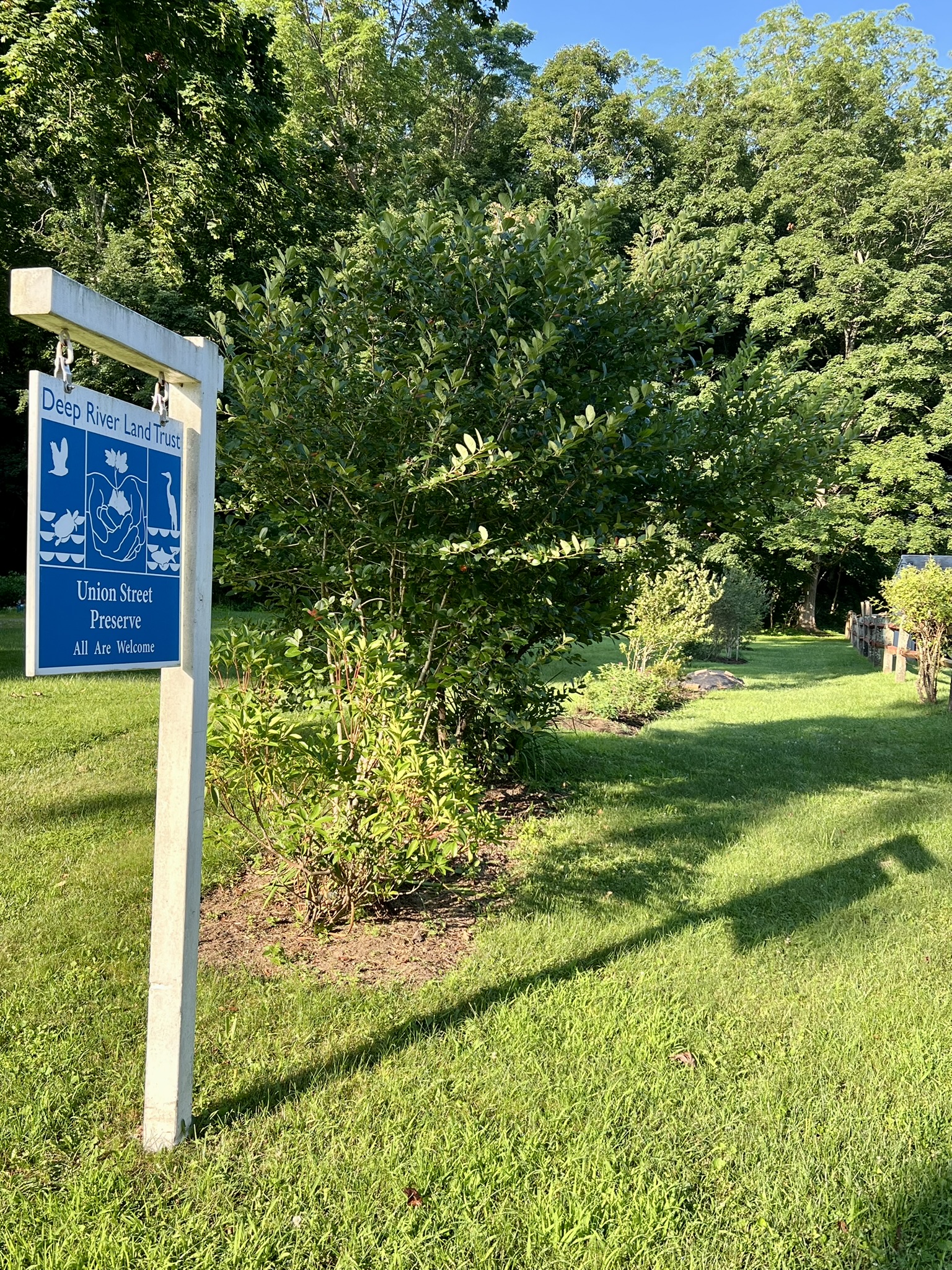
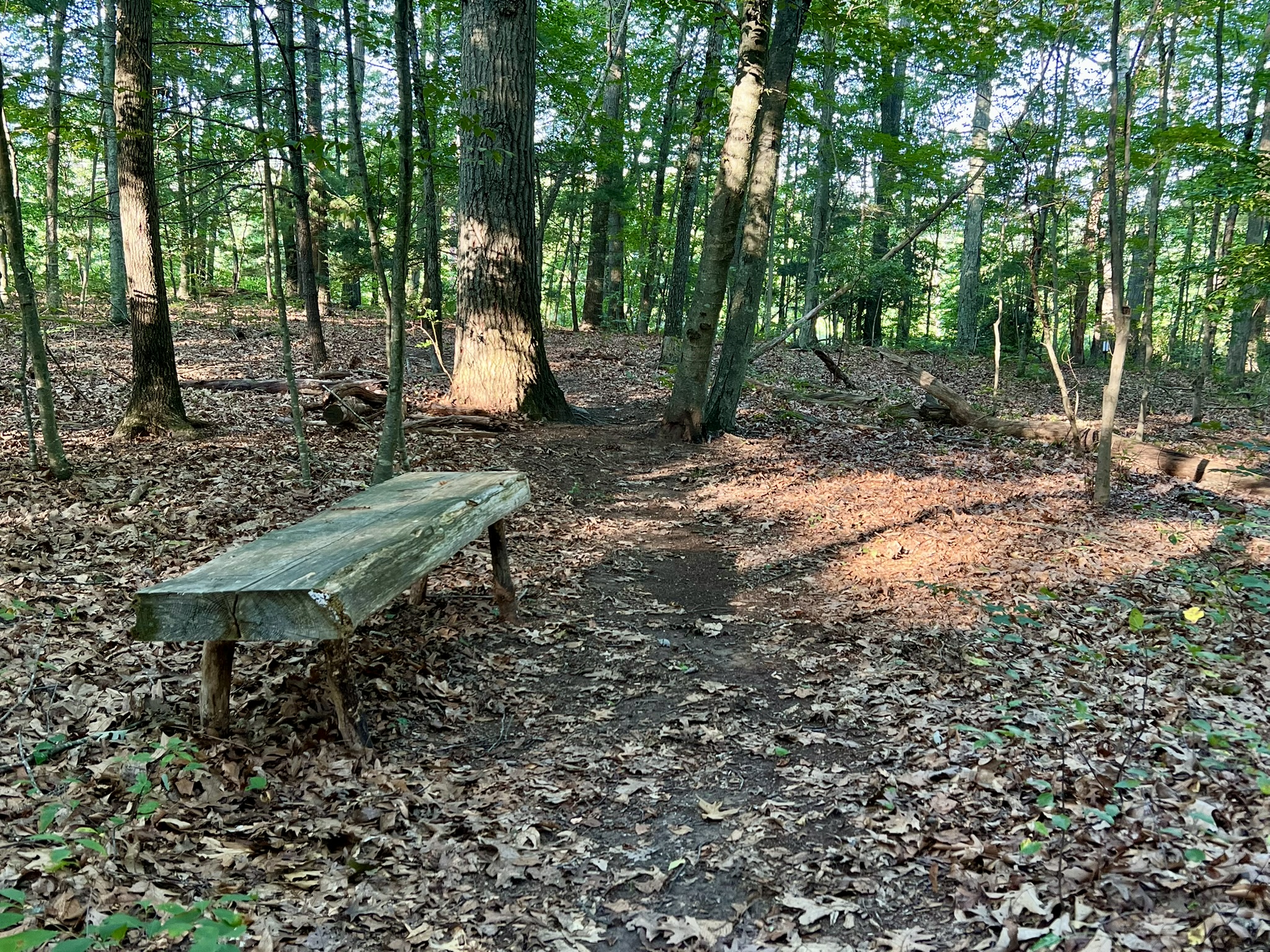
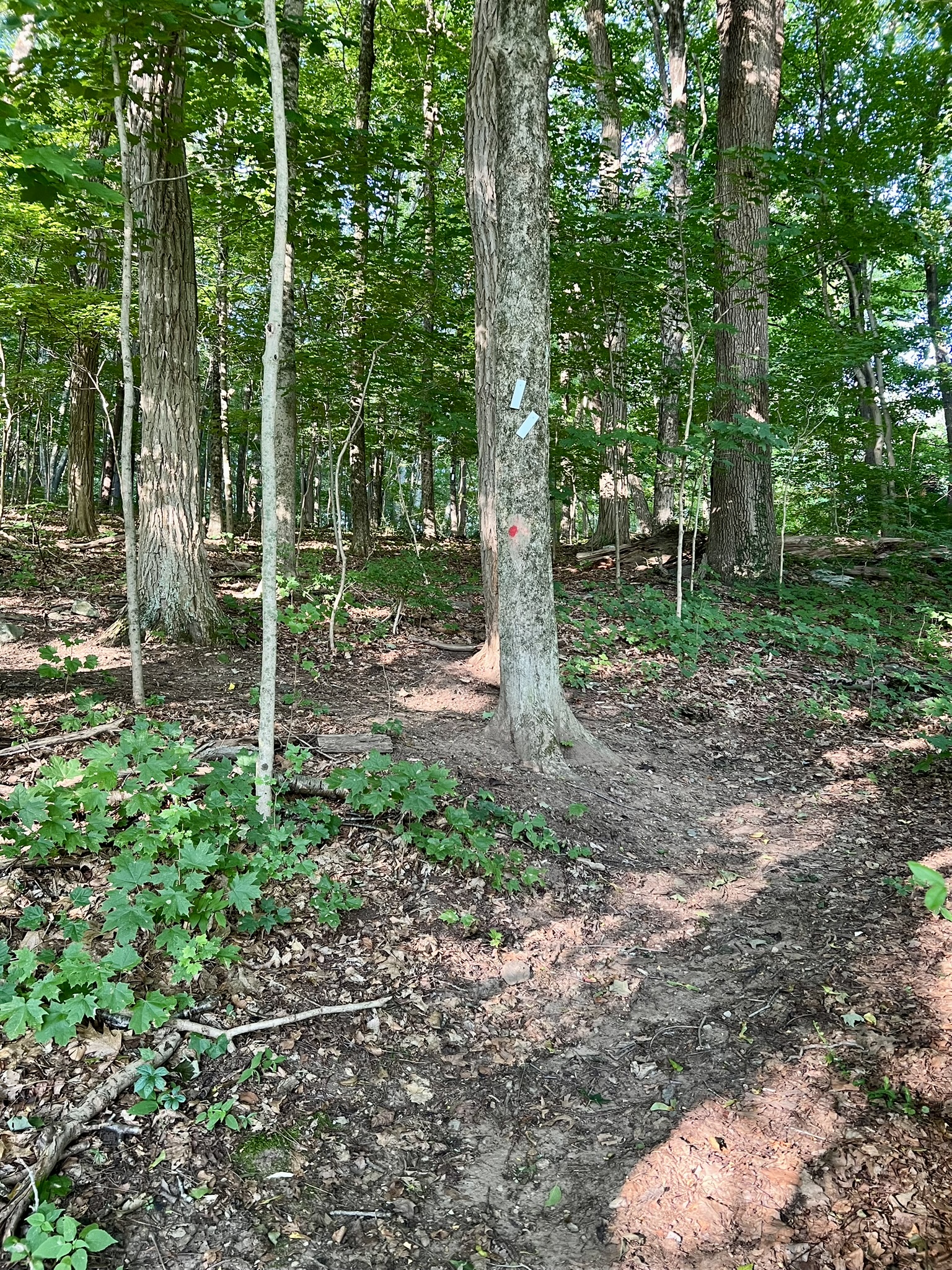
From left to right: The entrance to the Union Street Preserve; a bench along the trail; trail blazings mark a short loop
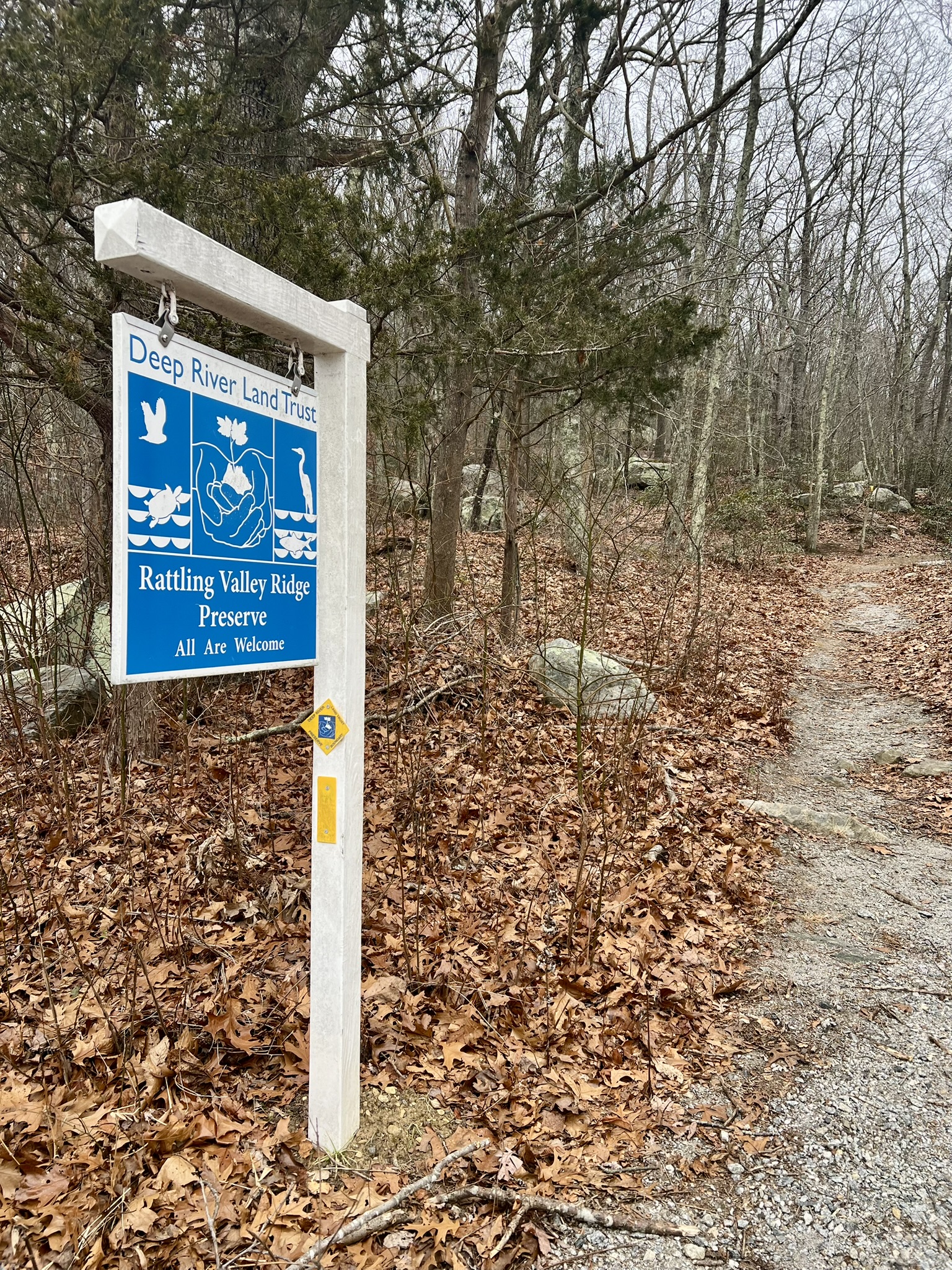
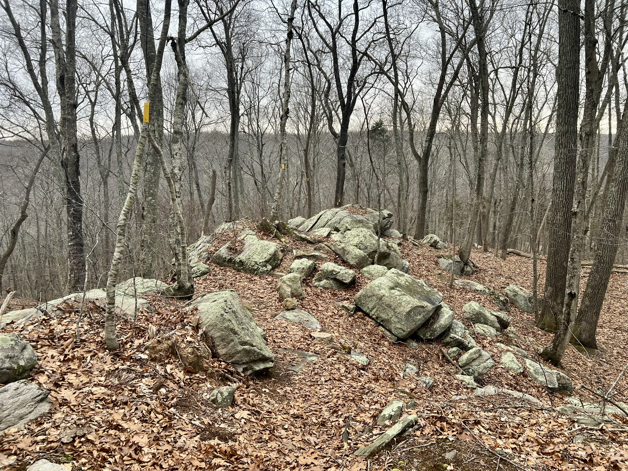
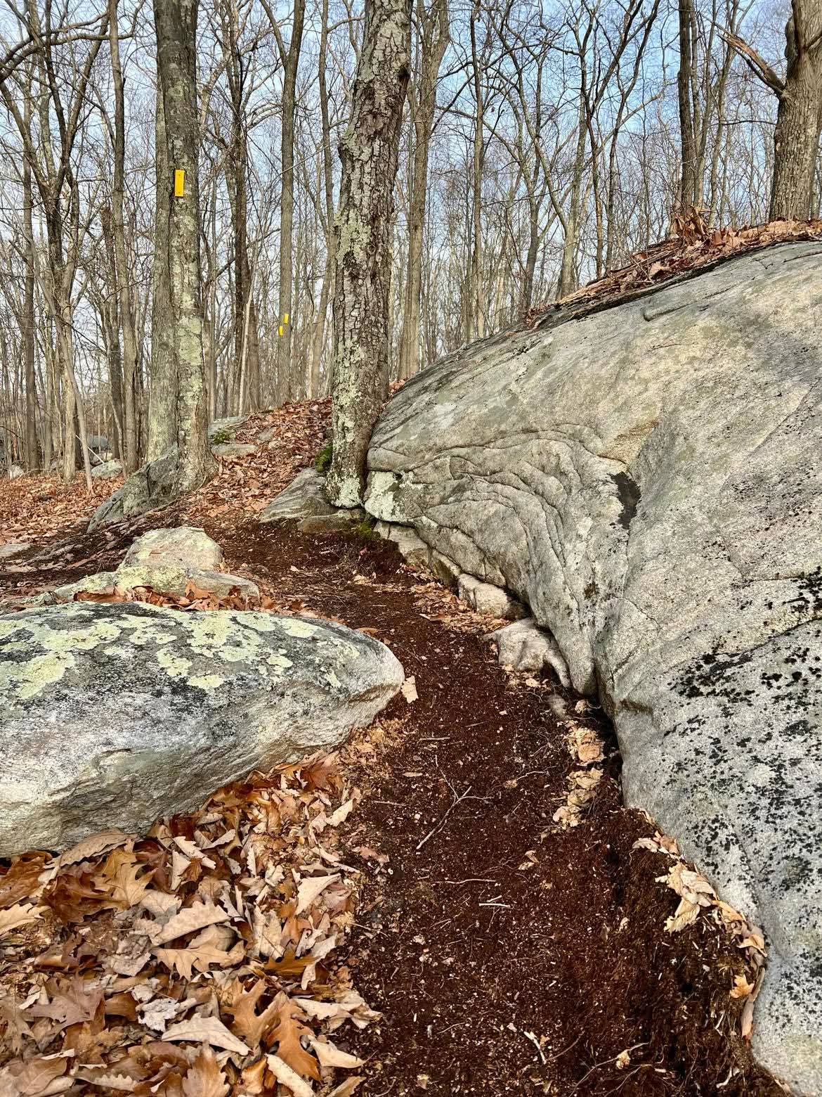
Rattling Valley Ridge Preserve/Florence Bidwell Sanctuary/Smyth Sanctuary and the Canfield Connector. 2 to 3 miles.
The Deep River Land Trust has been hard at work improving trails and blazing new trails. Seasonally they run a Trails Tuesday, led by Rob Butterworth, where volunteers gather to work on creating or improving Deep River’s land trust trails. In past years, the crew connected the Rattling Valley Ridge Preserve to the Florence Bidwell Sanctuary. In 2025, they worked on a new side trail, the yellow/blue blazed Quarry Hollow Trail, within the Rattling Valley Ridge Preserve, and the Canfield Connector trail – a red/yellow blazed trail that leads from the Florence Bidwell Sanctuary on Rattling Valley Road to the large Canfield Meadow Woods property that spans Deep River and Essex.
While you can park at either end, I like to park at the pullout on Essex Street by the Essex Street Bridge Landing at Pratt Cove (there is a canoe/kayak launch here). Look for the blue and white land trust sign for the Rattling Valley Ridge Preserve. The trail is blazed yellow, and heads up the steep hillside in a series of switchbacks. The trail was well designed to go past the most interesting features. Please stay on the trail, even if it drives you crazy being able to see the shortcut possibilities, as these trails were built with avoiding erosion in mind. Along the way you will see the new yellow/blue blazed trail fork off to the right. I took this loop on my return. As you near the top, watch for the junction with the yellow/white trail, labeled ridge bypass trail on the TRAIL MAP (Scroll down to the “Smyth Rattling Valley Ridge Bidwell Trail Map”). Continue on either trail to the Florence Bidwell Sanctuary parking area on Rattling Valley Road then return via the other trail, which will be close to two miles round trip.
To extend your hike, you can take the new Canfield Connector Trail, a half mile yellow/red blazed trail that connects the Florence Bidwell Sanctuary to the Canfield Meadow Woods Nature Preserve. From the sanctuary parking lot, turn right on Rattling Valley Road. After a short distance, watch for a post with a yellow/red blazed carved into it. Follow the blazes along a series of switchbacks that take you up the hill to eventually connect with the red-blazed Old Cellar Trail at the northernmost part of Canfield Meadow Woods. With the snow still present in mid-February, the parking area at the sanctuary was inaccessible so I decided to try to find the trail from the other direction (looking at the map I assumed it would connect to the red trail). Parking was challenging in the Route 154 lot as that had not been plowed either, but I managed to get in and, more importantly, out. I had to break trail with my snowshoes once I got to the red trail, and was excited to find the post marking the new yellow/red trail. It was challenging to find the trail in the unbroken snow, as I couldn’t always see the next blaze, but I found my way. This new connector trail opens up the possibilities for a very long hike, as Canfield Meadow Woods offers over a dozen trails on 300 acres spanning the towns of Deep River and Essex.
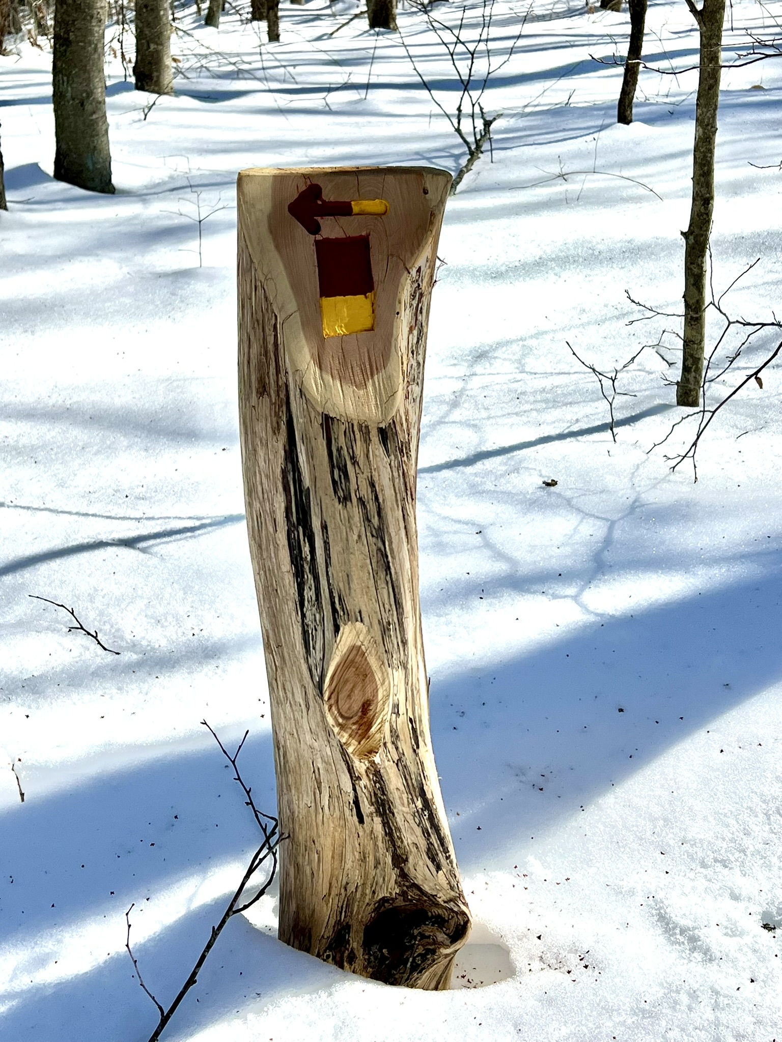
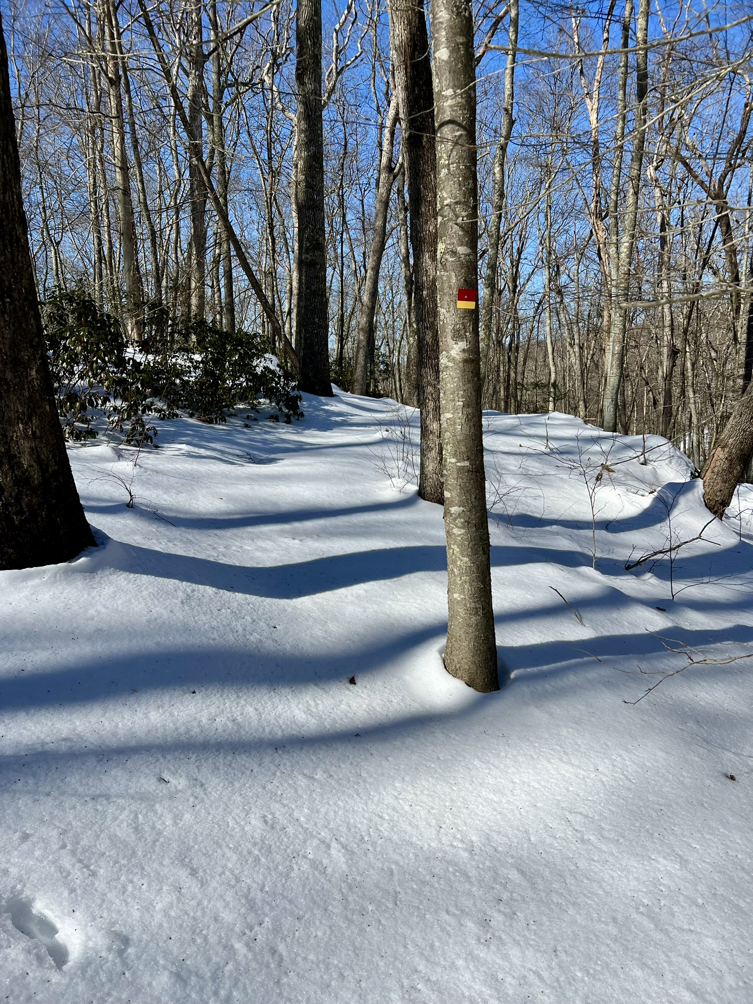
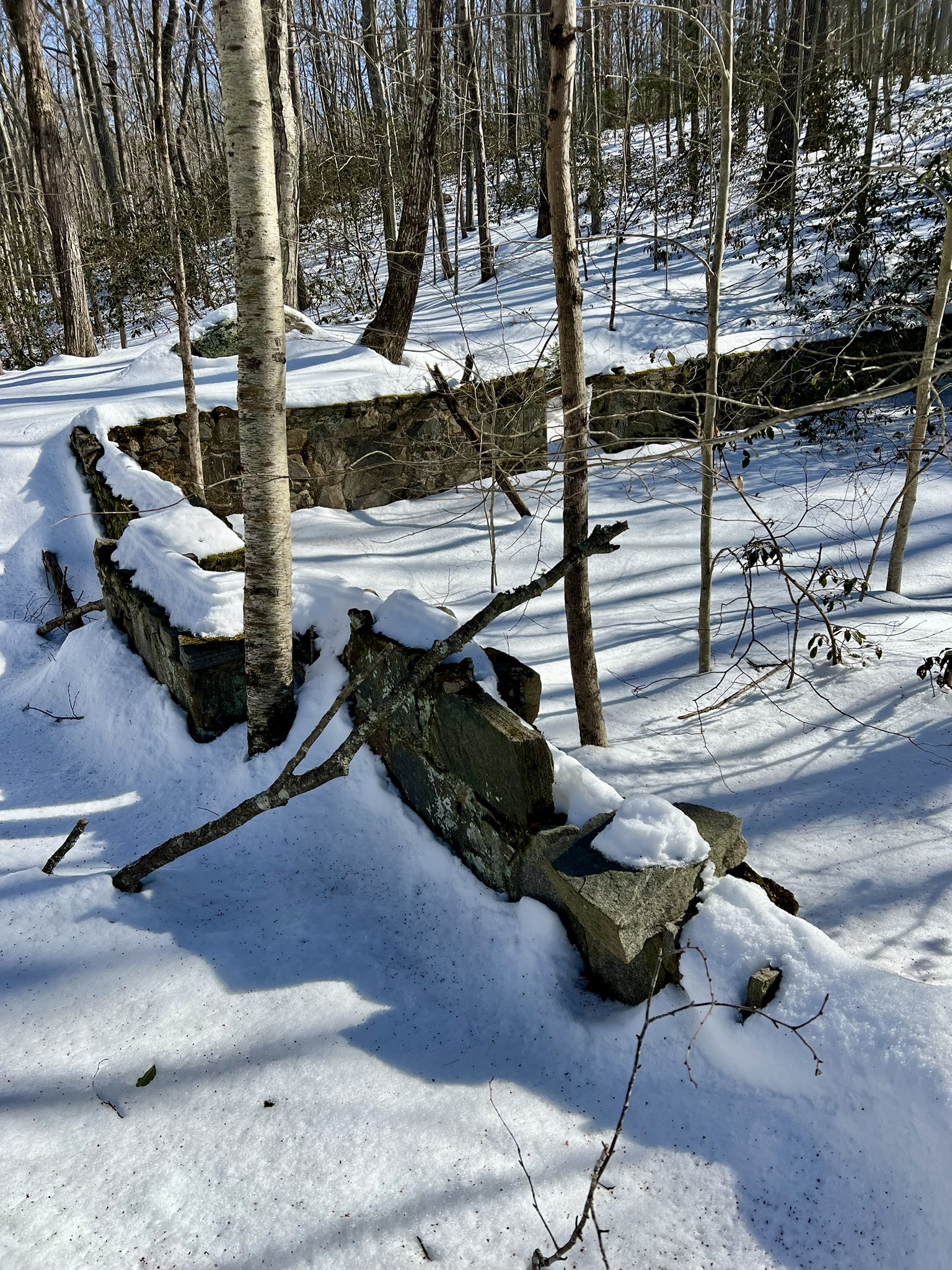
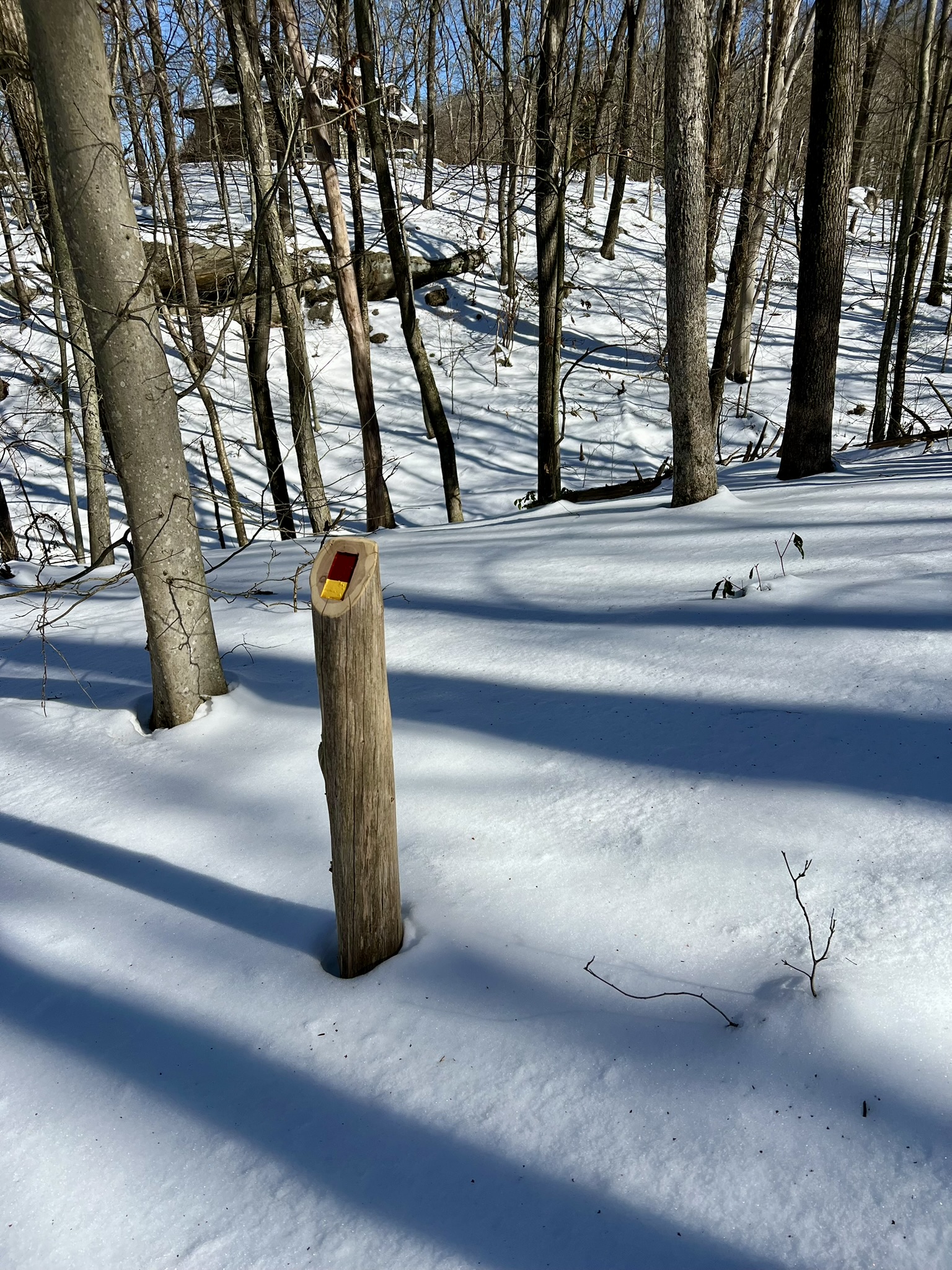
From left to right: this post marks the turnoff from the red blazed Old Cellar Trail; periodic blazes helped find the way in the unbroken snow; an old foundation; one of several marker posts
Back at Essex Street, take a minute to walk through the Smyth Sanctuary across from the parking pullout. There is a new dock along the cove, and a viewing platform that looks out onto an osprey nest.
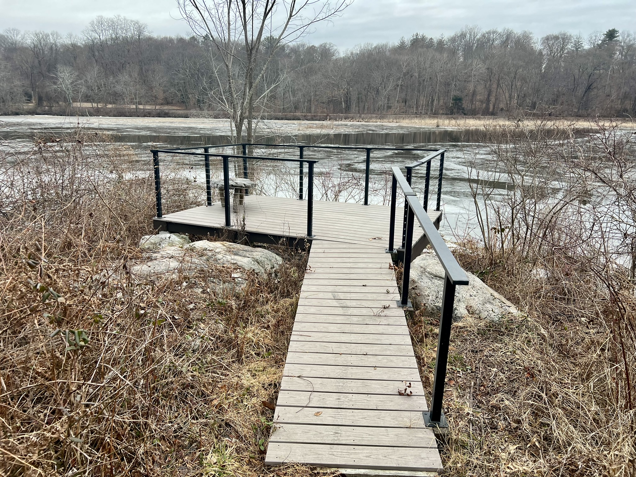
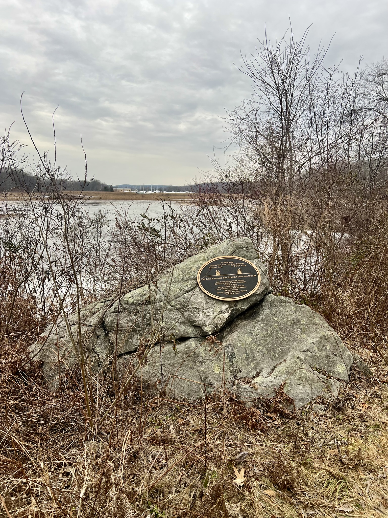
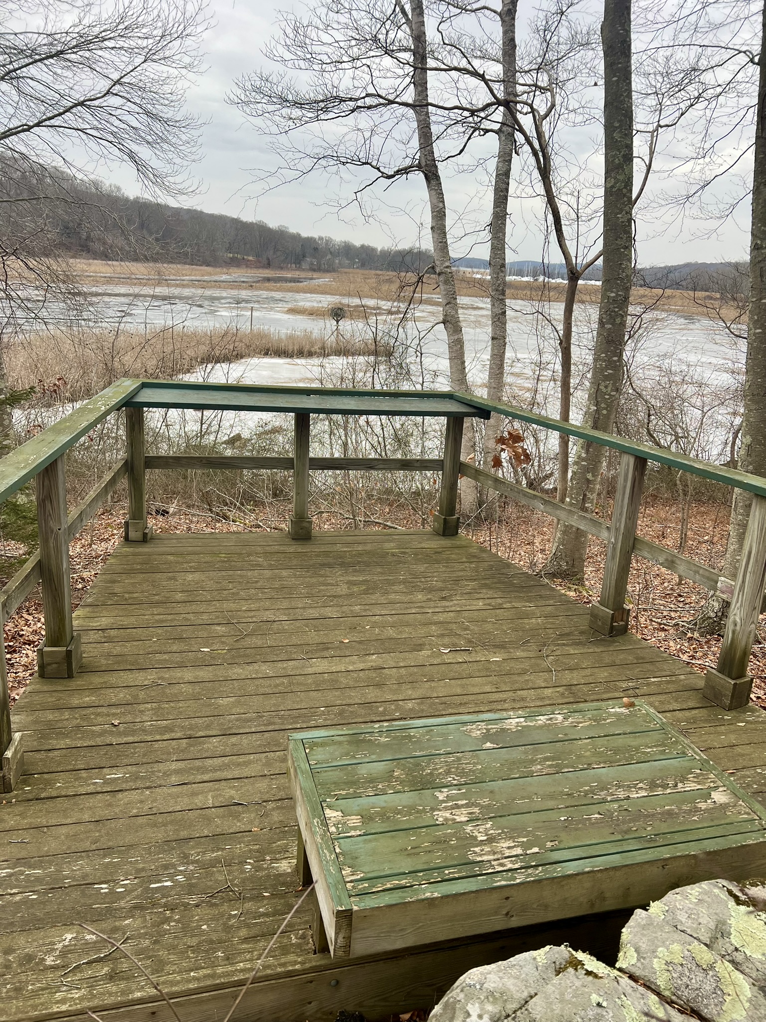
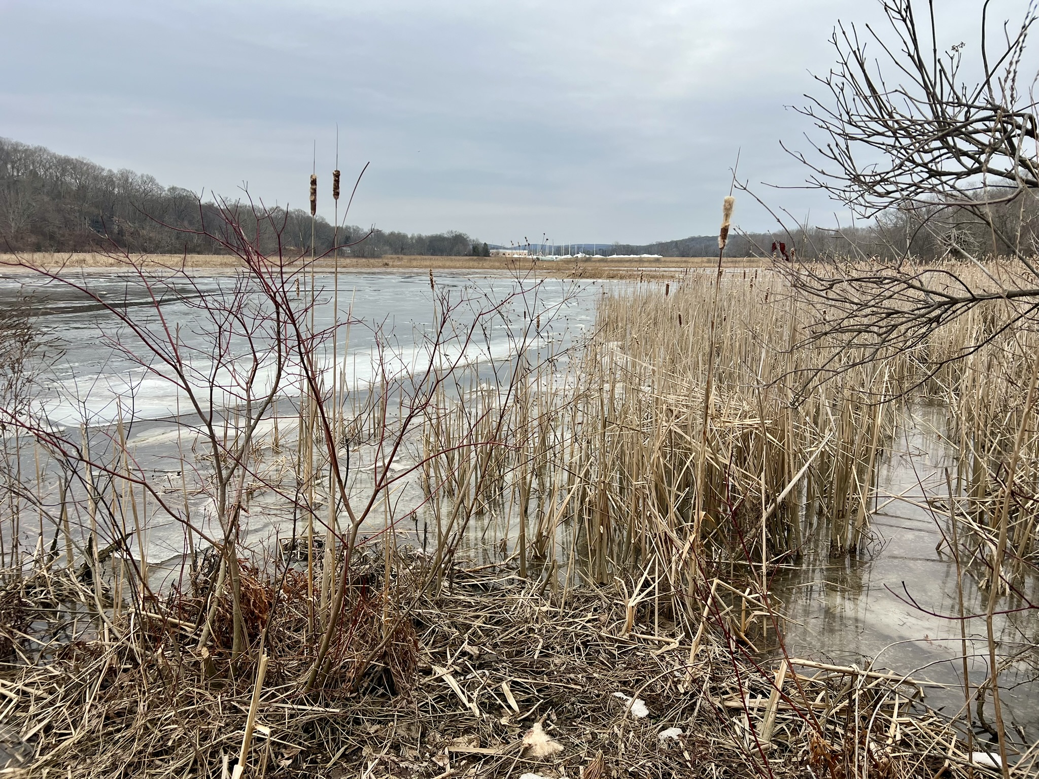
From left to right: a new platform along Pratt Cove; a dedication plaque; osprey nest viewing platform; view from the edge of the cove
Bibliography
Kate Silliman’s Chester Scrapbook, edited and revised by Thelma Clark (1986). This book is available at the Chester Library. I found it so useful that I purchased my own copy at the Chester Museum at the Mill
The Streams, Mill Dams and Mills of Chester, by Nathan L. Jacobson (2023). Available for purchase at the Chester Museum at the Mill
It Happened to Jane, 1959 movie featuring Doris Day and Jack Lemmon. Available at the Chester, Deep River and Killingworth libraries (as well as other libraries throughout the state)
Subscribe to Trail Talk
your next adventure awaits
Questions? Email me at naturenerdsramble@gmail.com or find me on Instagram @the_real_nature_renee.