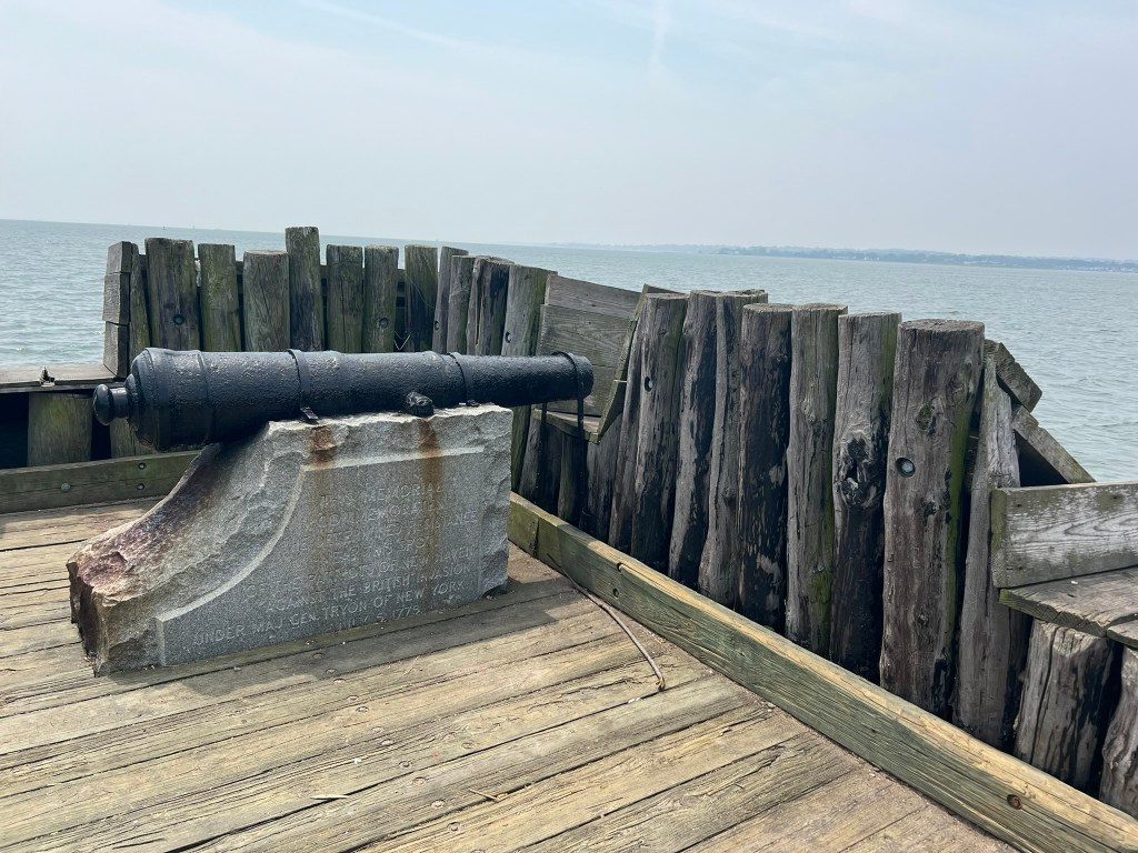
A cannon at the site of Black Rock Fort in New Haven where Patriots defended against a British raid on July 5, 1779
Good morning 2026! It is a big year for America as we approach the 250th anniversary of the signing of the Declaration of Independence. We are a beautiful, contradictory, messy and wonderful people living in a beautiful, contradictory, messy and wonderful country, and to get into a celebratory mood I have been exploring Connecticut’s connections to the Revolutionary War, or as the Brits would call it, The American War for Independence.
Last November I attended a talk sponsored by the Chester and Killingworth Libraries entitled “From Liberty to Legacy: Exploring American Ideals in the Musicals 1776 and Hamilton”. Being a theater nerd, I reveled in watching clips from two of my favorite shows, but also appreciated an important element of the presentation: namely a focus on understanding the time periods in which each show was produced and how that informed how the creators framed their musicals and how the audiences perceived them. As we enter 2026, we are lucky to live in a time where we are inclined toward greater introspection in understanding the world around us and our place in it, and we strive to imagine the voices and experiences of those whose stories are not recorded in the history books. At the same time, I also feel it is important to understand our history in its context, careful to avoid using solely a modern lens to judge events. As a New Englander, I have always felt a strong allegiance to the Patriot cause, and never gave much thought to the plight of the Tories, who were essentially Americans loyal to the Crown. But now I often wonder which side I would have taken had I been alive 250 years ago, without the benefit of hindsight. I was particularly moved by the final stanza in the 1832 poem “The Tory” by Mrs. Sarah E. Royce, reprinted in the book “The Tories of Chippeny Hill, Connecticut”, by E. Leroy Pond. It reads:
O ‘twas a dark and fearful time
When loyalty was deemed a crime!
Was theirs indeed unknowing zeal?
Can we for hunted Tories feel?
I grew up in a suburb of Boston, where reminders of the Revolutionary War are practically on every street corner. When I started looking for trails and walks related to the Revolutionary War in Connecticut, it was a little more challenging. We are often thought of as the state that people drive through to get from New York to Boston, and it seems that was the case 250 years ago as well, only at that time it was more like marching through. However, my search yielded several gems:
- Putnam Memorial State Park in Redding, where troops under the command of General Israel Putnam overwintered in 1778/1779
- Mashamoquet Brook State Park where a young Israel Putnam allegedly shot the last wolf in CT
- The Tory’s Den in Burlington, where Stephen Graves and other Royalist sympathizers hid from the Sons of Liberty looking to draft them into the local militia
- Fort Nathan Hale/Black Rock Fort in New Haven, where local militia defended against British raids
- The Museum in the Streets in Ridgefield, site of the only inland battle of the war
- Fort Griswold Battlefield State Park, where turncoat Benedict Arnold set New London afire and directed a British assault on Groton Heights
As American Naval Captain John Paul Jones allegedly shouted to his British counterpart when asked if he was ready to surrender: “I have not yet begun to fight!” – I say “I have not yet begun to explore!” I hope to spend the next 12 months continuing to learn about Connecticut’s part in the Revolution and I encourage you to do the same. At the end, I include a list of references to help you in your explorations.
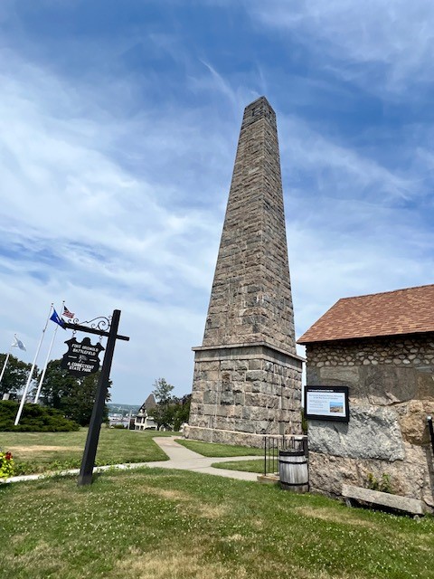
Putnam Memorial State Park. Redding, CT
Putnam Memorial State Park sits on a parcel of land that was one of three encampments around Redding in the winter of 1778-1779 under the command of General Israel Putnam. Thanks to the foresight of a group of locals who wanted to memorialize the American soldiers of the Revolutionary War, the parcel was acquired in 1887 for “$1 and other considerations” and a granite obelisk was erected in 1888. It is the oldest public park in Connecticut. There is an informative Visitor’s Center and a small museum at the park.
A General in the Continental Army, Israel Putnam was once a household name, and Michael Shay’s 2023 book, The Whites of Their Eyes: The Life of Revolutionary War Hero Israel Putnam from Roger’s Rangers to Bunker Hill, works to keep Putnam’s contributions to the creation of our country in the foreground. He paints a portrait of a farmer who joined in the fighting of the French & Indian Wars, and whose staunch patriotism led him to fight unwaveringly for the American cause a decade later. I visited on a steamy Saturday morning in July, parking in the large lot on Route 107, near the junction with Route 58 (Black Rock Turnpike). I started at the Visitor’s Center, which had several sign boards telling the history of the park. Don’t miss the statue out front, completed by sculptress Anna Hyatt Huntington at the age of 94, which depicts “General Putnam’s legendary ride down the stone steps in Greenwich…where he narrowly escaped from the British dragoons.” From there, I headed back toward the parking lot, collected a park map from the map box, and started up the gravel road, which runs in a loop for approximately one mile and is accessible to walkers, cyclists and cars. The loop follows a series of historical landmarks, described on signboards and on the backside of the paper map. I chose to go clockwise, following the numbers in reverse to visit the museum last.

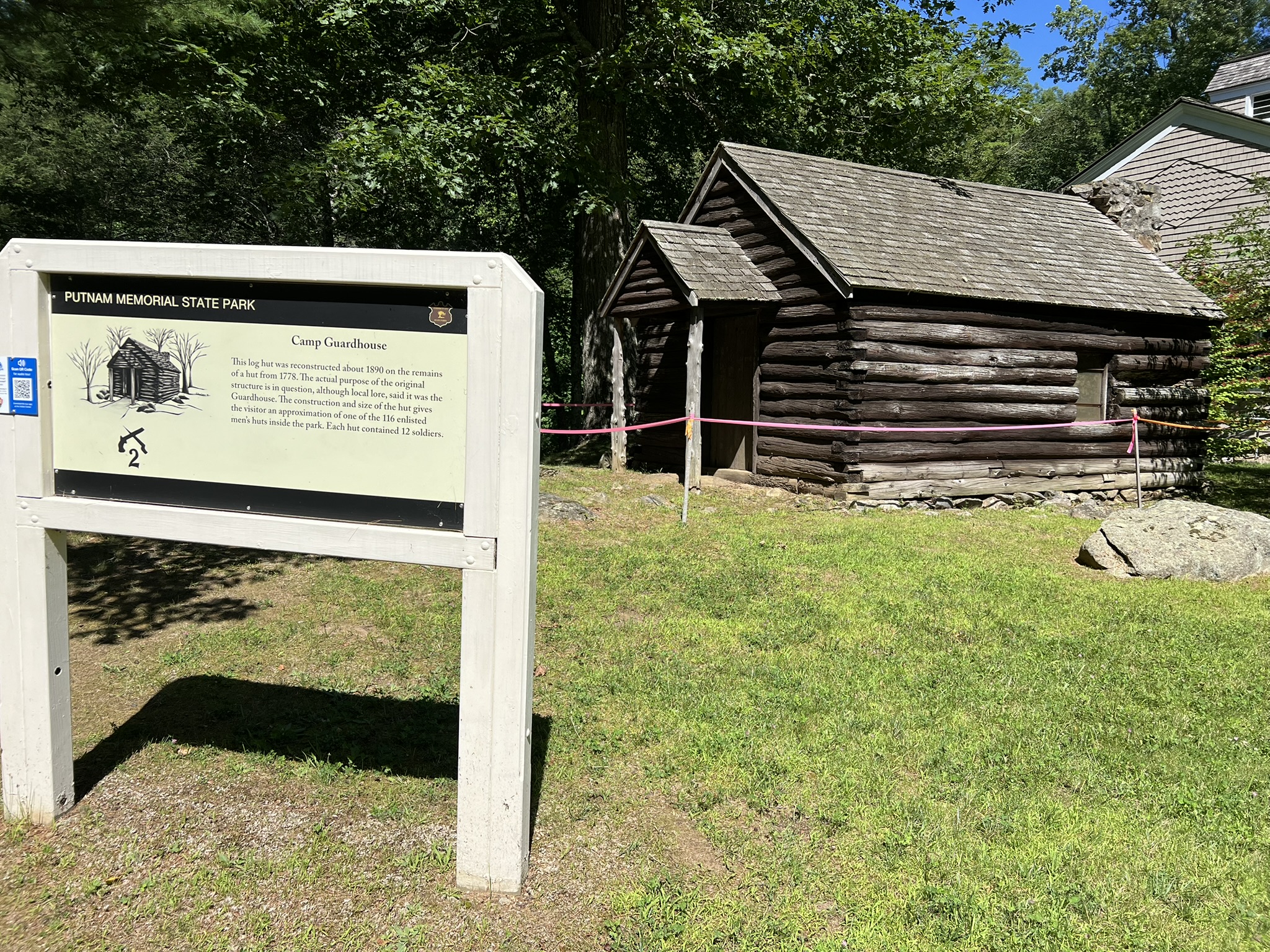
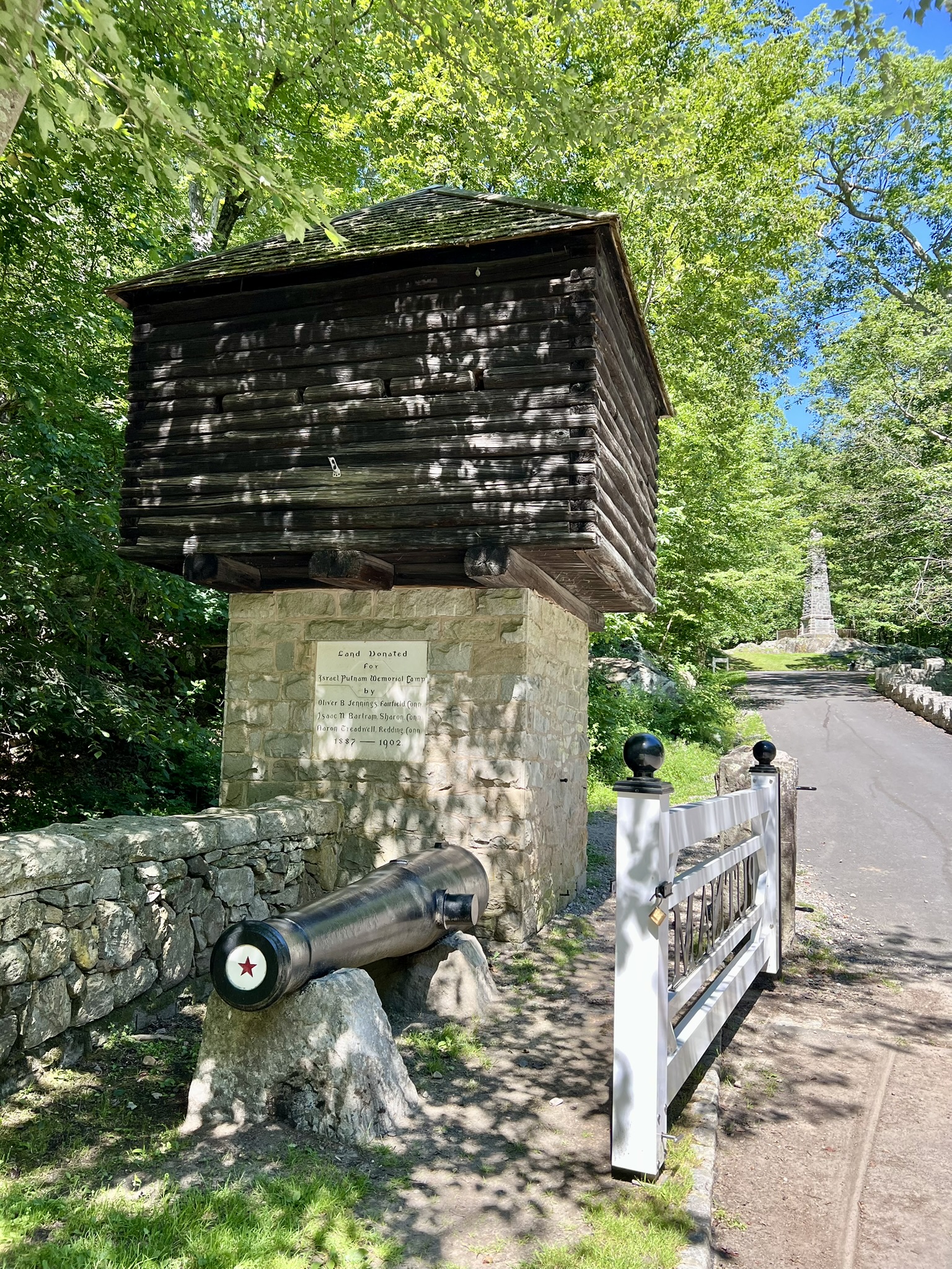
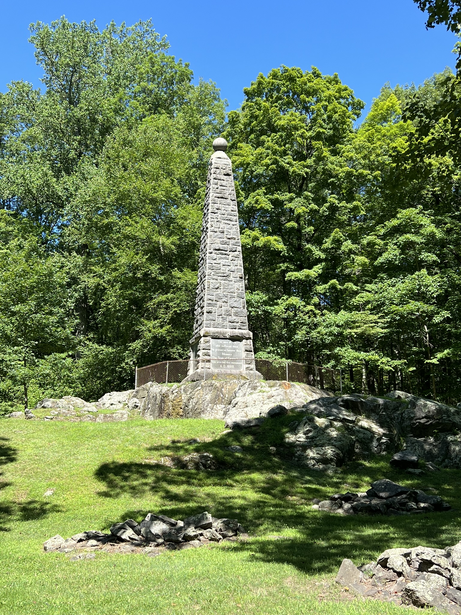
From left to right: the sculpture of Israel Putnam; a replica guardhouse near the Visitor Center; the entrance to the loop road; the obelisk memorial.
At the cemetery, I approached a monument to get a closer look and noticed a trail to the left marked with white blazes. I decided to follow this through the woods. While a bit overgrown in summer, it wasn’t too difficult to follow, and while I did lose sight of the blazes at one point, I emerged from the woods by the Bake Oven signboard. Rather than follow the road to the museum, I kept on the gravel loop road and watched for the footpath on the left that has stairs leading down to the museum. The museum has a combination of artifacts from the camp collected during the archaeological digs, and other historical pieces from a variety of time periods donated mostly by locals. Every December, the Park Director leads a guided walk of the park followed by a reenactment. Watch the FANS website for the 2026 date. The park is open to cyclists and pedestrians all year from dawn to dusk. Buildings are open 10am – 5pm daily between Memorial Day & Veterans Day. For more information, check the Friends and Neighbors (FANS) of Putman Park website and the CT Parks Website.
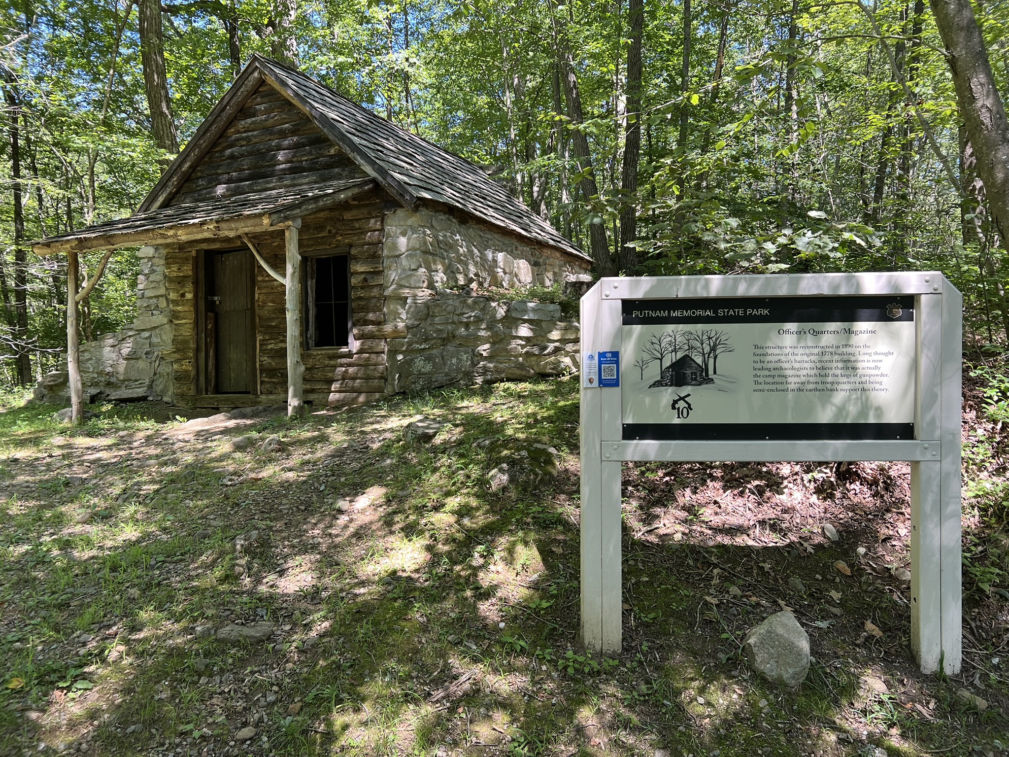

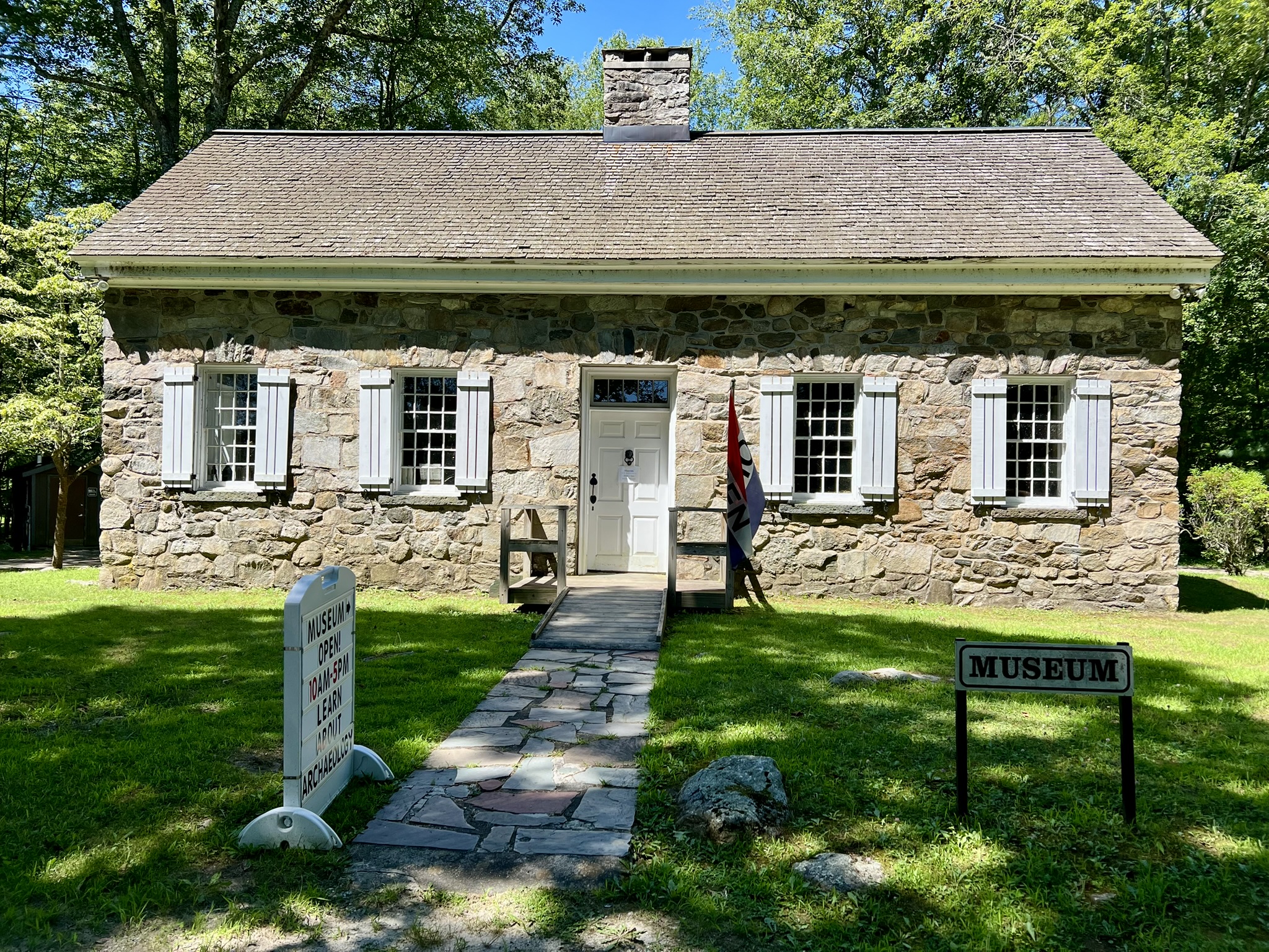
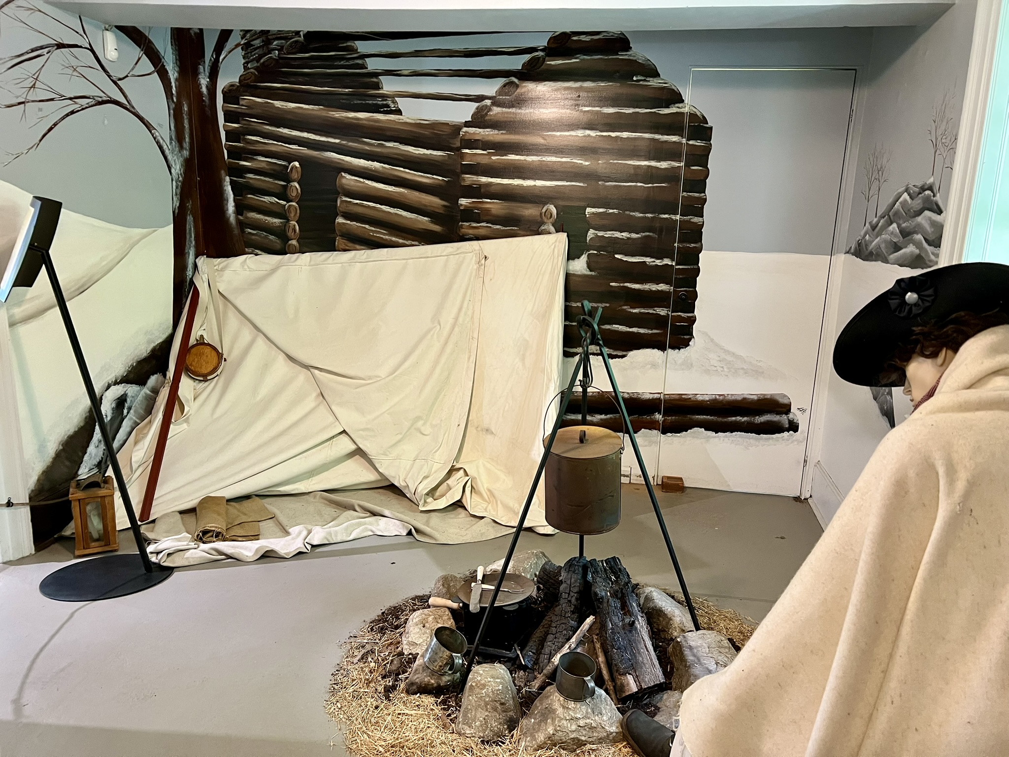
From left to right: replica magazine store; chimney ruins; the museum; a museum exhibit
Fort Nathan Hale (Black Rock Fort), New Haven
I visited this historical landmark on a hot Saturday in July. This is a tired looking park that could benefit from some care and attention. When I arrived midday there was only one other car in the parking lot, which had grass growing up through the cracks in the broken asphalt. There is a booth that operates as a Visitor Center where you can sign the guest book and pick up a map with a self-guided walking tour. The grounds are open year round, but the booth is open from Memorial Day Weekend to Labor Day Weekend, Wed-Sun from 10:00am to 4:00pm. The main remnants of the past forts are the circular moat and drawbridge, and several bunkers built into the banks. After crossing the drawbridge I came upon a sign that helped explain the multiple fort names. The first fort erected on this site in 1657 was unnamed. In 1775, the Black Rock Fort stood here. In 1807 it was renamed Fort Nathan Hale, and then in 1863 it was Fort Nathan Hale II.
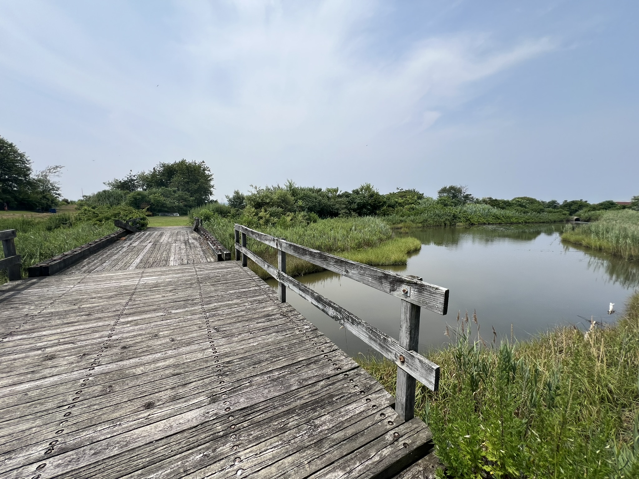
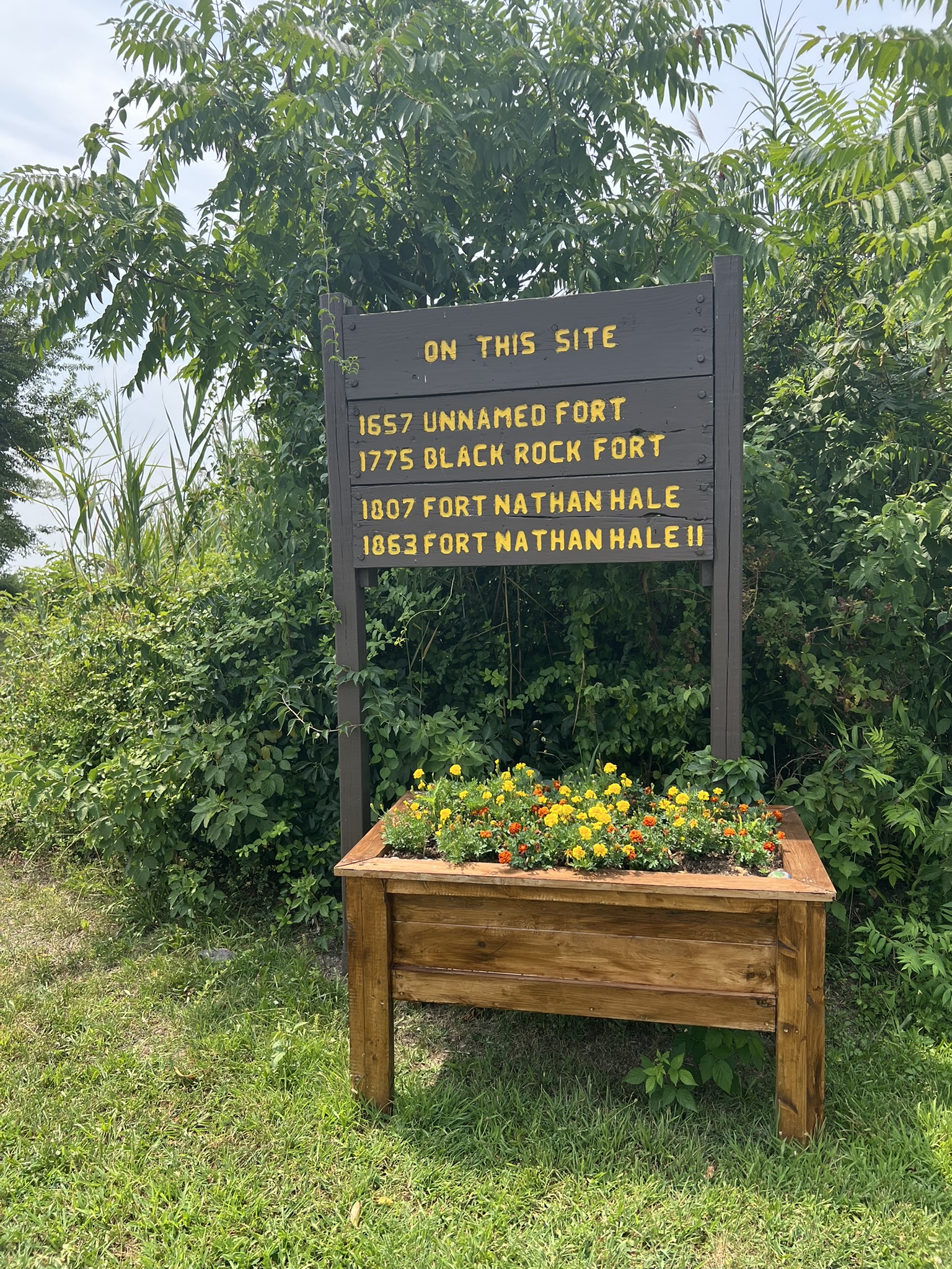
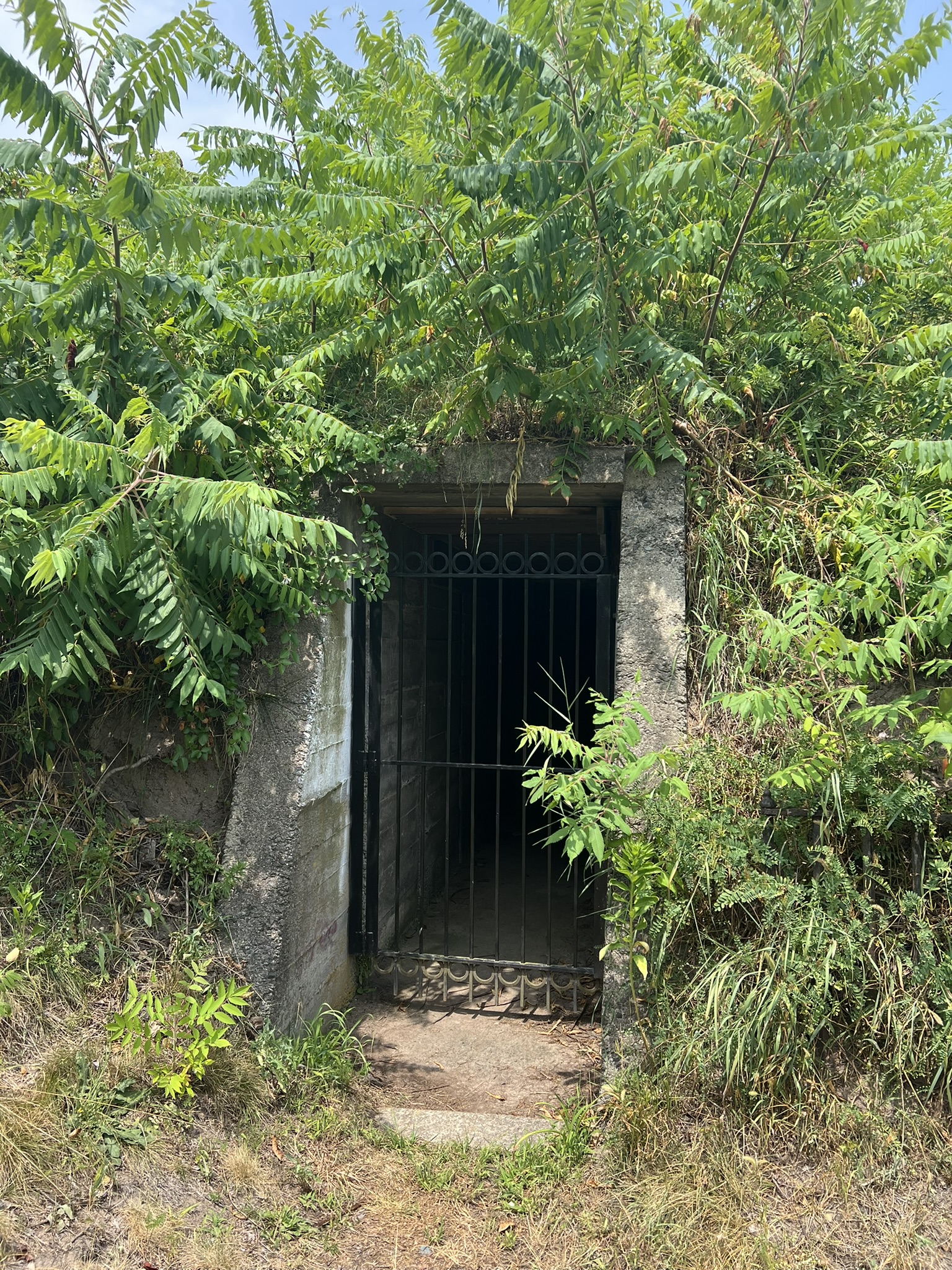
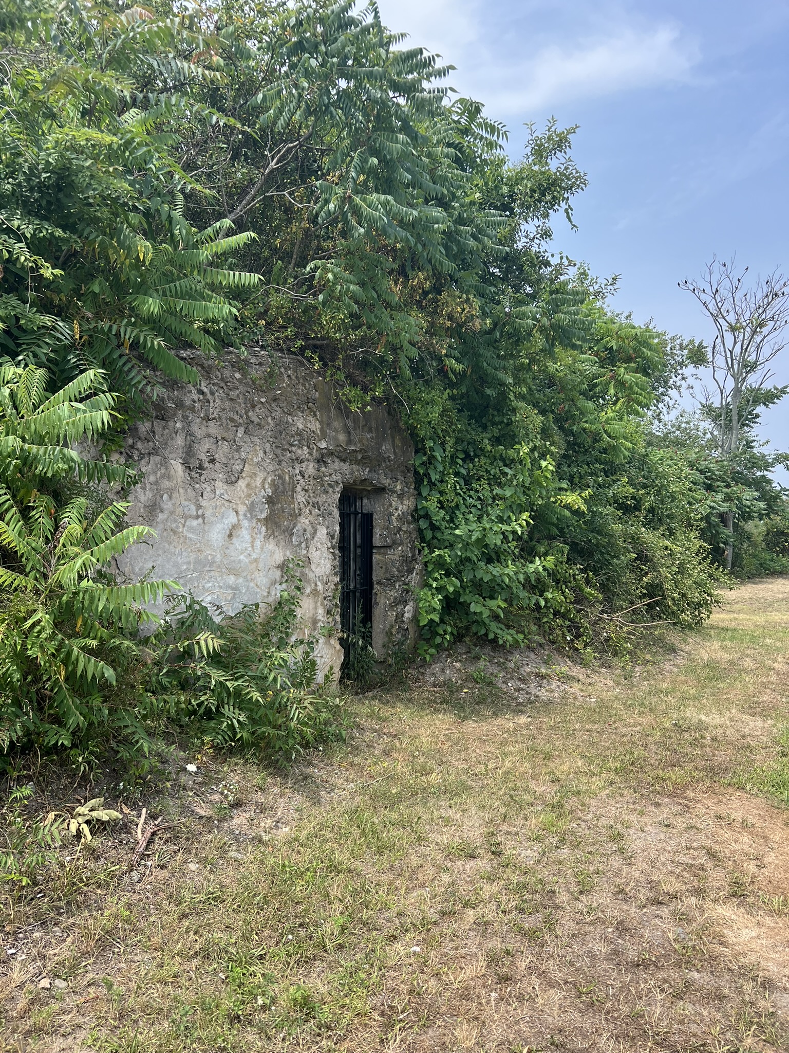
From left to right: crossing the moat on the drawbridge; the sign explaining the history of the names; bunkers built into the banks
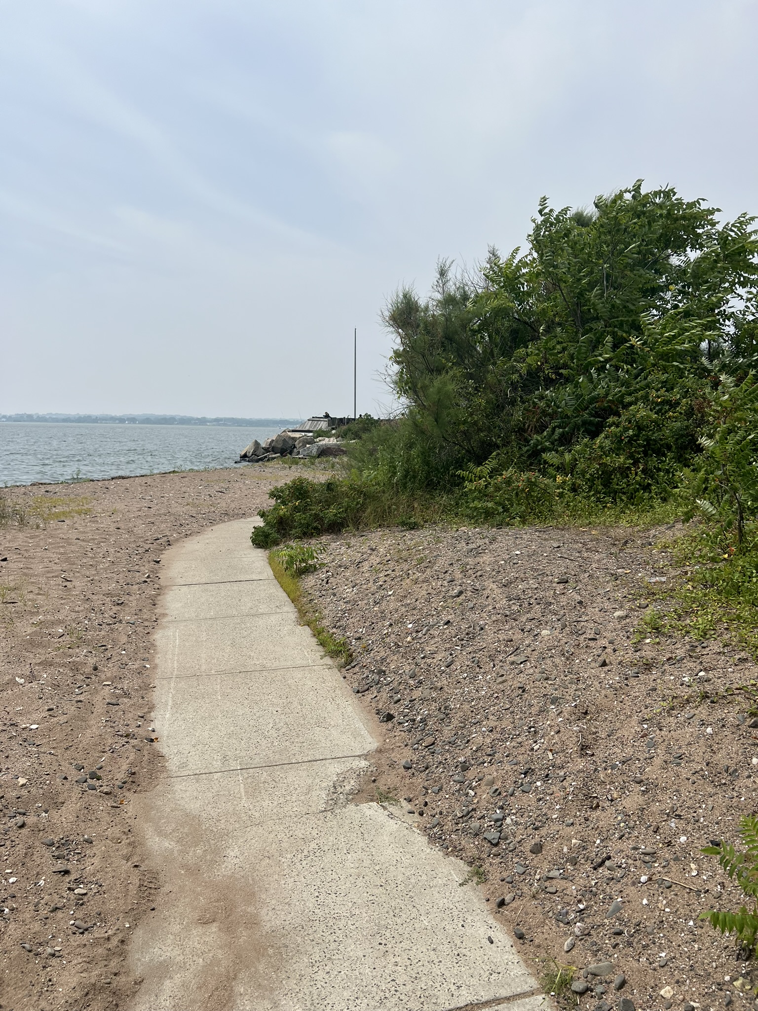
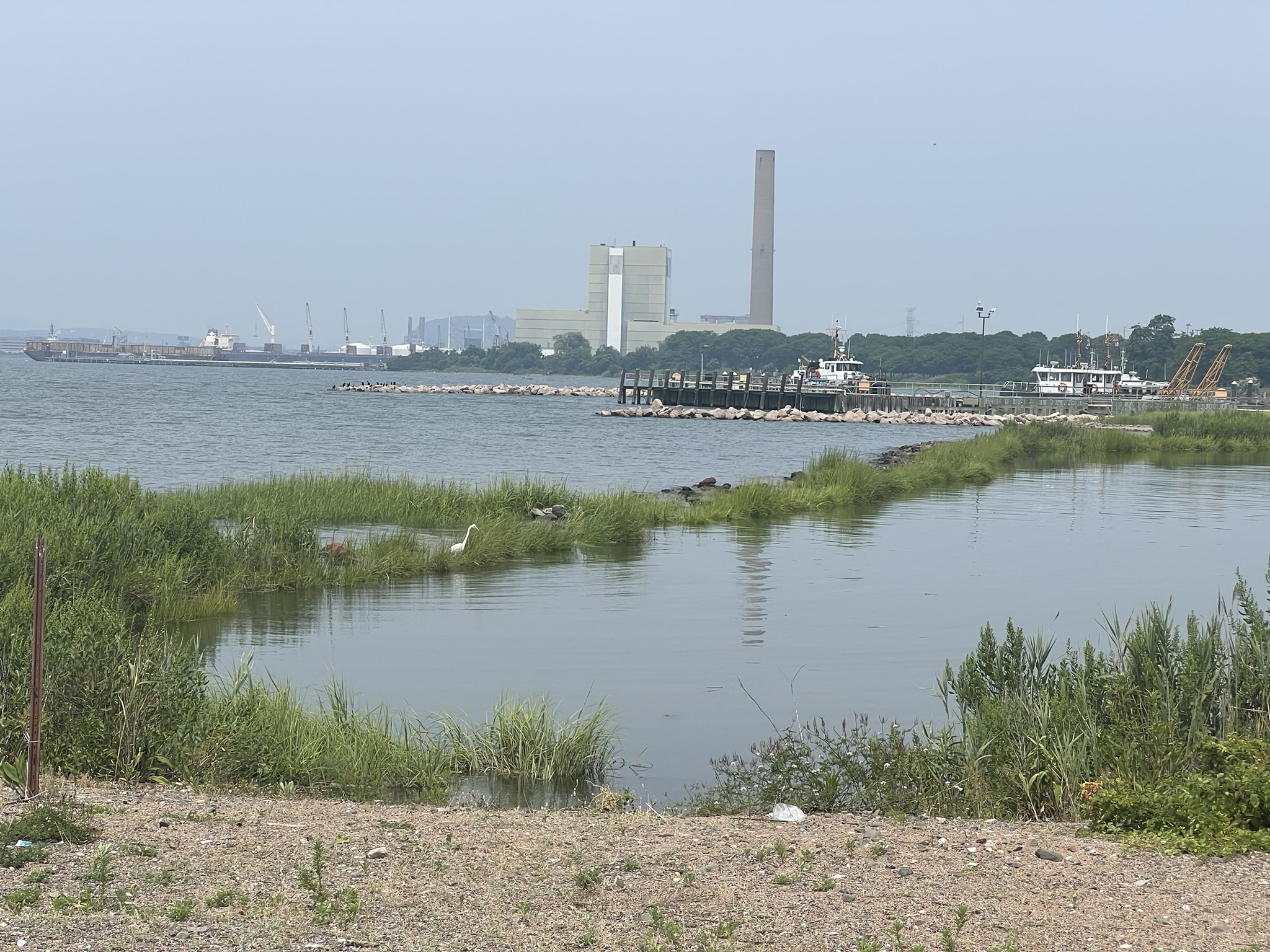
Walking out to the beach I followed a path down to a small decked area where there is a replica of a cannon and an overgrown sign that talks of a skirmish that took place at this site on July 5, 1779. There were many locals fishing off the deck and the beach. I walked all the paths, and upon returning to my car had covered about ¾ of a mile. At the end of the parking lot there is a sign indicating the site of a Native American Area, along with what looks to be a very old totem pole. The sign explains that “very few eastern Indian totem poles have been found and were for ceremonies only.” Unfortunately, safety has been an issue at this location. I saw this news article after my visit.
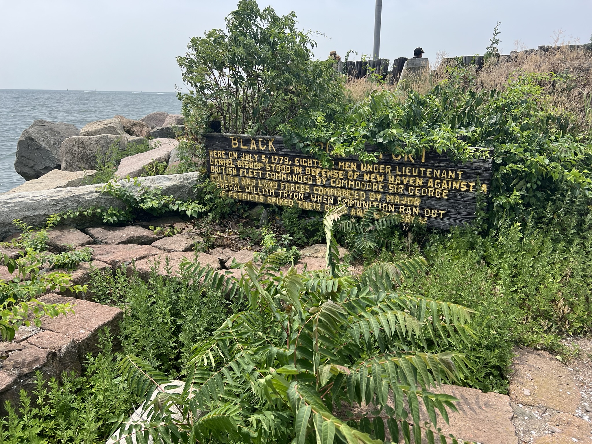
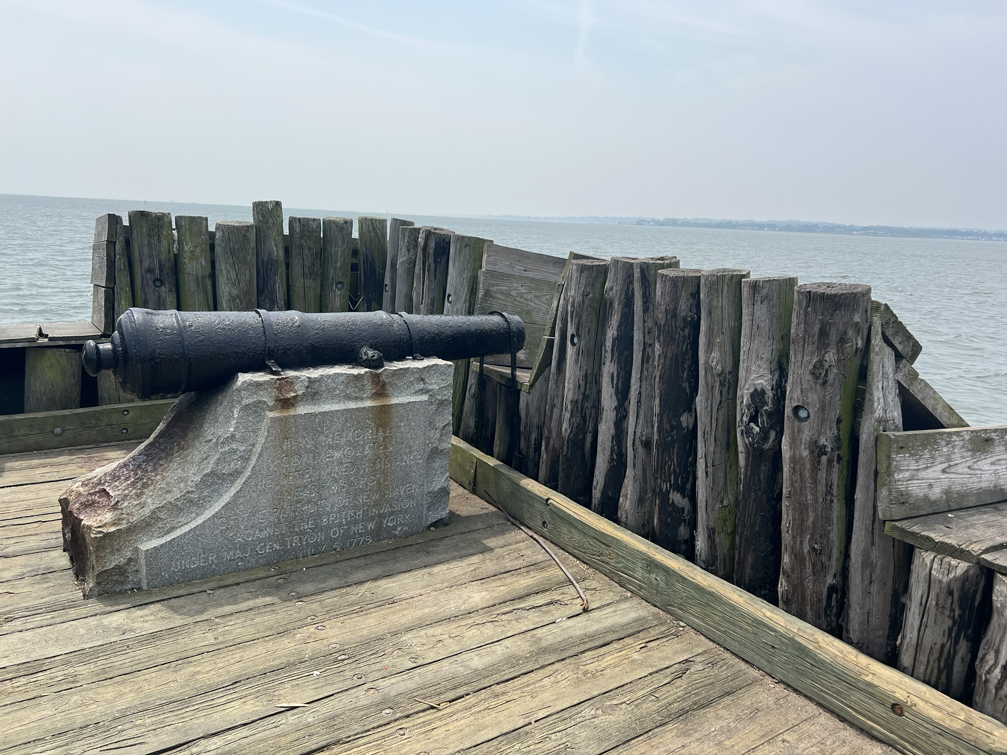
From left to right: the overgrown sign commemorating the attack on New Haven; the path to the fort deck; the fort deck and memorial cannon; view of New Haven
Mashamoquet Brook State Park, Pomfret. Approximately 3.5 miles.
I visited Mashamoquet Brook State Park with family in January of 2025, long before I envisioned this blog post and knew the name Israel Putnam. According to the website, “[t]he park’s most famous feature is the Wolf Den. Legend has it that on a night in 1742, Israel Putnam, later a Major General in the Continental Army during the Revolutionary War, crept into the den and shot Connecticut’s last documented wolf. The wolf was notorious for preying upon local sheep and livestock and Putnam was heralded for the slaying.” We did a clockwise loop, crossing the bridge on the yellow trail then looping south on the red trail and back north on the blue trail.
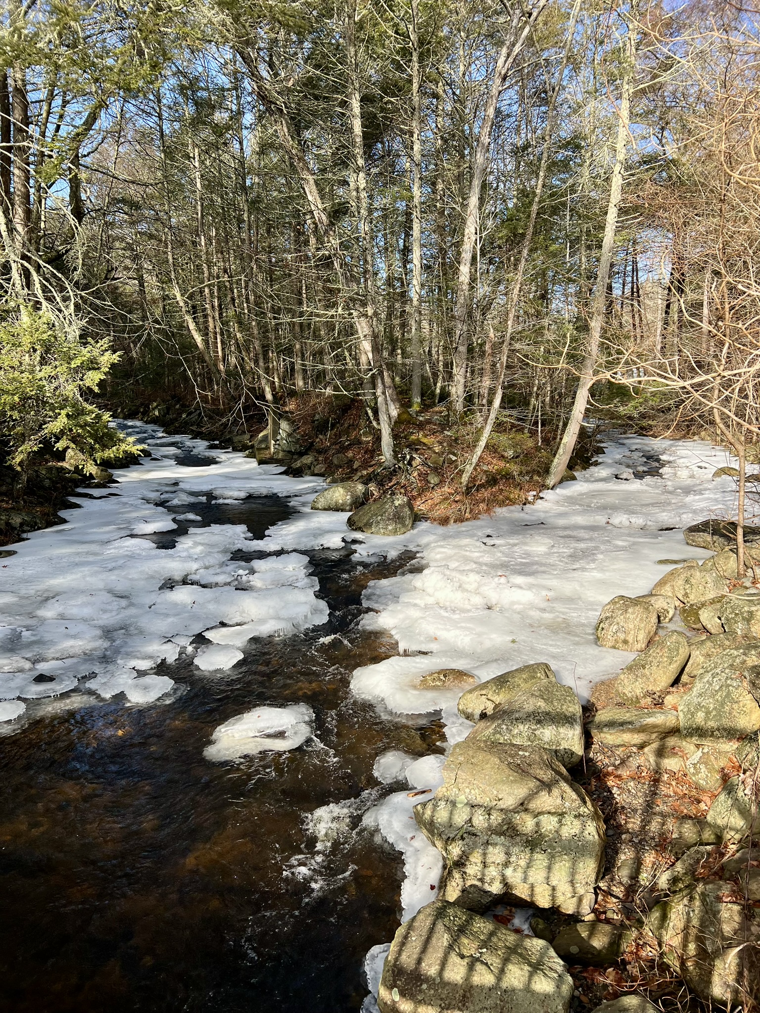
From left to right: the bridge over Mashamoquet Brook; the brook in January 2025; a pine forest section of trail; the Table Rock landmark on the red trail.
At the southernmost point we did a short out and back to visit the Wolf’s Den, which I peered into but didn’t dare crawl in. This was January, and it had snowed earlier. Although most of the snow had melted, the semi-frozen ground made for difficult walking, especially on the red trail, as our feet kept sinking into frost pockets. The blue trail on the way back was more pleasant, and this seemed like a seasonal issue. For more information visit the CT Parks Website and download the Trail Map.
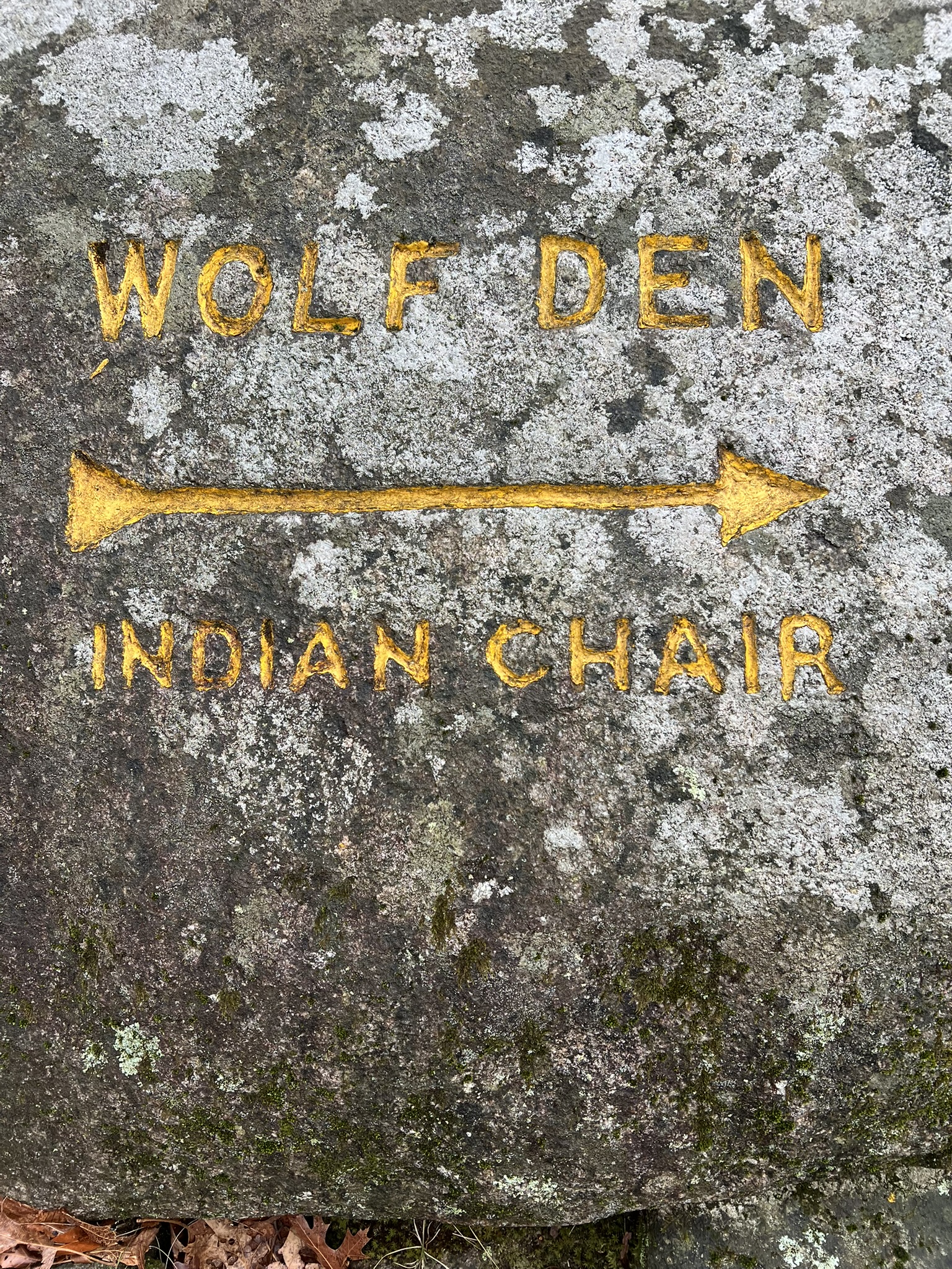
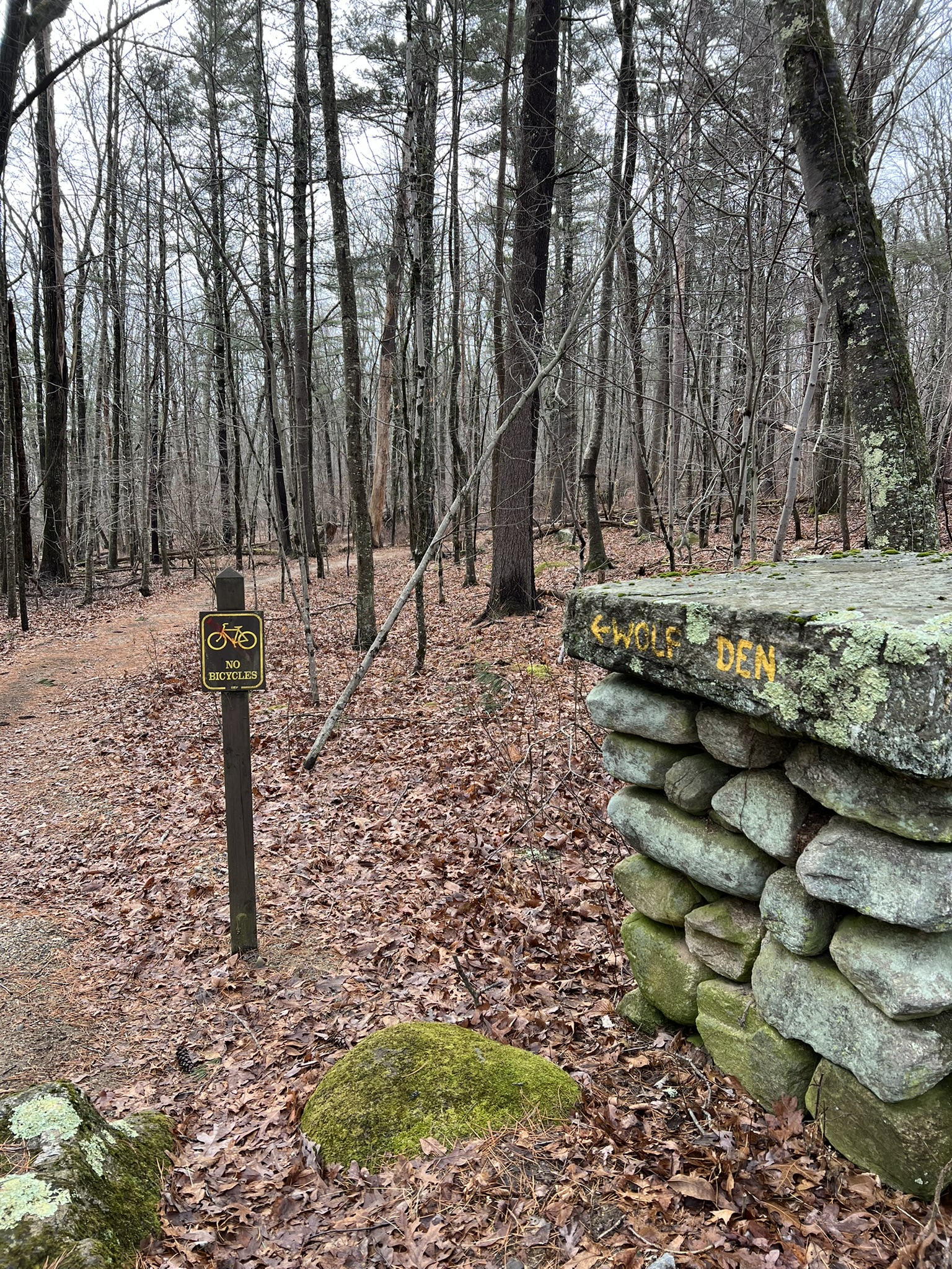
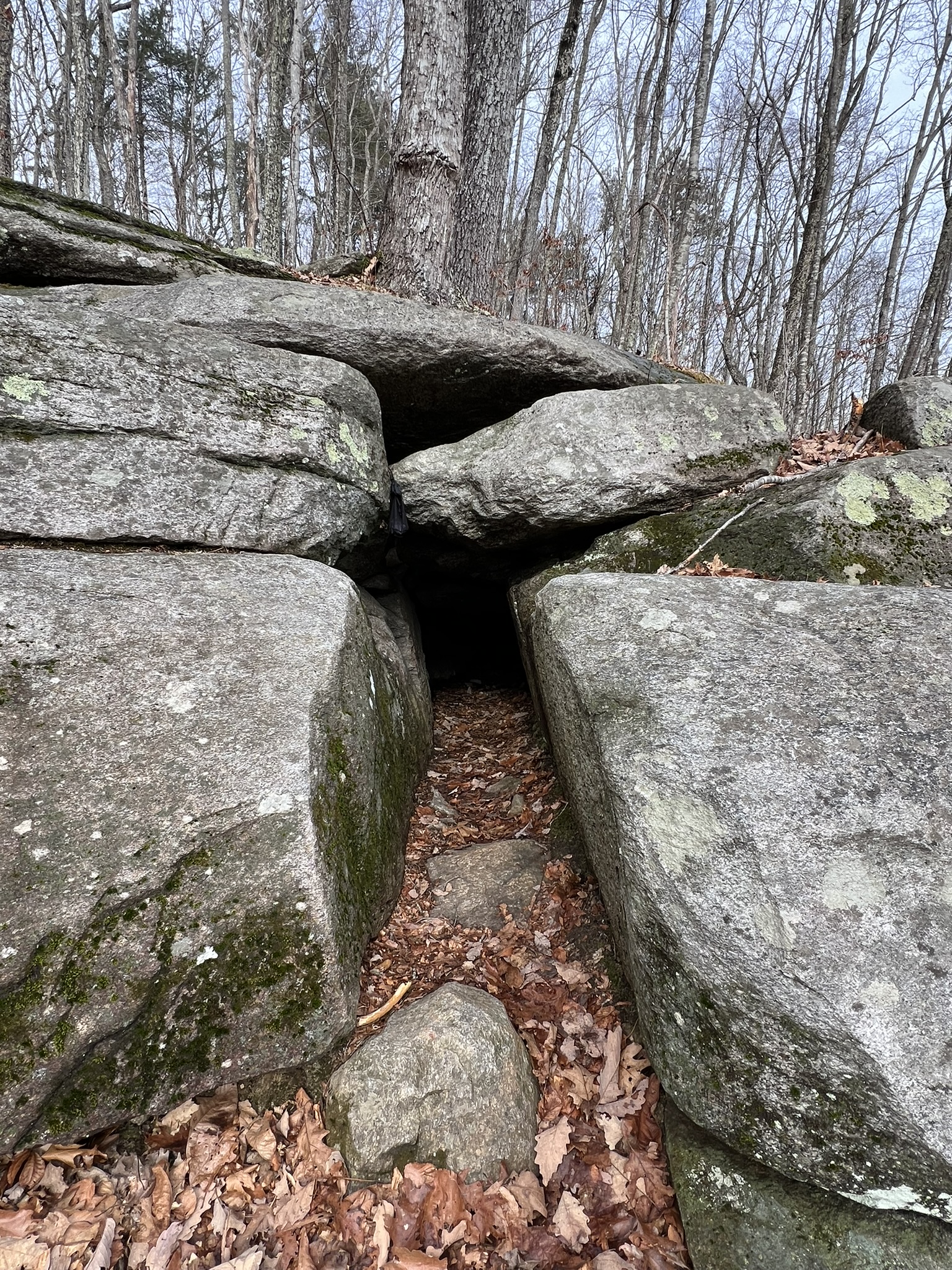
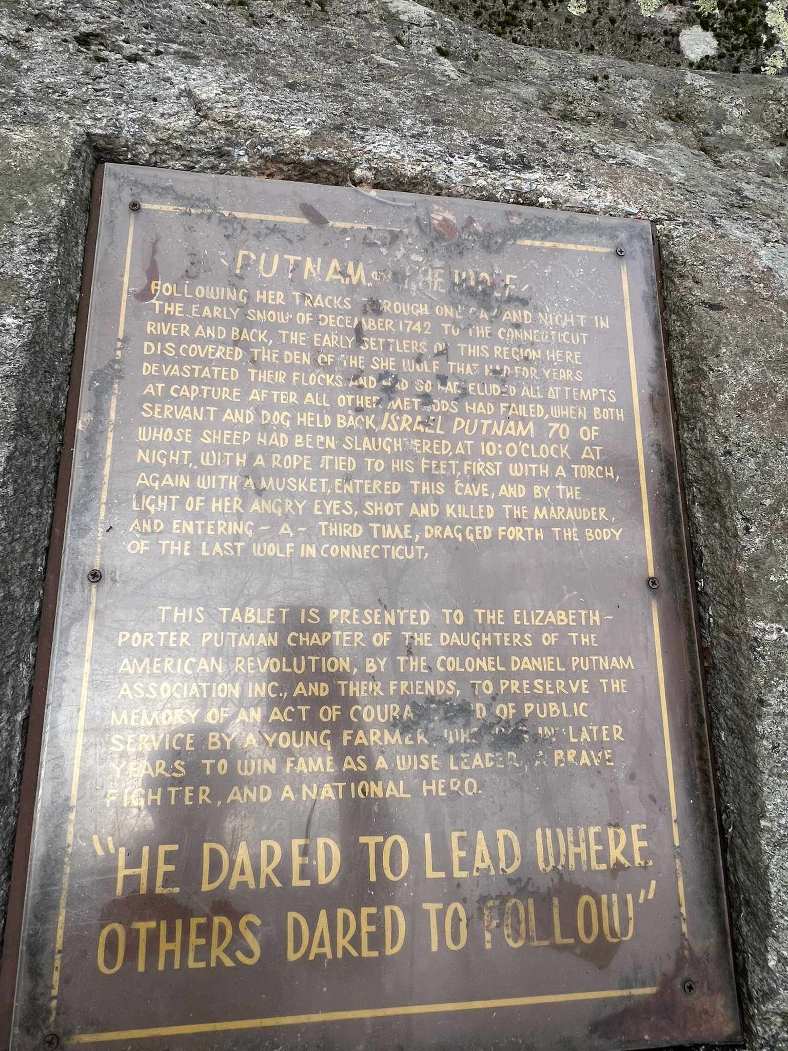
From left to right: Many signs point the way (we did not go as far as the Indian Chair); the entrance to the Wolf Den; the memorial plaque
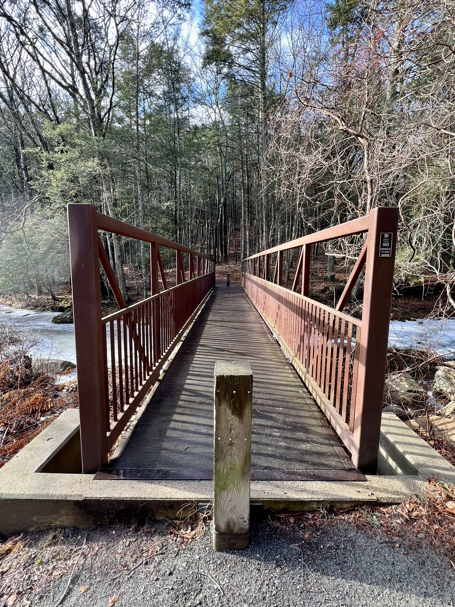
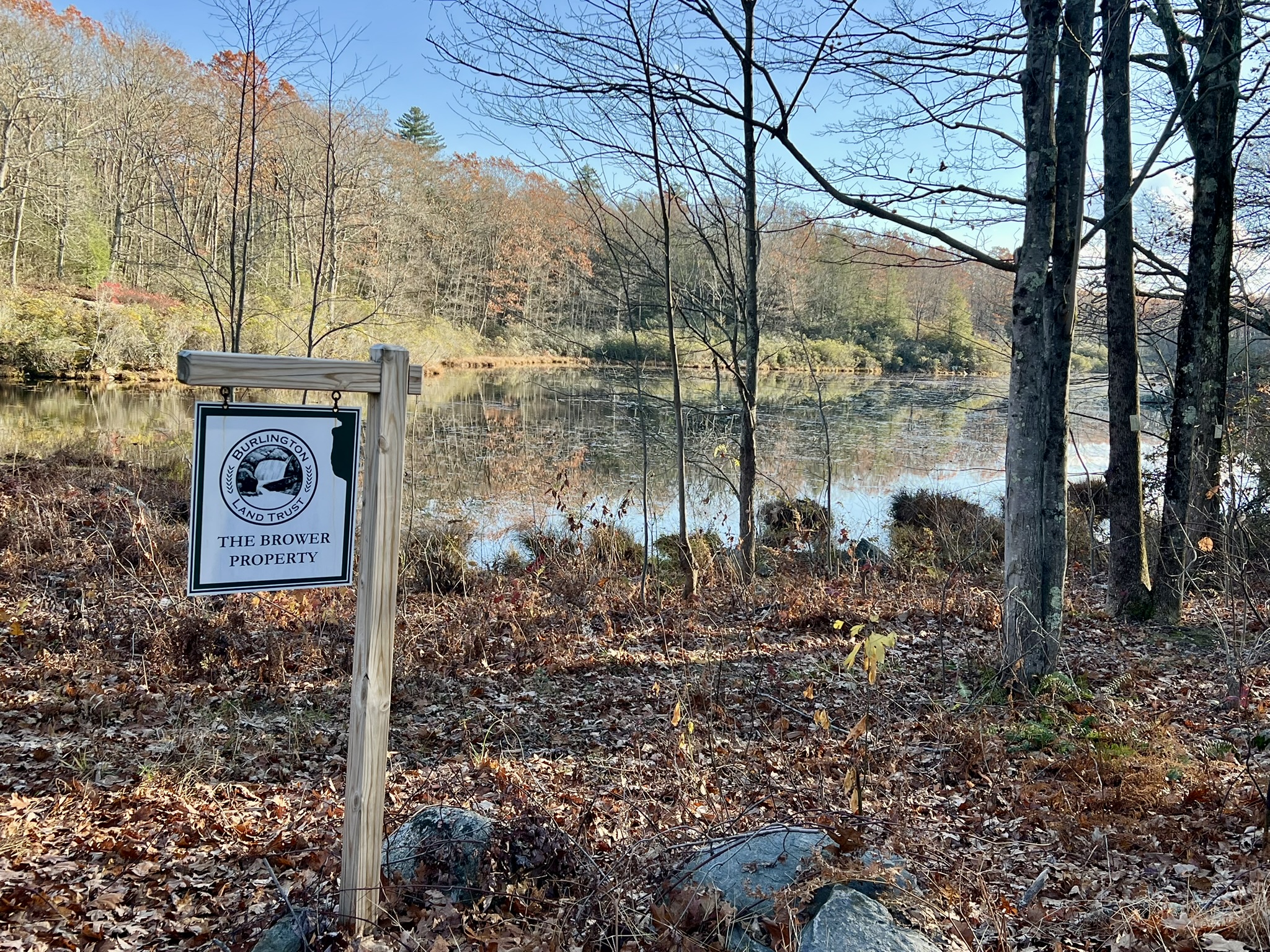
Tory’s Den, Burlington. 3 1/2 miles.
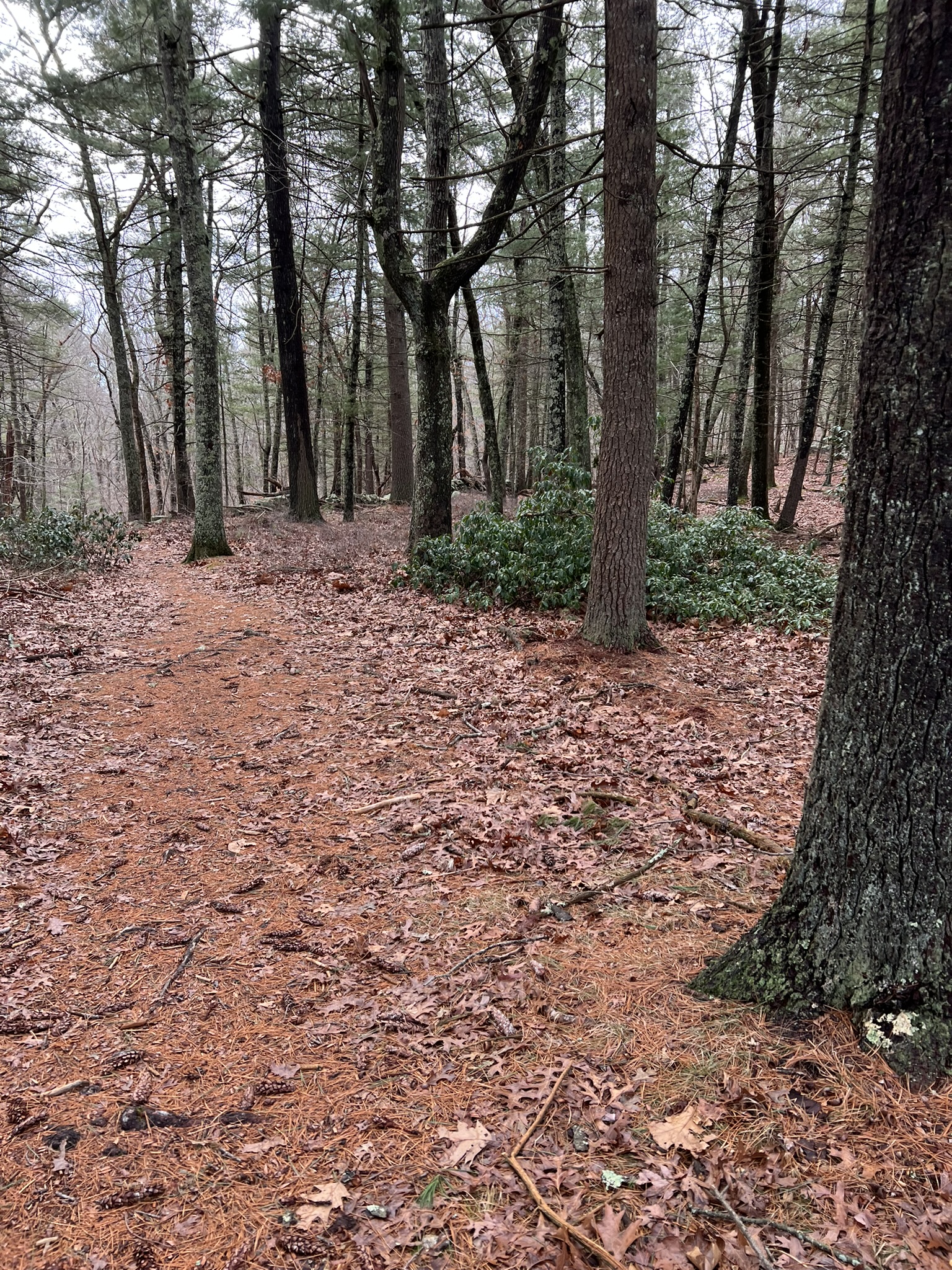
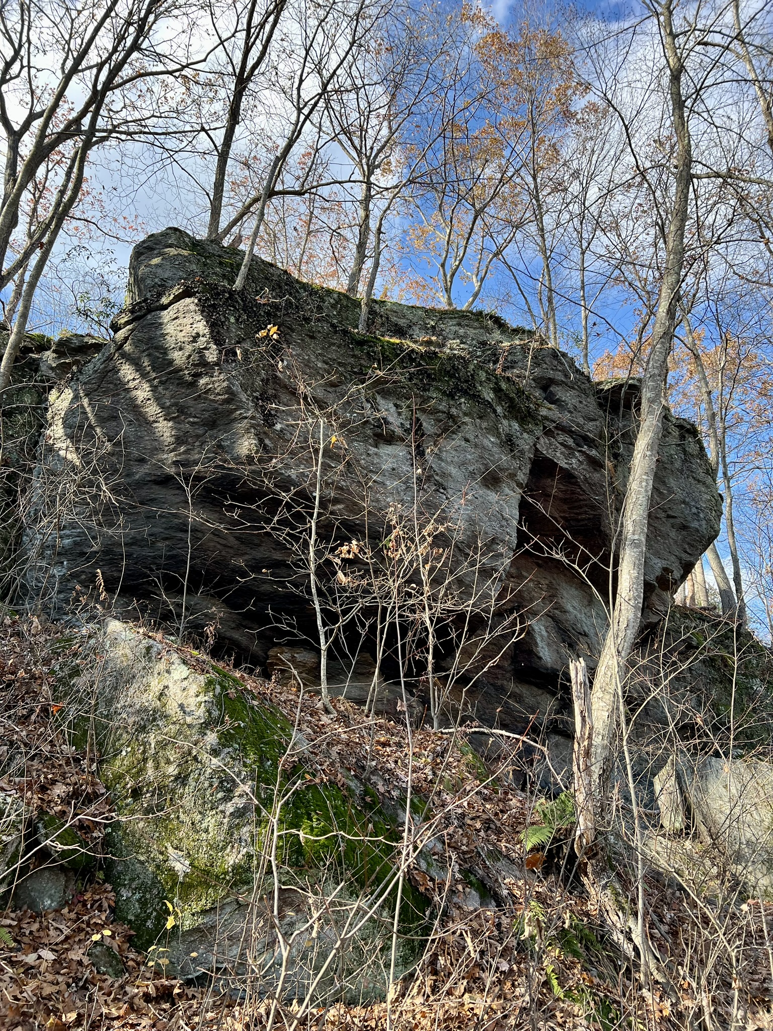
While there were many Tories that hid in the hills across the land, we know about this spot thanks to Stephen Graves’ descendants, who kept the story alive through oral tradition, and eventually in the pages of a book, The Tories of Chippeny Hill, Connecticut, by E. Leroy Pond (1909). How much is fact versus legend is unknown but an article entitled The Connecticut Tory Den – Safe Haven for the Royalist Sympathizers by the New England Historical Society shares the tale. On a warm November afternoon we visited the locale by way of the Mile of Ledges Trail. We followed this AllTrails route, except that we parked at the Brower Property on Greer Road, marked on Google Maps as the Tunxis Trail Trailhead. There is parking for several cars at a pullout next to Country Pond. (NOTE: If you use this AllTrails loop, please know that the written directions are to the Greer Road Trailhead, but the directions link goes to a parking area on E. Plymouth Road. By parking on Greer Road we eliminated the out-and-back section of the loop.) The map at the kiosk shows the trails of the Martha Brower Wildlife Sanctuary, a red loop trail, and the blue/yellow trail, a side trail of the main blue-blazed Tunxis Trail that passes through and connects to Sessions Woods. We did the loop in a clockwise direction, starting with the most difficult section – the Mile of Ledges. I loved this section of trail, but it was very challenging. There are numerous rock scrambles that require concentration and the use of your hands. Many of them seem to have workarounds if you find it too challenging, but I can’t guarantee that as we were determined to do all the tricky bits. We went slowly and used extra care because it had rained earlier and we faced both wet rocks and slippery leaves.
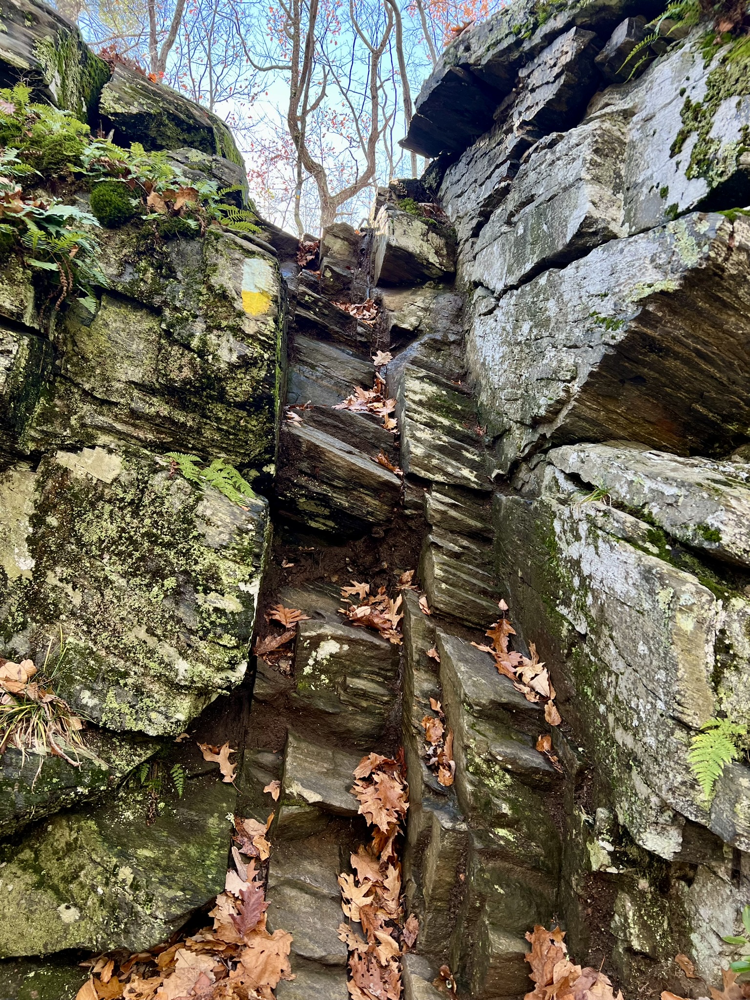
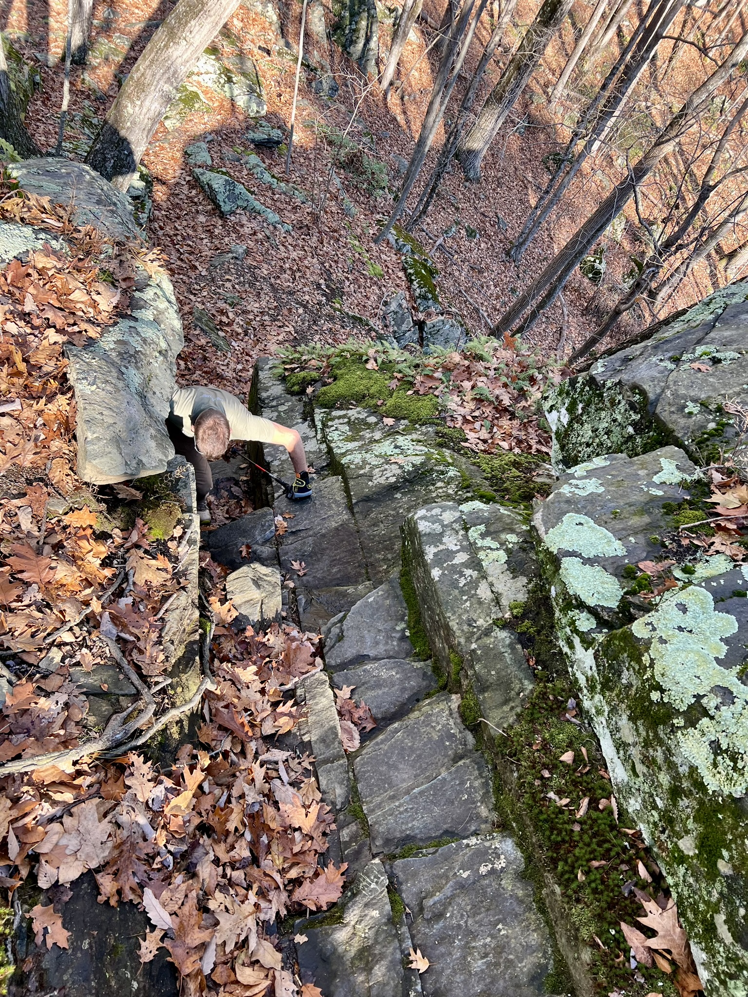
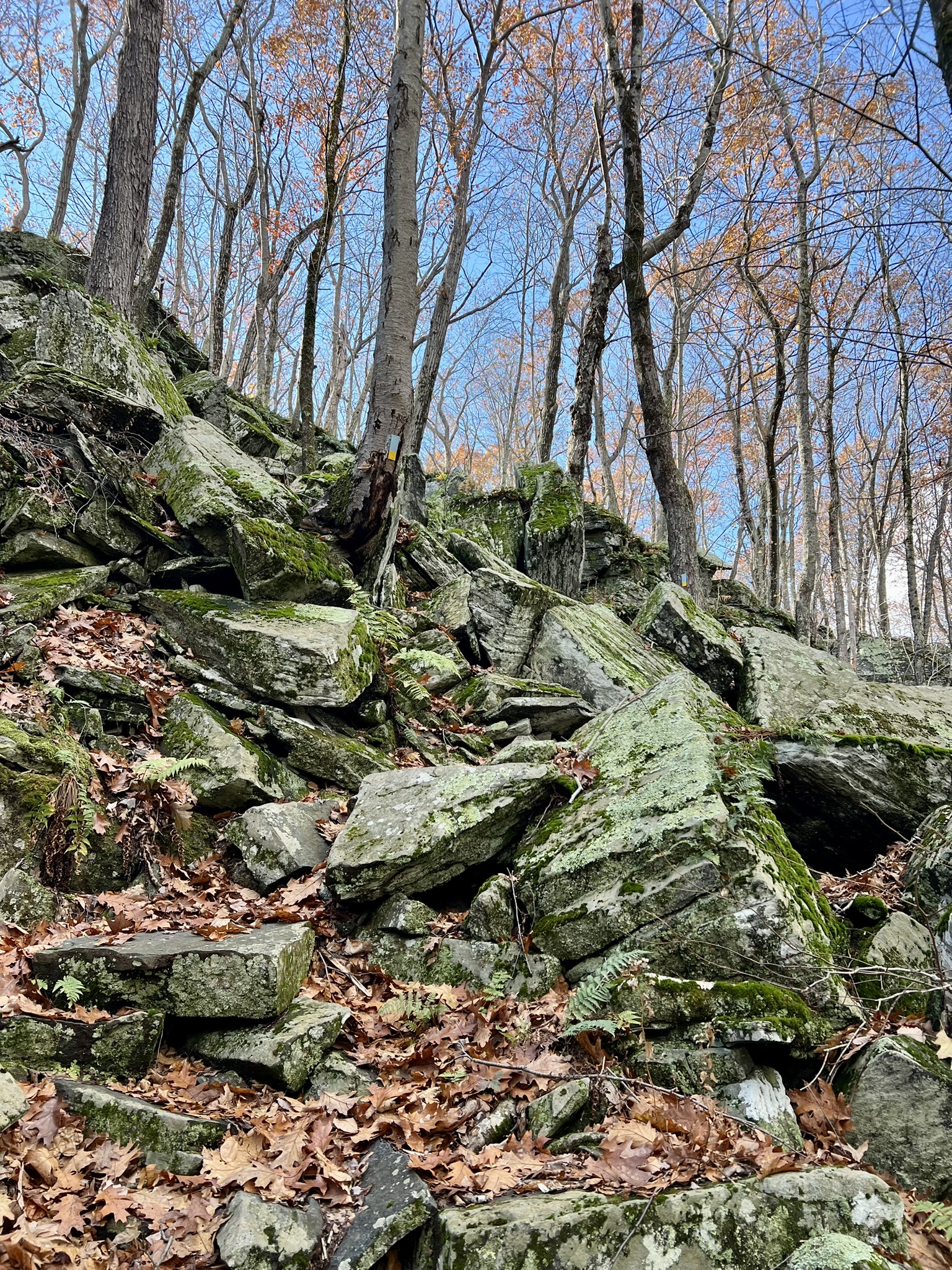
From left to right: the trailhead sign; one of the trickier scrambles; the view from above of my husband’s head as he climbs up; typical trail terrain
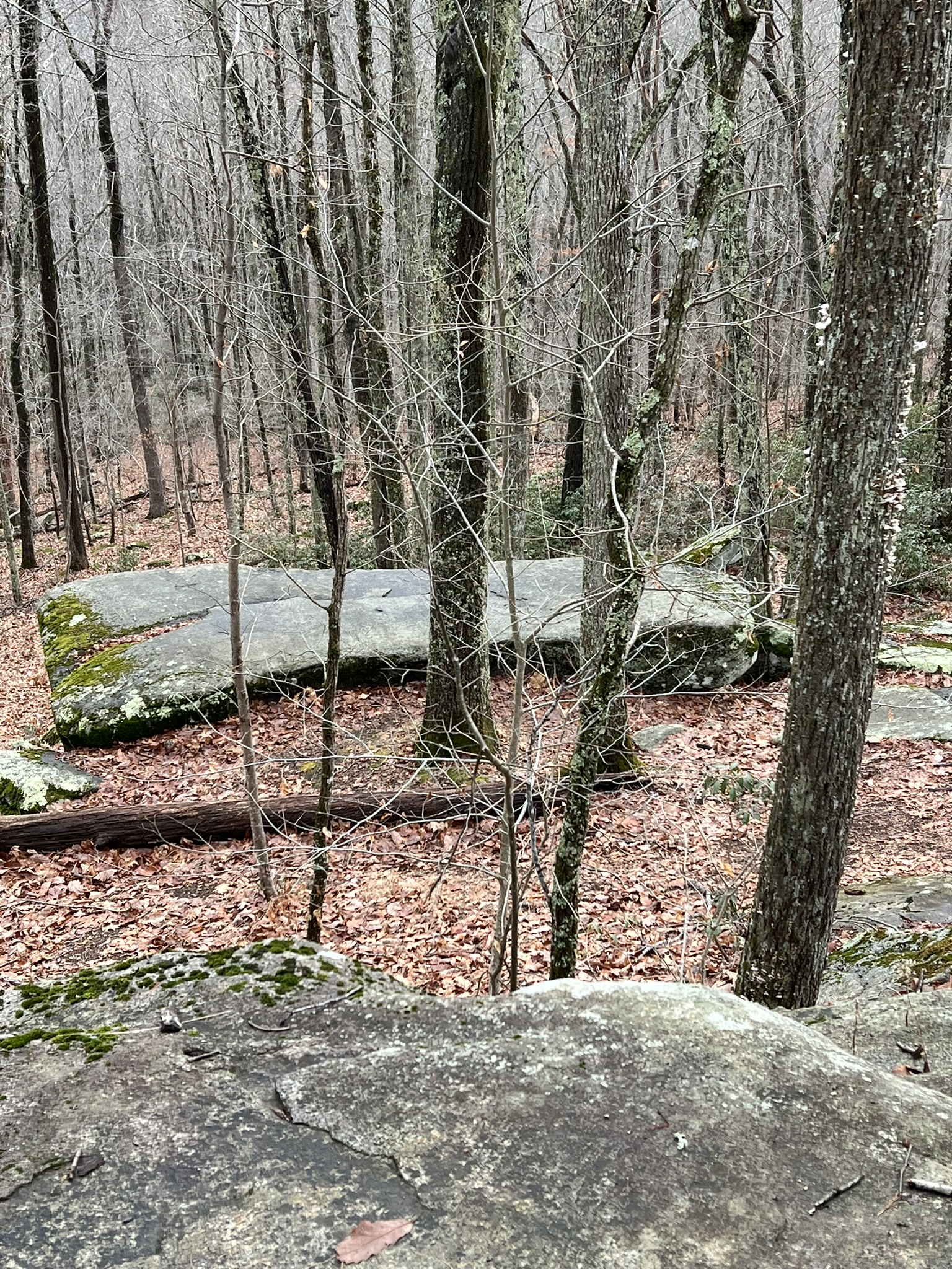
After close to 1-¾ miles we reached the junction with the main blue-blazed Tunxis Trail. Turning right, we came across the famous Tory’s Den a short distance later. While several crevices were visible, we couldn’t discern where this alleged cave was but we also didn’t spend much time exploring the area. Now that I have read the chapter “The Tory Den” in the 1909 book “The Tories of Chippeny Hill, Connecticut”, I want to return for further explorations. The author writes “[i]t lies in the Ledges, and is backed by a tall cliff, facing southeast toward Chippeny Hill, which an agile climber can scale in less than a minute….Two lines of seven men could sit facing each other beneath the roofs of rock; three could stand upright where the rocks are highest.” He goes on to explain that “[t]he den was discovered on Thanksgiving day in the year 1838 by X. A. Welton, a grandson of Stephen Graves, and Bela A. Welton, boys of fourteen, who after hunting all day accidentally came upon the south and larger entrance.” We continued along the Tunxis Trail, which still had a few moderate sections, but no more hand over hand scrambles. We veered off to the right at the sign posted “Greer Road”, then had a short road walk to our car. This road is a dead end, so there is limited car traffic.
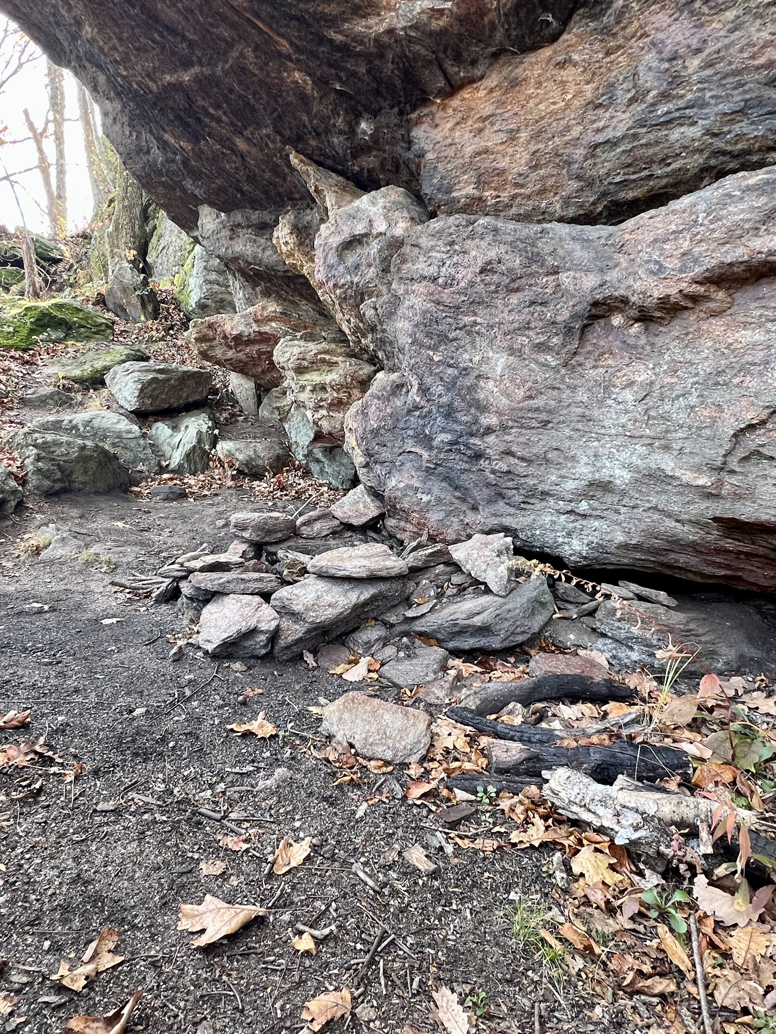
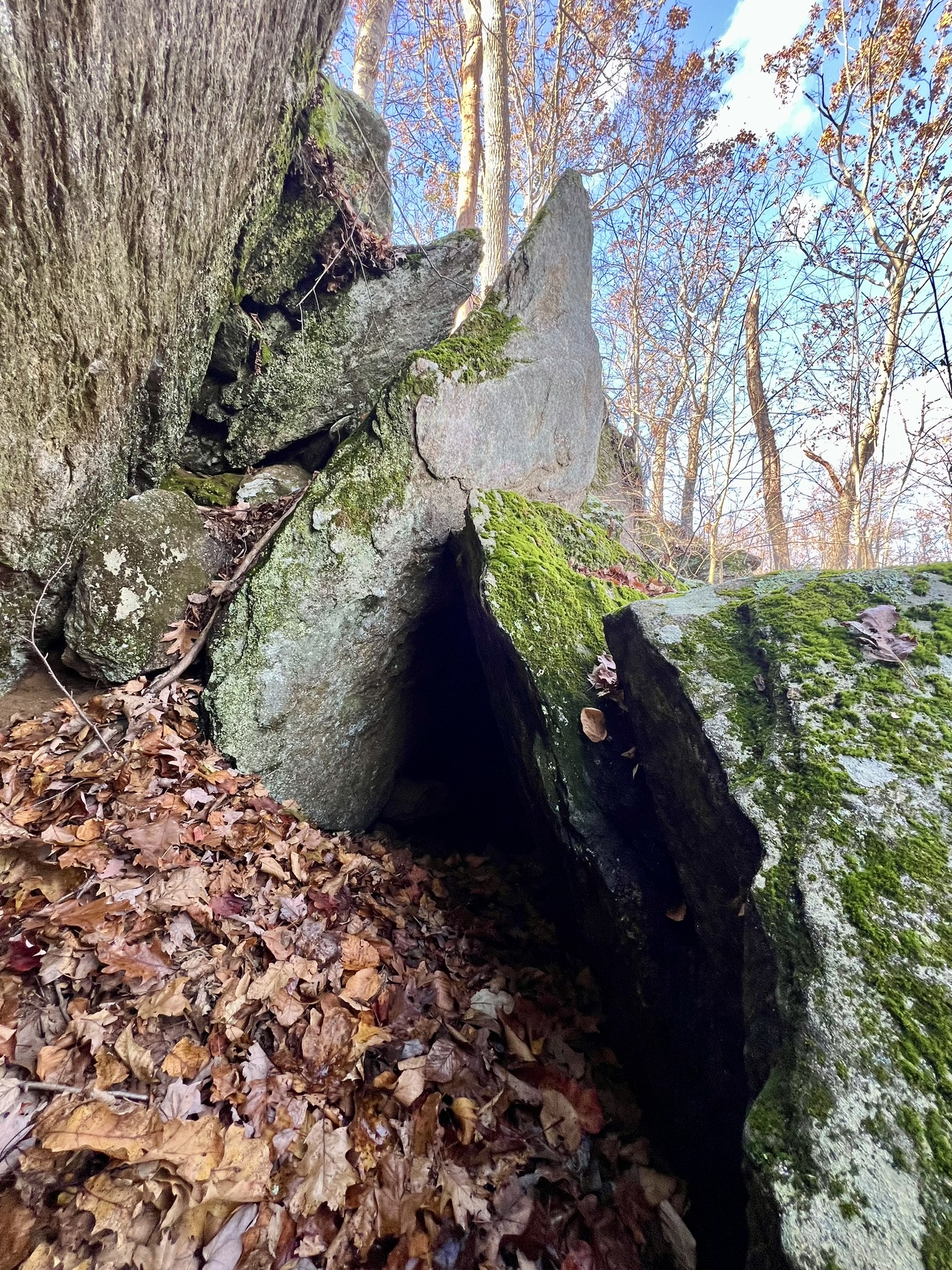
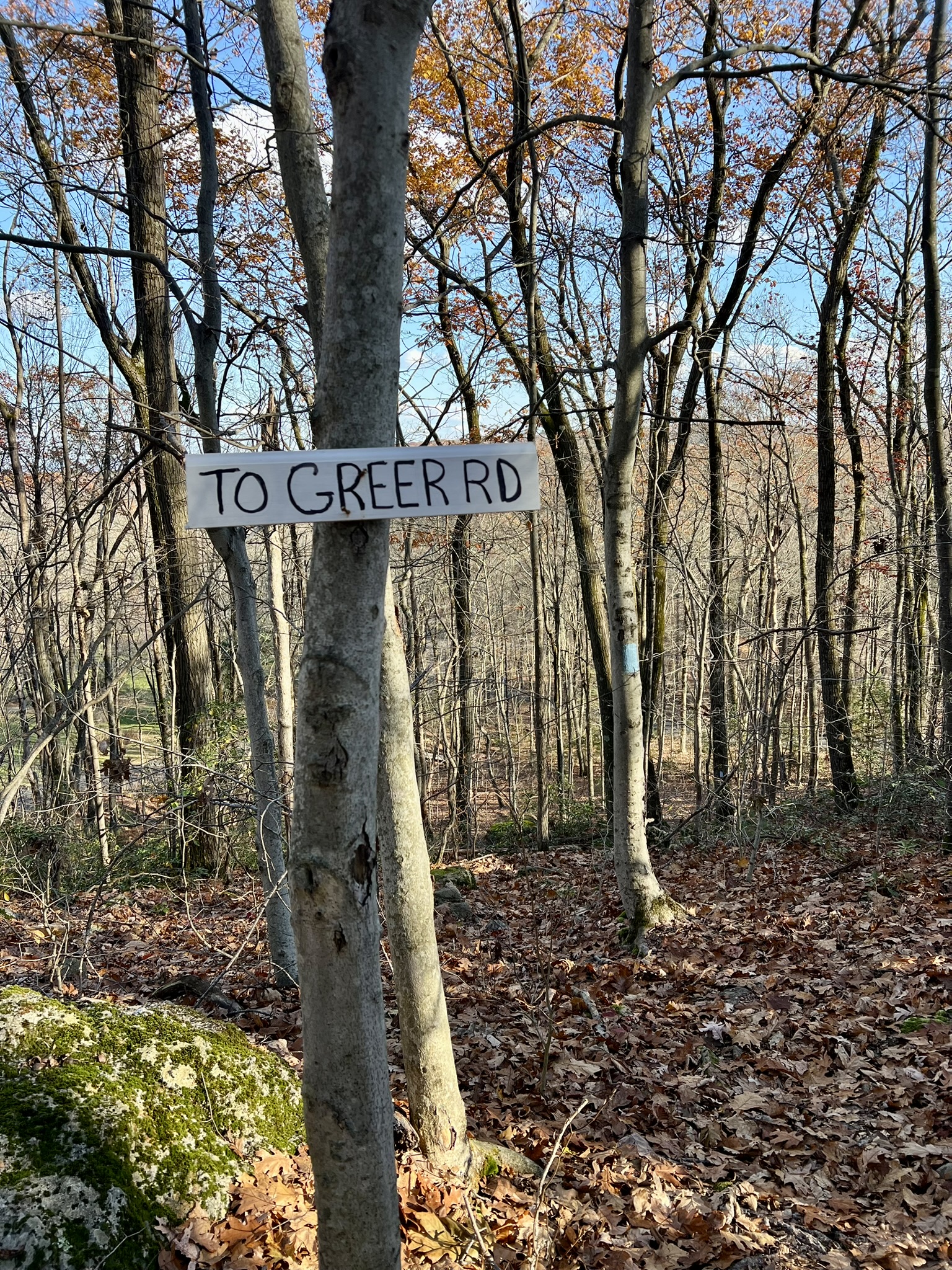
From left to right: approaching the Tory Den cliff; fire-ring under the overhang; one of several crevices; the sign for the turn off the Tunxis Trail
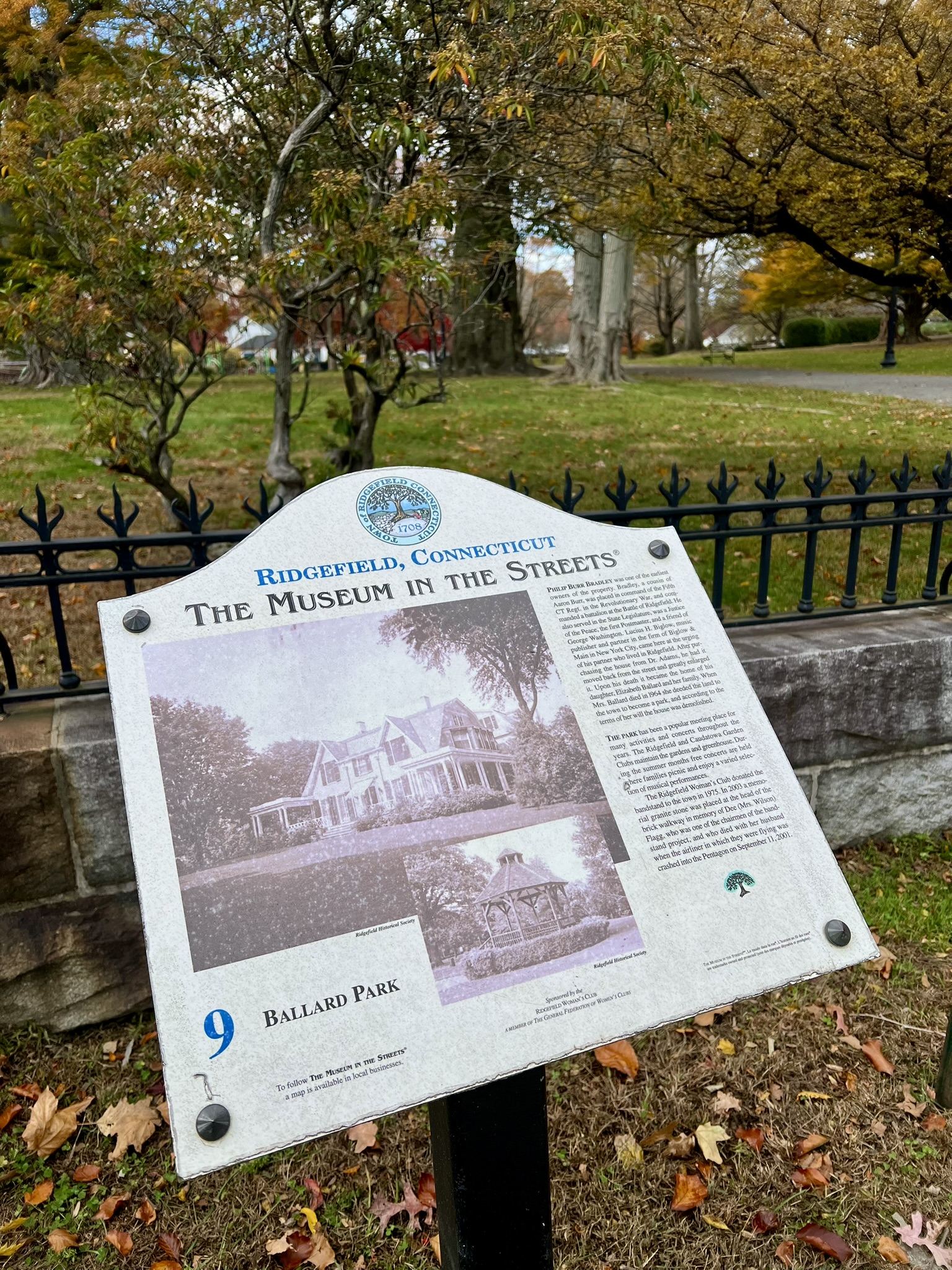
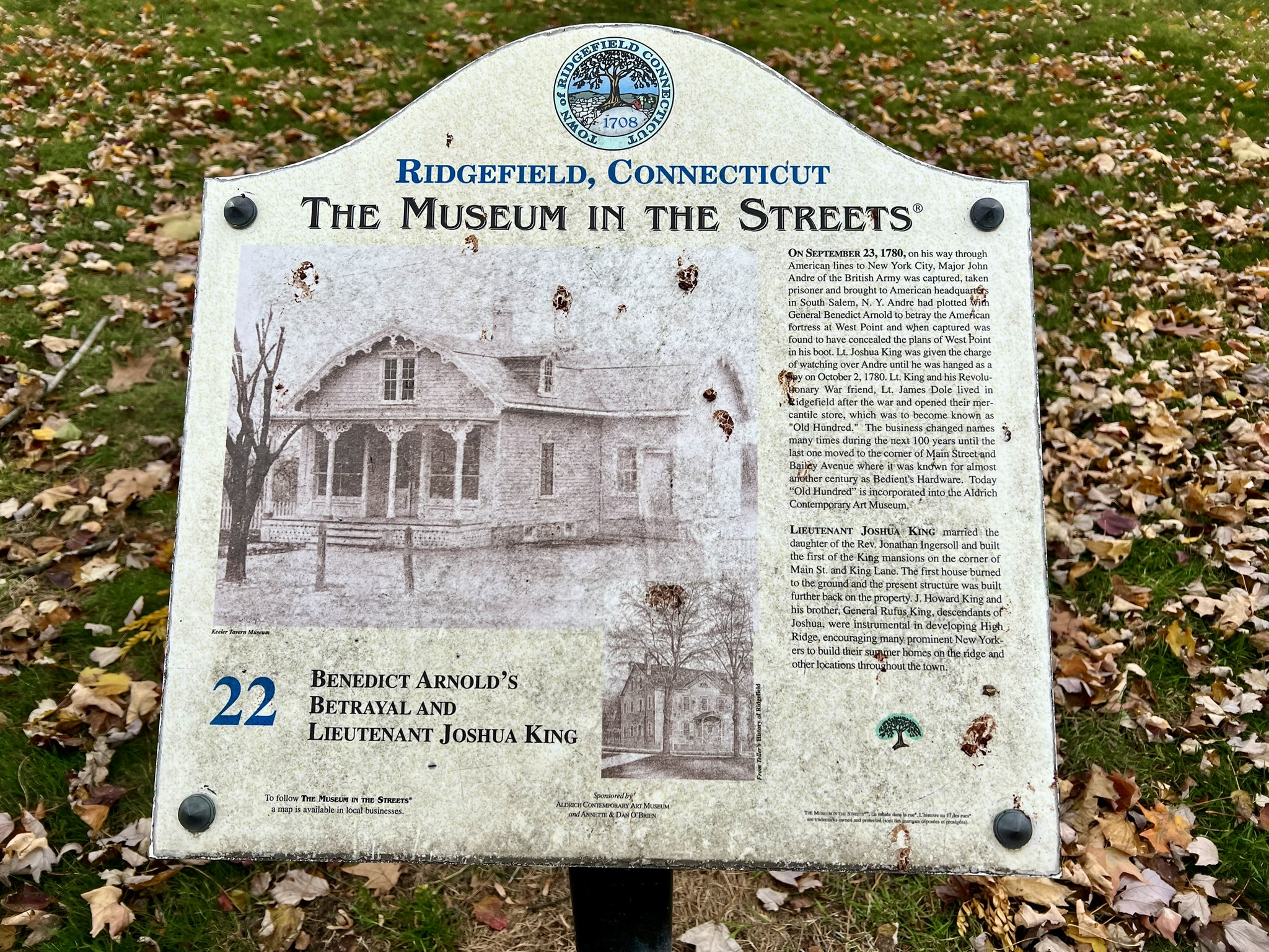
Museum in the Streets, Ridgefield
The only inland battle of the Revolutionary War in Connecticut was the Battle of Ridgefield, fought on April 27, 1777. When I learned that the town had created a “Museum in the Streets” installation in 2008 with 30 signboards posted around town to highlight and honor Ridgefield’s history, I made a plan to visit. Since I was focused on the Revolutionary War, I didn’t go out of my way to visit all signboards. In several cases there is significant wear and tear to the signs. While all the ones I visited were at least legible, often the photographs are no longer visible. In many instances the signboard is talking about a structure that once stood on that spot, so you must use your imagination. I will focus on the places I enjoyed the most.
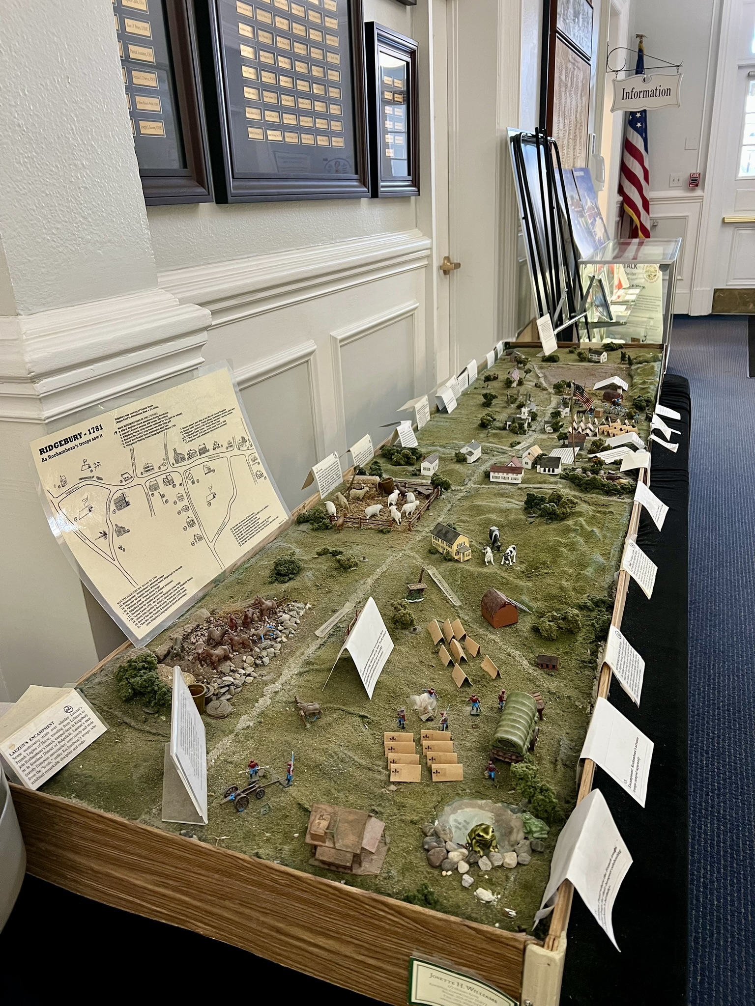
I parked in the Donnelly Shopping Center and walked to Main Street from Governor Street, then headed north, which brought me to signboards 17 and 18 detailing the fire of 1895. Signboard 17 is outside the Town Hall, and while it is not part of the Museum in the Streets installation, I noticed a sign reading: “EXHIBIT – Town Hall Lobby – HISTORIC RIDGEFIELD – Now on Display.” I entered the town hall and found a great diorama of town as it would have looked in 1781 when Rochambeau’s Troops passed through later in the Revolutionary War. If you visit when the Town Hall is open I recommend stopping in to see it.
Continuing north, I spent some time at the site of the 3rd skirmish of the battle. The British, under the leadership of General William Tryon, landed troops at Compo Beach in what is now Westport, and marched inland to destroy the American munitions depot in Danbury. Word got to Generals David Wooster and Benedict Arnold in New Haven, who led troops to intervene. While the raid was successful, Wooster’s unit caught up with the British troops as they returned to their ship and hassled them from the rear in some skirmishes during which General Wooster was mortally wounded. General Arnold led his troops overland in an attempt to circumvent the British. They set up a barricade on Main Street in front of Benjamin Stebbins’ house to engage the British troops as they passed by. The British lost many men in the skirmishes and never attempted another inland incursion into Connecticut for the remainder of the war. The Stebbins house was razed in the 1890’s and the new owner, George M. Olcott, built a mansion on the site which he named CASAGMO. This, in turn, was razed in 1968 when a condo and apartment complex was constructed in the back. You can still walk the grounds on the front hill, which is a combination of stone ruins and new pollinator pathway gardens. Visible on the street is the Historic Landmark sign. I caught the last of the fall colors, and enjoyed walking all the paths, envisioning both what the battle may have been like, as well as the old mansion.
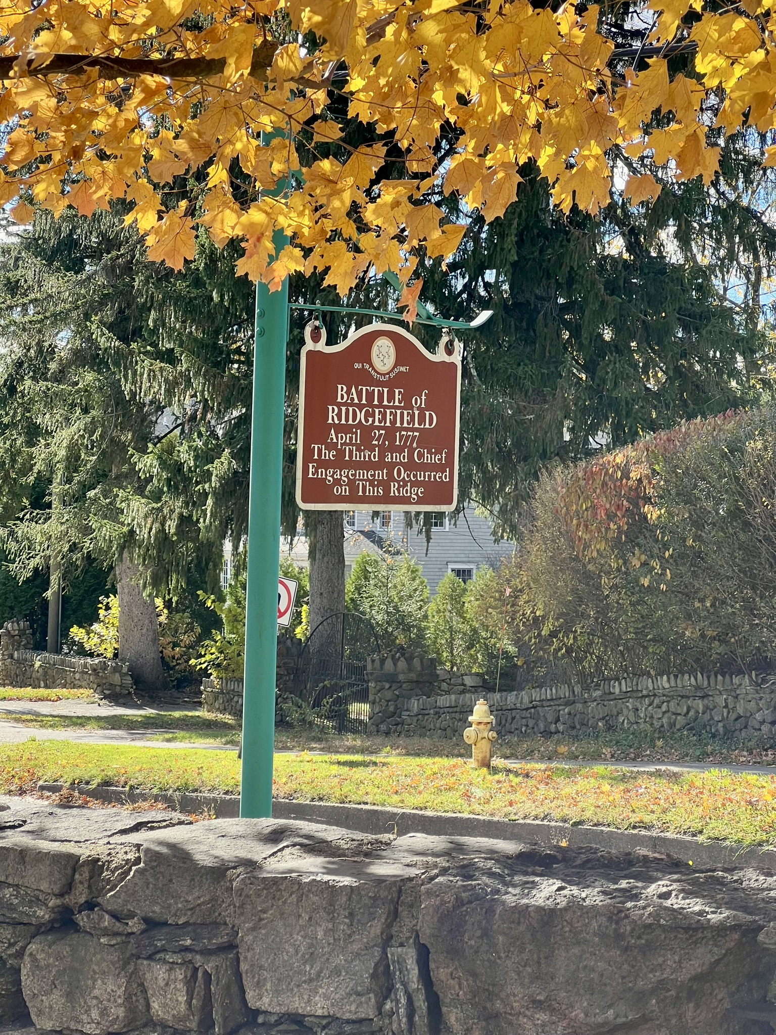
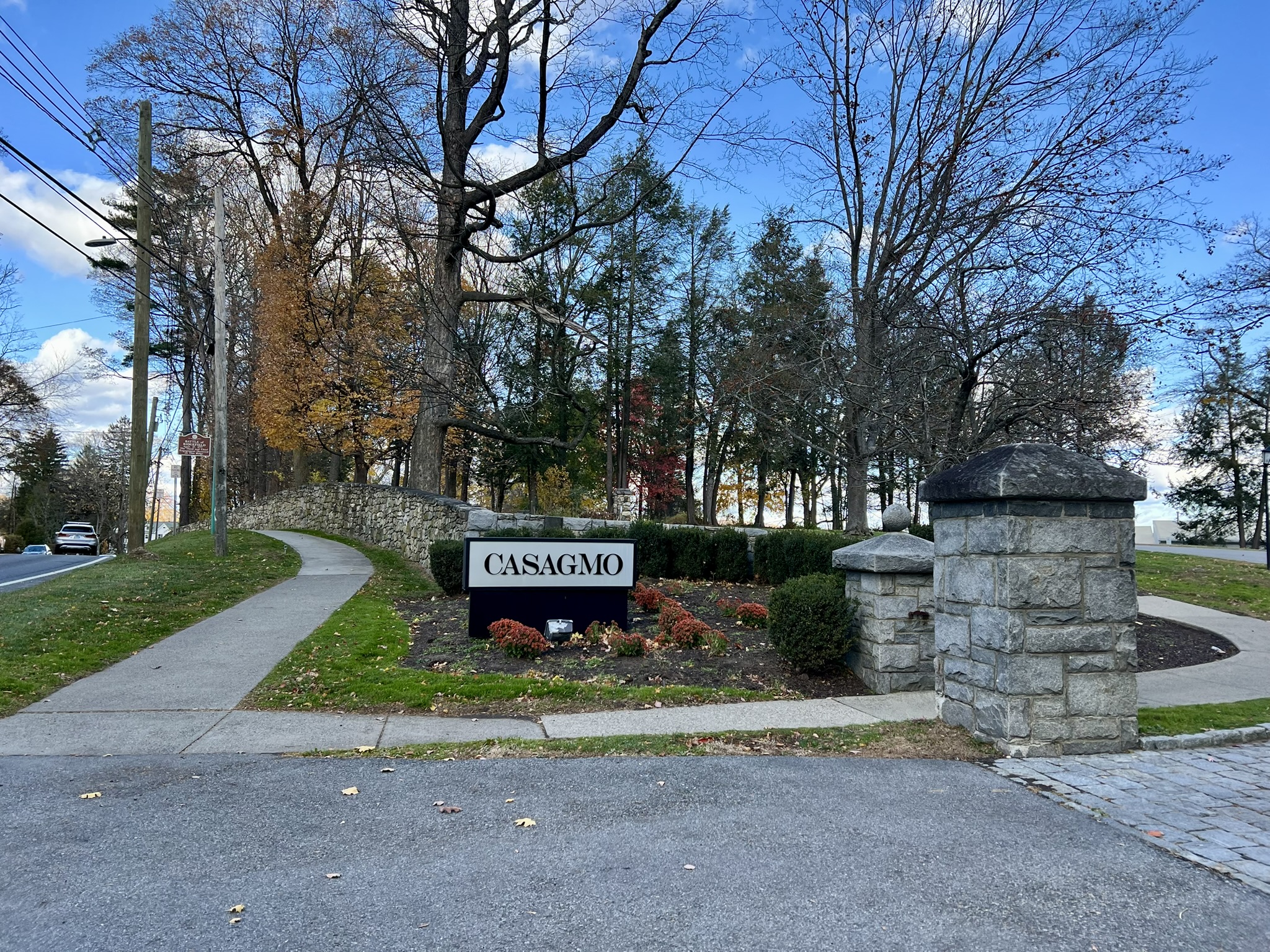
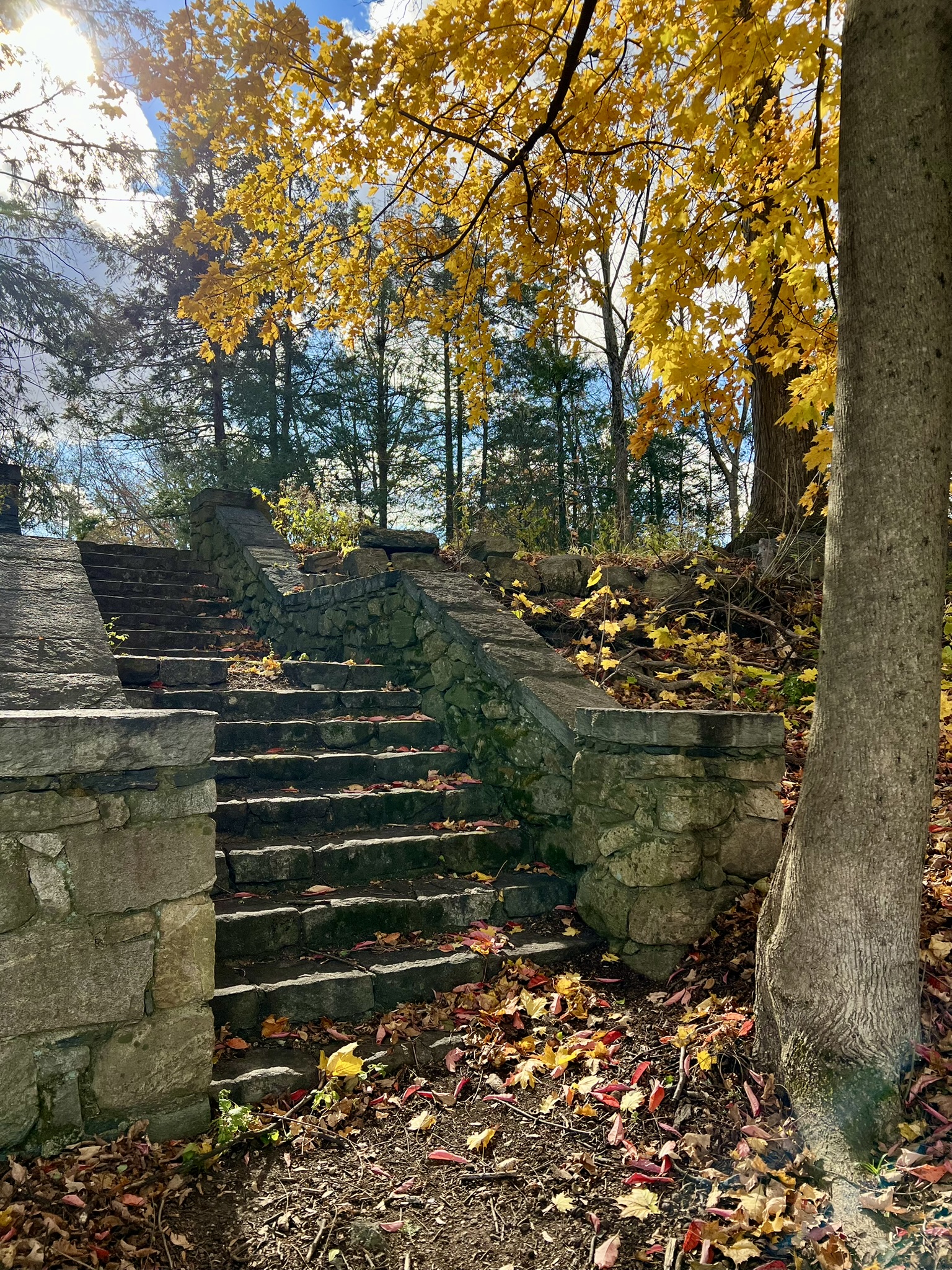
From left to right: the diorama inside town hall; the Battle of Ridgefield marker; the entrance to the CASAGMO ruins; some of the old mansion steps
From there I headed back south on Main Street, crossing to visit Ballard Park. An early owner of the property was Philip Burr Bradley, a cousin of Aaron Burr. Aaron Burr is perhaps best known for killing Alexander Hamilton in a duel. Bradley commanded the 5th Connecticut Regiment and led a battalion at the Battle of Ridgefield. When the most recent owner, Elizabeth Ballard, passed away in 1964, she deeded the property to the town and a town park was built on the grounds. It is a lovely park with many old trees, a small playground, a garden, a bandstand with a memorial walkway dedicated to Darlene “Dee” Flagg, who was on Flight 77 on September 11, 2001. There is also a plaque on a boulder detailing the Battle of Ridgefield that was dedicated on the 225th anniversary of the battle.
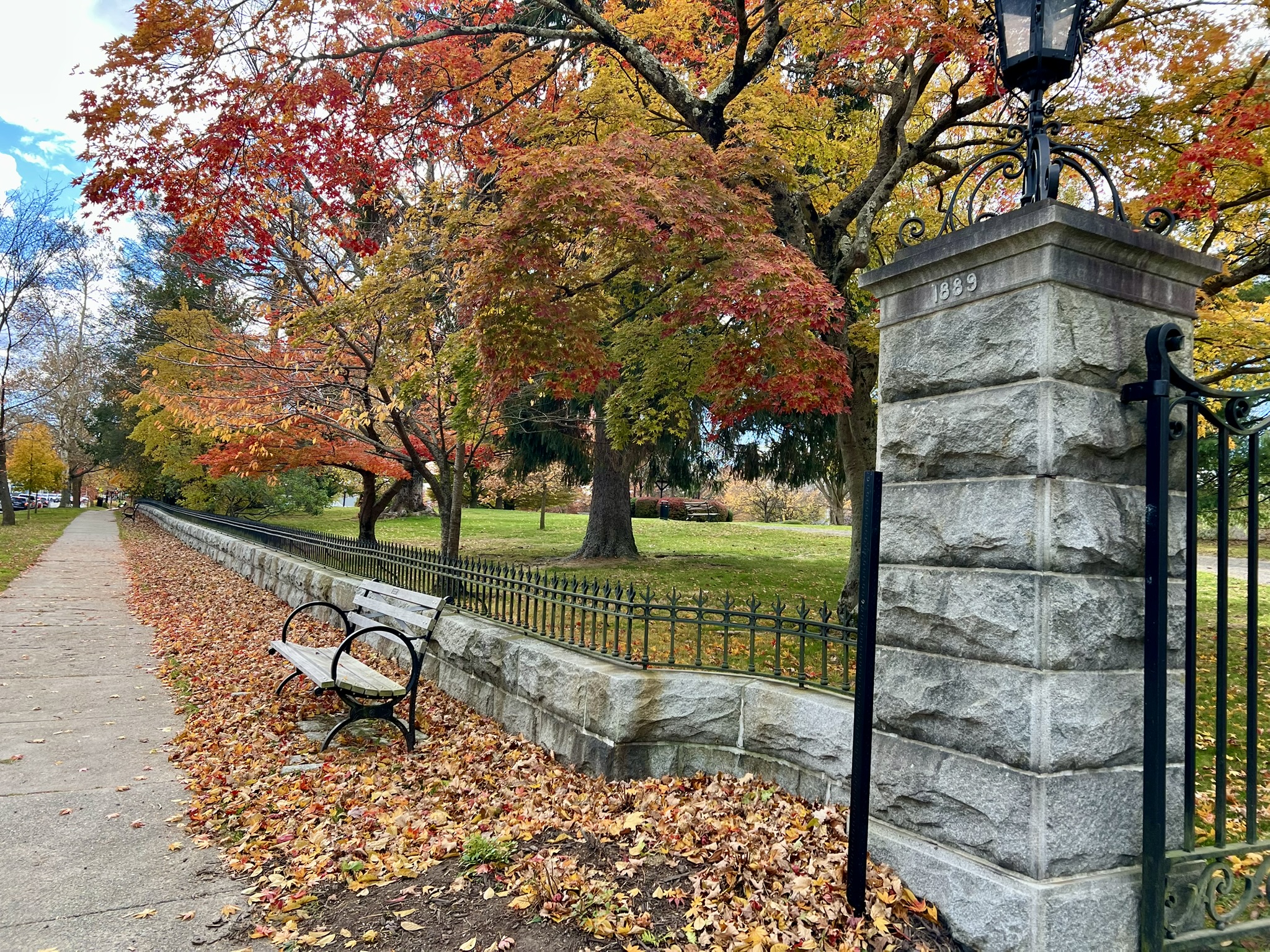
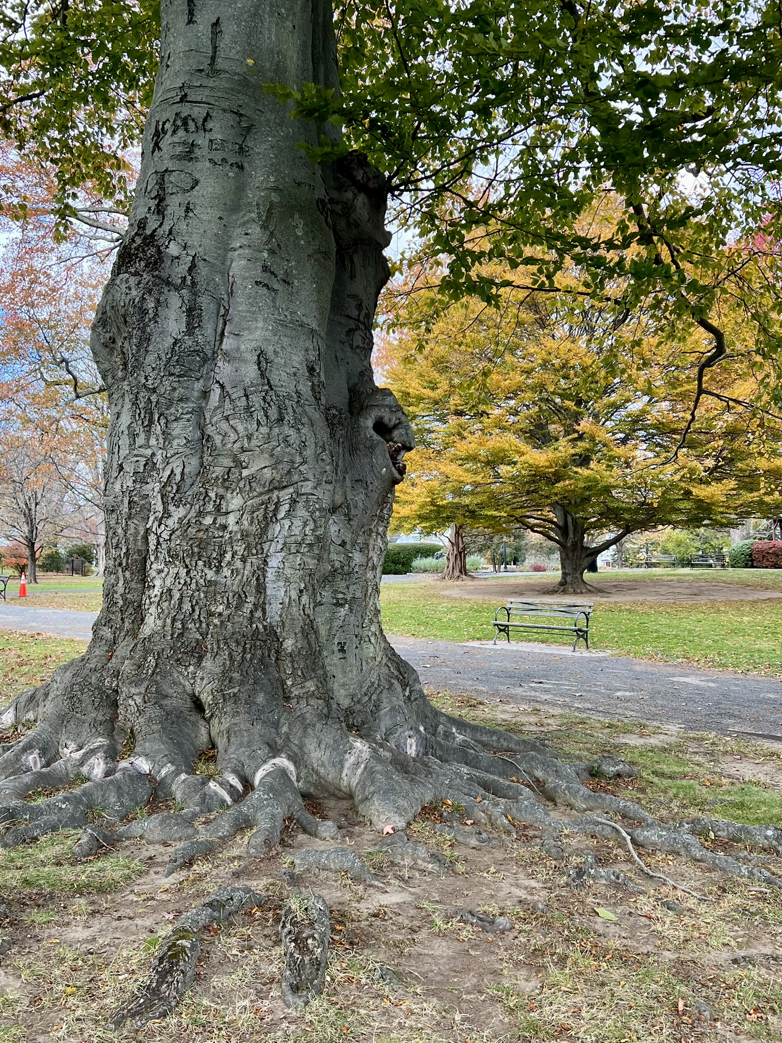
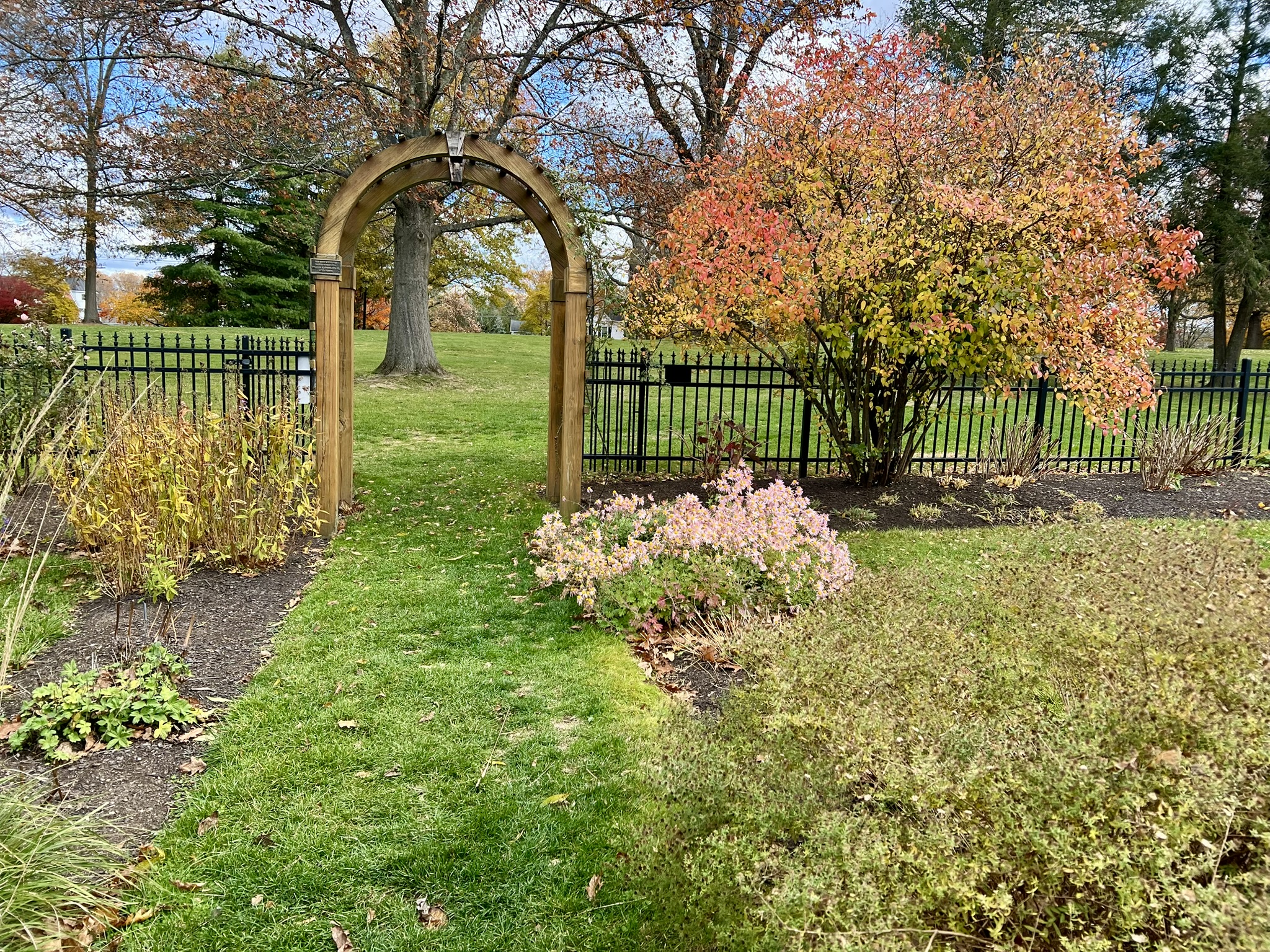
From left to right: the signboard outside Ballard Park; one of the park entrances; one of several ancient trees; a garden within the park
Returning to my car, I drove south on Main Street to the Keeler Tavern Museum and Visitor Center. As luck would have it, they have house tours on the ½ hour, and I was in time for the 12:30pm group tour on War at Home, where we would “learn about the experiences of the residents of our site during the Battle of Ridgefield.” I had about 15 minutes to kill, so I wandered north on Main Street to the signboard outside the Aldrich Contemporary Art Museum. Part of the museum building was the former mercantile store nicknamed “Old Hundred” and once owned by Lt. Joshua King. During the Revolutionary War, King had the responsibility of guarding British Major John Andre after he was caught with the plans for West Point in his boot, given to him by Benedict Arnold, whose treason was thus exposed. The Keeler Tavern was a highlight of my visit to Ridgefield, and the highlight of the museum tour was seeing an original cannonball from the battle that remains embedded in the side of the house. We learned about the residents that lived in and ran the tavern, and saw a combination of original artifacts, like the tavern sign, and carefully curated objects to show what life would have been like at that time. We spent time sitting around a table poring over maps to understand the logistics of the troop movements and pondering what it might have been like for the townspeople that day.
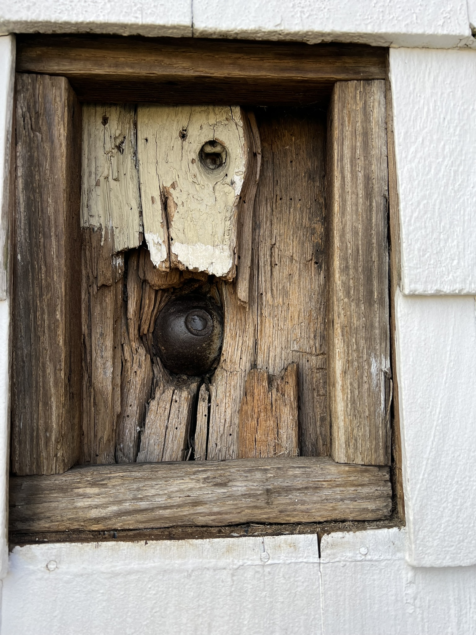
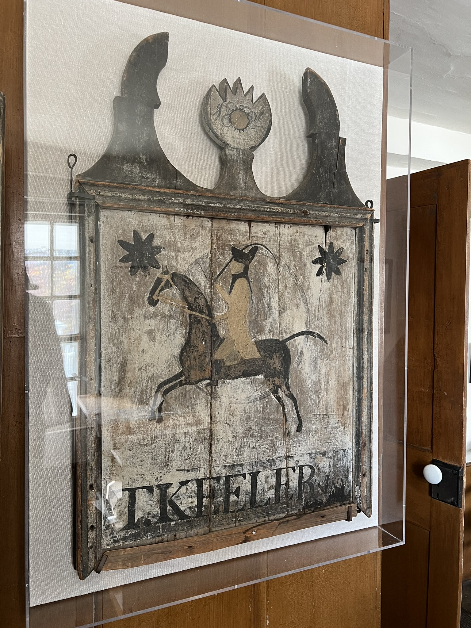
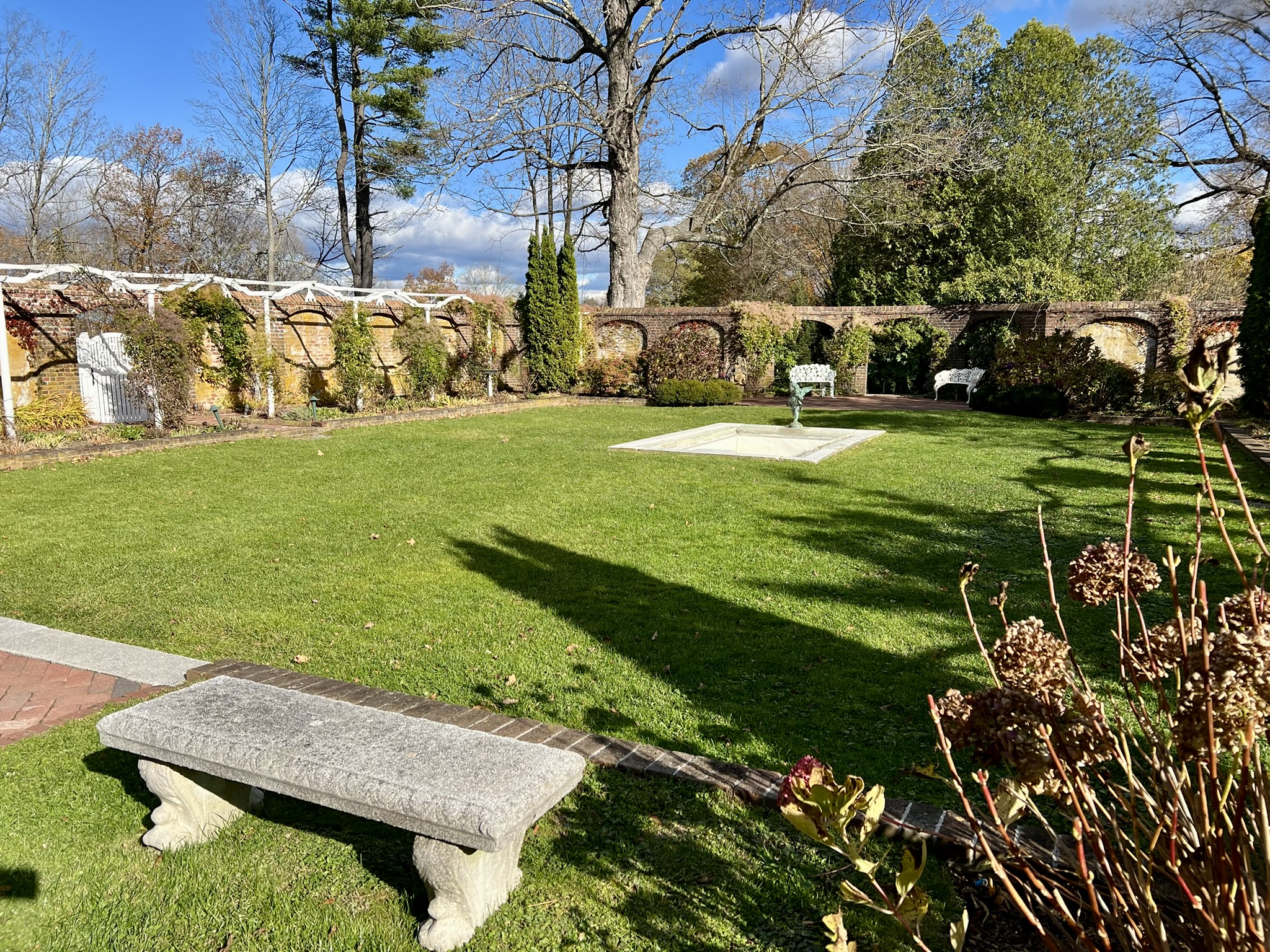
From left to right: the signboard outside the Aldrich Contemporary Art Museum; the original cannonball from the 1777 battle embedded in the tavern framing; the original tavern sign; the gardens at the museum
Fort Griswold Battlefield State Park, Groton
I wrote about the Battle for Groton Heights in my August 2023 Trail Talk: Soaking Up Some Sunshine and History. On that fateful day of September 6, 1781, 165 men defended the fort against the British troops, helpless to prevent the torching of New London taking place across the river. The fort eventually fell, and as the Americans tell it, Colonel William Ledyard surrendered his sword to the British Officer, who then promptly slayed Ledyard with it. According to an account by the Reverend N. H. Burnham in 1899, “like scenes were being enacted in other parts of the fort” in what would be remembered as a horrible massacre. A total of 88 died that day, with many more wounded. After the Revolutionary War, the fort was rebuilt and manned during other conflicts, but eventually became obsolete after the Spanish-American War. It opened as a State Park in 1953. Rather than recreate the post in its entirety, please click on the link above for all the photos and information about this gem of a state park.


From left to right: the memorial obelisk; climbing to the top of the obelisk; the view from the top of the fort below; a shot furnace built in 1843.
Resources for Further Exploration
EVENTS AROUND CONNECTICUT
America 250 CT is a good place to start looking for information regarding events around the state. Other resources are your local library and historical society.
Connecticut Explored: Connecticut History One Good Story After Another is a great resource. Check out their America’s 250th page
ATTEND A MUSTER. According to its website, the Deep River Muster is the oldest and largest gathering of fife and drum participants and enthusiasts in the world and has been referred to as “The Granddaddy of All Musters”. They hold their muster on the 3rd Saturday of July and 2026 promises to be a big one. For additional activities throughout the year consult the Company of Fife and Drum website.
Visit the Museum of Connecticut History at the CT State Library. The museum is open Monday through Friday from 10:00am to 4:00pm and is admission is free. The museum is preparing an exhibit on Connecticut and the Revolution, with a target grand opening of July 4, 2026. Already on display in the museum is Connecticut’s copy of the Declaration of Independence. While I was there for the Shay book talk, I got to see a linen napkin signed by Israel Putnam (this may be part of the upcoming exhibit).
BIBLIOGRAPHY
BOOKS
The Whites of Their Eyes: The Life of Revolutionary War Hero Israel Putnam from Roger’s Rangers to Bunker Hill, by Michael Shay (2023)
The Tories of Chippeny Hill, Connecticut, by E. Leroy Pond (1909)
Rebels at Sea, Privateering in the American Revolution, by Eric Jay Dolin (2022)
Forgotten Patriots: The Untold Story of American Prisoners During the Revolutionary War, by Edwin G. Burrows (2008)
The Battle of Groton Heights: A Story of the Storming of Fort Griswold and The Burning of New London on The Sixth Of September, 1781. This is a compilation of reports, including, among others, the title story written by the Reverend N. H. Burnham in 1899, Sergeant Rufus Avery’s Narrative of the events, and a testimony of Avery Downer, M.D., written in 1851 (at the age of 88) about his recollection serving as an Assistant Surgeon to the Connecticut Militia at the time of the battle.
Treacherous Beauty: Peggy Shippen, The Woman Behind Benedict Arnold’s Plot to Betray America, by Mark Jacob and Stephen H. Case (2012). A fascinating book intended as a popular biography (i.e. aimed at laypeople, not academics).
Connecticut Families of the Revolution, by Mark Allen Baker (2014)
PODCASTS AND DOCUMENTARIES
Grating the Nutmeg Podcast episode 213: When the Continental Army Camped in Connecticut.
Ken Burns presents: The American Revolution documentary. Streaming on PBS and Amazon. This 6-part series started November 16.
OTHER RESOURCES
The Historical Marker Database. According to the website, this is a “free illustrated, searchable online catalog viewed through the filter of roadside and other permanent outdoor markers, monuments and plaques…Anyone can add new markers to the database and update existing marker pages with new photographs, links, information and commentary.” A search for Revolutionary War Markers, sorted geographically, yielded 283 in Connecticut. In THIS SEARCH, the first Connecticut Marker is #95. They are sorted alphabetically by State, then County, then Town.
Subscribe to Trail Talk
your next adventure awaits
Questions? Email me at naturenerdsramble@gmail.com or find me on Instagram @the_real_nature_renee.