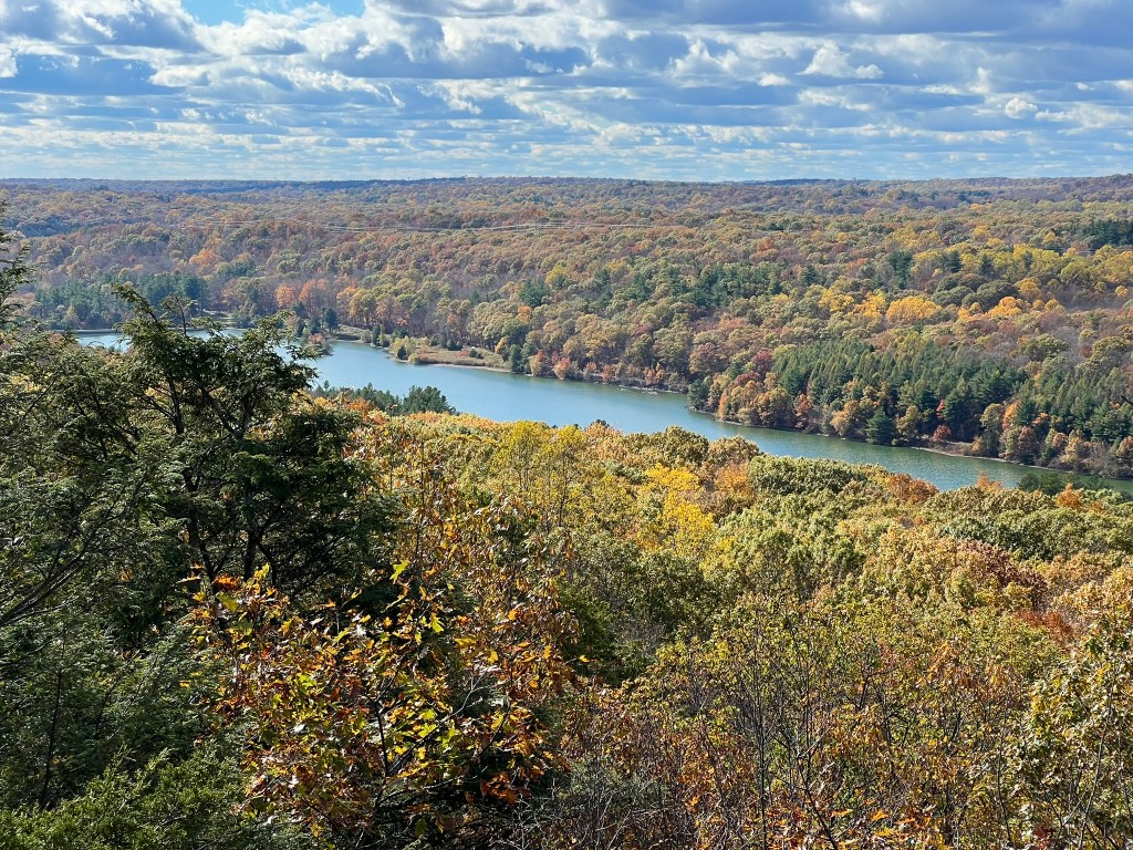
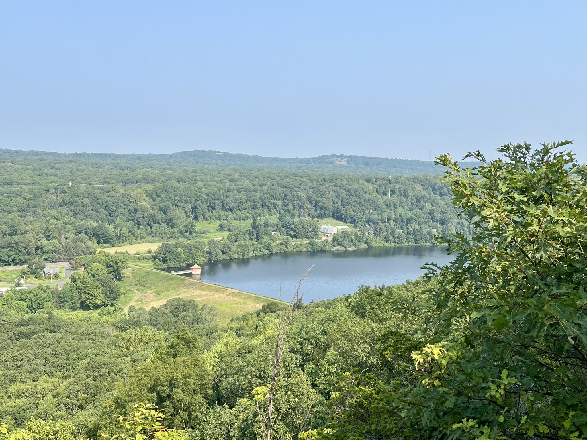
View of Lake Watrous from the Regicides Trail at West Rock Ridge State Park
The path that took me to the Regicides Trail is a quintessential example of my personal motto “Seeking Serendipity”, so please indulge me to share what happened. The Oxford dictionary defines serendipity as “the occurrence and development of events by chance in a happy or beneficial way.” I love serendipitous moments, but don’t believe they happen purely by chance. I believe serendipity happens when you engage in the world, whether you are looking for love, a new job, a cure for cancer, or, in my case, new hiking trails.
This is what happened.
In July I emailed my latest Trail Talk, The Connecticut River and the History of American Shad, to an English friend of mine. He replied that he could envision the landscape and the Native American methods for catching fish from the book he was reading: Act of Oblivion, by Robert Harris. He explained that the historical novel took place in New England and was the story of two of the regicides (king killers) on the run in the aftermath of the English Civil Wars. I had heard of the regicides, and knew we had a Regicides Trail in Connecticut with a cave where they supposedly hid, but I hadn’t been there. I told him it sounded like a perfect Trail Talk subject.
The VERY NEXT DAY I was visiting my Godmother. We were passing through her endearingly cluttered living room when there, face up on a table, sat the book Act of Oblivion. SAY, WHAT? Of course, I had to borrow it, and the rest, as they say, is history.
There were three regicides who fled to New England after the restoration of the monarchy in 1660, and you may recognize their names, if not from their history, from the New Haven streets named after them: Edward Whalley, William Goffe, and John Dixwell. To understand how these men ended up here, I had to go back in time and try to understand the English Civil Wars. As with many things, the more I learned about the English Civil Wars the more confusing it became. I will provide a brief summary to start, and include more information at the end of the post.
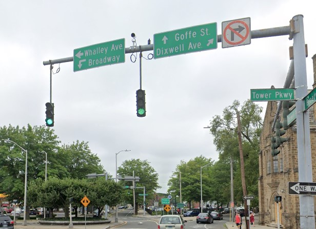
Whalley Ave, Goffe St and Dixwell Ave fan out from this intersection with Broadway in New Haven
A Brief History
In the 1600’s in England, political and religious disagreements between King Charles I and Parliament led to a Civil War between the King’s Army and Parliament’s Army, led by Oliver Cromwell. Parliament was victorious, tried the King for treason, and ordered his execution in 1649 with a warrant signed by the fifty nine “judges” that participated in the trial. When the Monarchy was restored in 1660, and Charles II (Charles I’s son) came to power, those judges still living feared for their lives. I can already feel my readers’ eyes glazing over so I will jump straight to the New England connection, and to Connecticut in particular.
Of the three regicides, we know the most about Edward Whalley and William Goffe, which is ironic because they spent most of their time in hiding, whereas John Dixwell, who arrived in New England later (historians believe he first fled to Germany), lived in the open in New Haven colony under the alias James Davids, eventually marrying at the age of 70 and fathering three children. Upon his death, his secret was officially disclosed.
Edward Whalley was William Goffe’s father-in-law, and Oliver Cromwell’s cousin. While not part of the noble class, both Whalley and Goffe had the opportunity to rise in rank in Cromwell’s New Model Army, which favored merit over bloodline. Both were appointed to the High Court of Justice for the King’s trial. Fearing retribution after Charles II’s return, they secured passage under assumed names on the merchant ship Prudent Mary setting sail for Boston in May of 1660. Lacking imagination, they chose the aliases Richardson (Whalley’s father was Richard) and Stephenson (Goffe’s father was Stephen). As Jack Henneman points out in the ‘Regicides on the Run’ episode of his noteworthy The History of the Americans podcast, “this was the 17th century equivalent of making your password ‘password’”. Whalley and Goffe spent some time in Massachusetts Bay Colony (MBC), but when the English crown sent a royal proclamation for their arrest, the fugitives fled to New Haven. New Haven Colony was established in 1638 by the minister John Davenport and Theophilus Eaton to create a Puritan settlement that was even stricter in its Biblical adherence than MBC. They were renegades of sorts, doing this without a charter from the king. While Davenport welcomed them, they had to be wary of being discovered, especially since the proclamation both explicitly stated that harboring the fugitives was a crime and offered a reward for information leading to their arrest. They lived for some time (the reports are conflicting) in New Haven and Milford. During the spring of 1661 they are said to have lived in a cave on West Rock (at the time called Providence Hill) while hiding out from two Boston men – Royalist bounty hunters Thomas Kirke and Thomas Kellond – sent by MBC Governor John Endecott in a show of compliance. They supposedly returned to West Rock in 1664 when the King sent troops to seek them out, although that turned out to be a side jaunt, the main purpose of the expedition being to take New York from the Dutch. After that, Whalley and Goffe traveled to the wilderness frontier town of Hadley, MA where they lived hidden in the home of the minister John Russell for many years. In his book “The Great Escape of Edward Whalley and William Goffe”, Christopher Pagliuco quotes from a letter that Goffe wrote to his wife, Frances, back in England, which implies that Whalley passed away after a long illness around 1675. There is also a good case to be made that Goffe was the mysterious “Angel of Hadley”. This historical figure appeared out of thin air on the eve of a skirmish with Native American warriors during King Philip’s War in 1676 to lead the townspeople in their efforts to defend the town, thus saving it from destruction. This “angel” disappeared as mysteriously as he arrived. Soon thereafter, Goffe left for New Haven to live out his final years in hiding there.
The Westville Post Office
You may want to start your own pursuit of the regicides at the Westville (New Haven) post office at 95 Fountain Street to view the mural “The Pursuit of the Regicides.” This mural was painted in 1939 by Karl Anderson as part of the New Deal Section of Fine Arts Program within the Treasury Department to bring art to the people. According to the Public Art Archive “The Rev. John Davenport appears to the right — copied from a well-known portrait in the Yale University Art Gallery.” The mural’s other scenes – a local Native American and a mountain lion discovering the fugitives’ hiding place, are popular legends. When I visited I parked on Harrison Street (between Fountain Street and Whalley Avenue). Walking back to my car I had a superb view of the West Rock ridge.


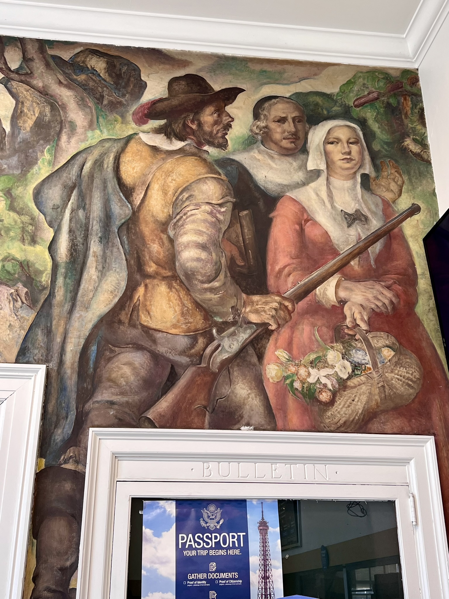

From left to right: The full mural; detail of the mountain lion encounter; detail of John Davenport; view of West Rock from Harrison Street
West Rock Ridge State Park
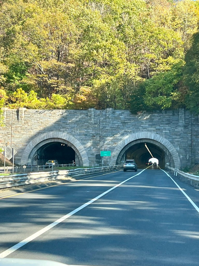
Next, I suggest a visit to West Rock Ridge State Park. This park may be one of Connecticut’s best kept secrets. Did you even know it was there? Have you ever driven on the Wilbur Cross Parkway? If so, you probably drove right under the park without realizing it.
According to the West Rock Ridge Park Association, “West Rock Ridge State Park, currently over 1700 acres [now 1960 acres], is located in four towns – Hamden, Bethany, Woodbridge and New Haven. It is now the second largest park in CT, and the only wilderness park located near a major city. The park began as a city park in 1826, when Elijah Thomson donated 50 acres to the City of New Haven. In 1927, Governor Simeon Baldwin donated over $100,000 to the New Haven Park Commission, leading to the acquisition of a large portion of the ridge and construction of Baldwin Drive in the 1930’s.”
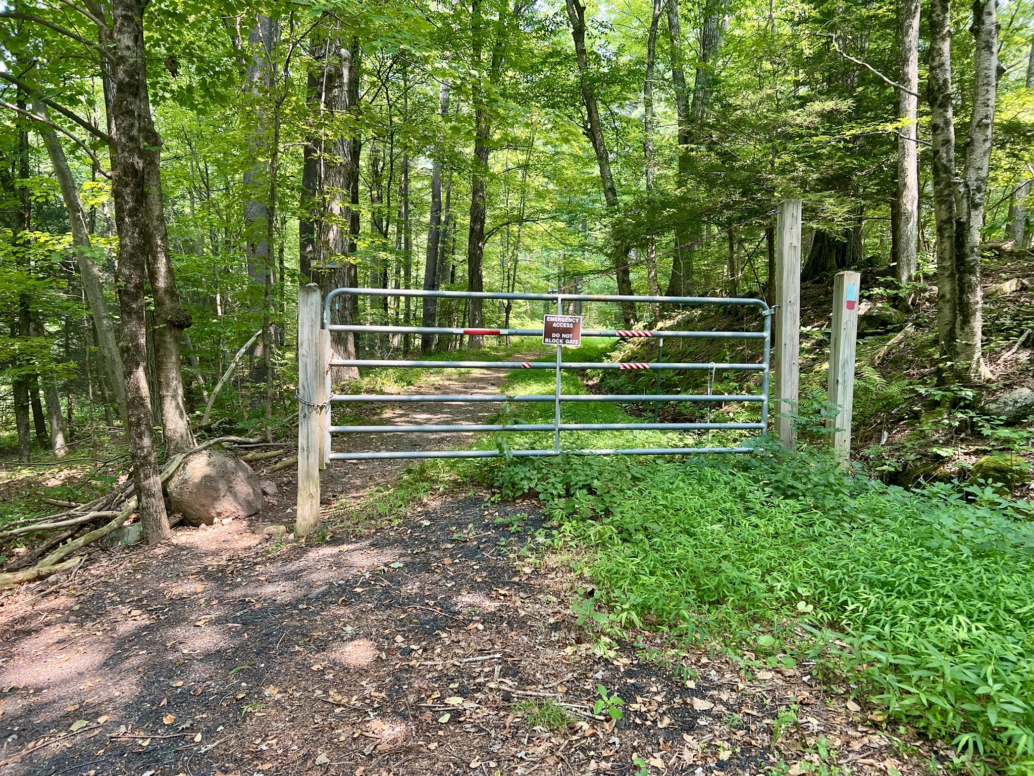
The Regicides Trail is a 7 mile trail that runs the length of West Rock Ridge State Park and is one of over 800 miles of blue-blazed trails maintained by the Connecticut Forest and Park Association. At the southern end, the trail starts by the South Overlook at the end of Regicide Drive, and in the north it connects to the blue-blazed Quinnipiac Trail. Judges Cave – the landmark where Whalley and Goffe allegedly hid from British bounty hunters – is accessible from both the trail and from Regicide Drive. According to the park website: “Regicide Drive, the 1.6 mile long road from Wintergreen Avenue to the South Overlook and Judges Cave, is open daily from Memorial Day weekend until the last weekend in October from 8 a.m. – 6 p.m.”
What route did Whalley and Goffe take to access the cave? Unfortunately, that detail is lost to history, but as I explored the park, it was fun to imagine the possibilities. Below I share the different trails and routes I took in my explorations. The distances and elevations listed are from my Garmin watch tracking. For a full picture of all the trails, including detailed parking information, trail descriptions and up-to-date notices, I highly recommend this West Rock Trails website written by Hiker Tom. This official Trail Map of West Rock Ridge State Park is helpful for understanding the routes described below.
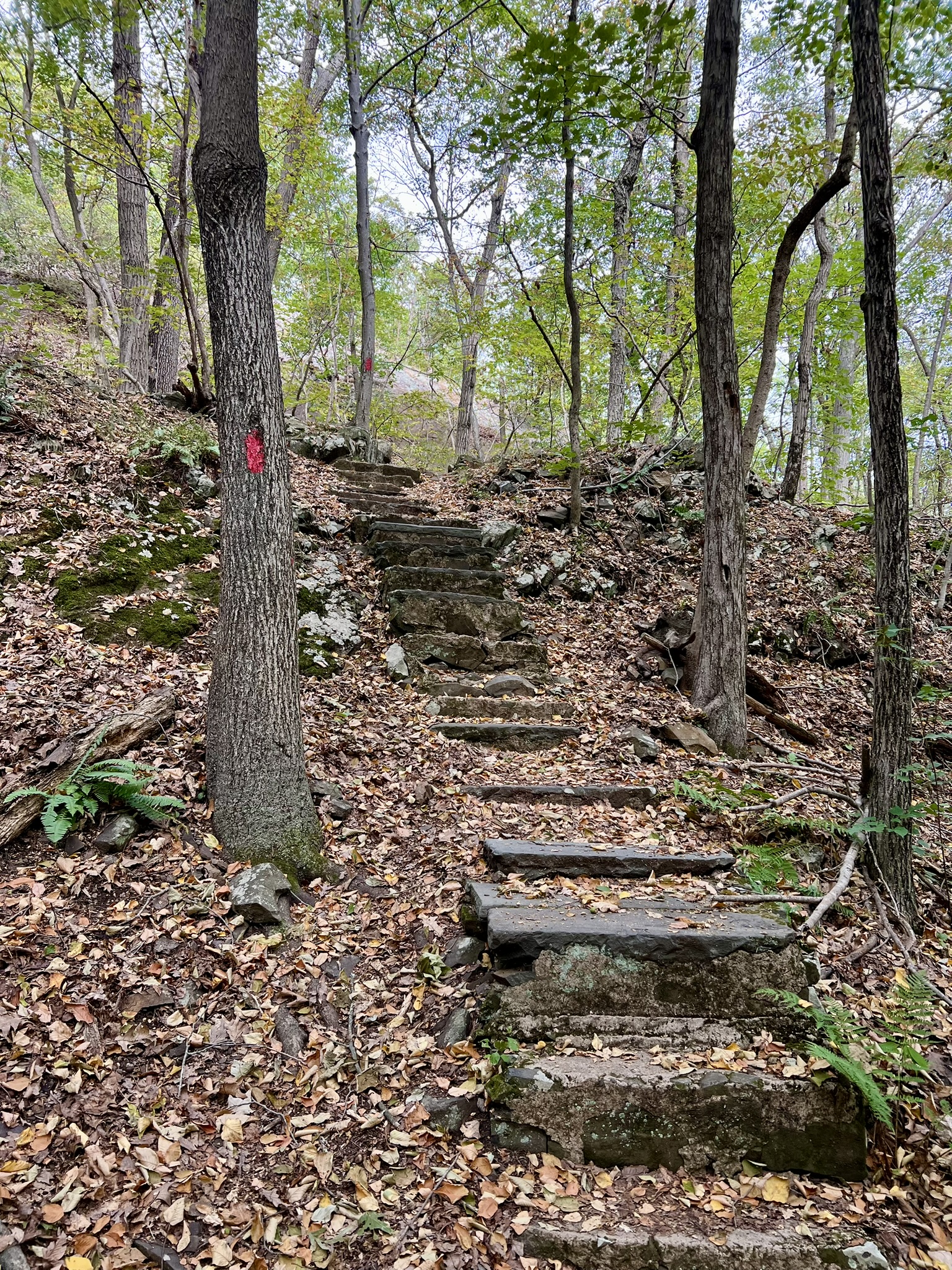
The Regicides Trail – Judges Cave to Brooks Street. 7.1 miles with 1,136′ of ascent.
I first hiked the Regicides Trail in early August as a point-to-point. We left a car at the trailhead on Brooks Street for the red/blue Sanders Feeder Trail then drove to the main park entrance, following Regicide Drive to the Judges Cave cul-de-sac, where there are spaces for a few cars. NOTE: This option is not possible when Regicides Drive is closed to traffic. To do a thru-hike in the off-season you could start at the Westville Feeder Trail south of the park for a total hike of about 8 miles. Perhaps this was the route Whalley and Goffe took! I haven’t hiked the Westville Feeder Trail, but this West Rock Trails link has detailed information about parking (scroll to “Westville Center, 495 Blake Street, New Haven.”)
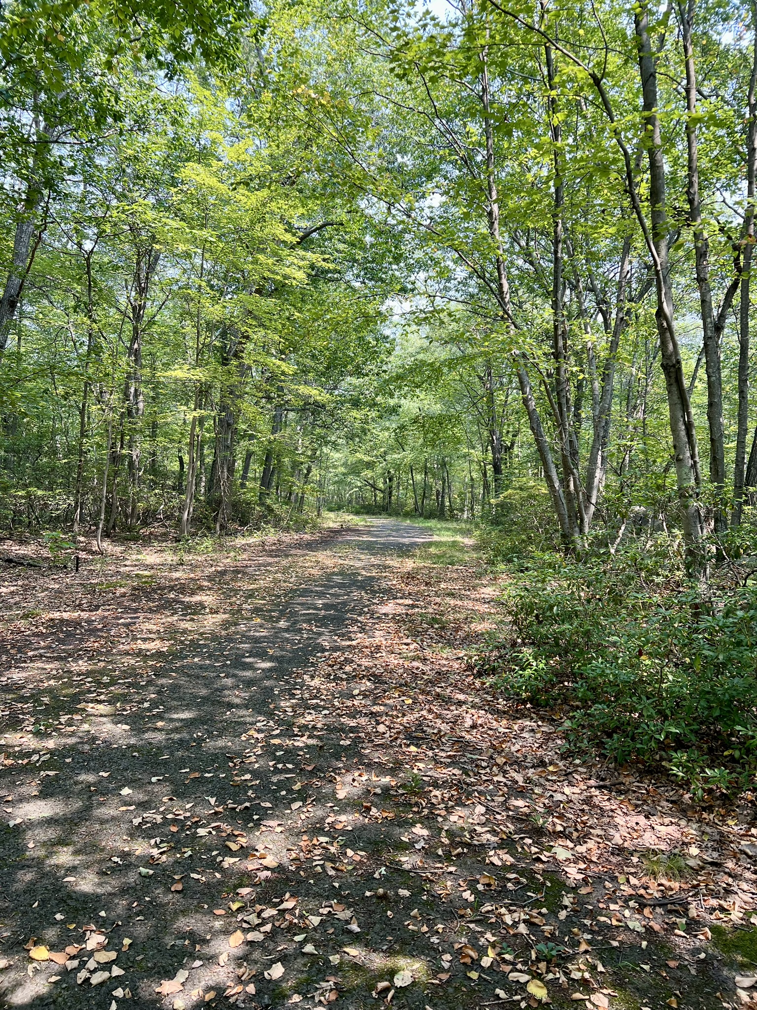
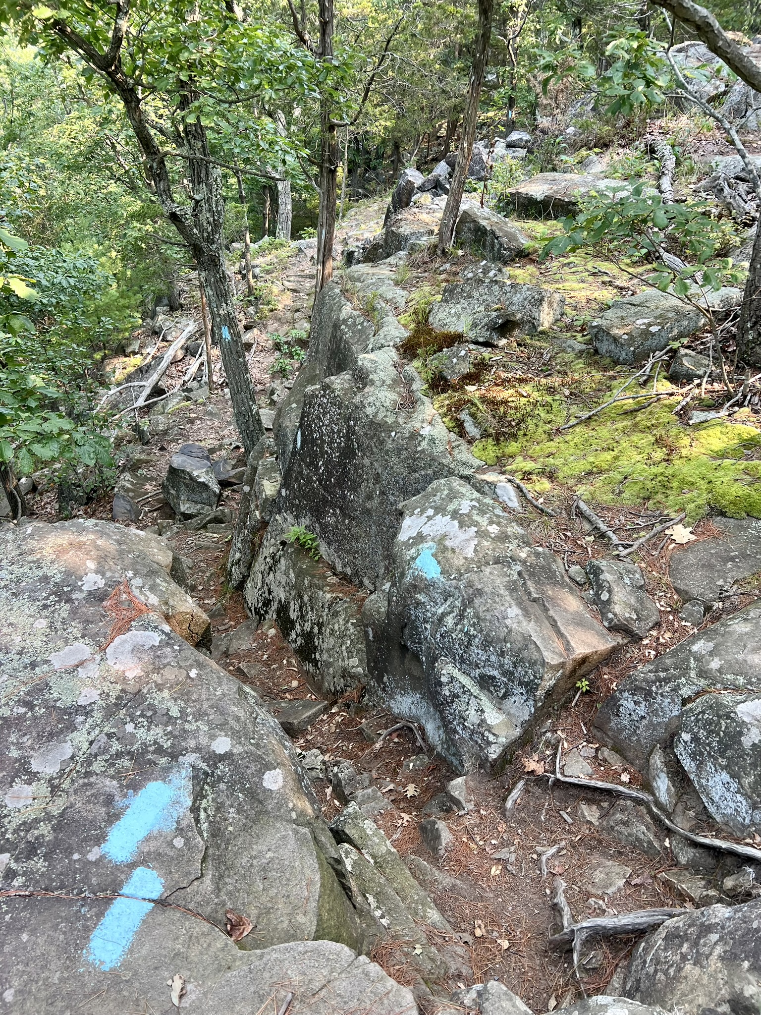
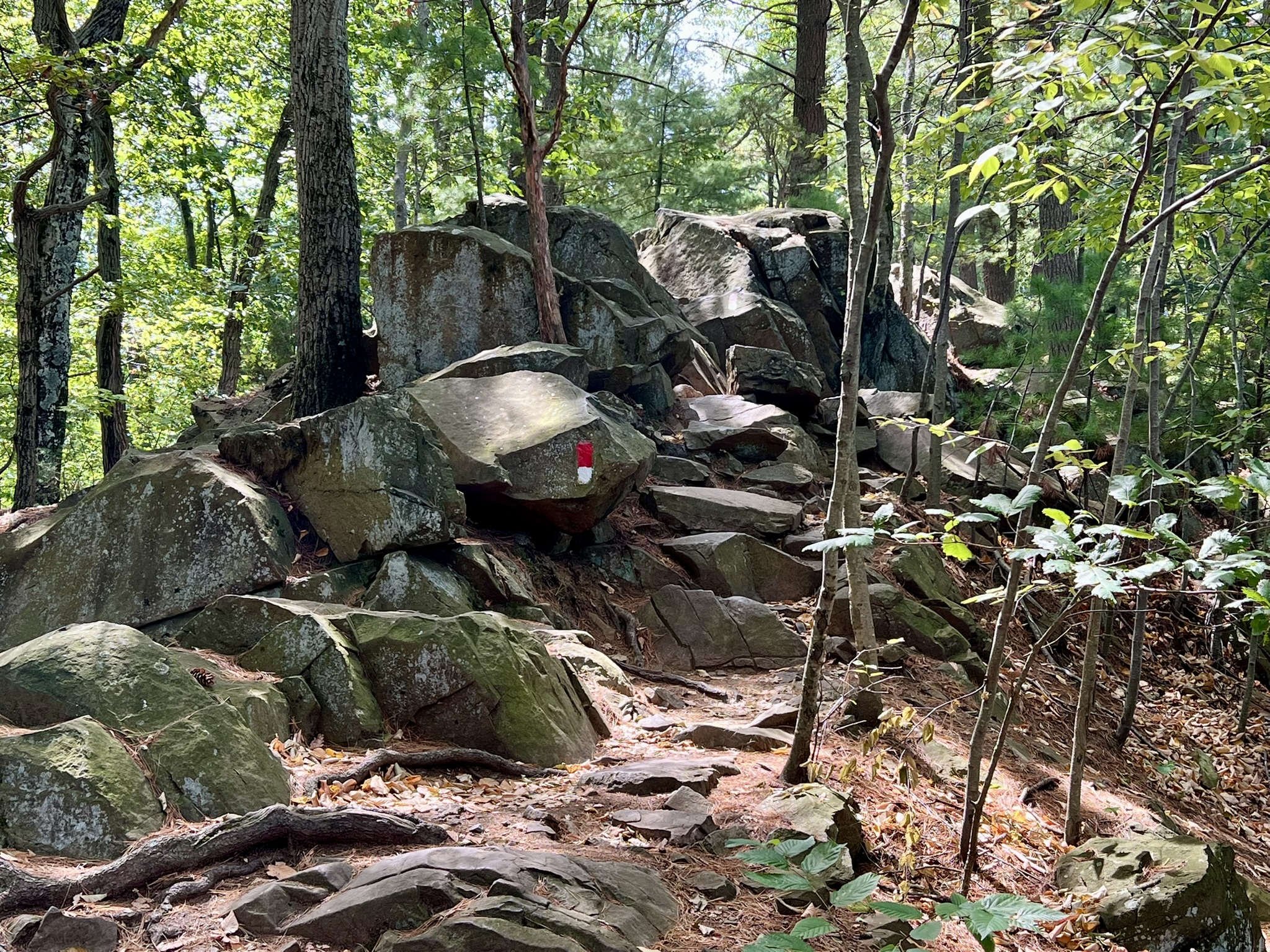
We first walked around the jumble of boulders called Judges Cave. While it is impressive, it is hard to imagine how it made a suitable hiding place for any length of time. We then set off on the blue trail heading north. The trail goes up and down along the ridgeline and is challenging due to the rocky terrain. On several occasions the trail parallels or crosses Baldwin Drive, which is an option for walking a vehicle-free road instead of the more difficult trail. According to the park website, Baldwin Drive was constructed in the 1930s as a Works Progress Administration (WPA) project.
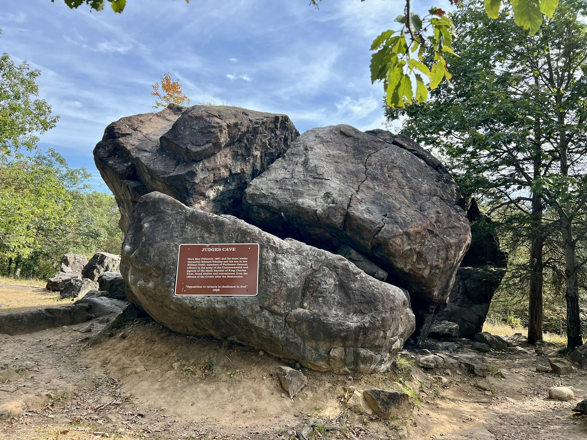

From left to right: Judges Cave from different angles; Baldwin Drive; a steep scramble along the blue trail
We reached the first of several overlook at about the 1.25 mile mark above Konold’s Pond. In the winter, with the leaves off the trees, there should be even more opportunities for good views off the ridge to Lake Dawson and Lake Watrous as you continue north. Further north, where the trail crosses Baldwin Drive, the ridge looks to the east over Farm Brook Flood Pond. It was a hazy day, but we could just make out New Haven in the distance. Just before the junction with the Quinnipiac Trail we took the red/blue Sanford Feeder Trail on the left to get down to our car.


From left to right: A view of the steep cliff by the Konold Pond overlook; view to Lake Dawson; an easier section of trail; the trailhead at Brooks Street
Loop Hike from the Darling House in Woodbridge. 5.35 miles with 785’ of ascent.
On my next visit, I parked at the trailhead parking lot just north of the Darling House (the Darling House is located at 1907 Litchfield Turnpike – Route 69). This Trail Map to the Bishop Estate and Darling House Trails was very useful. From the lot, a white-blazed trail enters the woods (marked blue on the map) to connect to the blue trail. At this junction, stay right to skirt the edge of a field. After crossing the West River, turn left at the next junction onto the blue/red trail. This passes through a nice open woods. At the next junction, turn left on the blue/yellow trail, which is blazed as a blue rectangle with a yellow dot. (The trail map shows the first section of this trail as blue, transitioning to blue/yellow after crossing onto Regional Water Authority property, but in the field it is all blue/yellow.) This is a gorgeous section of trail. The incline is gradual, with some flat sections and easy footing for about the first half mile. The landscape is dramatic, with the trap rock cliffs and talus slope visible through the trees. As the trail climbs it gets closer to cliff. For the last ¼ mile the trail is steeper and rocky. It meets the Regicides Trail just below the abandoned parking area along Baldwin Drive. If you do a strict out and back it is about 2.7 miles.
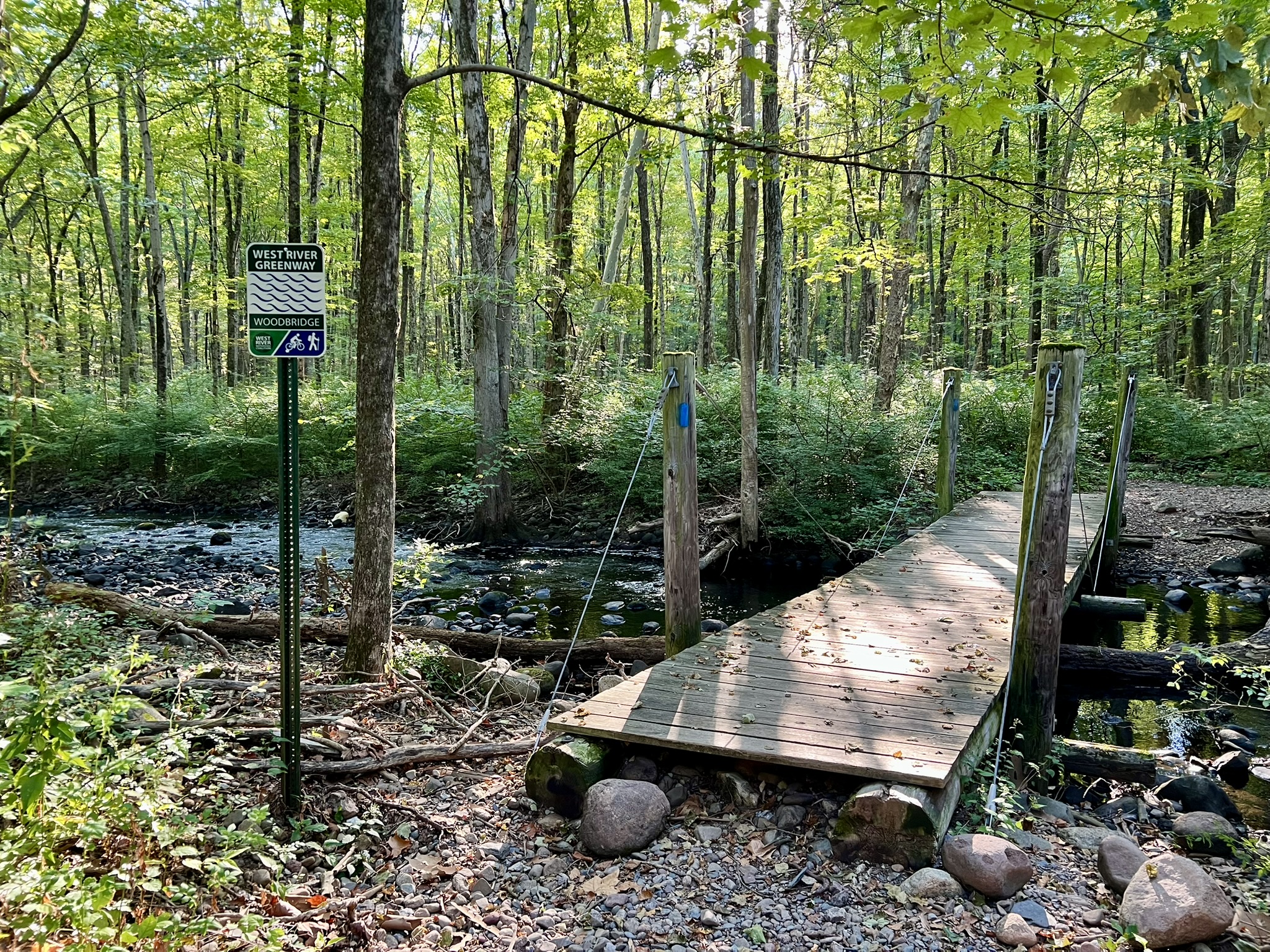


From left to right: the bridge over the West River; a gentler part of the blue/yellow trail; the rockier sections of the blue/yellow trail
I added to my hike by heading south on Baldwin Drive and taking the purple/orange blazed trail to the right to meet the Regicides Trail. There was a hint of a view that will open up once the leaves fall. I continued south on the blue trail approximately .8 miles to the junction with the blue/white connector trail (formerly the gold trail). Upon reaching Baldwin Drive, I walked north on Baldwin Drive to return to the blue/yellow trail. Upon reaching the junction with the blue/red and red trails I went left on red to see a different section of woods. I located the green connector trail to cut off the bottom loop. This is very poorly marked so a GPS is helpful. I used AllTrails to locate it. Worst case you’ll end up doing the full red loop for an additional ½ mile or so.


From left to right: where the purple/orange trail meets the blue trail; a section of blue trail; the new blue/white trail (gold on map); faded green blaze
Southern Loop from Lake Wintergreen Parking Lot on Main Street. 5.9 miles with 771’ of ascent.
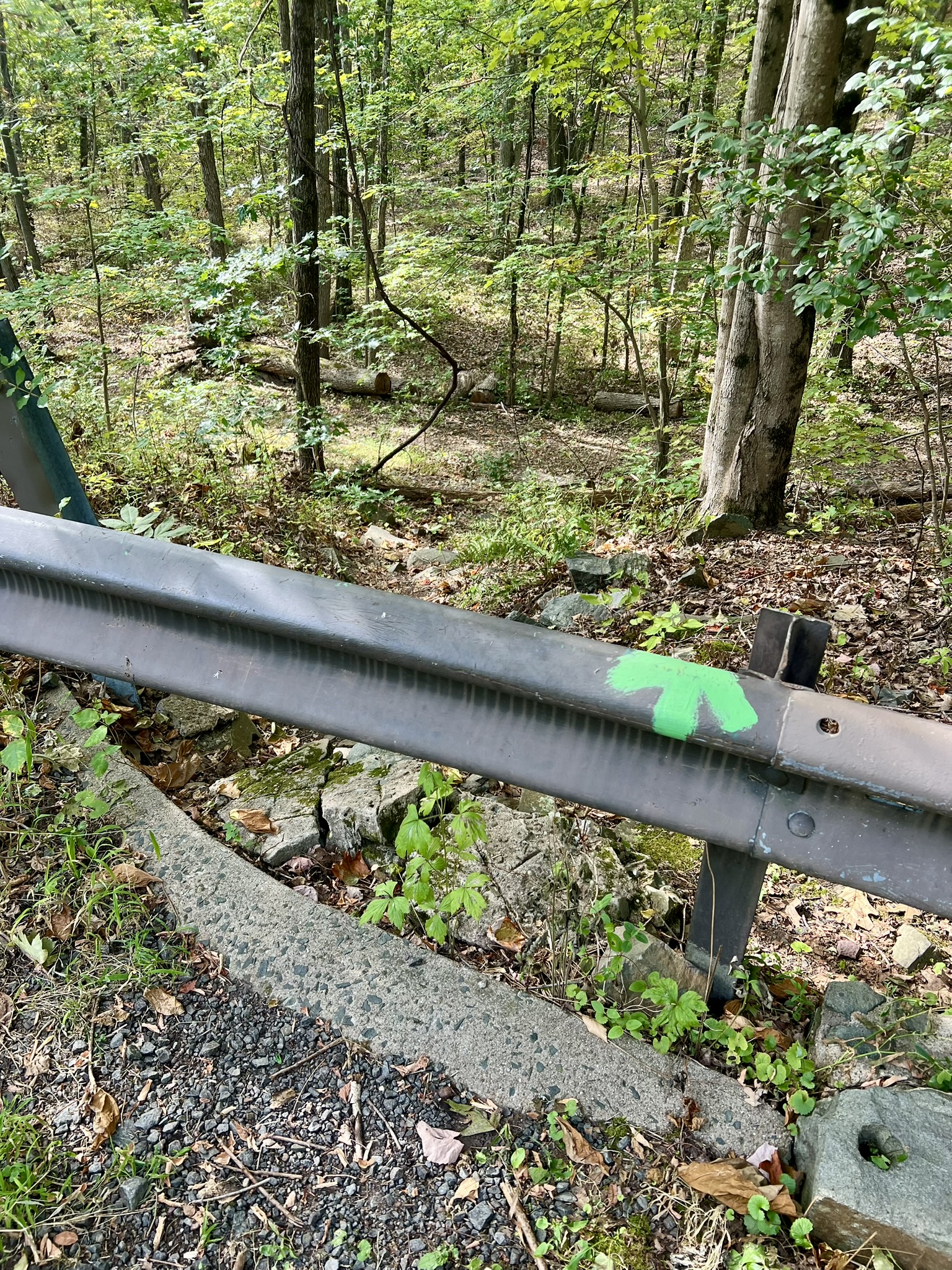
In late August we did a loop hike counterclockwise, starting at the Wintergreen Lake parking lot. We followed the white trail along the western edge of the lake, continuing south on red. We popped out on Baldwin Drive at a hairpin turn and went uphill to the right. We were so busy chatting that we forgot to look for the connection to the green trail at the next hairpin turn. When we realized this and backtracked, we noticed overgrown stairs to an abandoned pavilion building which I have since learned is the airshaft to the parkway tunnel. After making our way back to an obvious green arrow painted on the guardrail, we took the green trail uphill to the right. It meets the blue trail and then diverges again, running parallel to the blue trail to Judges Cave.

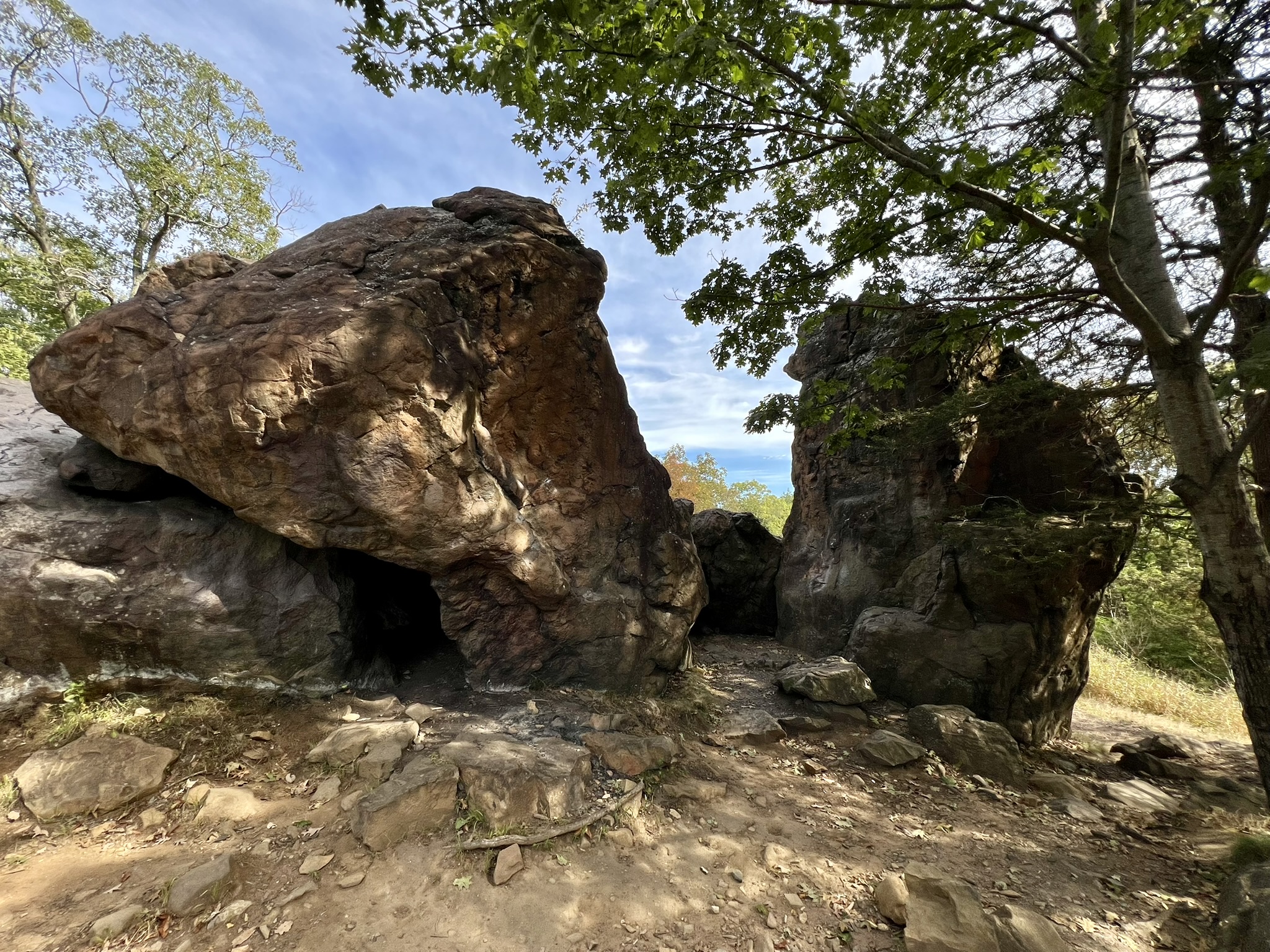
From left to right: Lake Wintergreen; the abandoned pavilion structure; the arrow pointing the way to the green trail; another view of Judges Cave
After the cave we took the blue trail as it continued south. The trail was rocky at times, with a steep drop off to the right – often with some railing protections but still intimidating. The blue/yellow Westville Feeder Trail forks down to the right. We stayed on blue as it continued toward the south lookout where there is a large pavilion and sweeping views of New Haven and the harbor. At the far end of the parking area we picked up the red trail, which was steep and rocky with a lot of old stairs built into the trail. We passed several overlooks with views both out to SCSU and of the cliffs.


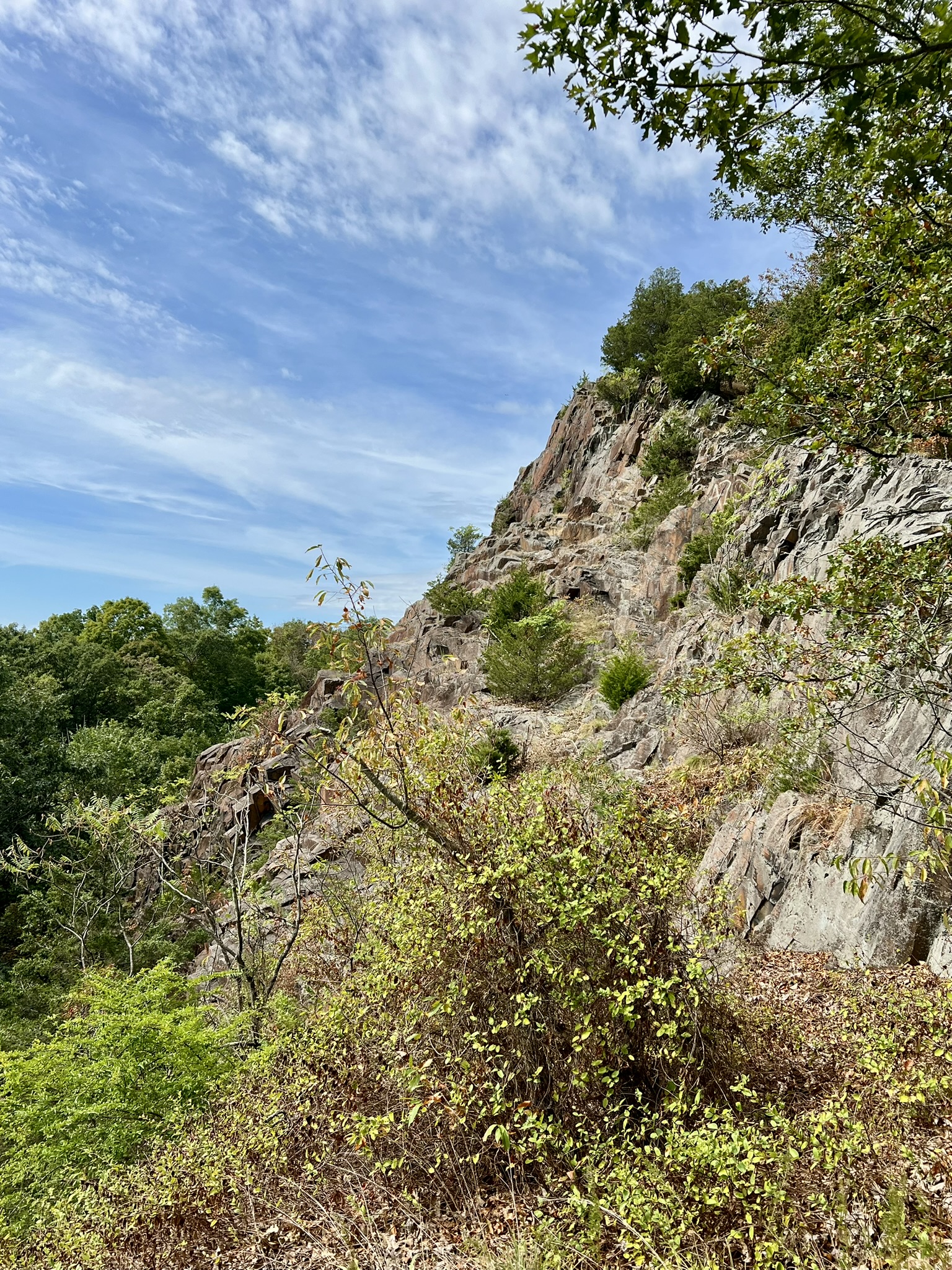
From left to right: the blue trail heading south to the overlook; a viewpoint along the trail; a view from the red trail of the cliffs; old red trail steps
As the red trail circles around and starts heading north it flattens out, curving in horizontal switchbacks to navigate the ravines. The views up to the ridge on the left are lovely. A few other trails come in and out (green and red/white).We stayed on red until it popped out on Regicide Drive near the park entrance gate. We went left, and then as the paved road turned sharply left we took a right on the old Baldwin Drive. This is the continuation of the red trail. At the hairpin turn we crossed the guardrail and were back on the red trail that we came out on. When we reached the lake, we took the red/white trail which skirts the eastern side of the lake. We loved this section of trail. There are lots of pines and scenic lake views, although there are also rocks and roots and a few boulder scrambles before reaching the dam. From there it is an easy stroll back to the parking lot.


From left to right: Wintergreen Lake from the red/white trail; a boulder section along the red/white trail; the dam at Wintergreen Lake
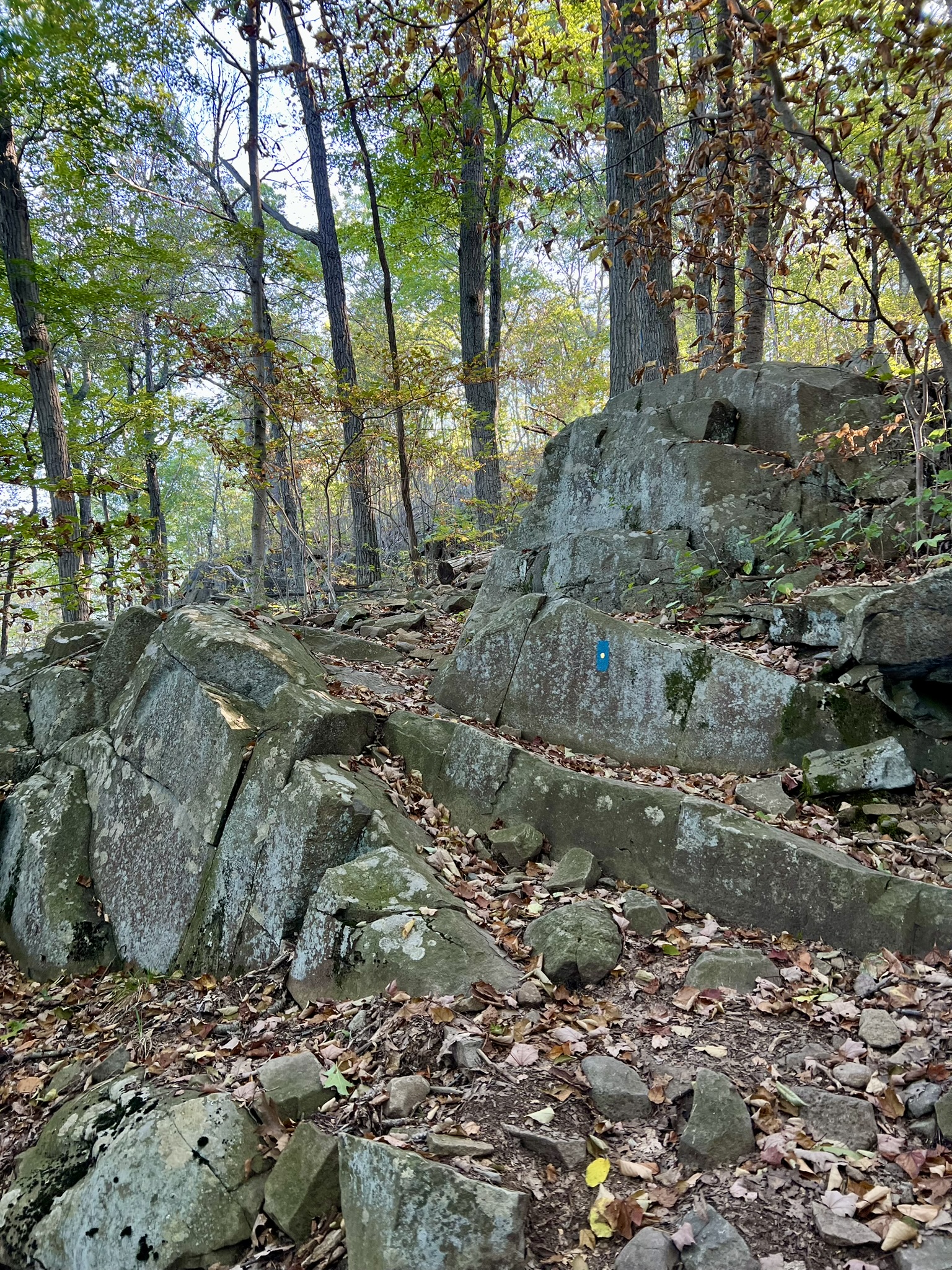
Out and Back from Hill Street Parking. 2.9 miles. Approx. 400’ of ascent
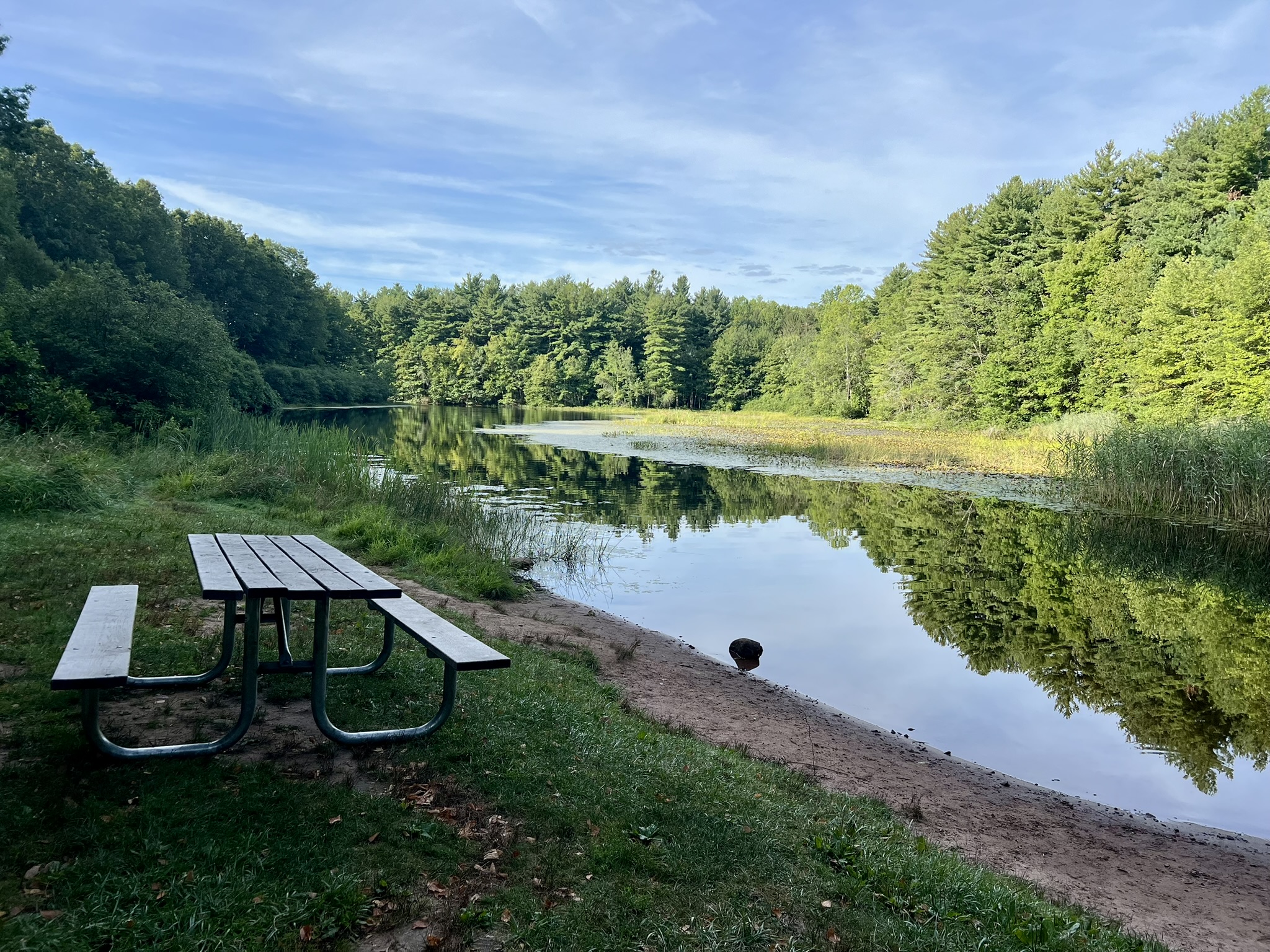
We returned in late October to see the park during fall foliage season and opted for an out-and-back in the north that would give us views to both the east and west. There is a parking area with room for several cars on Hill Street by Farm Brook Flood Pond. This is the red/white trailhead. We followed red/white until it met the red trail. We took a right on red, and stayed on the red trail at the next junction. This trail has several switchbacks as it climbs the ridge, passing some impressive rock formations. At the top of the ridge, the views over the pond with New Haven, the harbor and East Rock in the distance, were spectacular. We continued on red to its end at the junction with the blue-blazed Regicides Trail. We turned left on blue, crossing over the top of the ridge and Baldwin Drive to reach the scenic overlook above Lake Watrous. There are many options to extend your hike, but as we were pressed for time we made this our turnaround point.
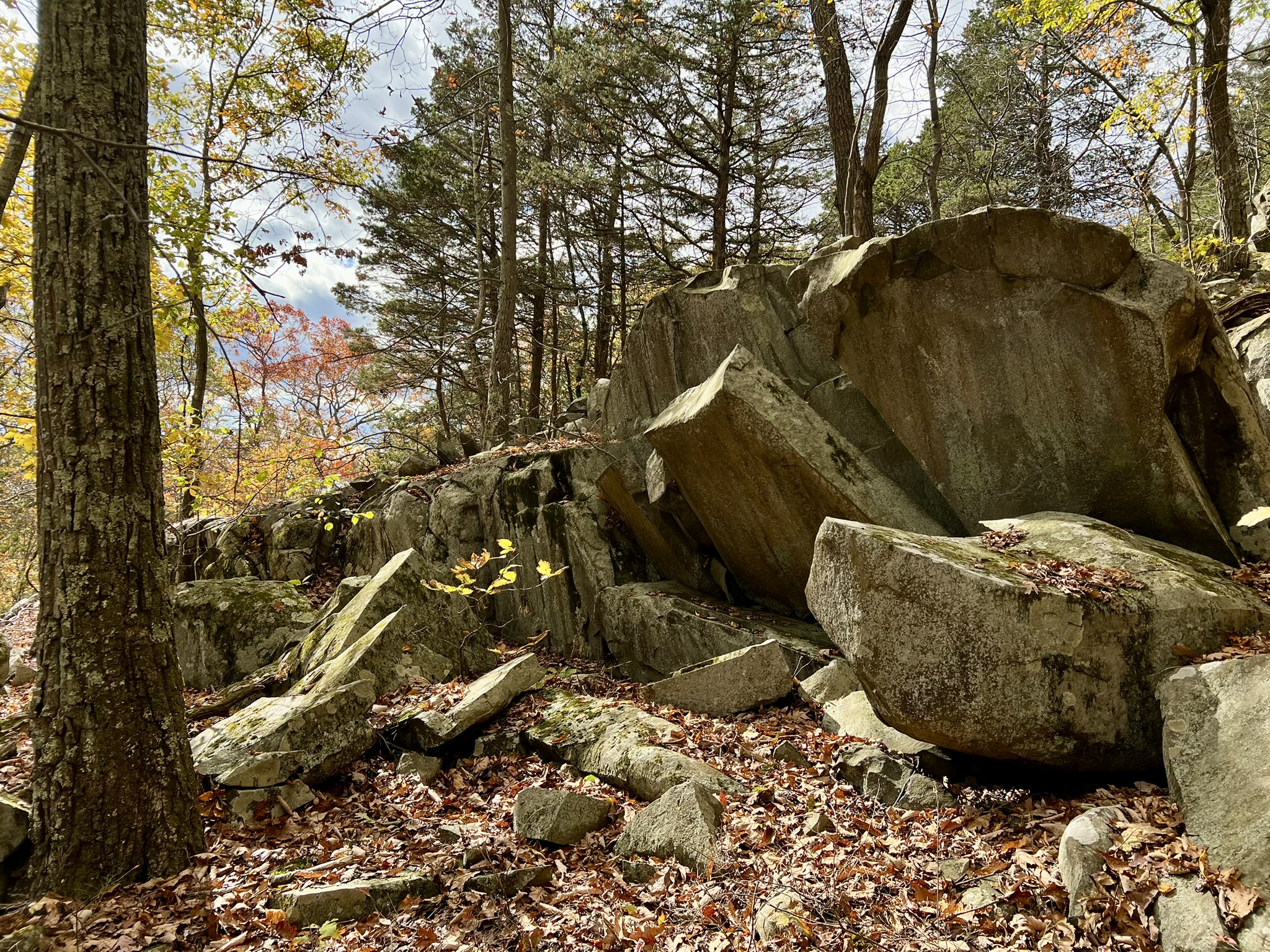
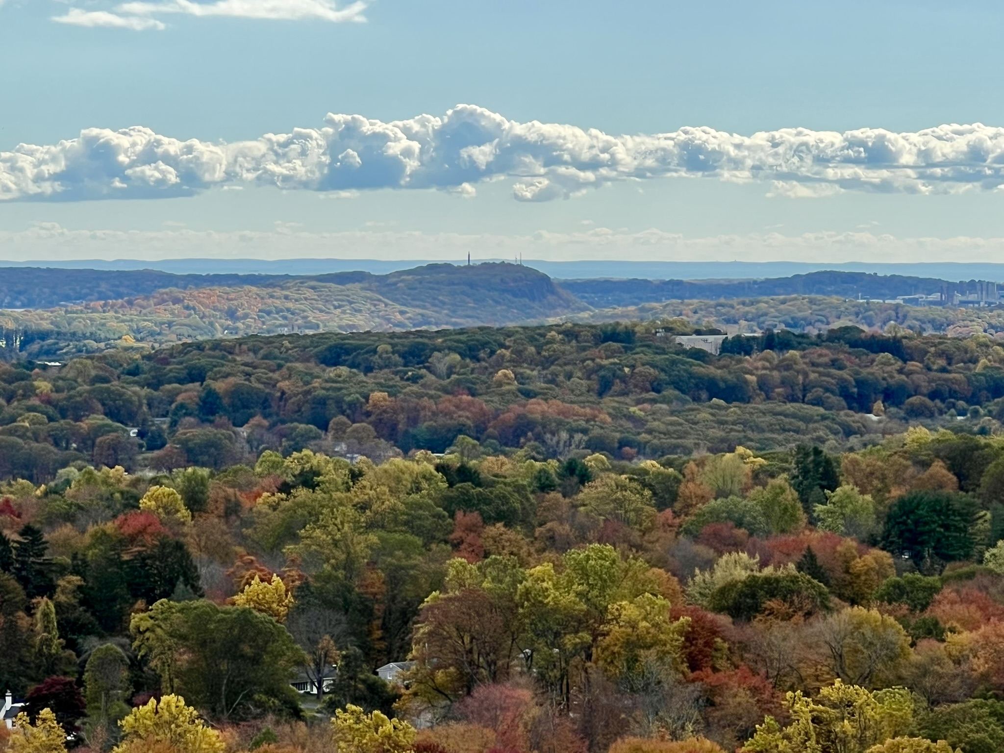

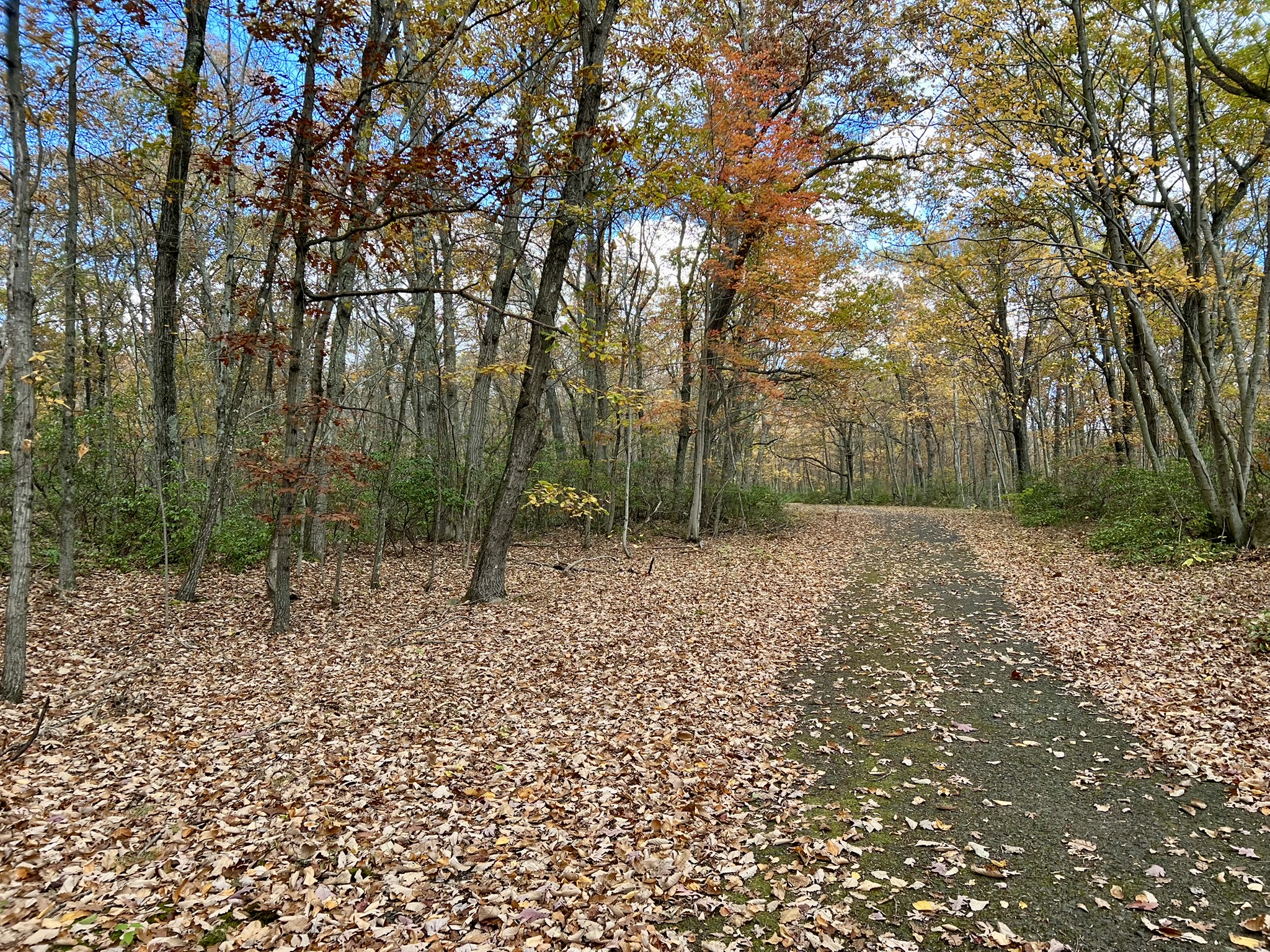
From left to right: rock formations along the trail; view to East Rock and New Haven Harbor; view of Lake Watrous; Baldwin Drive in autumn
To extend your pursuit of the regicides beyond West Rock Ridge State Park there are several nearby landmarks you can visit.
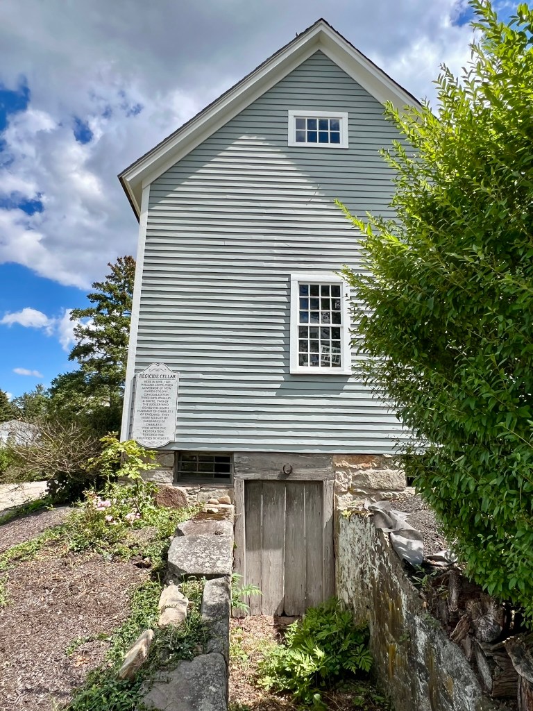
Regicides Cellar, Guilford
One local legend says that Whalley and Goffe spent some time hiding in a cellar behind the home of New Haven Colony Governor William Leete. On an outbuilding on River Street (behind the residence at the corner of River Street and Broad Street) is a plaque that reads: “Regicide Cellar: Here in June, 1661 William Leete, then Governor of New Haven Colony, concealed for three days Whalley and Goffe, two of the judges who signed the death warrant of Charles I of England. They were sought by emissaries of Charles II who after the restoration, ordered the regicides beheaded.” While that legend may or may not be true, scholars appear to agree that when the bounty hunters Kirke and Kellond arrived in Guilford with a copy of the royal proclamation, Governor Leete did a praise-worthy job of obstructing their progress under the guise of good governance. He did everything from invoking administrative technicalities, such as insisting on gathering all members of the Court to approve decisions, to refusing to break the Sabbath to provide assistance. In this manner he slow-rolled the bounty hunters’ progress, ostensibly to give the fugitives more time to hide. These details are well-described in Christopher Pagliuco’s engaging book “The Great Escape of Edward Whalley and William Goffe”, and these scenes are some of my favorites in Harris’ historical novel.
Site of the Former Home of Shopkeeper Michael Tompkins, Milford
After their time in Judges Cave on West Rock, Whalley and Goffe supposedly spent some years living in the stone storeroom at the home of shopkeeper Michael Tompkins in Milford, CT. According to Pagliuco, “Goffe wrote in his diary that he and Whalley had dared ‘not so much as walking out into the orchard for two years.’” While the house no longer remains, there is a plaque on the front lawn of the River Park Apartments at 111 W. River Street, Milford. NOTE: Goffe’s diary no longer exists. It was in the possession of Massachusetts Governor Thomas Hutchinson and referenced in his “History of Massachusetts Bay”, but lost or destroyed in the Stamp Act riot of 1765.

More on the English Civil Wars
The gist of the English Civil War was a dispute between King Charles I and Parliament over religion and politics. On the religious front, Charles I was accused of being too sympathetic to Catholicism: he favored elaborate ceremony, a bishop hierarchy, and married a Catholic princess from France, among other things. Many Parliamentarians favored a purer form of Protestantism that was closer to God, did not require intermediaries, and was simpler regarding rituals (we now label these folks Puritans, but that descriptor was not used at the time). Politically, Charles I hated sharing authority with Parliament. After coming to power in 1625 he spent time quibbling with Parliament, then dissolved it for 11 years – from 1629 to 1640 . That period became known as the period of Personal Rule. During that time the king used many questionable methods for raising funds. In 1640 he briefly reinstated Parliament, as he desperately needed to raise money through taxation – one of Parliament’s purviews. Charles I and Parliament were so at odds over terms that he dissolved it again after three weeks and that became known as the Short Parliament. Unfortunately for King Charles I, the next Parliament, formed later that year, lasted twenty years and was more forceful about keeping the king in check. That time is called the Long Parliament.
The religious puritans during the time of Charles I’s reign took different tacks. Some, such as the Pilgrims, who sailed away in 1620, were separatists, and left England determined to sever their ties with the Mother Country. Others, such as the Puritans who founded Massachusetts Bay Colony, came with a Charter from the King. They were determined to establish a purer religious community free from the influences of the more “Catholicized” Church of England, but they ultimately hoped that England would reform and had no wish to sever ties. Still others stayed in England with the hopes of reforming from within, and many of them sat in Parliament. One of those Parliamentary reformers was Oliver Cromwell. When Civil War broke out in 1642 after Charles I raised his standard to declare war, Cromwell quickly made a name for himself by raising an army and proving himself a cunning and successful commander.
At a time where military titles were purchased and held by men of noble birth he turned that paradigm on its head by establishing the New Model Army which promoted men on merit. This allowed his cousin, Edward Whalley, who started out as a woolen draper, to rise in the ranks of the army. Whalley’s son-in-law, William Goffe, was also able to rise in the army, eventually to Major-General, after an initial career as a salter (a trade that involved salting and preserving food).
There were several phases of the Civil War that I won’t delve into – except to say that at the end of the second phase, in 1649, Charles I was defeated and put on trial, overseen by a High Court of Justice. In 1649, fifty-nine of those judges signed a warrant calling for the execution of Charles I, which took place just two day later in London. The next two years saw the third phase of the war, where the king’s son, Charles II, attempted to take control and re-establish the monarchy. He eventually fled into exile, thus ushering in the period known as the Commonwealth and Protectorate. In 1653, Parliament appointed Cromwell as the Lord Protector, a position he held until his death in 1658. As happens often throughout history, noble ideals fizzle once power is attained. As Harris writes in his novel: “Cromwell had the power, but to what end? Each time he tried to restore Parliament, it antagonised him, and he dissolved it.”
Acting like a monarch in almost all ways except title, Cromwell named his son his rightful heir to the position. His son neither wanted it, nor was charismatic enough to keep it, and the country devolved again into a civil war between the Parliamentarians and the Royalists. This time, the Royalists won, and England entered the period we call the Restoration, where Charles II was restored to the throne. Upon coming to power, Charles II signed the new Act of Free and General Pardon, Indemnity, and Oblivion, which absolved most of the people who had supported Cromwell of any crimes. One exception was for the 59 judges, deemed Regicides (king killers), who had signed the death warrant of Charles I. The fate of those unfortunate folks varied. Although some were already dead, this did not save them – the king ordered Cromwell’s remains to be exhumed and ritually quartered. Some were imprisoned and brutally executed, while others had their executions stayed only to endure life imprisonment. Still others fled to Europe. Three fled to the new colonies, hopeful for a more welcome reception amongst Puritans sympathetic to Parliament. And we New Englanders remain determined that these three shall not be cast into oblivion.
Bibliography
The Great Escape of Edward Whalley and William Goffe: Smuggled Through Connecticut, by Christopher Pagliuco. (2012). This slim volume (127 pages) is engaging with much detailed information. If you only pick one, this is my recommendation.
Act of Oblivion, by Robert Harris. (2022). Historical thriller.
Killers of the King: The Men Who Dared to Execute Charles I, by Charles Spencer (2014)
The King’s Revenge: Charles II and the greatest manhunt in British history, by Don Jordan & Michael Walsh. (2012)
The History of the Americans Podcast by Jack Henneman. https://thehistoryoftheamericans.com/. This is a great podcast. For this Trail Talk, I recommend Episode 150 Regicides on the Run! https://thehistoryoftheamericans.com/regicides-on-the-run/. When I went to Henneman’s website I was thrilled to see a correction for his pronunciation of Whalley (he says WAH-lee throughout instead of WAY-lee. Luckily some New Haven locals set him straight.) Please forgive him!
https://ctparks.com/parks/west-rock-ridge-state-park is the state park website.
West Rock Ridge Park Association: https://westrockpark.wordpress.com/home/
West Rock Trails Website https://westrocktrails.blogspot.com/
Subscribe to Trail Talk
your next adventure awaits
Questions? Email me at naturenerdsramble@gmail.com or find me on Instagram @the_real_nature_renee.