(display at the Haddam Shad Museum)
ALOSA SAPIDISSIMA. That’s Latin for American Shad, which translates roughly to “most delicious shad”. Despite being named Connecticut’s State Fish in 2003, I knew almost nothing about shad. When I learned that the Haddam Historical Society (HHS) was planning a grand re-opening of the local shad museum I became interested in working the history of shad into a Trail Talk post highlighting trails and other destinations along the Connecticut River.
The Connecticut River gets its name from the Algonquian language word “Quinetucket”, meaning “long tidal river’, and it is exactly that: a river almost 410 miles long that runs from near the Canadian border in Vermont to Long Island Sound, affected by ocean tides as far up as Windsor Locks – 60 miles from its mouth. American Shad, a type of large herring, is an anadromous fish, meaning it spends most of its time in salt water, but seeks the freshwater river of its birth to spawn. American Shad populates the Atlantic Coast and spawns from Canada to Florida. (There is also a Pacific Shad that was introduced to the west coast in the 1870’s through a successful federal program that brought fertilized shad eggs by rail to California for release in the Sacramento River). On average, shad live 3 to 6 years. They are very sensitive to water temperature, spending the first 3 to 5 years of their lives migrating between summer feeding grounds in the Bay of Fundy and wintering in warmer Atlantic waters such as the Middle Atlantic Bight. They feed on zooplankton and other small critters, except when they head upriver. Once they start the spawning run they generally stop eating and use their physical reserves to get through the process. Their spawning survival rate is strongly impacted by their natal river location: cooler rivers to the north see a 30-50% survival rate, whereas southern rivers see an almost 0% survival rate. This is due to the water temperatures: the warmer the water the faster their metabolism rate, which causes stress that can lead them to such a depleted state that they can’t recover for the journey back to sea. In the cooler waters of the Connecticut River the survival rate can reach 50%.
What is it about shad that would induce Connecticut to designate it the state fish? The Connecticut River was flush with shad when the first Europeans arrived. Indian tribes along the river used weir techniques to harvest them during the spring run, and purportedly taught these techniques to the colonists. Shad was so prevalent that up until the mid-1700’s it was considered a low class food, sometimes referred to as a poor man’s salt pork. There are tales of servants having contractual stipulations regarding how many times per week they could be served shad. By the mid-1700’s shad’s reputation had grown considerably and it achieved legendary status as the food source that saved George Washington’s starving troops at Valley Forge. In his engaging book, “The Founding Fish”, author John McPhee builds the suspense around this tale with numerous details (including the fun fact that George Washington was a commercial shad fisherman) to the point where I laughed out loud when I got to his punchline: “[t]he emotive account of the nation-saving shad is a tale recommended by everything but sources….there is no documentation of the shad that reached Valley Forge, let alone of their numbers.” Shad remained an important and ubiquitous food source across the Atlantic seaboard through much of the 18th century until the construction of dams for hydropower became a literal obstacle. On the Connecticut River, the construction of the Turner Falls Dam in 1798, the first of several dams that impacted the fish run, stopped the shad migration at about the 140 mile mark. Another negative impact on shad in the 1800’s came from industrial waste and town sewage being released directly into the rivers. As William Devlin explains in his article Rivers of Outrage, “[p]ollution of Connecticut’s waters by industrial waste and sewage in the decades after the Civil War was arguably the state’s first modern environmental crisis.” Citizens turned to the courts in the late 1800’s in an effort to stop towns from dumping sewage into the rivers. While the plaintiffs were often victorious, the laws of economics were also in play, and frequently towns found it cheaper to pay damages than to take on the expense of building sewage treatment plants. While the lawsuits did not stop the pollution, they raised public awareness, and in 1887 the Connecticut Assembly authorized a commission to study the problem. One issue was the effect of pollution on fish. The Connecticut State Board of Fisheries and Game had been established in 1866 because of concern with declining populations of Atlantic Salmon and American Shad in the Connecticut River. While early efforts did not gain traction, as environmental awareness kicked into high gear in the 1960’s Connecticut enacted its own Clean Water Act in 1967, which was used as a guide for the federal Clean Water Act of 1972.
Concurrent with efforts to clean up our nation’s waterways, plans were underway to study and manage fish populations. As the Connecticut River American Shad Management Plan explains, in 1967 “the ‘Policy Committee for Fishery Management of the Connecticut River Basin’ was formed in response to the passage of the 1965 Anadromous Fish Conservation Act…by the U.S. Congress. This committee was replaced by the…Connecticut River Atlantic Salmon Commission (CRASC)…in 1983 [which] coordinates restoration and management activities with American Shad”. As the tidal river itself, the population of shad has ebbed and flowed. The installation of fishways and the decreased pollution spurred population increases between 1967 to 1992, but 1992 saw a precipitous decline in fish counts and while the population has fluctuated in the last 30 years it has stayed on the lower end. According to the US Fish and Wildlife Service (FWS), one likely reason for the decline is the increase in the population of the predatory Striped Bass. Along with the decrease in population, shad also faced a decrease in popularity. Shad enjoyed a brief resurgence in popularity in the mid-20th century after the rivers got cleaned up and while access to fresh fish was seasonal and thus a novelty. Once access to fresh seafood year round became the norm, interest in shad waned. One reason was certainly the hassle of preparing it. Shad is very bony, with approximately 1,000 bones per fish, and removing those bones is both an art form and a time-consuming process. One such shad boner, Dorothy Goss, became concerned that this art form would soon be lost. She worked with the Connecticut River Museum and filmmaker Richard Johnson on a documentary called “A Passion for Shad” which was released in 2002. Along with the knowledge base for deboning shad, the number of commercial shad fishermen has also shrunk. In 2020 the state issued only 6 commercial licenses, down from an already low 15 licenses in 2013.

Photo: Shad cooked on planks around the fire at the 2025 Essex Shad Bake
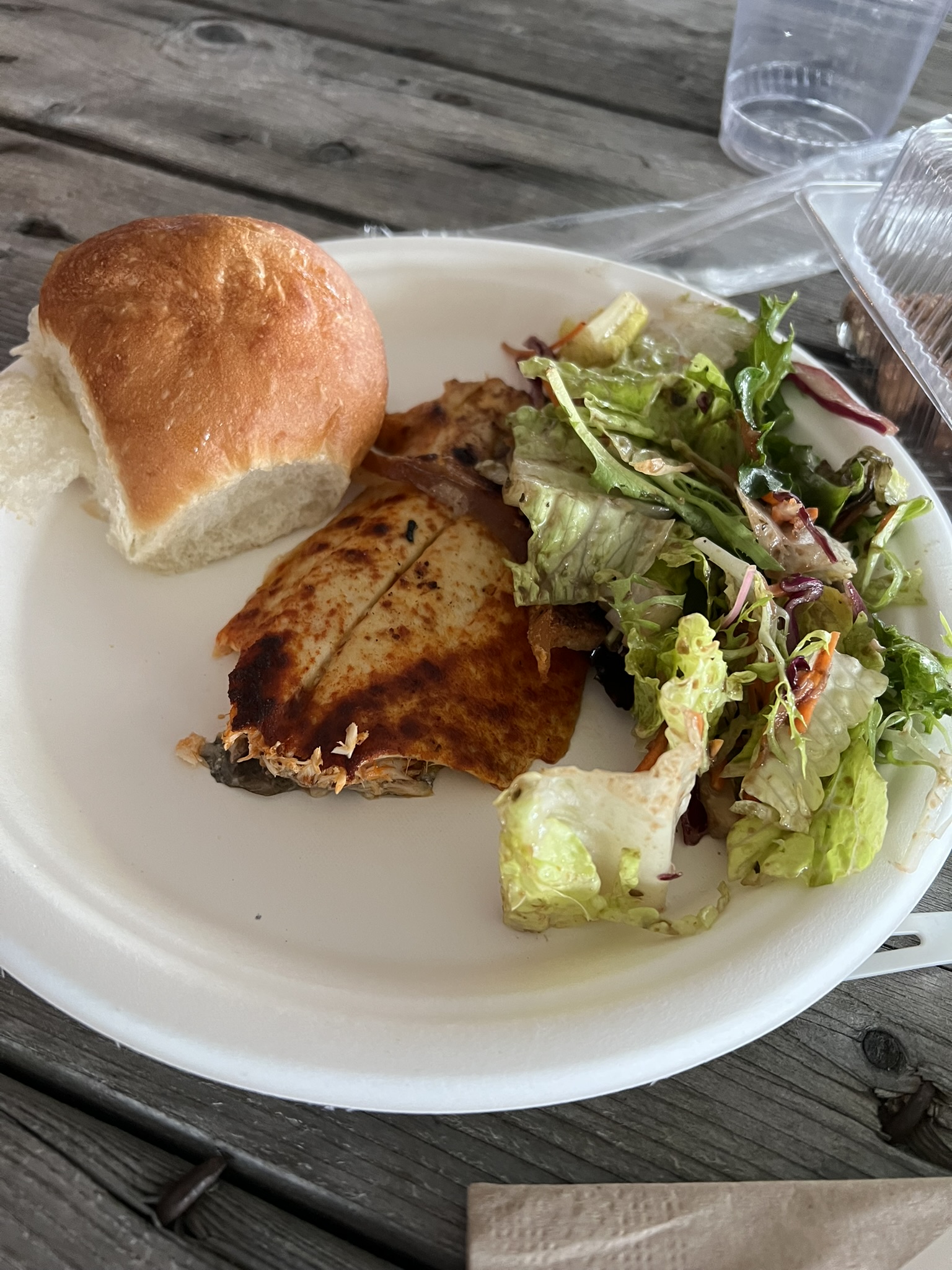
But how DOES it taste? Is it really and truly a “most delicious shad”? I was determined to find out, and bought tickets to the Essex Rotary Club’s 2025 Shad Bake, a tradition that goes back to 1958. Enough shad to feed 450 attendees is cooked around a large fire, nailed with pieces of salt pork to oak planks and seasoned simply with olive oil and paprika. The Shad Bake was held on a rainy Saturday in early June at the Essex Island Marina. I was impressed to see the large turnout given the lousy weather. A Swing Band played festive music from under cover of a tent. Hundreds of chairs were set up under a larger tent and folks good-naturedly formed a long line in the rain once the buffet started. Along with the shad, the meal included salad, rolls, and Lyman Orchards apple pie. Clam chowder, clams and oysters were available for purchase, along with a cash bar for beer, wine and soda. I had my first taste of shad and was pleasantly surprised. It was tasty, and I didn’t encounter a single bone. For a glimpse of what this quintessential event looks like, check out this short VIDEO from the 2024 Shad Bake.


But how to combine all this interesting history with trail recommendations? As I scoured the map looking for hiking destinations along the river I became overwhelmed by the possibilities. I decided to focus first on the eight towns that comprise the Connecticut River Gateway Commission (CRGC) – Haddam, Chester, Deep River, Essex, Old Saybrook, Old Lyme, Lyme and East Haddam. The CRGC was formed in 1973 after proposals in the 1960’s to create a National Recreation Area along the Connecticut River failed. Neighboring towns along the river banded together to form the CRGC, whose mission is to protect “the unique, scenic, ecological, scientific, and historic value” of the estuary region and “prevent deterioration of the natural and traditional river scene.” Starting in Haddam and East Haddam and working my way downriver, I share with you a selection of trails, scenic spots and historical sites where you can get a feel for the beauty and the history of the Connecticut River in anticipation of the next spring shad run.
HADDAM
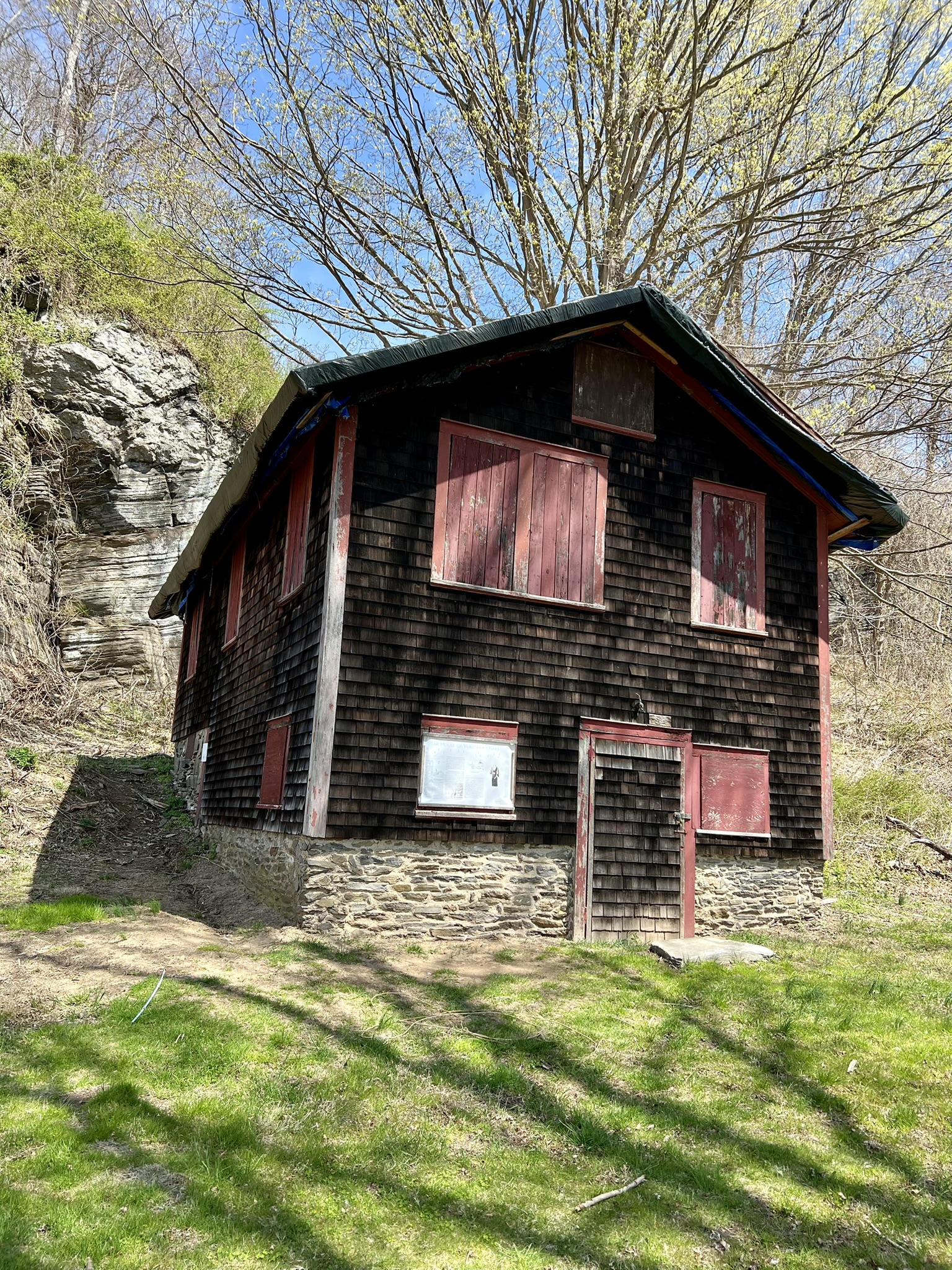
Haddam Shad Museum, 272 Saybrook Road, Higganum
Acquired by the Haddam Historical Society (HHS) in 2023, the newly refurbished museum sits on the grounds of the old Haddam Elementary School on Route 154 (Saybrook Road) in the center of Higganum. The museum, which first opened further north on Route 154 in 1995, was the brainchild of Dr. Joseph Zaientz, a dentist and recreational shad fisherman who had purchased the property in the 1960’s. When he realized that one of the buildings on the property had been Bill Maynard’s Shad Shack, he got the idea to transform it into a museum. A 1994 Middletown Press article quotes Dr. Zaientz explaining that his inspiration for the museum came from the fact that “shad fishing is such a big part of the history of the town and towns along the river. I thought it would be nice to do something to preserve it.” He ran the museum for many years, and before he passed away in March of 2023 he deeded the building to HHS. With the help of volunteers, it was moved to its current location. The last obstacle to opening its doors is the building of a barrier free access ramp and front porch. The current goal is to be ready to open before the end of 2025.
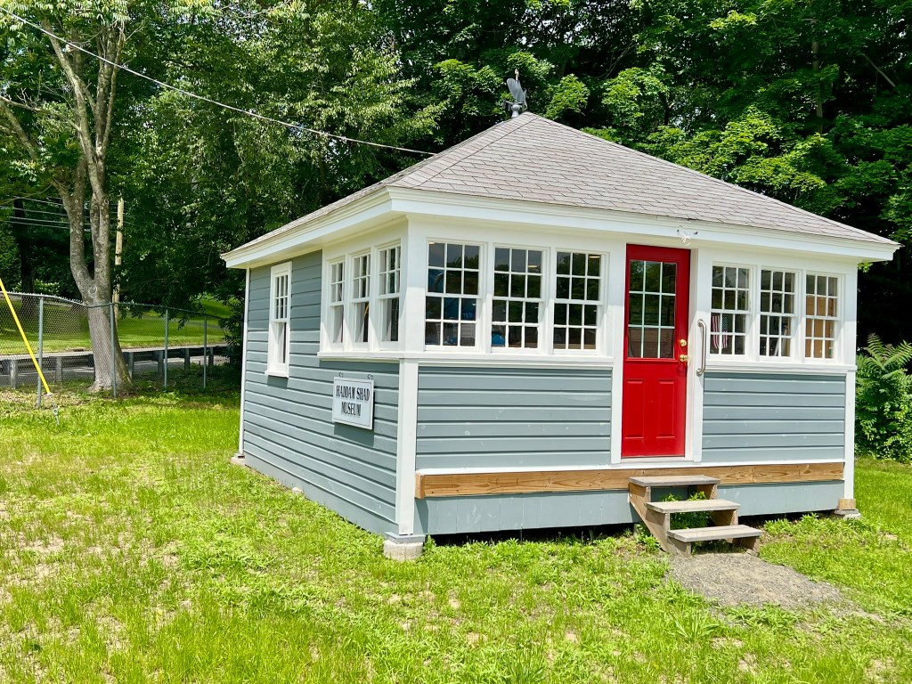
Photo: The Haddam Shad Museum is nearly ready to open its doors to the publlic. Note the shad weathervane on the roof.
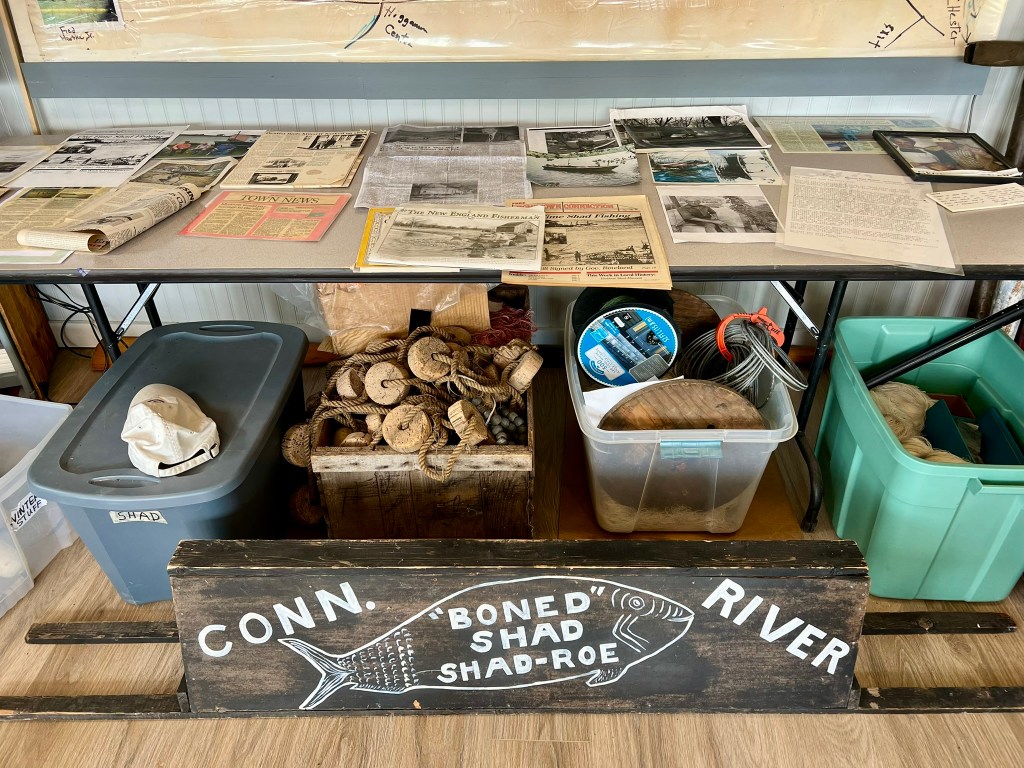
I visited in April and June as preparations were underway. Lisa Malloy, the HHS Executive Director, and two shad fishermen, Jack Calhoun and Fred Hartke, welcomed me and shared a wealth of information about the history of shad. Jack and Fred have been friends since they met in 1948 in the very first 1st grade class at Haddam Elementary School. Both have spent time as commercial shad fishermen (Jack during his high school years, and Fred from high school into the 1970’s). They regaled me with stories of shad fishing, explaining the differences between haul seining and gill nets, and reminiscing about the heyday of the mid-20th century when there would be “5 or 6 boats hauling shad in a 4 to 5 mile section of river,” according to Fred. Shad fishing happened at night, starting at dusk, because the shad could see the nets in the daytime. Now, they said, you’d be lucky to see a handful of boats along the entire stretch from Old Saybrook to Rocky Hill. The cheery one-room museum is chock full of memorabilia, including Bill Maynard’s old boning knives, examples of different nets, numerous photographs and articles, and various DVDs, including interviews with people from the industry, along with the documentary, A Passion for Shad. Following in Dr. Zaientz’s footsteps, Jack and Fred have dedicated many hours to keeping the history of shad alive. Among other things, Fred made some demonstration nets, fabricated the shad weathervane that sits atop the museum, and designed the river map on the white board with the help of his wife’s penmanship. Between now and the museum’s official re-opening, small groups can contact the Haddam Historical Society at 860-345-2400 or contact@haddamhistory.org to arrange a private visit. Keep an eye on the Haddam Shad Museum website for news of the official grand re-opening, and for information on how to donate to help defray the costs of the restoration.
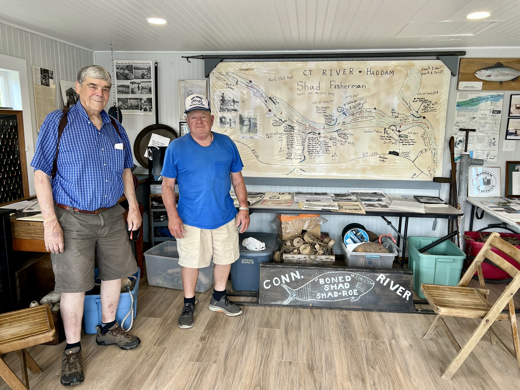

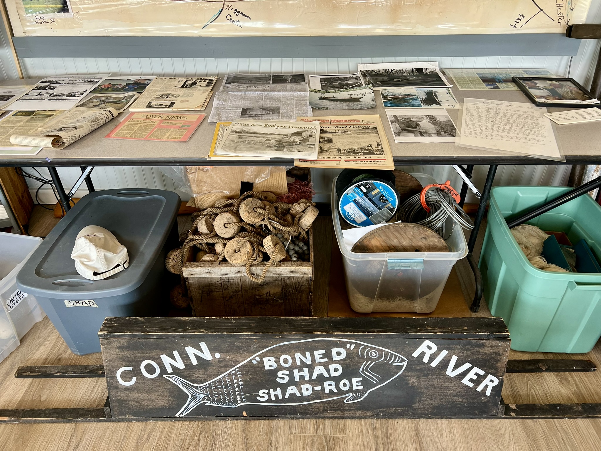
From left to right: Shad fishermen Jack Calhoun (left) and Fred Hartke pose in front of the river map; photos of the shad shack in its original location; some of the shad memorabilia awaiting visitors.
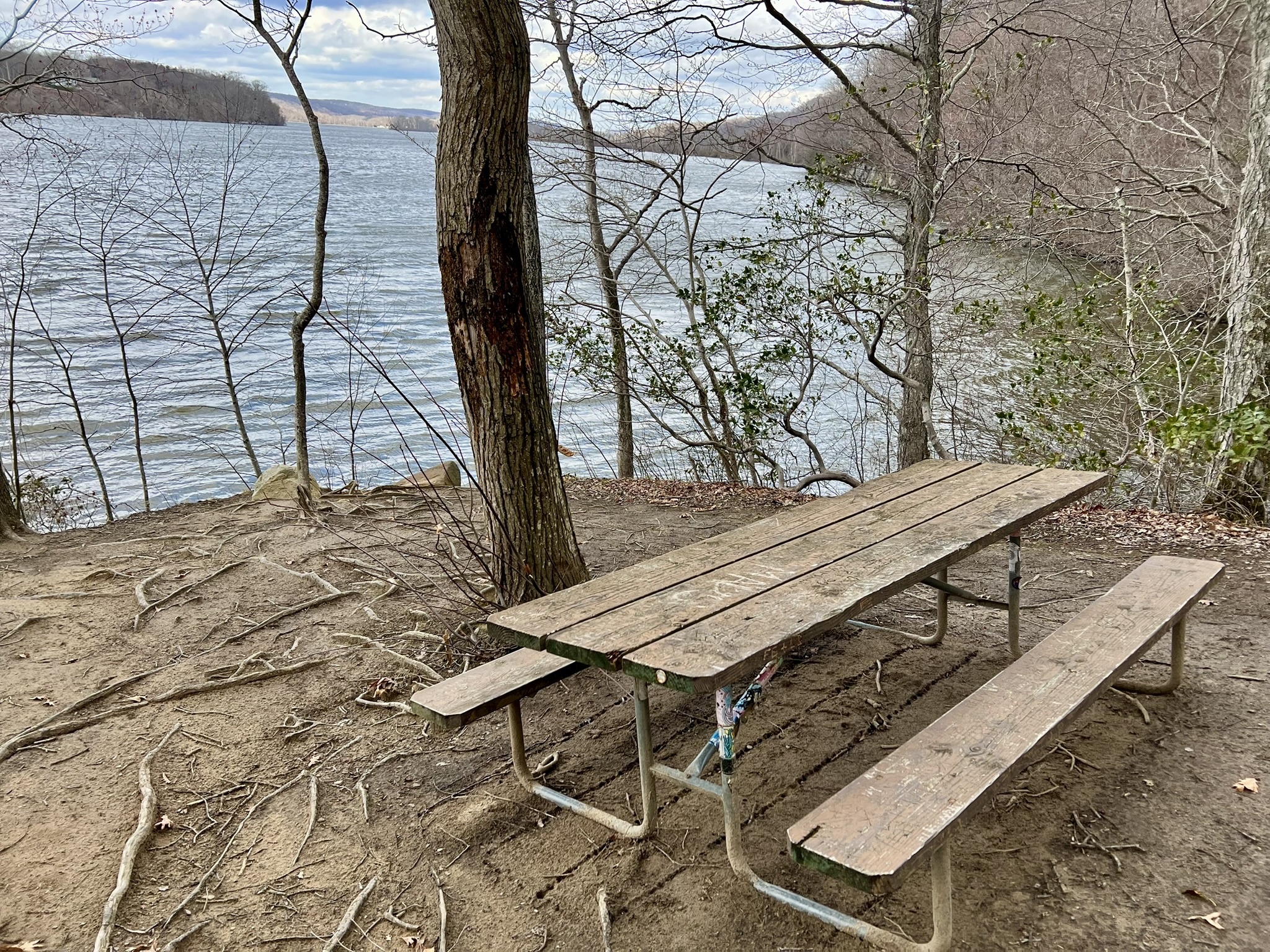
Haddam Meadows State Park, Haddam
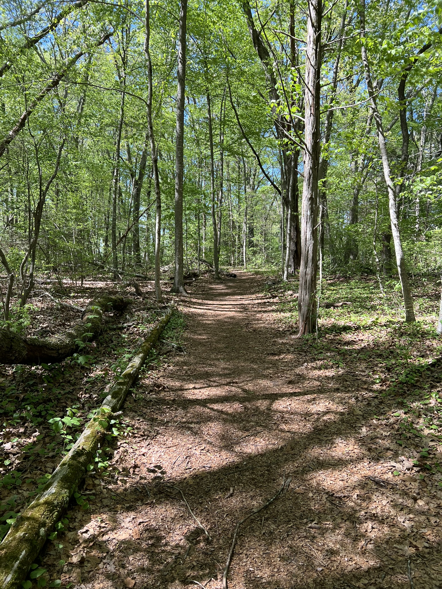
Continuing south on Route 154, your next stop could be Haddam Meadows State Park. Haddam Meadows is an ideal location to get close to the Connecticut River. There is a boat launch and dock, and a trail that goes parallel to the river with several stepped access points and picnic facilities. I wrote about Haddam Meadows in this January 2024 blog post on Sunrise Adventures, which has park information and a map link.
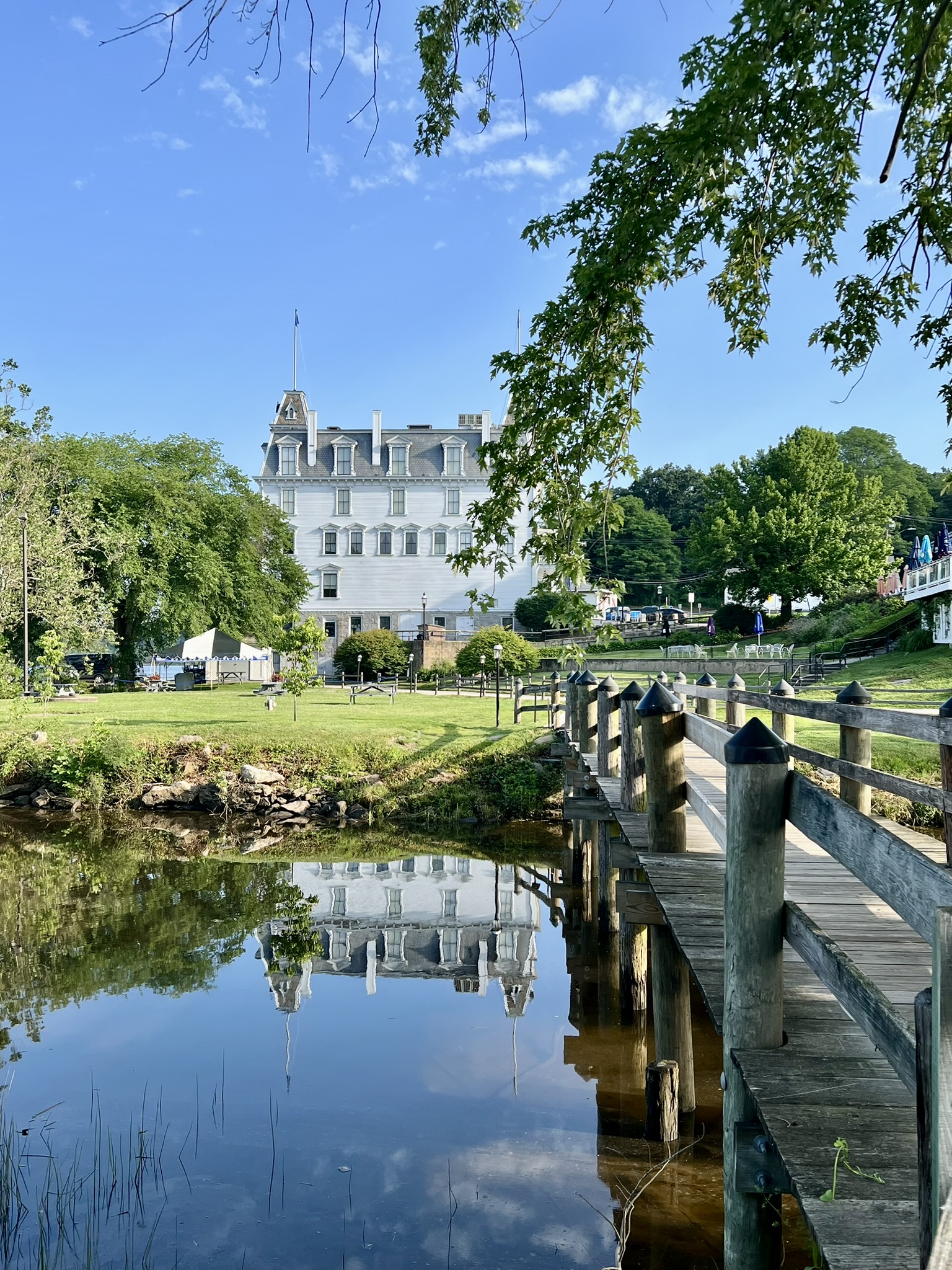
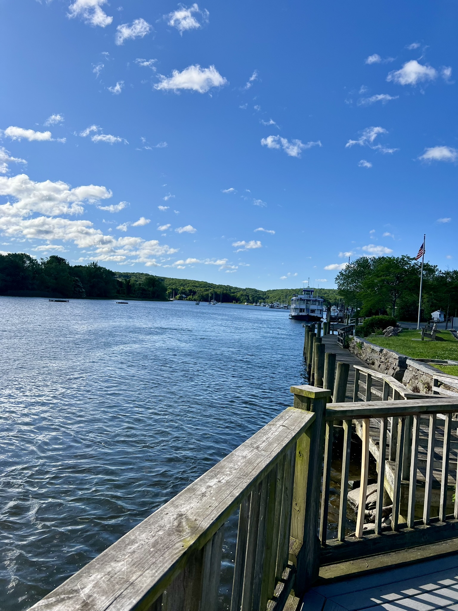
Eagle Landing State Park, Haddam and East Haddam Town Center
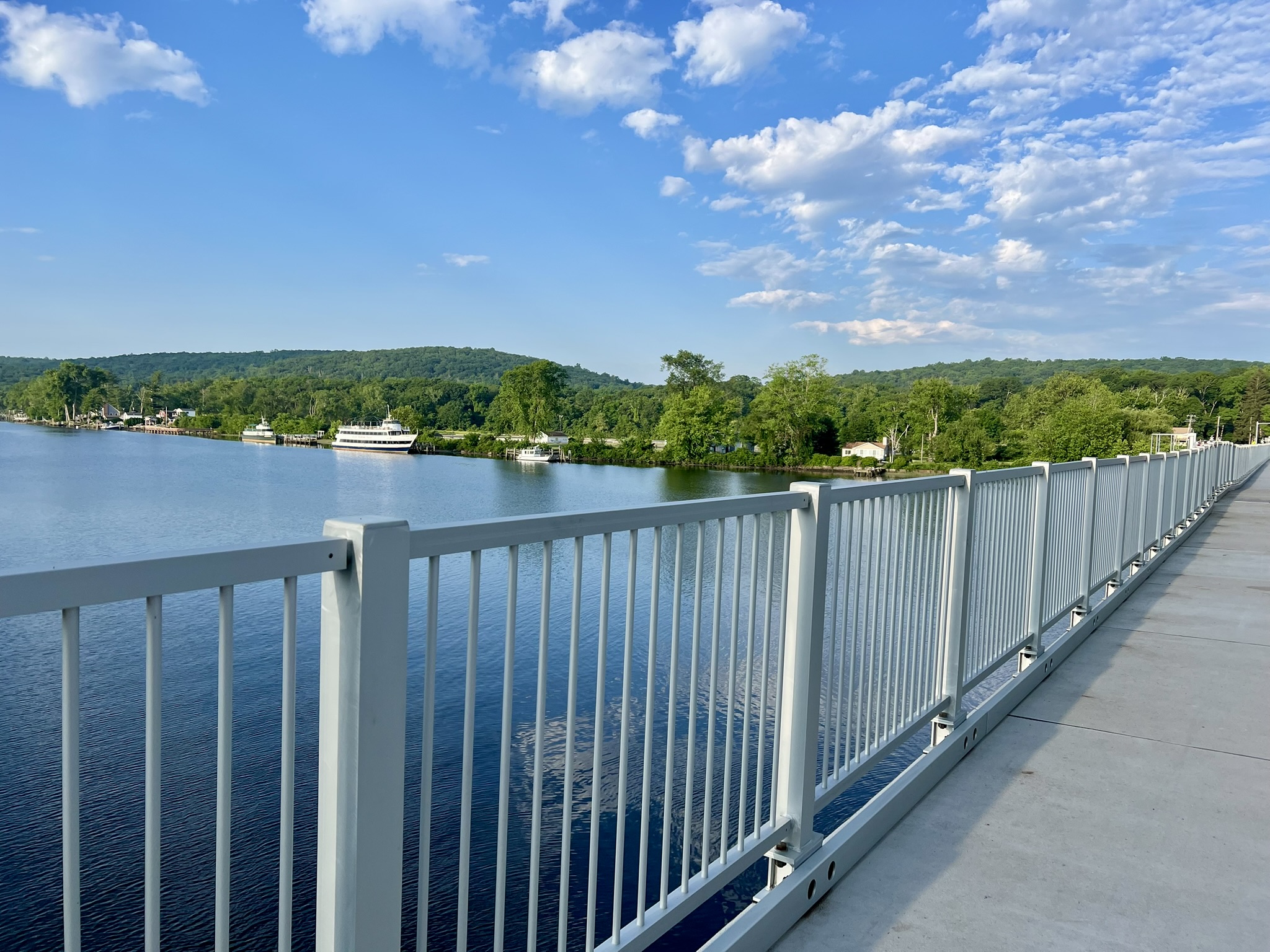
Continuing south on Route 154 to Tylerville and turning onto Route 82 will bring you to Eagle Landing State Park. This “park” is mostly a series of large gravel parking lots for river boat cruises, so I was delighted when I stopped by in early May and discovered a brand new fishing pier. When I looked it up, I found this press release from April 25th. The new pier is a joint Amtrak/DEEP project to provide an alternate fishing location because the Ferry Landing boardwalk and pier in Old Lyme is closed for a bridge replacement project. A new concrete sidewalk leads to the pier from the last parking lot. There are two benches, multiple pole holders, a line recycling container, and several pans to measure and gut fish. The pier has views of the East Haddam Swing Bridge and Goodspeed Opera House upstream, and a small plane airport directly across the river.
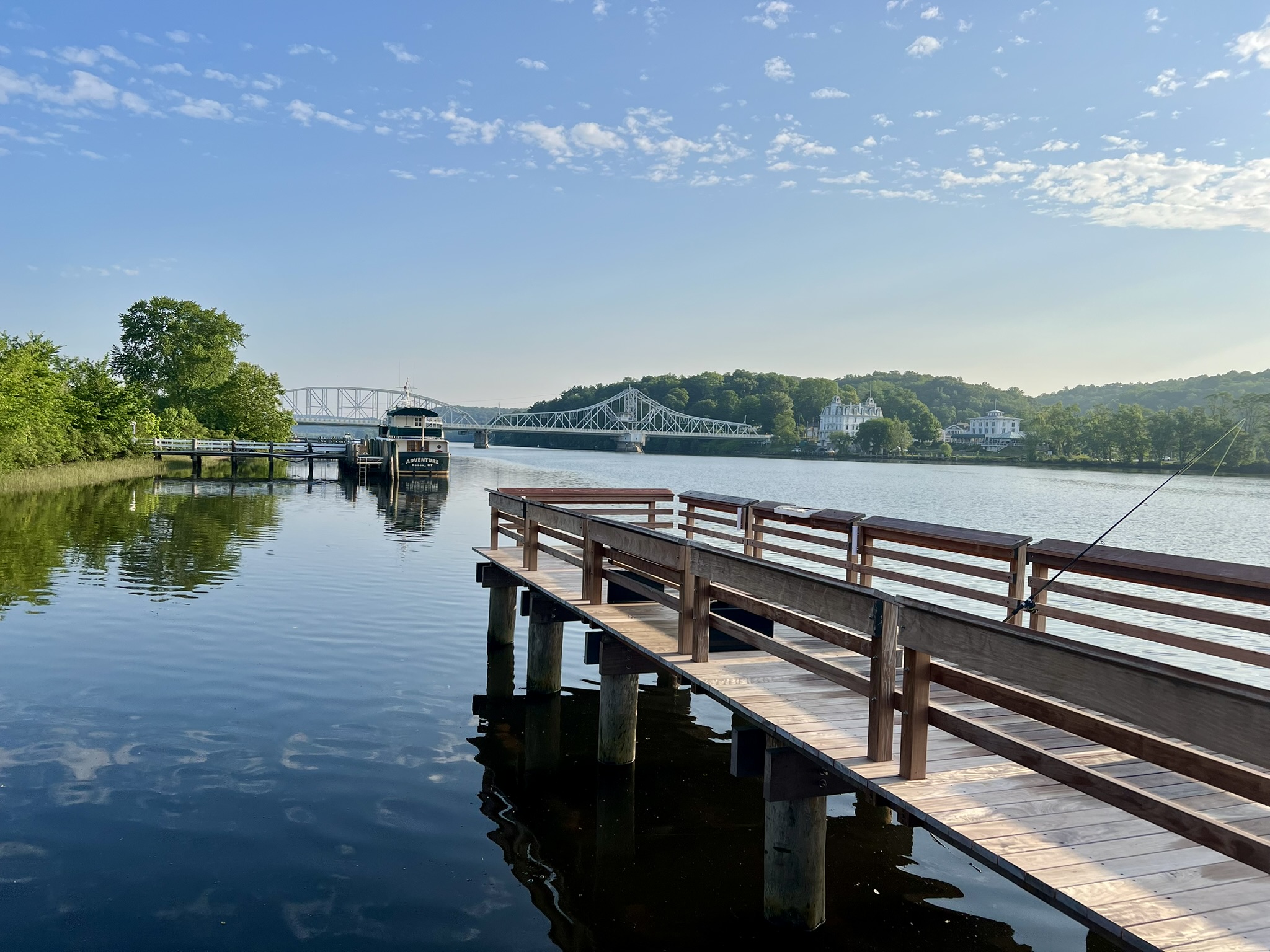
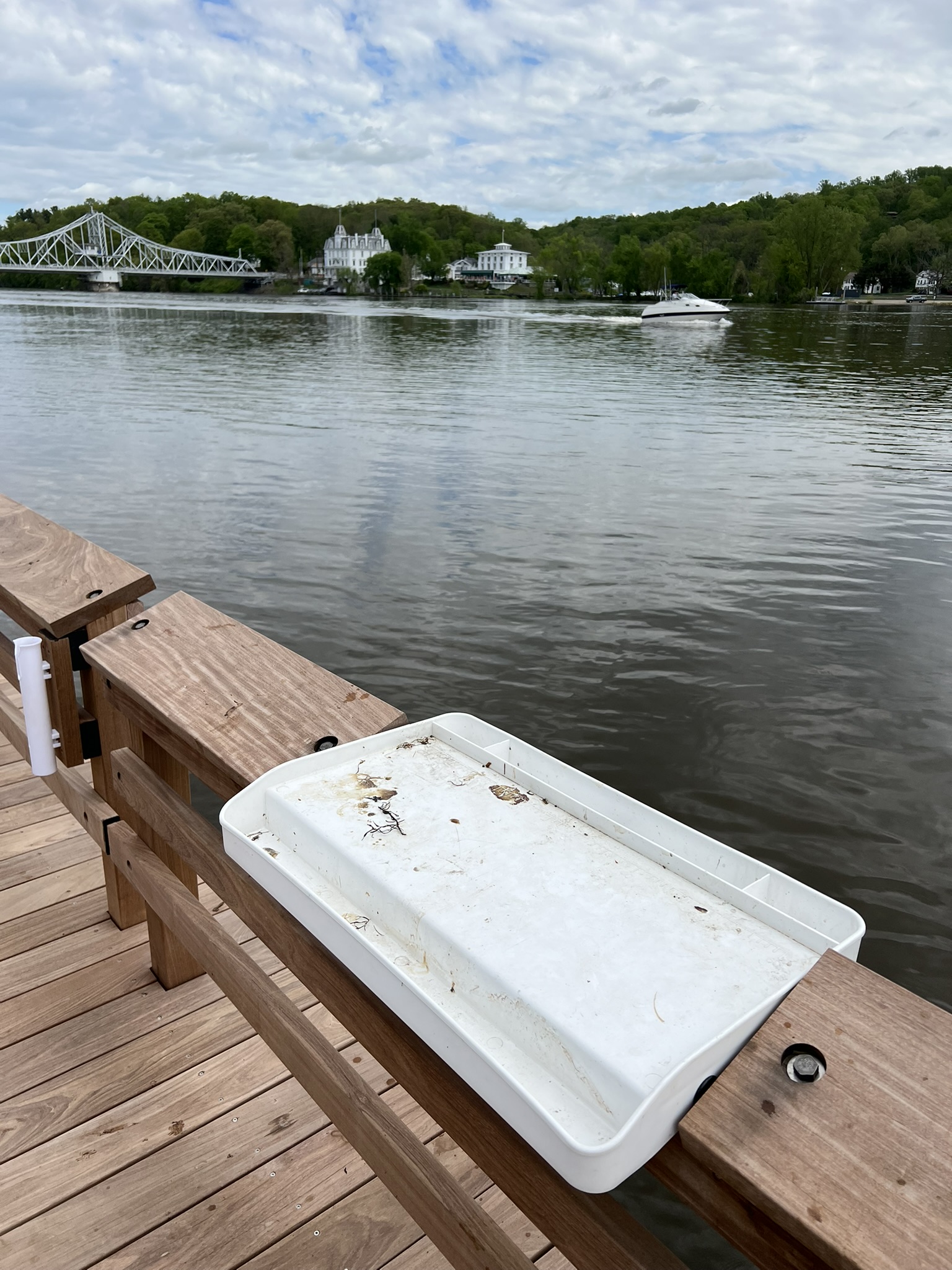

From left to right: the new pier on the first day of summer with the swing bridge in the distance; a fish gutting and measuring station; the entrance to the new pier
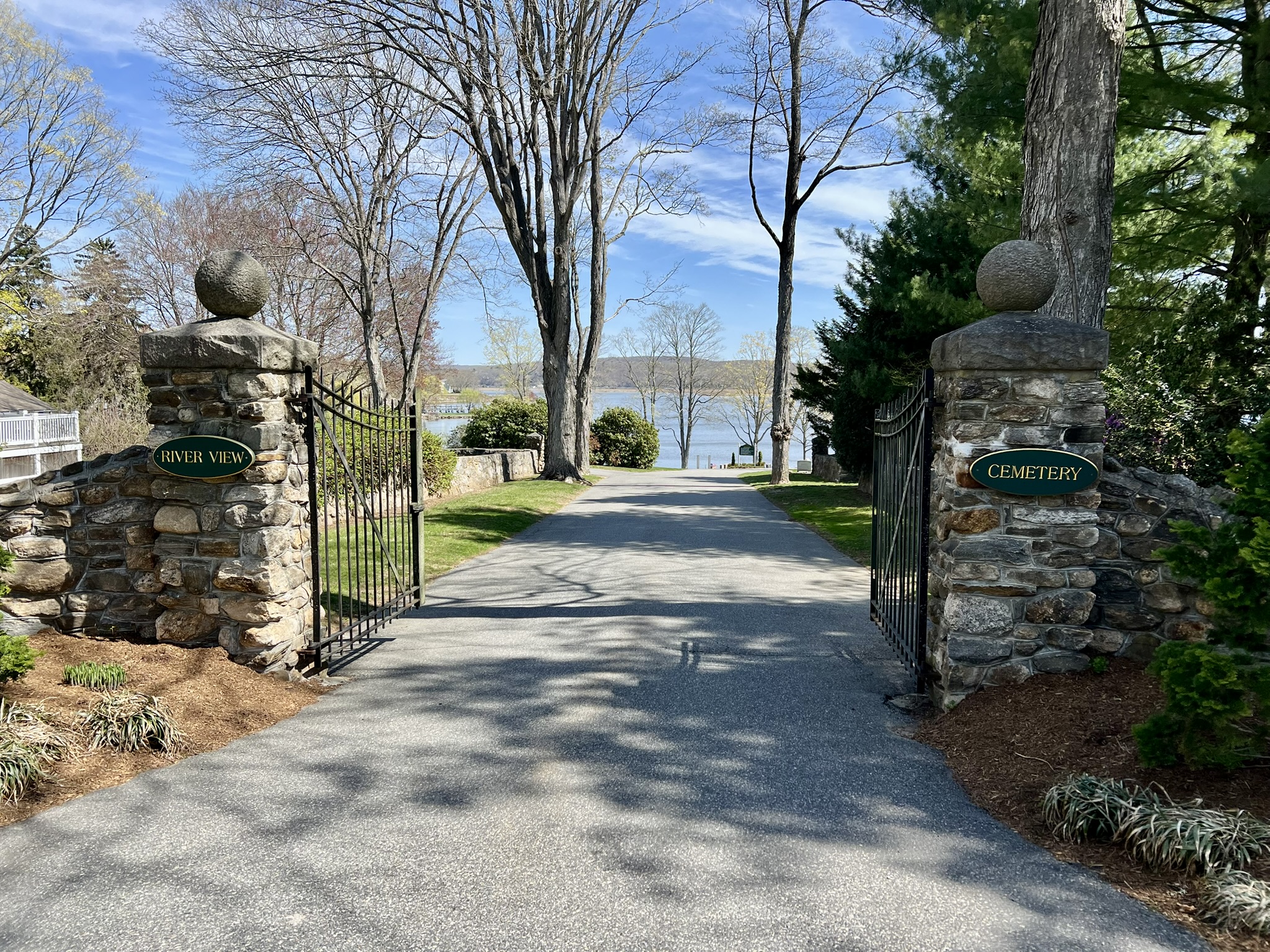
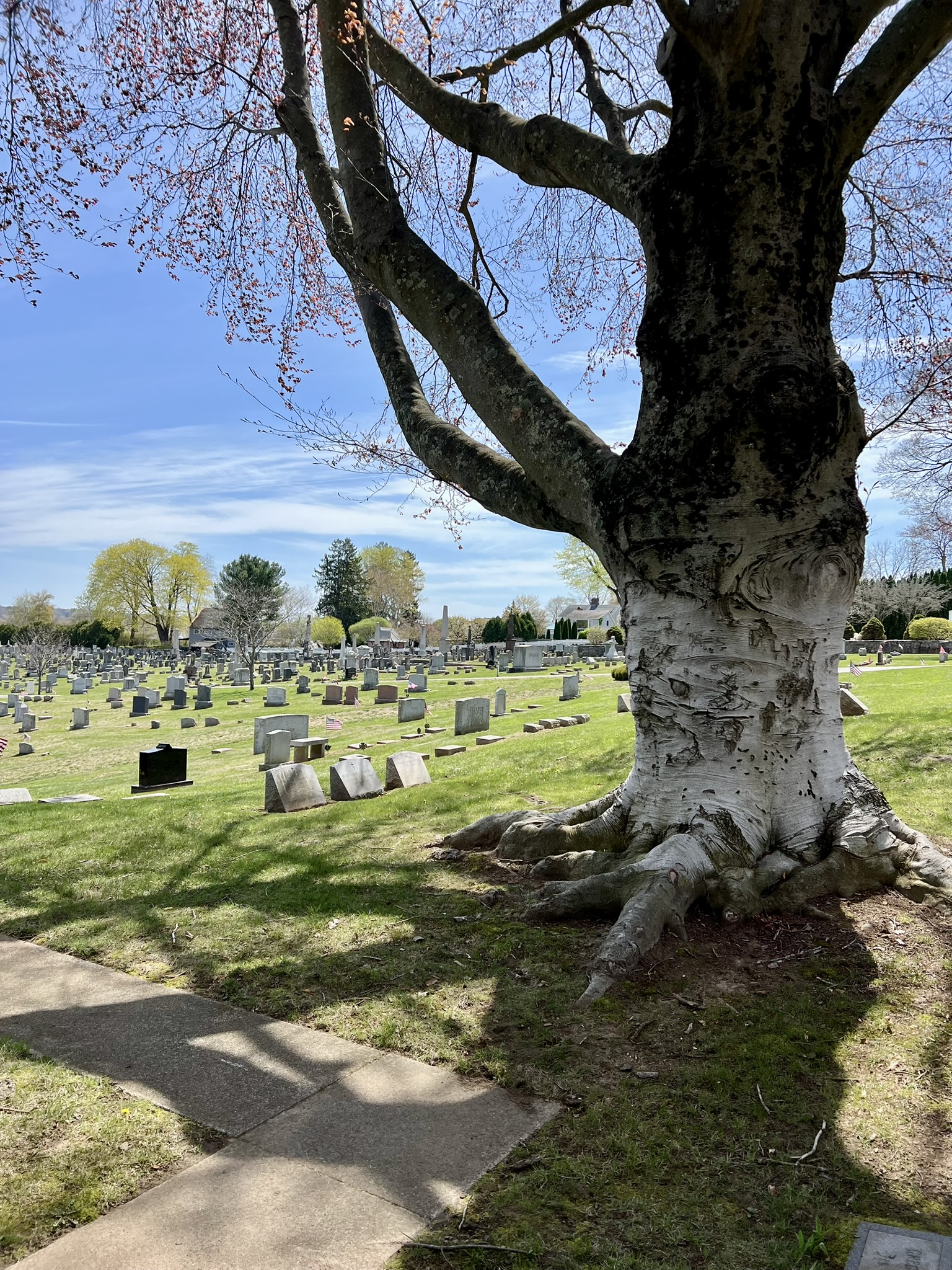
I returned on the first day of summer for a walk, starting at the pier where I encountered a local resident fishing for catfish. From there, I walked across the brand new pedestrian bridge built alongside the historical East Haddam Swing Bridge, which officially opened on June 14, 1913. Upon crossing the bridge I took a left on Route 149, heading up the hill and followed the signs for the Nathan Hale Schoolhouse which sits on a lovely perch above the river. While it was not open at that hour, the grounds were lovely, with several picnic tables and a bench overlooking the river (although the river was somewhat obscured by the foliage). Back at the main road I admired St. Stephen’s Episcopal Church in its “new” location (learn more below in the section on Duncan’s Preserve) and wandered around the adjacent River View Cemetery (not to be confused with the River View Cemetery in Essex that I highlight later on).


From left to right: view of the river and the new walkway from the East Haddam side; picnic tables and bench at the Nathan Hale Schoolhouse; the St. Stephen’s Episcopal Church.
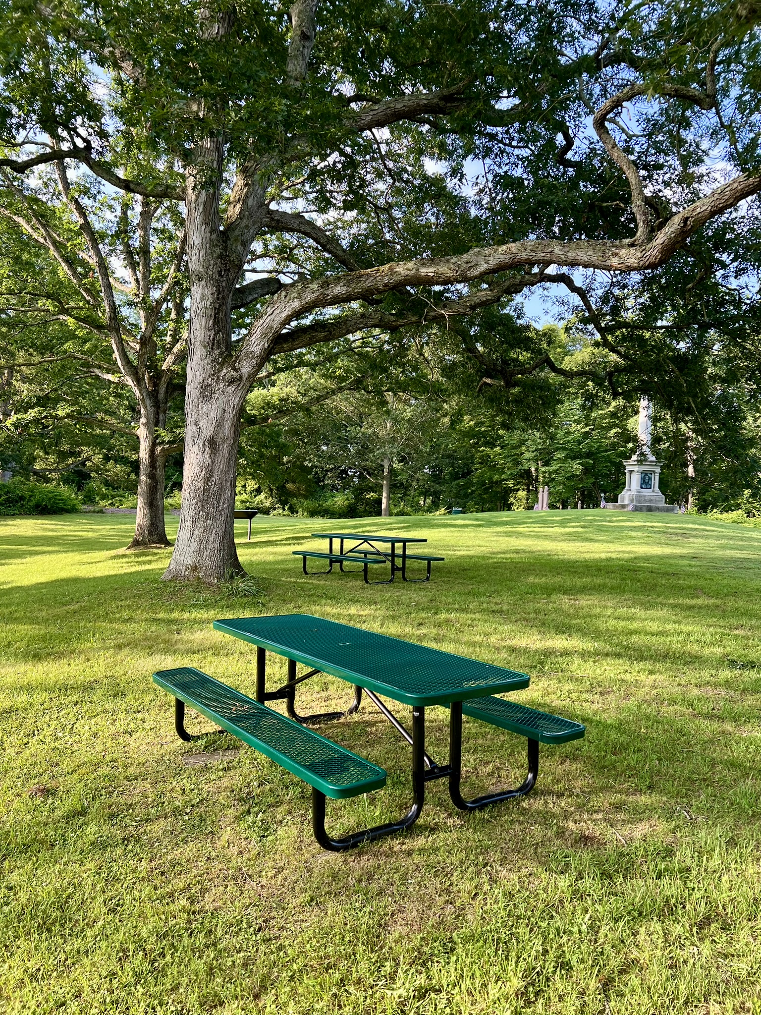
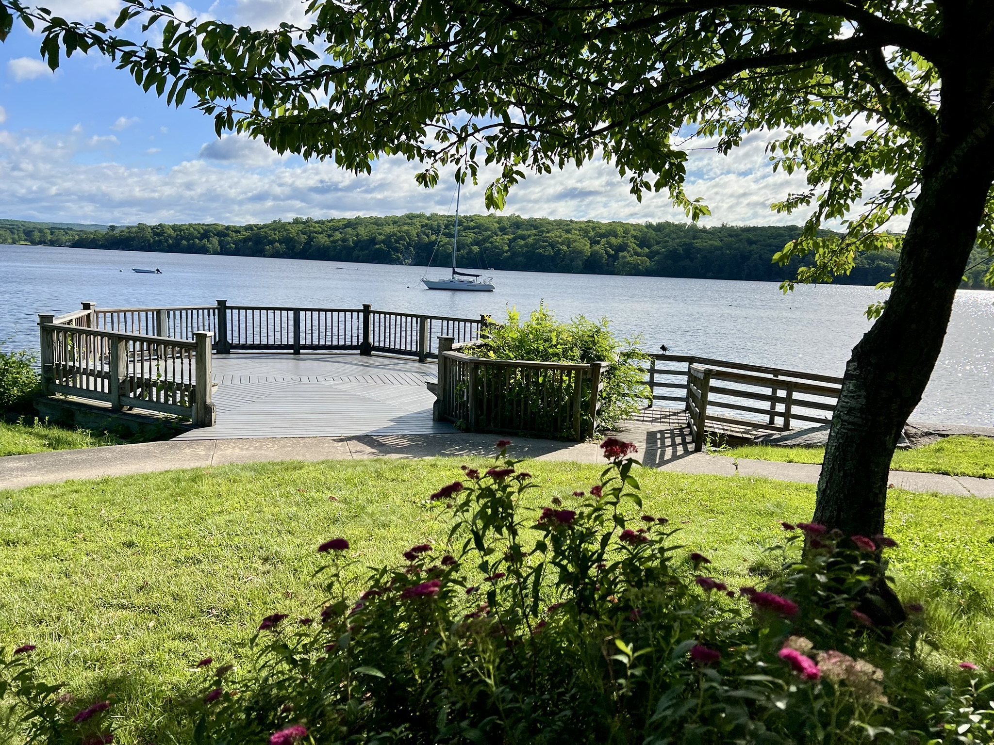
Retracing my steps, I walked down a side street towards the Theater Parking. Opposite the parking entrance I noticed a gazebo. Reading the plaque, I learned this tiny park is the Edgar D. Williams, Sr. Memorial Park, built on land donated to the East Haddam Rotary Club by his children. There is a gazebo and several picnic tables in need of some restoration work. Alongside, there is a small pond where I observed a great blue heron. Crossing the street and the theater parking lot I rested for a moment on a bench with a view to the bridge, then walked up the path to the Goodspeed Opera House. The green below the theater has several picnic tables overlooking the river. Returning across the bridge to my car, I recorded a total walk of 2.2 miles.
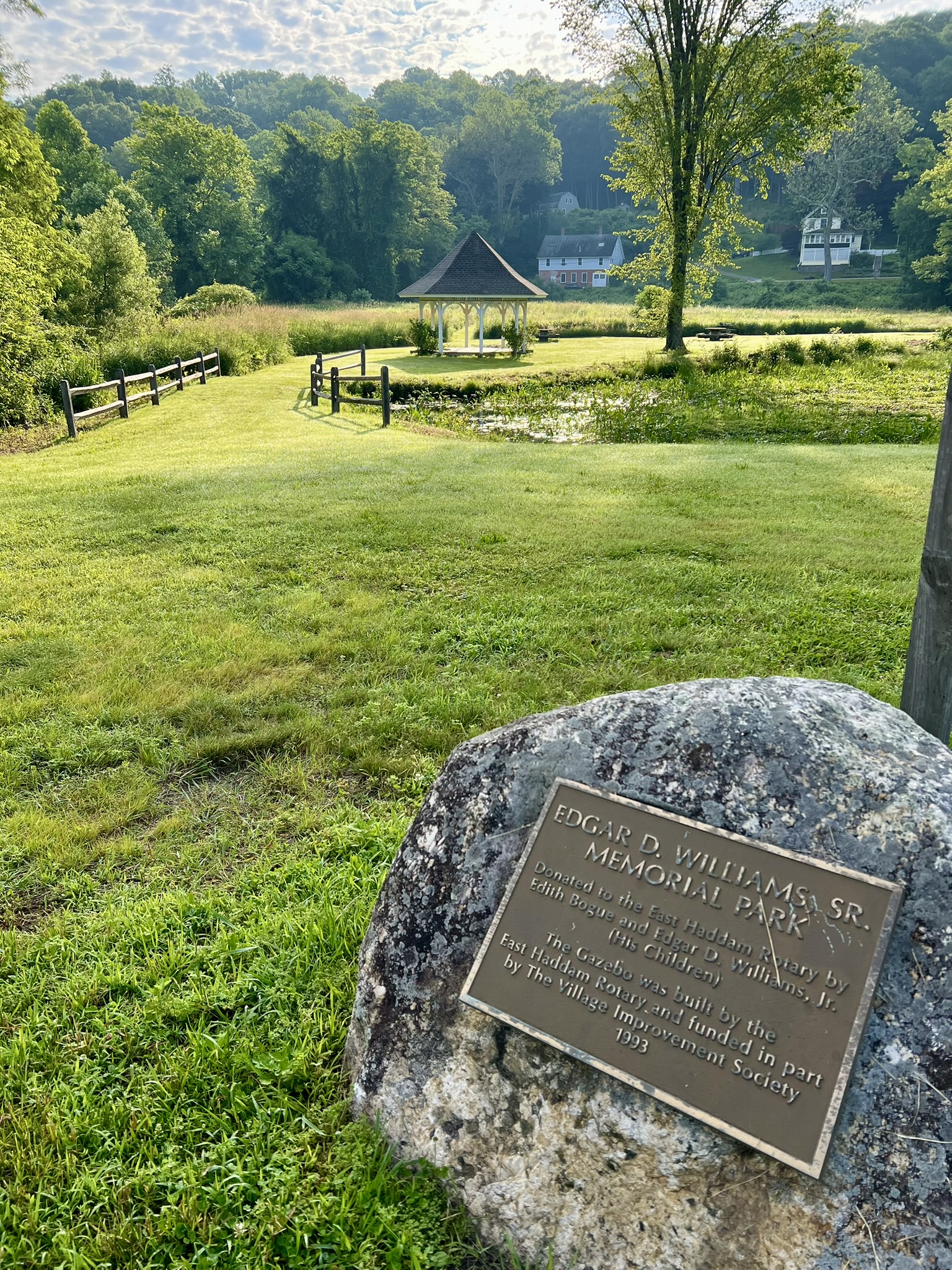

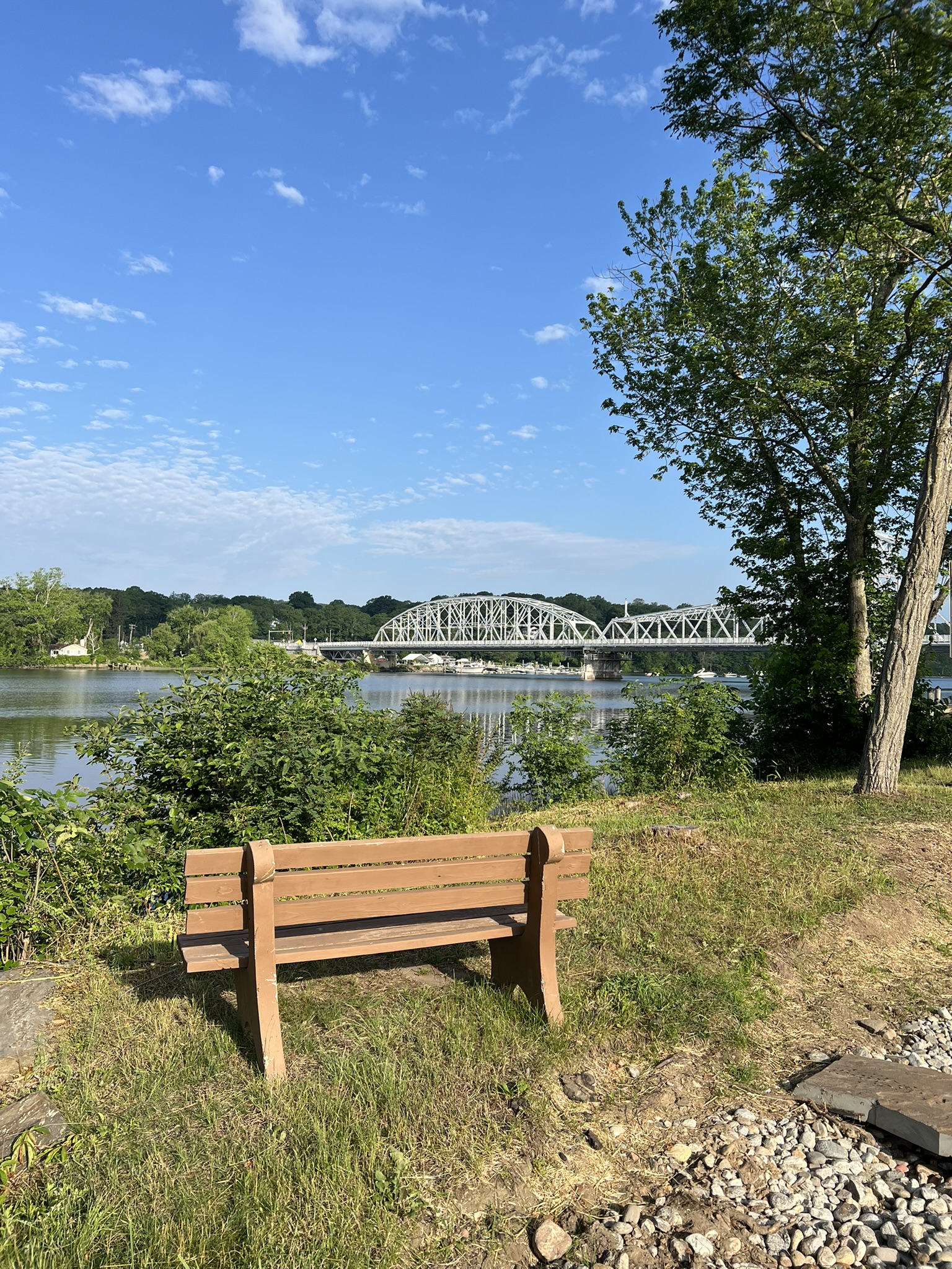
From left to right: The Edgar D. Williams, Sr. Memorial Park with gazebo and picnic tables; bench overlooking the river in the Theater Parking Lot; View of the Goodspeed Opera House
EAST HADDAM
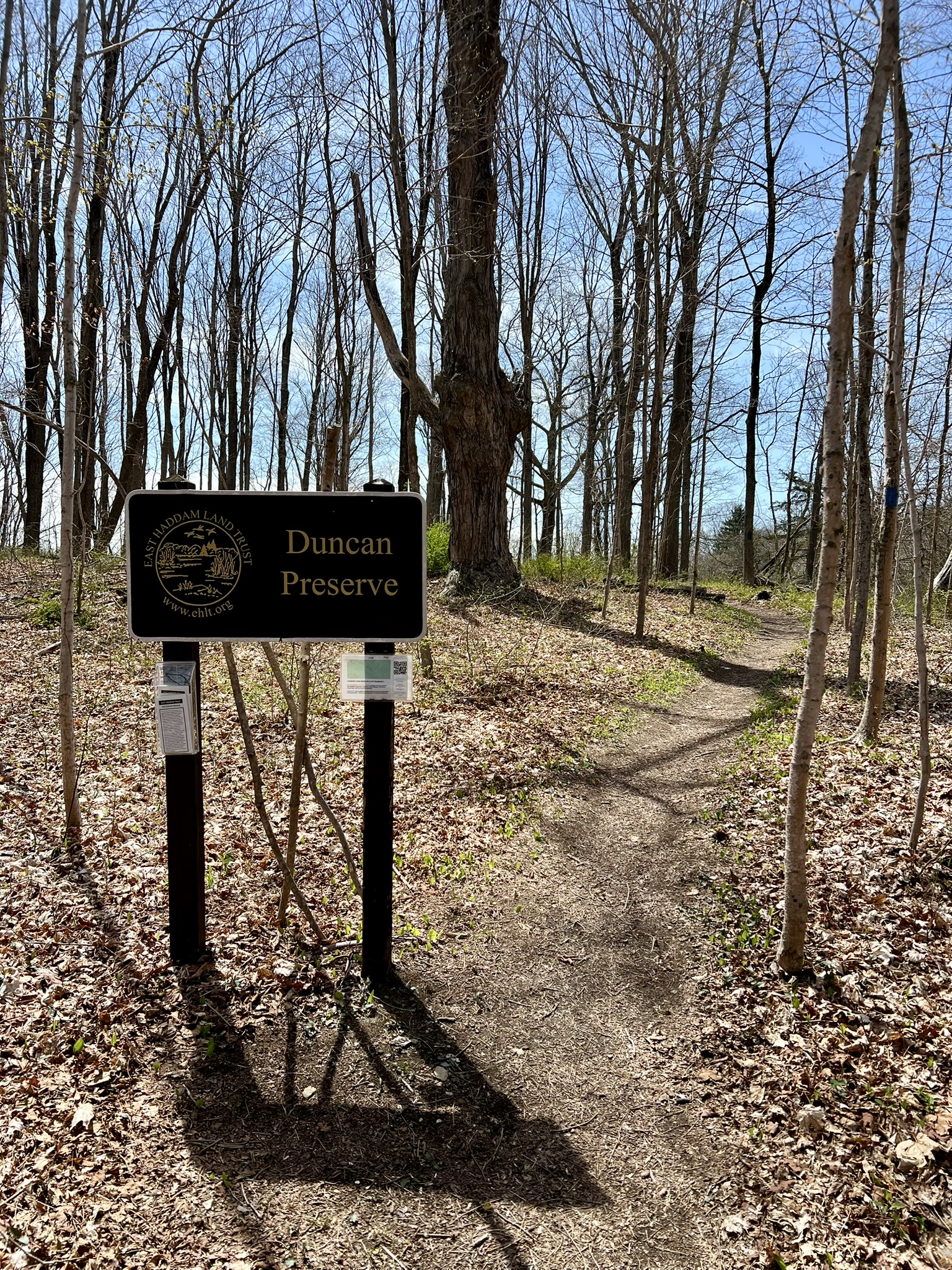
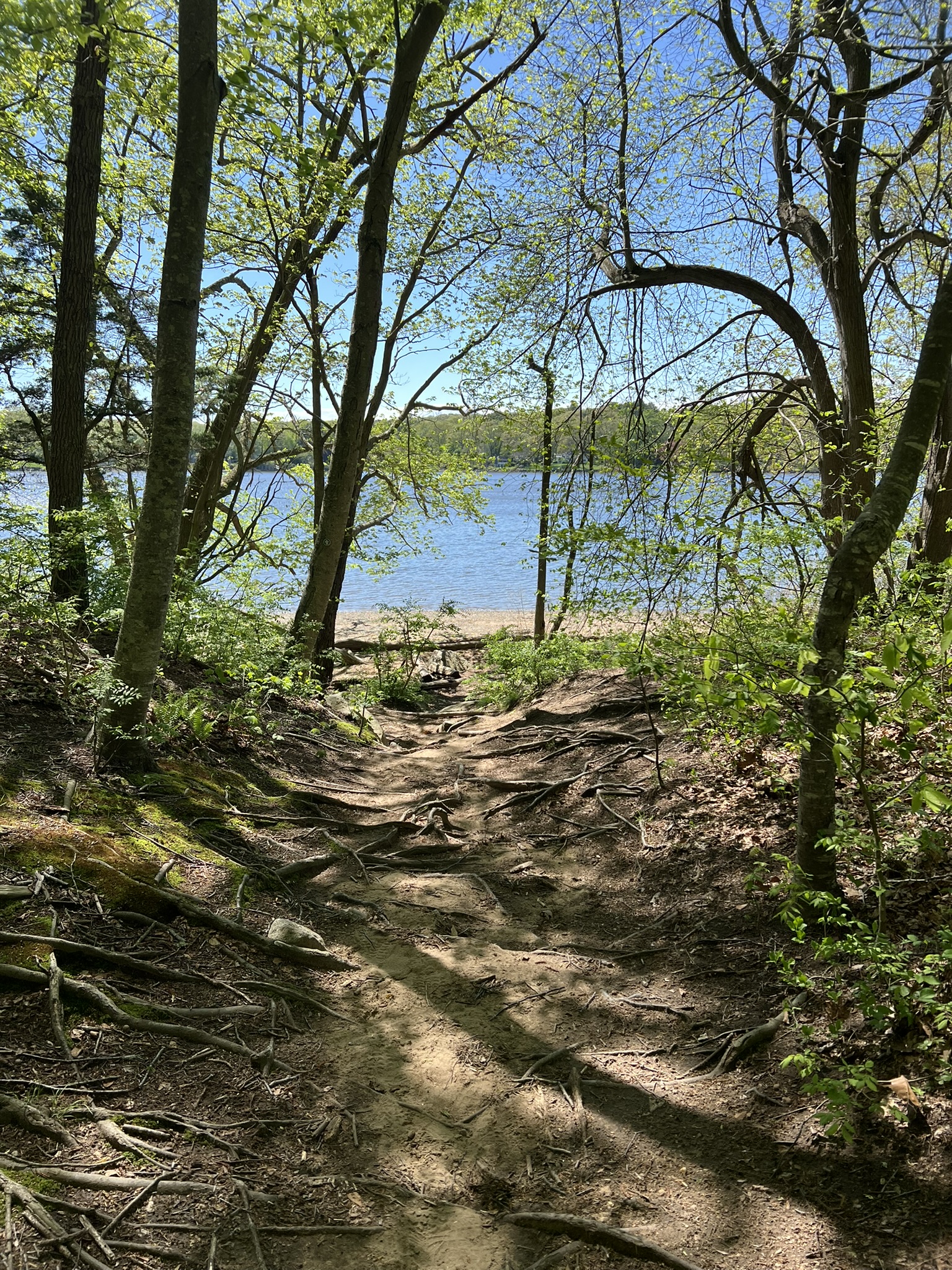
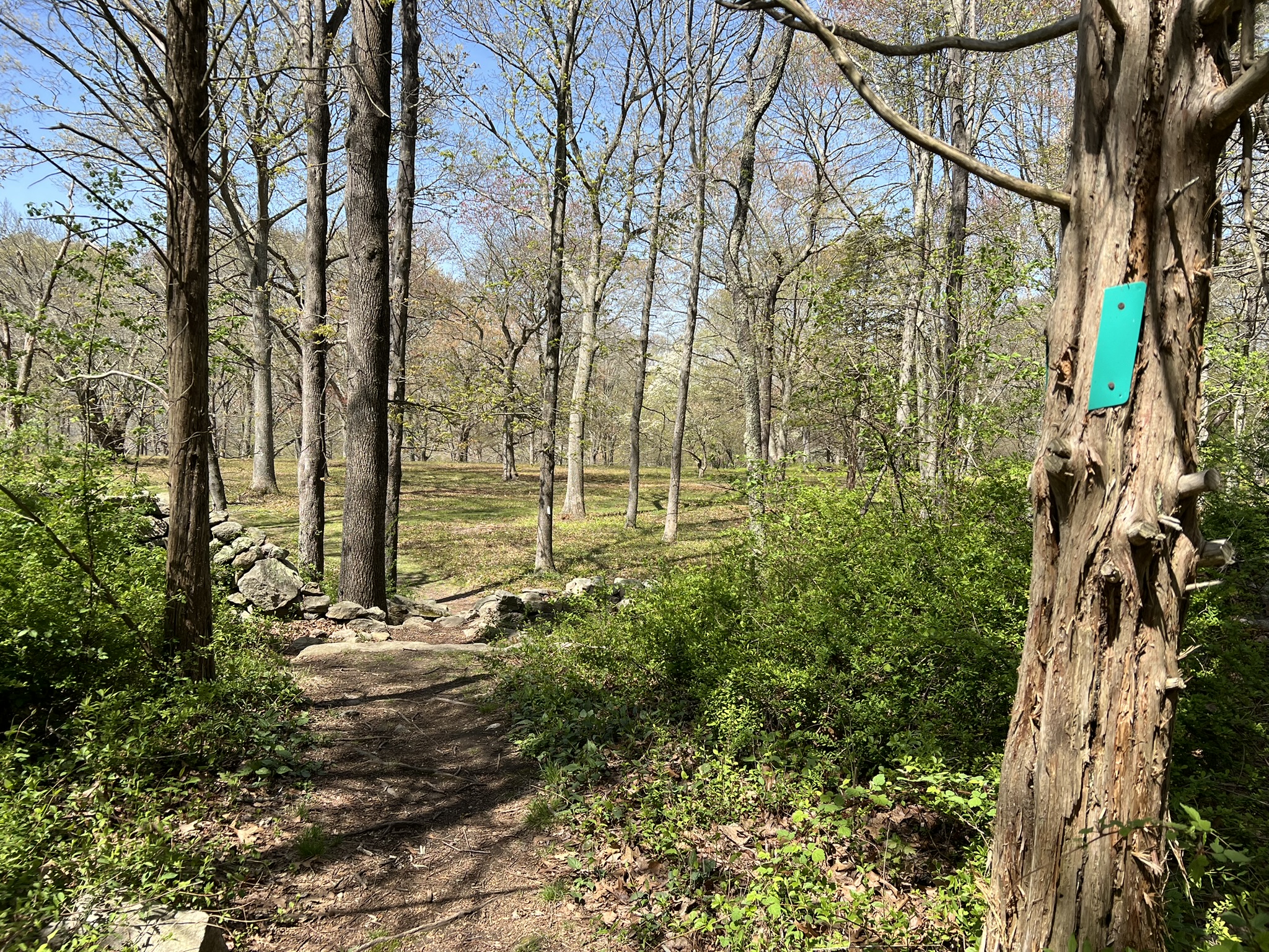
Duncan Preserve, East Haddam. 1 mile.
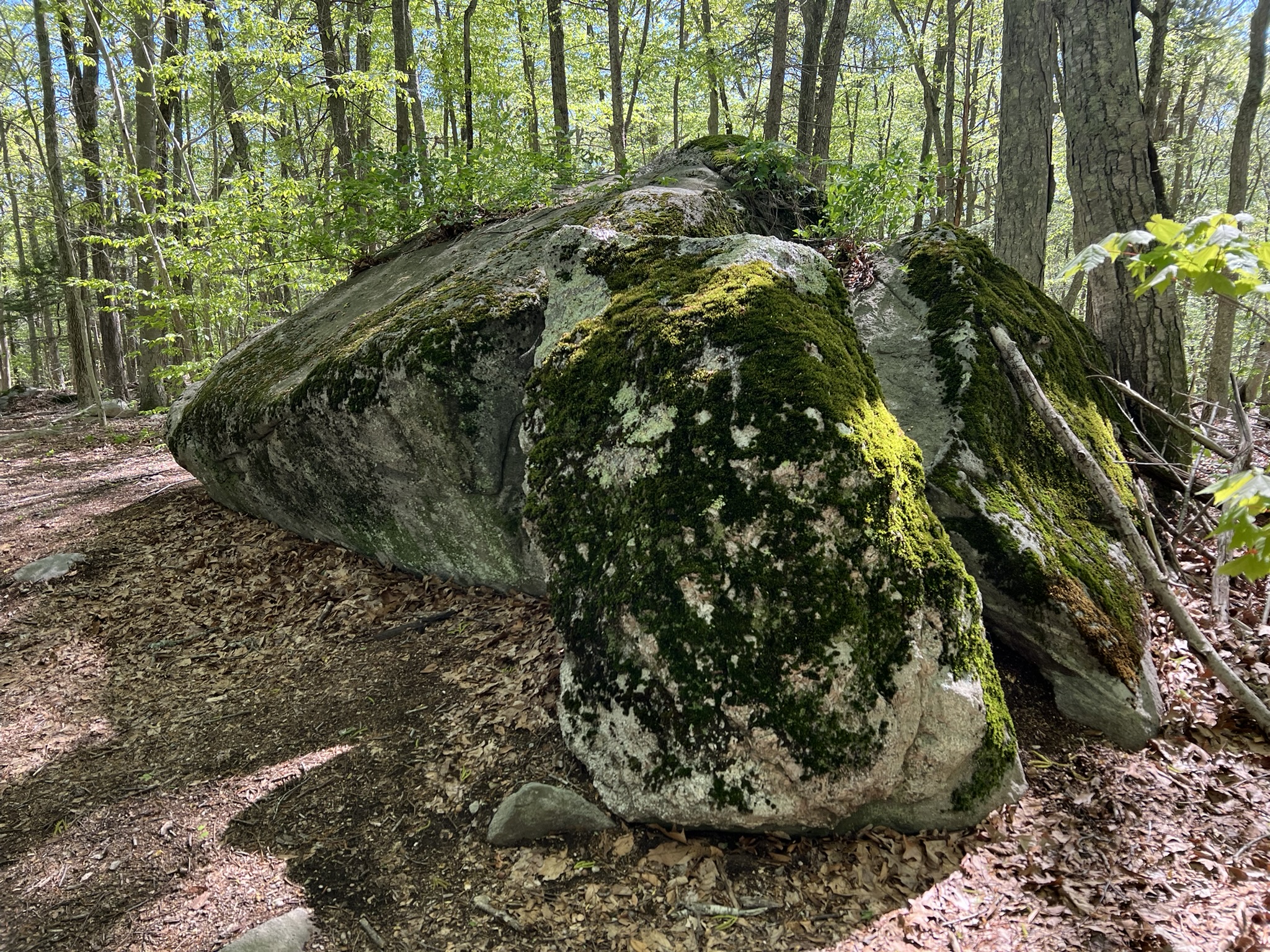
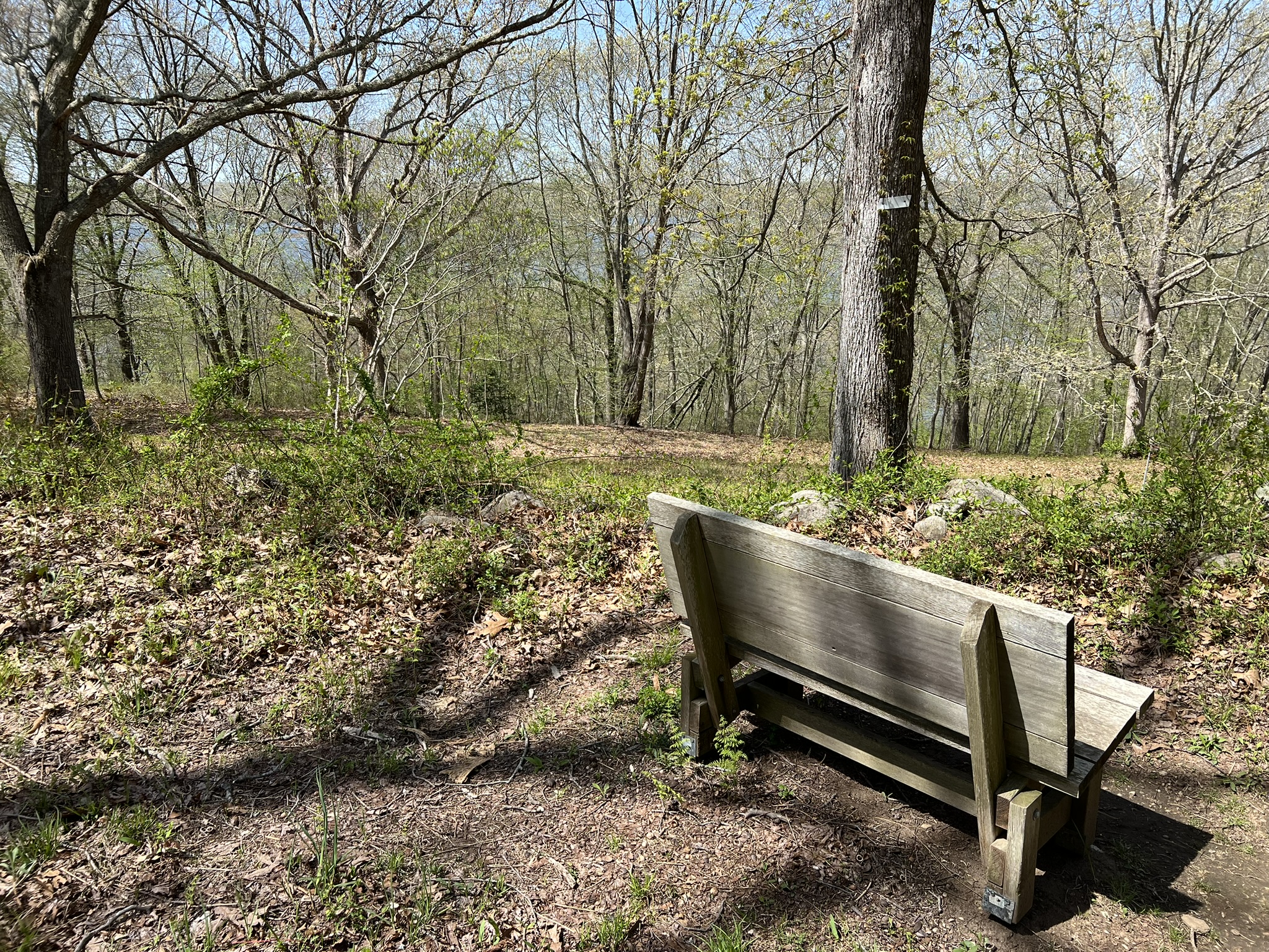
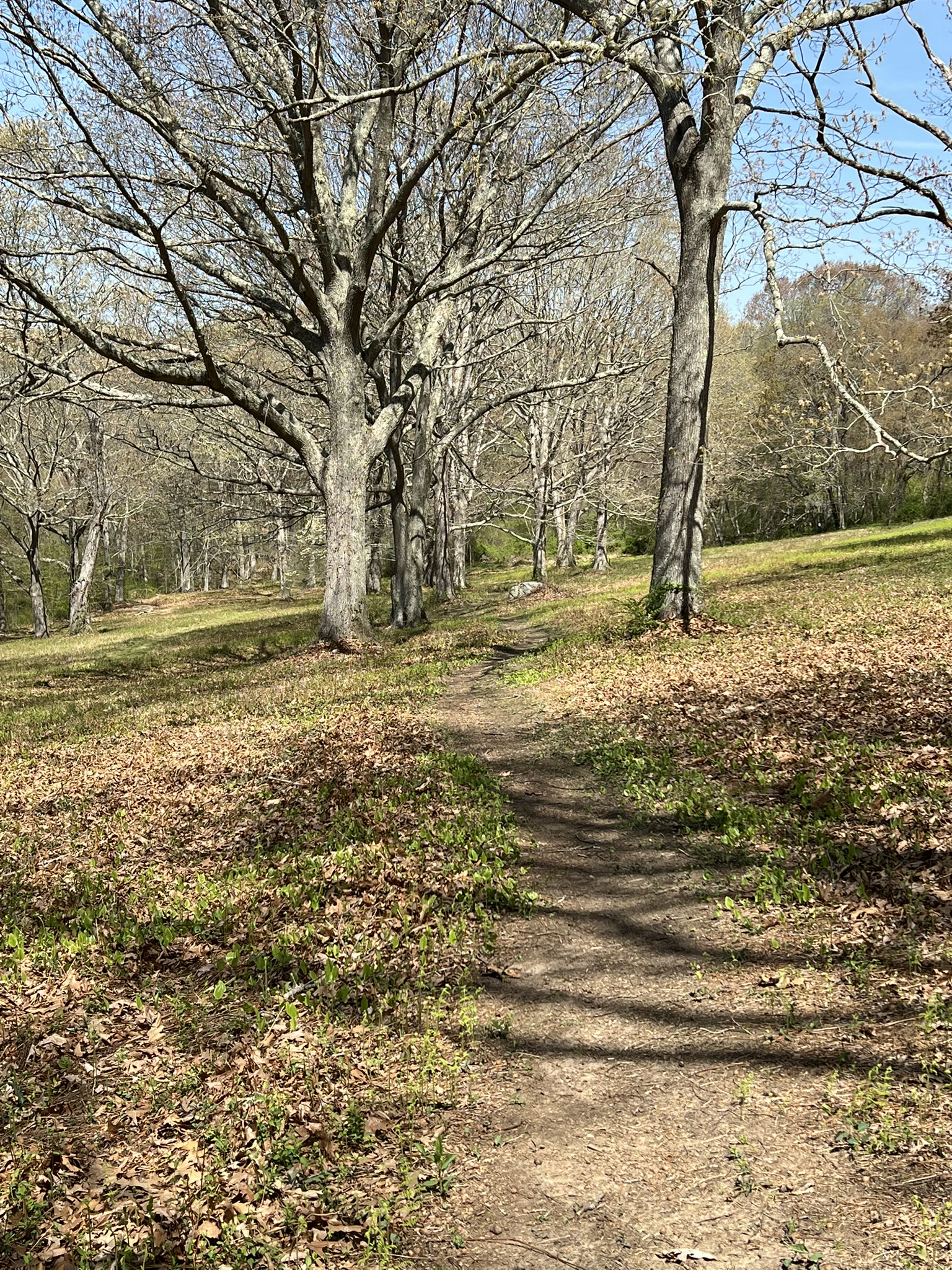
The parking for this sweet little preserve is on Porges Road where there is a pullout with room for several cars. I visited in April before the foliage blocked the river views. While the views will not be visible in summer, it is still a lovely hike, and can be combined with other nearby opportunities to experience the river. This property was acquired from the Duncan estate by the Connecticut River Gateway Commission and later donated to the East Haddam Land Trust. Volunteers have created two trails on the property shown on this TRAIL MAP: a blue loop trail and a bisecting red trail. A short distance from the trailhead is the original site of St. Stephen’s Episcopal Church, constructed in 1791 and moved its current location on Main Street in 1921. There are some of the original foundation stones and a signboard with details about the Church’s history. From there, the trail descends steeply to the site of an old rock quarry which provided much of the stone used in the construction of the Church. When the blue trail diverged, I stayed to the right to do a counter-clockwise loop, ignoring the next intersection with the red trail and continuing straight. After a short distance I reached a rocky outcropping with a double Adirondack Chair that offered seasonal views of the Connecticut River. I hadn’t planned on taking a break this early in my hike but I could not resist. From there, the trail parallels the river for a distance before looping around. When I reached the other red trail intersection I took it to cross back to the blue trail, then followed blue past the rock quarry until I once again reached the red trail. At this point I retraced my steps to my car. I managed to eke out just over one mile.

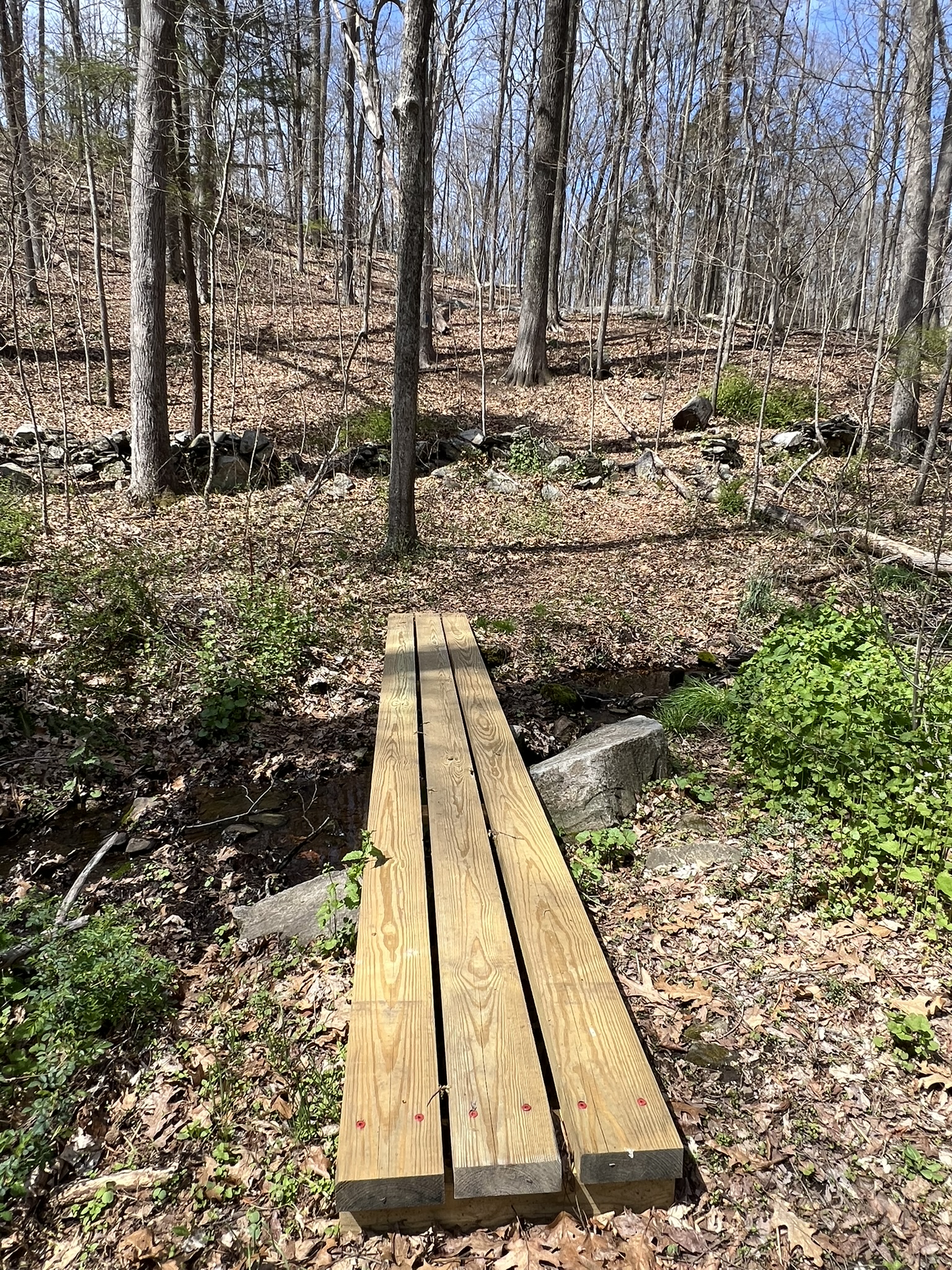
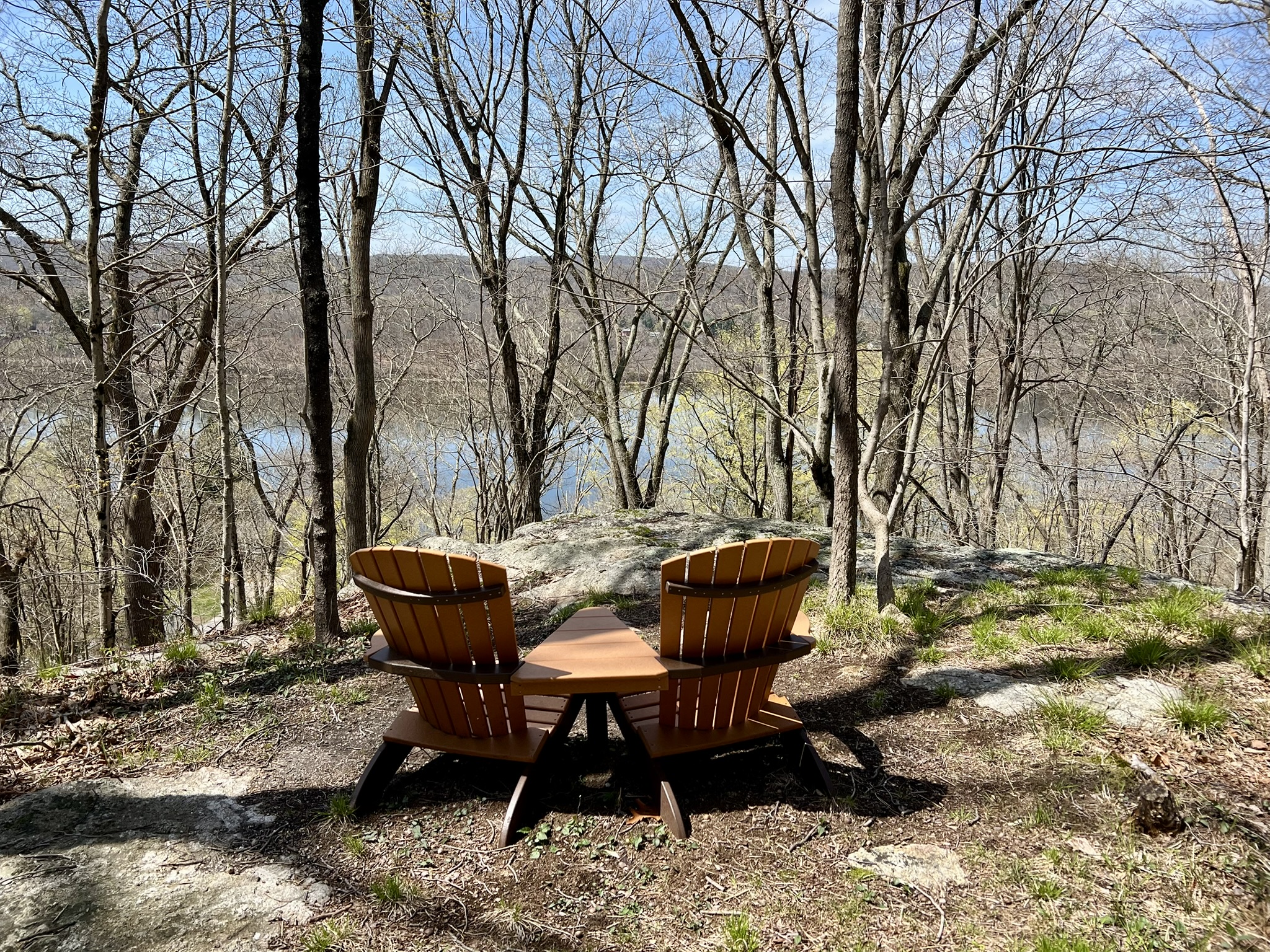
from left to right: the preserve entrance; the steep descent; bog bridging over a stream; the lookout and resting spot
EAST HADDAM/LYME
Gillette Castle State Park, East Haddam/Lyme.
According to the website, the castle was “built in 1914 by William Hooker Gillette, the actor, director, and playwright most famous for his portrayal of Sherlock Holmes. The ornate, 14,000-square-foot stone fortress sits 200 feet over the Connecticut River…and is surrounded by 184-acres of gorgeous Connecticut woodlands. After his passing, the State of Connecticut purchased the castle and adjoining acreage to create a state park.” (If you are interested in a castle tour, click the “Tour” button on the website for details. Advanced booking is recommended.) I visited on a blustery day in early April to explore the red and blue trails – the two trails closest to the river as shown on this TRAIL MAP. I started on the red trail which begins after passing through the archway on the approach to the castle on the upstream (right) side. I followed the trail in a clockwise direction, going closest to the river to start. The trail is steep in places, often with eroded sections to navigate. There are mostly seasonal views of the river through the trees, and several side trails that end abruptly. The trail gets more interesting at the point where it dips down to the water’s edge. Here there is a picnic table and good views of the river. As the trail loops back it passes through some of the interesting rock structures and landscape features Gillette incorporated into his property. The trail connects to the yellow trail which returns the castle. The trail map lists the mileage as .41 but I clocked it at .70 including a few short detours onto the unmarked sections. Before exploring the blue trail I took in the views from the “Grand Central Station” pavilion and the Castle’s terrace. These locations offer the best unobstructed views of the river from a high vantage point. I spent some minutes watching the Chester/Hadlyme Ferry cross the river.


from left to right: erosion on a section of red trail; picnic table near the river; a quirky bridge on the yellow trail; the Chester/Hadlyme Ferry crosses the river
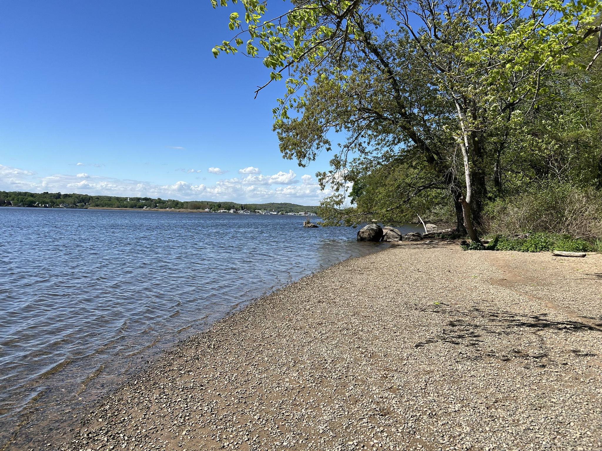
After taking in the views I crossed to the downstream (left) side of the castle and located the blazes for the blue trail down a set up steps. This was my favorite of the two trails. I did a clockwise loop following the blue trail to the bottom and the gravel road back to the parking lot. After descending the steps the trail climbs to the top of a scenic knoll before starting a series of downhill switchbacks. When the trail meets the gravel road look for the blue markers that continue on the opposite side. This descends all the way to road level, where there is a “foot traffic only” entrance from Ferry Road. As the gravel road winded back up, I saw a small footbridge with a blue blaze. This section of trail leads down a series of railroad tie steps to the banks of the Connecticut River. There is a lovely section of beach here, and a grassy lawn with picnic tables and grills. You can even camp overnight with an advance reservation, but only if you arrive by canoe or kayak.


From left to right: the start of the blue trail from the Castle; the footbridge where the blue trail continues; steps to the beach; the beach at higher tide
After I returned home I discovered videos online explaining some features I had overlooked, as well as this more informative history and trails map created by the Friends of Gillette Castle. I learned from one video that at low tide, I would be able to see some of the historical remains of the Aunt Polly, Gillette’s 142’ long boat. According to legend, Gillette was cruising in the Aunt Polly in 1913, when he stopped at the Ferry Landing. Exploring the adjacent hillside and seeing the incredible views, he decided this was the spot where he would build his retirement home. The boat sprung some leaks and was permanently moored in 1924, then caught fire and was destroyed in 1932. Another video explains the history of the wooden house, which Gillette built for his valet and good friend, Yukitaka Osaki. I returned a few days later at low tide, this time accessing the area from the Hadlyme Ferry Boat Launch parking lot. Sure enough, I found remnants of the Aunt Polly along the beach across from the hiking trail stairs. I then wandered over to the Osaki House, where I discovered an informational sign describing Yukitaka Osaki’s history. From this location, you can take a ride on the historic Chester/Hadlyme Ferry, detailed below.

From left to right: the remnants of the Aunt Polly; the beach at low tide; the Yukitaka Osaki house
CHESTER
Chester/Hadlyme Ferry.
John Warner of Chester started a private ferry service in 1769 known as Warner’s Ferry. This service was assumed by the town in 1877, and then by the State of Connecticut in 1914. It is the second oldest continuously operating ferry in Connecticut. The current vessel, the Selden III, has been in operation since 1949. It is open April 1 through November 30 except for Thanksgiving Day. Check the WEBSITE to confirm hours and rate information. On the website you can also sign up for ferry alerts. I recommend doing this before making a plan, as the ferry can be closed due to bad weather or flooding. The fare is $5 per car on weekdays and $6 on weekends. Cyclists and pedestrians can take the ferry for $2. There is a large parking area on the Hadlyme side at the Hadlyme Ferry Boat Launch. Don’t miss the signs on the parking lot side of the iron rail fence that show the Historical Floods of the Connecticut River. On the Chester side there is a small parking area with room for a few cars, a bench and a couple of weathered picnic tables.
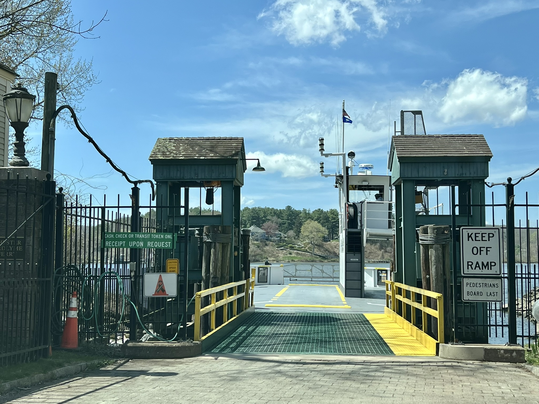

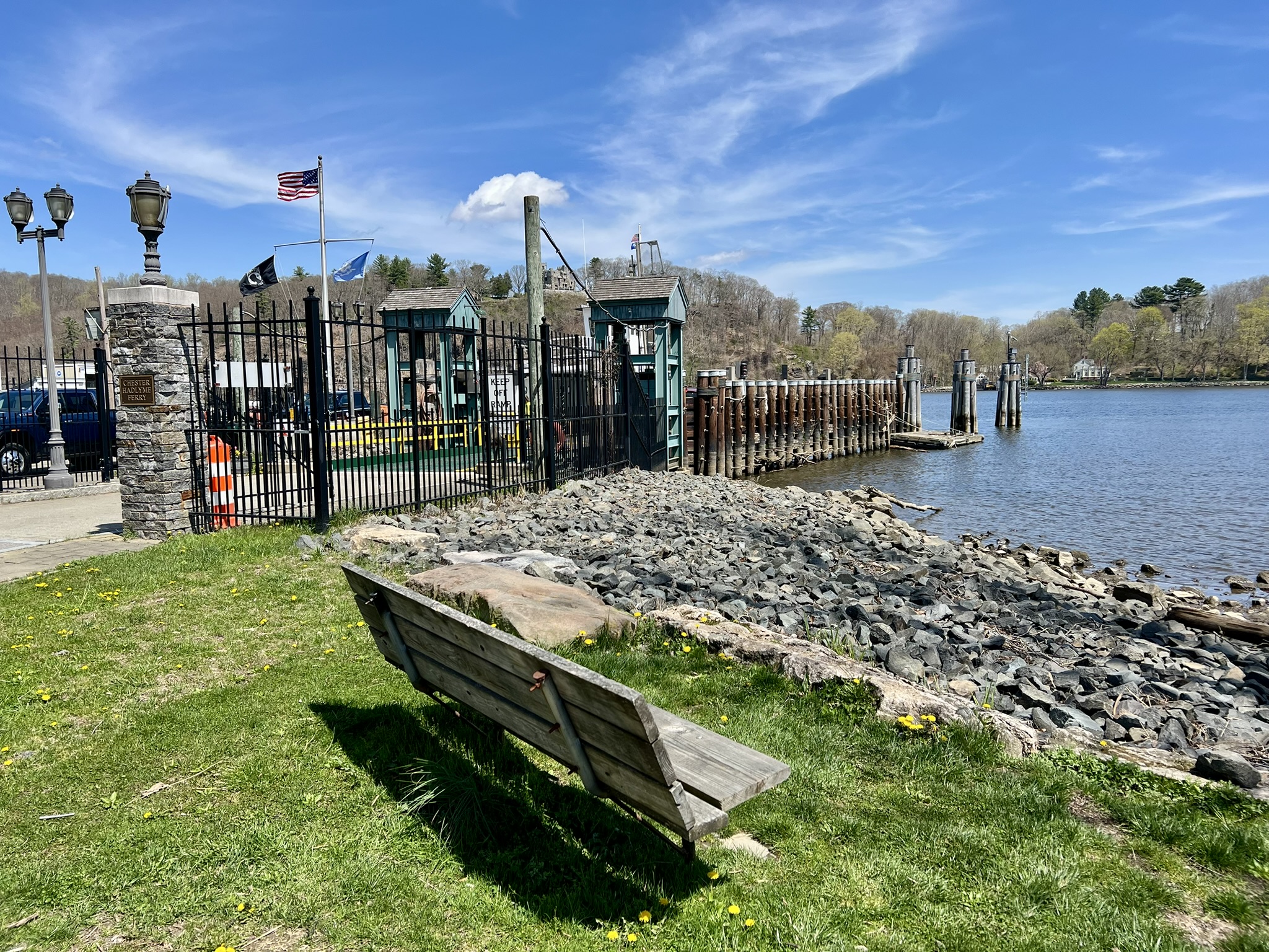
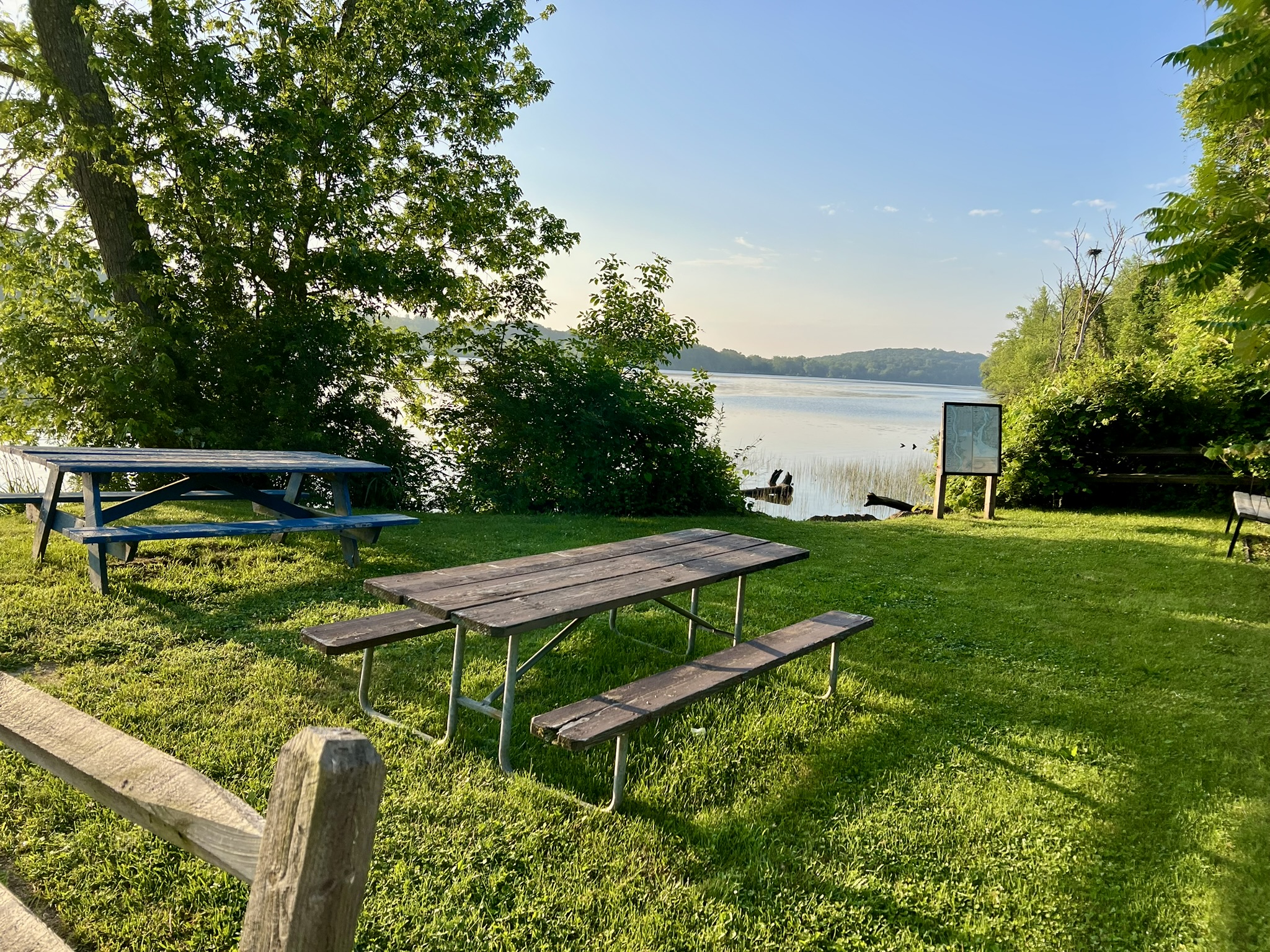
From left to right: waiting to get on the Ferry in Hadlyme; the signs showing historical flood levels; the small park with benches and picnic tables on the Chester side
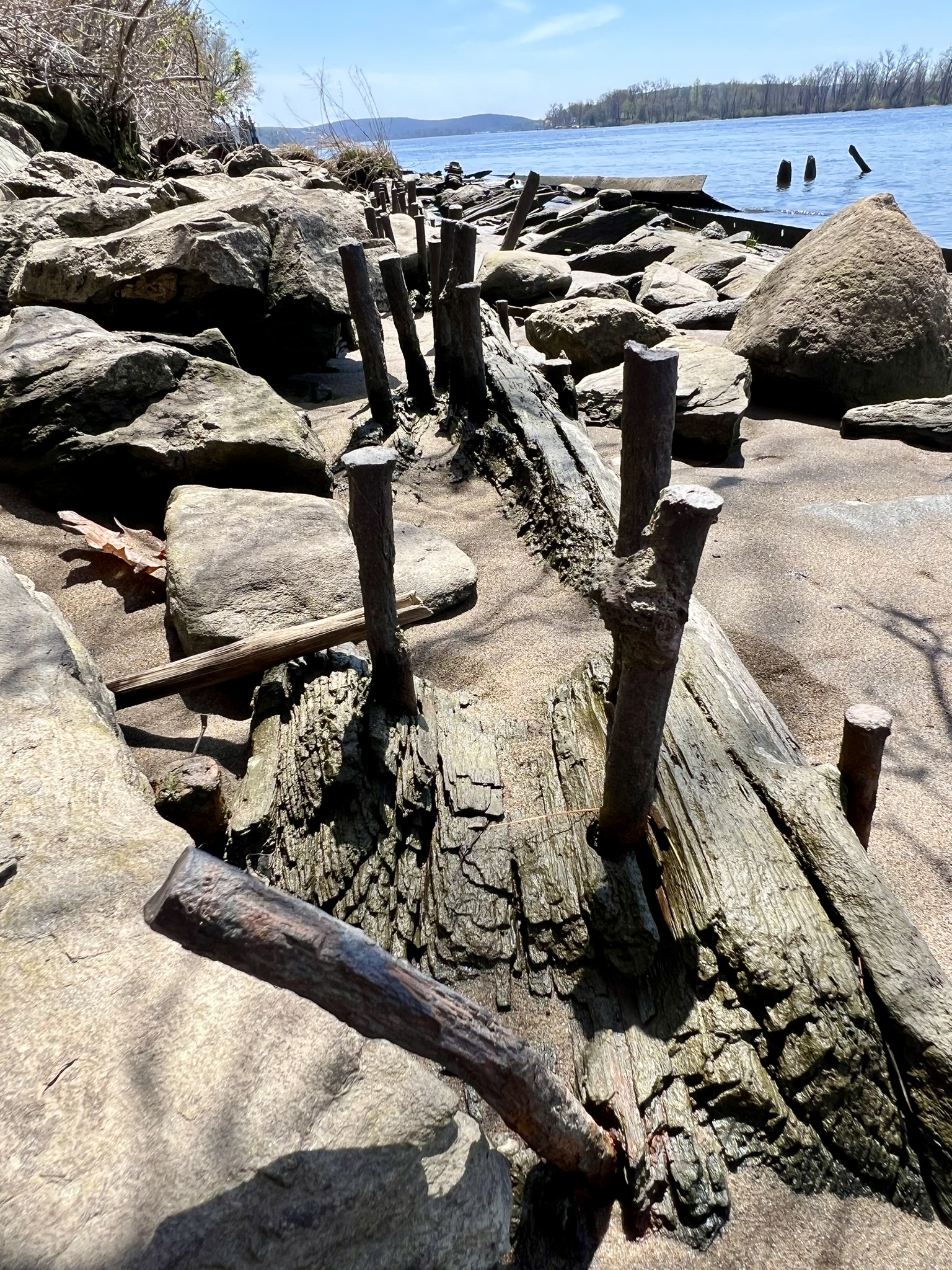
At the Chester park there is a signboard with a diagram of this section of river along with the types of fish that can be found there, and just downstream is an active osprey nest. For an additional bit of history, walk along Ferry Road less than ¼ mile to reach the old Hadlyme Rail Station. There is a signboard explaining the history of the railroad and ferry. In one of the photos you can see the Aunt Polly in the distance, docked on the opposite bank. (If you have your car, I recommend parking by the ferry and walking to the train station, as there is no good place to park along the road.)

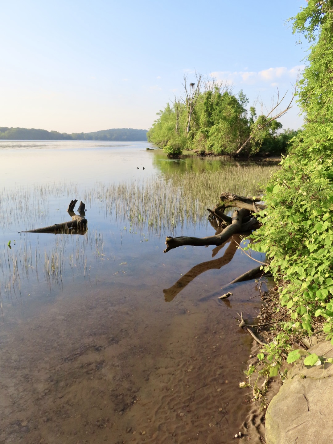
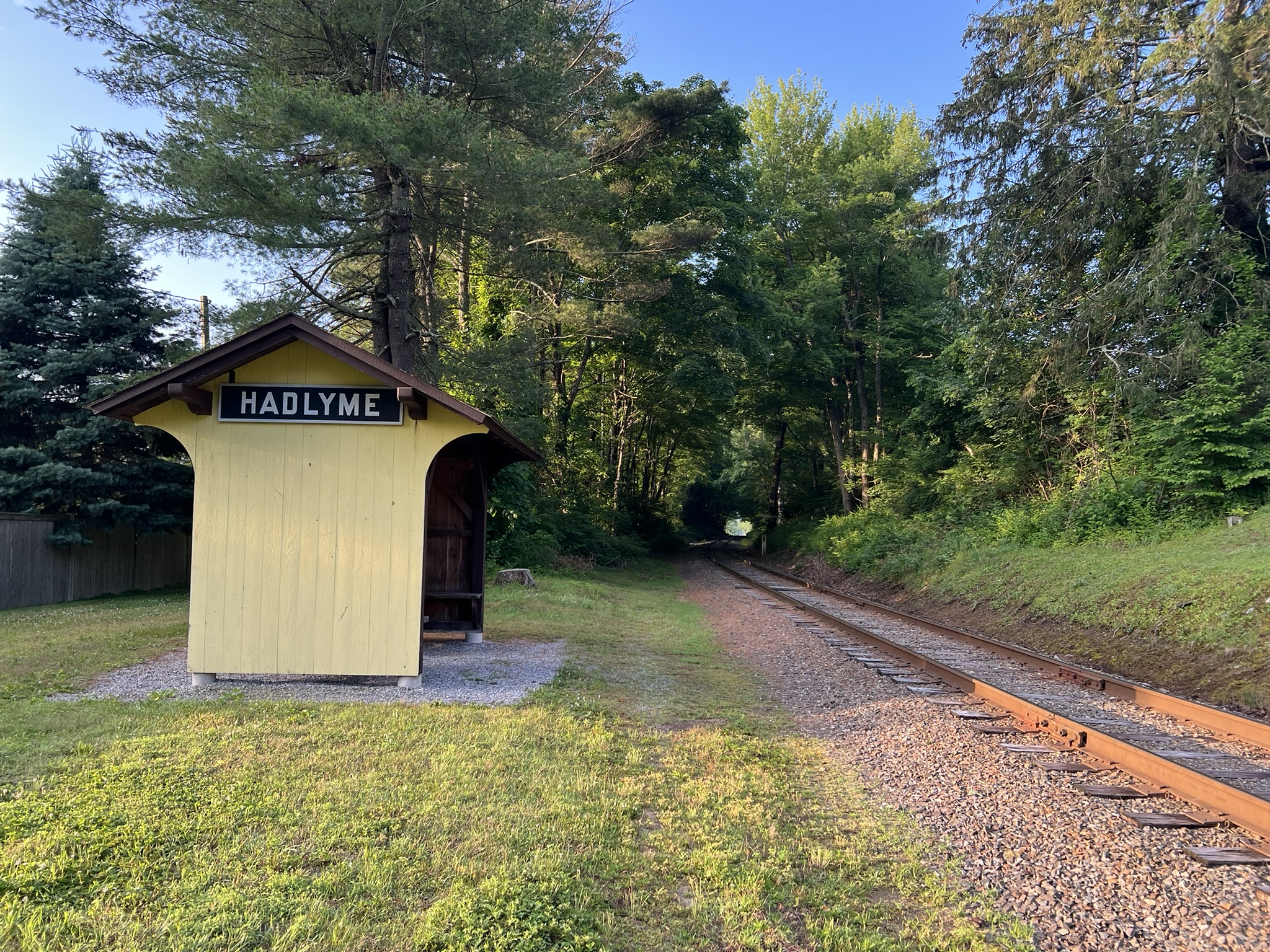
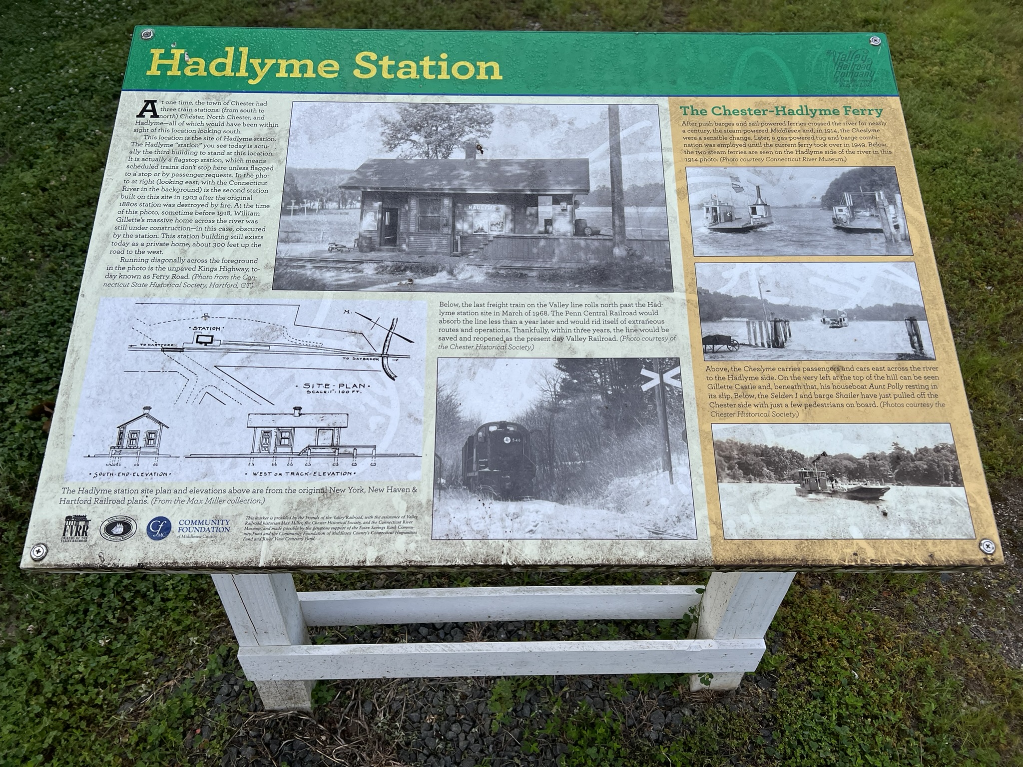
From left to right: an osprey and nest downstream from the park at high tide; the Hadlyme station; Hadlyme Station history sign
DEEP RIVER
Deep River Landing
From the Chester/Hadlyme Ferry, continue south on 154 and take a detour to visit Deep River Landing. As the sign proudly notes, “[f]or more than 150 years, this landing was the center of Deep River’s busy traffic with the sea. From here, the town’s ship captains went out to sail the world and to serve in this country’s wars.” These days, Deep River Landing is a beautiful town park. While the sign specifies that the space is for town residents and guests, I’ve never had a problem stopping for a brief visit.

ESSEX
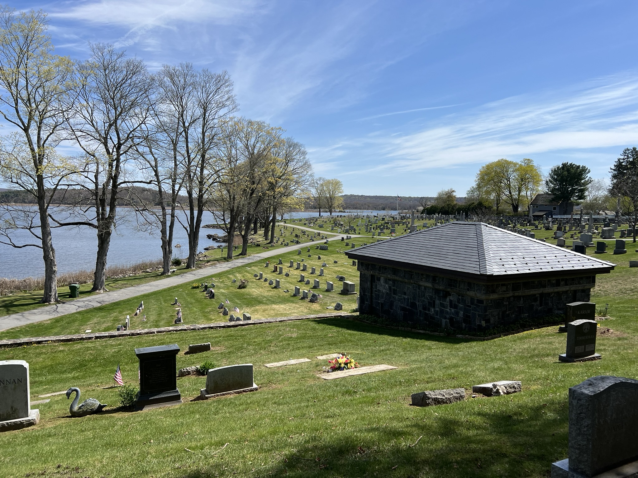
River View Cemetery, Essex.
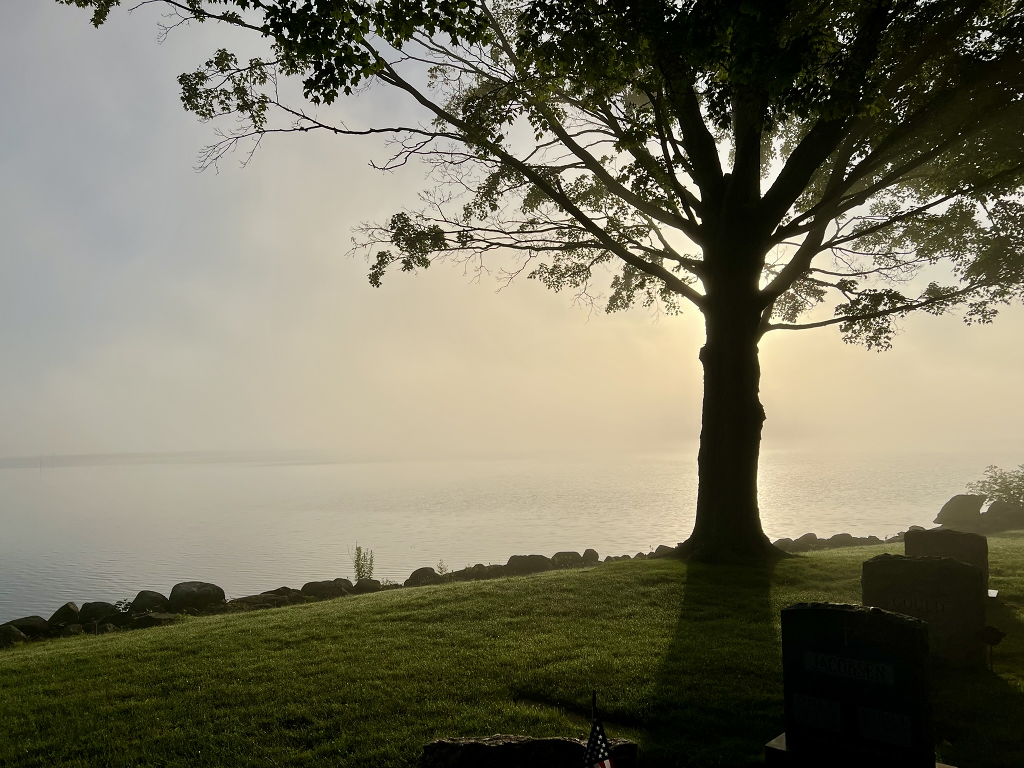
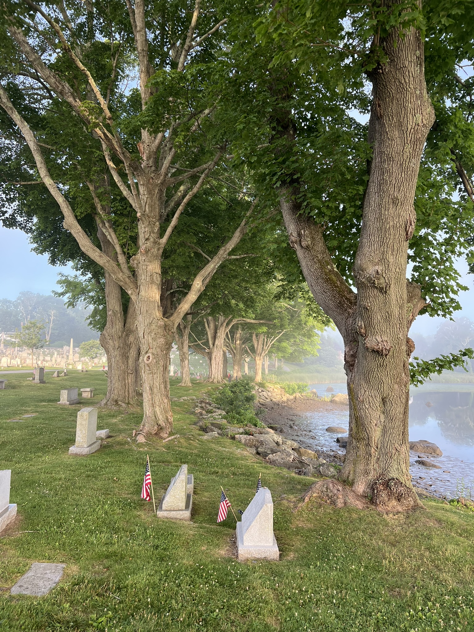
I learned about this cemetery from the Connecticut River Gateway Commissions Interactive Map. Curiously, the cemetery does not appear on Google Maps. You can find it in Apple Maps as “River View Cemetery” and in Waze as “Riverview Cemetery”. It is a ¼ mile walk from the rotary at the intersection of Main St. and North Main St. Heading north on North Main Street, the entrance is between 2 stone pillars on the right after passing Little Point Street. You can drive in as well. There is a small pullout for about 2 cars at the end of the circular drive. As with any cemetery, be respectful and follow the rules, which are posted on a large sign near the entrance. What a delightful spot! There are many impressive old trees to provide welcome shade in the summer, as well as numerous benches. From the stone patio at the far end there are views into Essex Harbor as well as sweeping river views. While there, take the time to walk amongst the headstones. Many of the graves date back to the 1700’s, and include veterans from as far back as the Revolutionary War.
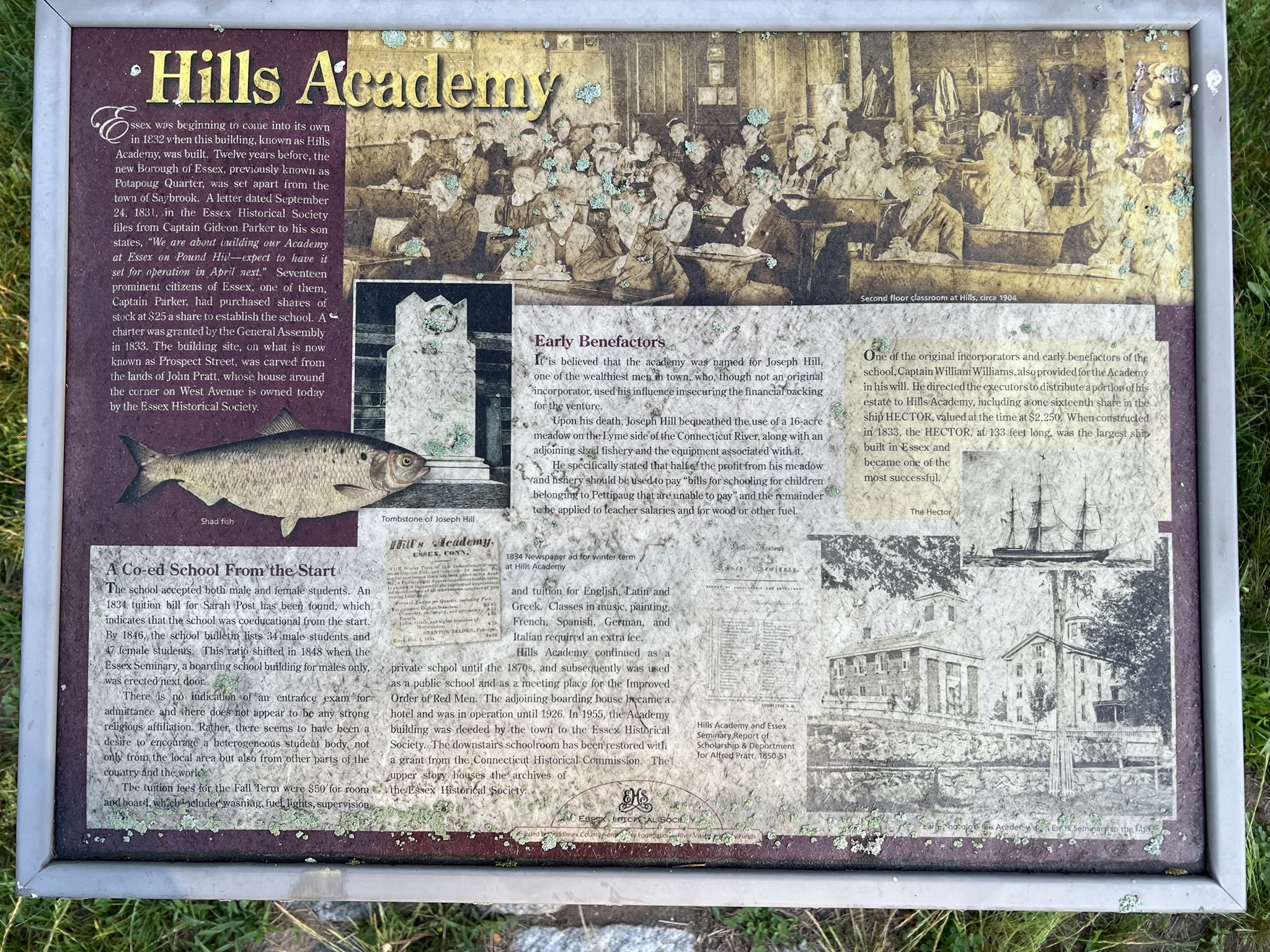
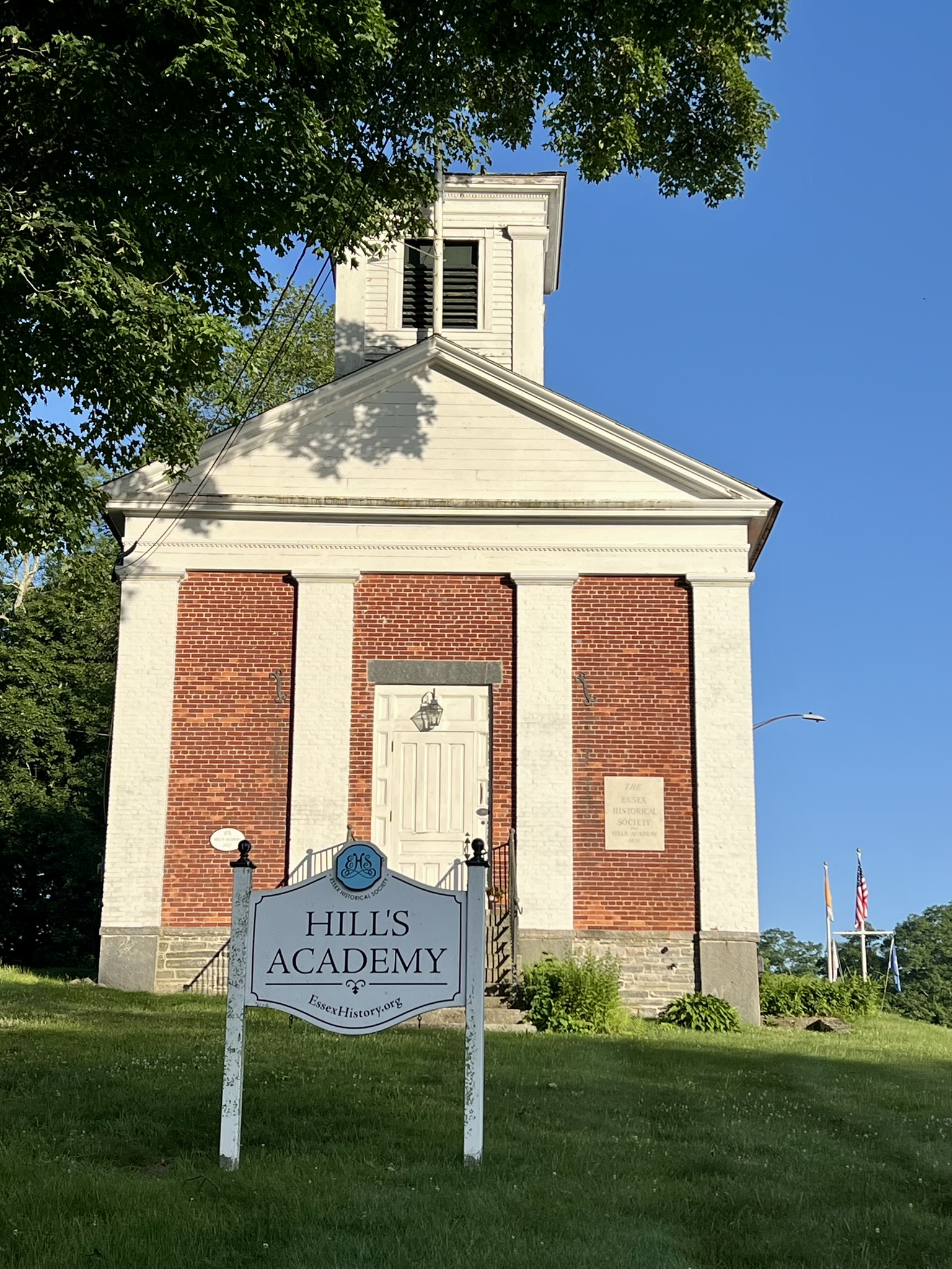
I visited a second time on an early June morning on what was predicted to be a blazing hot day. This time I parked by the Connecticut River Museum (see more information below) for a longer walk. The river mist was thick with the already sweltering temperatures. On the walk back, I experienced a Baader Meinhof phenomenon moment – otherwise known as a frequency illusion. This is the experience of seeing something all around you once you have learned about it, thus giving the illusion that it is more common that it is. An example is when you are in the market for a new/used car, you often start seeing the model you are considering everywhere you go. I noticed a sign reading Historical Site that pointed up Prospect Street, so I decided to loop back that way out of curiosity. I discovered a signboard in front of the Essex Historical Society, which is housed in the former Hills Academy. The Hills Academy was a co-educational school founded in 1832. On the sign was a large photo of….an American Shad, along with a description of how benefactor Joseph Hill, in his will, bequeathed to the school his shad fishery in Old Lyme, directing that the profits be used for scholarships and other school expenses. I now see shad everywhere! Continuing on, I visited the Essex Town Green before arriving back at my car for just over 2 miles.
The Connecticut River Museum
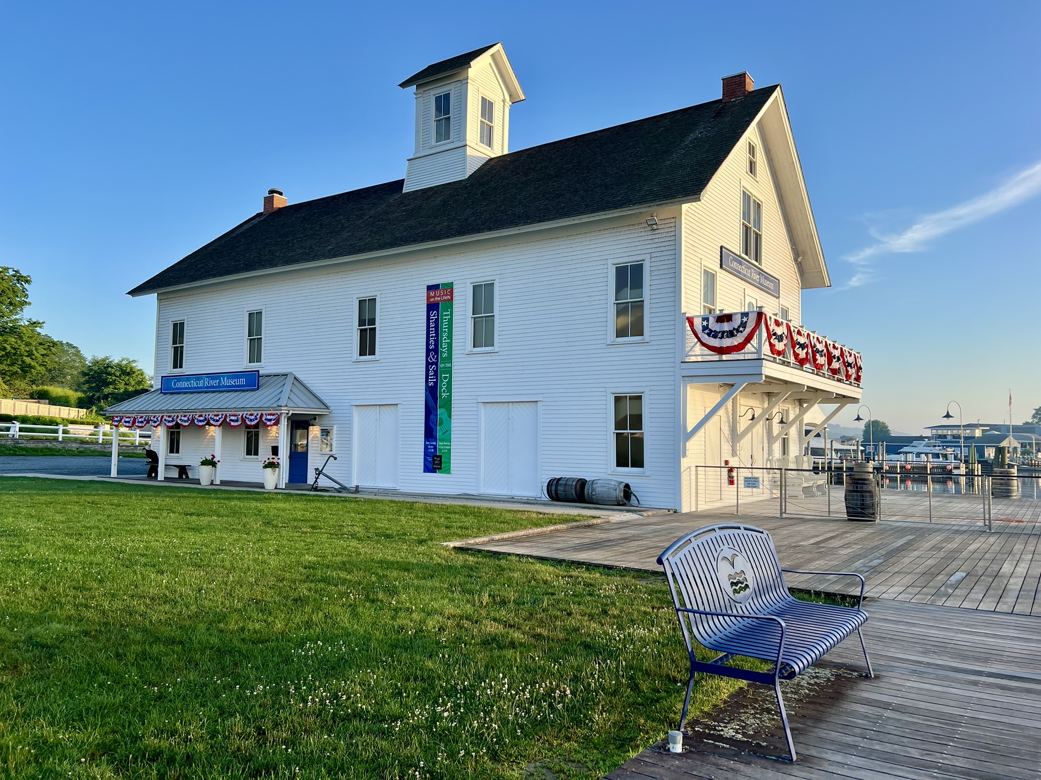
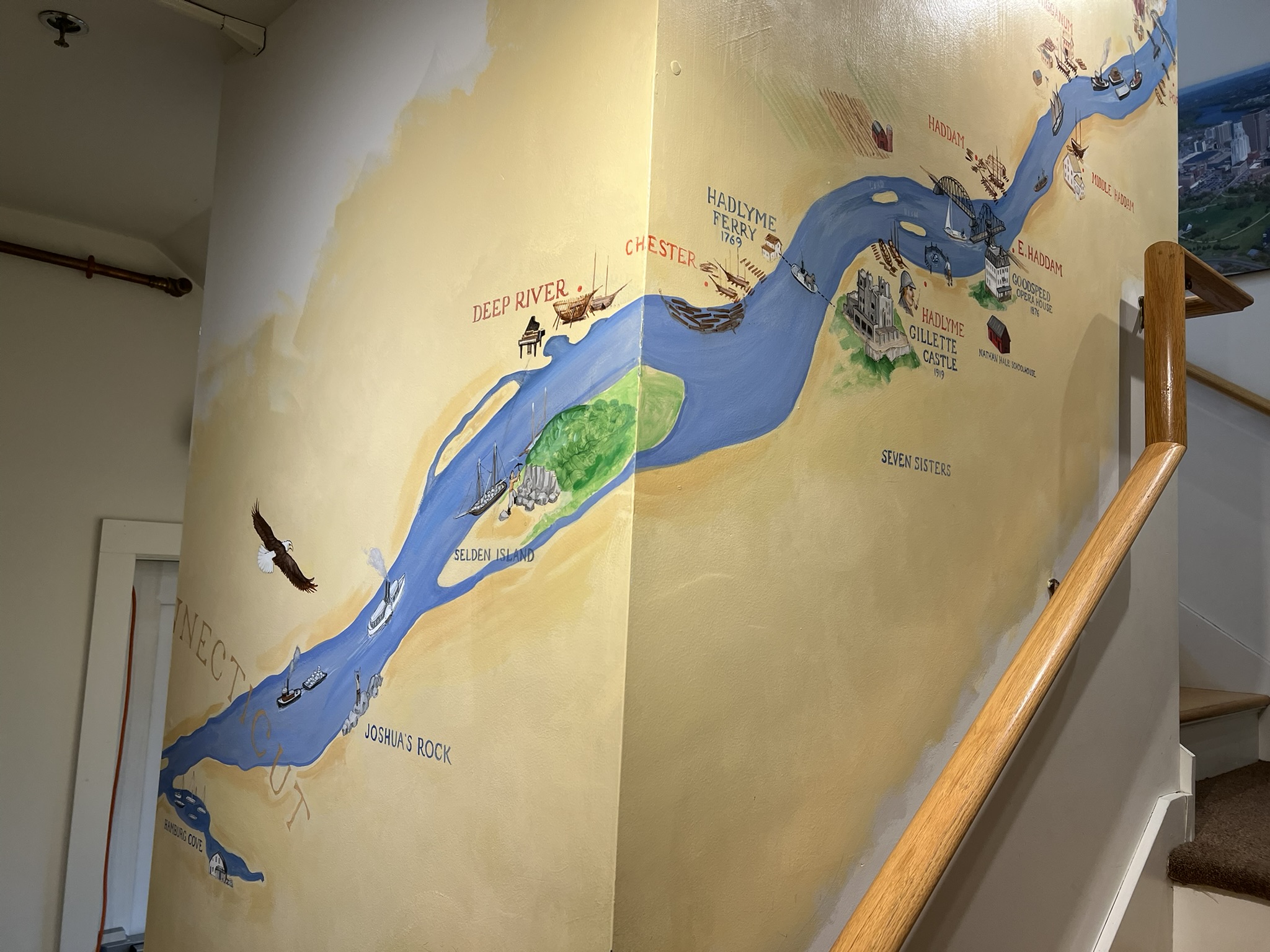
While in Essex, take time to visit the Connecticut River Museum. Adult admission is $15, or borrow a free admission pass from a participating library, or even become a member. There are three exhibit floors. Two floors have permanent displays covering all aspects of the river including the history of transportation, shipbuilding, wartime activities (there is a replica of the Revolutionary War Turtle – the first submarine deployed in combat), recreation, and even a small display dedicated to….shad fishing. During the shad run the museum sets out additional temporary shad fishing displays. A third floor has rotating exhibits. Currently on exhibit through August 3 is “Rising Waters: Flooding on the Connecticut River”, which explores “several devastating floods of the 20th century and poses questions about what we should expect in the future.” Don’t miss the back stairwell’s “vertical gallery” – a delightful mural painted in 2009 by the talented artist Russell Buckingham that provides a whimsical representation of all 410 river miles and the places it passes through. To get even closer to the river, book a trip on one of the museum’s public cruises – the On Rust, a replica of Adriaen Block’s 1614 ship, or the RiverQuest. Cruise tickets include museum admission. For more information, visit the museum’s WEBSITE.

Turtle Creek Preserve, Essex and Old Saybrook. 2 miles
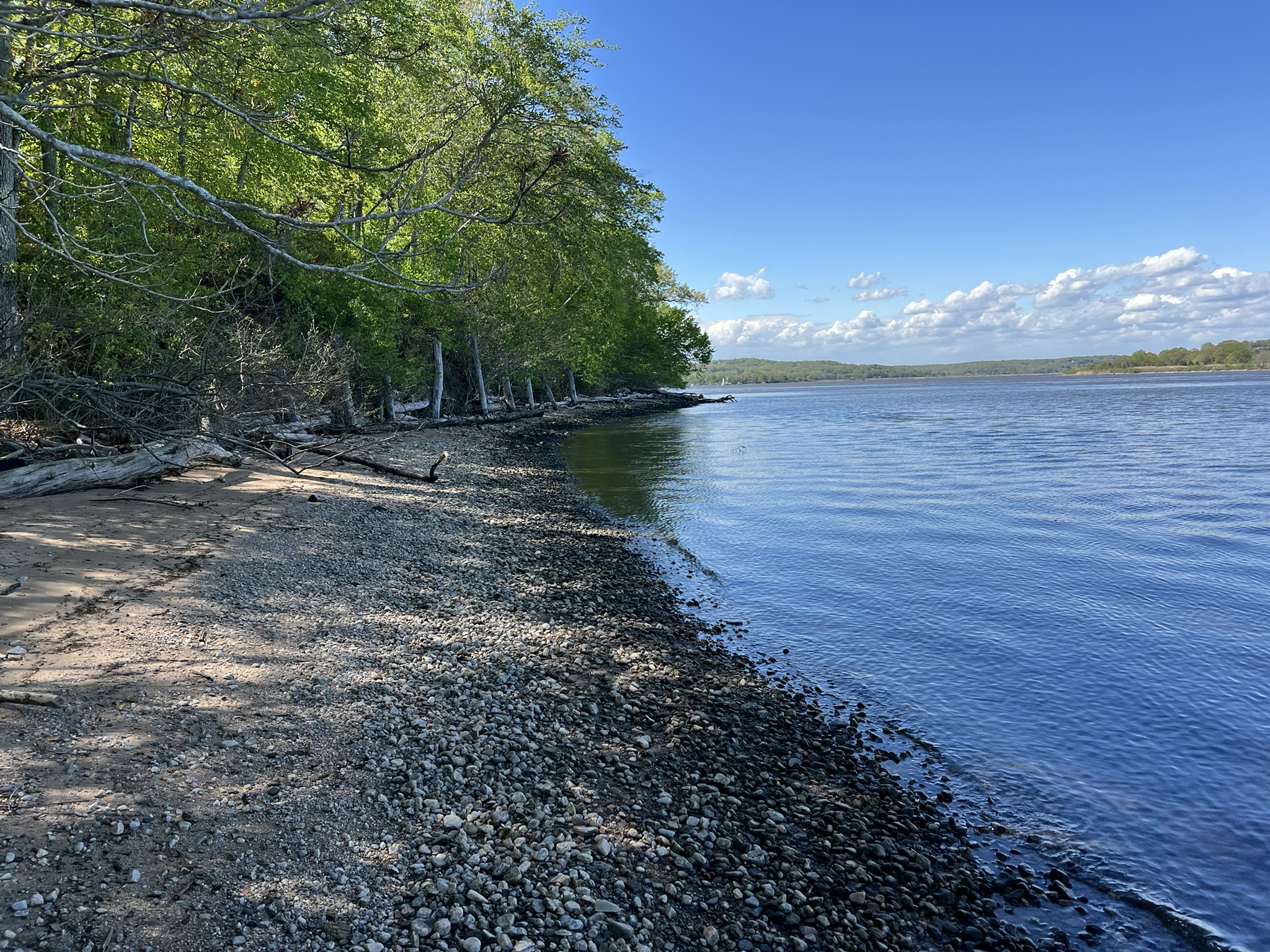
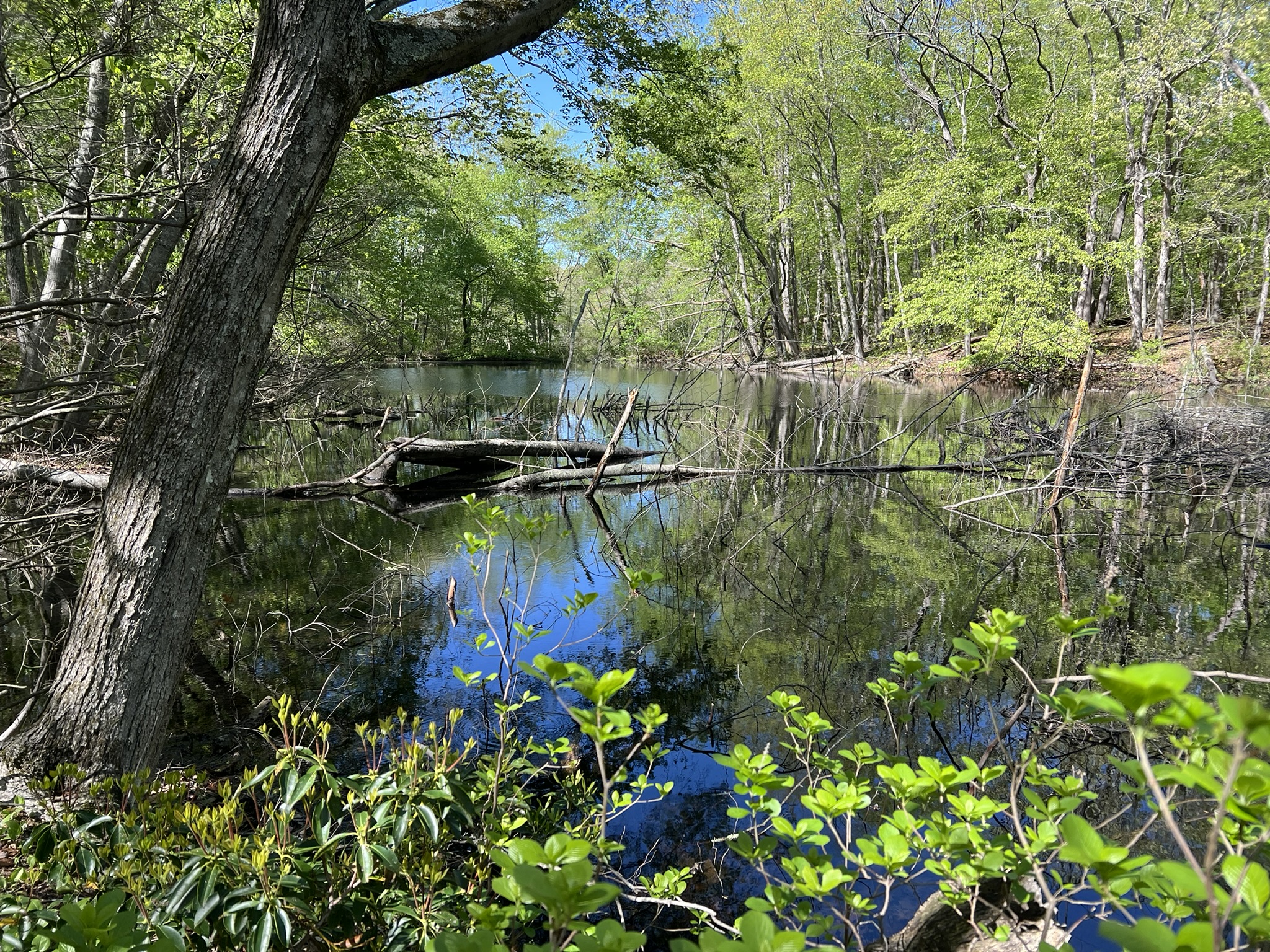
To the south of Essex Center lies the Turtle Creek Preserve. The first thing I noticed when I visited in May was how much better maintained the trails were, including blazing, which had been sporadic at best. Checking the kiosk, I learned that the prior steward, The Nature Conservancy, donated the property to the Essex Land Trust in 2024. Many thanks to the Essex Land Trust for all their improvements to the property. From the parking lot on Watrous Road I started on the green trail going clockwise. After crossing the private road I noticed a new orange blazed trail option. Staying on the green trail, I detoured to take the side trail down to the beach along South Cove. It was low tide and a beautiful sunny day after two days of heavy rain. Continuing on the green loop, I once again crossed the private road, then took the white trail on the left. This trail leads to a long beach along the Connecticut River. Often obscured in summer, look for the two large rusted mooring balls set back from the trail.

From left to right; the path to South Cove; South Cove beach at low tide; shaded paths; the old mooring balls
Retracing my steps, I continued on green until I came to the red trail on the right. This trail goes steeply uphill to a large boulder. I noticed that the new orange trail meets the red trail at this point. I stayed left on the red/orange trail until the two trails diverged at the bottom of the slope. I stayed left to go on orange. After passing another large boulder, the trail winds through a mountain laurel grove. Upon meeting the blue trail I took a left to go to the end where it meets Deitsch’s Pond. According to the brochure this pond was once used for ice production. I returned to my car by following the blue trail back. My Garmin recorded just over 2 miles. This is a popular destination for dog walkers. UPDATE: In late June I saw a notice about a black bear sighting on the property. Please be BEAR AWARE and keep your dog on a leash.
From left to right: the beach along the Connecticut River; boulders on the hill; Deitsch’s Pond
OLD SAYBROOK
There are several places to get up close to the Connecticut River in Old Saybrook, including Gardiner’s Landing at the mouth of the river, a scenic overlook described in the Fort Siege Route Loop, and the Baldwin Bridge State Boat Launch. You can find more detail about all these places in my April 2024 blog post about the Pequot Wars.
OLD LYME
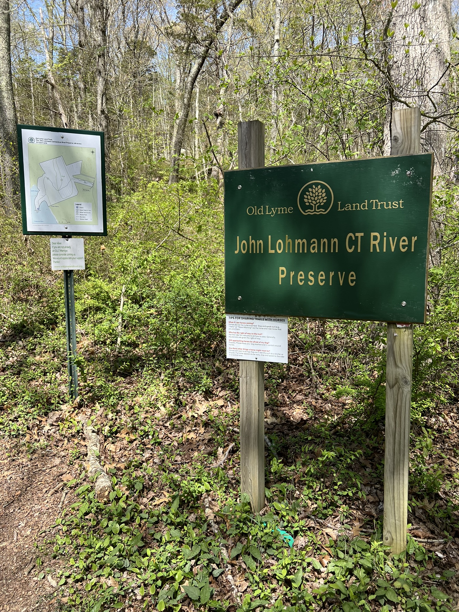
Lohmann Preserve, East Lyme. 1.2 miles plus
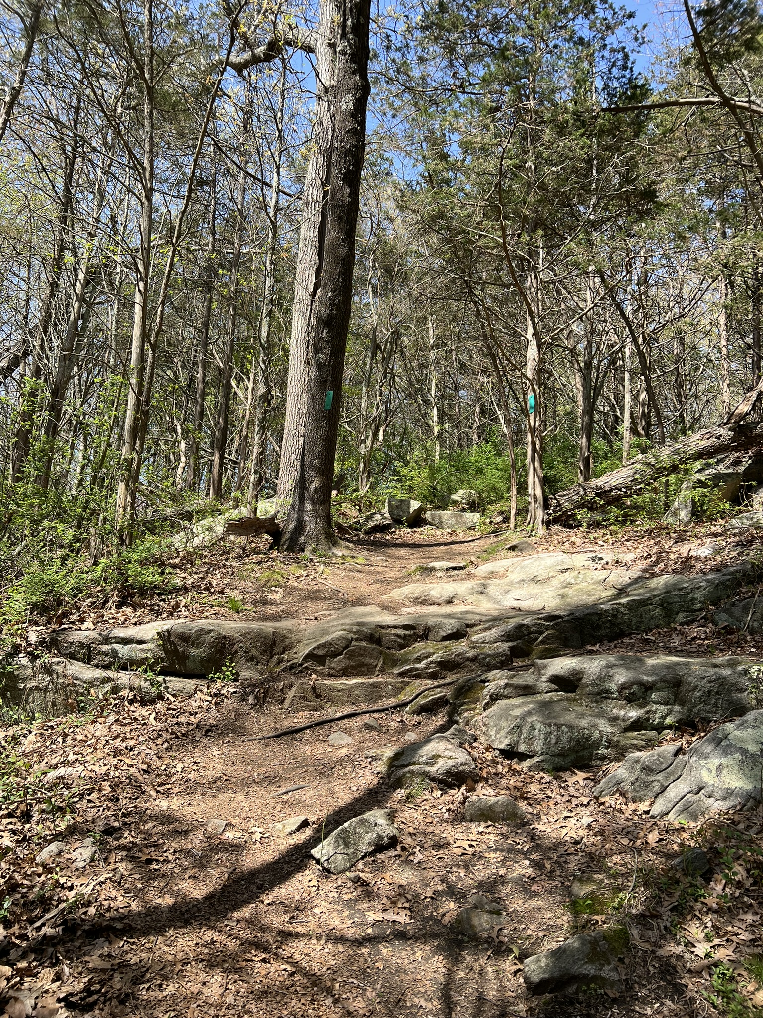
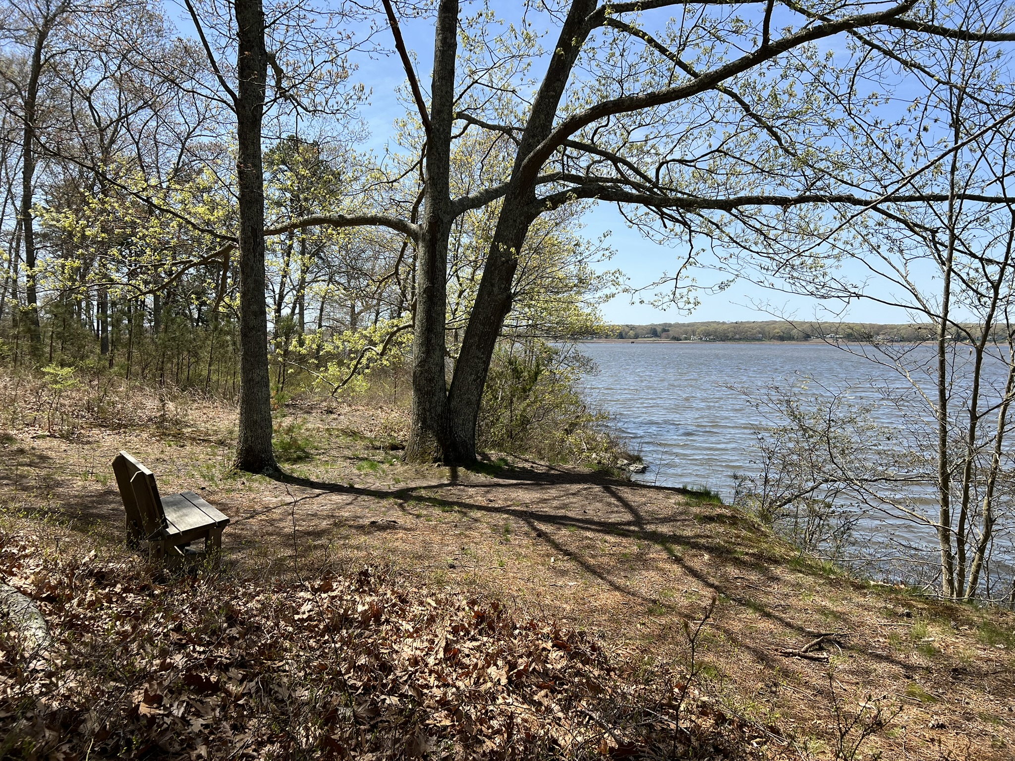
This Old Lyme Land Trust (OLLT) preserve is a special gem and one of my favorite Connecticut River spots. According to the OLLT website “[t]his 42 acre preserve was bequeathed by John Lohmann upon his death in 2005. In life, Lohmann was a dedicated conservationist who co-founded the OLLT.” The trailhead is on a residential street, so please drive slowly and be considerate. A small sign indicating the Old Lyme Land Trust and the address 33 Coulter Lane marks the entrance. Set further back from the road there is a larger sign and a map kiosk. The first .1 mile is steep and winds up through an old cedar forest. As the trail levels off, it feels a bit like Dorothy opening the door of the farmhouse to behold a land of great beauty. I exaggerate slightly – but it is a wondrous feeling to emerge from the woods to a stone wall marking a transition to a gorgeous meadow with a variety of mature trees dotted throughout and the Connecticut River in the distance (in the summer this view will be obscured). Cross the meadow until you reach a bench on the edge of a hillside. There are also mown paths that encircle the meadow where you can explore and add some extra mileage.
From left to right: Preserve sign and map kiosk; some rocks to navigate; the woods open to a meadow; a bench at the edge of the meadow with the river just visible in the distance in May
From the bench, follow the obvious path that leads down the hill at a gentle sloping angle and follow it as it curves back around to reach the level of the river. When you see some old outbuildings built into the hillside veer to the right to follow the path towards the river. The path then splits, with the trail to the right leading to a bench near the water’s edge fringed with mature pitch pines. The path to the left leads to Whaleback Rock, a rocky promontory that juts into the river. I happened to visit at high tide, but I have visited at low tide and was able to walk out all the way to the end. In summer be very careful of poison ivy. I saw some starting to emerge when I visited in early May. When I was there the shadbush was in bloom. The genus is Amelanchier and I have always known it by the name “Serviceberry”, but now I prefer to call it shadbush since it got that nickname because it blooms around the same time that the shad run. Pick out a slab of rock, take a seat and spend some time watching the river go by.
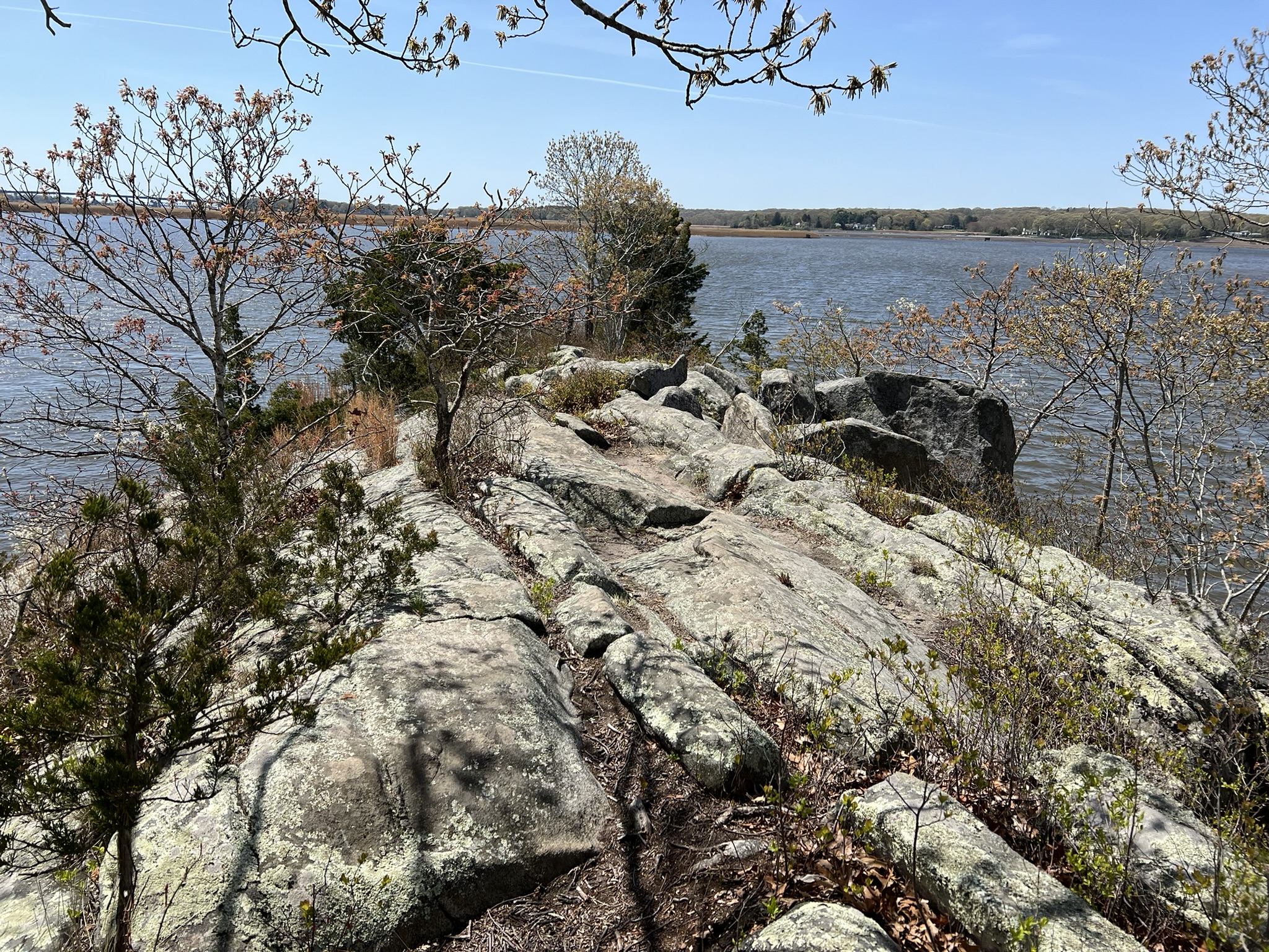

From left to right: the gentle slope to the river; Whaleback Rock; Shadbush in bloom; a bench by the river
BIBLIOGRAPHY
The Founding Fish, by John McPhee (2003)
The Connecticut River from the Air, by Jerry Roberts and Tom Walsh, 2018
A History of the Connecticut River, by Wick Griswold. 2012
Connecticut River Ferries, by Wick Griswold and Stephen Jones, 2018
The Connecticut River: New England’s Historic Waterway, by Edward Delaney, 1983
Connecticut Waters – Celebrating Our Coastline and Waterways, by Caryn B. Davis, 2021
Estuary Magazine (available at many libraries or online at https://www.estuarymagazine.com/)
- Winter 2024 – Supporting More Than Salmon: Connecticut River Salmon Association Celebrates 50 Years, by Steve Gephard
- Fall 2023 – American Shad, by David Deen
- Spring 2023 – Gateway Commission at 50, by Judy Preston
Connecticut Explored
- When Connecticut’s Rivers Ran Black, by William Devlin, V.19 no.2, Spring 2021.
A Passion for Shad, Documentary by Richard Johnson (2002).
Rivers of Outrage, by William Devlin
A Tale of Shad, the State Fish, by Christine Woodside
Clean Water Act Accomplishments in Connecticut, an official State of CT website
Connecticut River American Shad Management Plan
Information about American Shad on the CT DEEP website
Connecticut River American Shad Sustainable Fishing Plan Update Submitted to the Atlantic States Marine Fisheries Commission Prepared by Connecticut Department of Energy and Environmental Protection Fisheries Division August 2024
Connecticut River Gateway Commission website and the CRGC River Access and Vista Map. Enlarge the map, then click on Map Layers and select Scenic Locations.
Connecticut River Fishing Guide
The Connecticut River page on the American Rivers website.
Haddam Shad Museum, Only 1 dedicated to CT state fish in U.S., moved intact to school grounds, Middletown Press article by Gary Kleeblatt, August 10, 2023
Shad Recipes, Connecticut Sea Grant website
Had Any Shad Lately? It’s time to rediscover Connecticut’s state fish, by Judy Benson. Wreck Lines: A Connecticut Sea Grant Publication, Fall/Winter 2018-19.
Subscribe to Trail Talk
your next adventure awaits
Questions? Email me at naturenerdsramble@gmail.com or find me on Instagram @the_real_nature_renee.