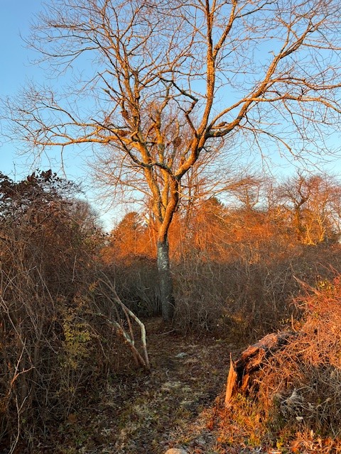
If you starting following my Trail Talk blog recently, you may not yet be aware that I am addicted to sunrise adventures. These can take many forms such as a destination hike to watch the sunrise from a scenic viewpoint, or merely a strategic spot to observe sunrise quietly. Sometimes I just like to be out on a trail at dawn to experience the awe of first light and the mystery of where I will be when the sun first appears on my horizon.
While I enjoy sunrises year round, I am particularly fond of winter sunrises for many reasons. First, winter sunrises are blissfully late compared to those impossibly early summer sunrises! Secondly, the atmospheric conditions of winter can make the colors more brilliant, and with the leaves off the trees the sunrise can be visible from more vantage points. Finally, with such short days during winter, I find being up and out for sunrise gives me a boost of energy that helps me take full advantage of every miserly moment of daylight.
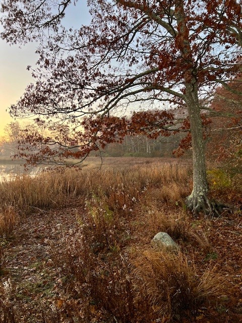
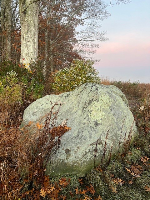
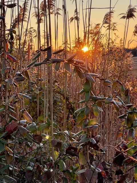
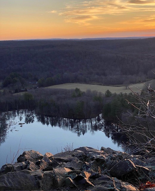
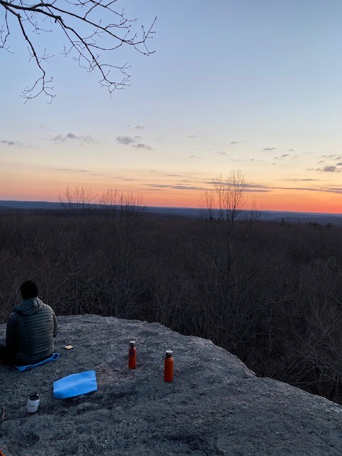
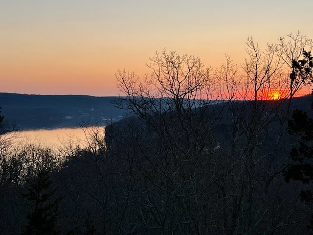
Still not convinced? I do understand. I have faced many an evening checking the forecast and hesitating to make a plan, and I have spent many a morning rolling over and wondering if I shouldn’t just skip it. But I can tell you this. I have NEVER regretted going out on a winter sunrise adventure, but I have OFTEN regretted NOT going out on a sunrise adventure. (Photo at Swan Hill Preserve, Haddam)
Winter temperatures can present challenges. Here are some tips to help ensure a positive experience.
- Research the property and its rules and regulations. Many places are open from sunrise to sunset, which I loosely interpret to include dawn – that period of time when the sky is lightening even though the sun has not appeared. Is hunting allowed? I always wear bright colors during hunting season.
- Do your time calculations – how long will it take to get to the trailhead and complete your hike? What time is sunrise? I try to reach my destination at least 10 minutes before sunrise.
- Check the weather forecast. A partly sunny forecast often has the best colors because you get reflections on the clouds. Dress appropriately for the weather and bring extra warm gear as you may be stationary for a period of time waiting for the sun. Benches can be cold and damp so a pad to sit on is a plus. You don’t need anything fancy – it can be a plastic garbage bag folded up with a blanket on top.
- Scout the property in advance. It can be very tricky to find and navigate a trail for the first time at dawn. I know because I don’t always follow my own advice.
- Bring a headlamp if you will be starting in the dark.
- If there’s a possibility the trail will be icy, bring microspikes.
- Convince a friend to join you, but don’t be hesitant about going alone. Always tell someone where you are going.
- Bring a thermos with your hot beverage of choice!
FENWICK GROVE TRAIL, Old Saybrook, CT – .75 miles.
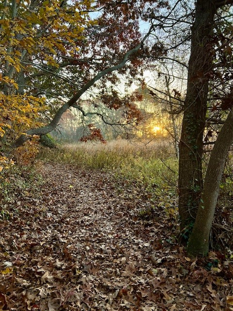
Fenwick Grove is a hidden gem, and locals probably prefer it stay that way. I noticed the trailhead one day while walking past and returned a few weeks later to check it out. It was September and the leaves had not yet turned. Numerous viburnum trees were laden with red berries. The trail is flat and laid out with wood chips so the walking is easy. As it loops to South Cove there are a few places where you can detour – including into a pine grove. All the detours are short and you can double back or carry on. There are two places with benches that look out over the cove. One bench faces east and looks out over the causeway. I returned in early November for a sunrise walk. When I arrived the cove was cloaked in a mist of pastel colors so thick the causeway itself was invisible. I watched ducks swimming and diving. The mist slowly faded and the causeway came into view. I moved from the bench to a large boulder perch, then down to the water’s edge, taking in the sights and sounds of the dawn. Because the sun only rises due east on the days of the spring and fall equinoxes, the sun rose more to the southeast so the view was slightly obscured by houses/trees but it was still lovely.
From left to right: The viewing bench in the mist; the view from the water’s edge; the sunrise through the trees; a tree still holding onto a few of its leaves
Occasional trail blazes denote the trail as maintained by the Lynde Point Land Trust. There was no information about this parcel on either the Land Trust or the Town of Old Saybrook website. In fact, I couldn’t find mention of it anywhere and I searched for a good 30 minutes, including on AllTrails and Google Maps. To get there, use “Fenwick Golf Club” as your destination. There is a parking area for the trailhead just south of the Golf Club on the west side of Maple Avenue. Fenwick Grove is open dawn to dusk. Please abide by the rules listed at the trailhead. Dogs on a leash are allowed.
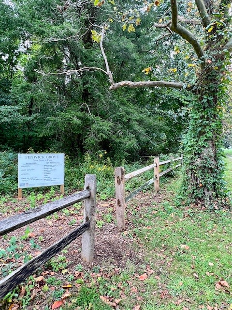
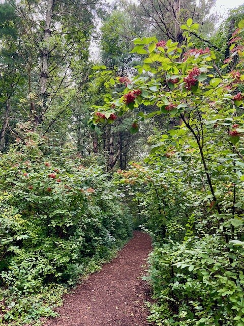
From left to right: The trailhead; the wood chip path and blooming viburnum in September; the path back out to the road; a large boulder makes a good alternate viewing perch
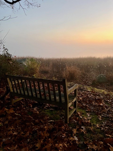
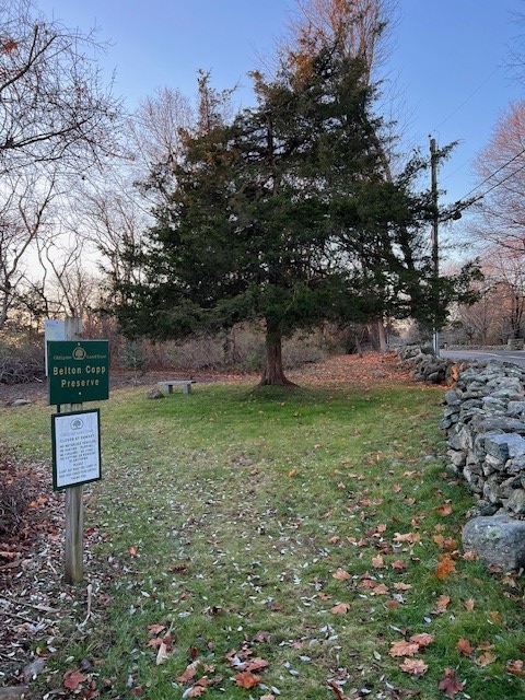
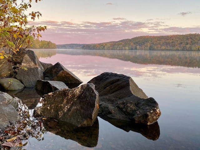
BELTON COPP PRESERVE, Old Lyme – .10 miles.
This 4 acre parcel overlooking the salt marsh offers more of a “sit spot” than a hike. I discovered it as a possible sunrise spot when I was perusing the Old Lyme Land Trust’s properties on their website and noticed a sunrise photo in the online description.
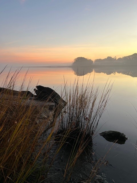
I visited twice in November – first to scope it out in daylight (sometimes I do follow my own advice), and the second time for sunrise. The preserve is on the left side of Smith’s Neck Road, which is a dead-end, and has limited parking. I found it easiest to drive the extra ½ mile to the end of the road and turn around at the State Boat Launch. One option to create a longer walk out of your visit is to park at the Boat Launch. If you do this for a sunrise visit I strongly recommend wearing something reflective and having a light. While the road is not heavily trafficked, it is narrow and there are no sidewalks. You can park on the grass alongside the road in front of the preserve – just be aware that the ground has a slight tilt which makes opening and closing the car door awkward. It looks like there is a flatter spot to pull off just beyond the preserve if you are heading north from the boat launch.
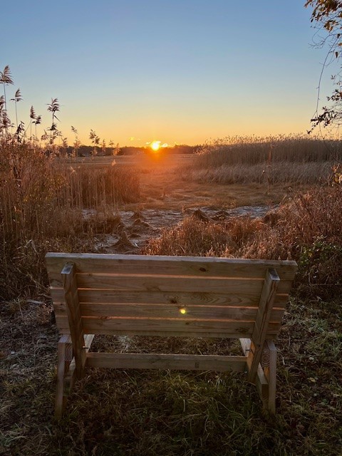
The entrance to the preserve has a sign and is marked by a cedar tree and a small granite bench. The entire loop is only one tenth of a mile and wanders through dense thicket where I encountered numerous birds. As you enter the trail follow the loop counter-clockwise to arrive at a bench and scenic viewpoint that faces east. Obscured a bit by the reeds is an osprey nest platform. According the Osprey Nation data the nest was active in 2023 and 2 young osprey successfully fledged. Just before the bench look for the entrance to the fairy loop on the right. This is a delightful clearing with numerous fairy decorations strewn about on the ground and in the trees.
When I first visited a friend joined me and we continued on to explore two other nearby Land Trust Properties. I parked in front of the preserve both times. When I went for sunrise I stopped at the Boat Launch to take pictures of the dawn colors. The launch is near the mouth of the Connecticut River and overlooks the Great Island Wildlife Area. I noticed at least 6 osprey nest platforms within easy viewing distance. When I later checked the Osprey Nation website I saw there are well over a dozen platforms on the island. At the boat launch there is a viewing deck with a signboard about the wildlife. I plan to come back during osprey season. If you walk onto this deck in winter be careful as the boards can be icy and slippery, especially in the early morning.
For Information about the Belton Copp Preserve click HERE. For a Trail Map, click HERE
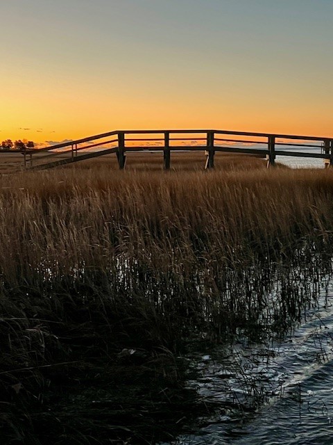
From left to right: The view from the State Boat Launch on Smith’s Neck Road; the entrance to the Belton Copp Preserve; sunrise through the reeds; the sun illuminating the path
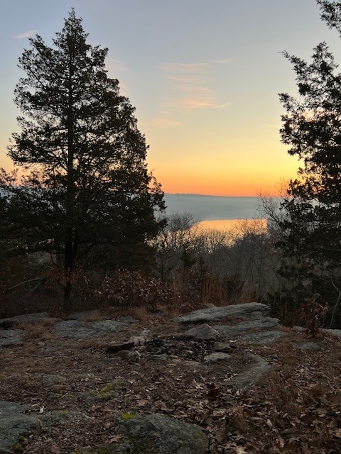
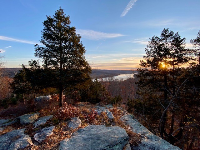
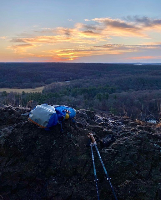
SWAN HILL PRESERVE, Higganum, CT – 2 miles.
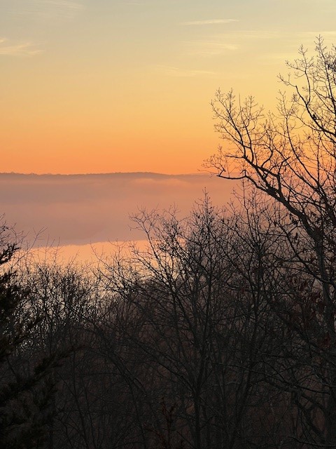
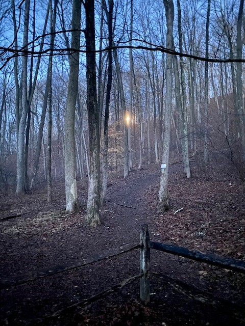
This trail starts behind the old Haddam Elementary School on Route 154. The trailhead can be tricky to find. Walk around the building on the right side and look for the path that descends to an open field. In the field you will see a large kiosk at the edge with a trail map next to an open gate. The trail is 3 loops. When I go for sunrise, I like to go counterclockwise as it is a shorter distance to the scenic overlook at .75 miles. After you cross the bridge over Bible Rock Brook take a right on the Upland Loop Trail. Be careful on the bridge as one of the posts has fallen down. You will wind your way uphill with views of some impressive boulders until you reach the Old Cart Path. Go right, following the sign for Swan Hill. As you continue along the cart path, watch for a sign on a tree to your left directing you to where the path veers up the ridge. As you climb you will start to see the Connecticut River below to your right, and a rock cliff studded with red cedar trees to your left. As the trail winds around look for a fire ring by a rock outcropping with a view to the river. The best views are before you climb all the way to the top of the ridge.
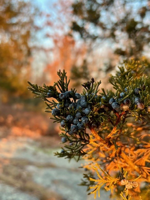
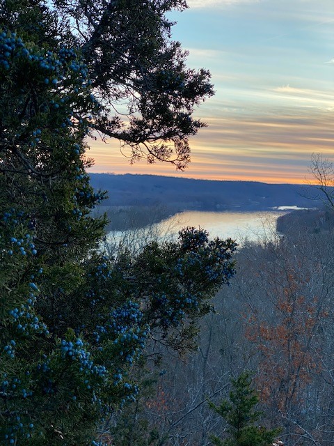
From left to right: December 2023 sunrise; cedar berries beloved by the birds; December 2021 views
I love this particular scenic overlook because the birds are especially active. While you wait for the sun to rise you can listen to the birds and watch them flitting amongst the branches of the cedar to eat the berries. I’m not good at identifying birds by their calls, but I am an enthusiastic new user of the Merlin App! Merlin produced a long list for me: American Robin, Blue Jay, Tufted Titmouse, Nuthatch, Chickadee, Hermit Thrush, Junco. When I visited for sunrise the first time in 2021 I observed a Yellow-Bellied Sapsucker at work.
After about 15 minutes of enjoying first light I set off to complete the loop. The trail passes through some laurel and reaches a point where you can go left or right. I always go right, but both paths bring you up onto the ridge for a short distance before winding back down through more laurel to the Old Cart Trail. When you reach the junction with the Upland Loop Trail take it to the right. This brings you back down to the bridge. After a short distance there is another junction. Stay right on the Bible Rock Brook Trail which will take you back to the end of the main field.
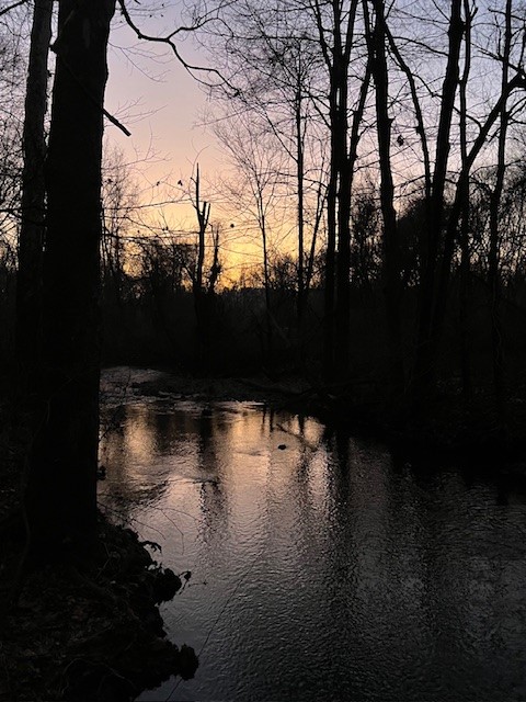
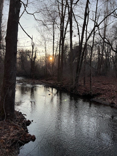
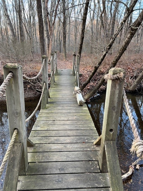
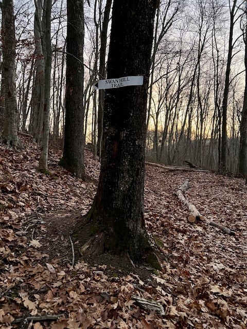
From left to right: Bible Rock Brook at the start of my hike; the same spot an hour later; the bridge crossing with the broken post; the sign on the tree pointing the way to Swan Hill.
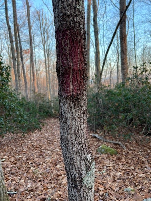
A note about trail markers. In some places there are worn, red paint blazes on trees, but they are not consistent. There are signs at most of the trail junctions, and the trail is well-trod. Take a photo of the trail map at the kiosk as a helpful reference, but please note it is not to scale.
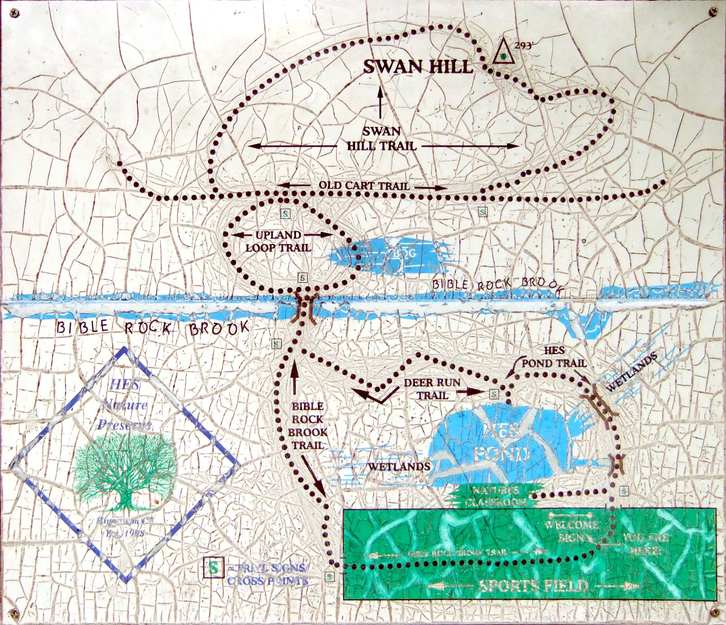
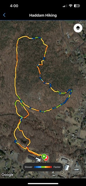
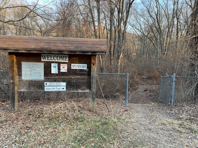
From left to right: the map on the kiosk; The Garmin map of of my route — note the actual shapes of the loops; the kiosk and entry gate; an example of the red blazes.
BLUFF HEAD and JAMES VALLEY PRESERVE, Guilford, CT – 7.7 miles.
You may be looking for a longer, more challenging hike, in which case I will suggest a hike I did in 2022 to celebrate the first day of spring. I started in the parking lot for Bluff Head on Route 77. When I arrived at the trailhead I was treated to a bright moon just visible at the top of the ridge. To get my blood pumping, I chased that moon up the short but very steep blue/yellow trail, which offers a shortcut to the top of the ridge. From there I made my way to a scenic viewpoint overlooking Myer Huber Pond. There are several viewpoints along the path. After watching the sun rise I continued along the ridge doing a clockwise loop into the James Valley Preserve – blue (Mattabesett/New England Trail) to blue/red (Lone Pine Trail) to blue/white (North Slope Trail) and back to blue. Rather than take the steep trail back down, I took the gentler blue trail to the parking lot. These trails are all maintained by CFPA.
A note on the maps. The map on the Guilford Land Trust site has detailed topography and the correct trail blaze colors, but is difficult to read because there is so much detail. However, the map put out by the SCRCOG (South Central Regional Council of Governments) website could use more detail and topography but in other respects is easier to follow. One important note about the SCRCOG map: it has not been updated to reflect a change in blaze colors. From the parking lot, the steep shortcut shows blue on the map but is now blue/yellow. And the longer route leading from the parking lot to the ridge shows blue/red on the map but is now blazed blue.
Click HERE for the SCRCOG map and brochure. Click HERE for the Guilford Land Trust map.
From left to right: the moon from the trailhead parking lot; sunrise from Bluff Head; looking over Myer Huber Pond.
If the above hasn’t been enough to convince you to get out there for sunrise, here is some bonus material! In my December 2021 Trail Talk for the Killingworth Krier I wrote about 4 recommended sunrise adventures. Here are my two favorites from that article.
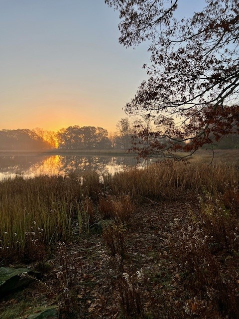
HADDAM MEADOWS STATE PARK, Haddam, CT – 2.75 miles
Haddam Meadows is an ideal location for watching sunrise because you have so many options. You can even skip the hike altogether and just drive down to the dock instead. When I visited in early November of 2021 I started at dawn in the first lot by the entrance on Route 154. I walked down the road to the next parking area where I transitioned to the riverside trail. Following the trail past the boat ramp I crossed a field onto the woodland path. I went all the way past the red gate as shown on the map, and along the gravel road to the river’s edge by Channel Marker 53. Watching sunrise from that spot was glorious. The sunrise itself was downriver, but curiously, my favorite photo was the view upriver with the sky, water and rocks illuminated in a pink reflective glow. Approximately 2.75 miles roundtrip. For a Park map click HERE.
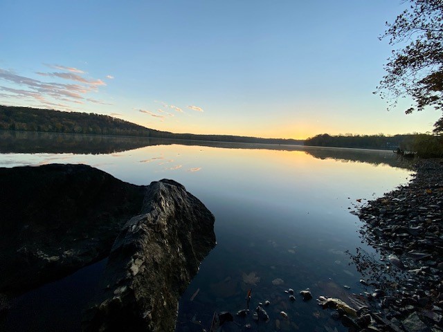
The view upriver on the left; the view downriver of the sunrise on the right.
EAGLE’S BEAK POINT, Higganum, CT – 2 miles.
Perhaps my favorite sunrise hike in south central Connecticut is up to Eagle’s Beak Point. It is a large granite outcropping on a section of the Mattabesett blue-blazed trail between Brainard Hill Road and Foot Hills Road. There is space for 2 or 3 cars along the roadside on Brainard Hill Road opposite Brush Mill Trail. Use either “Brush Mill Trail, Higganum” or “238 Brainard Hill Road, Higganum” in Google Maps.
The old Connecticut Walk Book published by the Connecticut Forest & Park Association (CFPA) marks the outcropping as Eagle’s Beak Point on the map, but this description does NOT appear in CFPA’s online blue-blazed trail interactive system. There is a Haddam Trails website which has a good description of the hike HERE as well as a trail map. This is a trail you are better off scoping out in advance. Because it is a mile hike to the viewpoint, you will be starting in the dark and the trickiest part is a stream crossing at the start that requires some boulder hopping (read my Postscript below). You will want your headlamp for this! The trail goes uphill at the beginning, and eventually levels out, following a granite outcropping until you and reach the sunrise spot. Hunting is allowed in this section of State Forest so I always wear my bright orange vest.
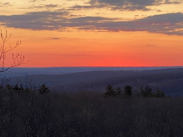
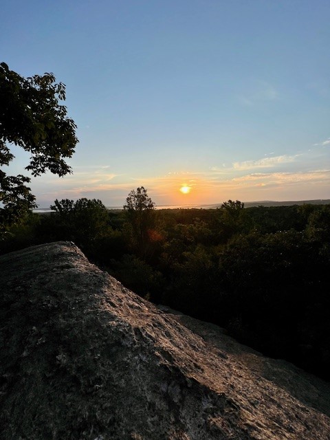
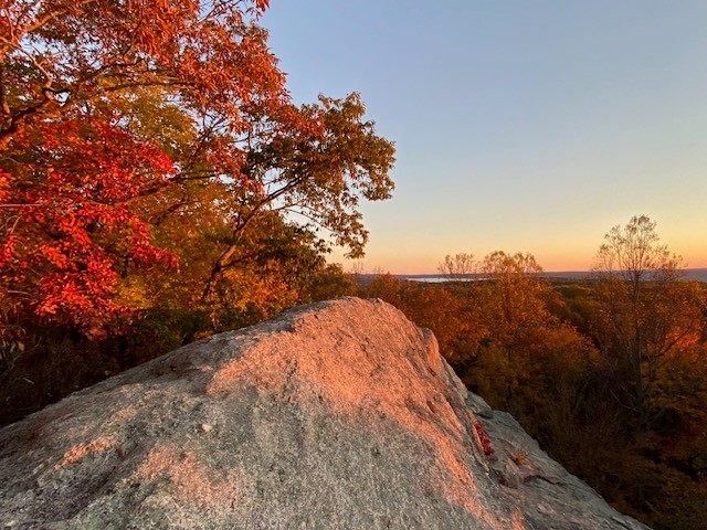
From left to right: Perfect winter sunrise; I convinced my husband to join me with the lure of a thermos full of coffee; summer sunrise; Autumn sunrise
POSTSCRIPT
In mid-December I decided to hike to Eagle’s Beak Point again to provide up-to-date information. Which led me to write this TALE OF TWO SITUATIONS
As I mentioned, this particular hike starts with a sketchy stream crossing. Today was the second time I arrived at the trailhead and faced a decision to proceed or abort.
On the first occasion, I realized I had forgotten my headlamp. Crossing the stream in the dark would have been too dangerous. I decided to proceed using the flashlight on my phone, because I felt it was a LOW consequence situation. The stream was low, so crossing did not require a big leap, which meant the chance of losing my balance or my phone was also low. And I knew I would only need the light for a short time — 5 minutes tops — before there was enough pre-dawn light to see the trail.
On the next occasion, I decided the consequences of attempting the crossing were too HIGH. It was only a few days after a big storm had dropped several inches of rain in the region and the gap between boulders was wide. While I may have made the leap successfully, if I had botched it, there would have been trouble. I was alone, it was winter conditions and the stream was raging. It wasn’t a question of merely getting wet; if I had slipped I might have been swept away.
Always consider the consequences! The hike will be there another day. I quickly formed a Plan B and drove over to Swan Hill, this time doing the hike clockwise. I made it in time for sunrise. I am happy to report the hike works well in either direction — it just takes a little longer to get to the viewpoint when you go clockwise. Flooding affected this trail too, covering the bridge with debris which I cleaned off as best I could.
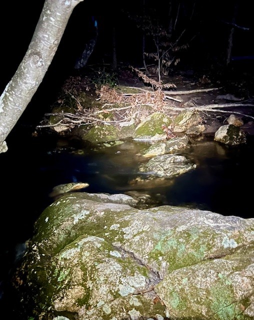
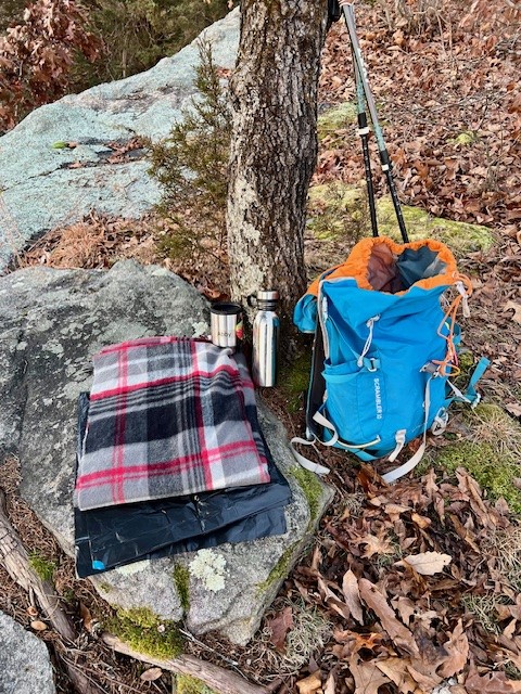
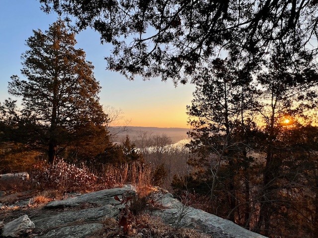
From left to right: the stream crossing at the Eagles Beak trailhead — the gap was wider than it looks in the photo; following my Plan B, I made it to the top of Swan Hill for sunrise; my plastic bag/blanket and coffee; view of the Connecticut River from my perch.
Questions? Email me at naturenerdsramble@gmail.com or find me on Instagram @the_real_nature_renee.
Subscribe to Trail Talk
your next adventure awaits
