Dear Readers:
I am going to a new bi-monthly format starting in 2025.
Subscribers will still get each post in their inbox, it will just be every other month.
This will give me more time to explore and write without getting frantic.
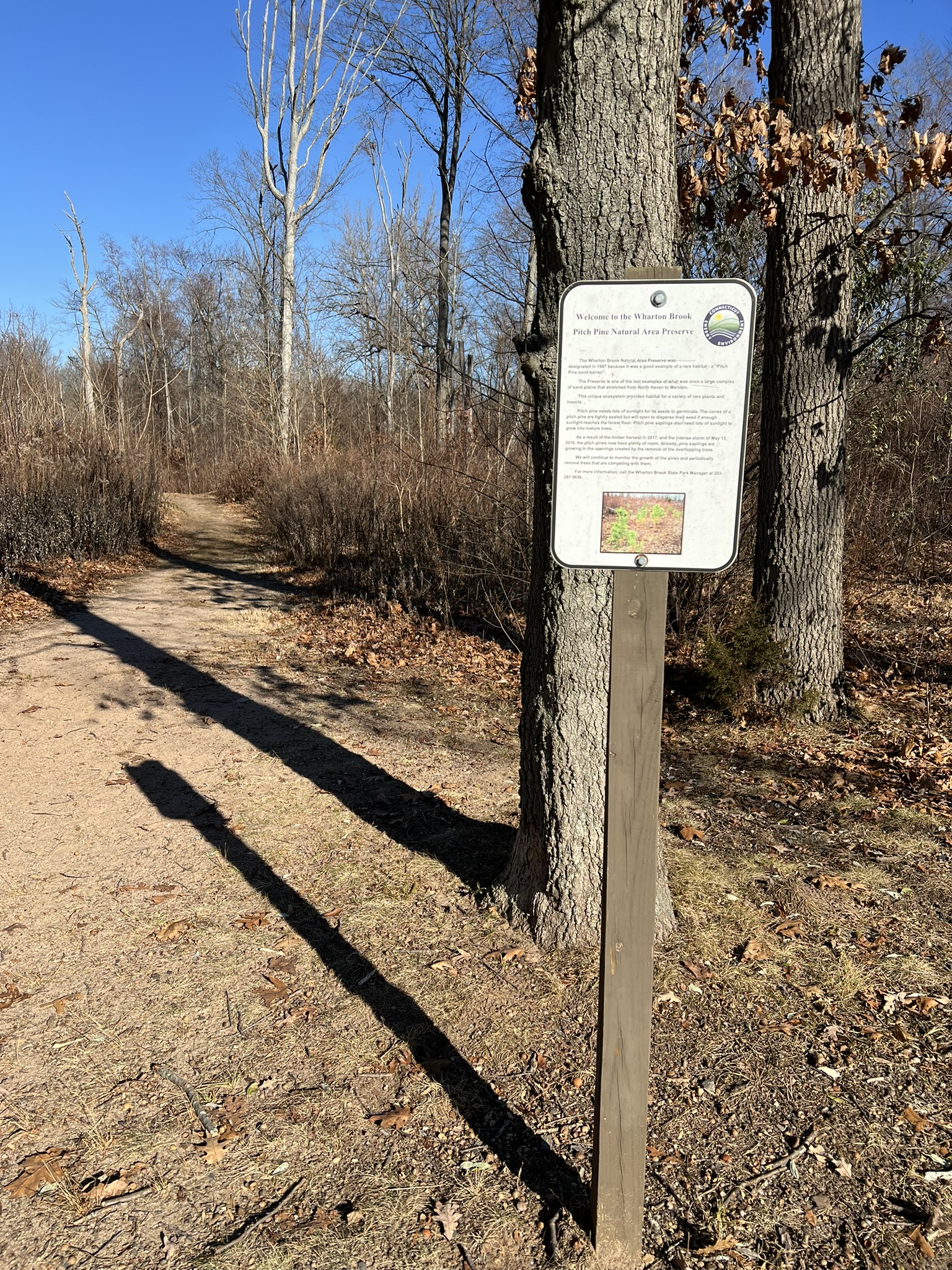
Over the years I have taken joy in seeing gnarled pitch pines growing on the ledges and knobby balds of our Connecticut hills. The sight usually meant I had reached a high point and would soon descend the other side. I rarely thought about why I saw them in these places. That changed earlier this year when I visited Wharton Brook State Park and found myself in the Pitch Pine Natural Area Preserve. A sign explained that the preserve was created in 1987 “because it was a good example of a rare habitat – a Pitch Pine sand barren”. Additional research taught me that pitch pine-scrub oak barrens are one of the 13 most imperiled ecosystems in Connecticut according to this 1998 draft document on the Department of Energy and Environmental Protection’s (DEEP) website by Kenneth J. Metzler and David L. Wagner.
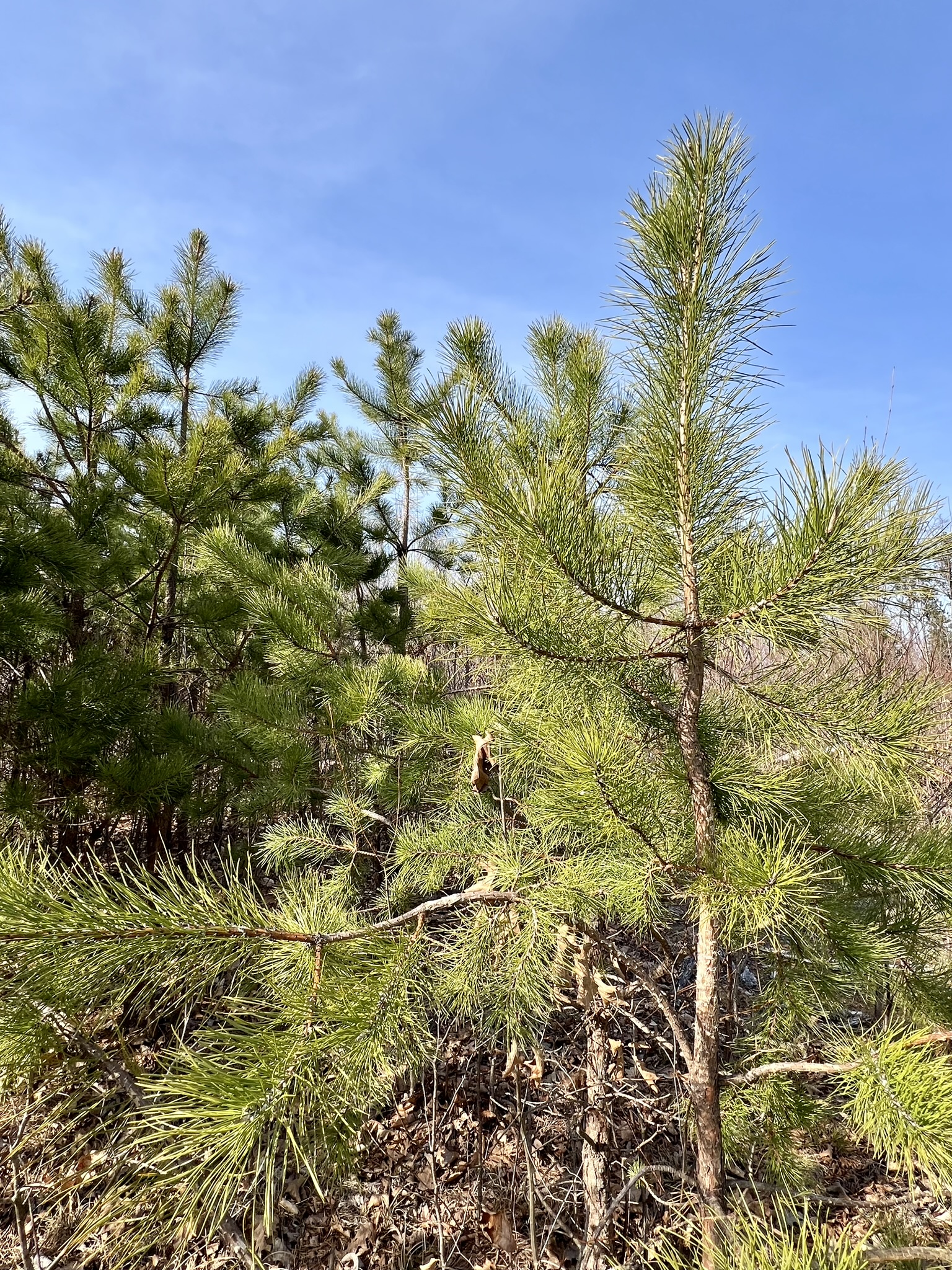
The pitch pine (Pinus rigida) is considered a medium sized tree which grows on average between 30’ and 50’ in height (although the two state co-champion trees were recorded at 92’ and 95’. More information on that later). While they can live up to 200 years they more commonly have a life span closer to 75 years. Pitch pines were once common in Connecticut, harvested in colonial times primarily to make pine tar, a prime ingredient in wooden shipbuilding. The colonists called the pine knots “candlewood”, burning the knots when access to candles was scarce. Emery Gluck, a recently retired Connecticut state forester, wrote an excellent article in the Spring 2015 Connecticut Woodlands Magazine entitled Pitch Pine-Scrub Oak Barrens which has in-depth information about the history of pitch pine in our state. He wrote: “Pitch pine-scrub oak ridge top and sand barrens are down to 0.04 of 1% of the Connecticut forest, and the conifer now composes less than 1 percent of all the pines that grow in the state.”
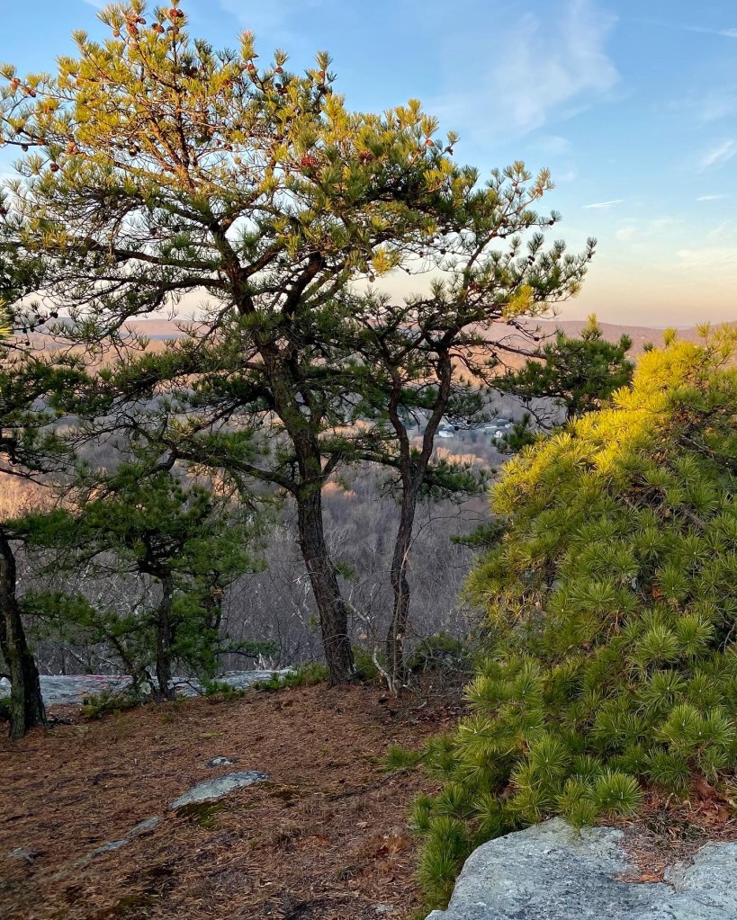
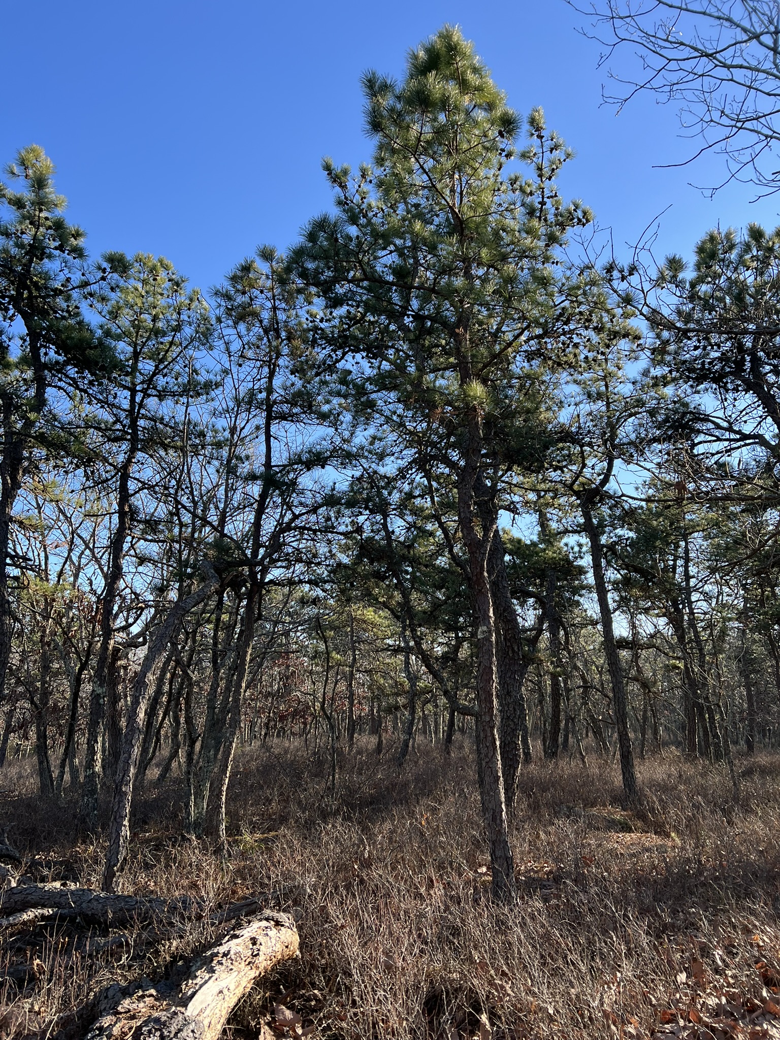
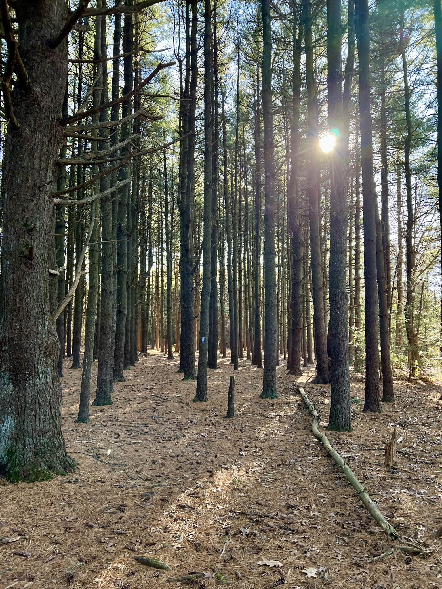
Photo to right: Early morning sun illuminating the pitch pines on Mount Pisgah in Durham.
While most trees love rich, moist soil, a select few such as the pitch pine are able to propagate and thrive in drier and soil-thin environments like the traprock ledges of central Connecticut and the knobby boulder-strewn hills. But in their other historic habitat, the sand plains, they have faced tough competition and their populations have been decimated. First they faced competition from humans, as we also like sandy soil to more easily build our homes and make use of sand and gravel pits for building materials. Then they faced competition from other trees. The reforestation of Connecticut over the past 100 years has been a success story in many respects, but not so much for the pitch pine, which is shade intolerant. As hardwoods such as oaks rose up, or even other, taller conifers like the eastern white pine (Pinus strobus), the pitch pine could not compete and struggled for lack of sunlight. Pitch pines are also disturbance dependent. The pine cones are historically serotinous, which means they require heat, usually accomplished with wildfire, to open up and release their seeds. This is particularly true for the coastal pines in the NJ pine barrens and on Cape Cod. Interestingly, in areas like Connecticut where fire is now rare, many of the trees have adapted to produce non-serotinous cones that can spread their seed without fire. Fire wasn’t always as rare. Native Americans periodically did intentional burns to manage the land to improve their hunting grounds and reduce underbrush, among other things. While New England was not as prone to raging wildfires as was the American West, fire suppression came into vogue here, too, in the 19th century after a series of massive fire events across the country. In Connecticut, the first Fire Warden was appointed in 1905 after the establishment of the Connecticut Forest Fire Law. Another challenge facing pitch pines is the southern pine beetle (SBP), first detected in Connecticut in 2015. While borer beetles are common, according to DEEP, “[w]hat sets SPB apart is its tendency to go periodically into outbreak mode. When the population builds up to large numbers, it can attack and kill even healthy trees, creating large stands of dead trees.” This is a concern in Connecticut because pitch pine is a known target of the SPB. Monitoring stations are utilized throughout the state, and luckily a deadly outbreak has not occurred yet. Click HERE for more information.
How do you recognize a pitch pine tree? Here are a few clues:
- The needles tend to be thick and long and have 3 needles per cluster (the eastern white pine has 5 needles per cluster).
- The bark is more ragged and is often described as looking like alligator skin
- The cones are ovoid (egg-like) in shape
- The pitch pine has the unique ability to sprout new growth directly from its trunk. This is called epicormic growth,
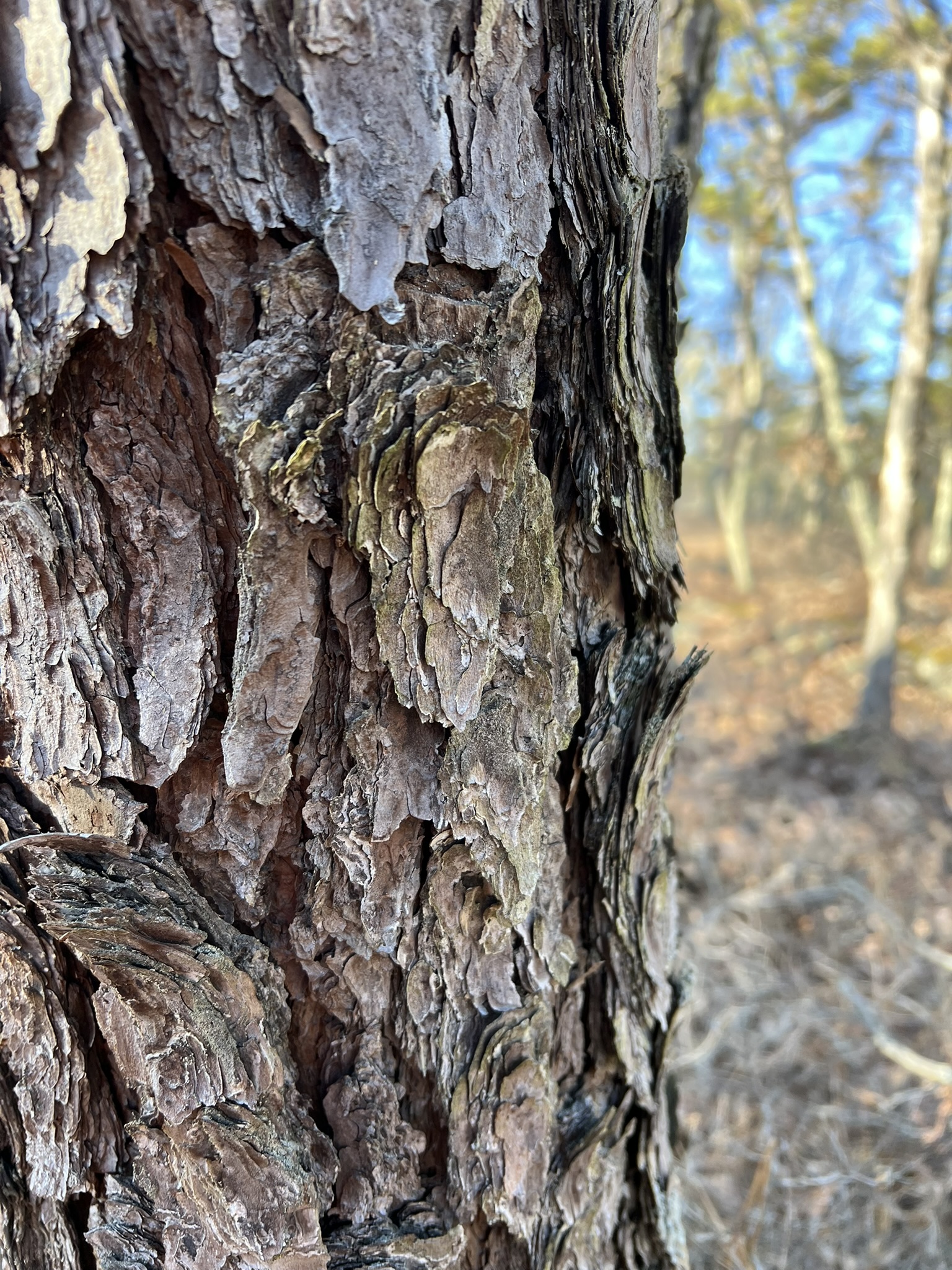
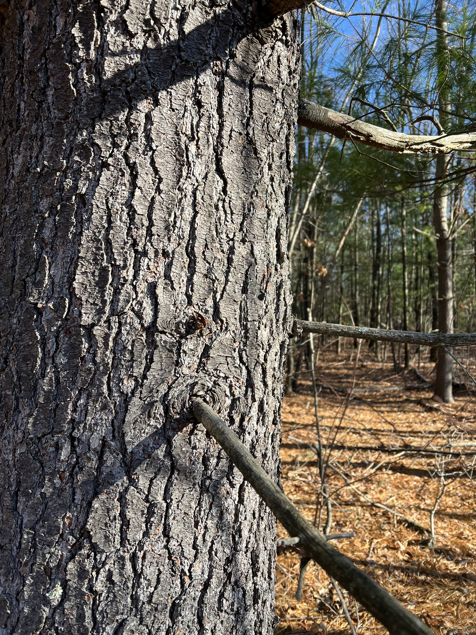
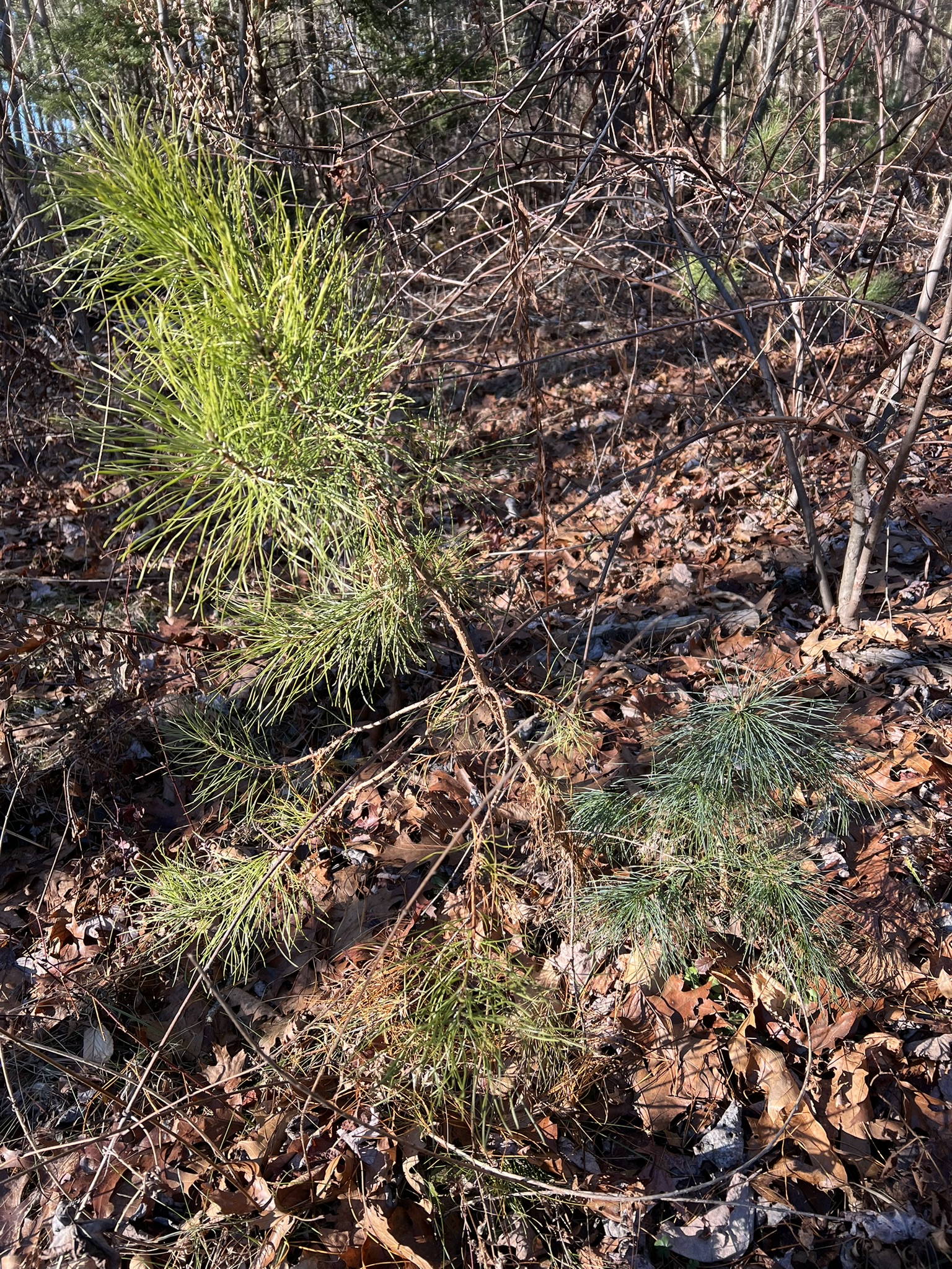
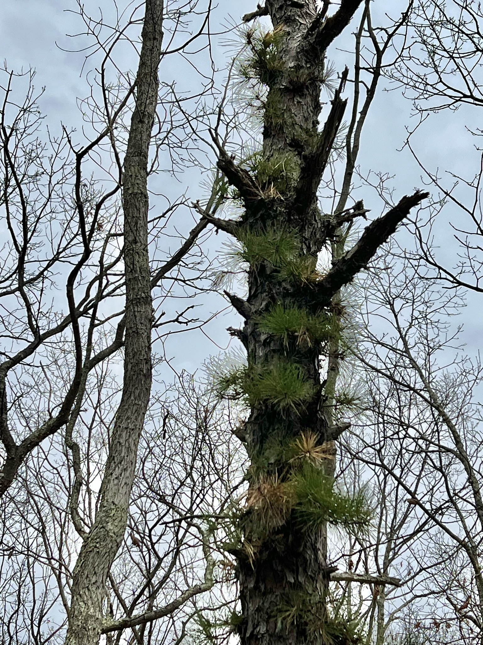
From left to right: pitch pine bark; eastern white pine bark; pitch pine sapling (left) and white pine sapling (right) — the white pine needles are softer and smaller; a distressed pitch pine shoots out new growth directly from the trunk
Continuing my research, one of the positive developments I discovered is the proliferation of regeneration projects around the state. I found this video on YouTube about a regeneration project at the Nassahegon State Forest in Burlington and was able to speak with DEEP Forester David Irvin, who was involved in this regeneration project, along with the comprehensive Nassahegon SF Management Plan, for additional insights. While out on the trails I have encountered random specimens. For example, there were several mature trees on the Holcomb Farm Tree Trail that I explored for my September Tree ID Trail blog post. These mature trees are tall enough to reach the sunlight in the canopy, but can’t propagate because the sunlight doesn’t penetrate the forest floor. Below are several ideas for hikes in the state where you can find these increasingly rare Connecticut trees.
Wharton Brook State Park, North Haven/Wallingford. 1 to 1.6 miles.
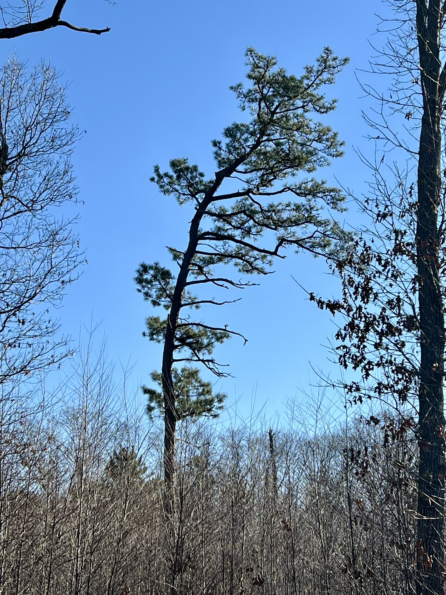
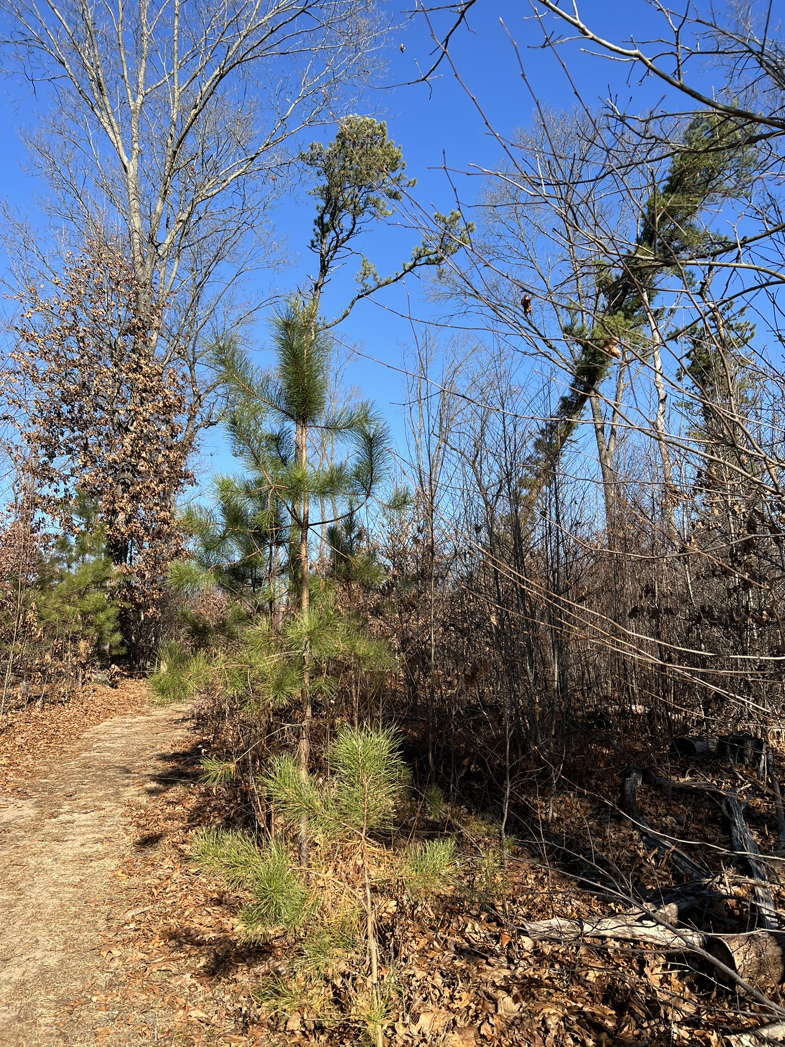
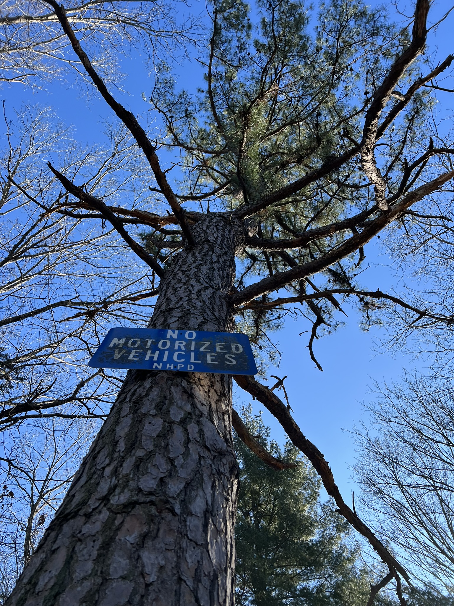
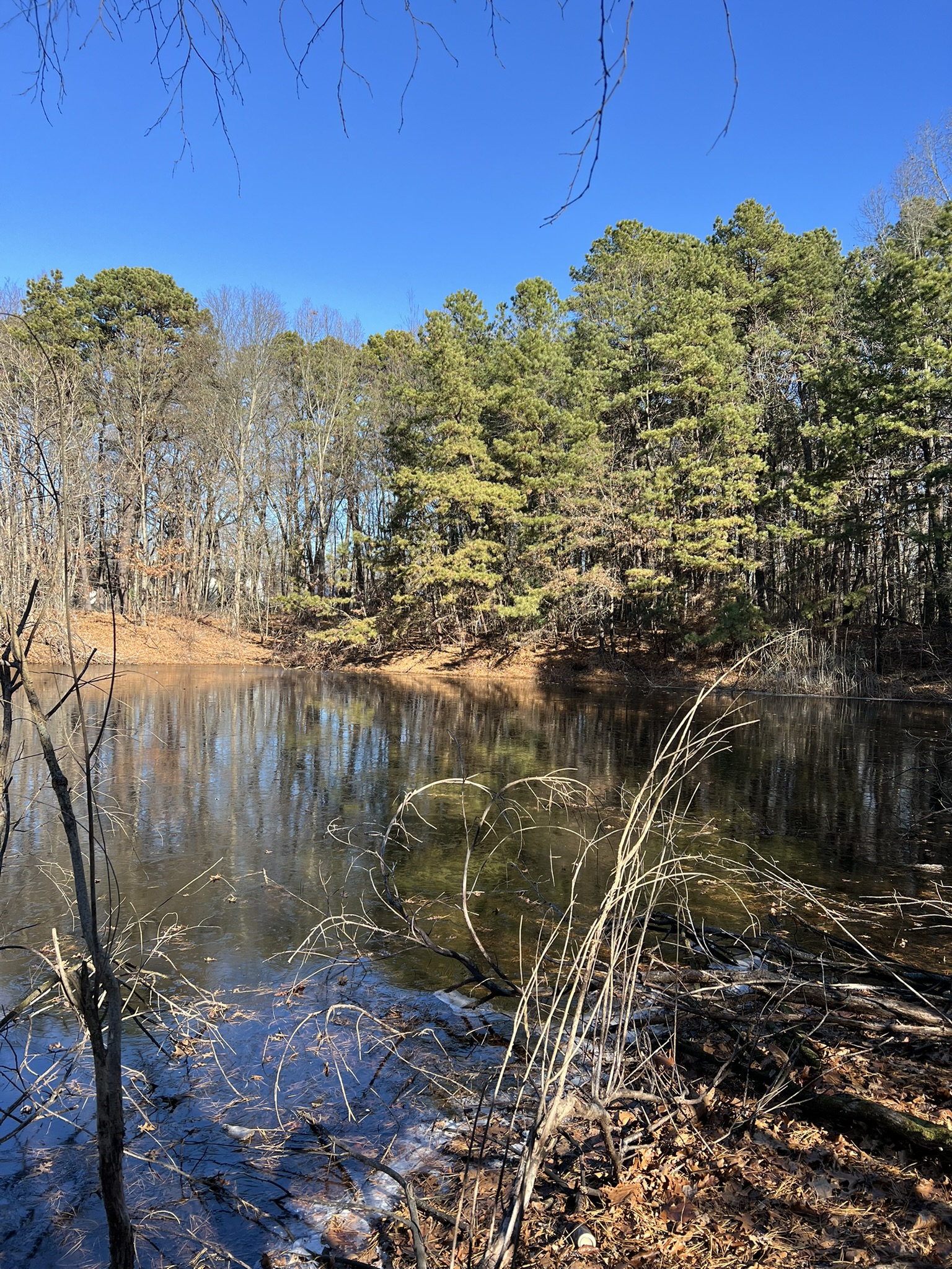
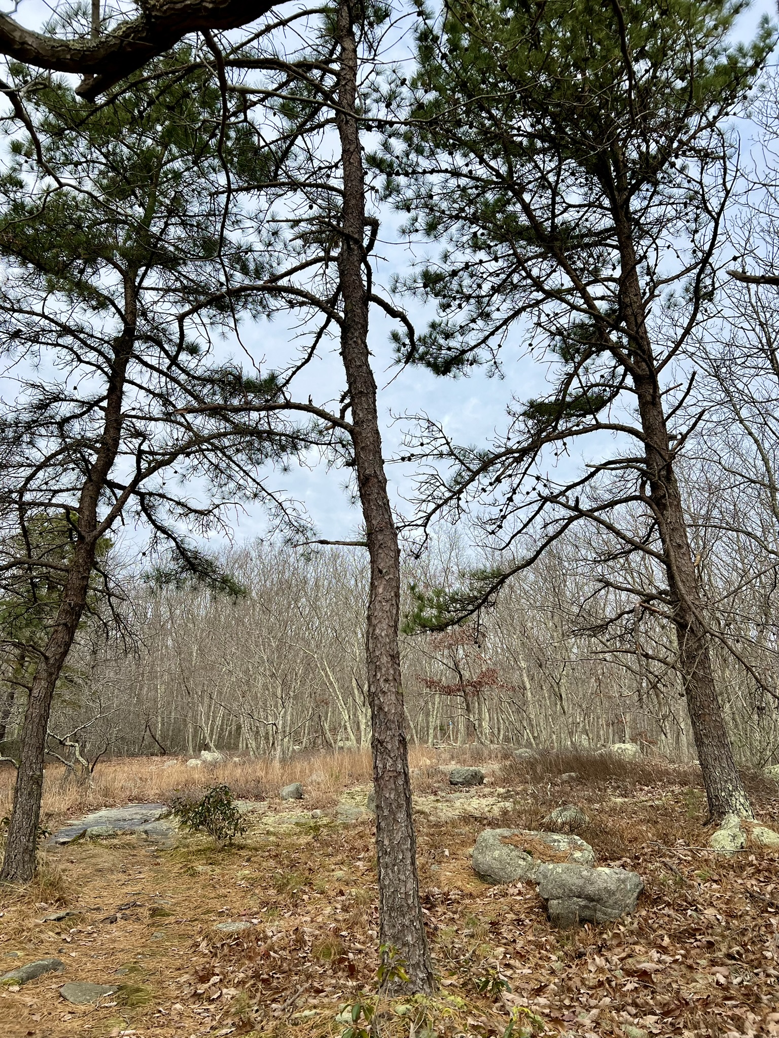
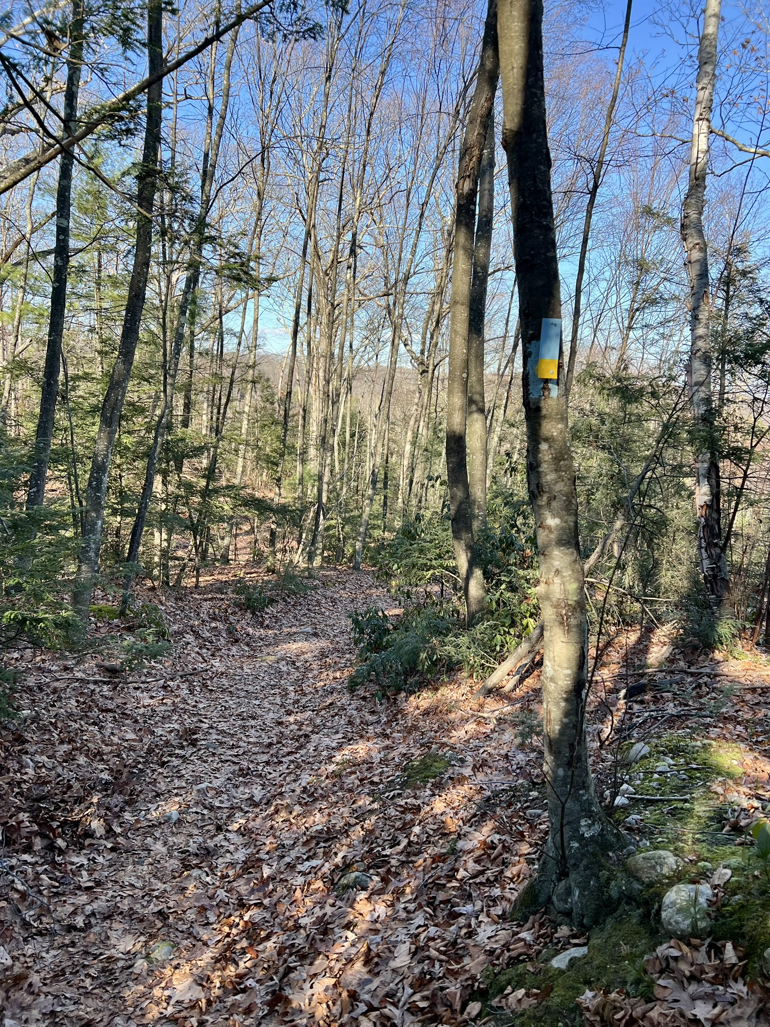
This 96 acre state park is popular for swimming, trout fishing, picnicking and ice skating. According to the website, the park “was the forerunner of the rest areas developed by the State Department of Transportation. From 1918 to 1920, this park was known as a traveler’s wayside where motorists could stop to have their cars serviced and enjoy a quiet picnic lunch.” The eastern side of the pond is a Pitch Pine Natural Area Preserve with a network of unmarked trails. These are easy trails on flat, sandy terrain, a perfect environment for the pines. A 2017 timber harvest focused on culling oak trees to provide more sunlight to the pitch pines and encourage regeneration, as there were only mature trees and few seedlings. A tornado hit in 2018, which devastated the mature trees, but provided an opportunity for additional growth. The sign at the trailhead explains: “[a]lready pine saplings are growing in the openings created by the removal of the overtopping trees.” The park is bordered by Route 5 and train tracks to the west and I-95 to the north, so there is traffic noise, but the trails themselves are lightly traveled. In the winter the gates to the lower lot are closed. Park in the upper lot and walk down the road, or across the field with the picnic pavilions to a set of steps that lead to the pond. As you make your way along the western edge of the pond to cross over the dam, notice the tall eastern white pines shading the picnic tables. The trailhead is next to the beach. I followed the outer loop in a clockwise direction. In addition to the trail shown on the DEEP map, there are several short trails that criss-cross the interior and a trail that loops down to the southern end of the pond and follows the water’s edge back to the dam. I recommend doing them all.

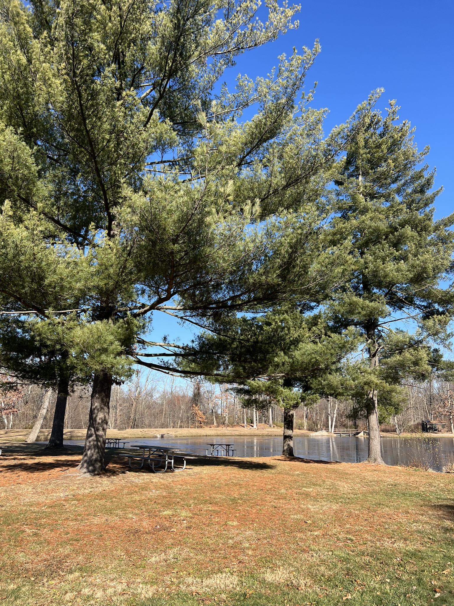
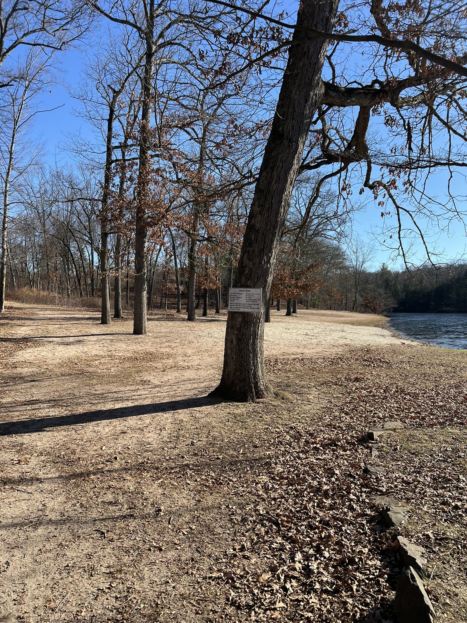
From left to right: the steps down to the pond; eastern white pines tower over the picnic area; the beach is quiet in winter; the trailhead to the Natural Area
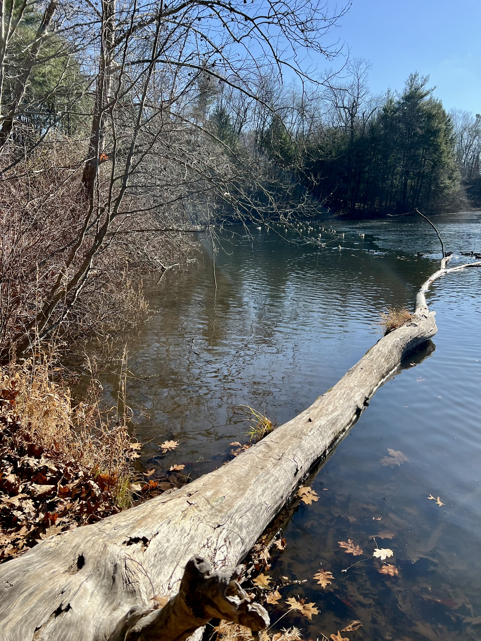
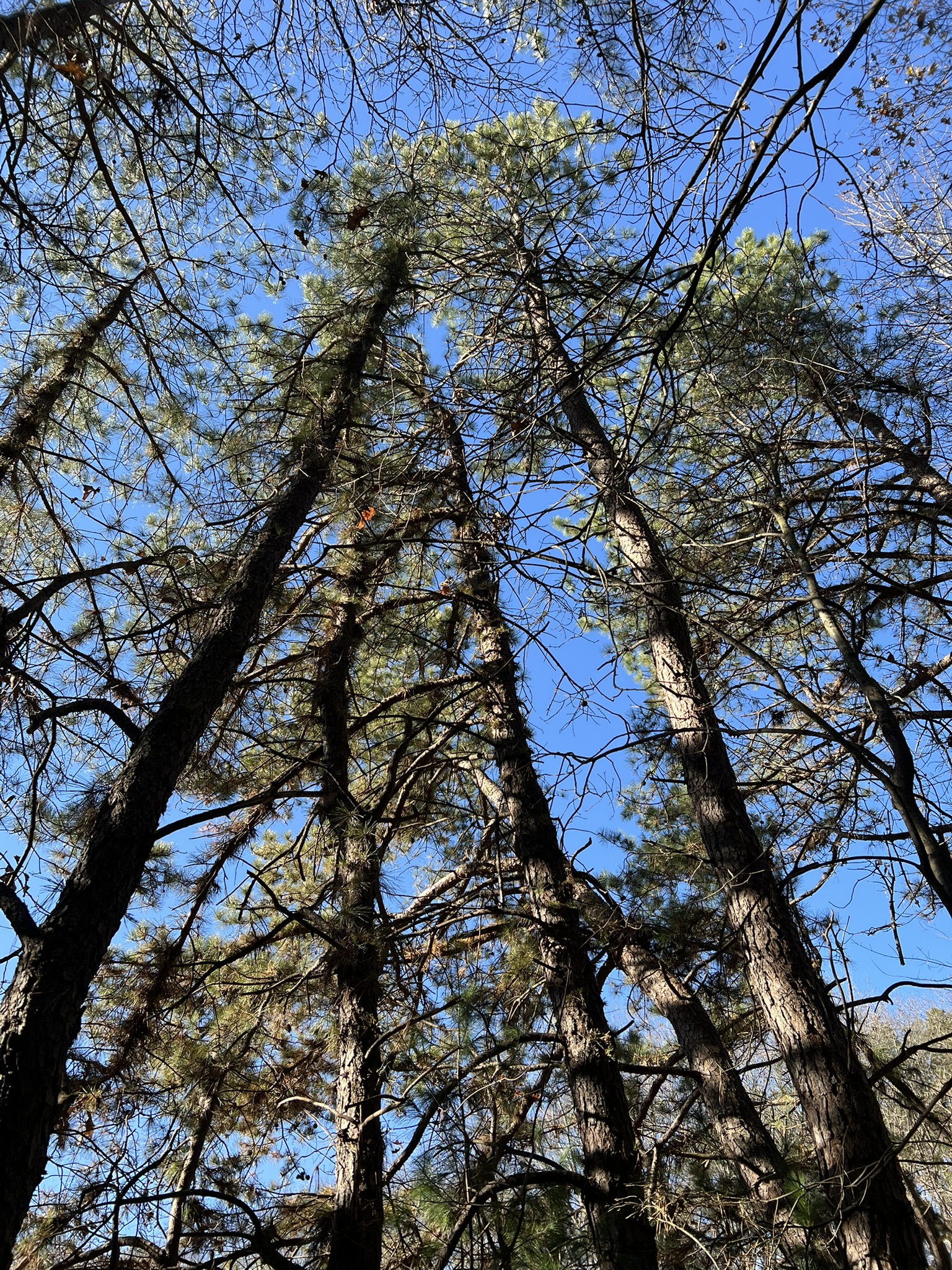
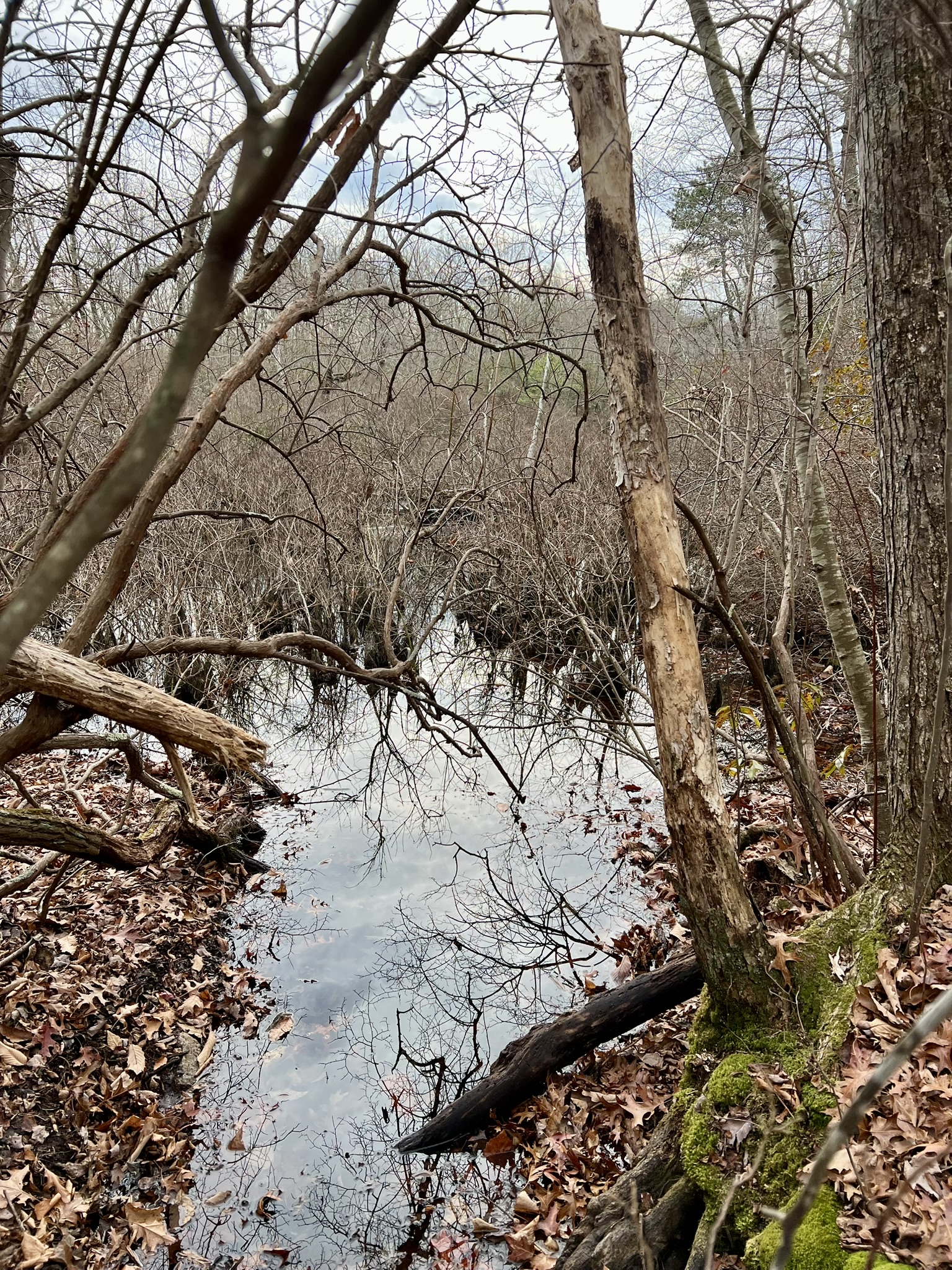
I visited last March, and again on a blustery day in early December. At first, the surrounding landscape was bleak and barren, but after a short time I came across one of the remaining mature pitch pines, which looked like a Dr. Seuss tree. Continuing around the loop I came across many seedlings and saplings. There was an occasional white pine in the mix so I could do a side-by-side comparison. The pitch pine needles are noticeably thicker and stiffer, and the bark is furrowed with thick plates and slightly reddish in color. To return I took the trail along the lake, which passes through a hemlock forest before opening up onto the beach. There were dozens of mallard ducks floating in the sun and stretched out atop a fallen log in the water. I felt bad inevitably disturbing them as I continued along the trail.

From left to right: the first wind-blown tree; sapling, juvenile and adult all in a row; a thick section of new growth; the duck log.
For the Wharton Brook State Park Trail Map click HERE. For more information about the Wharton Brook regeneration effort scroll to the bottom of the page on this Yankee Division of the Society of American Foresters PHOTOJOURNAL LINK.
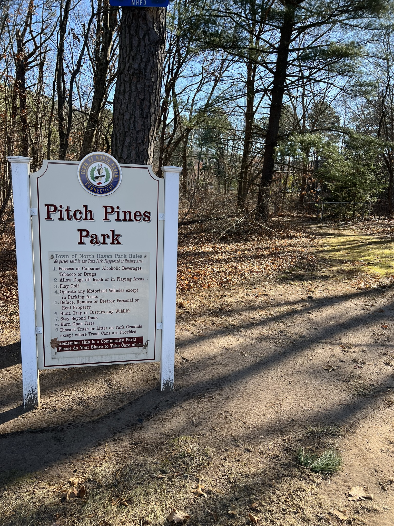
Pitch Pines Park, North Haven. ¼ mile loop.
Around the corner from Wharton Brook State Park is the small, municipal Pitch Pines Park. As the brochure explains: “[t]his small park is located on North Haven’s last undeveloped parcel of sand plain, which was formed at least 15,000 years ago as the last melting glacier deposited sand and gravel debris in this area.” While the brochure adds that you can park on the street, Bradley Road is fairly busy, so I pulled into the dirt and grass area by the entrance where the curb is cut. There aren’t official spaces, but there is room for a few cars. The trail is a loop around a vernal pool. It is hard to get lost with the pond on one side and a chain link fence on the other. The trail was passable, but looks like it was overgrown in the summer. As an add-on to Wharton Brook State Park it is interesting to visit, but not a hike to go out of your way to do. There are a number of larger trees on both sides of the fence. For the Trail Map click HERE.
From left to right: the park entrance; an older pine at the trailhead; numerous mature trees; a view across the pond to a forest of trees.
Candlewood Hill Wildlife Management Area, Groton. 2.7 miles.
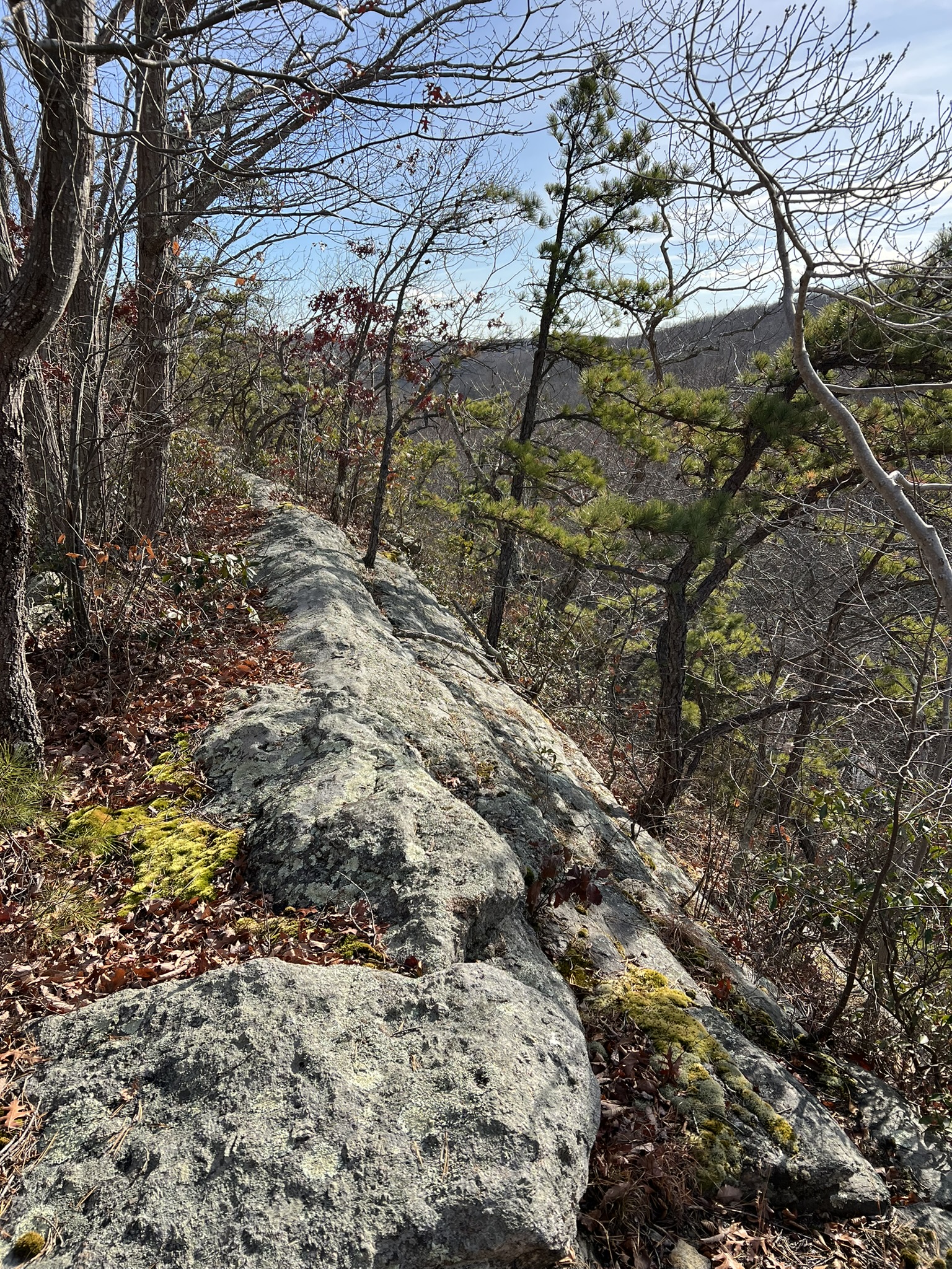
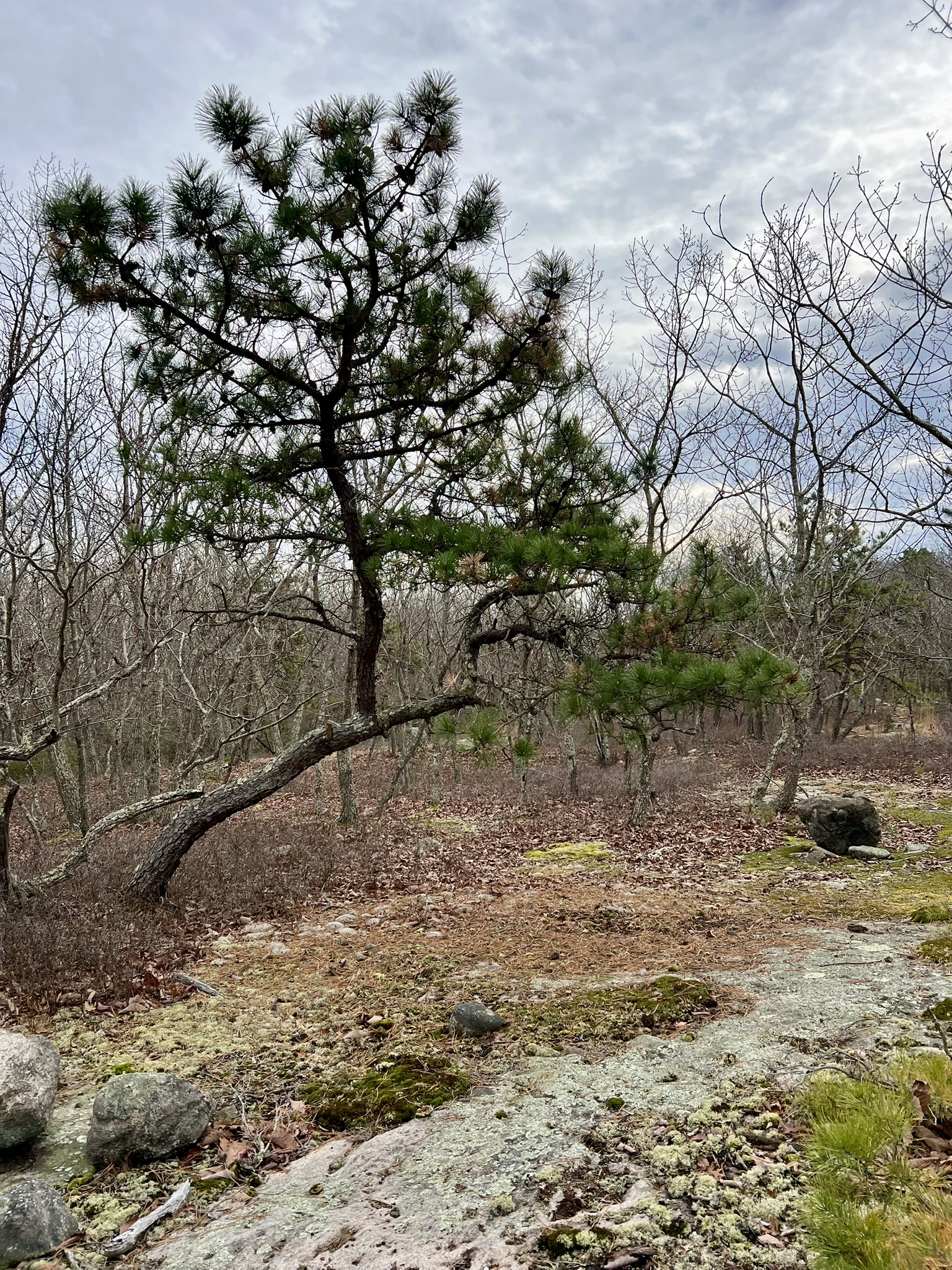
The state created Candlewood Hill WMA in 2017 when it acquired a 200 acre property from Tilcon. The parcel includes a 44 acre pine barren across a wide ridgetop plateau. The trailhead is on Route 184. While there are no signs or trail blazes yet, the unmarked trails are easy to follow. We visited in early December and found it very helpful to use this AllTrails map as a guide. There were often places where side trails split off, and the tracker helped us determine which route to take. Cautionary Note: There is a second AllTrails hike entitled Candlewood Hill Wildlife Management Area Extended Loop. This track goes across private property and should be avoided. The parking directions in the AllTrails link are accurate and lead to a wide dirt pullout along Route 184 that has space for several vehicles. After following the trail from the pullout a short distance it branches off to form a loop. We did a clockwise loop. This area of the state was the end point or “terminal moraine” of the glaciers that inhabited the landscape thousands of years ago and the remaining rock formations and scattered glacial erratics as you climb the ridge are spectacular. With all the deciduous trees bare, this is the perfect time of year to notice the pine trees. The first trees came into view around the .6 mile mark. Many of these specimens were larger, mature trees lower down on the slope and not as exposed to the elements.
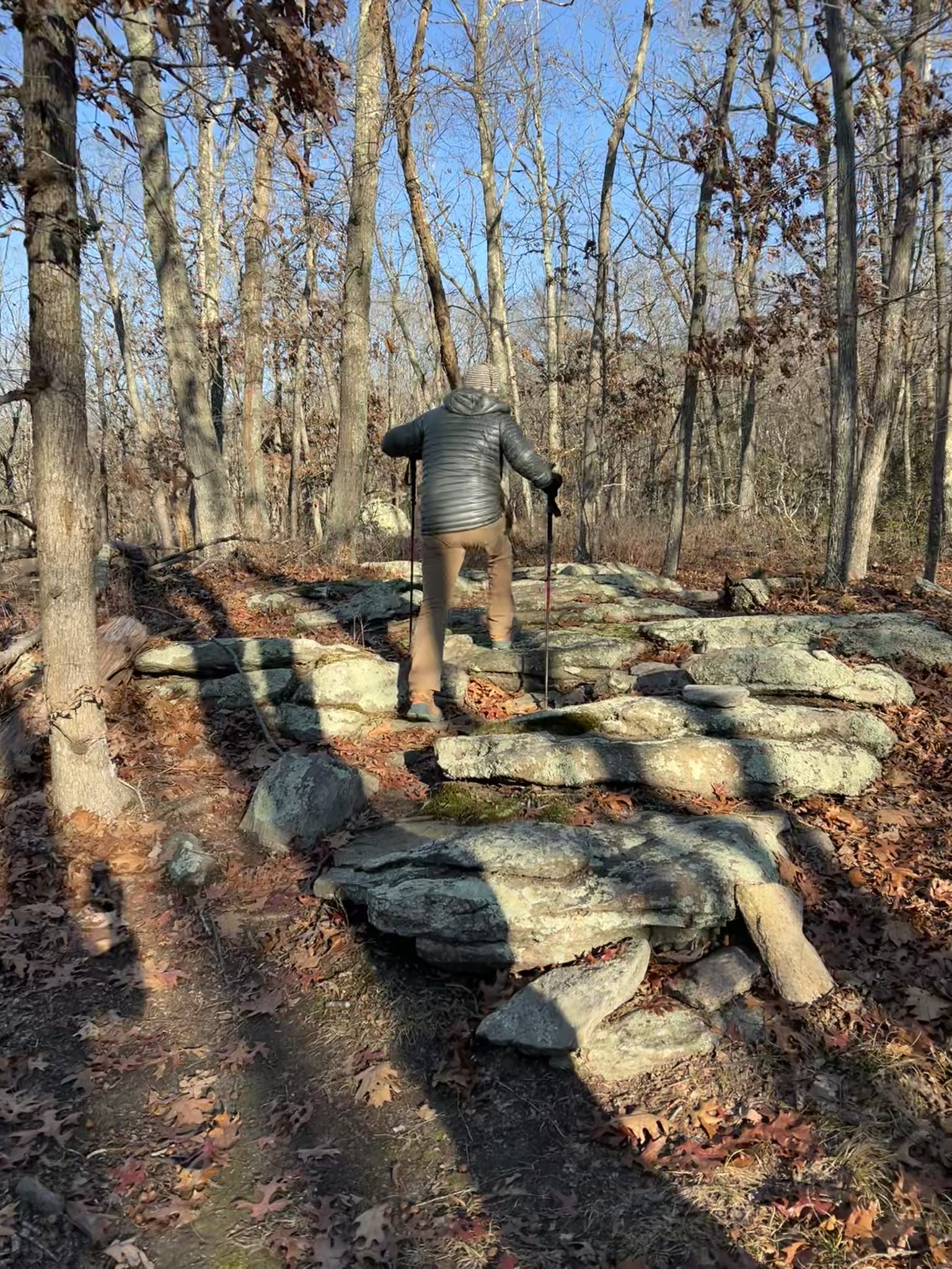
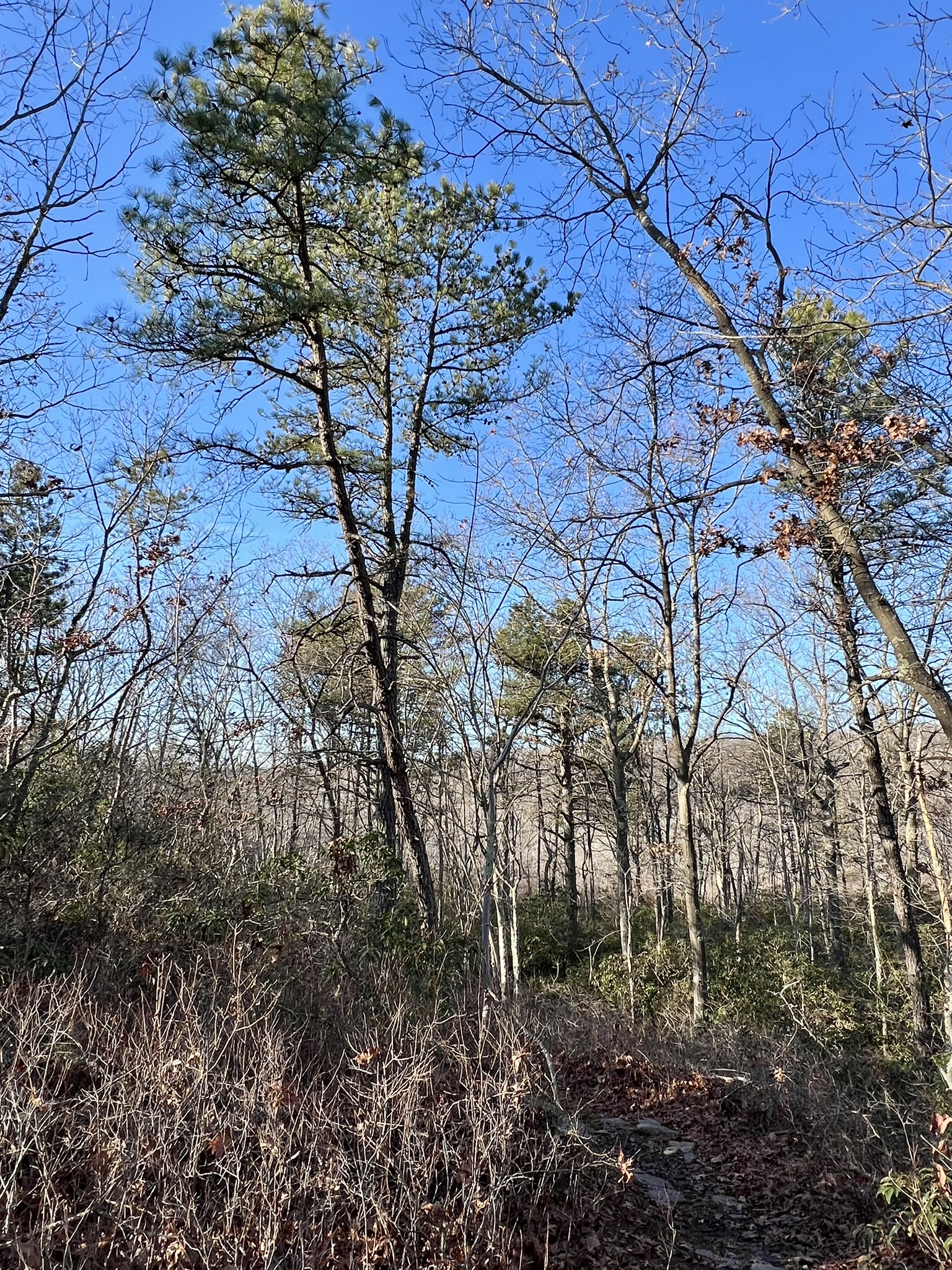
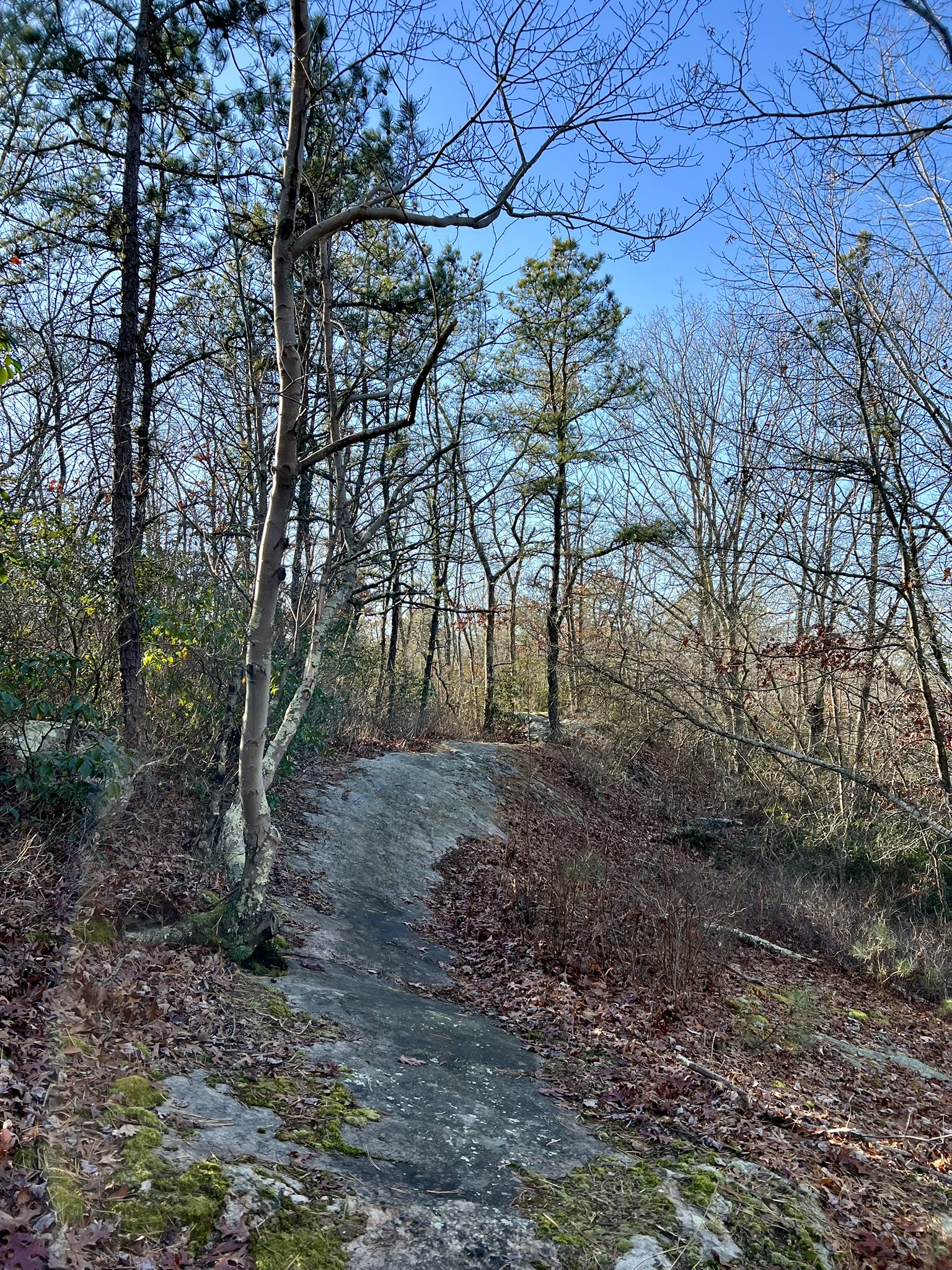
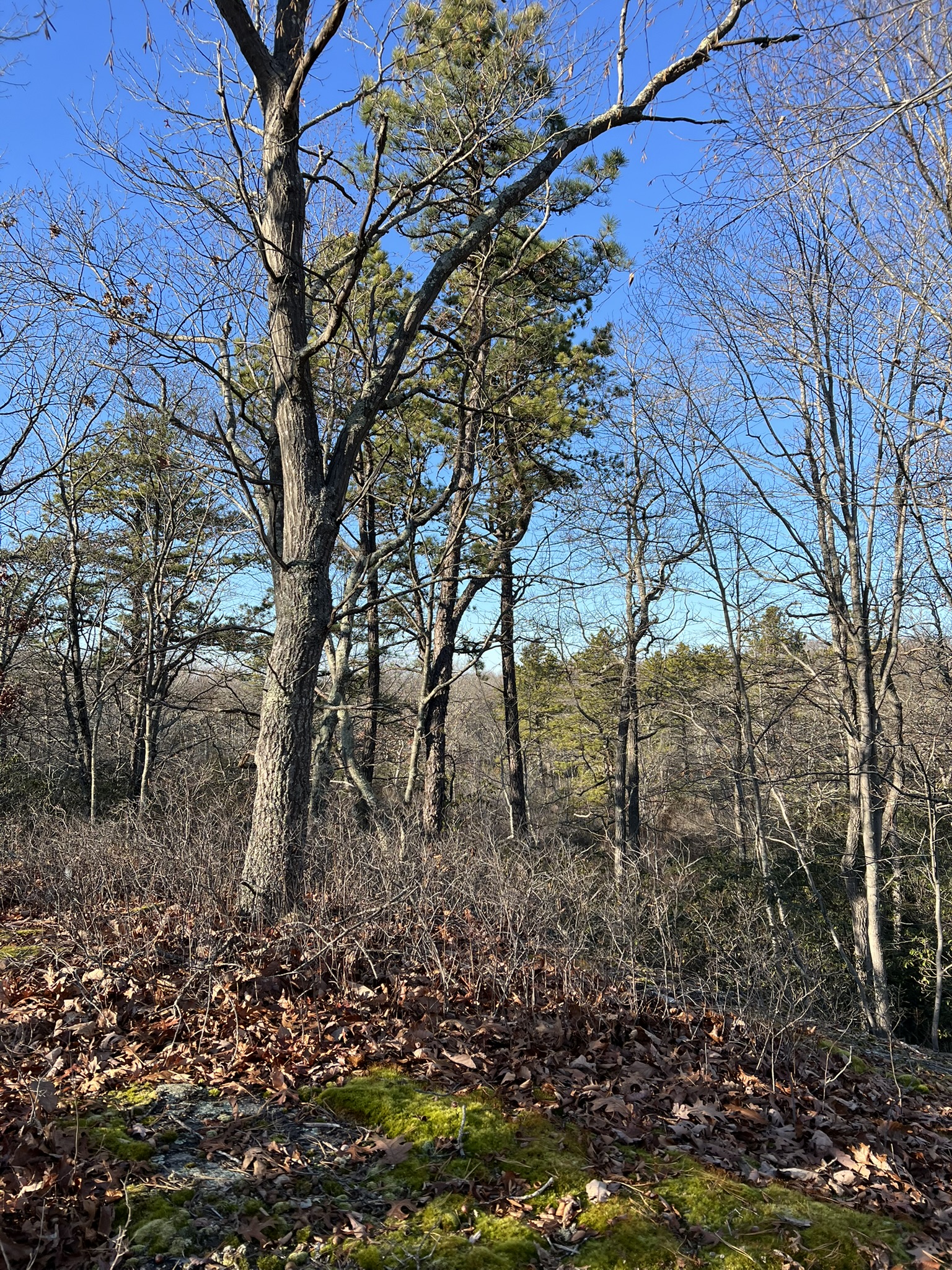
From left to right: Making our way up the rocky trail; our first views of pitch pines on the slope; many sections of trail were rocky outcroppings; approaching the top
When we finally reached the high plateau close to the one mile mark I was giddy with the number of pitch pines visible along the ridgetop. The ridge extends for quite a distance, and finally starts to loop around at the 1.4 mile mark or so. The AllTrails track has a short extension continuing south off the loop but we chose to ignore it. We used the satellite signal several times at trail junctions to make sure we stayed on track. It appears that several side trails crisscross the top of the plateau. Near the end of the loop there is a rock quarry and pond below on the left. While parking is limited, this was a favorite of mine and I highly recommend it. For more information about CHWMA in particular and pitch pines in general, read The Pitch Pine Forest: A Rare Ecosystem – by Laurie Gorham on the Groton Open Space Association (GOSA) website.
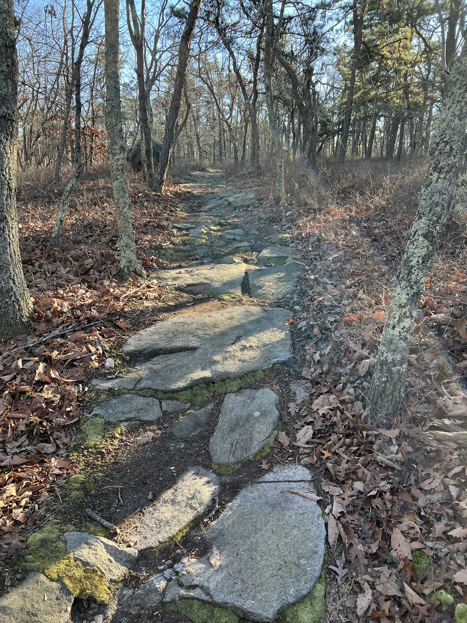

From left to right: the ridgetop plateau; a field of pitch pines; one of many intriguing boulders; the quarry and pond
Pine Ledge, Chester
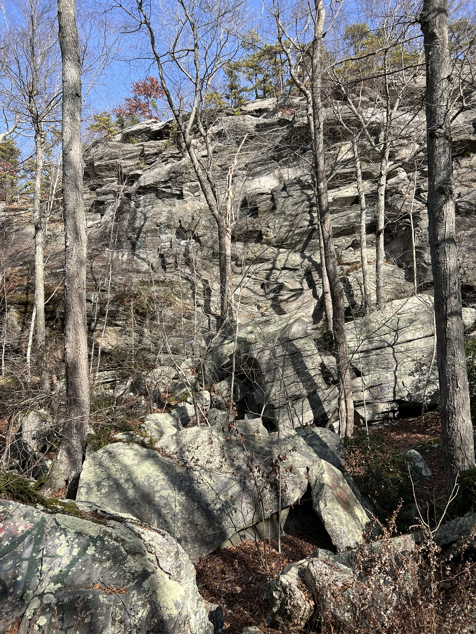
In the first paragraph of Emery Gluck’s article, he lists a few specific places in the state where pitch pine is found. I did a double-take when I read “Pitch pine is found on……Pine Ledge in Chester….” That’s my home town! I knew Pine Ledge was a rock climber’s mecca, but how is it that I have never explored this spot? I was familiar with the Pine Ledge block of Cockponset, having visited it often, but I mostly stayed to the western end where the cedar swamp is located. DEEP has conducted major state forest road improvements there, so I decided to venture further down N. Pine Ledges Road than I had done in the past. I found THIS MAP online which helped me locate the ledges.
A WORD OF CAUTION: the forest roads are gravel roads and 4-wheel drive is recommended. I visited in early December while the yellow forest gate was still open. Winter storms can close the road and cause damage, so proceed with caution. Car access to this forest block is from Cedar Swamp Road off Route 80 in Deep River. Drive north to the end of the paved road. After passing Shailer Pond the road turns to gravel and there is a large parking area on the left. This is the main parking area when the gates are closed. If the gate is open, continue through and at the first junction take a right onto another gravel road. This is N. Pine Ledges Road. Follow this road for approximately 2.3 miles. As the road starts a steep descent stone cliffs rise up to the left. At the bottom there is a wide parking pullout on the right. I parked here, briefly admiring the cliff and taking note of the pitch pines clinging to the top. I continued on foot down the road and around the corner and came to a spot that looked like a good access trail despite its initial steepness, and indeed it was. After a short distance I reached the top of the ledge and marveled at both the pines and the views. I walked along the ledges to the far end, and turned around when I reached the last of the pines, then retraced my steps.

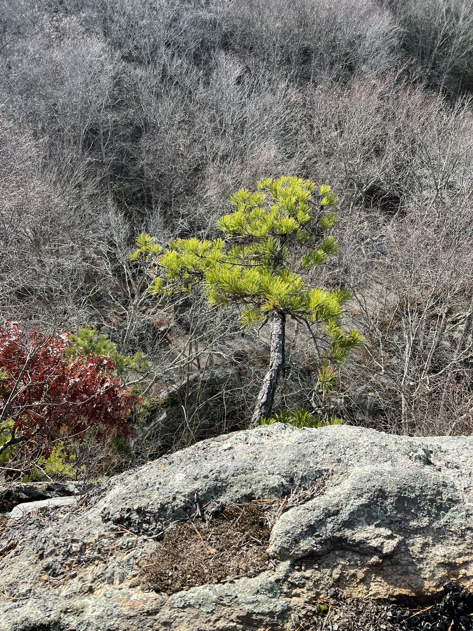
From left to right: the ledges from below; the top of the ledge; a sapling clinging to the edge; walking along the ledge.
Oswegatchie Hills Nature Preserve, East Lyme.
It’s been a while since I hiked at Oswegatchie, so I was thrilled to learn of the new Greg Decker Pitch Pine Park installation spearheaded by the Friends of Oswegatchie Hills Nature Preserve (FOHNP). The installation is on town land at the main entrance to the preserve on Memorial Park Drive by Veteran’s Memorial Field. The park is more of a nursery and garden with a bower and circular bench seating, and a winding path with a few dozen pitch pines ranging from saplings to juveniles and a series of educational signboards. Equally amazing was the description of the time and effort put into eradicating invasive mugwort plants over a course of two years to create this space. For a virtual walk of the signboards posted throughout the park click HERE.
The new park is named after Greg Decker, the FOHNP Stewardship Chair, who was quoted in this 2018 Save the Sound article about the pitch pine restoration project as saying: “I’ve personally been a part of and witnessed the results of a concerted effort to help ensure the survival of a one-time dwindling species in coastal Connecticut, ospreys. I believe the same can be done in the Hills with the pitch pine ecosystem. It won’t happen if we don’t try.” Part of the restoration project will be to plant seeds and/or transplant saplings into the existing pitch pine landscape of the preserve. A 2017 Save the Sound article says : “Forester [Emery] Gluck and Friends of Oswegatchie Hills Nature Preserve (OHNP) volunteers estimated that there are at least 100 Pitch Pines and a handful of Scrub Oaks growing in the upper ridgeline sections of the preserve after hiking it together earlier this year. While some of the stands appear to have sprouted after the last fire in the Hills, which occurred in 1962, younger trees growing in rock crevices indicate that Pitch Pines continue to adapt and grow.” I decided to set out to try to find some of them.
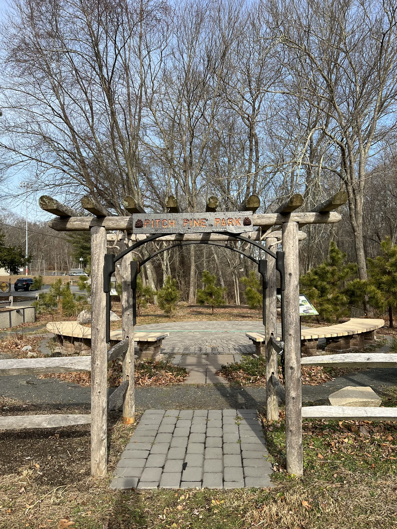
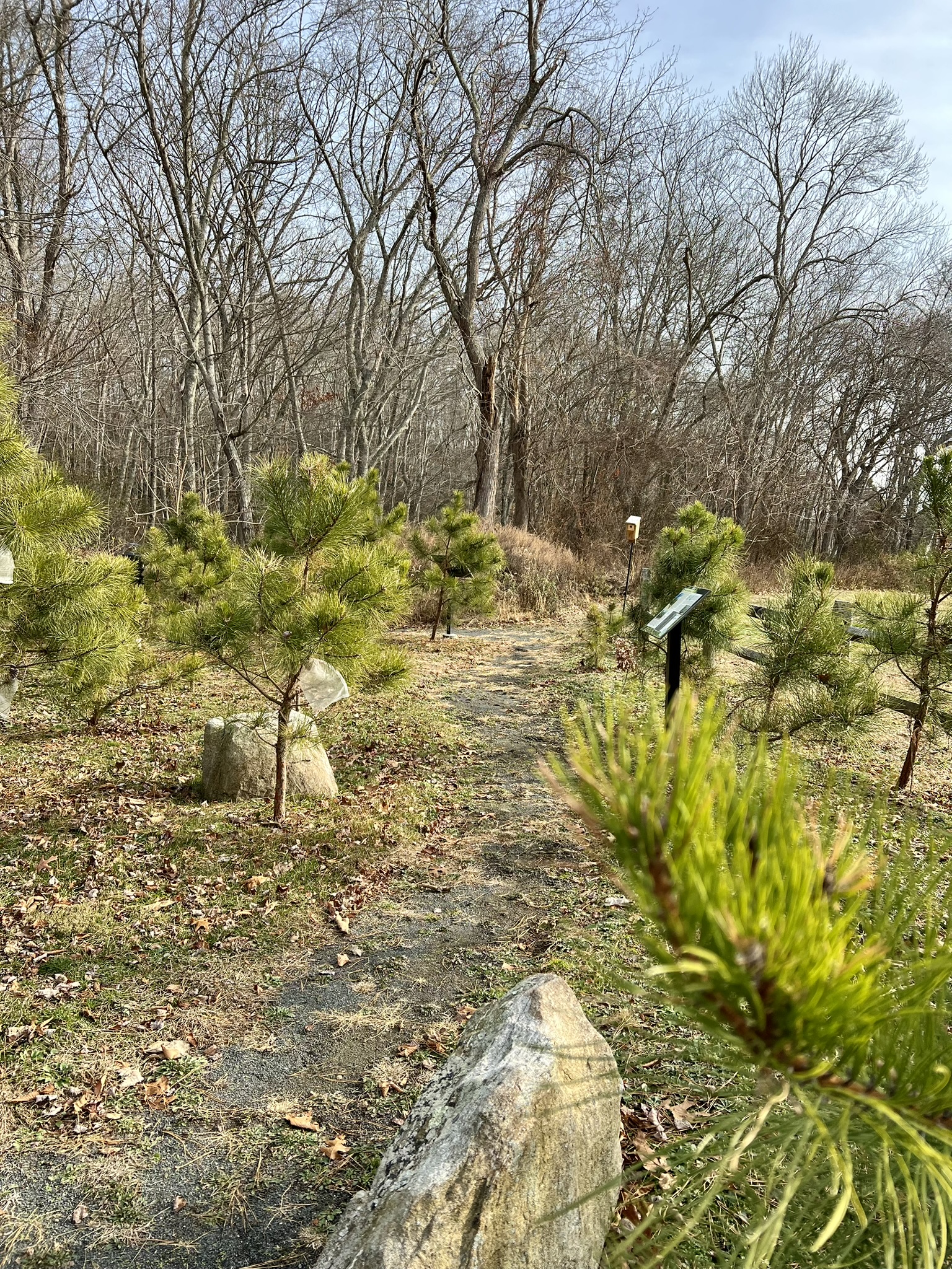
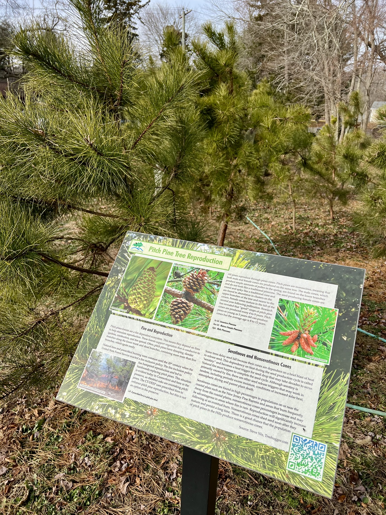
From left to right: the entrance to the park; a path through a garden of young trees; one of several educational signboards; an experiment to collect seeds from what are suspected to be non-serotinous cones
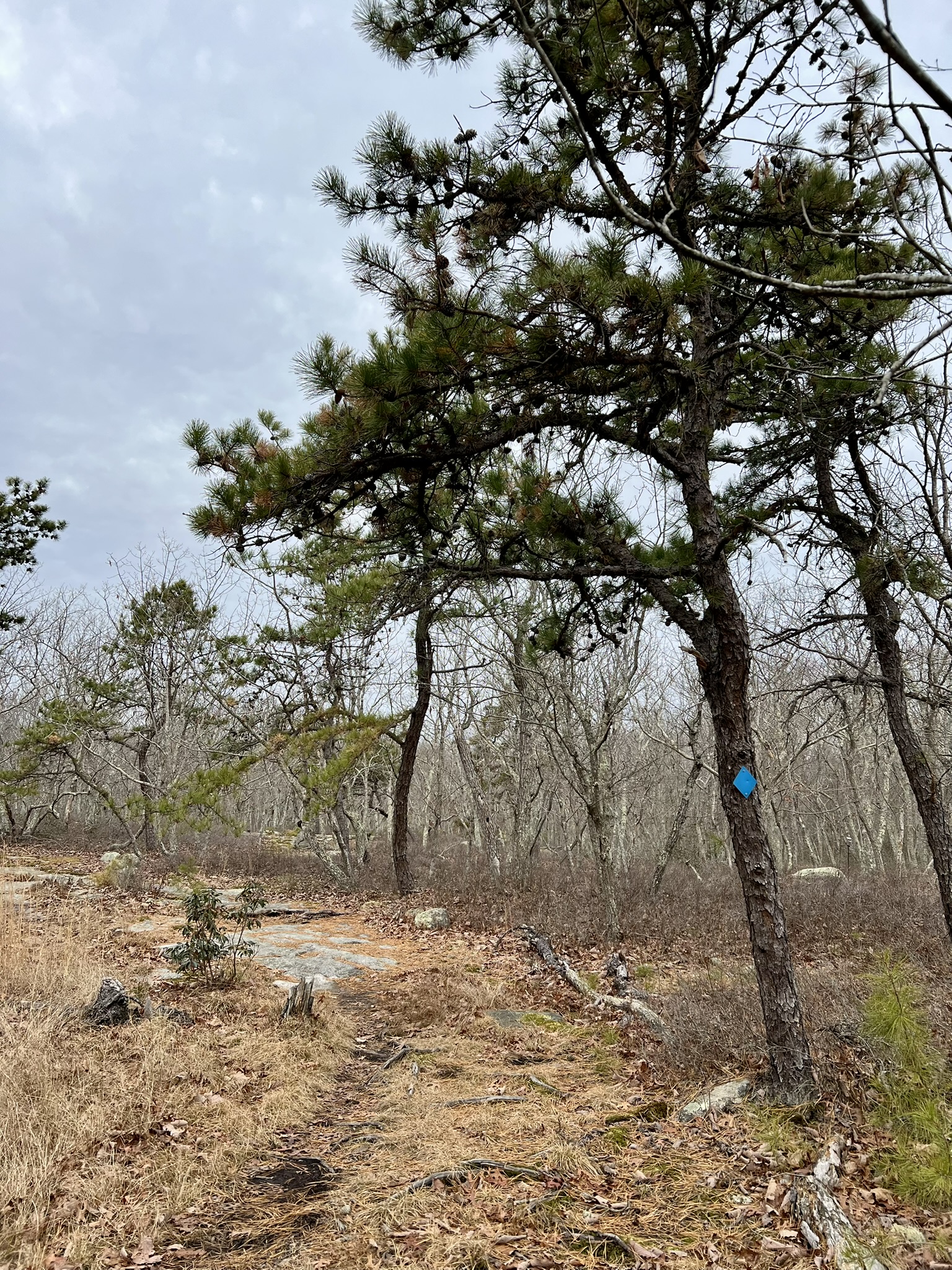
In early December, I visited the new park then set out to hike the trails in search of some pitch pines. Notes on the kiosk board indicated that the western ridge of the blue trail was a prime spot for pitch pines, so I decided I would do a clockwise loop hike of the blue trail. The blue trail starts with crossing the bridge at the outlet of Clark Pond. Take a moment to read the plaques about the history of the pond as a source for ice and as a popular skating venue. Be sure to look down and notice the handiwork of beavers who have created a large dam on the north side of the bridge and the black culvert installed to help control the water flow. I followed the blue trail and when the trail split I stayed straight (north). This trail passes through a ravine on the eastern side of the stream that feeds Clark Pond. My biggest problem hiking this trail is avoiding tripping because the rock formations on both sides of the ravine are so impressive that I forget to look down at my feet. As the trail veers west it goes steeply uphill, climbing up out of the ravine. (A note about the trails: in general the north/south trails are gentler as they traverse either the ravine or ridgetops, and steep as you go in an east/west direction). At the junction of the blue and red trails on the western ridge I finally started to see my first pitch pines. I went right to stay on blue. It’s possible that the red ridge trail also has some pitch pines but I did not explore that route. You could take the red trail from the parking lot to get to this point as an alternative track. I continued on blue and passed a clearing with 3 large pitch pines right on the trail and another one off to the edge of the clearing. I took note of at least one sapling along the trail.
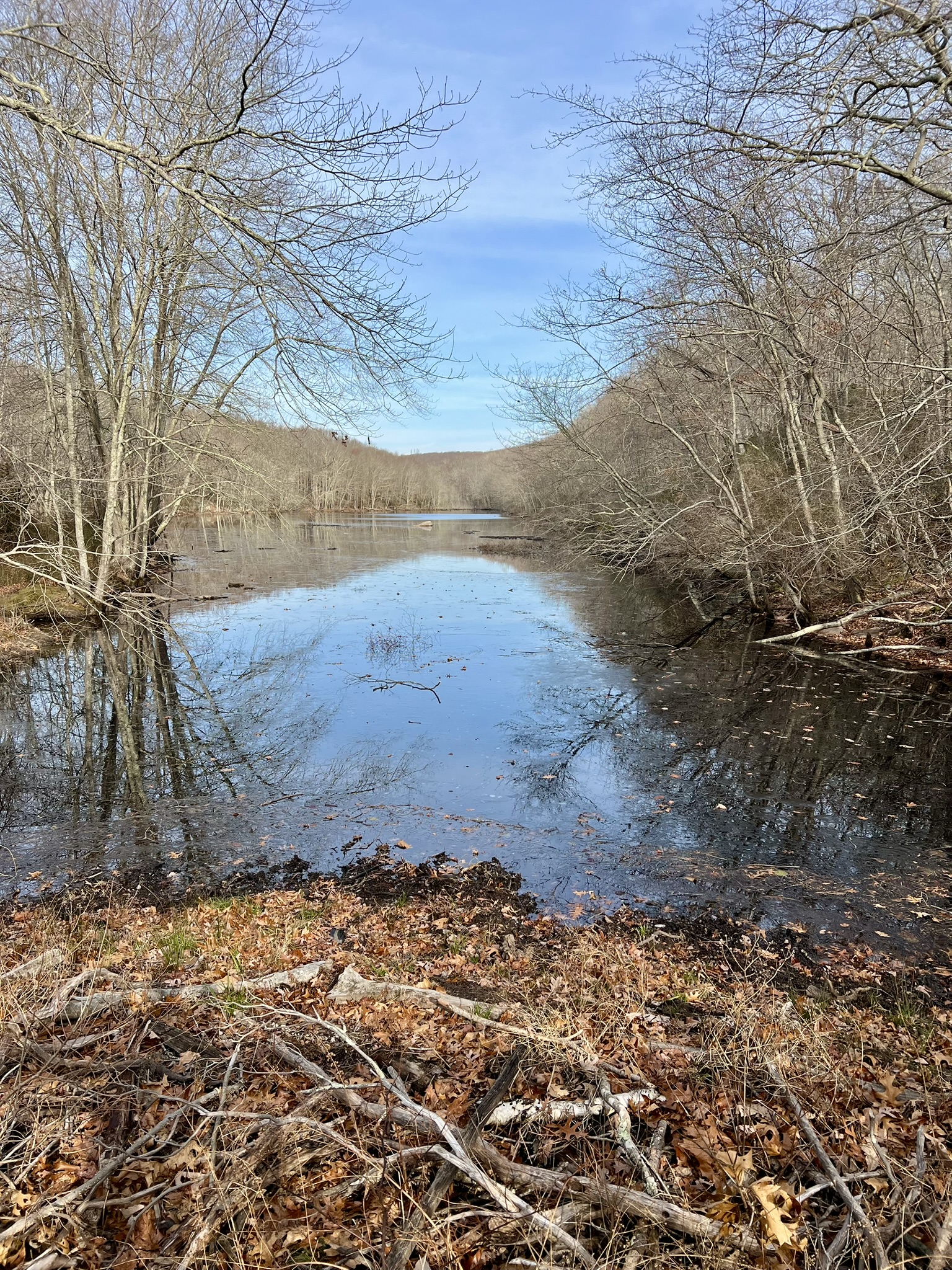
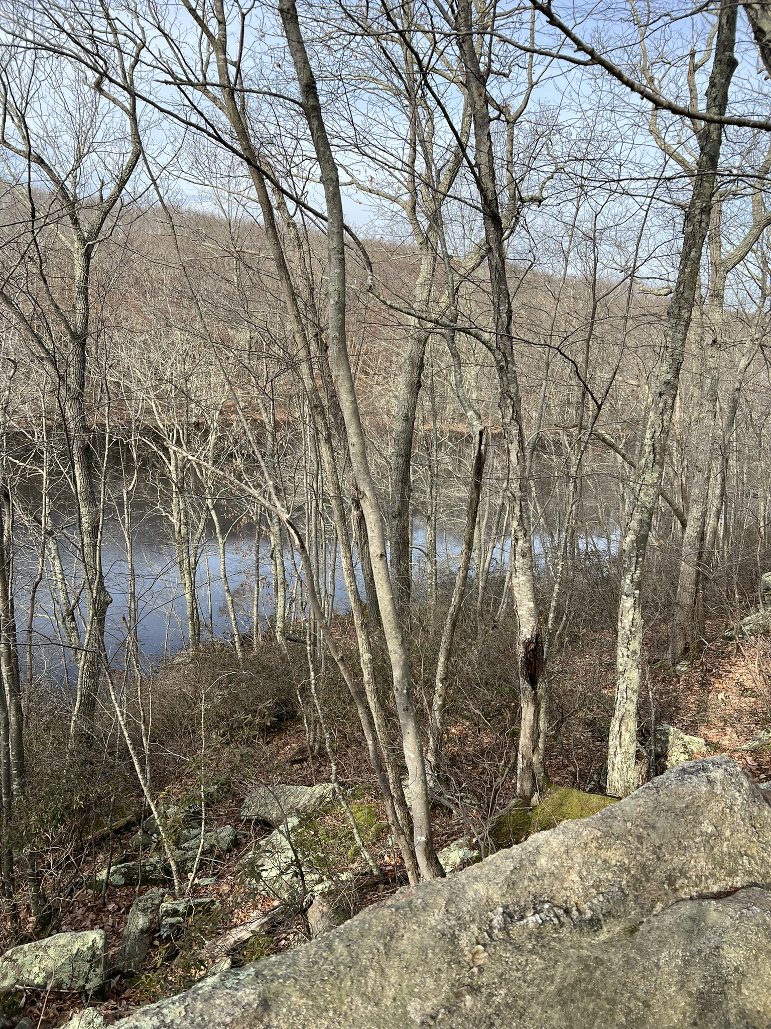
From left to right: Clark Pond; view of Clark Pond from a viewpoint along the blue trail; climbing the ridge; a clearing with several pitch pines
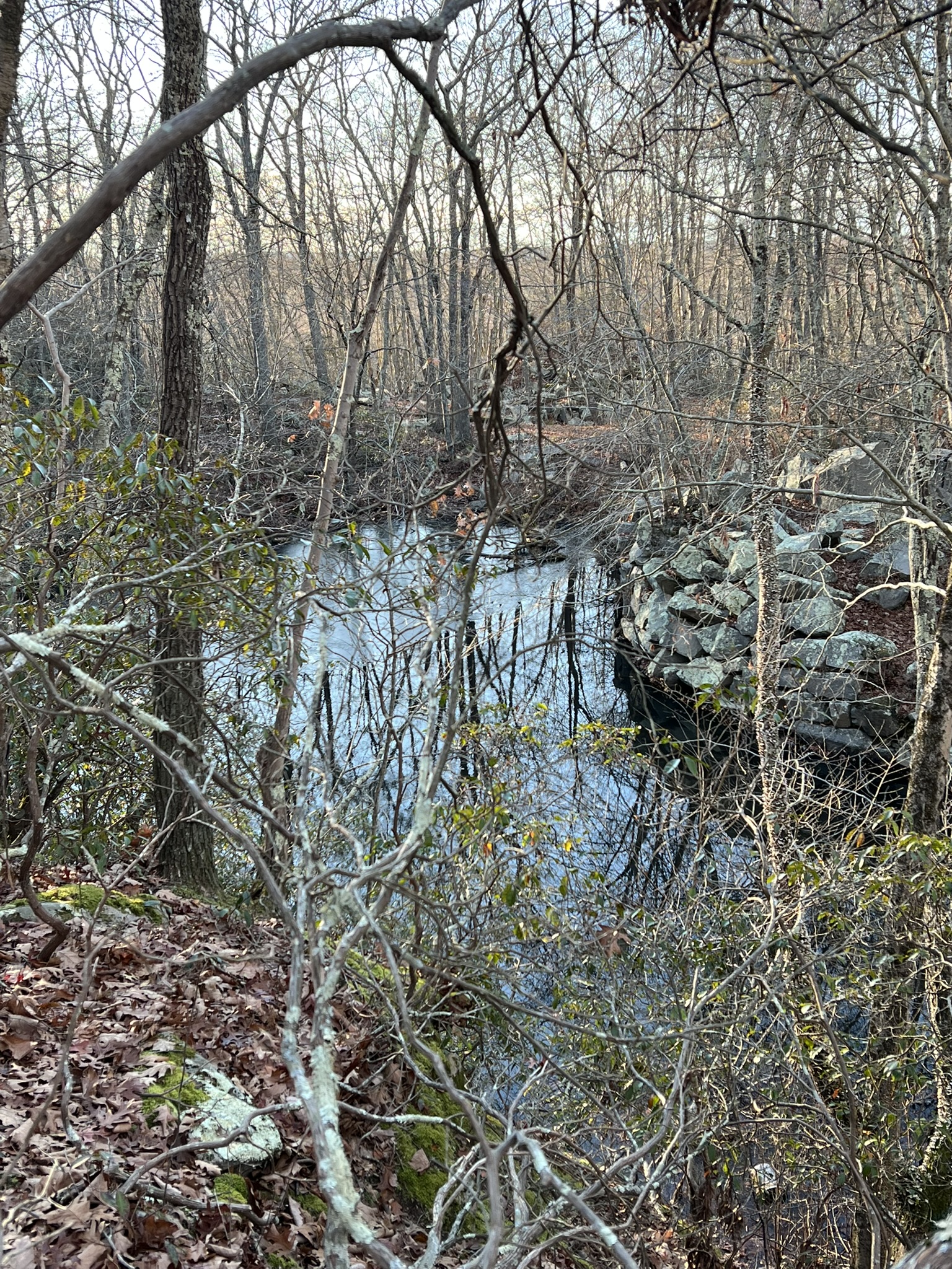
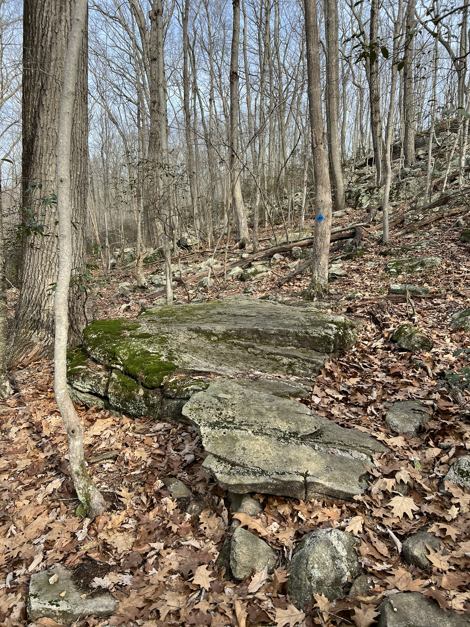
I was strapped for time so when I reached the junction with the yellow trail I took it to reach the eastern side of the blue trail loop. This trail had a lovely vernal pool not shown on the map. As I reached the top of the ridge and the junction of the blue and yellow trails I started to see pitch pines in much greater numbers. If you have the time, continue on the yellow trail for the short (one quarter mile) loop of Mount Tabor, the highest point in the Preserve at 243’ with seasonal views of the sound. It is well worth the detour, and is populated with more pitch pines and scrub oaks. For my hike, I headed south on the blue trail. This next section of blue trail on the ridgetop plateau had numerous pitch pines all the way to the stone wall at the junction with the orange trail. I stayed on blue, which passes several interesting glacial erratic boulders before descending to the pond. I recorded a total hike of 3.25 miles with 430’ of ascent. For more information about the preserve and to download the trail map click HERE.
From left to right: the secret vernal pool; pitch pines on the eastern ridge; a glacial erratic
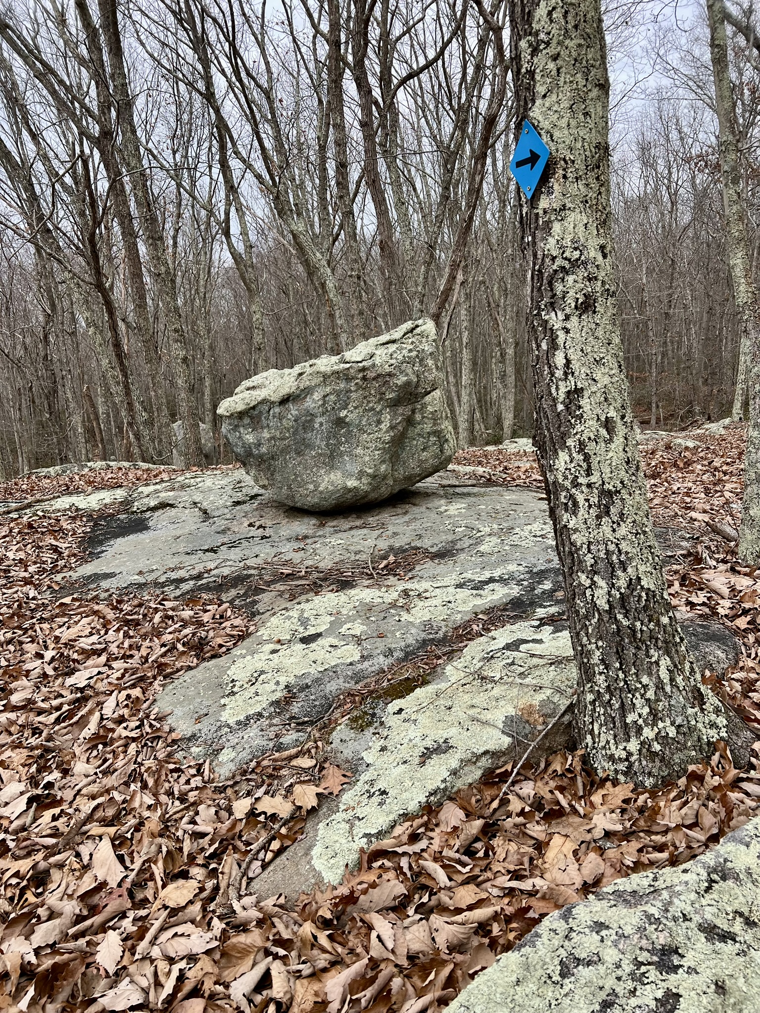
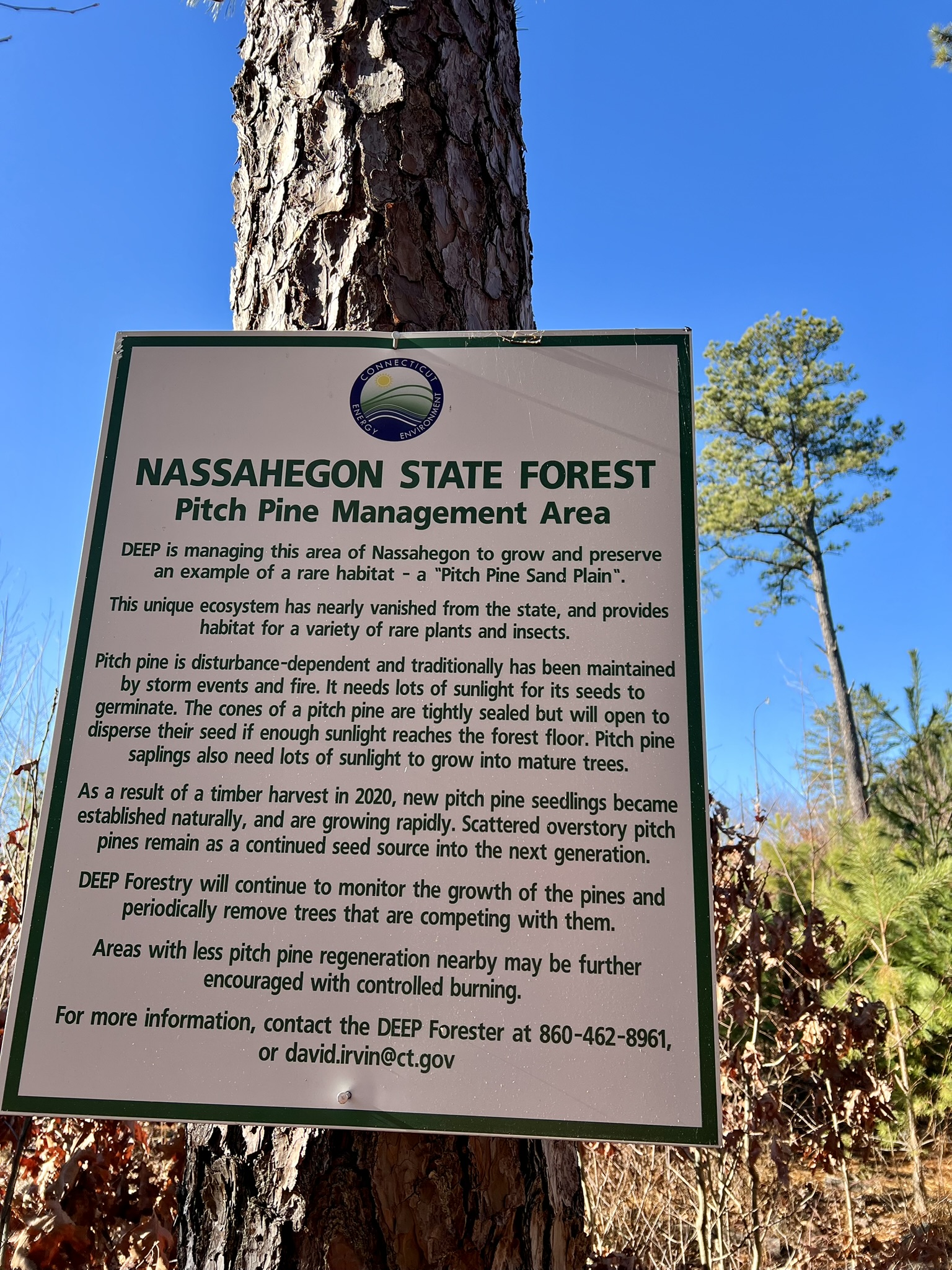
Nassahegon State Forest, Burlington. Punch Brook Trail, 3.75 miles.
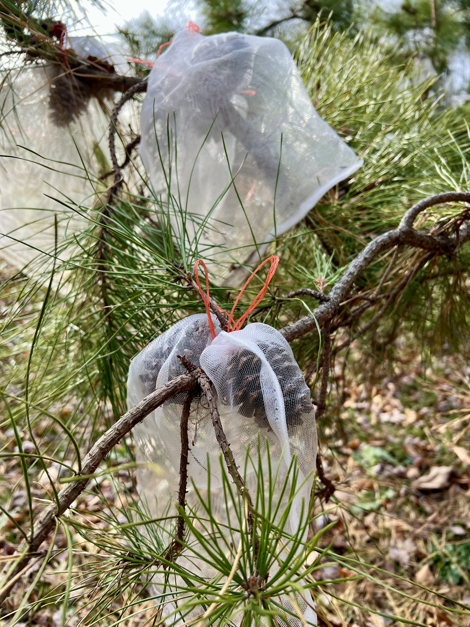
After speaking with DEEP Forester, David Irvin, I was excited to visit the regeneration project in Nassahegon State Forest. He gave me clear directions on how to find it, and I searched the internet for nearby hikes. By searching Nassahegon State Forest, I found the Punch Brook Trail on AllTrails which looked to be very close by. If you look at the map on this link, I parked at the P sign on the north side of Punch Brook Road to the left (west) of the loop. At this spot there is a dirt pullout by a set of logs set up to block vehicular traffic. To get there, navigate to the Nassahegon Recreational Complex, which is directly across the street (and an alternative place to park). To get to the pines, go past the logs and take the unmarked trail immediately on your left that parallels Punch Brook road. When the trail takes a sharp 90 degree turn north (right) you will immediately start to see some tall pitch pines to your left, scattered in a plot that was cut several years ago where young pitch pine saplings and other underbrush are now growing. Watch for the sign alongside the trail that describes the project. The sign says that “as a result of a timber harvest in 2020, new pitch pine seedlings became established naturally, and are growing rapidly. Scattered overstory pitch pines remain as a continued seed source into the next generation.” Irvin explained that the work harvesting timber was enough to scratch up or “scarify” the soil, and the sunlight reaching the then exposed ground was enough to cause the fallen cones to open up and release their seeds. Controlled burns may be employed in the future in areas where the cones need a boost to open up.
From left to right: the entrance from the pullout through the logs; mature pitch pines at the clearing edge; the informational sign; new healthy growth
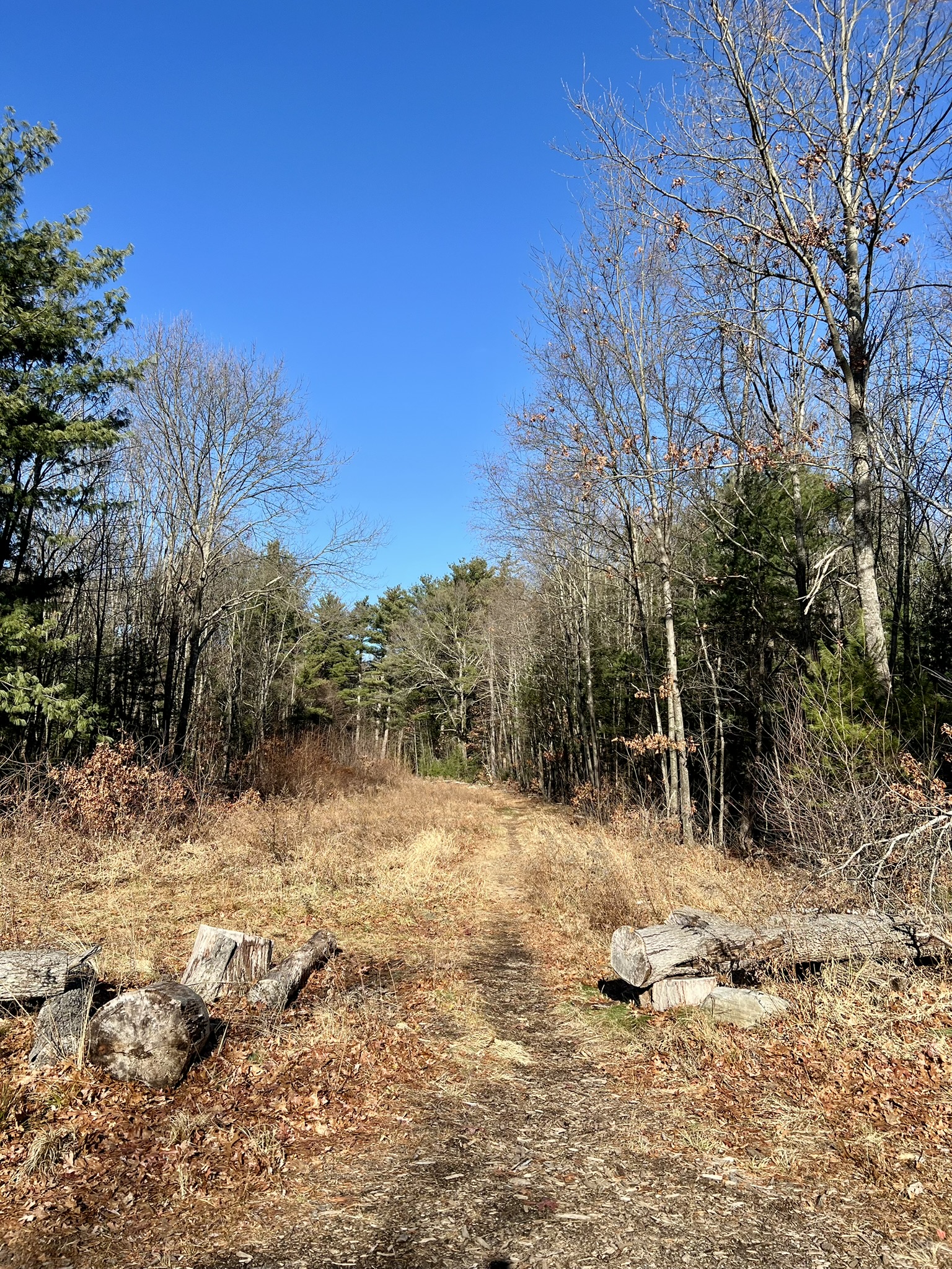
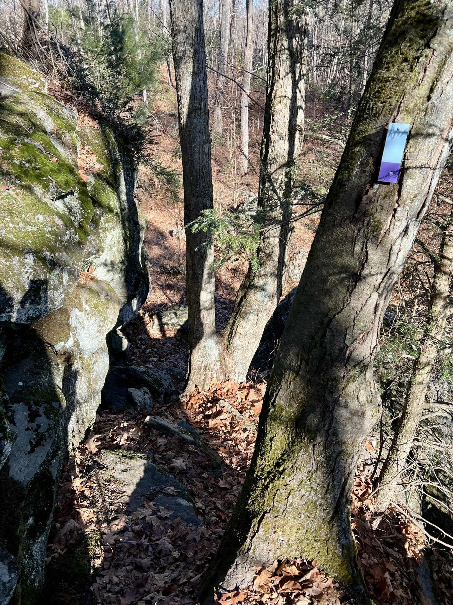
I continued north until I reached a trail split. I went left and was happily surprised when I found myself on a section of blue-blazed trail. Instead of following this blue/white trail, I made my way on unmarked trails heading east to find the AllTrails loop. I was thrilled when I discovered the loop was also a blue-blazed trail. The Connecticut Forest & Park Association (CFPA) maintains all the blue-blazed trails in the state (over 800 miles of them) and volunteers have been busy recently re-blazing these trails with new markers so the trail was easy to follow. Once on the blue/yellow trail I went in a clockwise loop. At first the trail was a wide woods road. It narrowed eventually, and at the northernmost point I came to trail junction with blue/yellow continuing north and the blue/purple trail turning right in a southeasterly direction. This is the Punch Brook Trail. This was a moderate trail with a few challenging steep sections.
From left to right: on the blue/yellow trail; new blue/purple blazes are easy to follow; a steep cliff section was a fun challenge
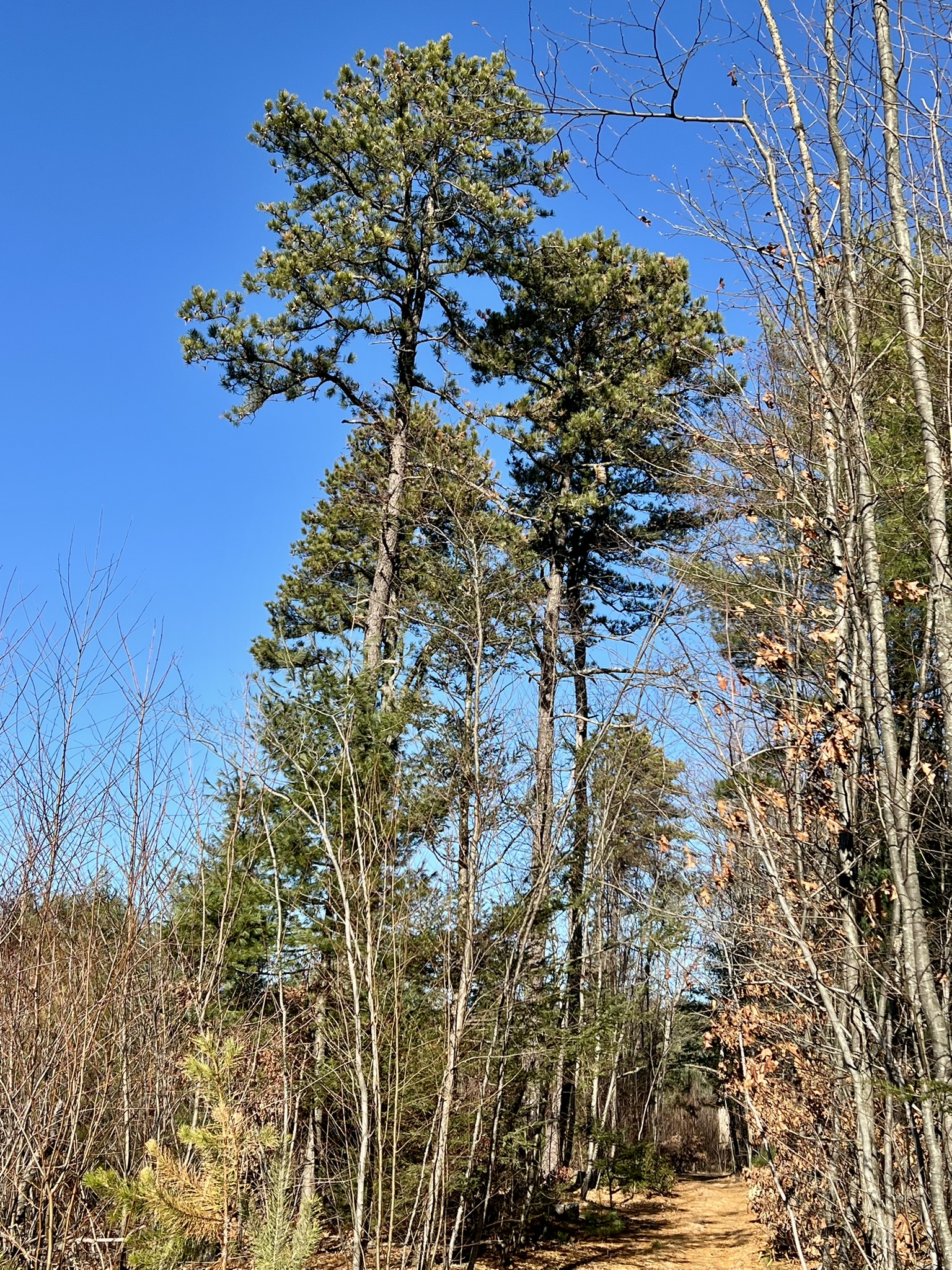
While the trail occasionally went near residential backyards, it mostly felt secluded. At one point the trail goes through a plantation of tall white pines. Even on a cloudless day the sun had trouble penetrating the canopy to reach the forest floor, and I could understand what a difficult time the pitch pines would have propagating amidst this competition. After a steep switchback descent the trail crosses the brook, made easy by the recent construction of a wooden bridge. The trail then crosses Punch Brook Road and loops through a southern section of forest. The blue/purple trail ends, and I stayed right to head north on the blue/yellow trail, which crosses the road again. At this point I watched for an unmarked trail on the left to make my way back. The unmarked trail emerges on a wide woods road. I took a left and followed the road. This road intersects with another woods road, and I could see my car parked in the distance to my left. I chose to go straight and take a final pass of the pitch pine natural area, recording a total of 3.8 miles and 534’ of elevation gain. Afterwards, I located a better map on CFPA’s interactive map link. Click HERE and type “Punch Brook Trail” into the search box. I also found many useful links on the Town of Burlington’s website. Click HERE for their Punch Brook Trail map (note the different starting location). Click HERE for a comprehensive list of hiking and mountain biking trails in Burlington.

From left to right: a pine plantation; new bridge over Punch Brook; more bridges built as an Eagle Scout project; interesting boulders along the trail
Connecticut’s Co-Champion Pitch Pines, Avon and Glastonbury
While conducting research I discovered this Connecticut College website that tracks notable trees for all the tree species in the state. These trees are referred to as Champion Trees. There are two pitch pines in the state that share Champion Tree status, located in Glastonbury and Avon. They have recorded heights of 92’ measured in 2011 (Glastonbury) and 95’ measured in 2015 (Avon). The location of the Avon tree is not public, but the Glastonbury tree is in the Shoddy Mill Preserve. I visited earlier this year for my August blog post on Mill Towns and Trails – if only I had known to look for it! I assume the tree is still standing. For an address, use 111 Shoddy Mill Road, Glastonbury. The trail can be tricky to find. You can get more information on my blog post, and AllTrails would be helpful to show the unmarked trails. The notable tree website description says: “From Shoddy Mill Rd. between Coon Hollow Brook & Roaring Brook, go north on Blue/White Trail to “S” Trail. Tree is 100 ft north of point where “S” trail crosses Coon Hollow Brook, 20 ft south of unmarked e./w.trail. Located on a small mound which may be wet in spring.”
Bibliography
The Pitch Pine Forest: A Rare Ecosystem – by Laurie Gorham https://www.gosaonline.org/the-pitch-pine-forest-a-rare-ecosystem-by-laurie-gorham/
Connecticut Woodlands Magazine Spring 2015 article by Emery Gluck, Pitch Pine-Scrub Oak Barrens https://portal.ct.gov/-/media/deep/forestry/spb/ctwoodlandspitchpine2pdf.pdf
DEEP Forestry Division video on Pitch Pines at Nassahegon State Park https://www.youtube.com/watch?v=r40LkgoF-2Y
More details and photos of Pitch Pine Park in North Haven https://www.ctmq.org/pitch-pines-park/
DEEP flyer on the southern pine beetle in Connecticut https://portal.ct.gov/deep/forestry/forest-protection/southern-pine-beetle
Subscribe to Trail Talk
your next adventure awaits
Questions? Email me at naturenerdsramble@gmail.com or find me on Instagram @the_real_nature_renee.