When I began my Trail Talk column a few years ago I made a concerted effort to seek out new trails, and one of the happy surprises was the abundance of diverse, well-planned and maintained trails courtesy of local Land Trusts. Land Trusts are non-profit organizations dedicated to land conservation through land acquisition and conservation easements. While I am a member of my own local land trust, I hadn’t spent much time exploring the offerings in neighboring towns and beyond. When I began that quest in earnest I was amazed at what I found, many of which I have written about in my blog. This post focuses on new trails or sections of trail that have opened up in the past couple of years in my neck of the woods – south central Connecticut.
Deep River is one of my favorite Connecticut towns. Around 30 years ago it became a hotbed of contention over a proposed town motto, “Scruffy but Proud”. The whole affair got so big that an article was published about it in the New York Times stating: “[a]nd so the pro-scruffy and anti-scruffy forces took hold in Deep River. The pro forces argued that the term scruffy conveyed the folksy quality of Deep River’s people. The anti forces countered that while that may be true, out-of-towners wouldn’t understand the sentiment. If people from New York or California saw a Scruffy and Proud bumper sticker or T-shirt, they might think that Deep River is, well, scruffy.”
While the proposed town motto may have been an area for disagreement, I am betting that everyone will be able to agree that the Deep River Land Trust has done an amazing job of acquiring special parcels and building trails. Led by their Chief Trail Steward, Rob Butterworth, the Deep River Land Trust has been busy creating new trails. They run a Trail Tuesdays every Tuesday evening beginning in April and running until late summer/early fall when it becomes too dark to feasibly work. If you’ve ever been interested in learning the basics of trail work, or simply want to lend a hand, these work parties are open to the public and you can get more information at this link.
(photo: sign along the trail upon entering the George C. Lyon Nature Preserve)

Williams Woodland Preserve, Deep River. 2 miles. 3.75 miles with extended hike.
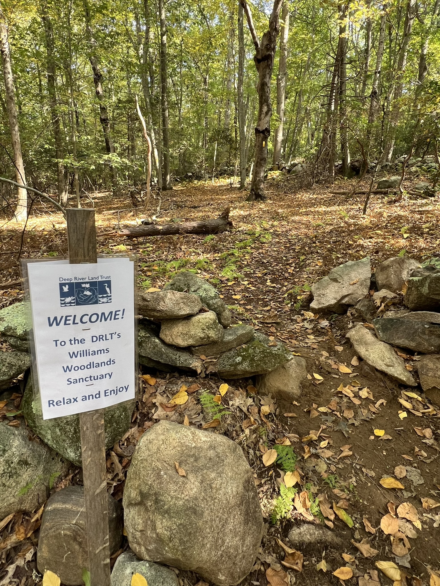
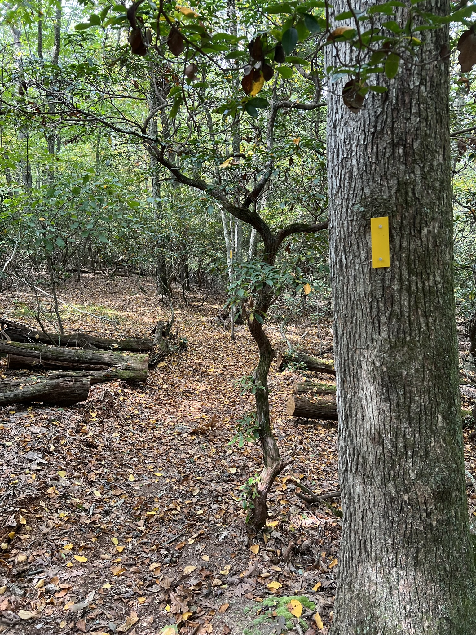
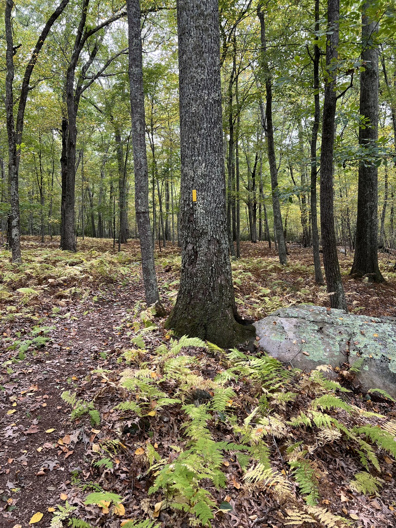
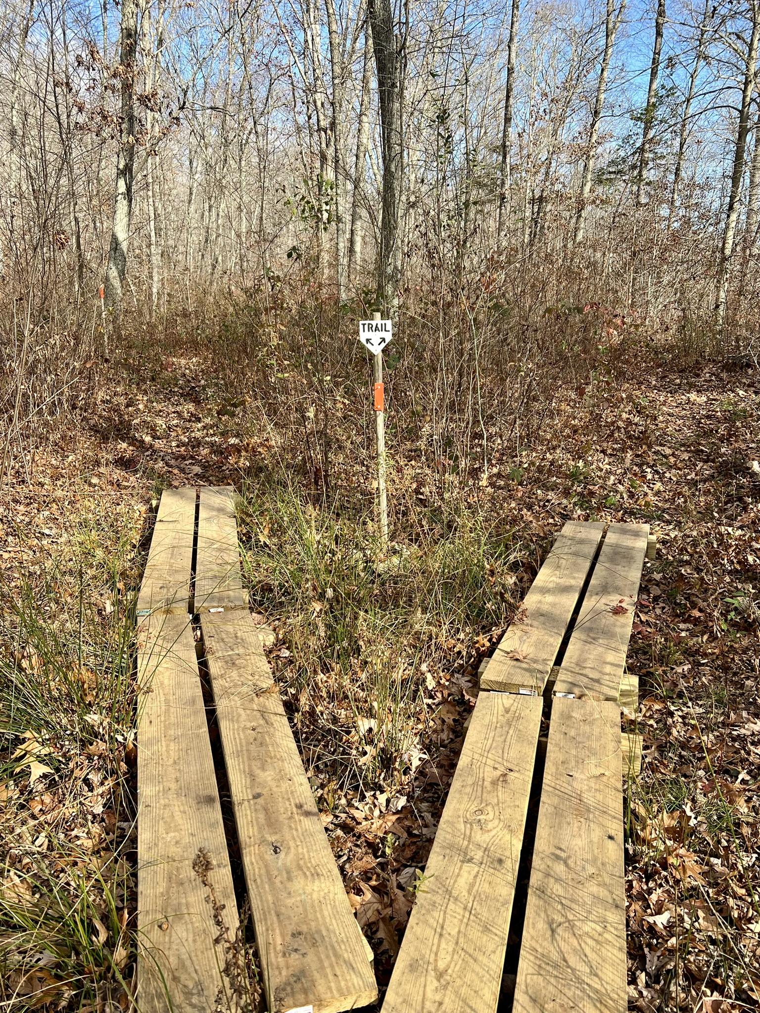
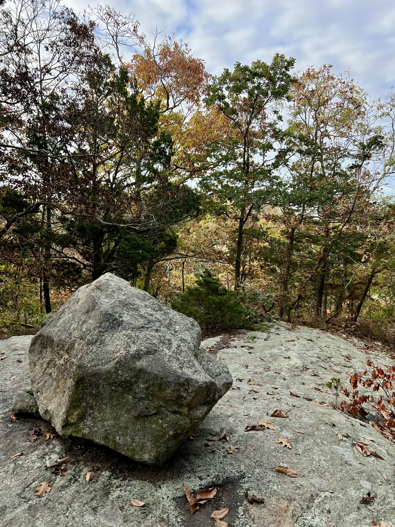
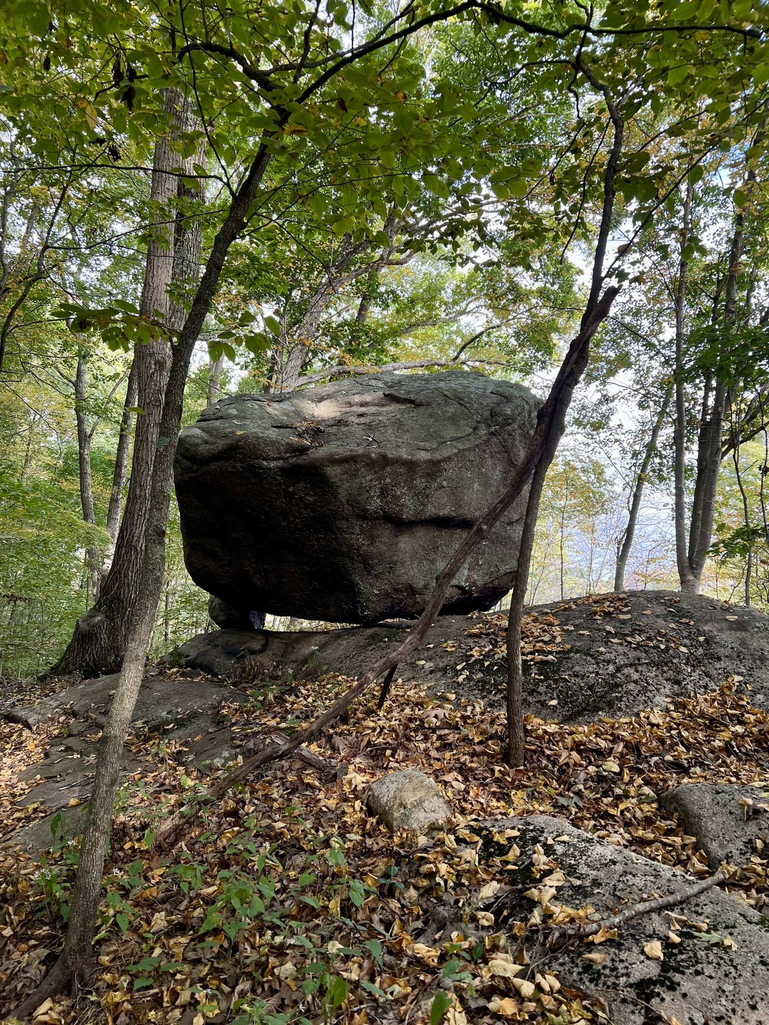
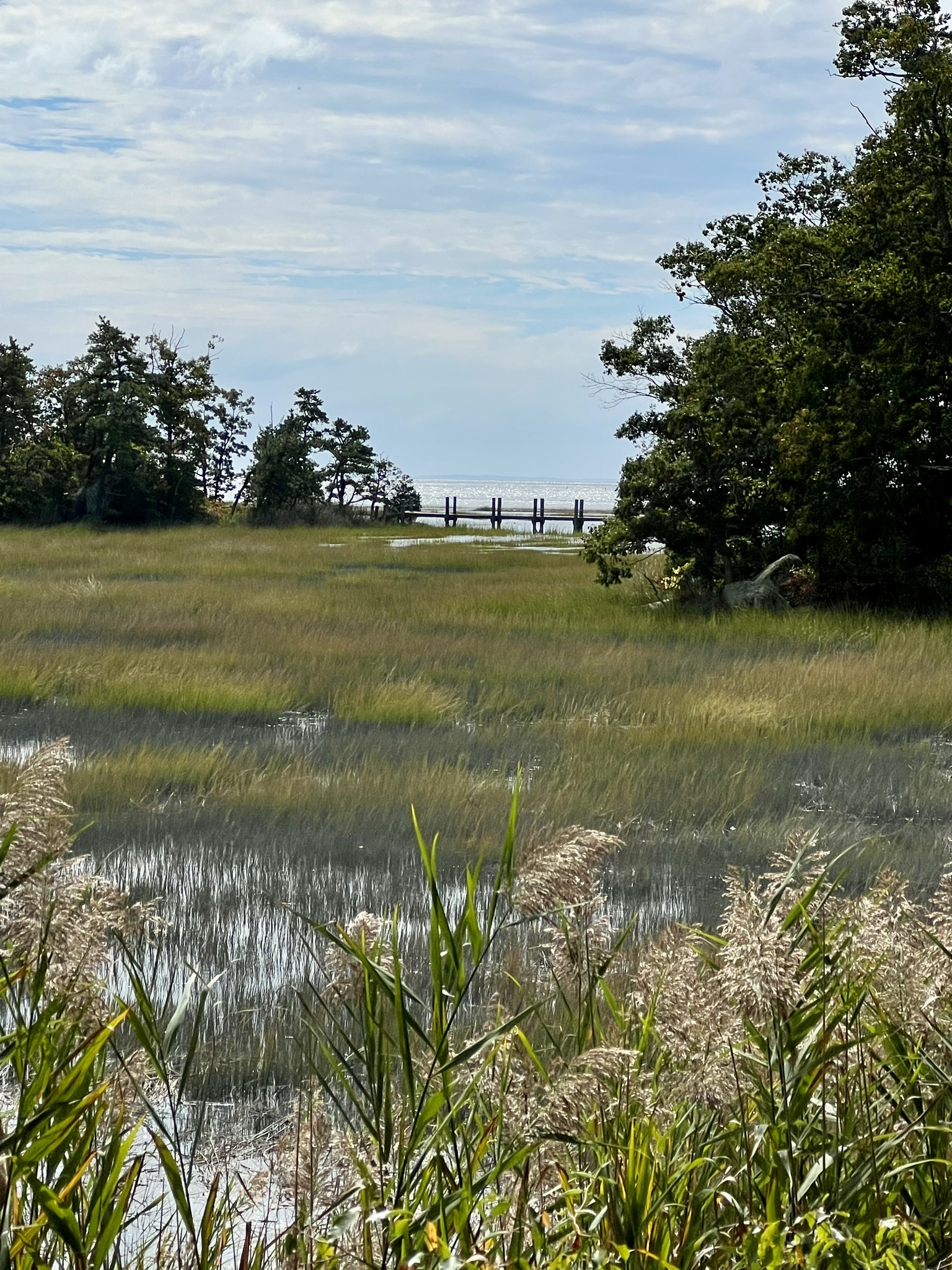
In 2024, the trail crew worked on the recently donated 38.5 acre Williams Woodland Preserve. The Williams Woodland Preserve is adjacent to the existing George C. Lyon Nature Preserve, which in turn is connected to three conjoined Essex Land Trust Properties – the Woodja Hill/Doanes’ Woods/James Glen Preserves (Click HERE for the Essex properties trail map). Whether you choose to hike just the Deep River properties or do an extended hike to include the Essex trails, I recommend that you park at the small lot for Woodja Hill Preserve at the end of Oxbow Lane. At the cul-de-sac, continue down the driveway straight ahead and look for the land trust parking sign on the left. The parking lot shares a driveway with a home. At publication time for this post, a trail map for the new parcel was not available. I suggest using this map of the George C. Lyon Trail in conjunction with AllTrails, which shows the newly labeled Williams Woodland Preserve boundaries albeit without trails. Keep your eye on the Deep River Land Trust website. In addition to updating their maps, they are working on a trail for their 3.5 acre Millstone Hill Sanctuary which is adjacent to Williams Woodland Preserve and supposedly offers seasonal views of the Connecticut River. From the parking lot take the green circle trail at the lower end of the field. This trail skirts the edge of the field and enters the woods, heading in the direction of the George C. Lyon Preserve. As you cross the town line into Deep River the trail blazes become yellow rectangles. The trail goes through a cedar grove, alongside a wetlands and over a bridge. As you come to a stone wall near the top of Lyon’s Meadow Pond, watch for the trail to split. At this point it becomes a loop trail and you can go in either direction. The new trail is a loop off this trail. I took a counterclockwise loop, staying to the right at the stone wall. The trail climbs up the hill in a backwards “S” curve passing features noted on the map such as a block foundation and “whaleback rock”. As you approach the “big boulder”, watch for a sign welcoming you to the Williams Woodland Preserve. At this junction, the yellow trail continues onto the Williams Parcel and the continuation of the old trail is now blazed yellow/red.
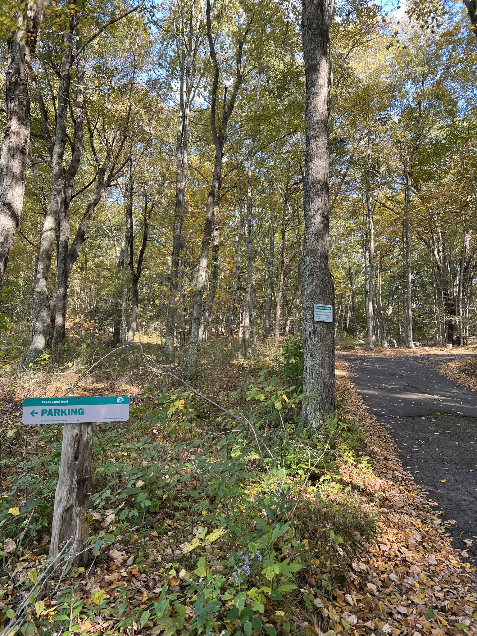
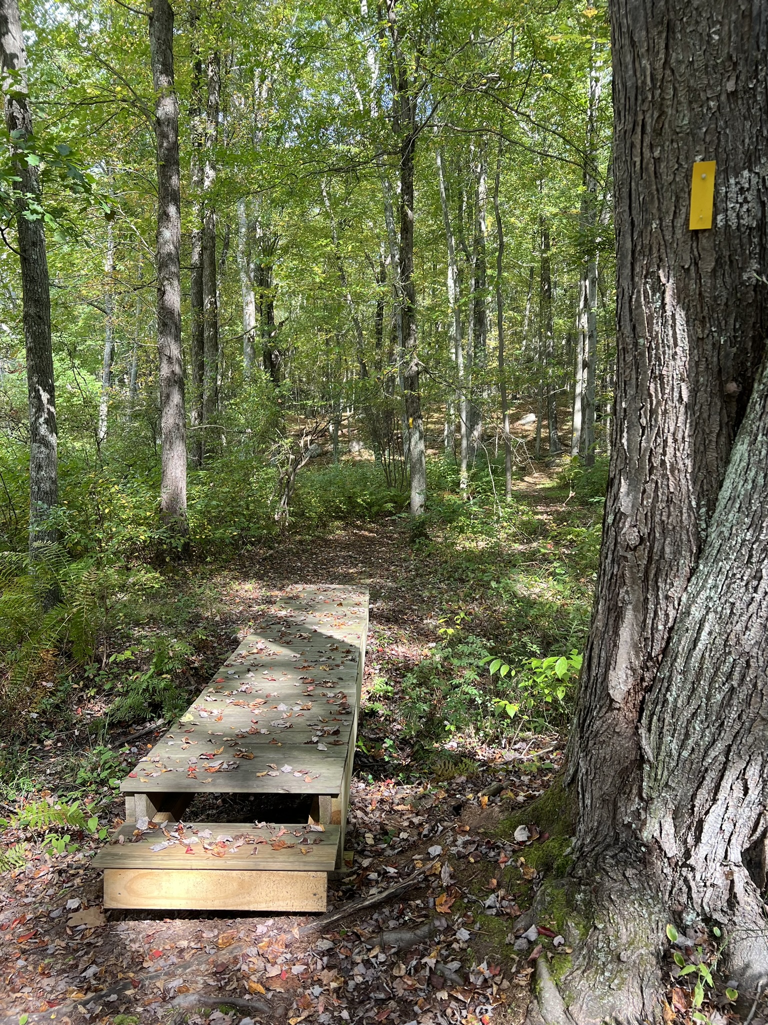
from left to right: the sign along the driveway for the Parking Area; a bridge along the trail; the entrance to the new Williams Woodland trail
As you continue on yellow, the trail winds up through a tranquil mountain laurel maze, opening up into a grassy woodland at the upper section. Looping back down, the summer woods are filled with fragrant ferns and mature trees (I visited before the leaves fell). The trail eventually meets back up with the George C. Lyon trail and connects back at the pond. After you cross the border into Essex watch for a yellow circle trail to appear on your left. This rises up and goes along the base of an interesting jumble of rocks. At the point, when you see the parking lot, you can end your hike or continue on the Essex hiking trails.
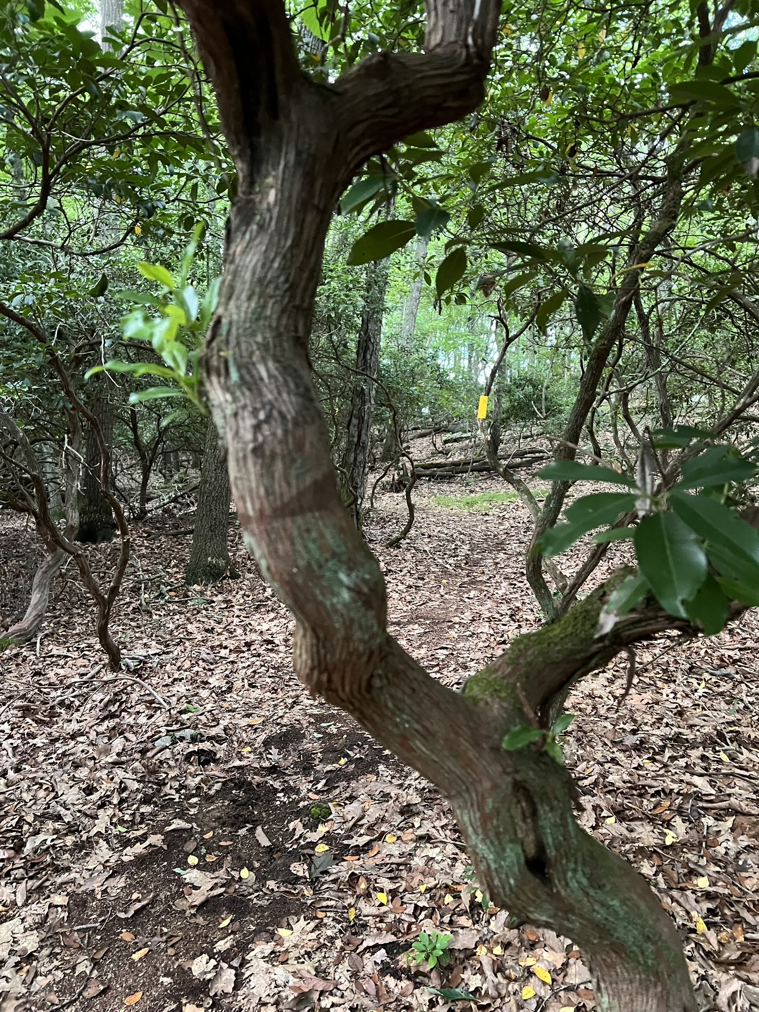

From left to right: a maze of Mountain Laurel; stone steps built by the hard-working trail crew; early fall in the fern-laden forest
Continuing on, I followed a clockwise loop starting with the yellow trail. This trail goes alongside an impressive stone wall. I chose to take the red side trail to the right which goes past an overlook (more of a rock outcropping, but with the leaves down you can look out on the surrounding terrain) before rejoining the yellow trail. As the trail enters the James Glen parcel I like to take the red trail that goes steeply up and along the ridge before coming down to loop back on yellow, which allows you to see the rock cliffs from both above and below. Circling back on yellow, when I get to the Doanes’ Woods section I stay mostly to the outer loop, taking red to green to orange to blue and back to red. These trails are very popular with trail runners. When I visited in mid-October the trails were mossy and wide, blown clear of leaves. Keep an eye out for the green trail that will bring you back to the parking area.
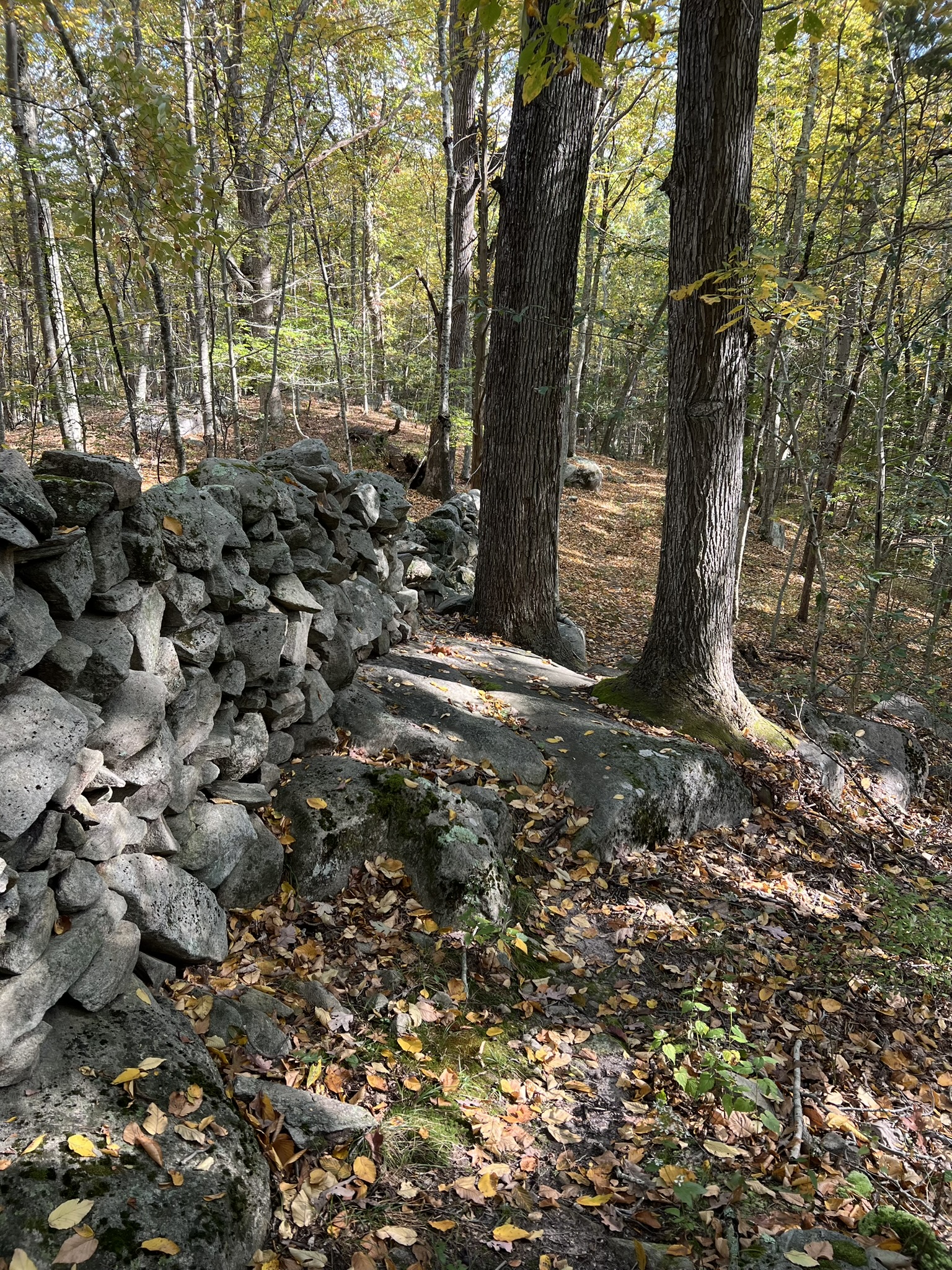


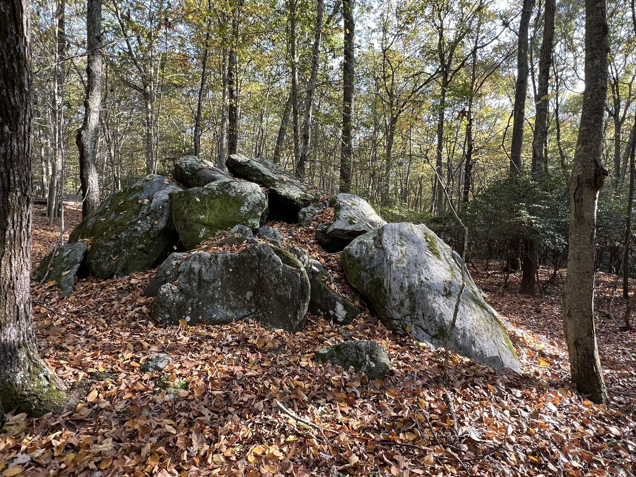
from left to right: the Woodja HIll stone wall; views through the woods; the mossy paths in Doanes’ Woods; the Doanes’ Woods “Rock Pile”
Keystone Preserve, Killingworth. 1 mile loop with possible extensions
The Keystone Preserve is the Killingworth Land Conservation Trust’s (KLCT) newest acquisition. This 24 acre parcel, purchased in March of 2023, is wedged between existing KLCT parcels, effectively creating “a 75 acre conglomerate of open space in which there are trails and a beautiful pond with waterfowl and other wildlife”, according to the website. The access is from Route 80 just east of the traffic circle. The driveway for the 3-4 car parking lot is between an old white colonial home (the old Country Squire) and a green federal-style home at approximately 237 Route 80. There is an oval sign reading “Keystone Preserve” but it is set back from the road and hard to see in advance. Click HERE for the Google Maps view. The KLCT put a tremendous amount of work into creating informative signboards and interactive stations, set up mostly in the first .25 mile section of trail between the parking lot and the pond viewing platform. Features include a bat box, barred owl box and information about the local flora and fauna. My favorite display is the sensory station where you can bang a stick on different wood species to hear the difference in tones. The trail is well marked with red blazes and forms a long, narrow lollipop loop. Some resident beavers have presented challenges, and KLCT has added bog bridges to make the trail more passable.

From the parking lot, follow the red trail north. Along the bog bridging there is a trail junction. I went to the right, making my way to the pond viewing platform. There is even a binoculars box for hikers to borrow a set to look for birds and other wildlife and two contemplation benches. From there, the trail continues north. At the northernmost point of the red loop trail there is a sign for the Wolf Hollow Trail with a connector trail blazed blue to get to it.
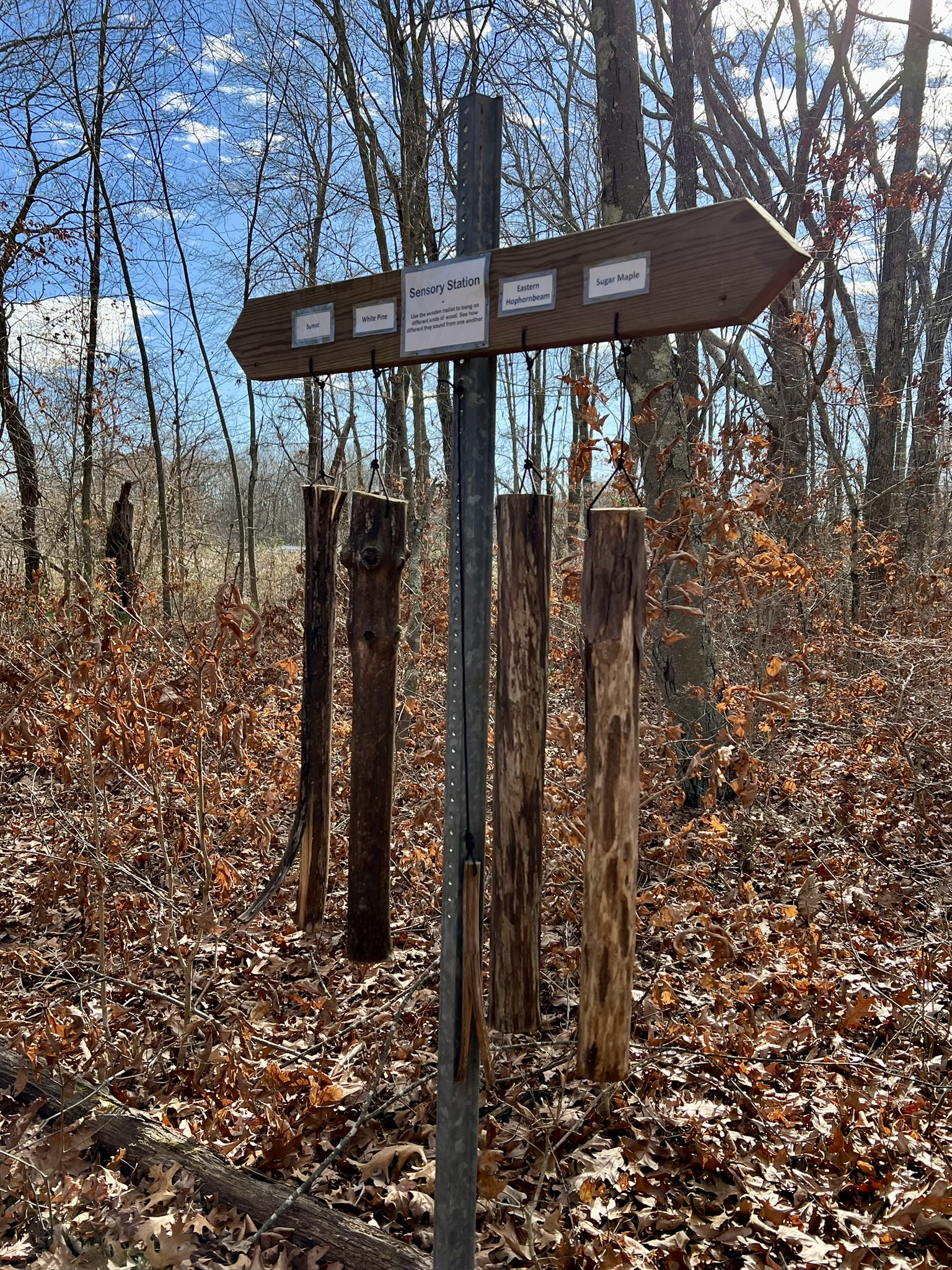
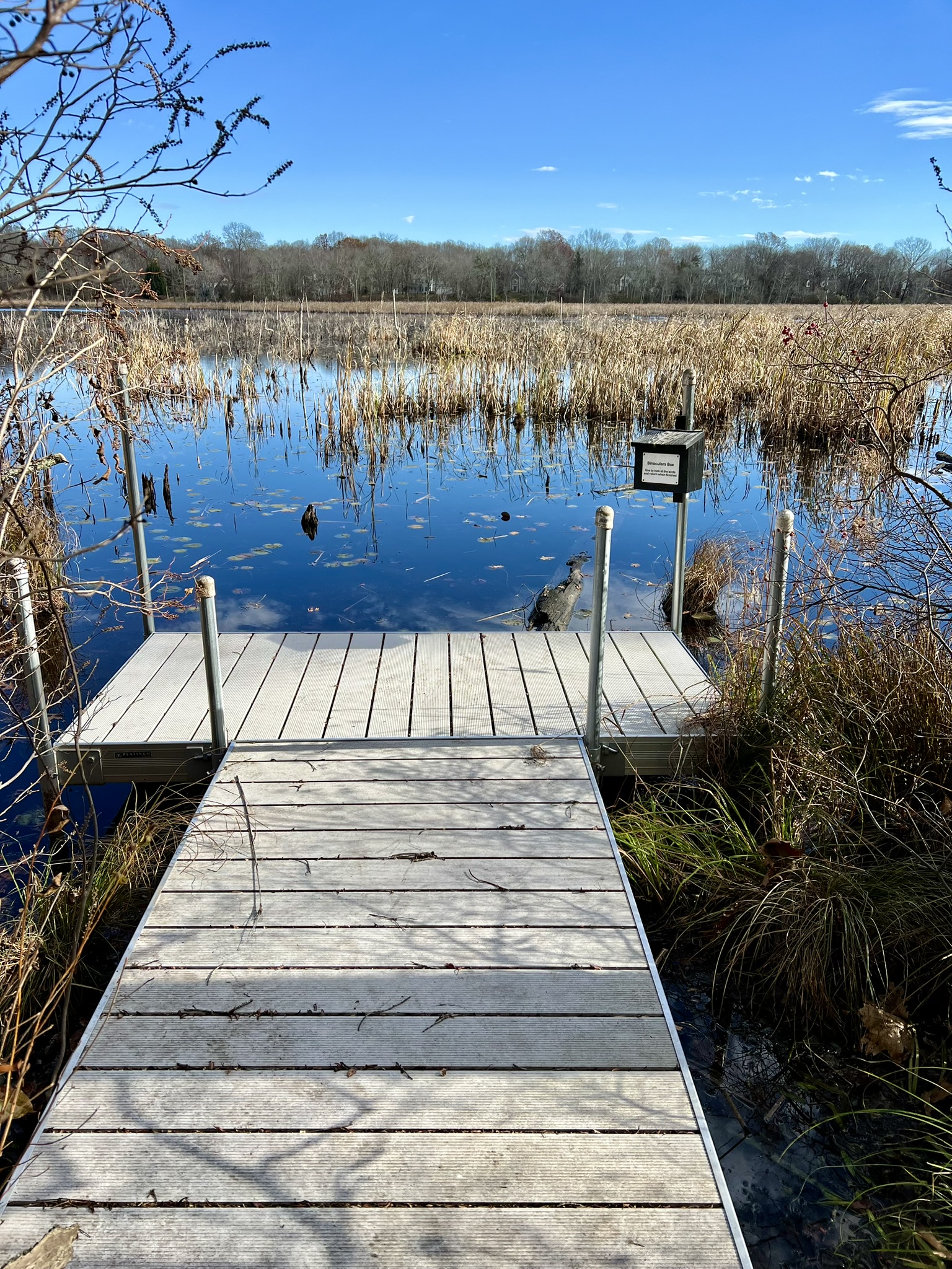

From left to right: the trail junction; the sensory wood exhibit; the viewing platform; the blue-blazed connector to the Wolf Hollow Trail
As I followed this trail north, I came to a section where the leaves had been blown off and I noticed several unmarked cross trails. In conversation with KLCT I learned these were previously created ATV trails from before the land was clearly marked as land trust property. The blue trail ends at a T junction at a sign for the Wolf Hollow Trail pointing in both directions. My understanding is that the trail to the left continues to Wolf Hollow Road near the Killingworth Elementary School (KES) and that the trail to the right is not actively maintained. I also learned that the old Wolf Hollow trail apparently was used by revolutionary soldiers traveling between Route 81 and Roast Meat Hill Road! Rather than continue on the Wolf Hollow Trail, I made this my turnaround point, which added .5 miles to the overall hike. Back at the red loop junction I turned right to continue the Keystone loop. When you start seeing a stone wall on your left, keep your eye out on the right for a white blazed spur trail. There is a sign that says “Winkel’s Pond”, but the sign faces hikers coming from a southerly direction.

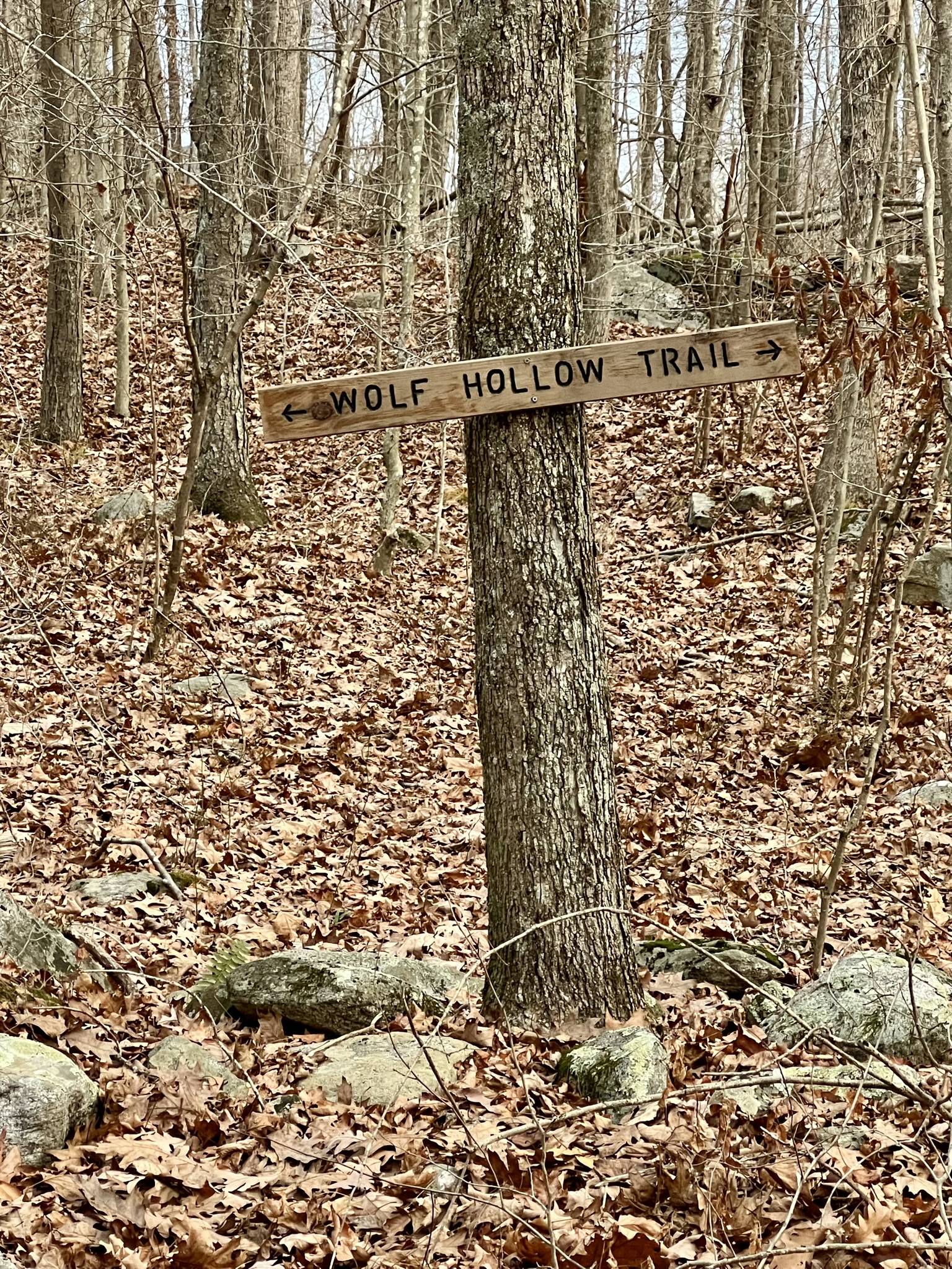

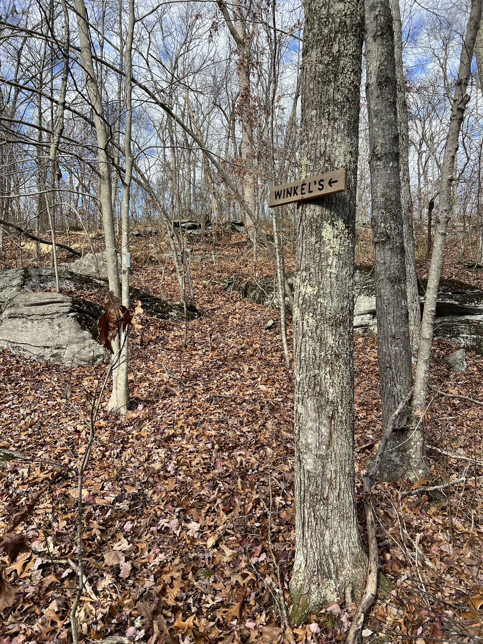
From left to right: the blue connector trail; the Wolf Hollow Trail sign at the T-junction; if you continue on the Wolf Hollow Trail, note there is a wet crossing; the sign for Winkel’s Pond
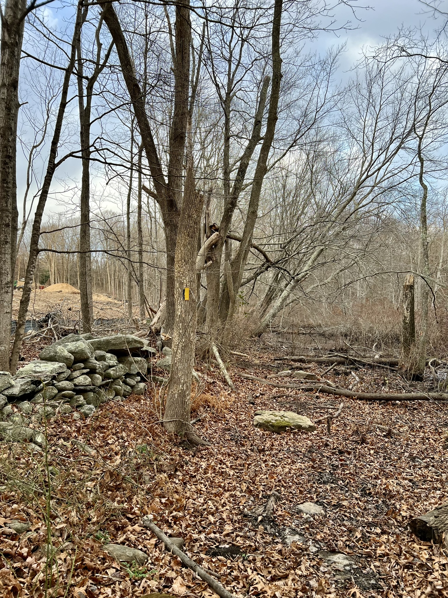
I visited during the drought days of November, and at that time this connector trail was passable. However, KLCT has faced even greater beaver challenges on the Winkel’s Pond parcel. I love the proliferation of beavers in our state, so I was more in awe of their work than disturbed by it. However – be prepared for a slightly apocalyptic experience if you attempt the Winkel’s Pond Loop. I was amazed by the number and size of the trees these beavers are tackling. Along the northern edge of the pond there is a sign for a .25 mile Church Trail, but this trail is no longer identifiable or maintained. Continuing along the western border there is a big construction project underway on the far side of the stone wall. Because of the beaver activity, the ground was quite muddy all the way up to the stone wall – even during the November drought. I opted to test my balance on top of the stone wall to cross this section. Looping the pond to the south and starting up the eastern side there is some bog bridging through the muddier sections, and then the trail actually goes across the top of the beaver dam, through which a culvert is installed to try to direct the flooding. The Winkel’s Pond adventure adds another .6 miles.
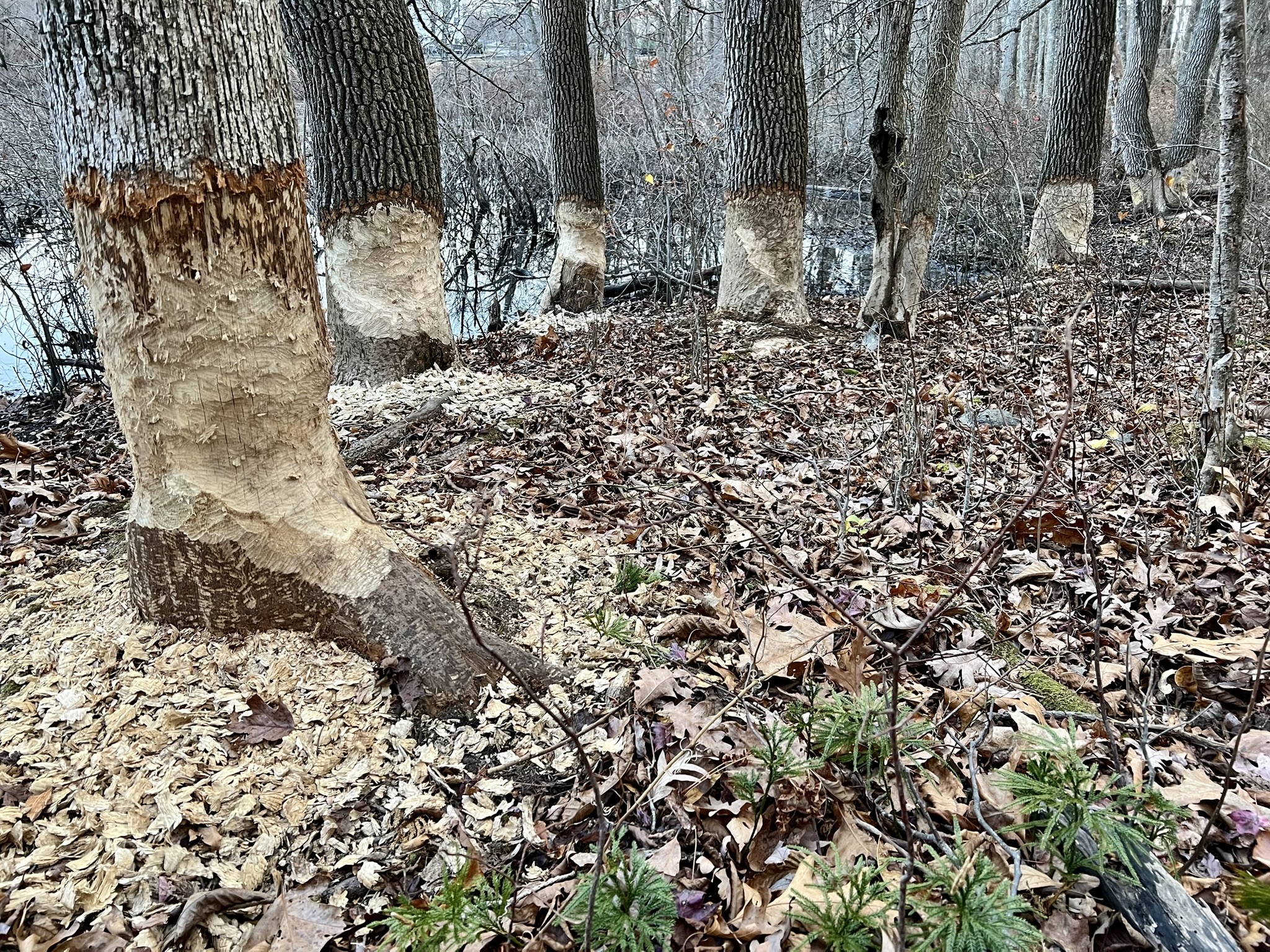

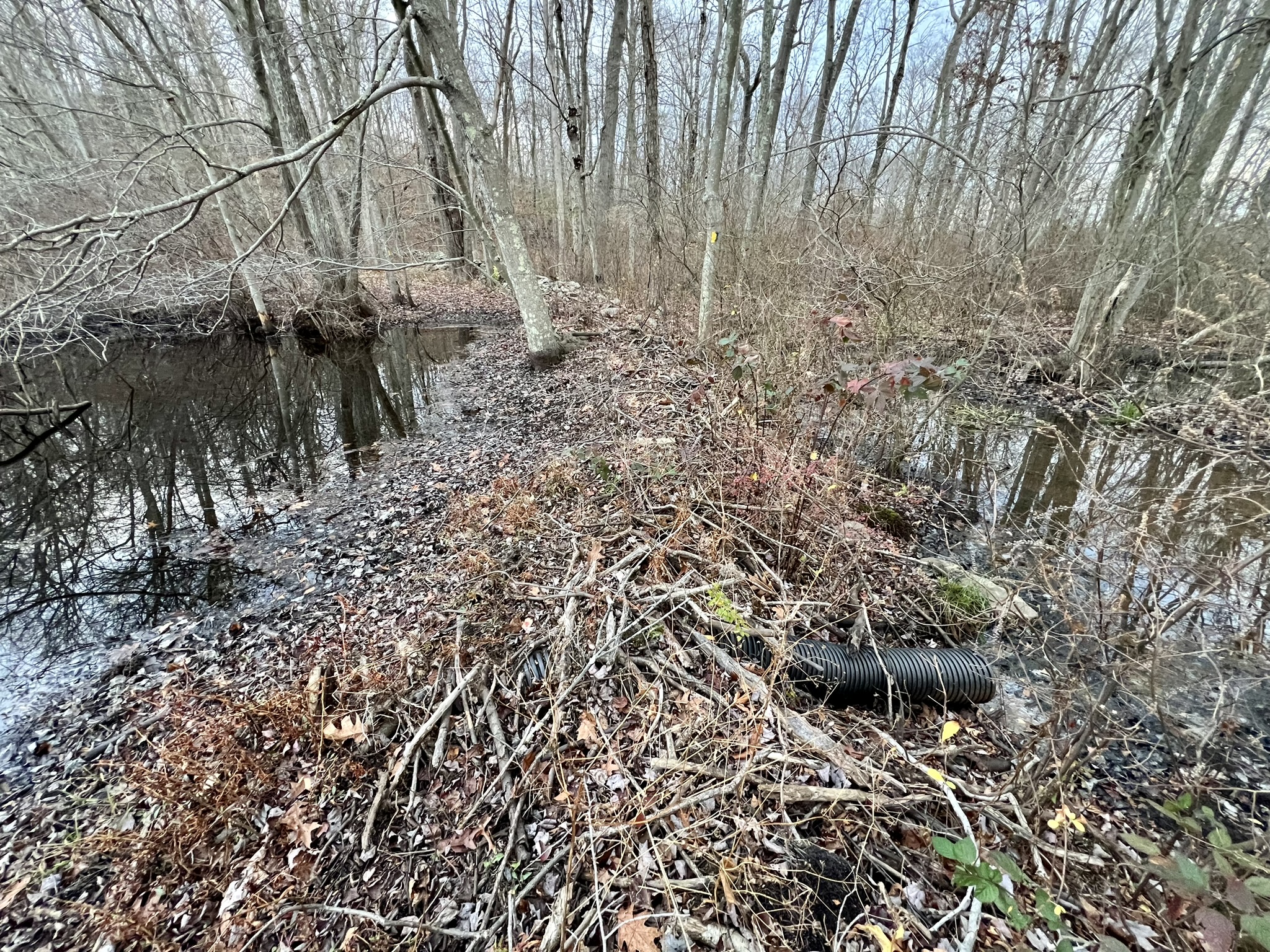
From left to right: Beaver activity at Winkel’s Pond; the muddy section by the stone wall; bog bridges on the eastern side; the trail crosses over the dam — note the culvert pipe sticking through
Jarvis Creek Farm and Stony Creek Preserves, Branford. 3.5 miles.
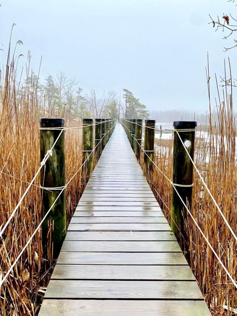
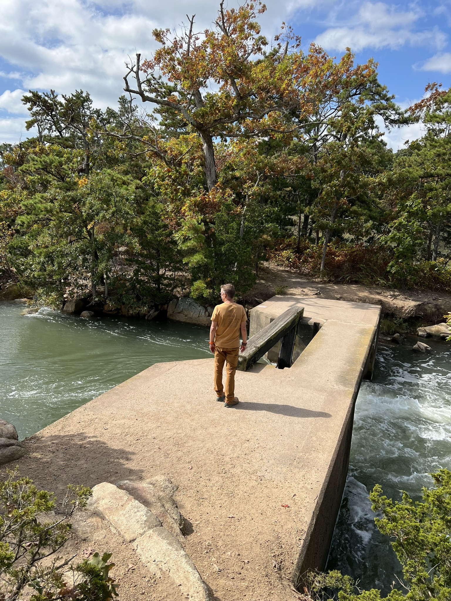
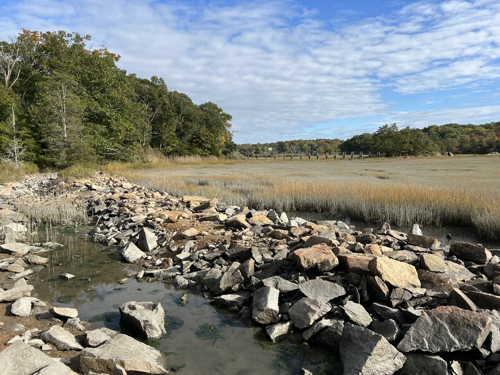
When I first visited this Branford Land Trust property I used their map entitled “Stony Creek Partnership, Washburn Preserve & Weil Property.” I started at the Washburn Preserve trailhead which involved parking on the main road (Thimble Island Road), walking up Wallace Road, and then a private driveway. I was doing this in the dim light of pre-dawn and it felt awkward and a bit like trespassing. I was relieved when I found the trailhead. When I wrote about this visit in my May 2022 Trail Talk I said “I visited early on a foggy morning and it was a magical experience.” I remember it well. Out of the fog in front of me a well-made bridge spanned a section of creek, leading to a tiny island. There is a cement dam and sluice gate that can cause a small degree of vertigo to cross, even though it is wide and easy to traverse. The views of the salt marsh and the sound are blissful. The online brochure describes the topography as “indelibly defined by 19th century quarry operations” where some of the trails “cross over helter-skelter piles of jagged rock rubble.”
Fast forward to September of 2024. My husband, Tom, and I found ourselves in Branford with time to kill, so I immediately thought of the Washburn Preserve as an ideal destination for a short hike. I went online for the maps, but became confused when I saw no mention of either the Washburn or Weil Properties in the list of trail maps. I started to drill down, opening each map until I found what I was searching for – the name of the map had changed to Jarvis Creek Farms and Stony Creek Preserves. In studying the map, I noticed there was a new trail with a parking area on Route 146 that accessed the trail system from the east, and that the Parking symbol was no longer there for the Wallace Road access. (Confusingly, the trail description in the online brochure links to the old document, with no mention of the new trail and parking). Perusing the website again, I learned that “[i]n 2021, the Branford Land Trust added the Jarvis Creek Farm to its Jarvis Creek Preserve. Jarvis Creek Farm encompasses more than 20 acres of salt marsh, wooded uplands, rocky outcrops, and farmland on the southern side of historic Route 146. Over the years, the area had been used for a variety of agricultural and non-agricultural purposes and is now being restored by the BLT.”
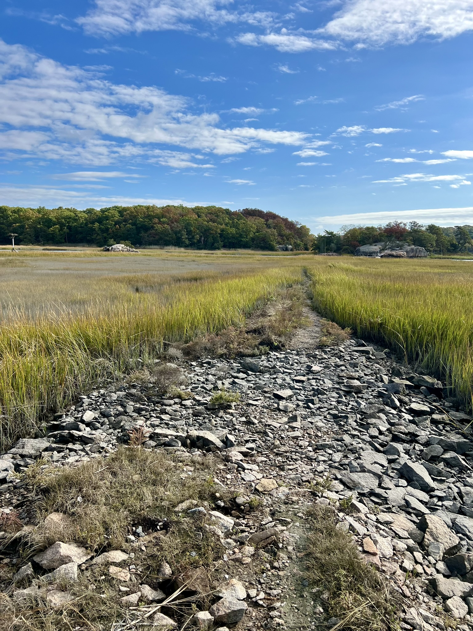
On that September day we parked at another lot at the end of Buena Vista Road and did a 1.6 mile loop hike going as far as the dam and sluice gate. We were there at a king tide (one of the highest tides of the year) and were impressed at the volume of water flowing into the salt marsh. Click here for a link to my Instagram reel from that day. It was still early enough in the fall to get a glimpse of the ospreys living there, before their long journey back to South America. I decided to return one morning a few weeks later to do a longer 3.6 mile hike starting from the new parcel. There is a large parking area on Route 146 that appears on Google Maps as the Jarvis Creek Farm Trail. From the parking lot, take the connecting trail on the east side to connect to the white Branford Trail. Turn right on this trail and follow it as it skirts the edge of a farm field and continues under the railroad tracks. Shortly after passing under the railroad tracks watch for an unmarked trail on your left side. Although unmarked, it is hard to get lost on this loop trail because it is bordered on three sides by the marsh. At its southernmost tip there is viewpoint marked on the map. This is a seasonal viewpoint once the leaves have fallen.


From left to right: skirting the farm field; the two unmarked trails off the white trail that form a loop; the “viewpoint” on the map; one of many interesting boulders along the unmarked loop trail
After completing this loop continue on the white trail. Watch for another short unmarked trail just before the creek. This leads to a lovely rock outcropping and view of the marsh and sound. Continue on the white trail across the dam and bridge until the junction with the red trail. Turn left on the red trail. At the southern tip, you can take the unmarked “trails” and walk out onto the rock levee. This can be tide dependent. The osprey nests are empty now, but they generally return in March and stay through September.


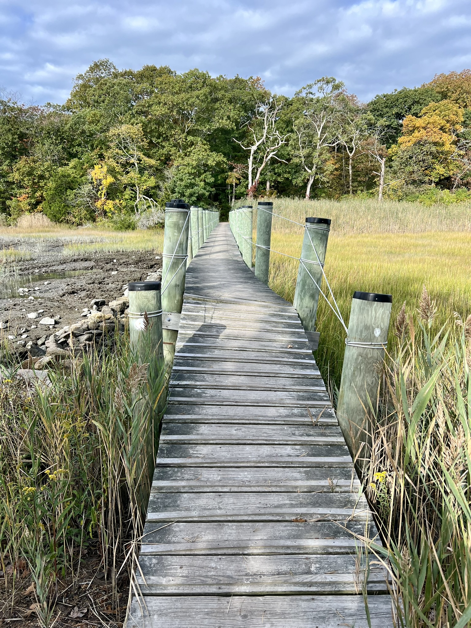
From left to right: the view from the rock outcropping; crossing the dam; the view into the salt marsh; the bridge
Finish the red loop (while I did not follow the red trail to its start, you can add some mileage by checking out that portion of trail) and continue left on the white trail. Watch for the intersection with the blue trail on your left. I did a clockwise loop of the blue trail and then followed white back to the parking lot. Part of the blue trail is along a driveway that is shared with the white blazed Branford Trail. Be sure to watch for where the blue trail veers off to the right shortly before reaching Buena Vista Road.
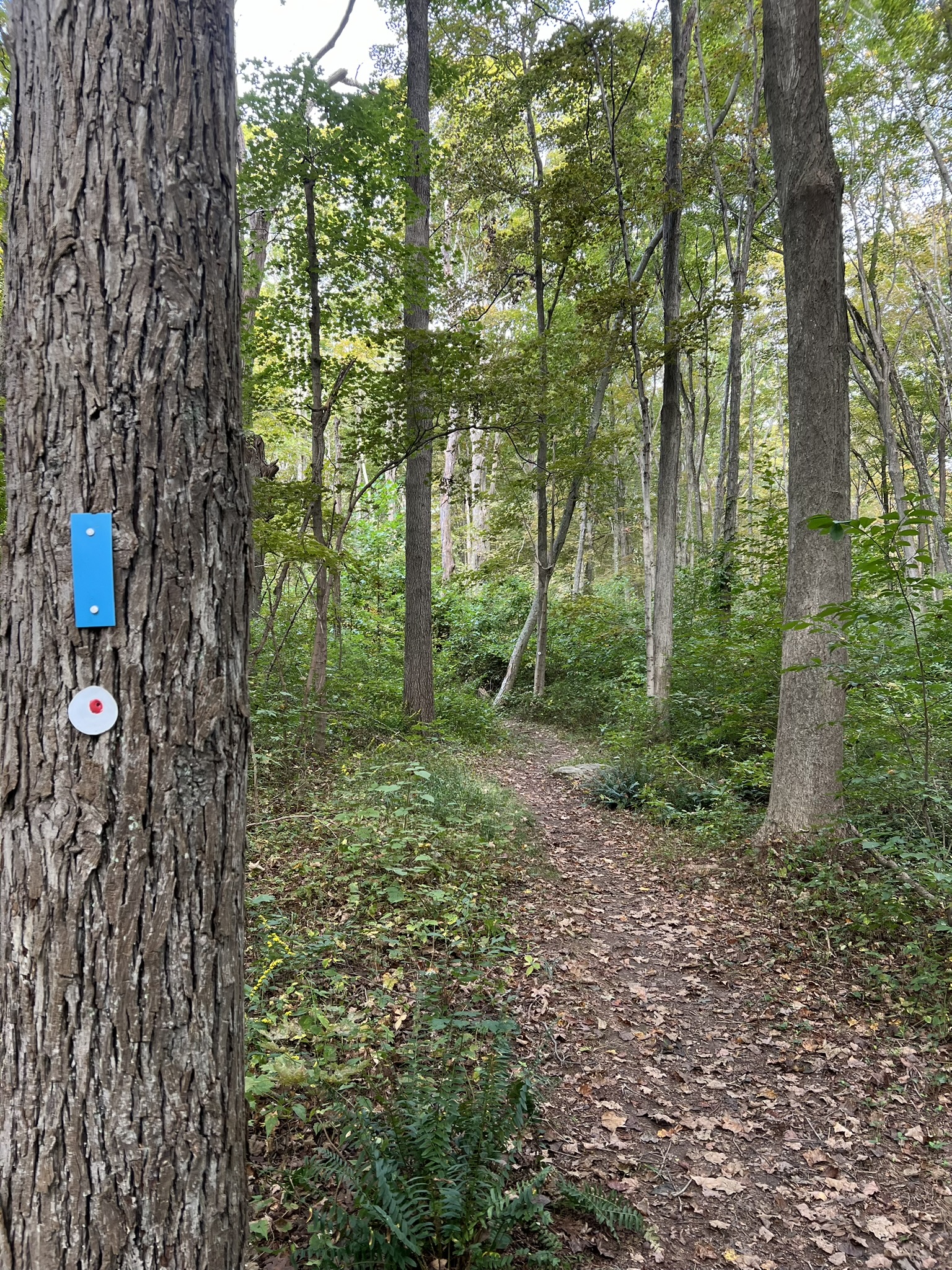
From left to right: the rock levee; the blue trail — in places the Branford Trail is indicated by its old blaze – a white disc with a red dot; the view to the bridge from the blue loop trail
Subscribe to Trail Talk
your next adventure awaits
Questions? Email me at naturenerdsramble@gmail.com or find me on Instagram @the_real_nature_renee.