Scantic River State Park, Enfield, Somers and East Windsor.
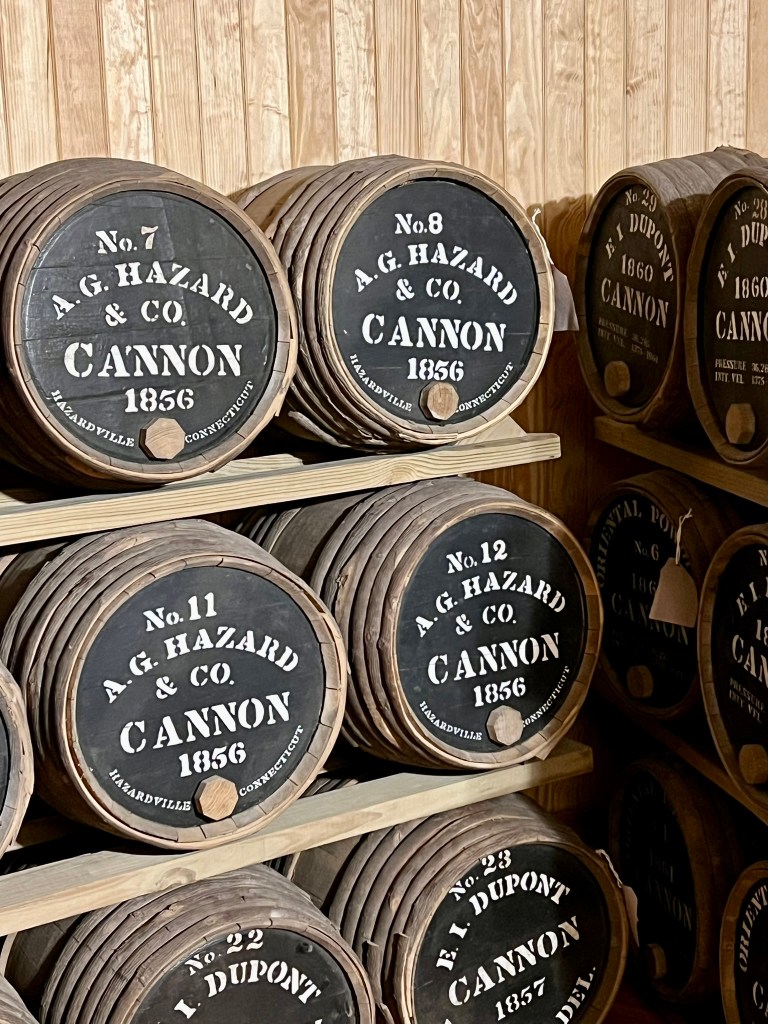
I first learned of Hazardville, CT circuitously – while touring Fort Macon State Park in Atlantic Beach, North Carolina last September. Fort Macon was built in the aftermath of the War of 1812 as part of the Federal Government’s Third System of Defense strategy to protect America’s coastline. (Fort Trumbull, in New London, was another fort built under this program). Peering into the gunpowder storage room I saw a stack of barrels stamped “A. G. Hazard & Co. CANNON 1856. Hazardville, Connecticut.” Intrigued, I later learned that Colonel Augustus George Hazard owned and operated the Hazard Powder Company in Enfield, Connecticut. According to the Enfield Historical Society: “In 1843, Col. Augustus Hazard -the man after whom the Village of Hazardville was named- established the Hazard Powder Company [which] supplied a significant amount of the gunpowder used during the Civil War, but after decades of declined production, it closed in 1913 after a major explosion.” The town name and the fact that manufacturing gunpowder was a hazardous occupation turned out to be entirely coincidental, if not ironic.
I was eager to learn about any remaining ruins and thus discovered Scantic River State Park, named in recognition of the Native American Scantuck people who lived on the land prior to trading it to English settlers for “some small matter” (according to the kiosk sign). This time, I did advance research which turned out to be invaluable. First, I learned the park suffers from an identity crisis. The DEEP website refers to Scantic River State Park, but the trail maps and several entrance signs say Scantic River Linear Park. To add to the confusion, all three trail maps are labeled Scantic River Linear Park, with the only difference being the town. These maps are for three separate, non-contiguous parcels – one exclusively in Enfield, one is in Enfield & Somers, and the third in East Windsor.
(Photo: Gunpowder at Fort Macon State Park. Hazard Powder was used by both sides during the American Civil War.)
Once again, the explorect.org website, developed by a guy named Matt, had excellent information about the different parcels including helpful addresses for parking. More importantly, he had links to historical maps. While these links were not working at the time of my first visit, I tried them again before my second visit and was thrilled to find they worked. In later conversations with Matt I learned that he had salvaged these invaluable maps from a now-defunct blog about Powder Hollow, so we can all thank Matt for his foresight in preserving them. I recommend reading his Scantic River blog post in conjunction with mine for more complete details.
Another invaluable resource I discovered while searching online is a 2021 book authored by Enfield resident Peter Floyd Sorenson entitled Hazard Powder: The Powder Hollow Explosion of 1913. You can read the first chapter for free on his website. I downloaded the book to Kindle, but you can also purchase a hard copy. Several copies are available in libraries throughout the state. The book covers not just the explosion of 1913 that ended up shuttering the mills for good, but the entire history, including information about gunpowder production. I found it to be engrossing, readable and very informative. It includes many photographs, too, which are helpful in adding context.
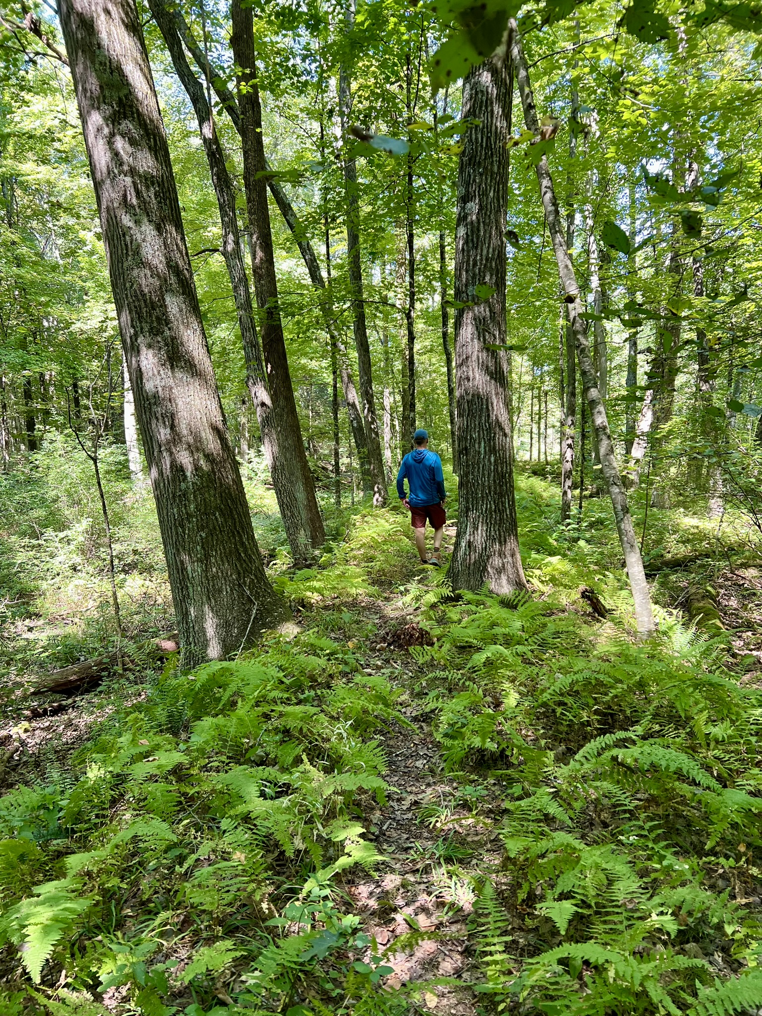
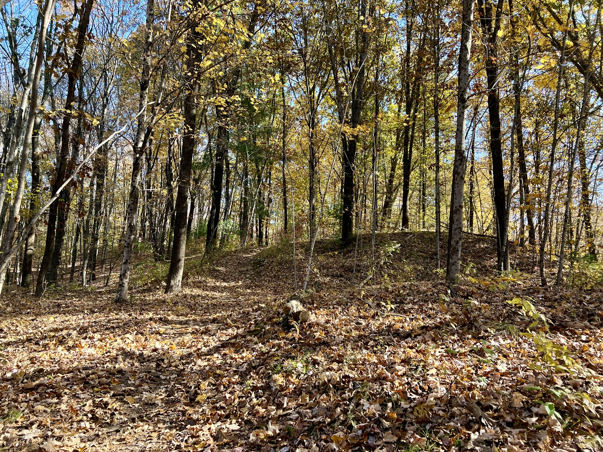
I started my explorations on the Enfield and Somers parcels. For clarity, the eastern parcel spans Enfield and Somers and is sometimes referred to as the Scitico parcel. The western parcel is in Enfield and is sometimes referred to as the Hazardville parcel or Powder Hollow block. Both parcels have trail systems on the north and the south sides of the river, so for the two parcels there are four trailhead locations. In my research, I learned that the Somers Open Space and Trails Committee had built a one mile trail from an unrelated mill site on Maple Street that followed the south bank of the Scantic River and connected with the trails in Scantic River State Park – East. I decided this would be a good place to start. Enlisting my husband, Tom, and our friend, Sue, we set off on a chilly September day to explore.
Somersville Mill Trail, Somers.
We located the large, well-kept parking area on Maple Street, but the trail was another story. The overgrown “Hiking Trail” sign that we eventually discovered in the underbrush should have been a dead giveaway. We plowed ahead nonetheless. At first things seemed promising, with some pretty views of the river. But after a short distance we encountered thick growth crowding the trail. Passing under a closed arbor of Japanese knotweed we reached a point where the brambles were so thick I decided I couldn’t subject my intrepid team nor myself to any more of it. I aborted the hike, much to my team’s relief, and we returned to our vehicle. Plan B was to head to the southern entrance of Scantic River State Park’s eastern parcel and attempt the trails from the other direction.
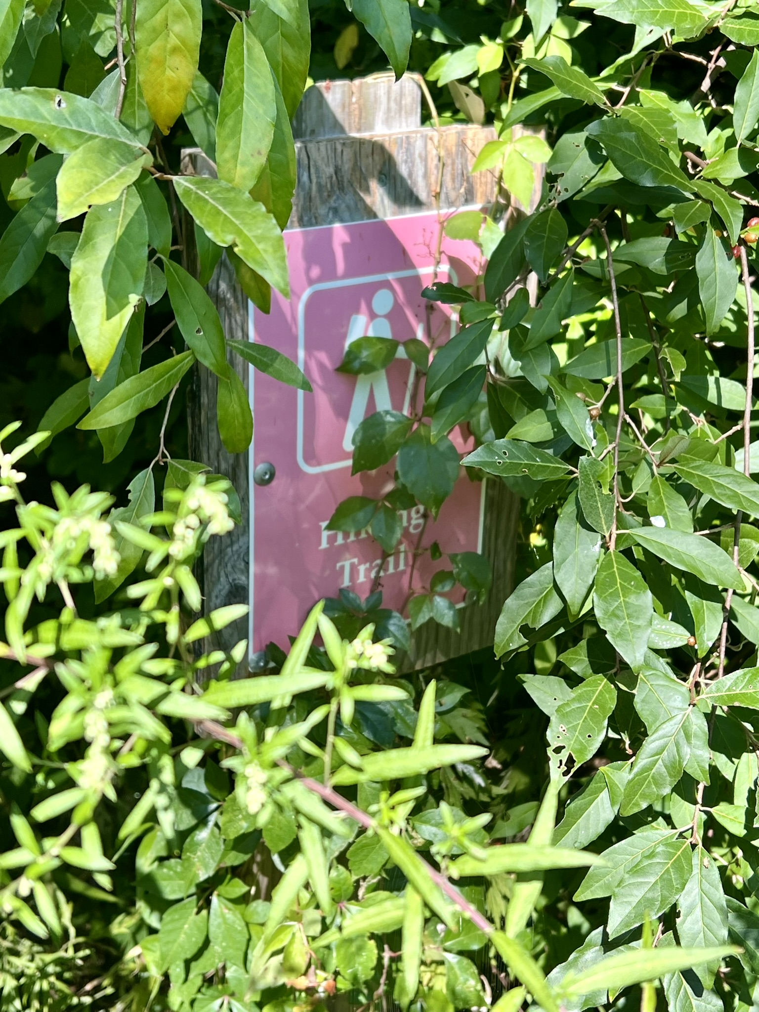
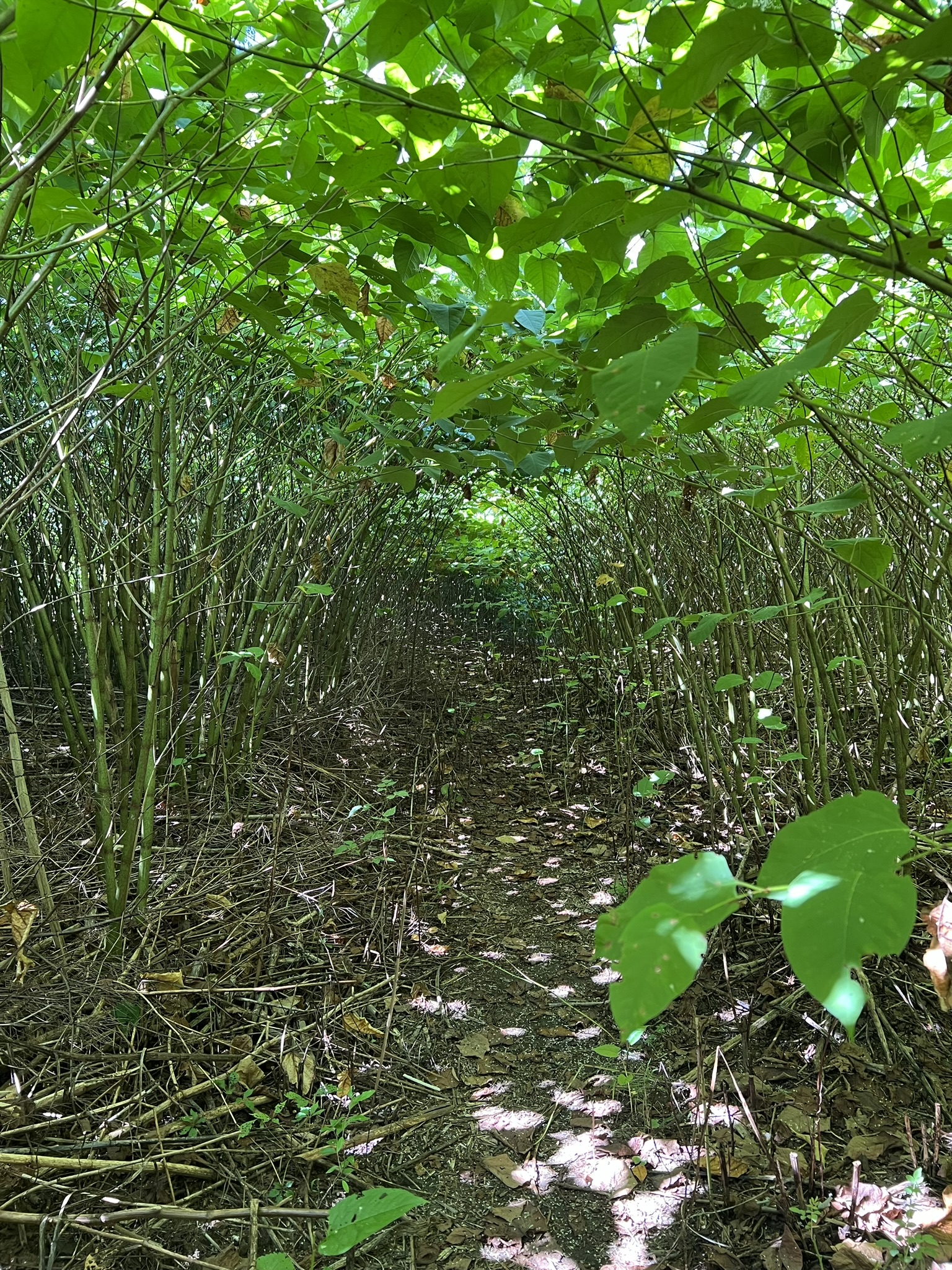
From left to right: the trailhead; ruins of a former bridge; Japanese Knotweed gone wild; tranquil river views
Scantic River Linear Park, Enfield & Somers, (southern trailhead). 2 miles.
In Google Maps use Scantic River State Park – South.
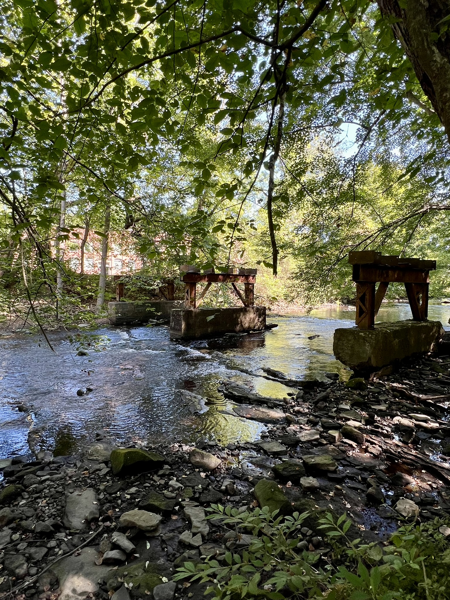
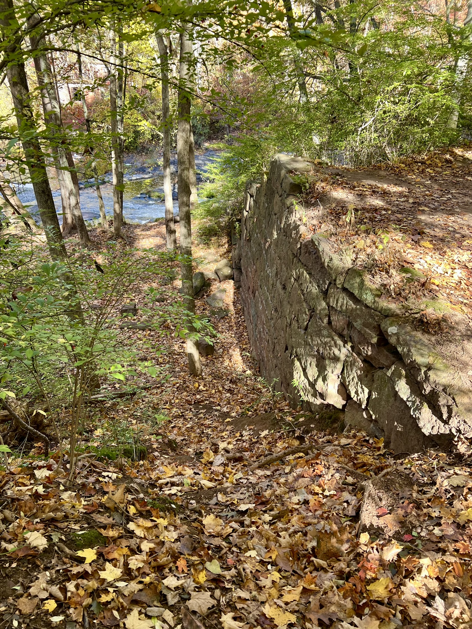
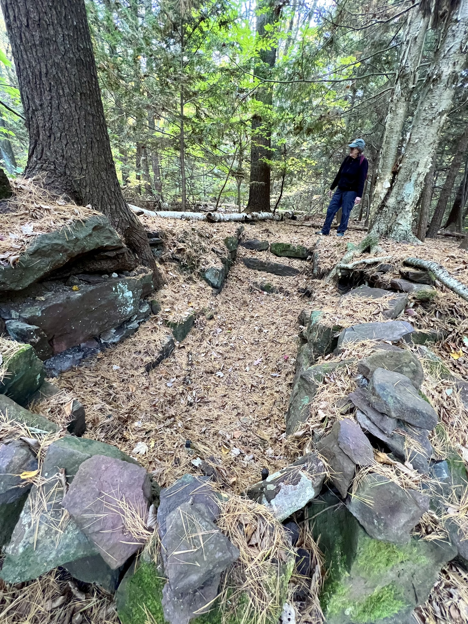
We located the small parking area on Bailey Road and started again. Taking a short, unblazed trail from the lot we turned right on the yellow trail, heading east toward the connection with the Somersville Mill Trail. While we had some views of the river below, the trail became overgrown the farther we went, so we stopped short of the end and quickly retraced our steps. We next opted for a counter-clockwise loop starting with the unmarked trail down to the river’s edge. It was here that we started to see some of the historical ruins from the Hazard Powder Company, starting with the sluice gate and dam. We did not know this at the time, but after gaining access to the historical map and reading Hazard Powder, I learned more about the history of the mill’s ownership at the Scitico site, which actually began as a separate enterprise under the name of Enfield Powder Company. I will provide my summary of events — cobbled together from the above references — but suggest using the bibliography at the end of this post to take a deeper dive.
When powder manufacturer Loomis, Denslow & Company was incorporated in the state of Connecticut in 1836, it is not far-fetched to believe that A.G. Hazard had a hand in it. Hazard had already been in business with both Denslow and the Loomis brothers in other entrepreneurial ventures. At the age of 19, Hazard, who had completed an apprenticeship as a housepainter where he grew up in Columbia, CT, headed to Savannah, GA after the fire of 1820 devastated that city. Somewhere along the way he met businessman Allen Andrew Denslow, with whom he opened a painting and supplies company in Savannah, Hazard & Denslow, in 1821. After moving back north to New York City to work in the import/export business he partnered with one of his suppliers, Allen Loomis, to acquire small powder mill operations first in Canton (1828) and later in Manchester (1830). So when 1837 rolled around and the country was reeling from a financial panic, it was not surprising to learn that Hazard took advantage of an opportunity and successfully negotiated for himself a ¼ interest in Loomis, Denslow & Company, which got re-registered under the name Loomises, Hazard & Company. Seven years later, in 1843, Loomises, Hazard & Company was dissolved and a new company formed. Sorenson writes: “The Joint Stockholders formed a new organization called ‘The Hazard Powder Company’ purchasing the assets from the Loomis Brothers in 1843 for $66,425 (or almost $2MM in 2020 dollars). The Loomises were then summarily dismissed, their services were no longer required.” Fast forward to 1849. A group of men teamed up, presumably with the backing of Loomis brother John Wells Loomis, and formed a competing powder company just upstream in the Scitico section of Enfield which they named Enfield Powder Company. This venture was short-lived, and after only a few years was bought out and folded into the Hazard Powder Company.
Back to the trail! Picking our way down a short, steep section from the top of the sluice gate we momentarily lost the trail, but with the help of AllTrails were able to figure it out. Although the main loop is supposedly blazed yellow, in reality the blazes are few and far between and the trail itself was overgrown with ferns. At least there were fewer brambles to contend with. We found ourselves walking along a raised section of ground that appeared manmade and followed what we guessed was an old raceway. We spotted several graffiti covered ruins that we later learned were the remains of the turbine housings for various mills (a glazing mill and a graining mill). At the far western turn in the trail we came upon the raceway controls and sluice gates. From there we relied on AllTrails to help us locate the trail back to the parking lot. It is possible that this trail is more manageable once the leaves have fallen, but I would still only recommend it if you feel comfortable navigating using a map and AllTrails, and you don’t mind some amount of bushwhacking.
For the Scitico historical map click HERE. For the DEEP Trail Map click HERE
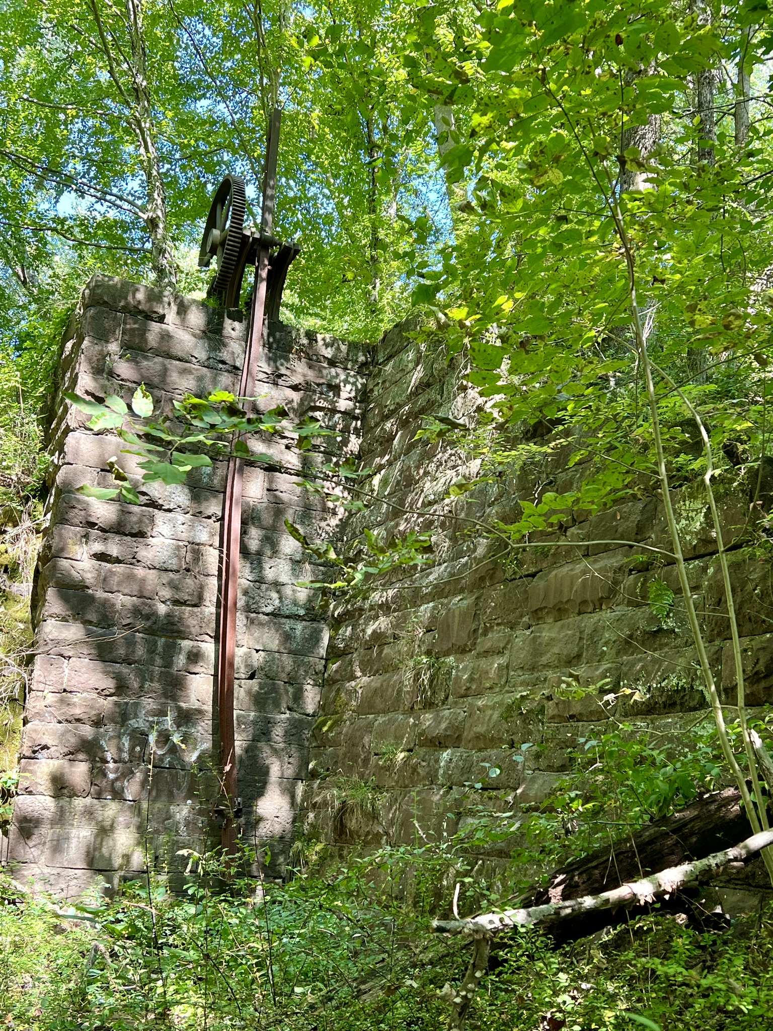
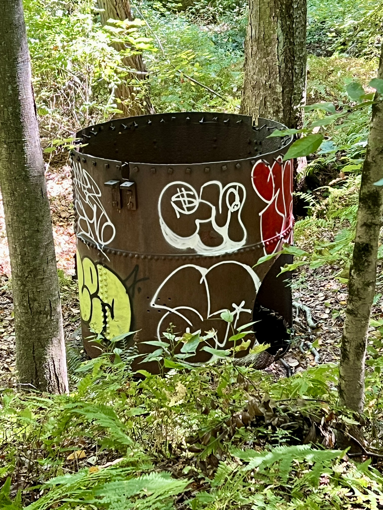
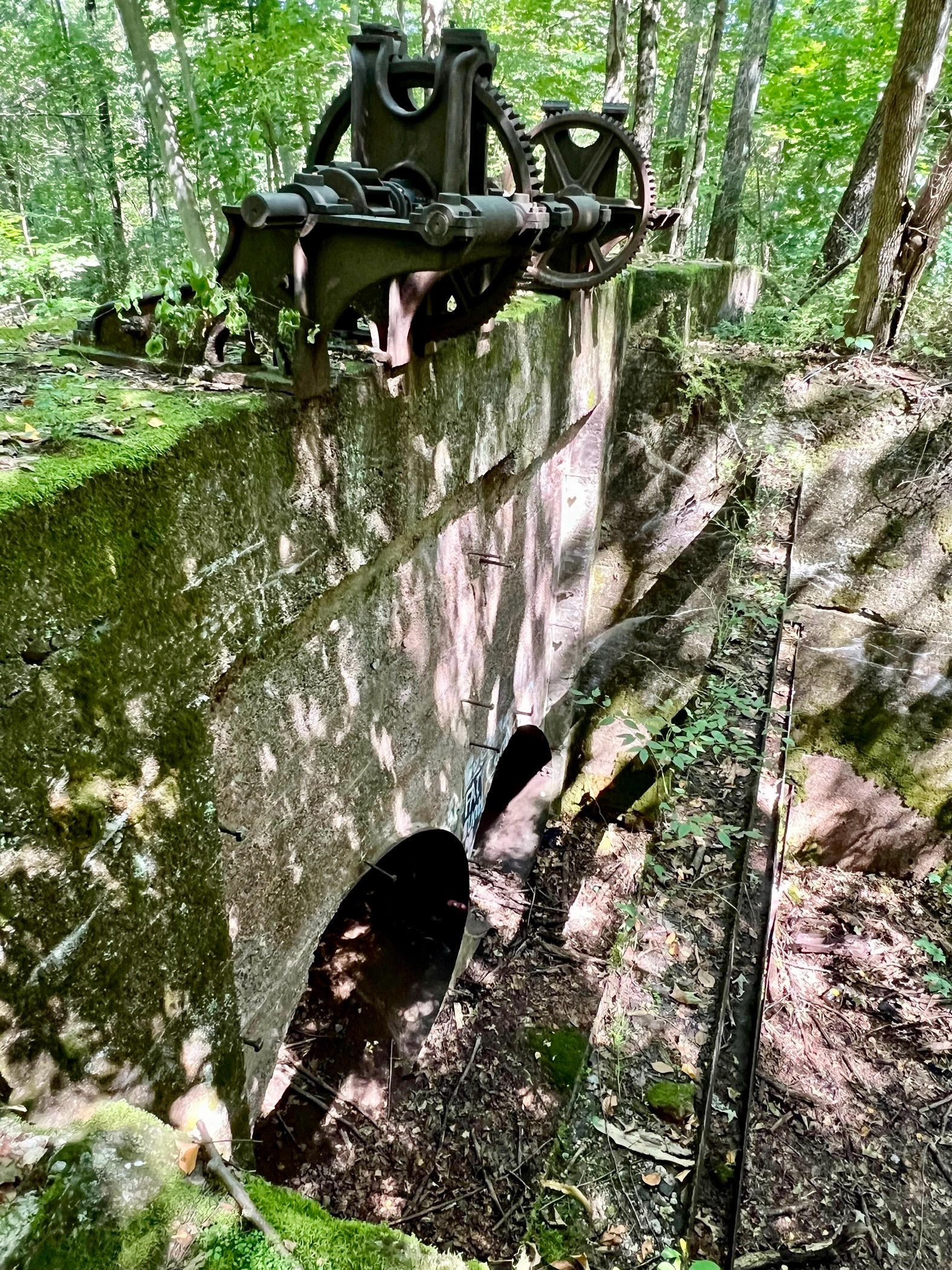
from left to right: Sluice gate and dam; turbine housing from one of the mills; the ‘not-so-obvious’ trail; raceway controls and sluice gate
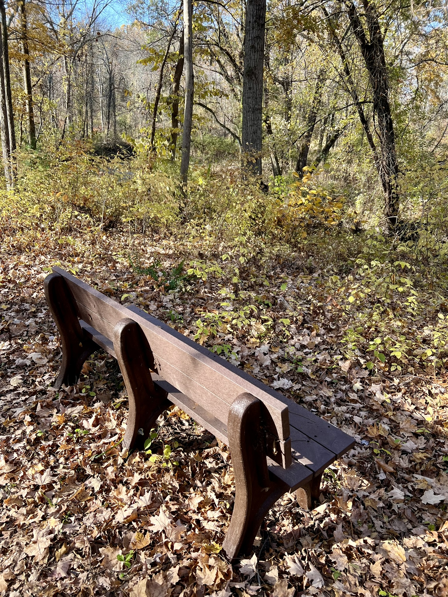
Scantic River Linear Park – East. 1.8 miles.
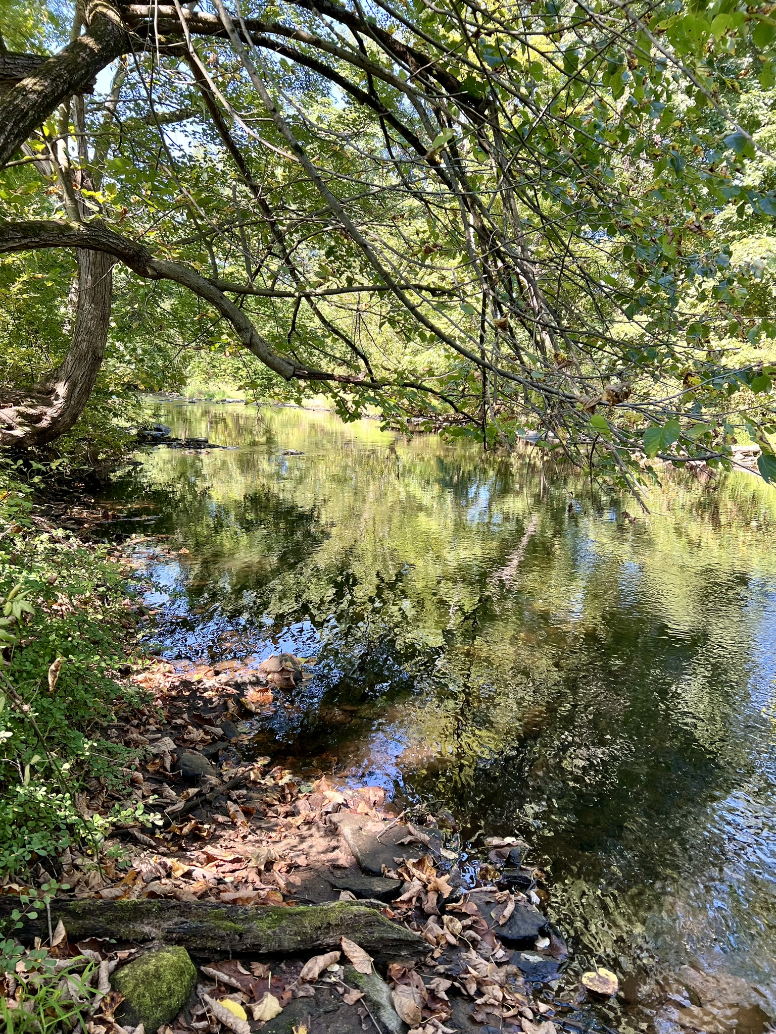
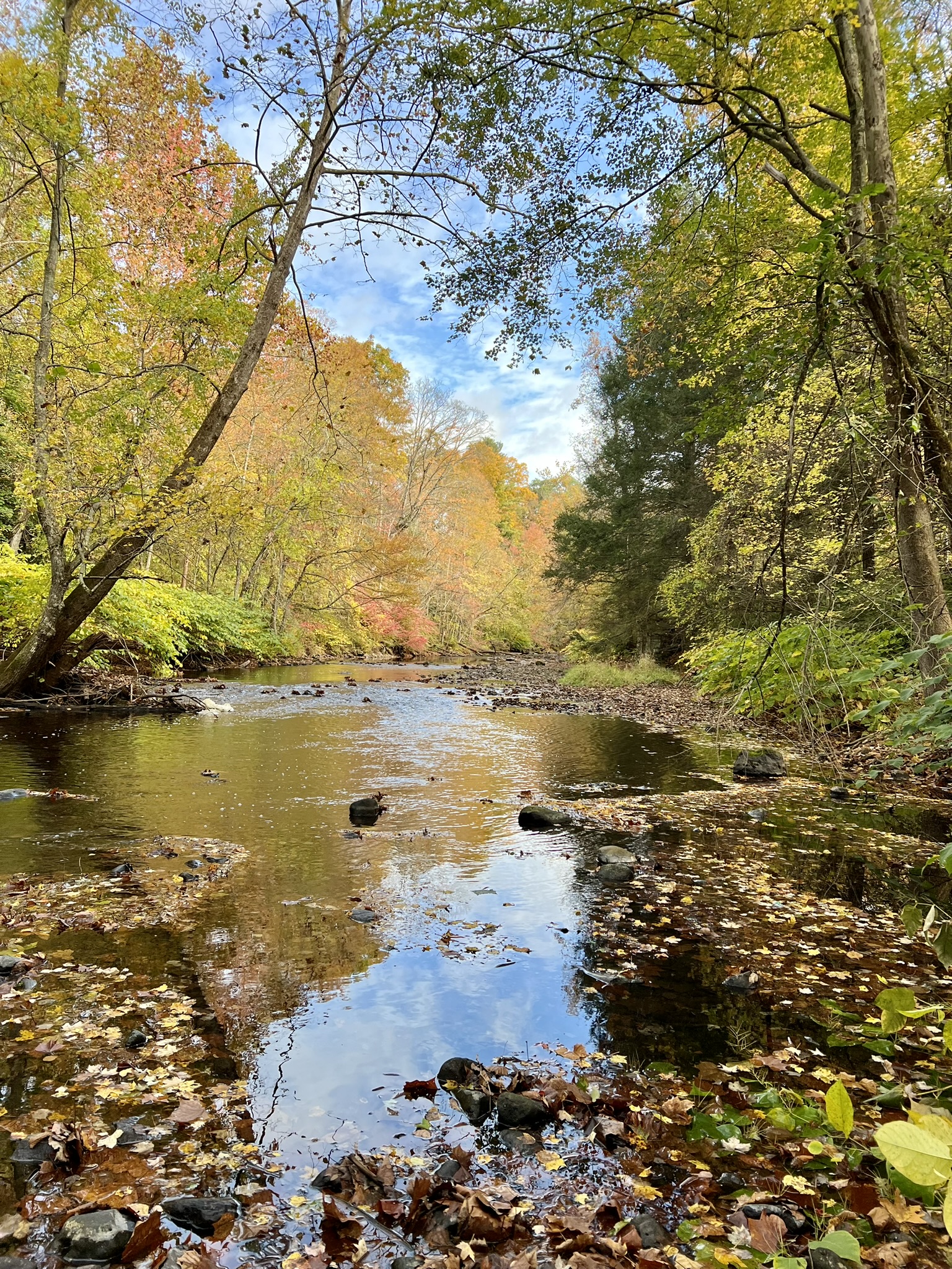
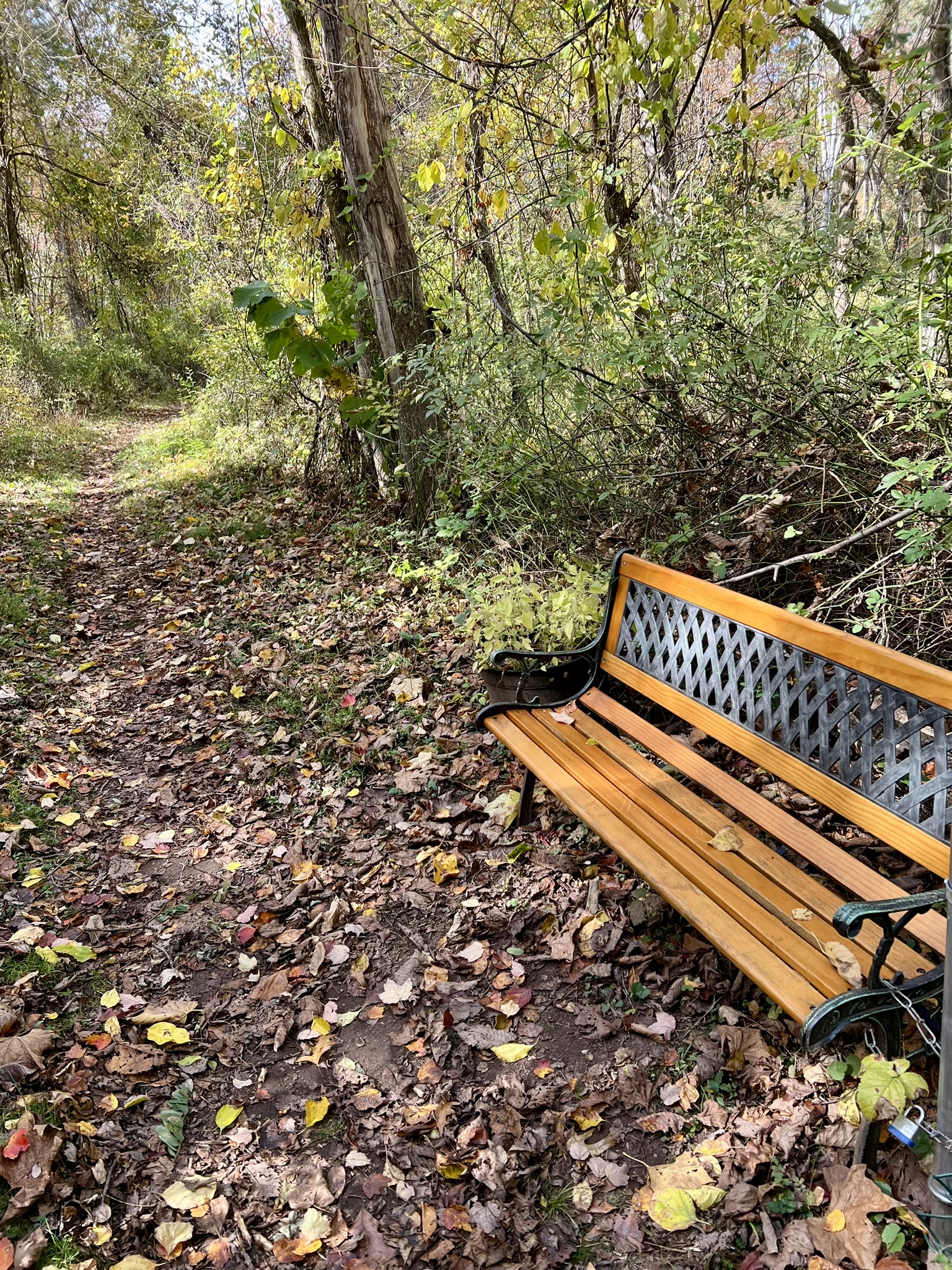
In Google Maps use Scantic River State Park East. Our next stop was to visit the trails on the northern portion of the Scitico parcel. While there were no historical ruins, this was an easier trail to follow and had better views of and access to the river. From the lot, we followed the yellow trail south to the river, walking along the bank as it looped west then north. At the trail junction we went left and followed the trail almost to its end. Part of the trail goes along a boardwalk that was a bit overgrown which looks like it can be slippery in wet weather. We retraced our steps to the trail junction and continued straight to complete the loop back to the parking lot.
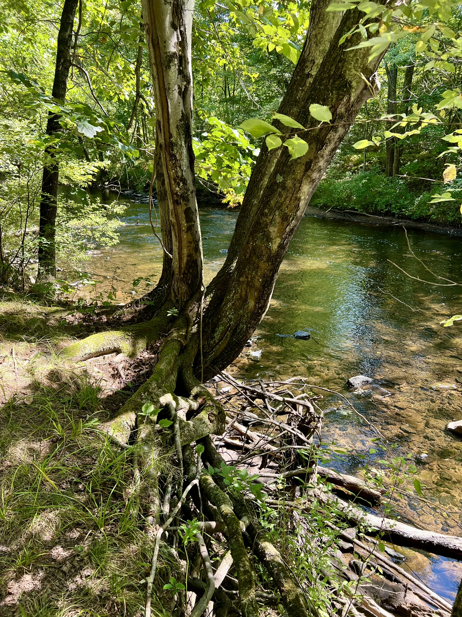

From left to right: The trail above the river; a contemplation bench along the trail; the overgrown boardwalk
Scantic River Linear Park – West (southern trailhead). 2.2 and 2.5 miles (two visits)
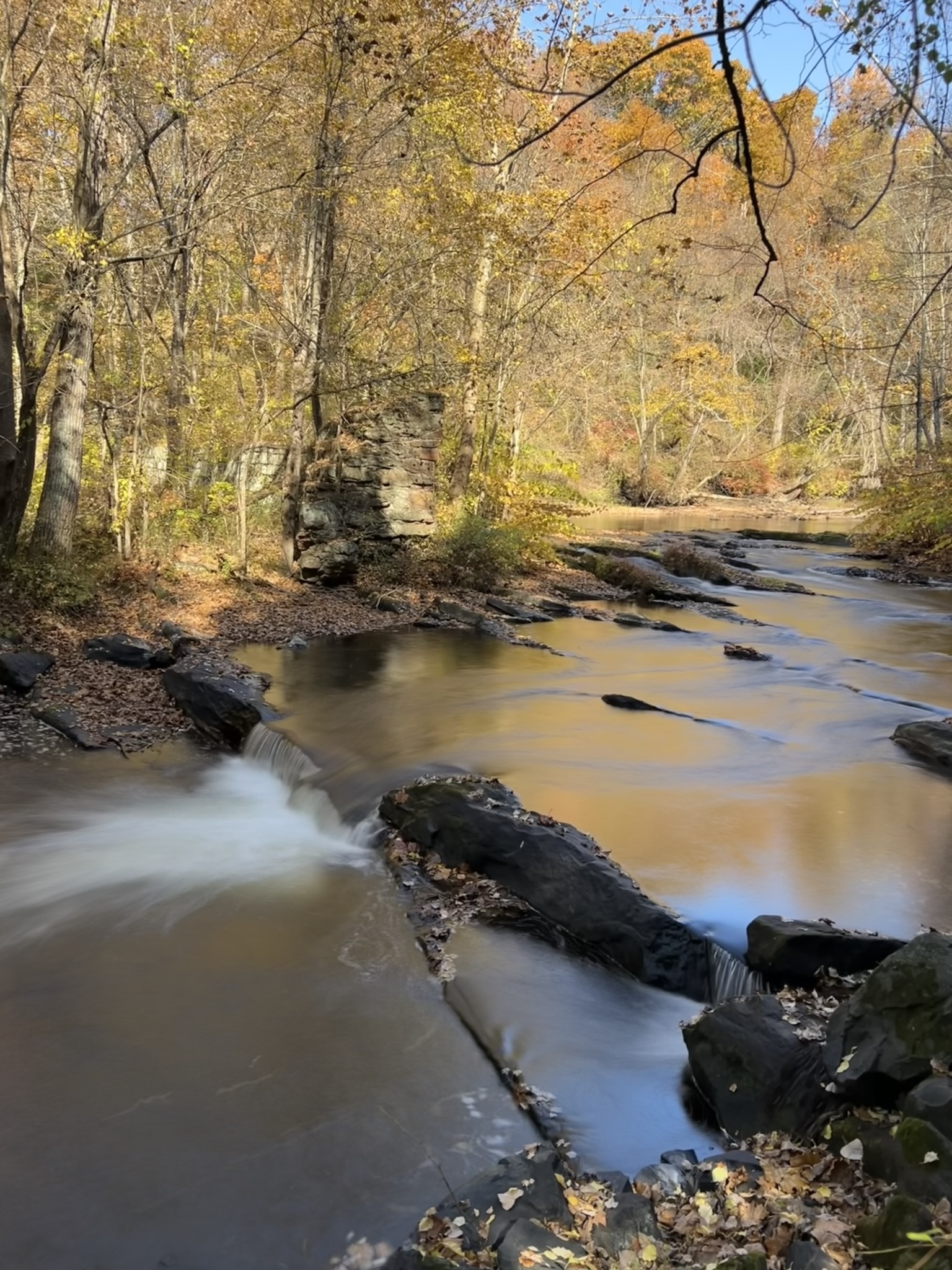
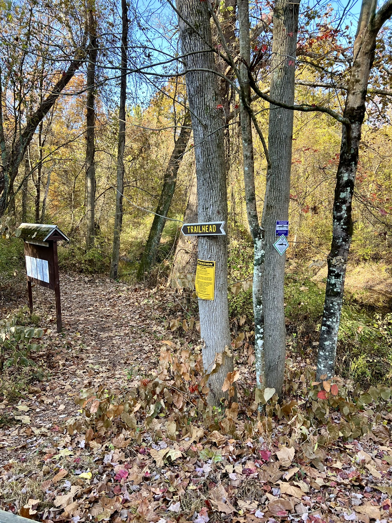
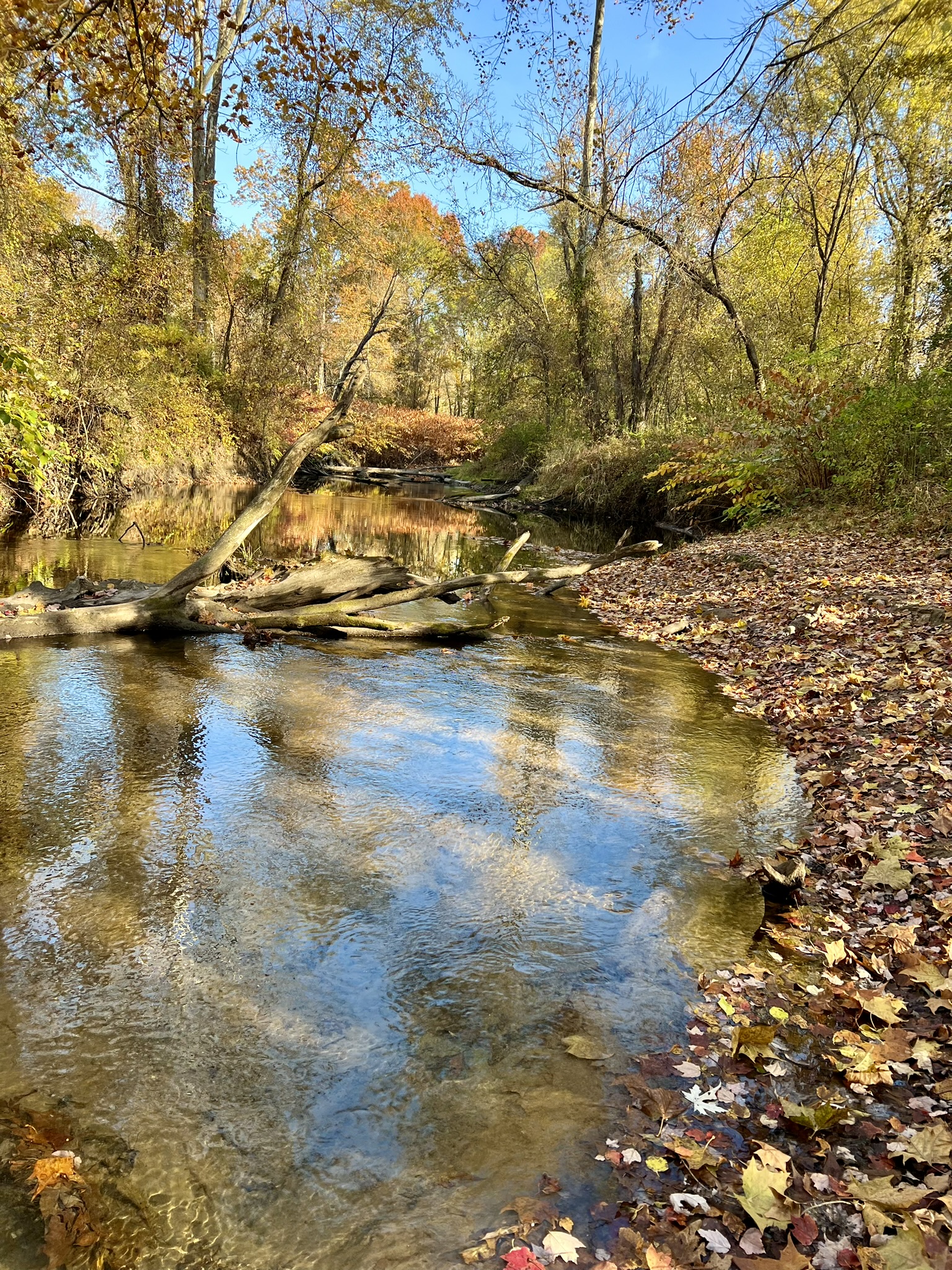
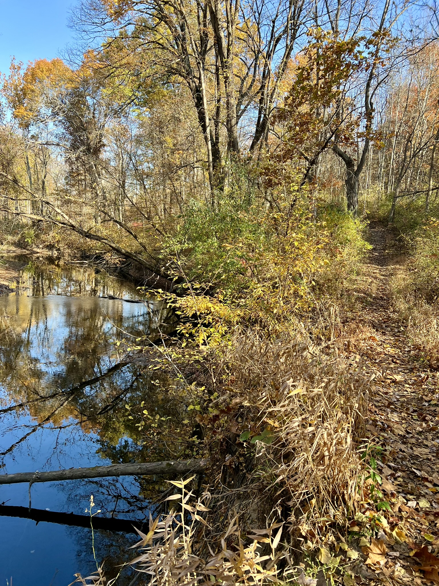
In Google Maps use: Scantic River State Park, Powder Hollow Block. Sue and I returned to Enfield on a chilly mid-October day to explore the “Hazardville” section. This time we arrived armed with the “historic tour” map from Matt’s blog post and the DEEP map. I had a printed copy of the history map so I could see the layout more clearly, and a digital copy for zooming in on the small writing. Driving down South Maple Street from Hazard Ave, the parking lot is on the left immediately after crossing the bridge. This is apparently a popular place, especially on summer weekends, with only 8 or 9 parking spots, so I recommend planning your visit accordingly. Take note of the red barn on the right just before the bridge. This was the original Hazard Powder Company horse barn. All the trails in this section are unmarked, but much easier to discern than the Scitico section. From the kiosk we took the trail to the far left which heads to the river. Almost immediately, we came upon the first listed ruin, the Upper Falls Dam. We continued along the river admiring the fall colors and scenic views at every turn. Several of the ruins are on the opposite bank and trickier to spot. Initially I was using the map in conjunction with AllTrails to locate the designated ruins. Then I came upon a better solution. The historic tour map includes GPS coordinates for each feature so I began to copy and paste the coordinates into Google Maps. While Google Maps doesn’t show the trails, it helped us more accurately locate our position in the field. (If you haven’t done this before, please know that you have to delete the “degree” symbol “o” to get it to work).
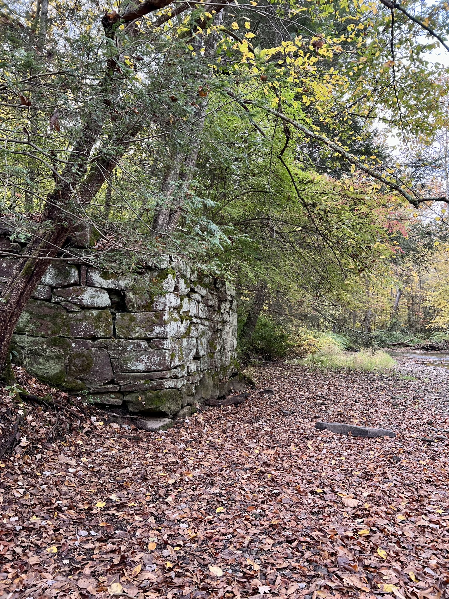
(from left to right: remains of the Upper Falls Dam; a serene spot along the river; the bridge abutment to the New Works; a remnant on the far bank, possibly from the Glazing Mill
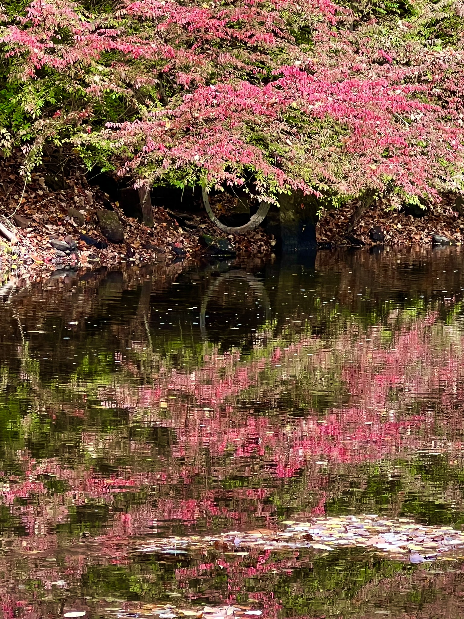
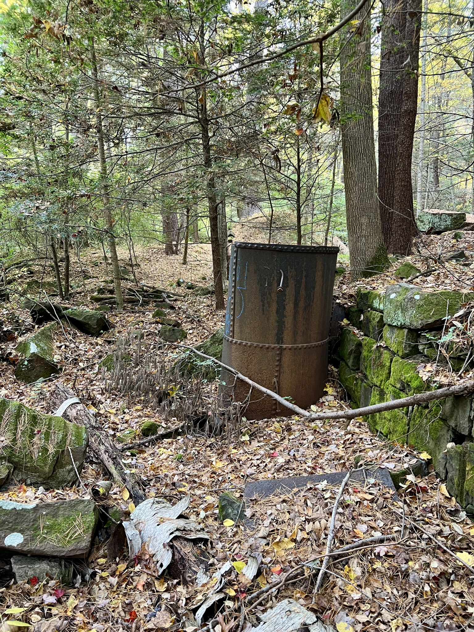
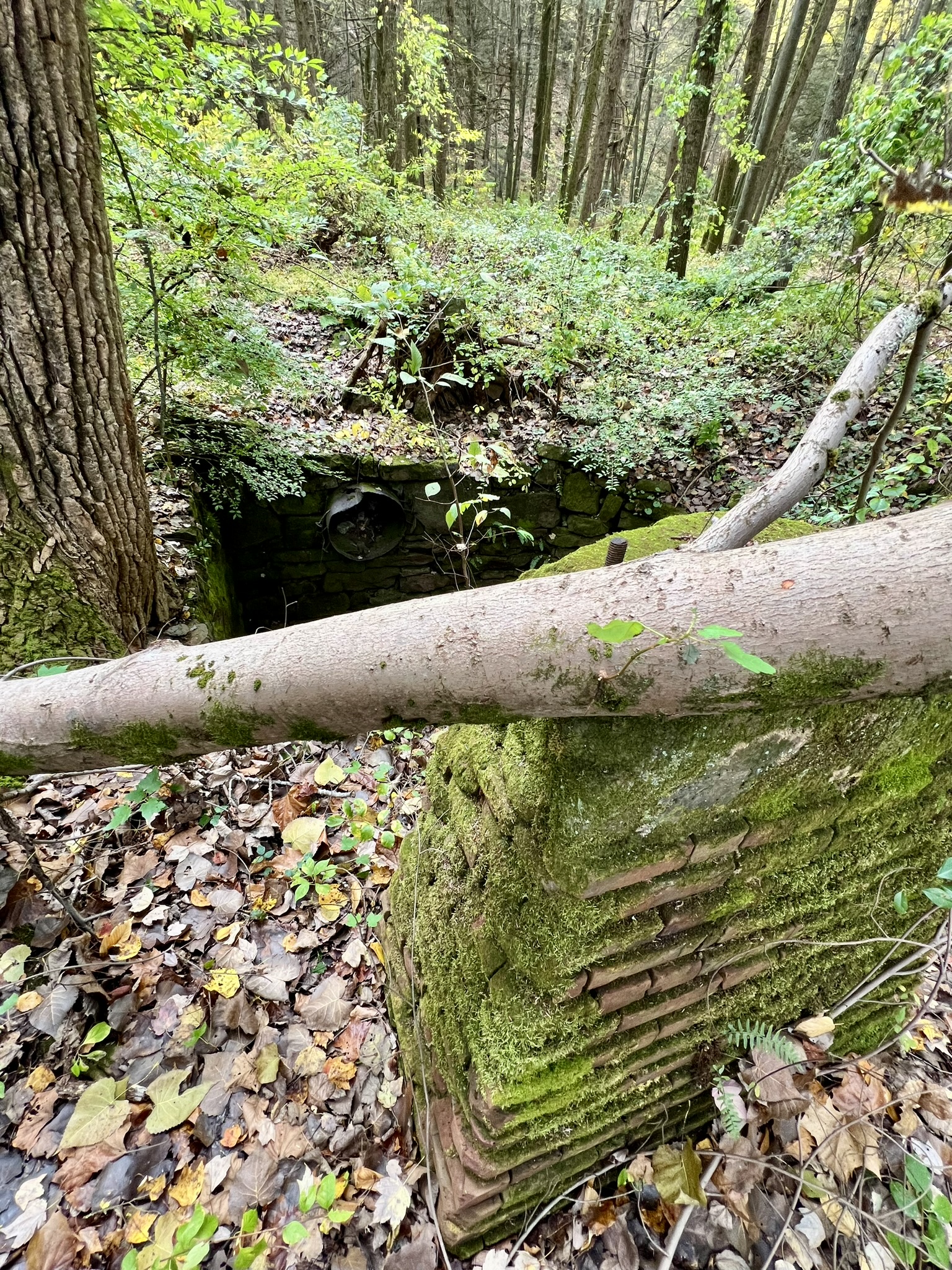
At one point near feature #6 (the New Works) we noticed an interesting jumble of rocks on the hill above so we went off-trail to explore. We found ourselves at what may be the ruins of the Watch House. It was here that we realized that the trails that parallel the river (marked in white on the map) go along either side of a man-made canal. We followed this canal trail east, then climbed back down to the river to explore ruin #8, the Rolling Mill, one of the steam-powered mills involved in the explosion of 1913, and #7, the Charter Dam, which supplied water to canals on both sides of the river. From there, we returned to the canal and followed the trail along the southern bank to the Press Mills, where the 1913 explosion originated.


from left to right: a foundation along the canal – possibly for the Watch House; a turbine housing of the New Works; The Rolling Mill in the New Works was built to run on steam power; remnant of the Charter Dam on the far bank
Two workers, Charles Blunden and Jacob Stocker, lost their lives in the chain reaction explosion that ripped through 4 mill buildings on January 14, 1913. The mills had been operating for just one month under their new legal name, Hercules Powder Company. The change occurred after then-owner DuPont lost an anti-trust suit brought by the Department of Justice in 1907. (After Hazard’s death from smallpox and pneumonia in 1868 the Hazard Powder Company struggled financially and was acquired by DuPont in 1876). This final explosion marked the end of powder manufacturing in Enfield. It was a tough and dangerous business, but according to the Enfield Historical Society, “[e]ven though explosions did occur over the years, the Hazardville operation was unusually safe with only 67 deaths during nearly eight decades of operation.” At this point, the trail became a little less obvious as we made our way toward the last ruin on the map, the Corning Mill. However, this was also the point at which we started to see pink ribbons marking the way. These ribbons led all the way to the Corning Mill ruins and back out to the main trail. I noted that the junction with the main trail is near a very large, recognizable tree (see photo below).

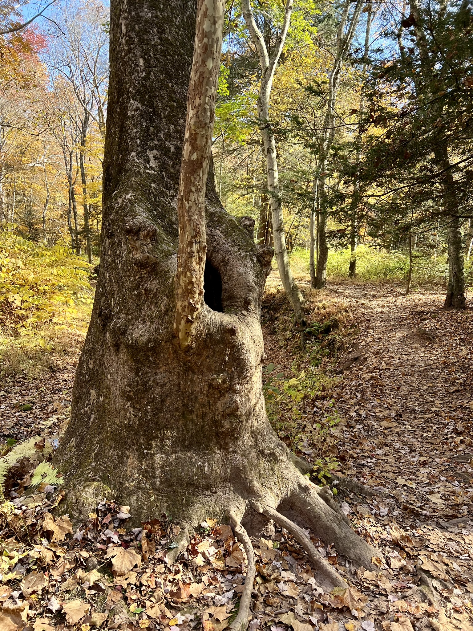
from left to right: the Press Mill ruins where the 1913 explosion started; pink ribbons helped guide the way; the Corning Mill ruins; the recognizable tree near the “pink ribbon” trail.
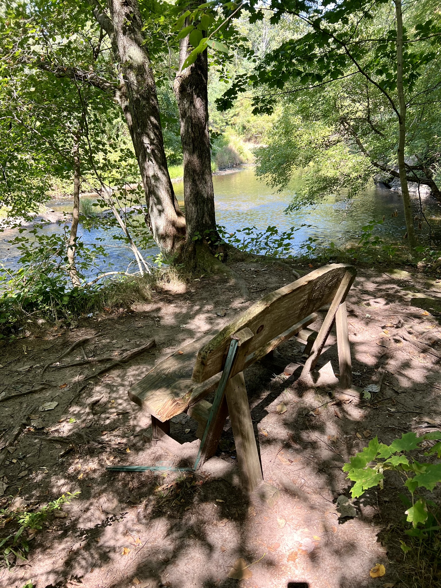
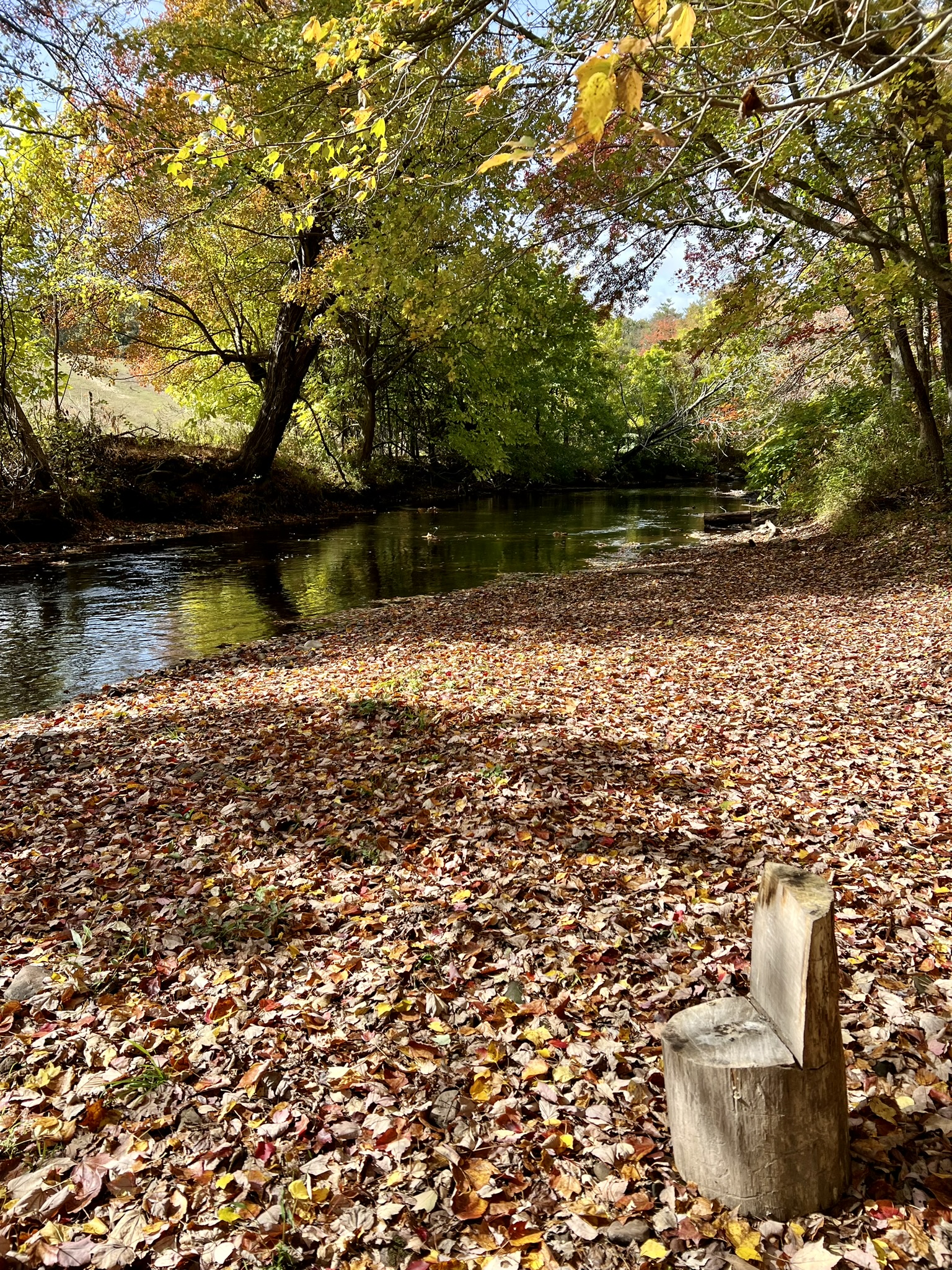
Sue and I returned the following week on a gorgeous, balmy late October day to hike the outer loop which includes the upper ridgeline. After our first visit we met a local hiker on the East Windsor parcel who was knowledgeable about the history. He asked if we had done the upper ridge trail, mentioning that while the mills were in operation the lower banks were flooded and much of the material had to be brought in by teams of horses from up above. He said the numerous paths visible along the way going steeply from the upper ridge down to the river were for that purpose. Intrigued, we planned a final trip to Enfield to explore this trail and the East Windsor parcel. On our second visit, just past the kiosk we took the very steep trail on the right to access the ridge. NOTE: All of our visits occurred during the fall drought weather. I imagine many of the trails can be challenging in wet/muddy times, especially this steep section. Once on the ridge, the trail follows an easy and scenic path through woods dotted with seemingly healthy hemlocks. The embankment down to the river is very steep, and once all the leaves come down I imagine there will be periodic views of the river. We did indeed notice several side paths that veer straight downhill as had been described to us. The trails are not blazed so this AllTrails link helped us stay on course. The one tricky section was at the point where the trail heads back down to the river. The first junction was denoted with some well-placed logs on either side of the trail entrance. The next junction, near the start of the steep downhill, we took the trail to the right which was conveniently marked with neon yellow/green paint. Upon reaching the river the trail loops back to the west (left). The trail map shows a bench, which turned out to be two folding chairs set up on the riverbank! This was the perfect snack spot and we dawdled here for some time enjoying the warm weather, the sound of running water and the beautiful fall colors. (Before we left we moved the chairs further up onto the bank). From there, we continued along the trail, taking a second look at many of the ruins of the Hazard Powder Company. Walking in this stunning setting, reclaimed by nature over the past 111 years, it was mind-boggling to think that at one time this entire length of river valley was once studded with over 120 structures running an enterprise that employed as many as 200 men in its heyday.


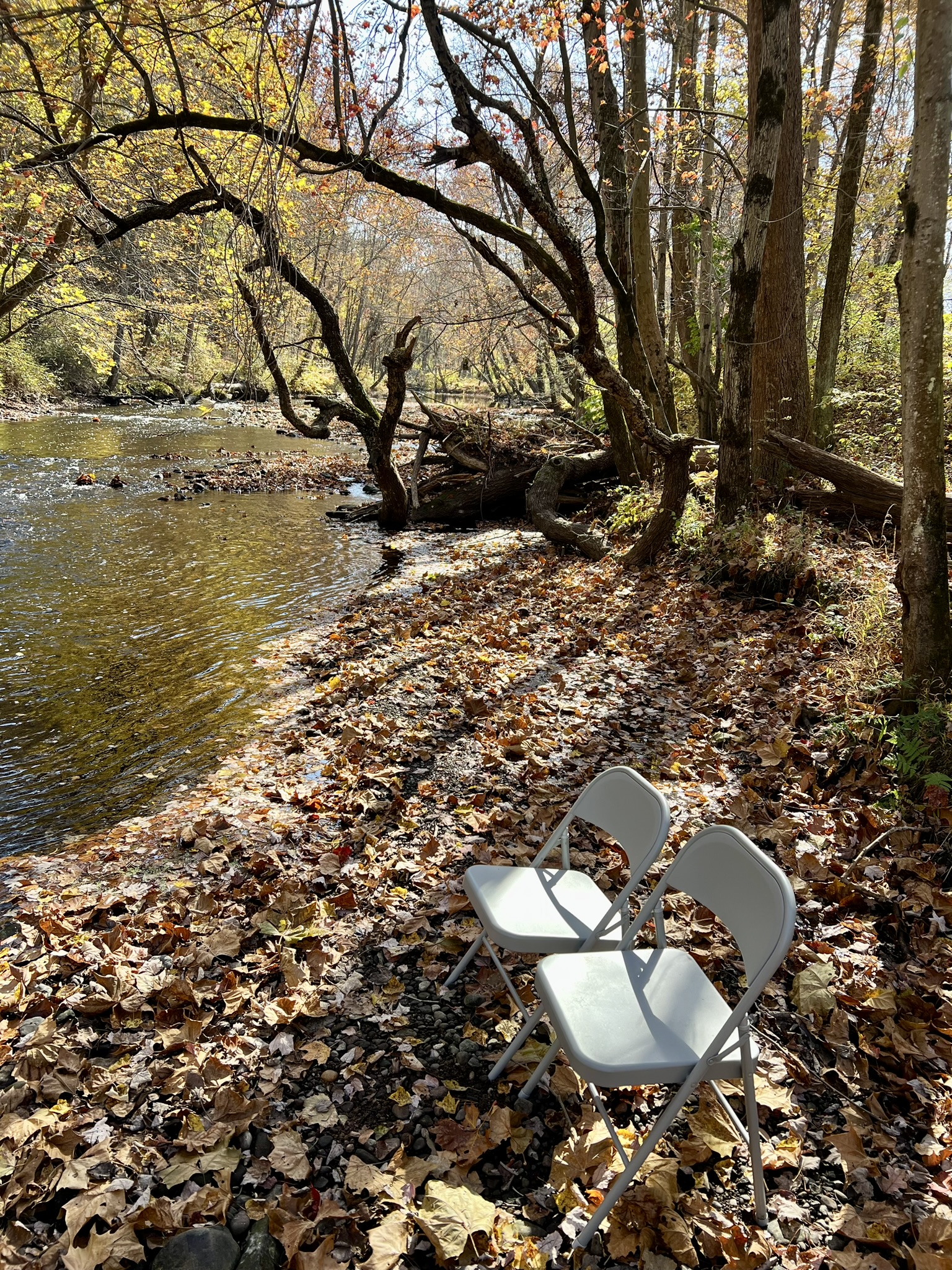
from left to right: the steep, eroded trail to the ridge; hemlock woods along the ridgetop; yellow marks helped guide us down; the “bench” offered the perfect rest stop
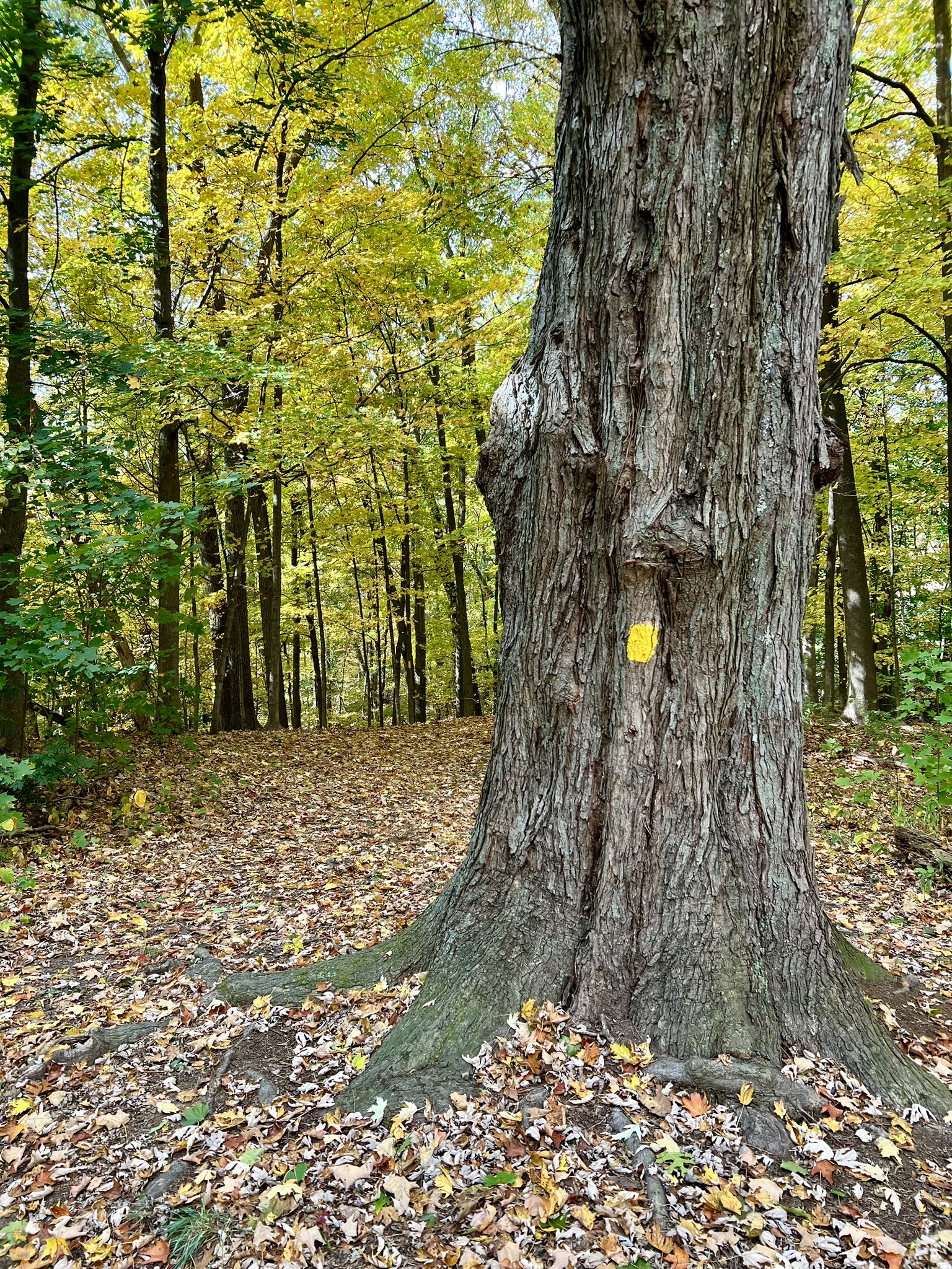
Scantic River Linear Park – West. 1.4 miles.
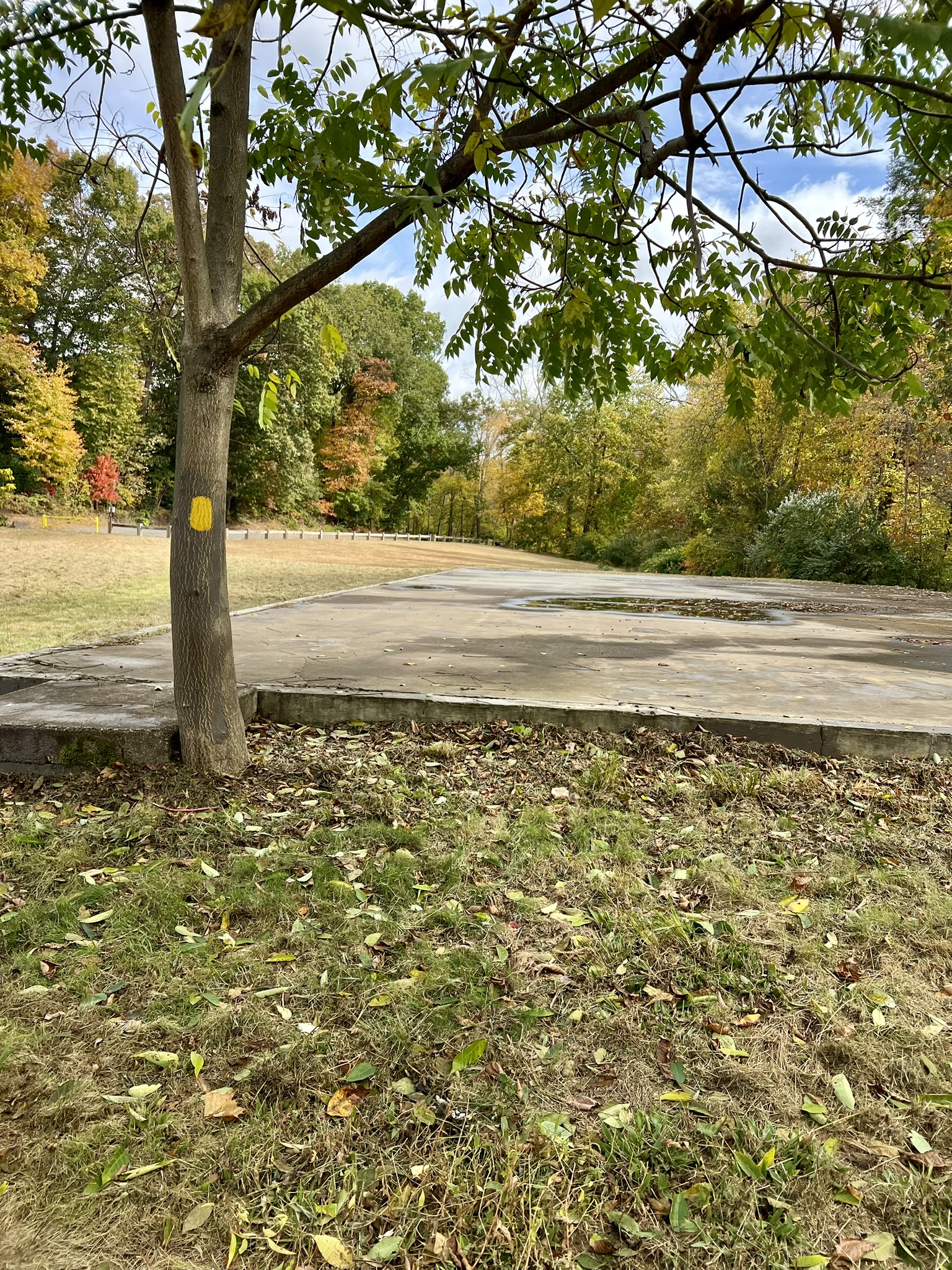
In Google Maps, use: Scantic River State Park – West. We visited this parcel after our first visit to the “Powder Hollow” block. Most of these trails are blazed in yellow, although there are some unmarked sections that create short loops. The AllTrails map helped. While there are no ruins, it made for a pleasant hike along the river. From the parking lot the yellow trail heads downhill toward the river. When the river came into view we continued onto an unmarked trail that leads to the bank. At the river’s edge we noticed two folding chairs on the opposite bank, not realizing that we would be enjoying a snack at that same spot the following week! From there we walked alongside the river until the trail cut back in and up to rejoin the yellow trail. At the next two junctions we stayed left, following the trail all the way to what is marked on the map as a warehouse. In the field it is merely a large concrete slab on the edge of a field. Circling back, we followed the trail along the river this time, until it looped up to meet the trail we came in on.

From left to right: the trail starts by this large tree; scenic river views; the “warehouse” on the map; a carved seat along the bank
Scantic River Linear Park, East Windsor. 2.5 miles
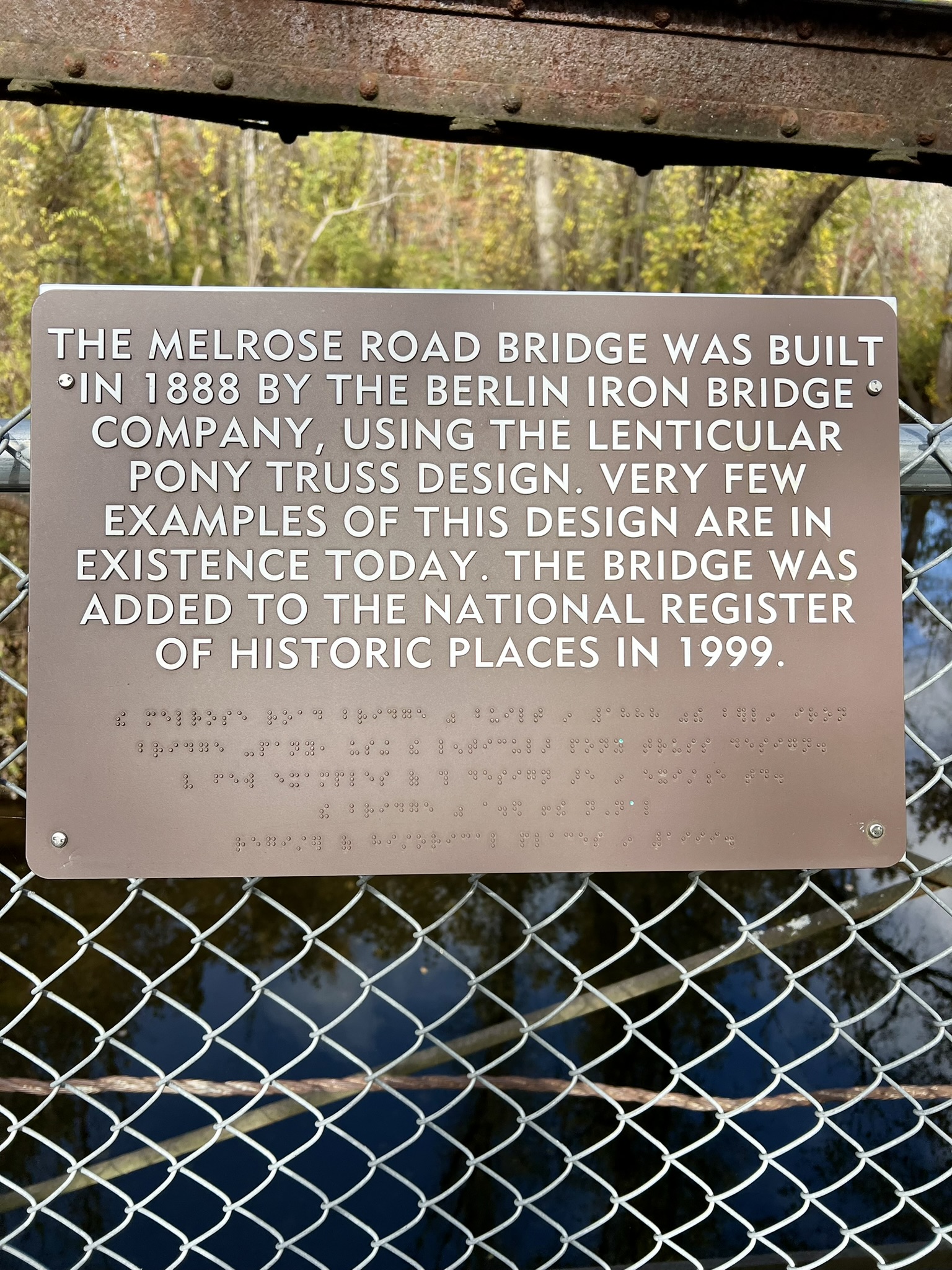
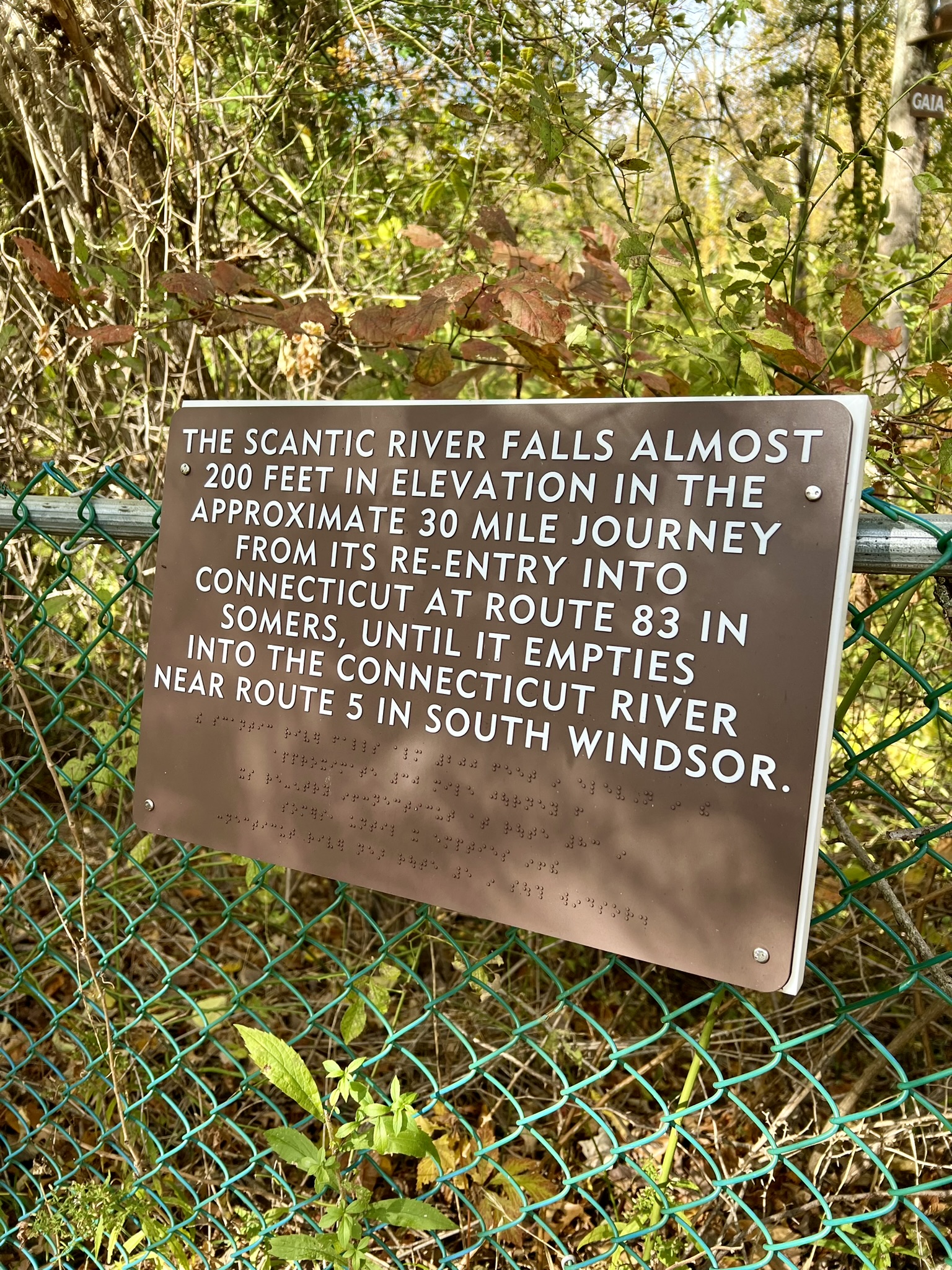
Access to this parcel is at the end of Melrose Road in East Windsor. In Google Maps, use Scantic River State Park East Windsor. Our first visit to the East Windsor parcel was a scouting trip. We had already done two hikes that day, and since this parcel is open for hunting and we had not brought our orange vests, we opted to just take a cursory look. Our first discovery was of the Braille Trail, developed after the publication of the DEEP map. It is a short trail that starts at the Old Melrose Bridge. The kiosk had a scan code that linked to this 2024 trail map which show the Braille trail, as well as two other trails that are still being developed. The map describes the Braille Trail as running “about 880 feet, displaying 11 signs in Braille and English describing the original bridge” as well as other points of interest.
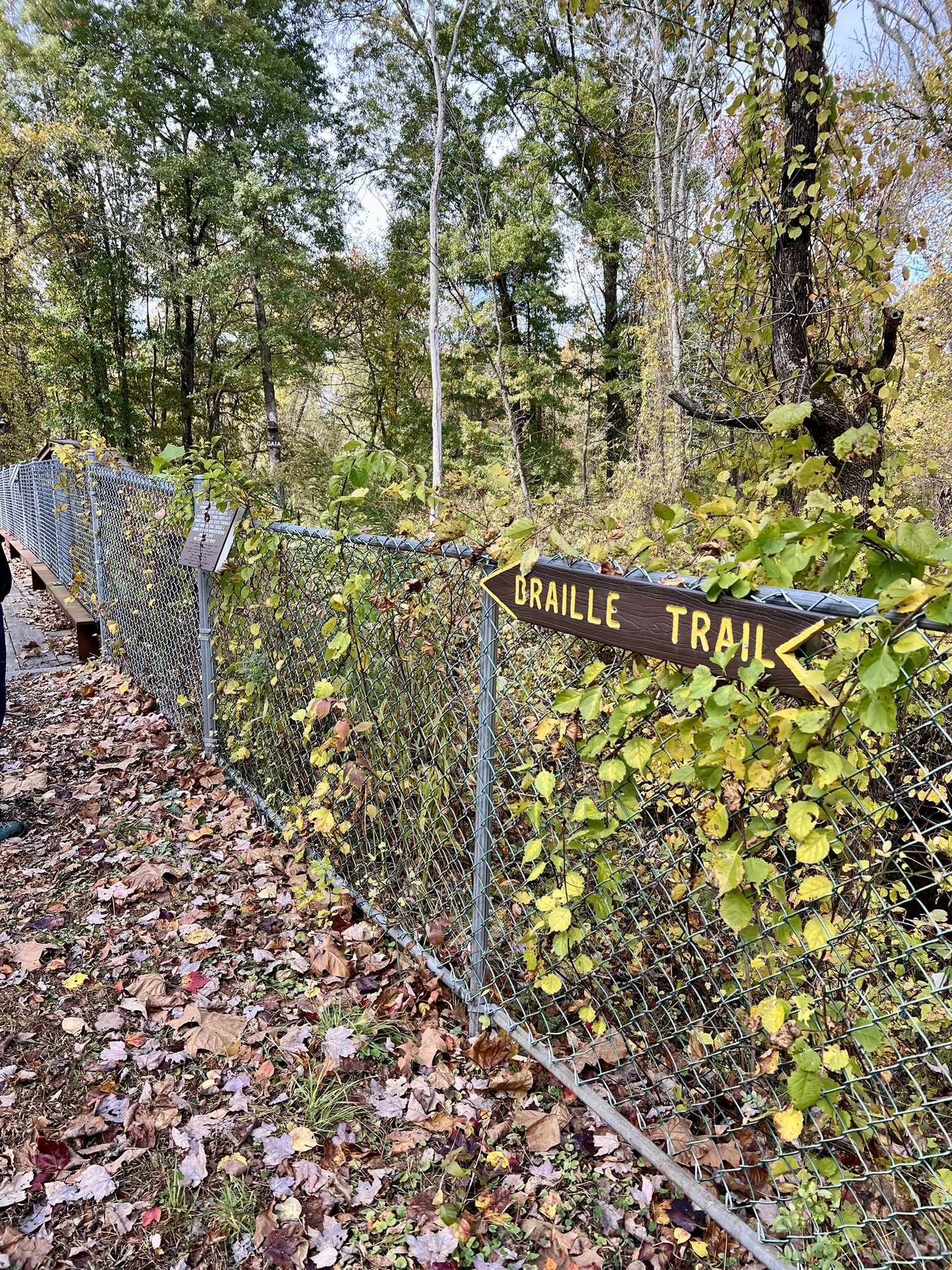
Scenes from the Braille Trail
We returned the following week to hike the yellow blazed trail, this time wearing our fluorescent orange as a precaution. We chose to hike in a counter-clockwise direction, starting along the river. The trail was easy to follow, meandering through a landscape of brush and young trees. There are a dozen wooden bridges that span small creeks and muddy sections. In several places we noted the erosion along both the river and creeks and imagined the landscape must look very different at higher water. There are a few places where spur trails cut out from the main trail so it was helpful to follow the route using both the map and AllTrails. As the trail rose it became more wooded and less brambly. Nearing the last section we opted for the far right path of the Ridge Loop which went along the highest part of the ridge. The trail then descended back down through brush and back to the road.
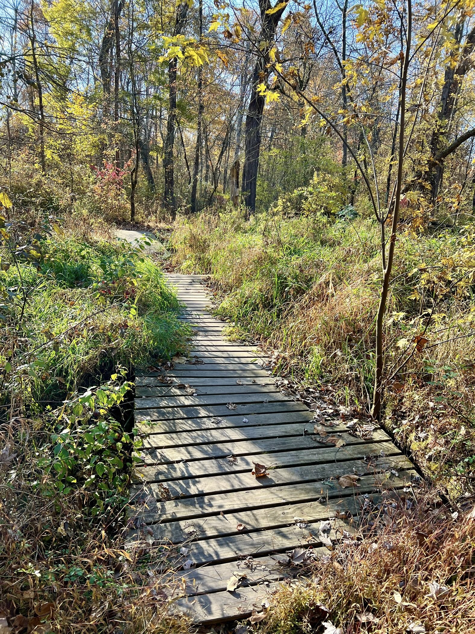
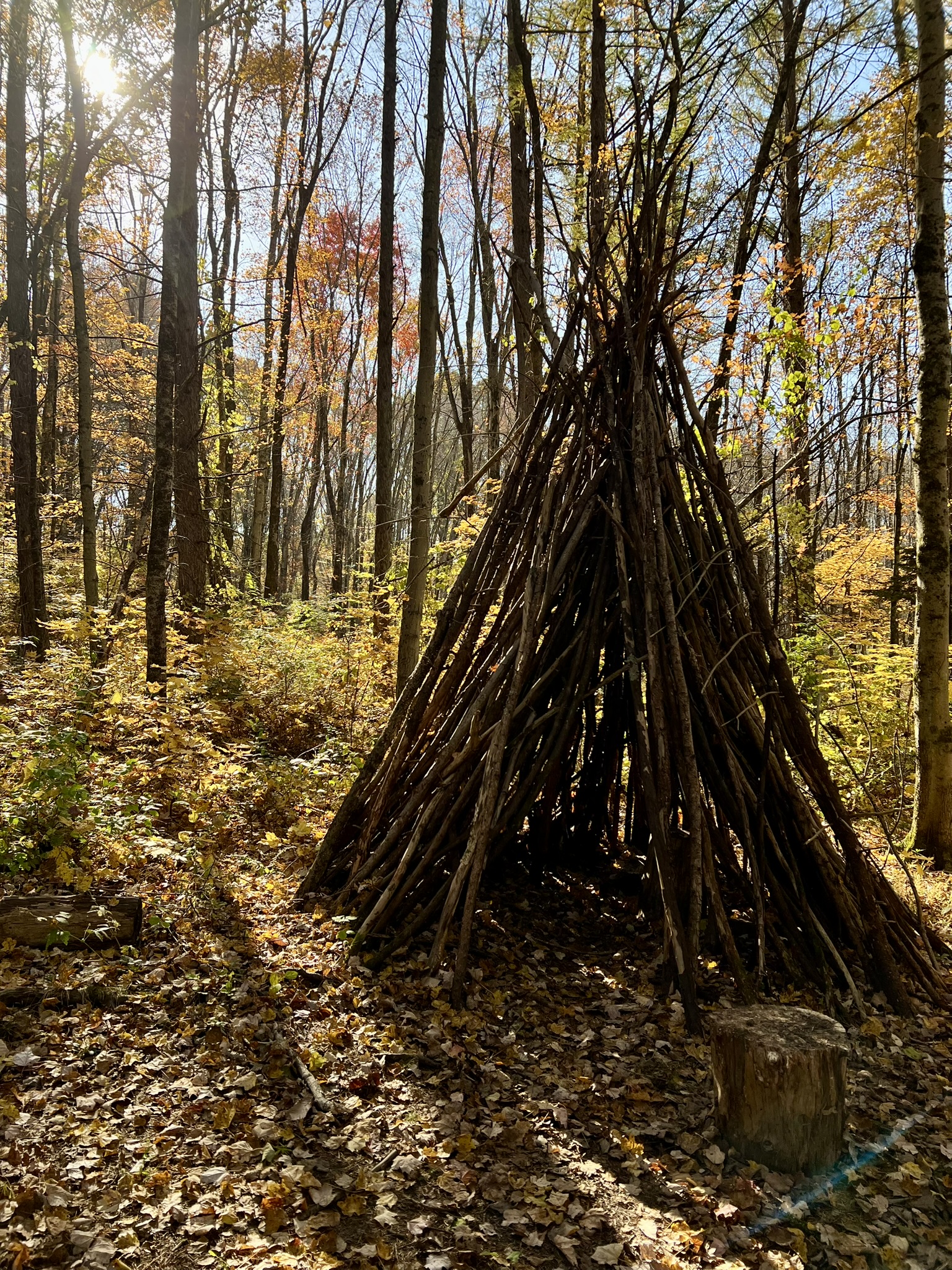
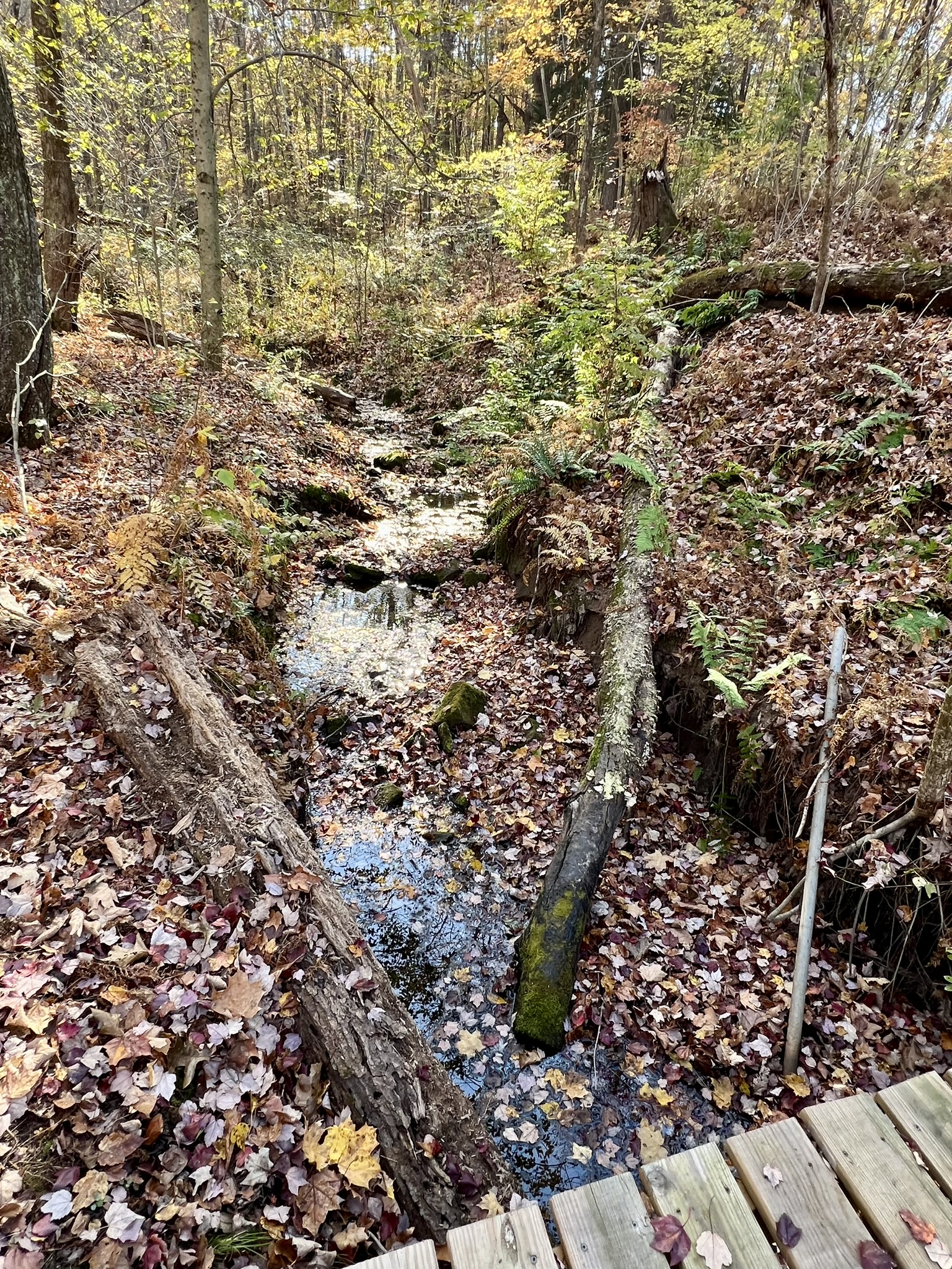
From left top corner, clockwise: the trailhead and kiosk; the river; one of many bridges; one of several benches; the ridge; small creek with eroded banks; a random tepee; trail along the river
BIBLIOGRAPHY
Explorect.org’s Scantic River blog post
Enfield Historical Society article about Hazard Powder and the gunpowder industry, containing many historical photos https://enfieldhistoricalsociety.org/old-town-hall/the-gunpowder-industry/
Hazard Powder: The Powder Hollow Explosion of 1913, by Peter Floyd Sorenson (2021). https://hazardpowder.com/
Fighting the Enemy Was a Civil War Hazard: so Was Manufacturing Weapons, by John Banks, 3/31/2022. This article talks about the process and dangers of manufacturing powder “from Connecticut to Mississippi” during the American Civil War. The article includes a photo of A.G. Hazard’s mansion which burned down in 1969. https://www.historynet.com/fighting-the-enemy-was-a-civil-war-hazard-so-was-manufacturing-weapons/
Connecticut Public article by Patrick Skahill (2019) about Hazardville and Scantic River State Park https://www.ctpublic.org/environment/2019-05-28/along-the-scantic-river-blasts-from-connecticuts-gunpowder-filled-past
Waymarking.com page with details about the horse barn, one of the few surviving buildings from Hazard Powder Company
Subscribe to Trail Talk
your next adventure awaits
Questions? Email me at naturenerdsramble@gmail.com or find me on Instagram @the_real_nature_renee.