OFF THE BEATEN PATH. We often use this phrase when we are seeking an experience for ourselves that separates us from the mainstream. While we usually mean it figuratively, I like to literally go off the beaten path. In hiking, we use the term bushwhacking, which means hiking off-trail where there is no clear path. I don’t practice this in any extreme way, but seasonally (when the leaves are off the trees and it is easier to see and get around) I love to wander through the local state forests and explore a little more freely. A happy medium is an unblazed trail where you can still get the feeling of being “off the beaten path” yet feel reassured that you are unlikely to get lost. In this Trail Talk, I share two of my favorite Cockaponset State Forest loops. Each loop has a combination of forest road, blazed trail and unblazed trail. I include a third hike that I explored for the first time this September. All three have DEEP maps that show most of the trails. I suggest using these maps in conjunction with your favorite trails App, where the satellite feature will allow you to see where you are on the trail at any given moment. I use AllTrails, which shows the trails for all three hikes, as does the Avenza App. Gaia does NOT show the trails for the Cockaponset hikes. The hikes are listed below in order from easiest to hardest in terms of way-finding. It is important to know your own comfort levels when hiking an unmarked path. All of these hikes are on state land where hunting is permitted. Please wear fluorescent orange when hiking during hunting season. Stay informed by checking the 2024 Connecticut Hunting and Trapping Guide .
(Photo to right: Rock ledges at George Dudley Seymour State Park in Haddam Neck)

George Dudley Seymour State Park, Haddam Neck, CT. 2.5 to 3.3 miles depending on the route.
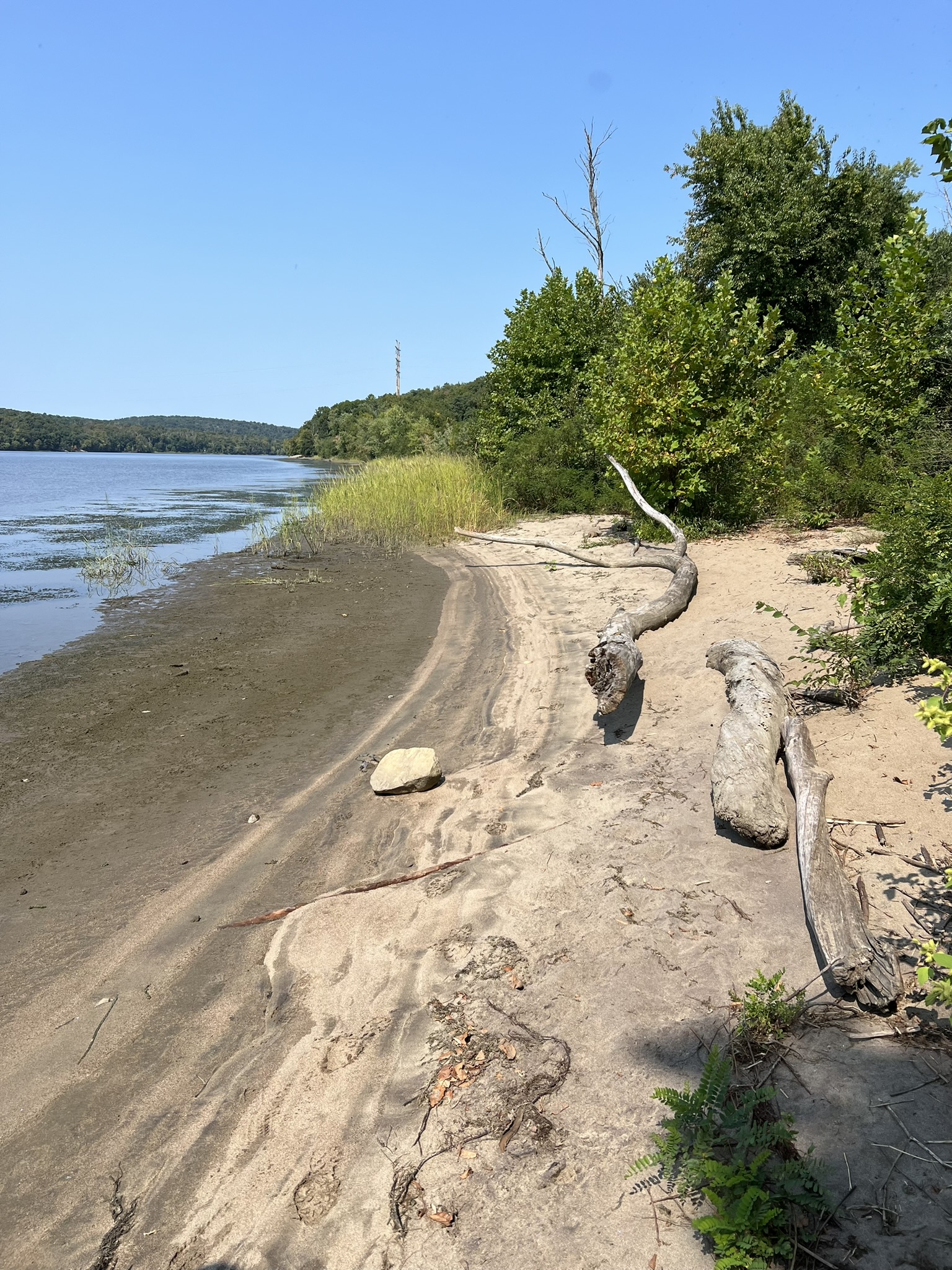
George Dudley Seymour (GDS) State Park in Haddam Neck is adjacent to Hurd State Park in East Hampton, which borders it to the north. I had long been interested in exploring there, but always parked at Hurd State Park, which has such a large network of trails that I never quite made it down as far as GDS State Park. I knew from the trail map that the park’s trails were all unblazed, so I was eager to explore them for this blog post. The 222 acres that make up GDS State Park were originally owned by three Clark brothers, successful businessmen in the 1800’s who built their family estate there. After the last brother’s death in 1914 the property changed hands several times, until the state finally acquired it in 1960 with the help of a $60,000 grant from the George Dudley Seymour Foundation. George Dudley Seymour (1859-1945) was a successful attorney, historian and philanthropist who was dedicated to conservation. I did some research after my visit, and found excellent information on ExploreCT – an informative website by a fellow named Matt. He gives a more complete history of the park, and includes some other useful tips which I will reference in my post. You can find the link to his blog post HERE. The trailhead is at the end of Clarkhurst Road in Haddam Neck. There is a wide parking pullout that accommodates 5 to 6 cars. There is no sign indicating that you are at a state park –just a ROAD CLOSED sign. Beyond the sign there is a metal bridge constructed over an older, wooden bridge that crosses an impressive gorge and the Axelson Brook below. It appears there may have been a dam here at one time. We visited on a blazing hot mid-September day after weeks of dry weather, so the brook was low. I imagine it is lovely when the water is flowing. The first half mile follows the old asphalt drive downhill. At about the half mile mark we started to see a series of impressive rock formations on our right. Luckily, I hadn’t paid attention to the “ruins” icon on the map, so didn’t spend time looking for the old estate foundation. I learned later from Matt’s post that the icon on the DEEP map indicating the ruins is in the wrong place. I encourage watching his video at the end of his post which will show you exactly where to look for the ruins. I plan to return after the leaves fall, as it sounds very overgrown. Continuing on, the path changes from gravel to dirt (and eventually to mowed field) and a marsh appears on the left side of the trail. Close to the one mile mark we reached a cross roads with mowed paths going to the left, right and straight.
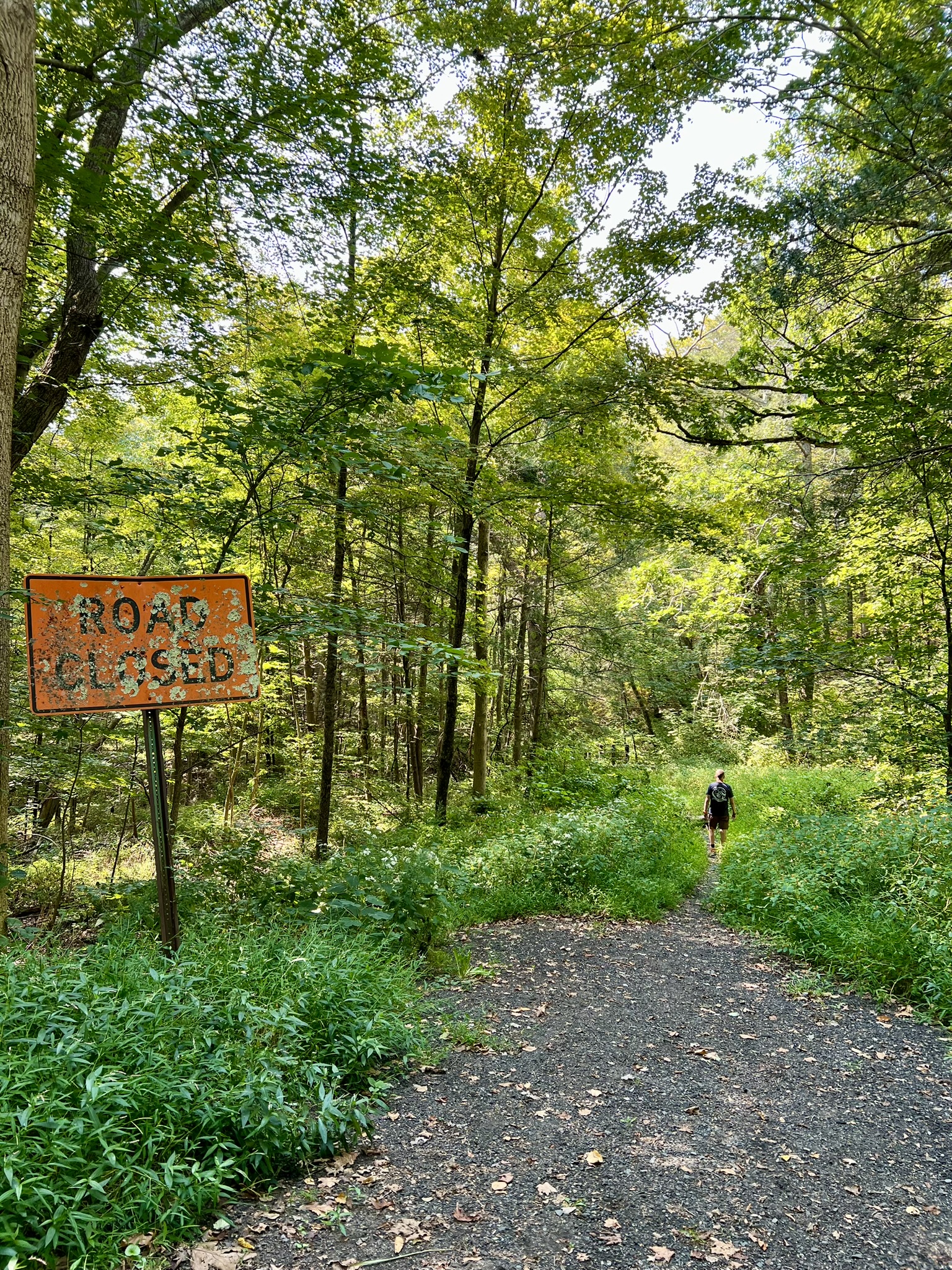
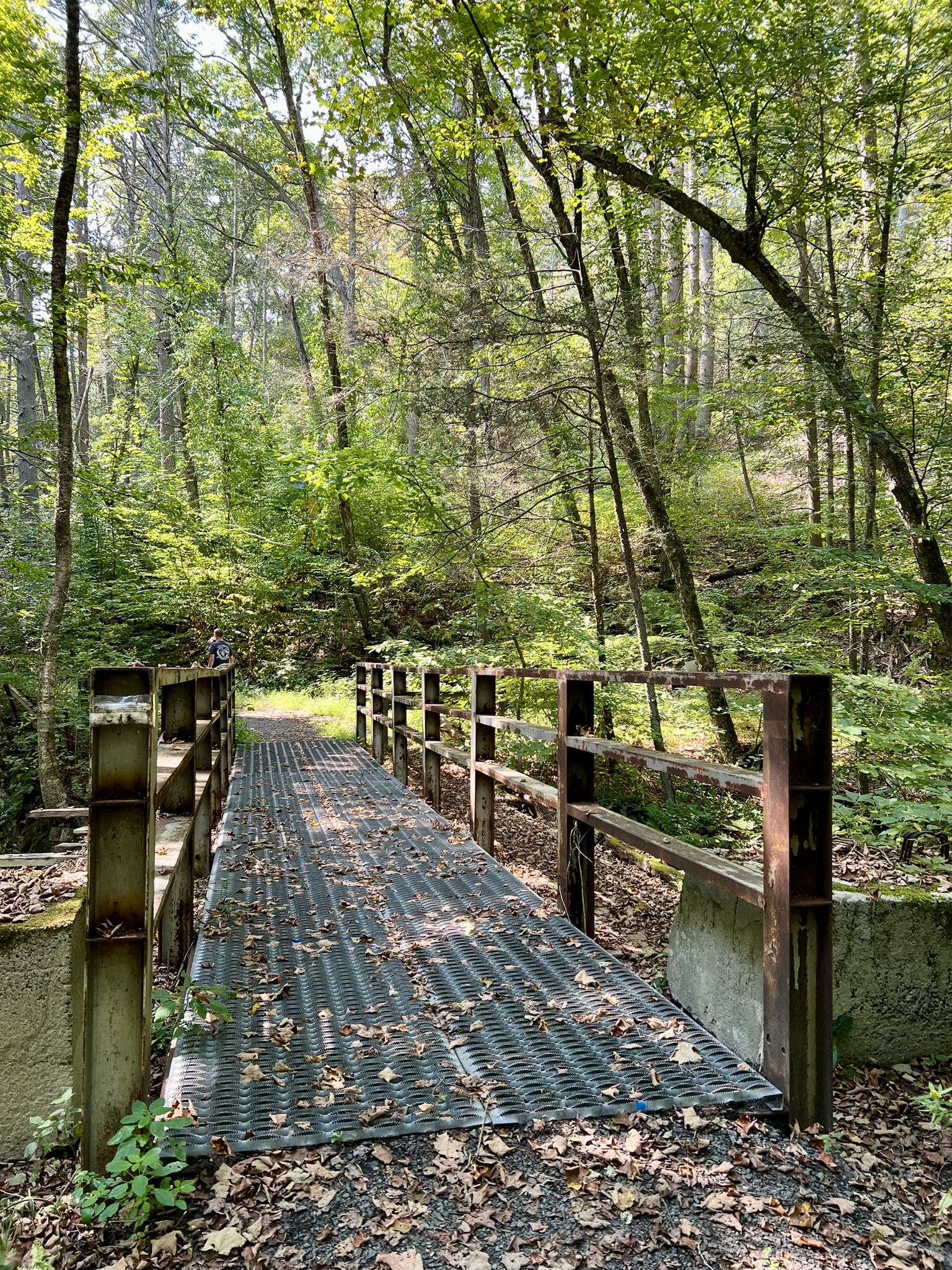

From left to right: The trailhead at the end of Clarkhurst Road; the bridge over Axelson Brook; a section of paved path: the crossroads in the field with the Connecticut River in the distance by the line of trees.
On the map, the path to the left goes south toward the Higganum Meadows Wildlife Management Area and an alleged viewing spot along the river. Because it was so hot we skipped that path. I came back on an overcast morning and discovered that the mowed section only goes about halfway to the supposed scenic spot, so I opted to turn around rather than bushwhack through the tall grass. The mowed path straight ahead goes to the Connecticut River. Matt does not recommend this, probably because it was not well mowed at the time of his visit. We followed the path just a short distance and came to a lovely section of beach. I checked it out again on my return visit and the tide was so low I could walk through to an adjacent beach and out onto a large sandbar. I highly recommend checking it out. Swan Hill Preserve and the entrance to Higganum Cove are directly across the river. As I was standing there two swans flew by low to the river heading downstream, honking at full volume. The path to the right heads north through the meadow into Hurd State Park. Just past the kiosk where the path turns to gravel, watch for a spur trail on the left that goes to a scenic boulder ledge along the river. Look for the Park USGS survey marker embedded in the rock.
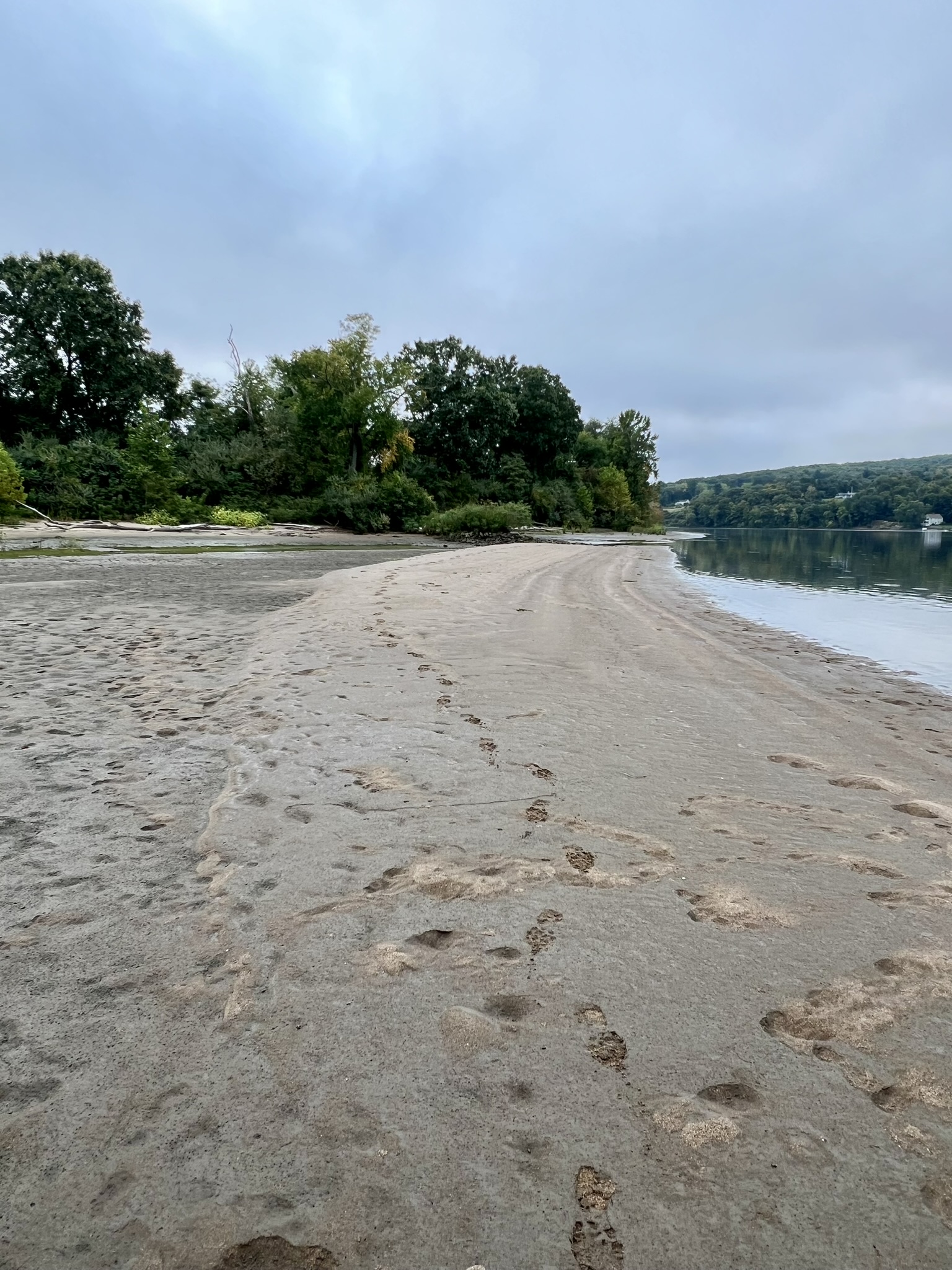
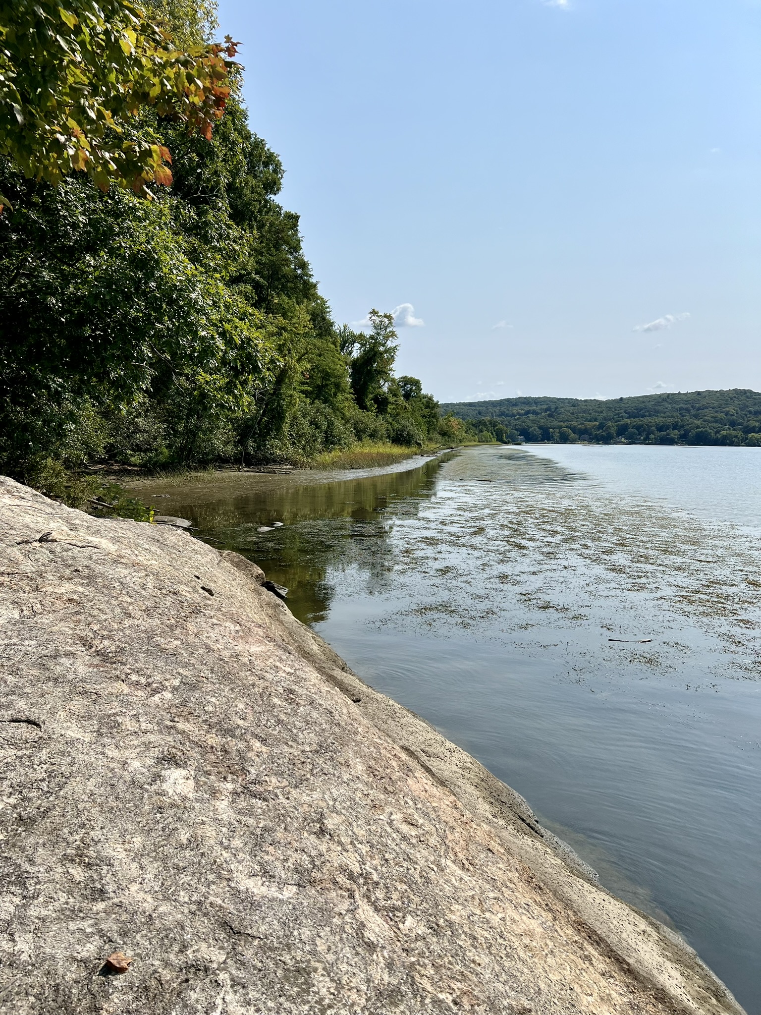
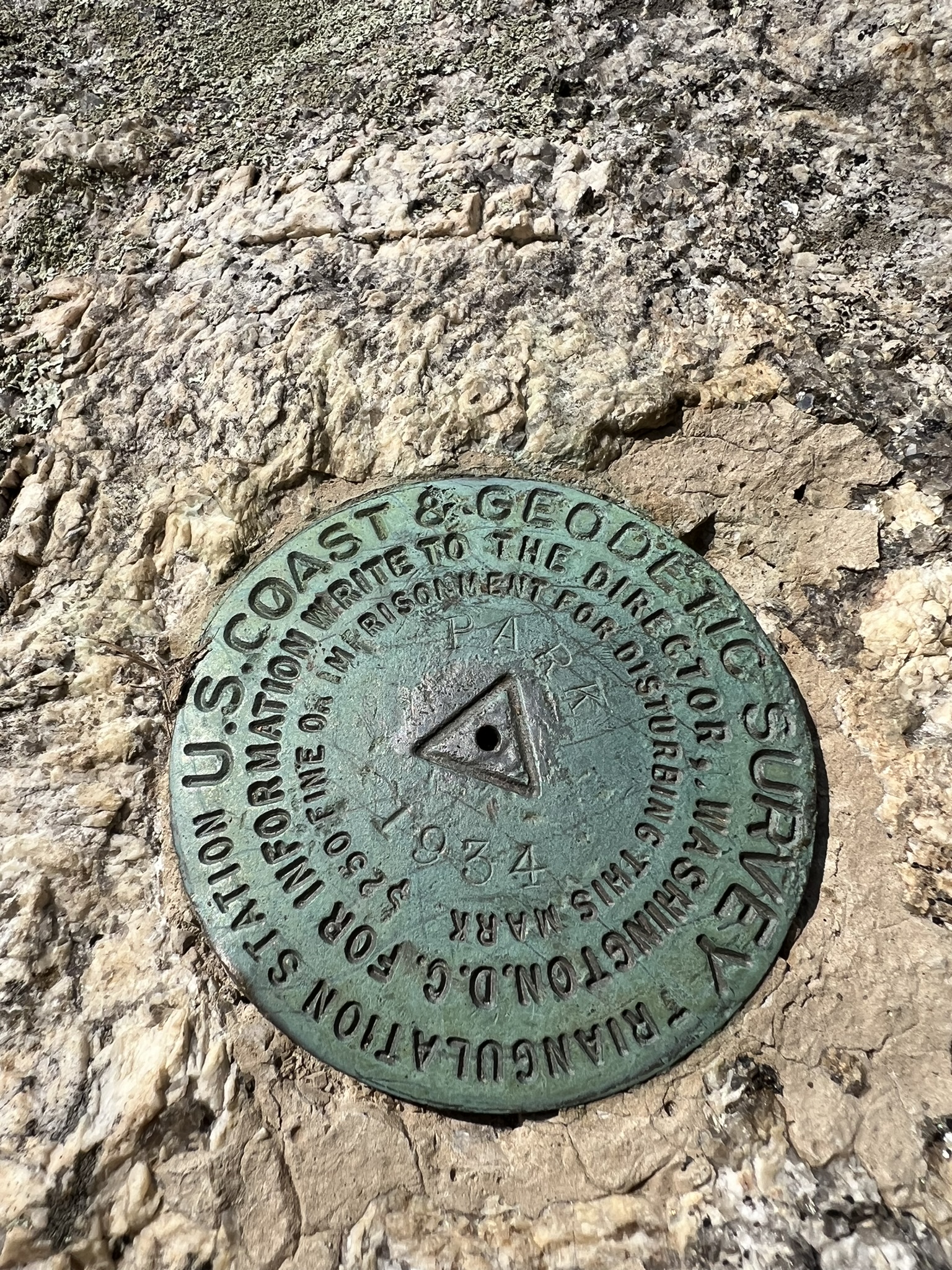
From left to right: the beach at low tide; a sandbar at an even lower tide (the day before the King Tide cycle); the granite outcropping along the river; the USGS marker
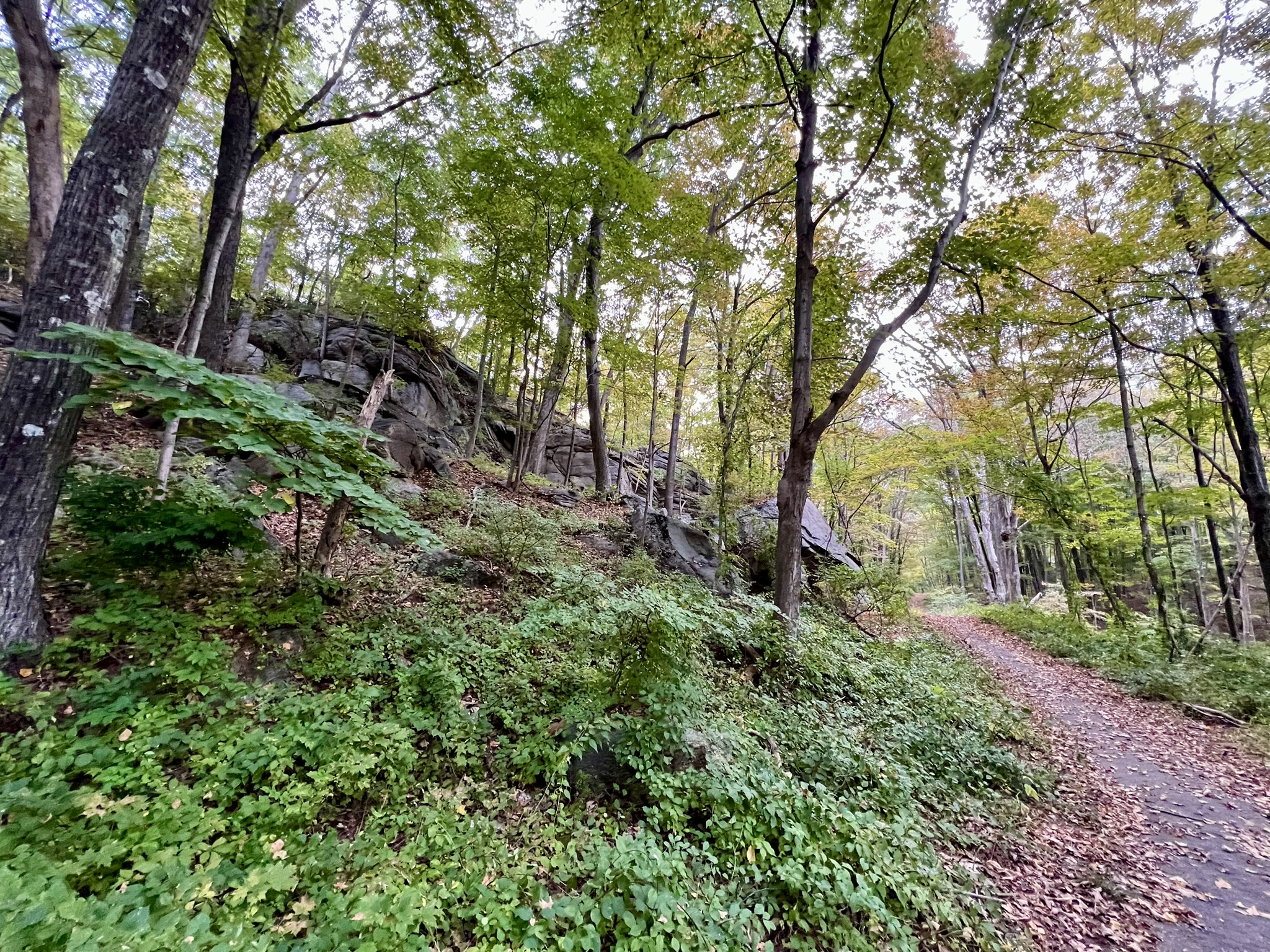
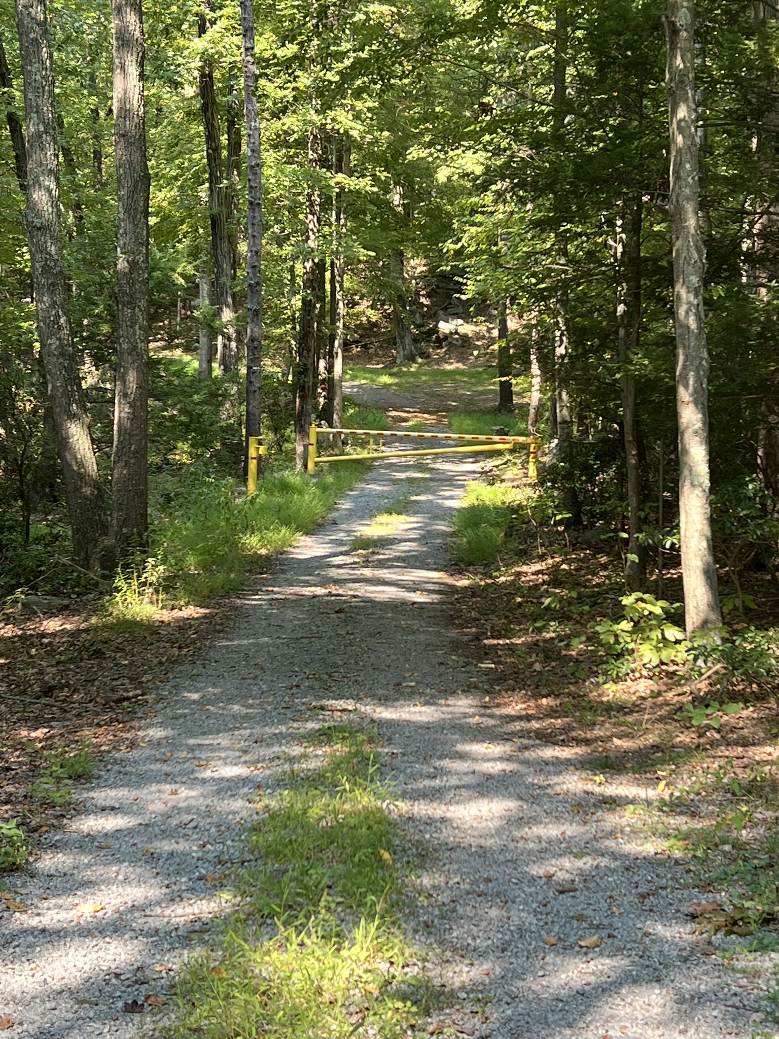
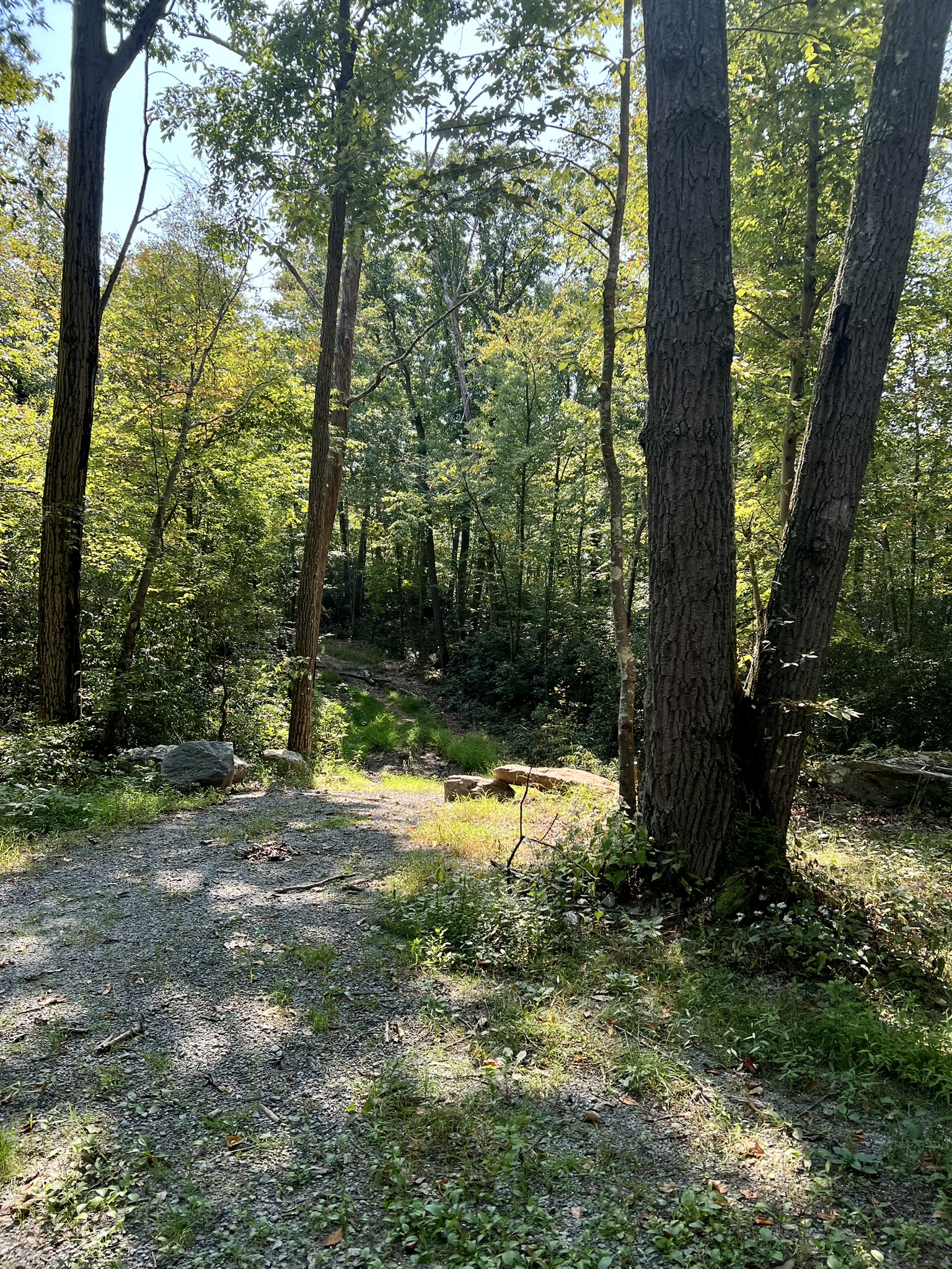
For an easier hike, make this your turnaround point and return the way you came. We continued to do a loop, which may be more enjoyable on a cooler day and after the vegetation has died back. Continuing north, the gravel road begins to parallel the power line corridor, heading steadily uphill in the open, which was unpleasant in the blazing heat. Climbing higher, the trail entered the woods on the left, where there is a yellow gate. We went past the gate and followed the road up and around a rocky outcrop. As the road levels out, we took an unblazed trail on the right. When we reached the power lines again, things got squirrely. This trail is not used much, so it is very faint and we picked our way down some steep, overgrown switchbacks. This is where AllTrails was very useful to ensure we were on the right path. Under the power lines, we noticed a faded pink ribbon that marked the way across. When we reentered the woods, the path became much more navigable, although there were several downed trees that we had to clamber over or around. The trail eventually came back out on the old asphalt drive, which we followed back to our car. Doing the hike as a loop is approximately 3.3 miles with 463’ of ascent. Doing as an out-and-back only as far as the rock by the river would be slightly less.

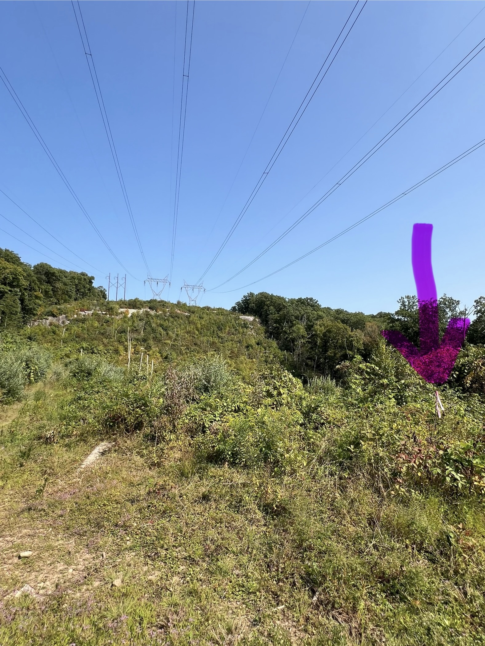
From left to right: the forest road gate after leaving the power line corridor; the trail to look for coming off the forest road; thick vegetation; the pink ribbon marking the way
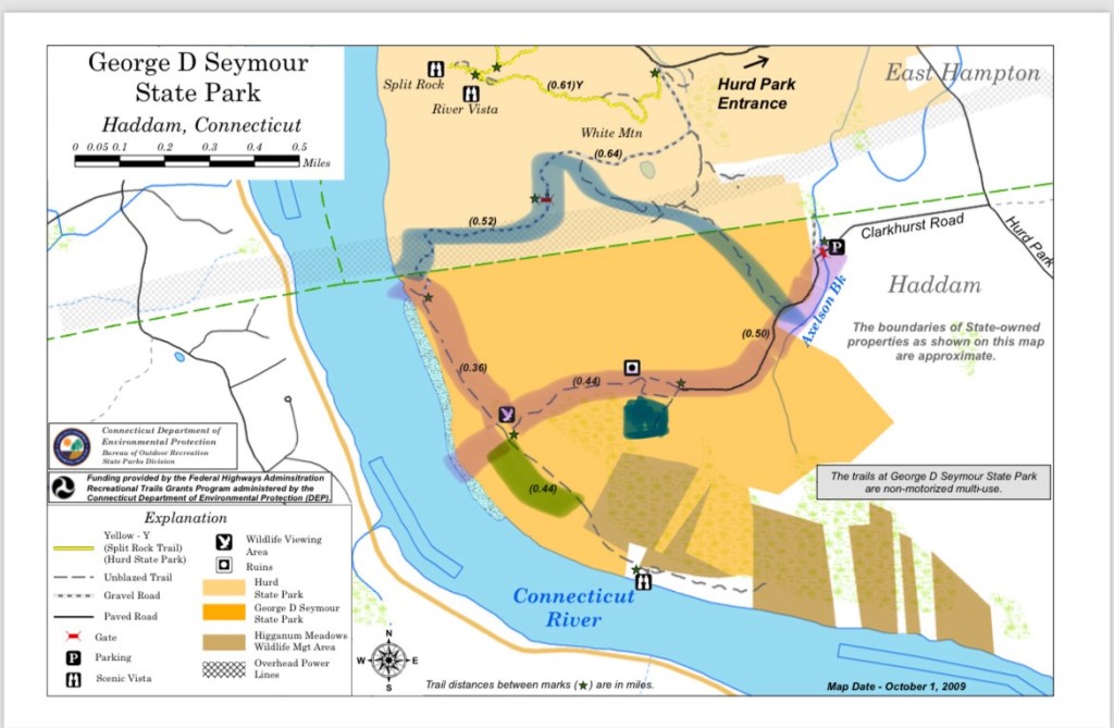
For the link to the DEEP map click HERE. For an article from the Connecticut Trail Finder website click HERE.
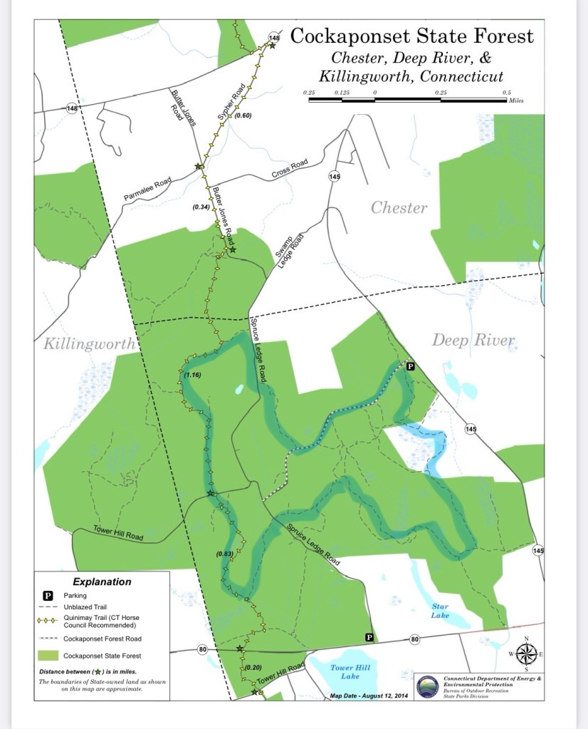
Cockaponset State Forest – Spruce Ledge Block, Deep River. 2.7 to 5.5 miles.
Two forest roads (Spruce Ledge Road and N. Tower Hill Road) cross through this parcel of Cockaponset, although both are blocked by gates and closed to vehicular traffic. The white-blazed Quinimay Trail runs north-south from Haddam to Westbrook. The DEEP website explains that this trail is “a non-motorized multi-use, equestrian friendly trail, which extends north to south through both towns, [and] is symbolized by yellow diamonds on all maps.” The rest of the trails shown on the map are all unblazed. The highlight of this parcel is a spectacular beaver pond. If you visit early or late in the day, you have a good chance of seeing the beavers in action. There are parking areas on Route 80 and Route 145. For the loop I describe I start at the Route 145 lot. This small lot has no signage, but THIS LINK to “N. Tower Hill Road” will take you to the right spot. From the lot, pass around the yellow gate and take the trail that appears very soon on your left. As the pond comes into view, the trail splits. At this junction go left to take a clockwise circuit of the pond. As the trail descends from a high point, stay to the right to avoid the muddier route. As you make your way along the southern border of the pond watch for beaver activity. One morning, I was lucky to catch the beavers unawares and I sat and watched while one worked hard at fortifying the lodge, occasionally stopping to snack. Once they were aware of my presence, they teamed up and tried to intimidate me by swimming up close and giving a few tail slaps. It was a thrill. Click HERE for a link to the video montage I posted to Instagram.
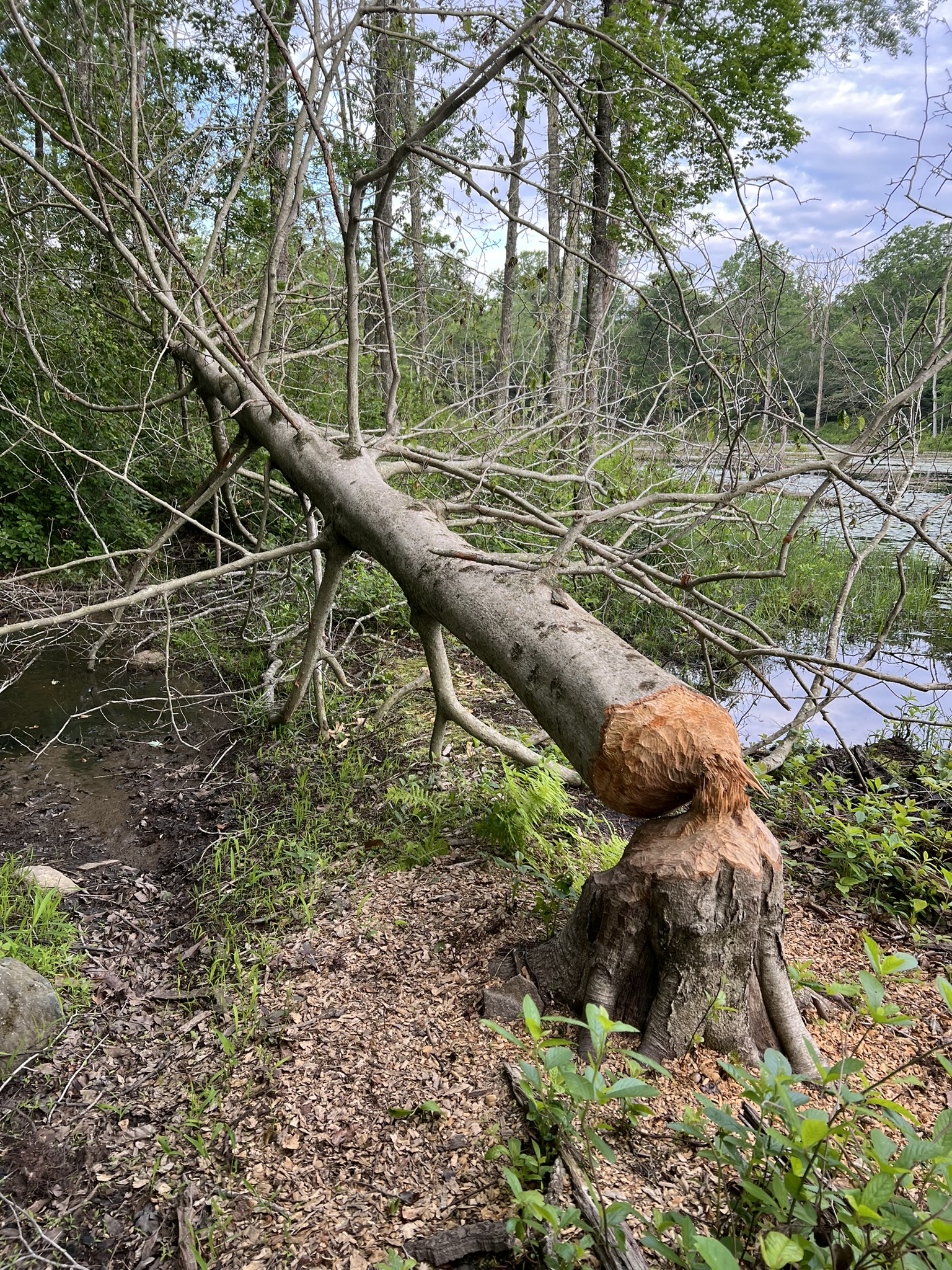

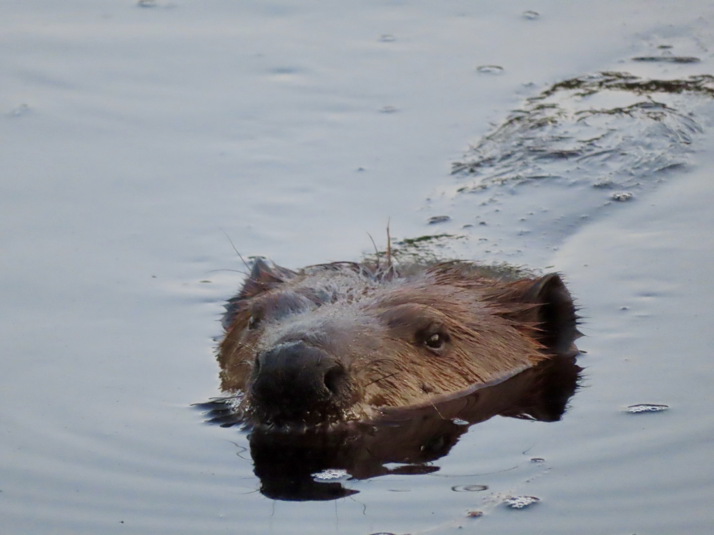
From left to right: signs of beaver activity; the beaver pond early in the morning; one of the beavers giving me a warning look.
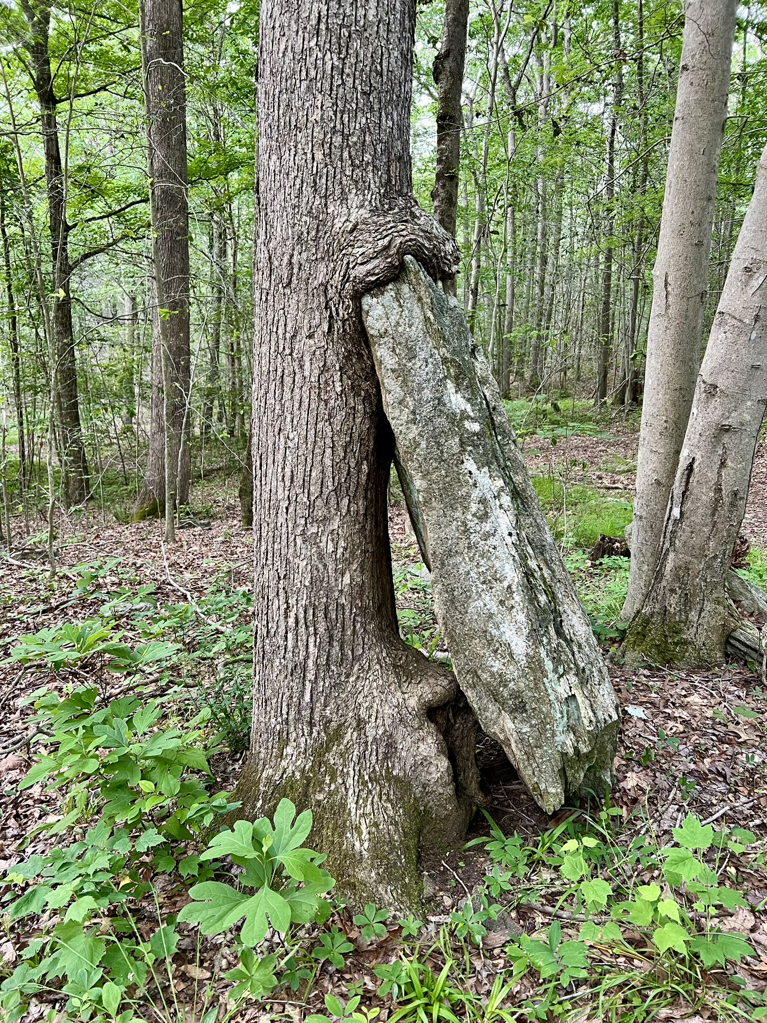
Shortly after passing the beaver lodge the trail leaves the pond and heads south. When you get to a T junction turn right and follow this woods road as it heads west and northwest around the farthest reaches of the marsh. There can be wet, muddy spots. In a few places there are secondary trails that avoid the worst of the mud. The section just before the old bridge is the wettest. The bridge is out so I channel my inner gymnast to cross it — although I’m not suggesting you should. The alternative is to pick your way across the stream. After the bridge the trail splits. I prefer to stay right, but the two paths meet again a short distance on, so either route works (the path to the left is a grassy road). At the next juncture, go left for the longer route – but take a moment to check out the very cool rock-eating tree near the junction. (For the shorter 2.7 mile option turn right here and follow the trail back. There are a few options, but all lead to N. Tower Hill Road). Following the trail to the left will take you to Spruce Ledge Road (there is one trail split on this section where I stayed to the right.) At the forest road, cross over and continue into the woods on another trail almost directly opposite. This next section of trail goes along some scenic ledges in a ravine with a babbling brook. At the brook, I encountered an injured fox on the opposite bank. It tried to scurry up the hill but was hampered by a leg injury. I tried calling the DEEP hotline for dead/injured animals but learned the office wouldn’t open for another 30 minutes so I kept going. When I called back later, I learned the following: there is no rehabilitation program for foxes as they do poorly in captivity, even for a short time. The two options were to let it be and hope it either recovered (foxes are very resilient), or to have DEEP “put it out of its misery” – a comforting euphemism for killing it. The latter they would only consider if I was still there and had “eyeballs” on it, as it would be too difficult to locate otherwise. So in the end, I am glad that I did not stay, as I prefer to imagine that it was able to recover on its own. At the next T junction by another marsh the trail meets the white blazed Quinimay trail. I turned right and followed this trail north, crossing North Tower Hill Road. The trail loops back east and comes out on Spruce Ledge Road. Follow Spruce Ledge Road south, watching for a crossover trail on the left which provides a woods trail shortcut to North Tower Hill Road. From there, turn left and follow the road back to the parking lot.


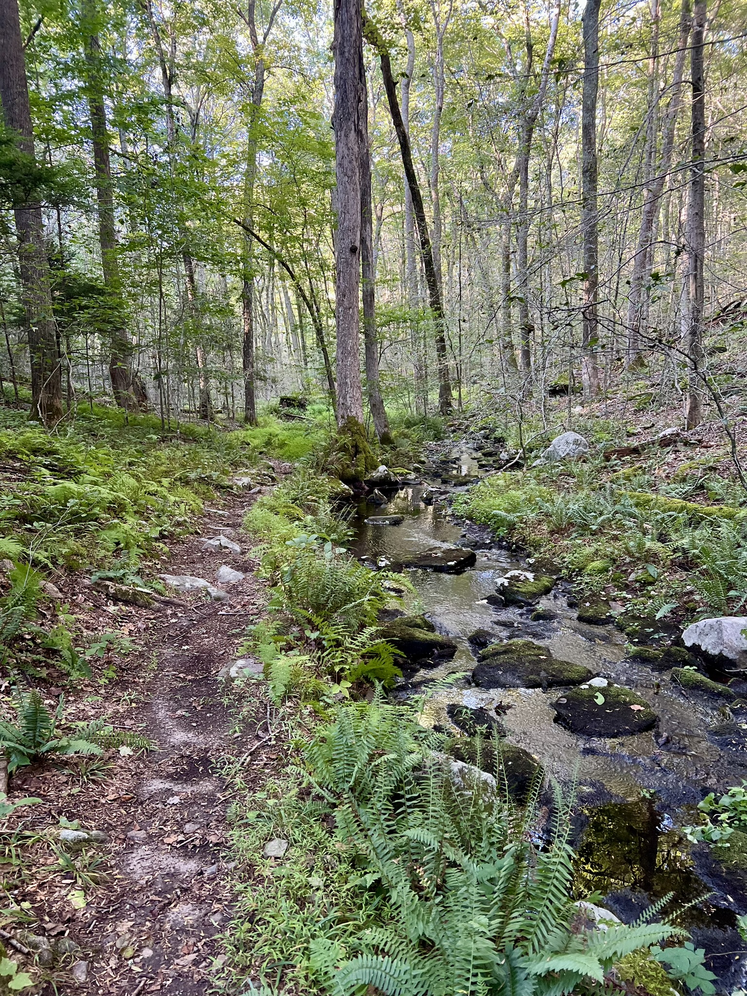
From left to right: in early June there was a bit more mud to navigate at the approach to the wrecked bridge; the bridge requires careful balance; the rock-eating tree; the path where I had my fox encounter
Cockaponset State Forest, Turkey Hill Reservoir Loop, Chester and Haddam. 3 miles.
The route for this loop is only partially represented on the DEEP maps, and is split between the Central and Southern map sections. There are many options for a starting point. My description starts at the Turkey Hill Marsh parking lot on Filley Road and goes in a counter-clockwise loop. Filley Road is a gravel forest road. While DEEP works hard to keep it passable, be aware that it can get badly eroded after a tough winter. Park at the Turkey Hill Marsh. The lot is harder to see in the summer when the leaves are out. Once you pull in, there is a sign that says “Turkey Hill Marsh”. From the lot, turn right (south) on Filley Road. At the bottom of the hill at the bridge you get beautiful views of the reservoir. From there the road rises steeply. Look for the red trail, which crosses Filley Road. Turn left on the red trail and follow it as it skirts the western side of the reservoir. The trail passes through a section of new growth that was logged several years ago. As you near the southern tip, watch for an unmarked trail on the left. (If you go too far you will emerge onto Cedar Lake Road). Take this unmarked trail, which pops out of the woods at the dam. The dam can be tricky to cross at high water levels, so plan accordingly. After crossing the dam, the trail enters a beautiful pine forest, then re-emerges and follows a high berm with the reservoir on your left. When you reenter the woods the trail becomes single track and can be quite rocky. At one place the trail splits. There used to be a fallen tree blocking the way on the steeper trail, which led to the creation of the other trail. They meet up again, so you can take either one. The trail ends at an old road.
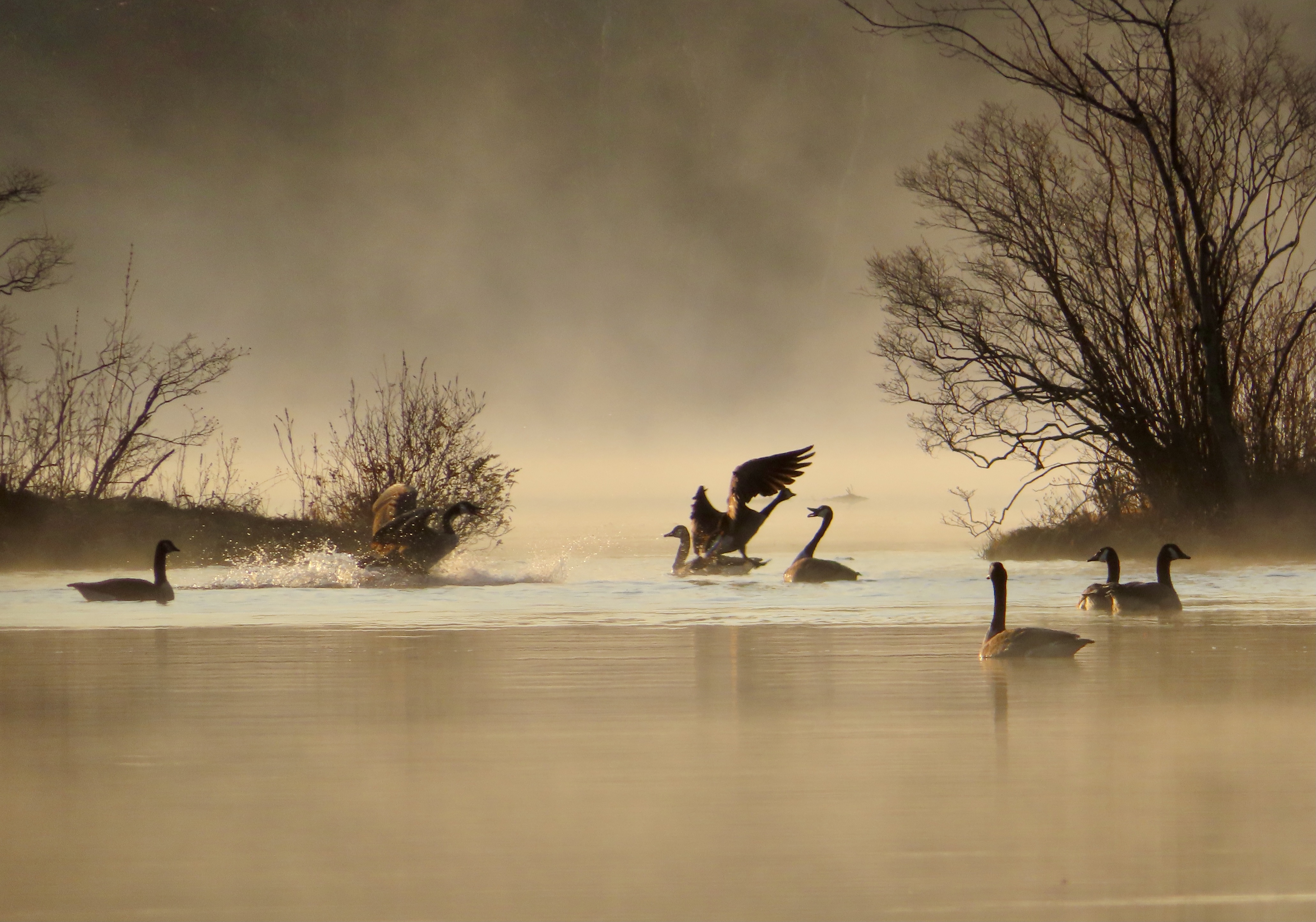


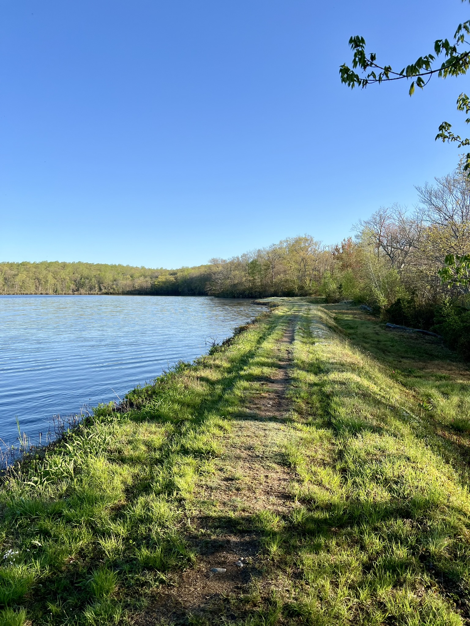
From left to right: one misty morning the geese were making a ruckus; the dam crossing can be tricky at high water; the pine forest; the berm along the eastern bank.
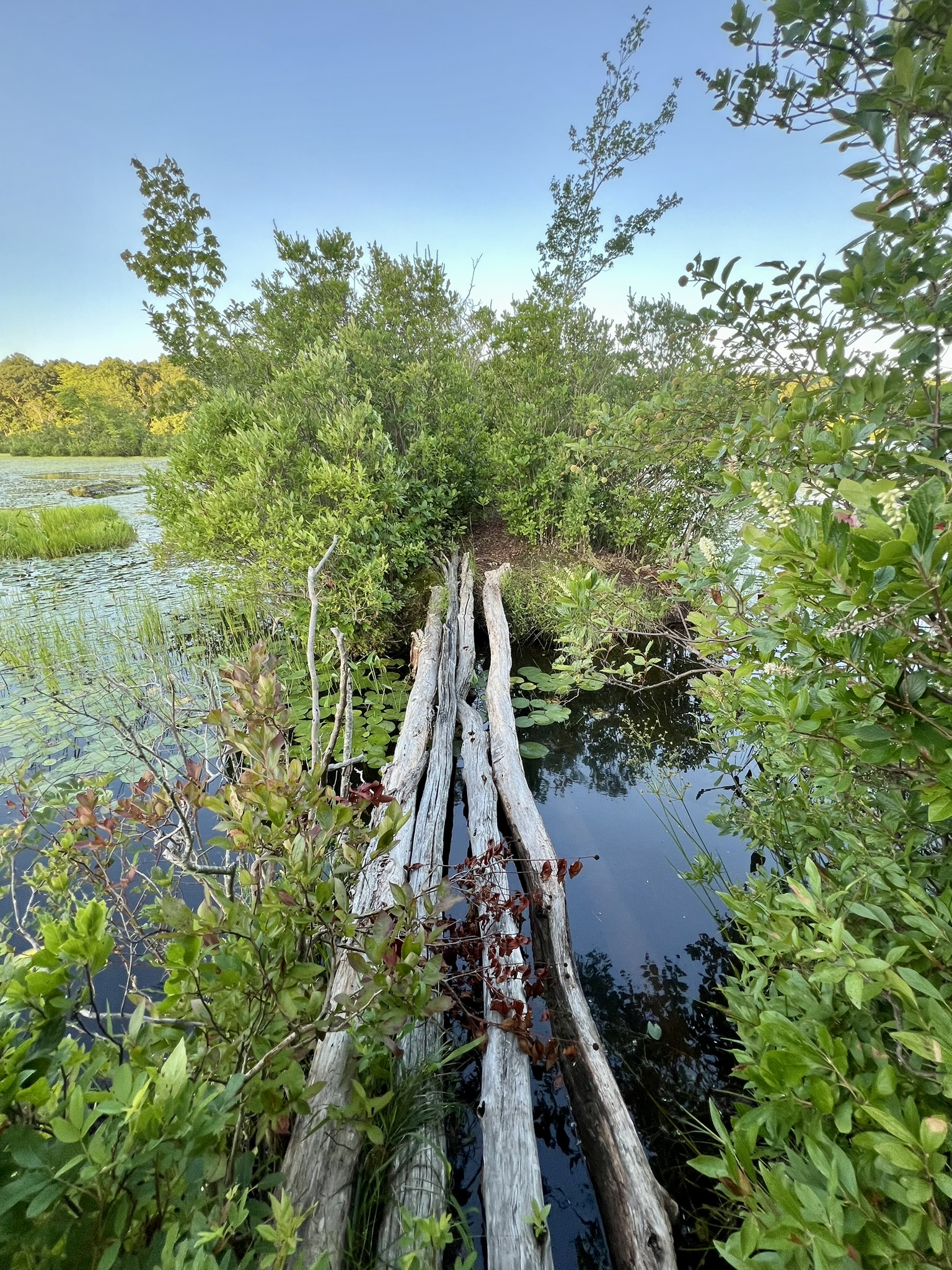
Turn left to walk out onto the peninsula, which is actually the old road bed. If you look at Google Maps the land mass appears to extend all the way across. I usually venture out only as far as the lone pine tree. At that point there are some intimidating logs to cross, and I do not recommend this. When I visited in May I was surprised and thrilled to encounter beavers here. On a recent visit, I did not follow my own advice and I crossed the logs. Continuing as far as I could, the trail gets very overgrown and crosses two large beaver-created piles of branches, one that looked recently attended to with wet mud and leafy twigs. Retrace your steps and continue along the woods road. At this point there are two options. Traditionally, as the road inclines and starts to curve right, I take a rocky trail that veers off to the left. This trail leads back to Filley Road. While the rocky terrain is a nuisance, it is one of my favorite trails for blooming mountain laurel in June, as the trees form a true arbor over the trail. Once at Filley Road, turn left to get back to the parking area. Recently I noticed a new option which appears on both AllTrails and Gaia but not on the DEEP map. After retracing your steps, continue past the intersection with the trail you came on. Watch for a trail almost immediately on your left. This well-trod trail goes along the northern edge of the reservoir and pops out on Filley Road below the parking area. Please note that the land around the reservoir is Water Company property. Obey all signs and do not go in the water. If you have the time, I recommend following the woods road from the parking lot to the Turkey Hill Marsh. It’s a great place to look for all kinds of wildlife, frogs, birds etc. There is an old beaver lodge although I have not seen any recent activity.
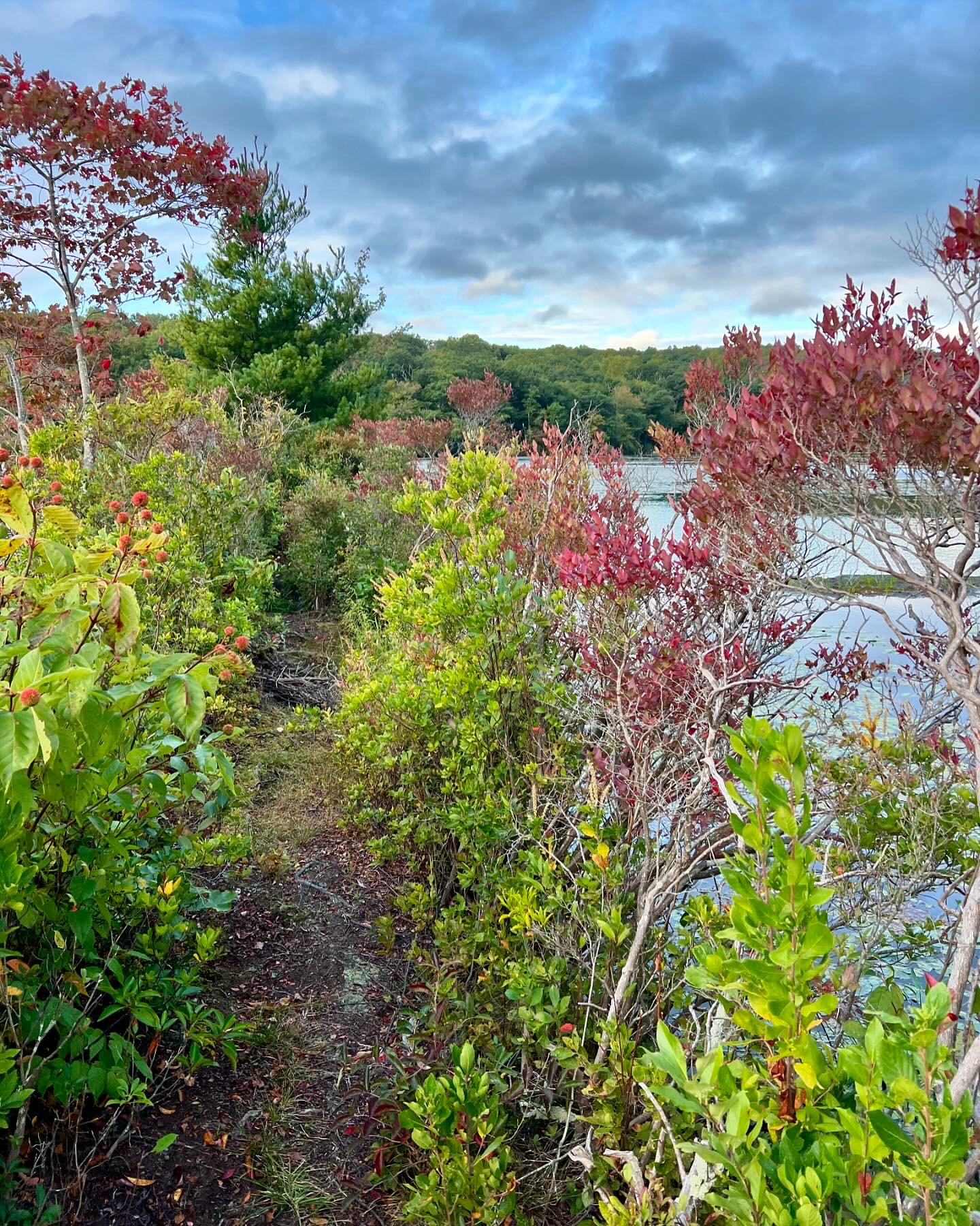

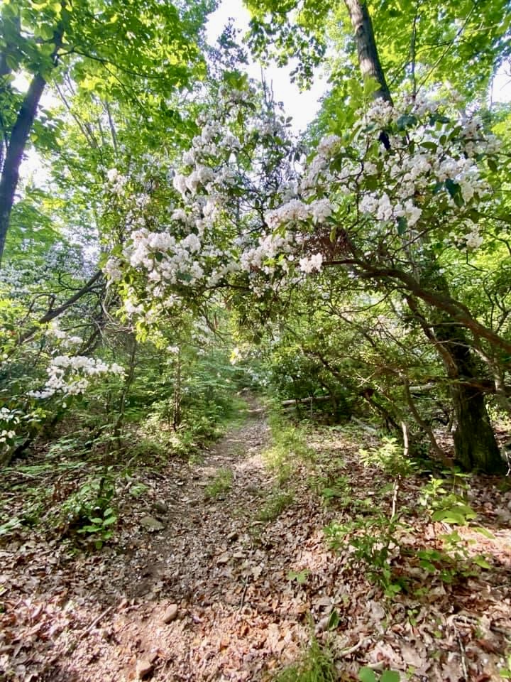
From left to right: fall colors emerging on the peninsula; the log “bridge” presents a challenge; the very end of the road; the laurel blooming in June.

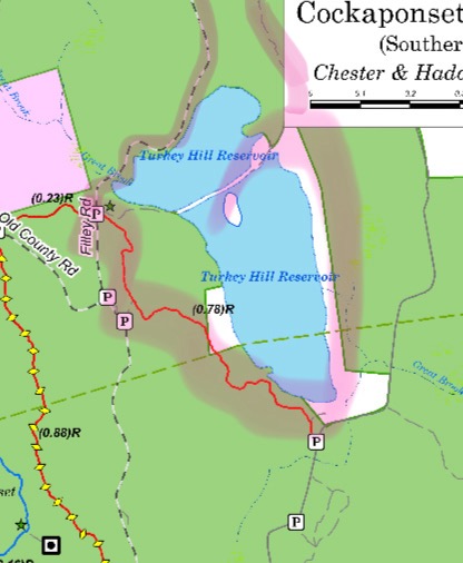
Click for links to the Central Cockaponset Map and the Southern Cockaponset Map
Subscribe to Trail Talk
your next adventure awaits
Questions? Email me at naturenerdsramble@gmail.com or find me on Instagram @the_real_nature_renee.