“To listen to trees, nature’s great connectors, is therefore to learn how to inhabit the relationships that give life its source, substance, and beauty.”
David George Haskell, from his book, The Songs of Trees: Stories from Nature’s Great Connectors.
As a nature enthusiast, it should come as no surprise that I have an affinity for trees. I have my favorite trees that I like to visit periodically. I even have pet names for some of them, like Big Bertha, Picasso and Hardy. Therefore, I am embarrassed to admit that I still feel like a novice when it comes to identifying tree species with confidence, despite the number of introductory Tree ID Walks I have attended. September’s Trail Talk is dedicated to those of you who also feel like you could use a guide for learning your trees. We are lucky to live in a state that cares very much about its trees. According to this USDA document, as of 2020, 55% of Connecticut, totaling 1,753,085 acres, was forested (exact figures differ slightly depending on source and year). That is over a 100% improvement from 200 years ago, when it is estimated that our forests had been reduced to 25% coverage. In fact, Connecticut is one of the nation’s most heavily forested states. You can read about the history of Connecticut’s Forestlands HERE. Over the years, forest management has evolved to consider trees as part of a larger ecosystem. Forests on state land are managed through the Department of Energy and Environmental Protection (DEEP). On its website you can access the latest forest management plans for the 33 State Forests DEEP administers.
There are many other entities in Connecticut dedicated to the advancement of trees. One I stumbled upon in my searches is the Connecticut Tree Protective Association. According to their website, CTPA is an educational association dedicated to advancing the care of Connecticut’s trees. They claim 780 members, including two thirds of the state’s licensed arborists. And of course there is the Connecticut Forest & Park Association (CFPA) for whom I volunteer as a Trail Manager and a Nature Nerds Hiking Guide. The top two directives in their 6-point 1896 mission statement (appropriately adopted on Arbor Day) are 1) To develop public appreciation of the value of forests, and of the urgent need for preserving and using them rightly; and 2) To disseminate information relating to the science of forestry, the proper use of forests and the care of trees.
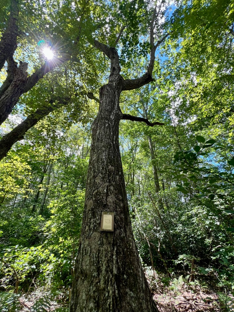
(Photo to right: Northern Red oak at Pond Meadow Preserve in Essex)
As I wander the woods I have become increasingly alarmed by the state of our American Beech trees, which cover large areas of the forest near me in south central Connecticut. Our beech trees have been affected with a blight called Beech Leaf Disease (BLD). This disease was first noticed in Connecticut in 2012, making its way here from Ohio. The culprit is a nematode, a tiny worm that burrows into the tree’s buds, causing the leaves to shrivel shortly after budding out. While there has been some experimentation with solutions that may help isolated trees (click HERE for more detail) , there is currently no way to protect the forest beeches from a widespread die-off. Part of me is devastated by this. The other part of me is curious as to what will fill the void. I hear Peter Wohlleben’s voice in my head, where in his book, The Hidden Life of Trees, he refers to beeches as the forest bullies, growing tall and fast and crowding out other species. Authors like Fred Pearce in his book, A Trillion Trees: Restoring Our Forests By Trusting in Nature, make me wonder how the forests will redefine themselves to fill the vacuum left by a beech die-off. Will Beeches’ loss be Oaks’ gain? Already I am noticing new patches of ferns on the forest floor.
Following are four Tree ID Trails I explored recently. They were a fun way to both brush-up on my tree knowledge and visit new trails.
Holcomb Farm Tree Trail, West Granby. 2 miles with approximately 273’ of ascent.
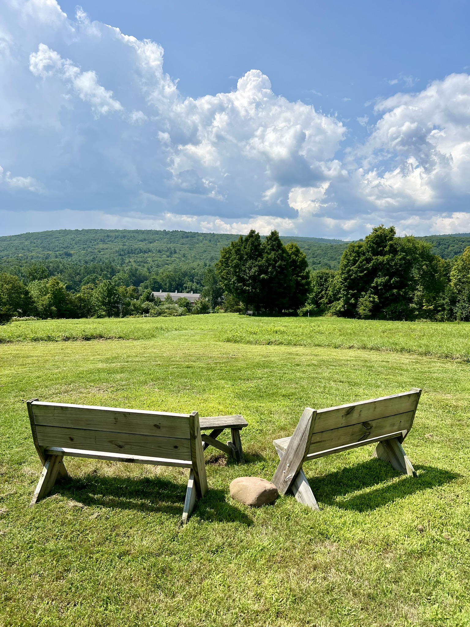
According to the website, the Holcomb Family farmed here for more than 200 years, from the mid-1700s until 1990. In 1976, siblings Tudor and Laura gifted the farm to the University of Connecticut. In 1990 the farm was passed from UCONN to the Town of Granby and it is owned by the Town today. All of the trails and programs are maintained and run by volunteers through the nonprofit Friends of Holcomb Farm, including a Farm Store. This easy trail, with some gentle hills and a mix of field and woods, is highlighted in a recent Connecticut Woodlands Magazine article by Eric Lukingbeal entitled “A New Arboretum Takes Root” (link HERE). The article describes a joint effort by two retirees (Eric Lukingbeal and Barry Avery) to convince the Town of Granby to allow them to plant trees and establish a new arboretum on the Holcomb Farm lands. The first trees were planted in 2018, and now comprise more than three dozen young trees.
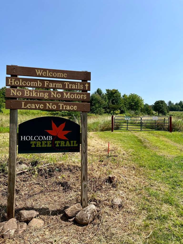
We visited the Tree Trail on a hot August day, parking at the main farm building at the junction of Day Street and Simsbury Road. There are 10 miles of trails on the Holcomb Farm property. For a PDF of all the trails click HERE. For a trail map and written descriptions to do your own self-guided tree trail hike click HERE. We mostly followed the written guide. For a longer hike, you can follow the Vernal Pool and Pine Grove Loop Trails, all part of the eastern trail network. There is another network of trails on the western side of the property that I hope to explore another day. The hike starts across the road from the farm, the entrance well-marked with a large sign (see photo to left). The trail goes gently uphill, following mowed paths. As you skirt the potato field, I highly recommend a short detour to the left where there are benches with a view back to the farm and the hills beyond. This is where the Friends of Holcomb Farm have planted a number of American Elm trees. Not too long ago, the American Elm was a prized tree and planted extensively in urban settings. Elm trees had many positive qualities, including the ability to tolerate pollution. According to Eric Rutkow, in his book American Canopy: Trees, Forests, and the Making of a Nation, the “leaf-browning and bark die-back” that signaled a disease began to appear near the end of World War I in Holland. Scientists determined that the cause was a fungus that was spread by a boring beetle (named the elm bark beetle) and it became known as Dutch Elm Disease (DED). Despite widespread efforts to stop the spread, “by the 1980’s, DED had claimed the lives of more than 77 million trees.” I was thrilled, then, to see several American Elm saplings planted in the new Holcomb Farm Arboretum which are supposedly from a cultivar (cultivated variety) that is resistant to DED.
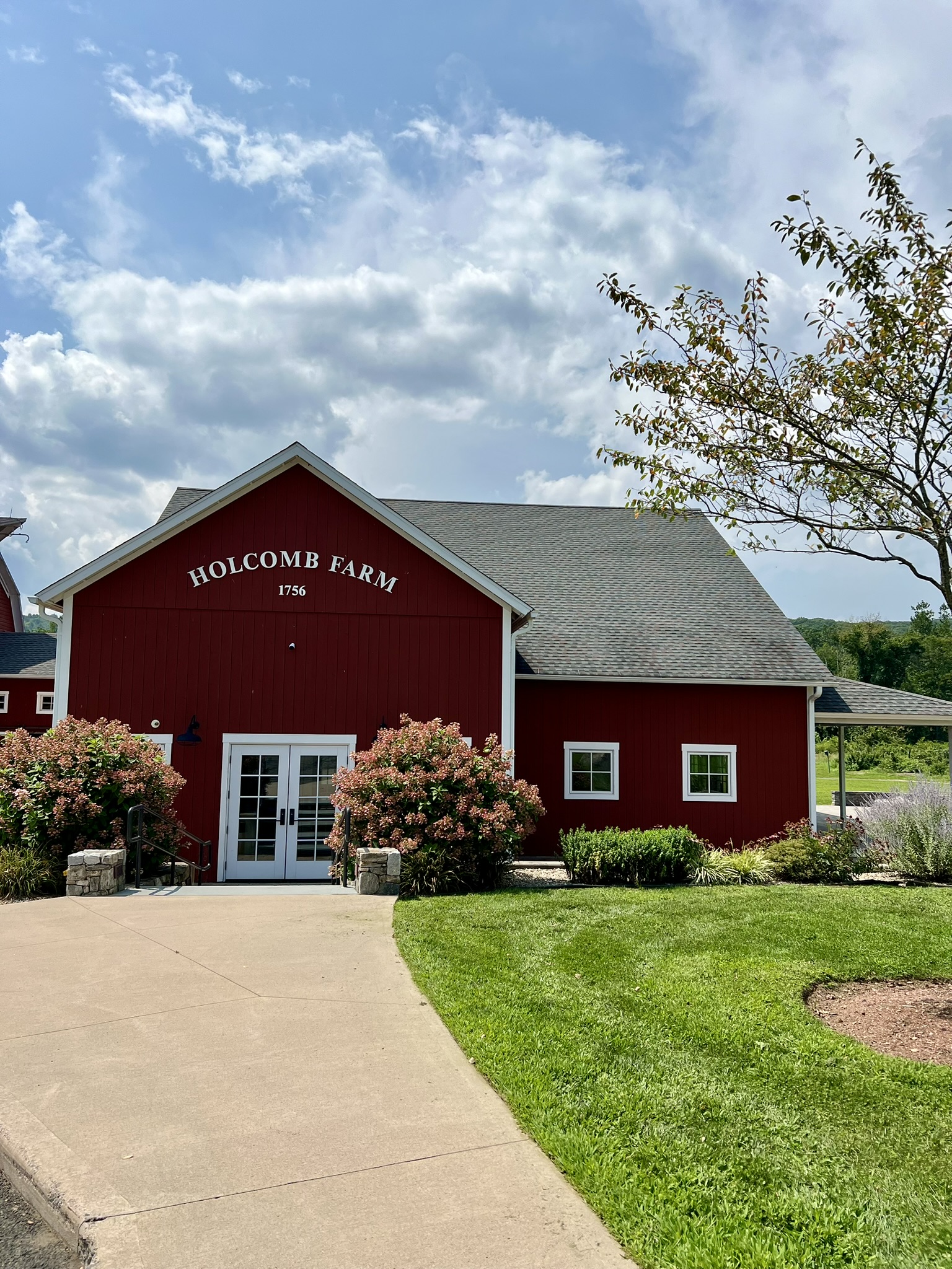
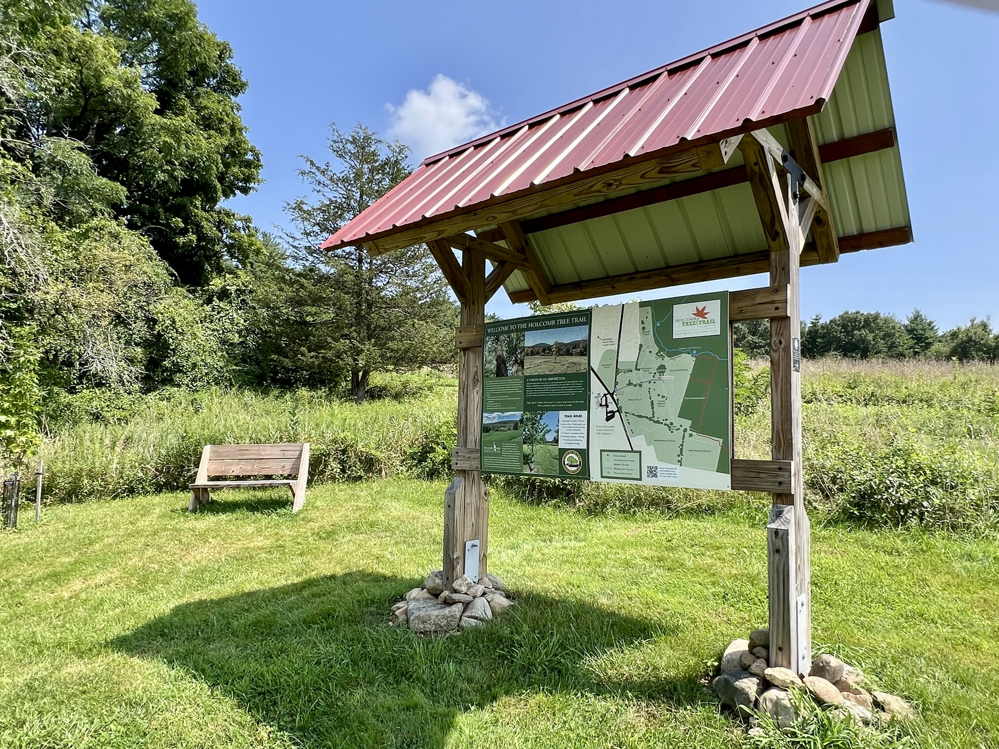
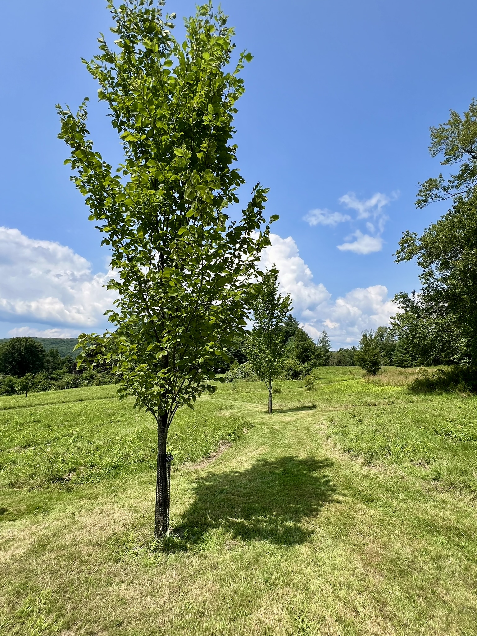
From left to right: the main farm building; the kiosk at the top of the first hill; the views back toward the farm buildings; young American Elm trees
Continuing along the edge of the field we passed several young trees – Kentucky Coffee, Shingle Oak and American Linden or Basswood to name a few. The field portion of the walk is delightful in late summer, with an abundance of wildflowers (goldenrod, Queen Anne’s lace, ironweed, echinacea), bees and butterflies. With the heat, however, we were glad to reach to woodlands portion of the walk. There are over 40 mature trees on the forest trails with identification tags. The woods trails have nice variety with pine groves and a few wetlands sections. One tree highlight is the white birch with visible bear claw marks. I also recommend taking the orange Refuge Trail option which passes by several mature pitch pines. Pitch pines have struggled in Connecticut with our fire suppression policies, as they are one of the pine species (like Lodgepole and Ponderosa out west) that require fire to release seeds from the pine cones. Before or after your hike take time to read the signboards in the front yard of the farm describing the history of West Granby and the farm through five generations. Once back in your car, you can go .1 mile north to stop at the CSA Farm Store for produce and/or a snack and cold drink. I also recommend a detour to see the Dewey-Granby Oak Tree. This spectacular tree is located about 1.5 north on Day Street on the right hand side. We were concerned about recognizing it. That concern melted away because you can’t miss it. Many people believe this tree was already growing at the time Columbus traveled to these shores. For a series of articles about the Granby Oak, click HERE. For more information about the Granby Land Trust click HERE.


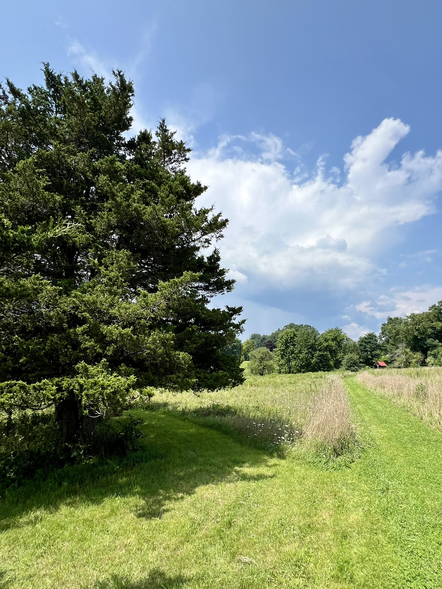

From left to right: the trail enters the woods; a White (Paper) Birch with bear claw marks; mowed paths pass a Red Cedar grove; the Dewey-Granby Oak
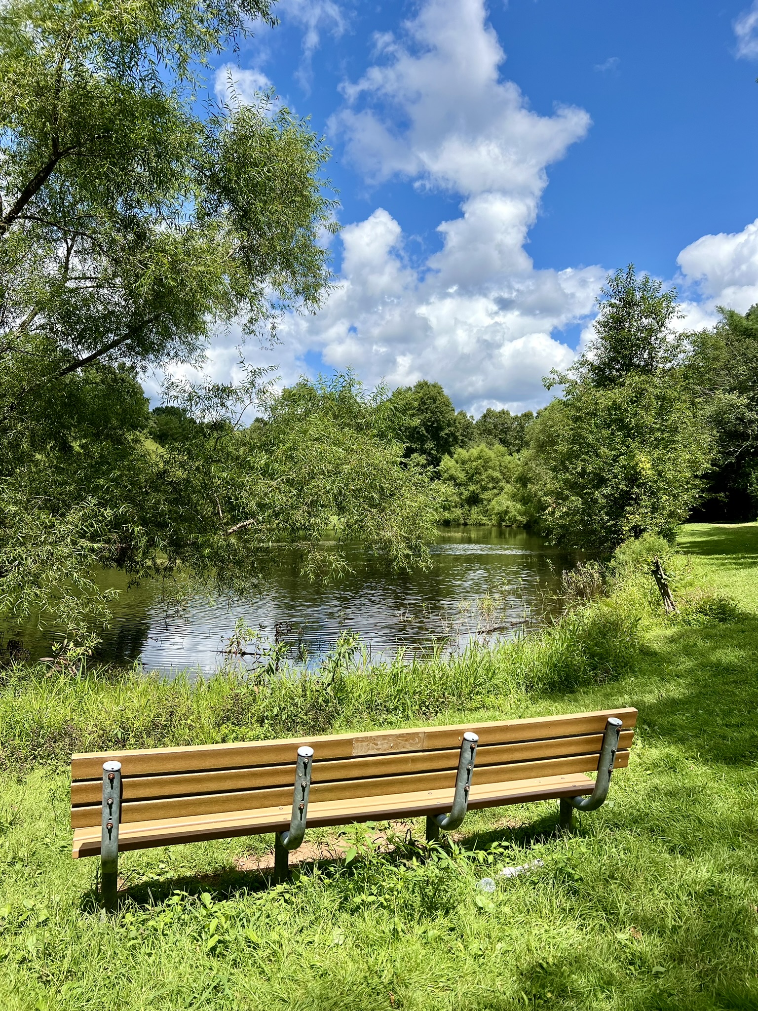
Pond Meadow Preserve, Essex. Approximately .75 miles. Mostly flat and easy.
I first discovered Pond Meadow Preserve in early spring. It is adjacent to the Comstock Park ballfield, which is itself tucked away in a residential pocket of Ivoryton. The trail includes a long section of boardwalk through the marsh, which in early spring was abloom with marsh marigolds and other early wildflowers. An occasional frog leapt for the safety of the water as I passed along. At the time, I noticed that many trees had identification labels on them. I returned in August to pay closer attention to the trees. According to the Essex Land Trust Trail Map and Guide there are 33 different types of trees, many with identification labels. I thoroughly enjoyed my late summer visit. The trailhead starts just past the gazebo at a bridge built by a Boy Scout Troop in 2015 as part of an Eagle Scout project. The wildflowers were abundant, including red cardinal flowers.
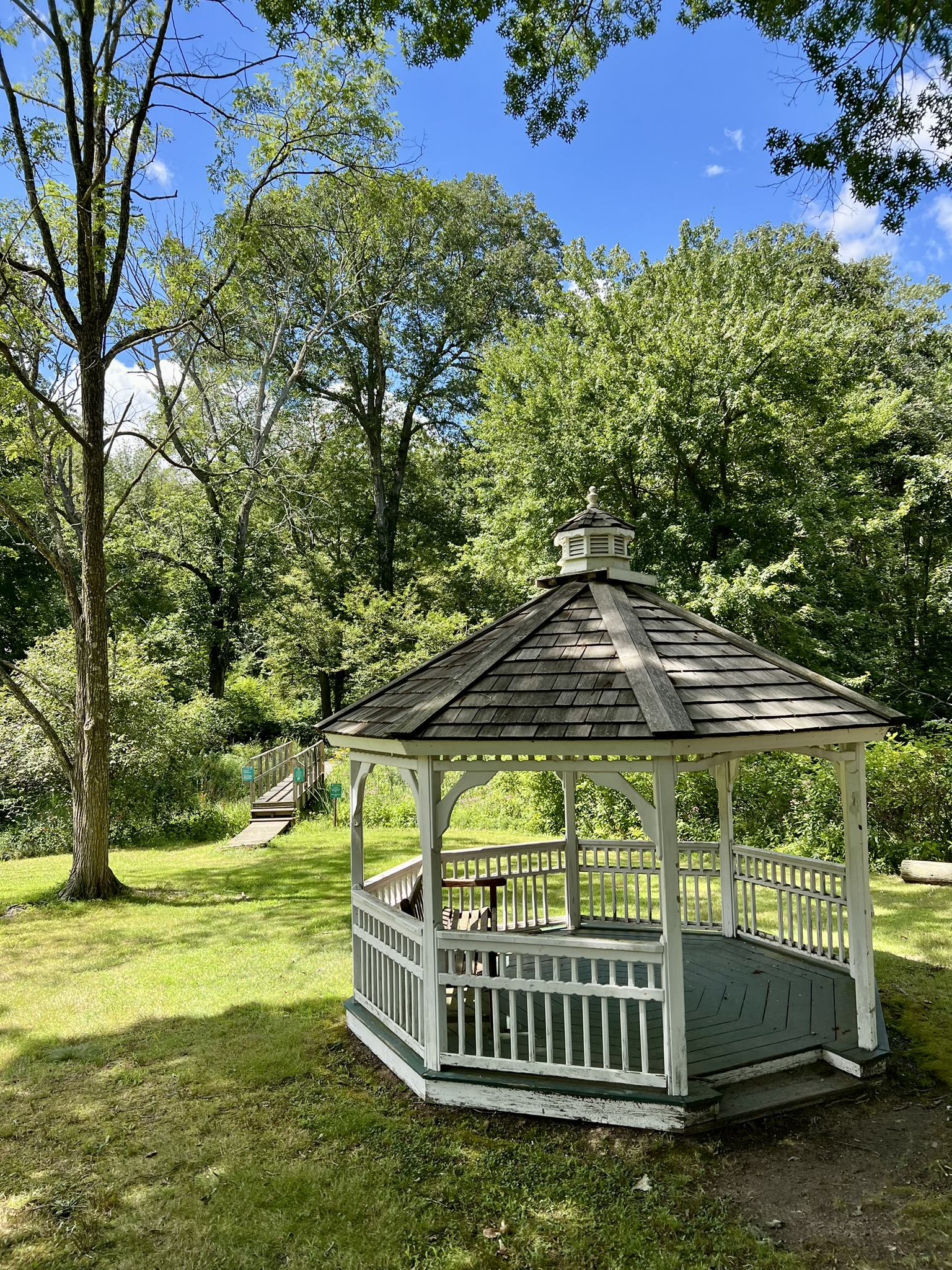

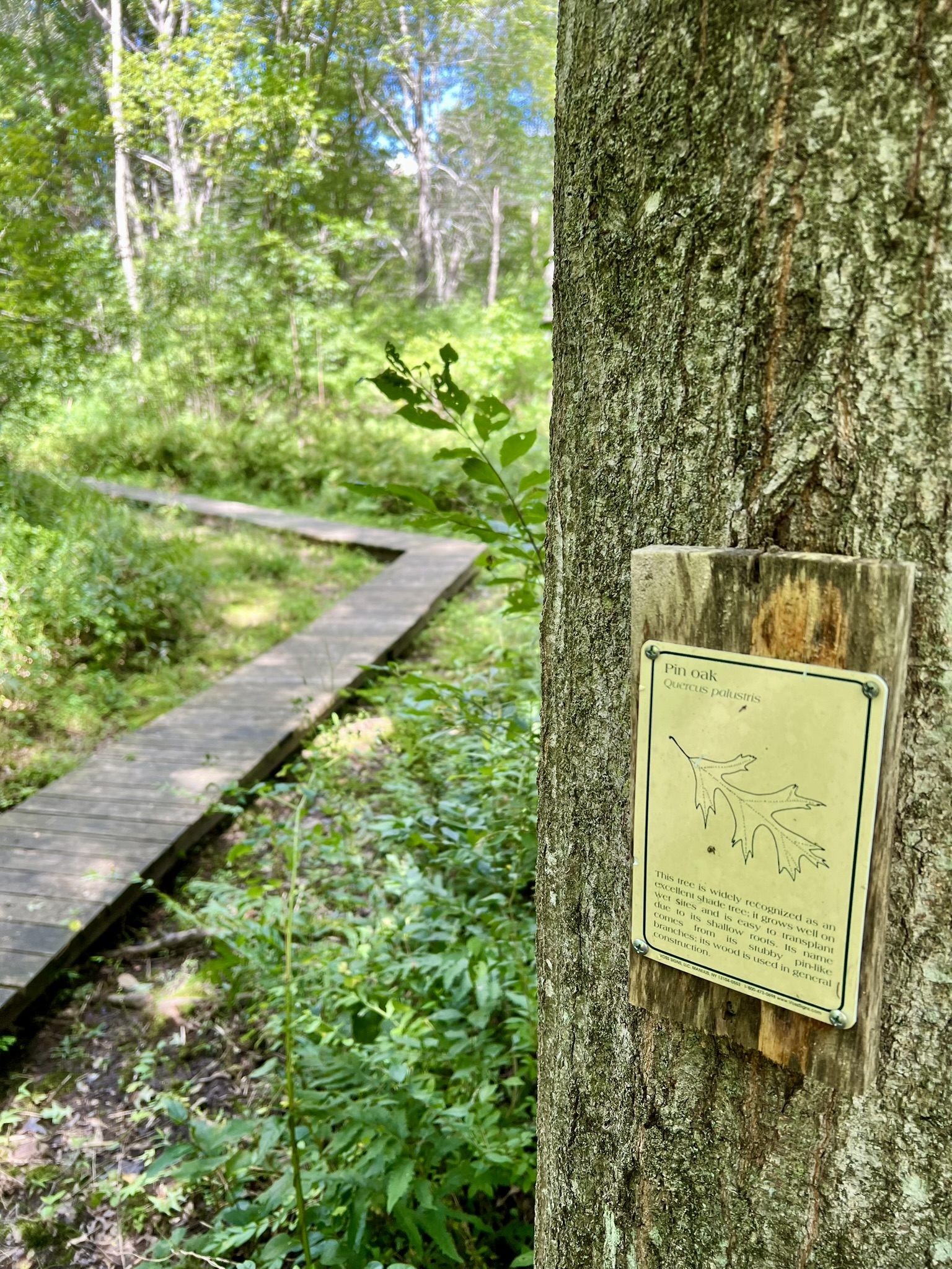

From left to right: The trailhead is behind the gazebo; the boardwalk in April; a Pin Oak along the boardwalk in August; a large Scarlet Oak
There were also many interesting mushrooms along the trail, including one of my favorite weird species – Calostoma cinnabarinum (Stalked Puffball in Aspic). Many of the labeled trees are impressive mature specimens, and I enjoyed reading all the descriptions and taking time to notice the bark and the leaves. After the boardwalk section there is a short spur trail on the left with a sign that reads “scenic overlook”. This leads to a bench – but there is neither an overlook nor anything scenic to see, whether you visit in winter or summer. Perhaps the brush has filled in whatever view existed previously. Continuing the loop, I followed the orange trail to the right, which adds some mileage. After it merges back with the yellow trail, I highly recommend taking the “Trail to No Where” boardwalk. This leads to a contemplation bench deep in the bog where there is a wooden bear carving and a plastic box containing a journal and pen so that you can sign in and make comments.
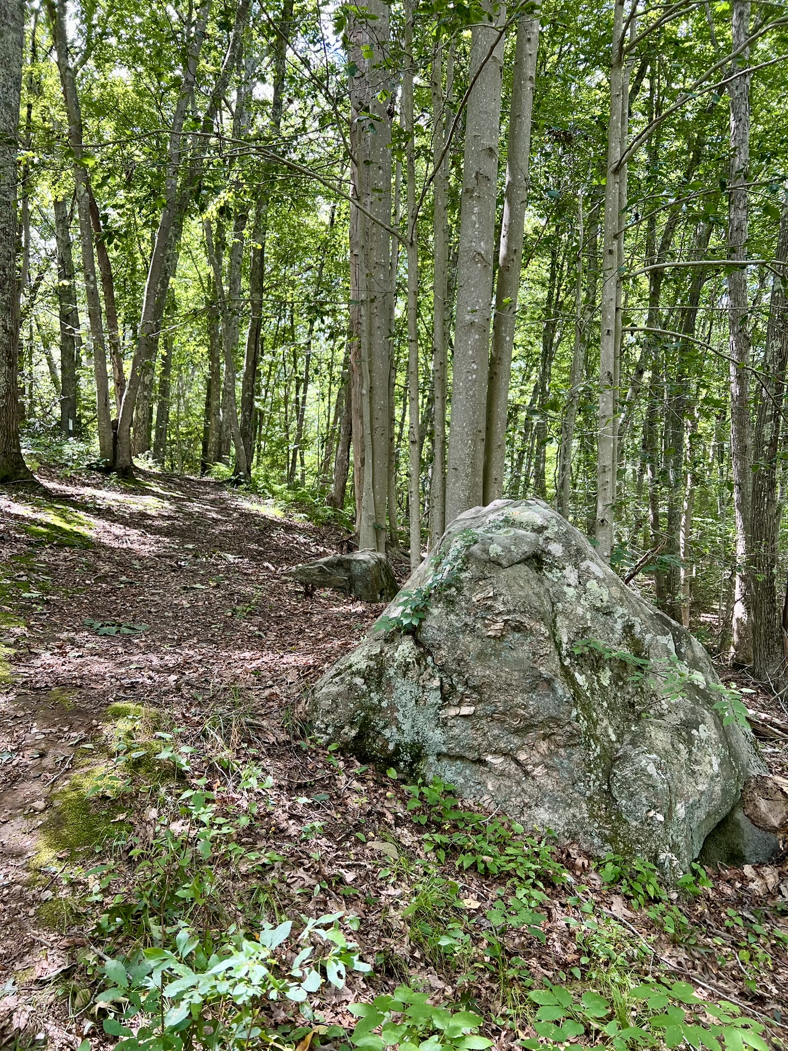
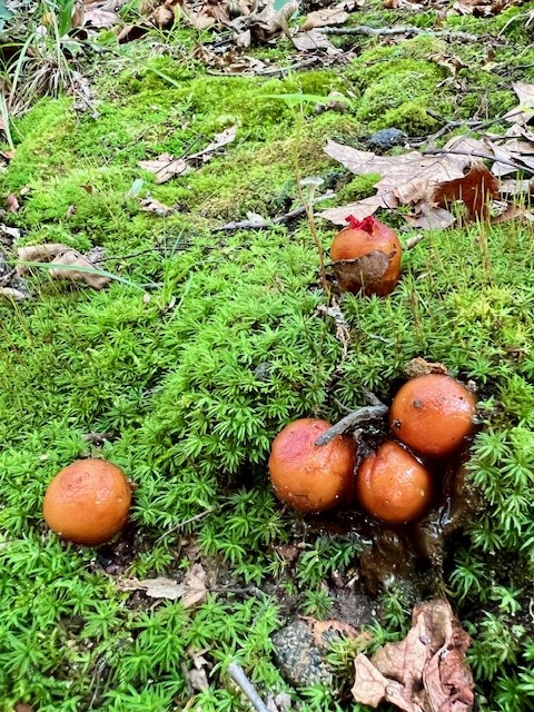

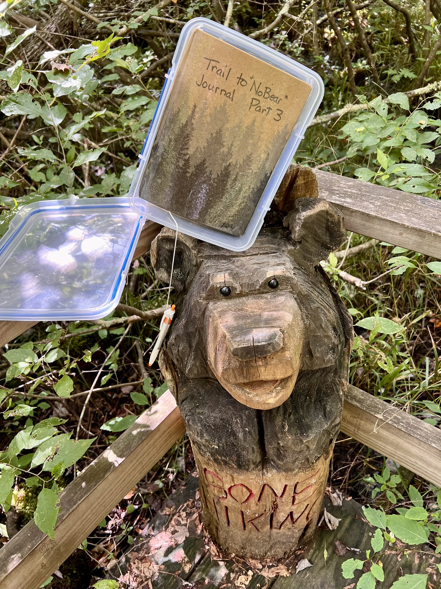
From left to right: a gentle hill passes a large boulder; Calostoma cinnabarinum; The Trail to No Where; the hiker’s journal — don’t forget to leave a comment!
Main Street Park, Essex.
To see some trees without going on a hike, stop by Main Street Park (14 Main Street). There is parking behind the post office or along the street. Start near Main Street, where there is a signboard with a map of the park showing the location of over 20 different tree species in the park. This small park has contemplation benches, picnic tables and a gazebo. At the opposite end, the park overlooks Middle Cove. This is also a public launch for the cove here.
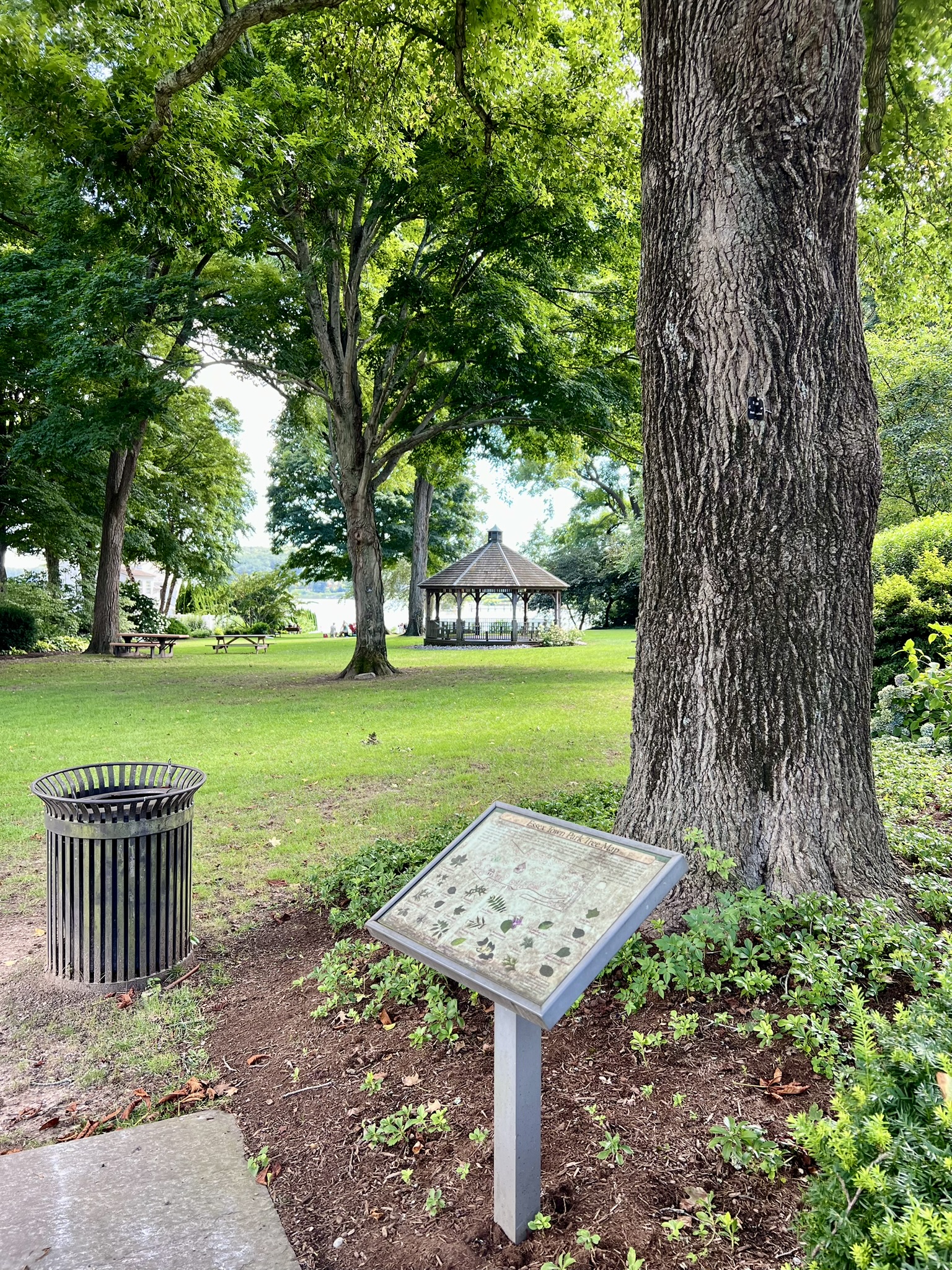
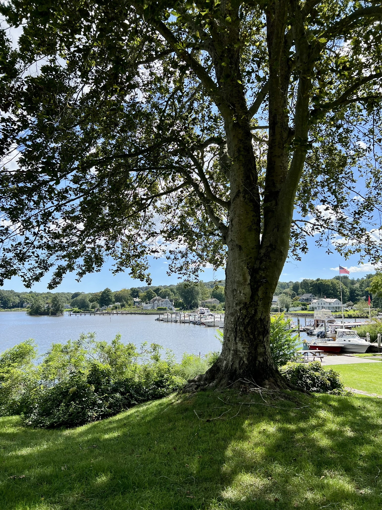
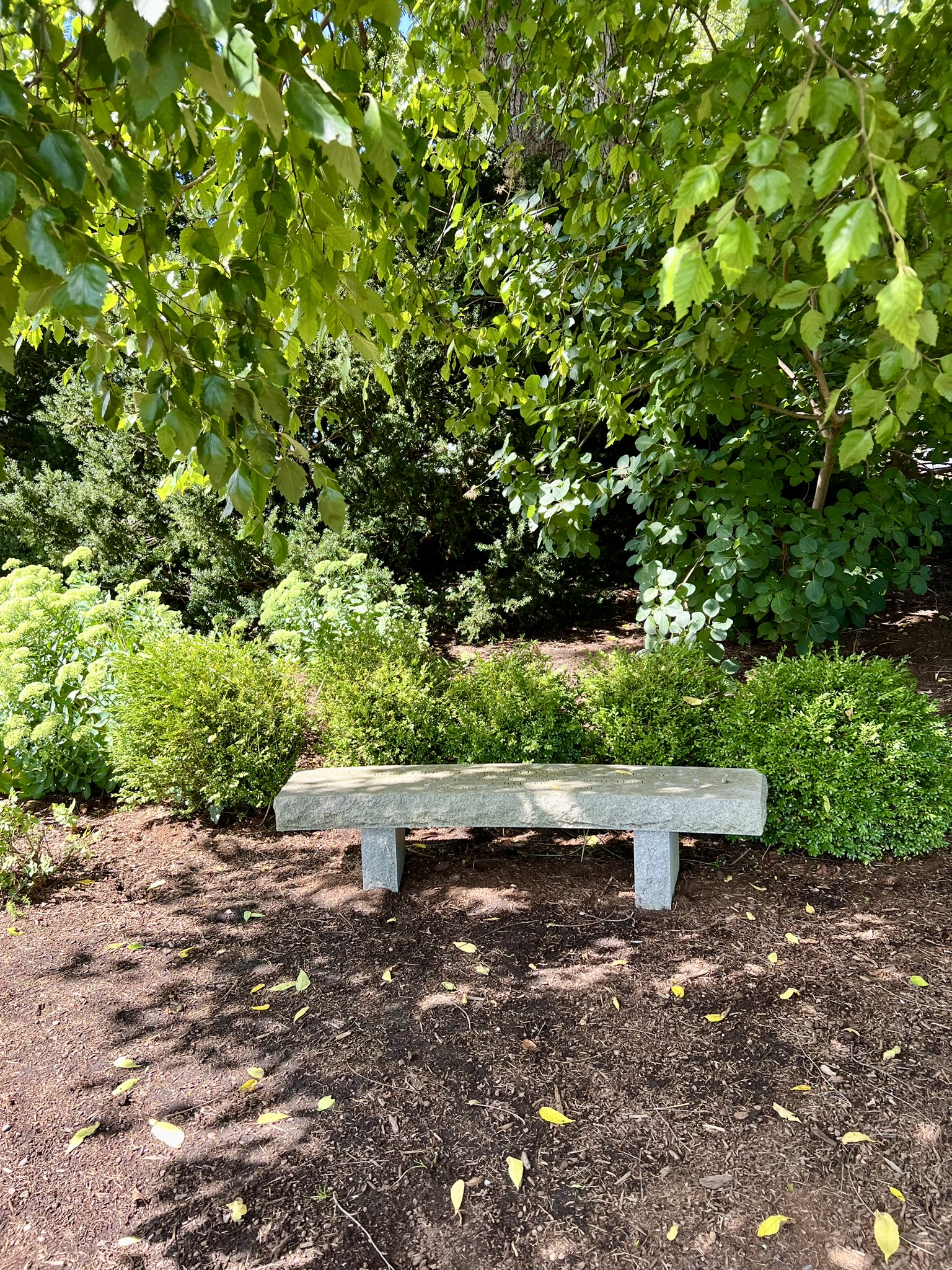
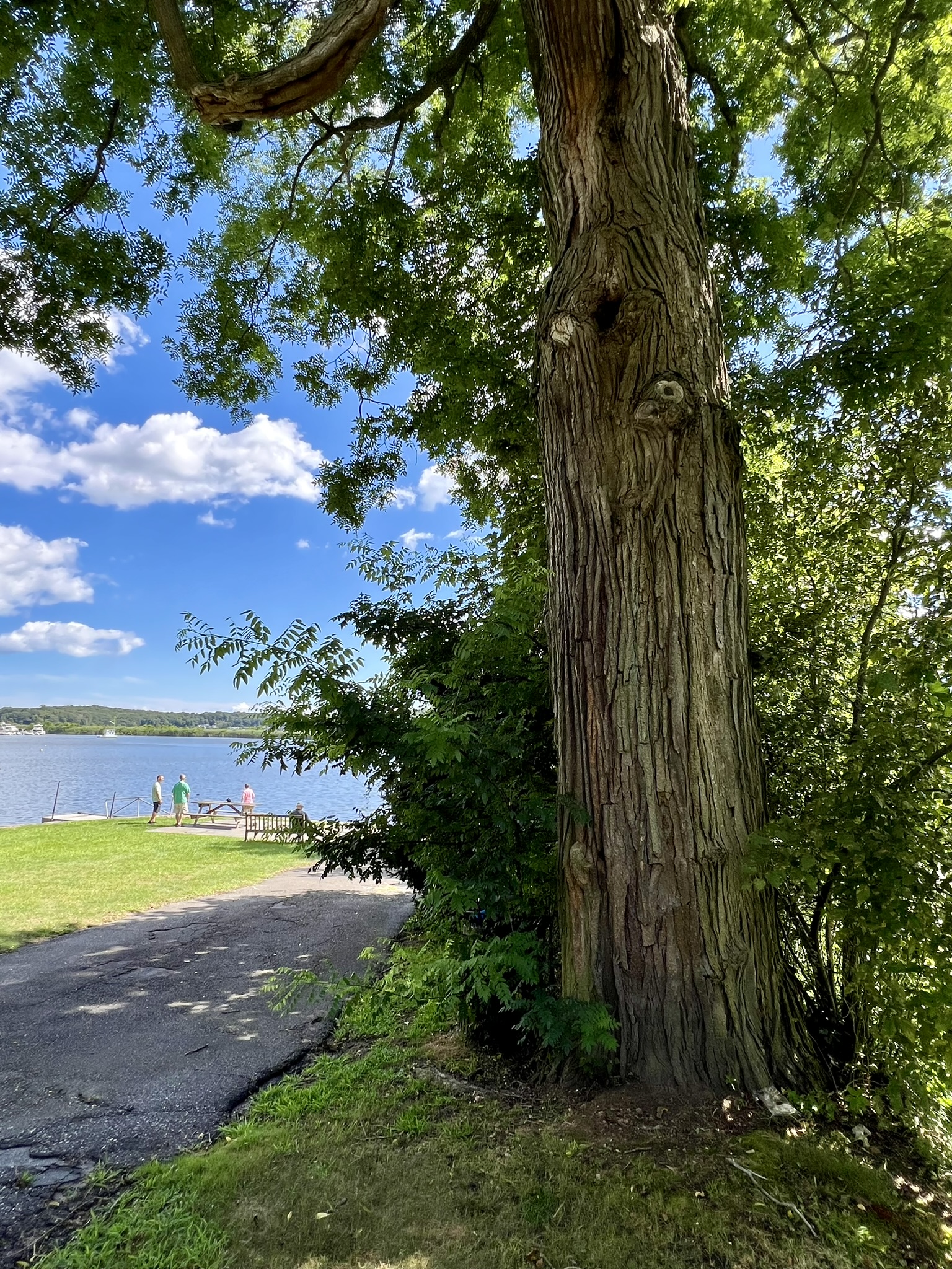
From left to right: The Tree Map by the Main Street entrance with a Sweetgum tree behind it; American Beech; a contemplation bench; the path to the public launch next to a towering Black Walnut tree
Brooksvale Park, Hamden. Easy .75 mile hike with approximately 127′ of ascent.
For our August visit we parked in the main lot by the street, as cars were not allowed to drive further in while summer camp was in session. From the street lot, including a few wrong turns and backtracks, I recorded 1.4 miles on my Garmin watch. As with many of the improvements I have encountered in my trail explorations, this Tree ID Trail was an Eagle Scout Project. I was impressed with the details in the BROCHURE, which guides hikers as to the order in which to look for the marked trees, as well as general guidelines such as whether they are on the left or right side of the trail, along with drawings and/or descriptions of the leaves, fruit, and bark. I recommend printing the brochure to use as a reference. From the parking lot, we walked north up the drive, past the red barn. At the turn in the road we continued straight to enter the woods, stopping at the kiosk to review the trail map. Note that the tree trail is blazed white. Since white does not show well on the map, it is enhanced with a thin purple line (not to be confused with the purple trail).

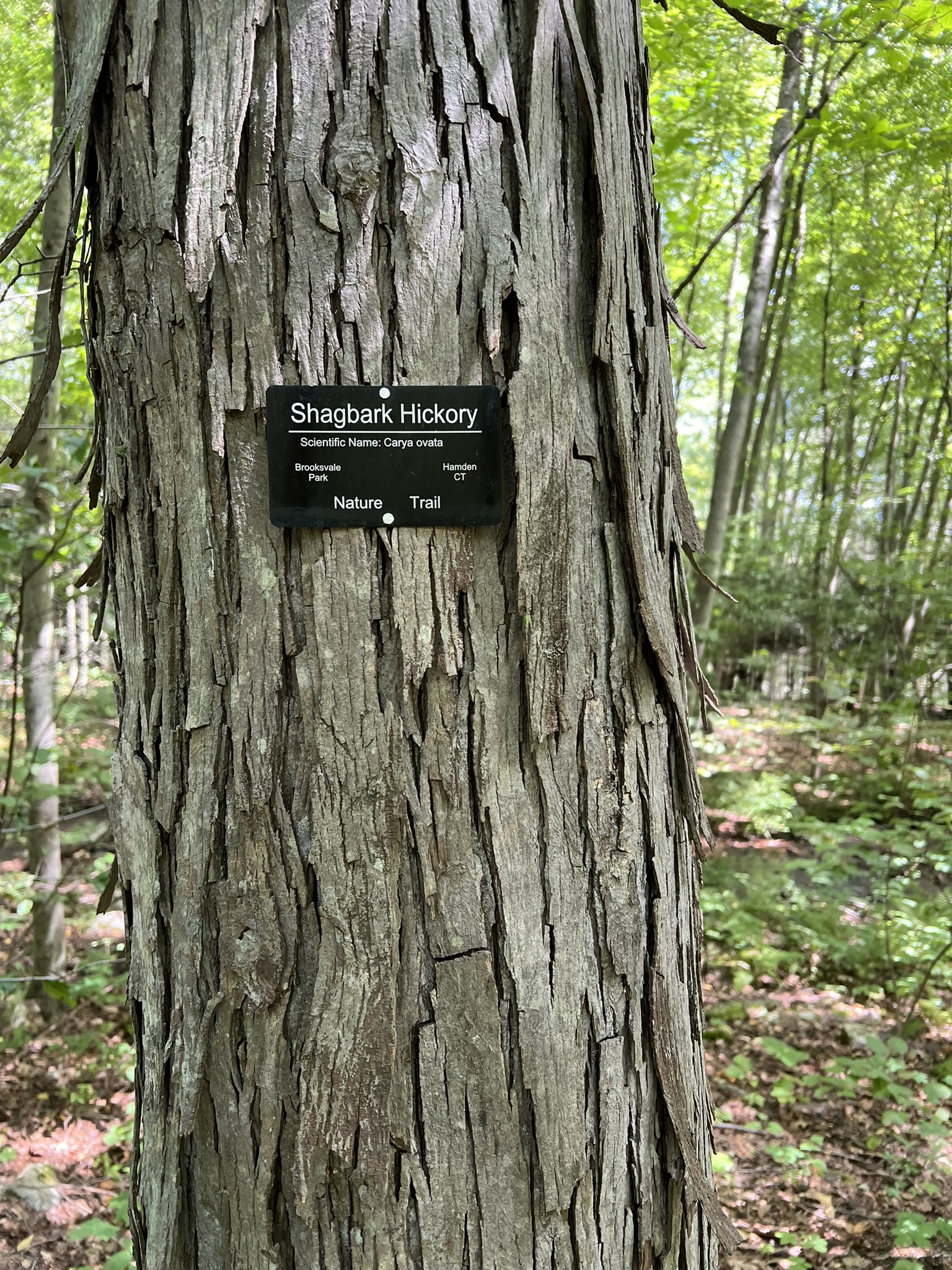
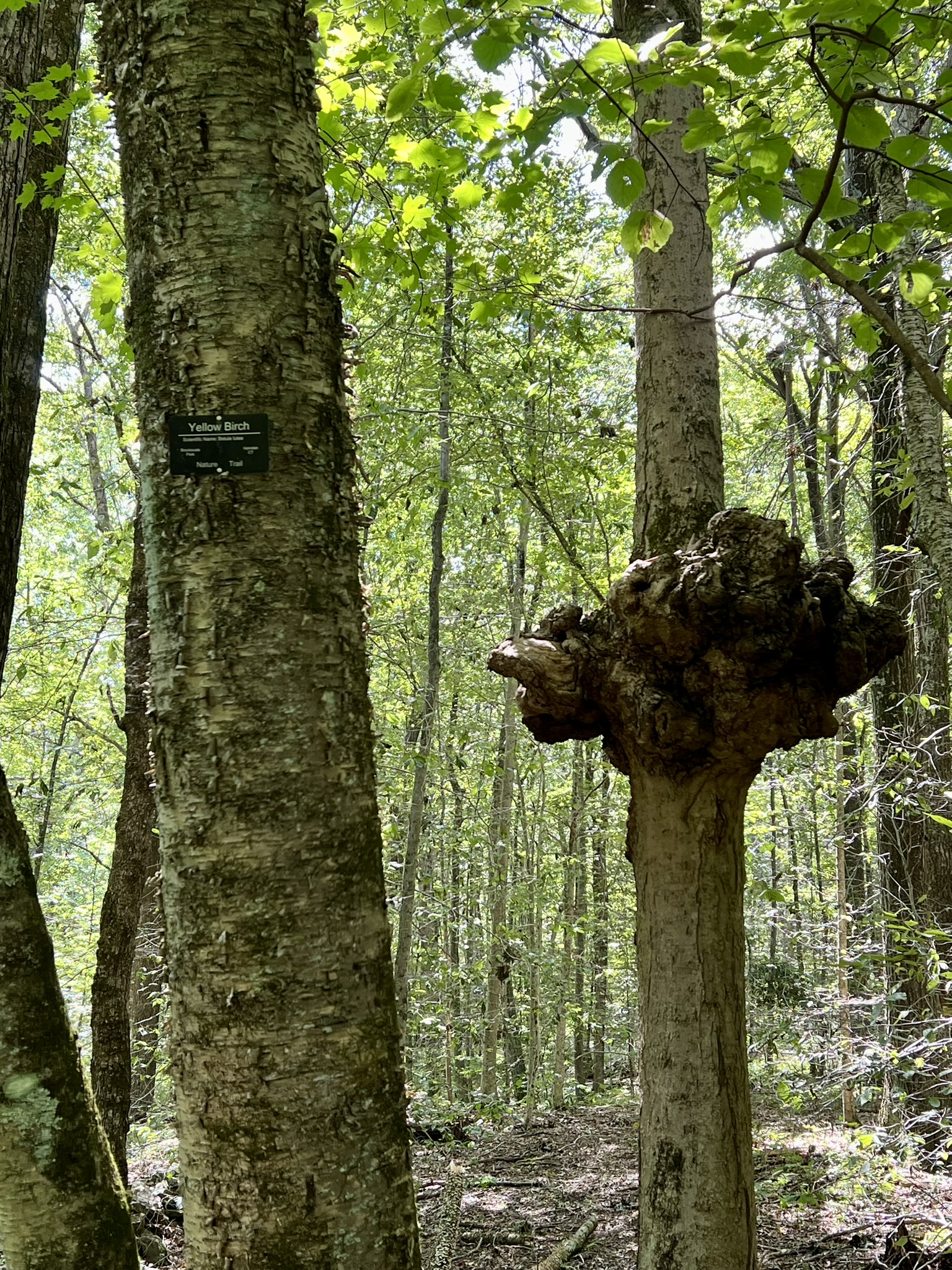
From left to right: with higher water from recent flooding rains there was one trickier stream crossing; bench overlooking the duck pond; a Shagbark Hickory; to find the Yellow Birch it helps to look for the tree with the giant burl
I am not sure how long the trail has been there, but it has held up quite well with a few exceptions that I will relay to save you some confusion. Here is a short list of observations:
- The brochure lists 24 different marked trees in order. Note that the brochure lists them from left to right across the page.
- I did not spot the #2 tree (Black Cherry). This may be because I didn’t see it, or because either the marker or the tree is gone. Perhaps you will have better luck!
- The marked tree is not necessarily the first tree of that species you will see. For example, looking for #5 Sassafras, I spotted a sassafras tree with no label and wondered if the label was missing – but further down the trail I found the labeled tree.
- The #6 Sycamore label was missing from the tree, but it was easy to find from the description – it is the very large tree growing along the curved dam (which is also a cool feature)
- I got very confused at #12 Tulip Poplar. The tree was on the right side of the trail, although the brochure said it was on the left. At first I assumed the brochure was wrong, but when we reached the green trail intersection we realized we hadn’t seen any white blazes for a long time. We backtracked to the tulip tree, and that is when we noticed that the white trail takes a sharp right turn into the woods by the tulip tree (which puts the tree on your left once you turn). We were able to find our way by following the white blazes, but the trail on the ground was not as obvious.
- When you cross the bridge before the duck pond, several tree labels are on posts, indicating a tree further in the bushes.
- The only other label that was missing was #20 for the Eastern Red Cedar. The post was there, along with a sliver of the old label.
- The trail follows the contours of the duck pond and emerges behind the Veteran’s building. Behind the building, on the left side of the trail, look for the bonus trees A, B and C. Guess the species for a bonus quiz! The answers are at the end of the brochure.
For a complete trail map and description of the park, including its history, click HERE. There are many miles of trails to explore, and the park connects both to the Farmington Canal Trail at the southern border and to the Naugatuck State Forest in the north. For the tree trail map and additional information, including descriptive links for each tree species, click HERE.

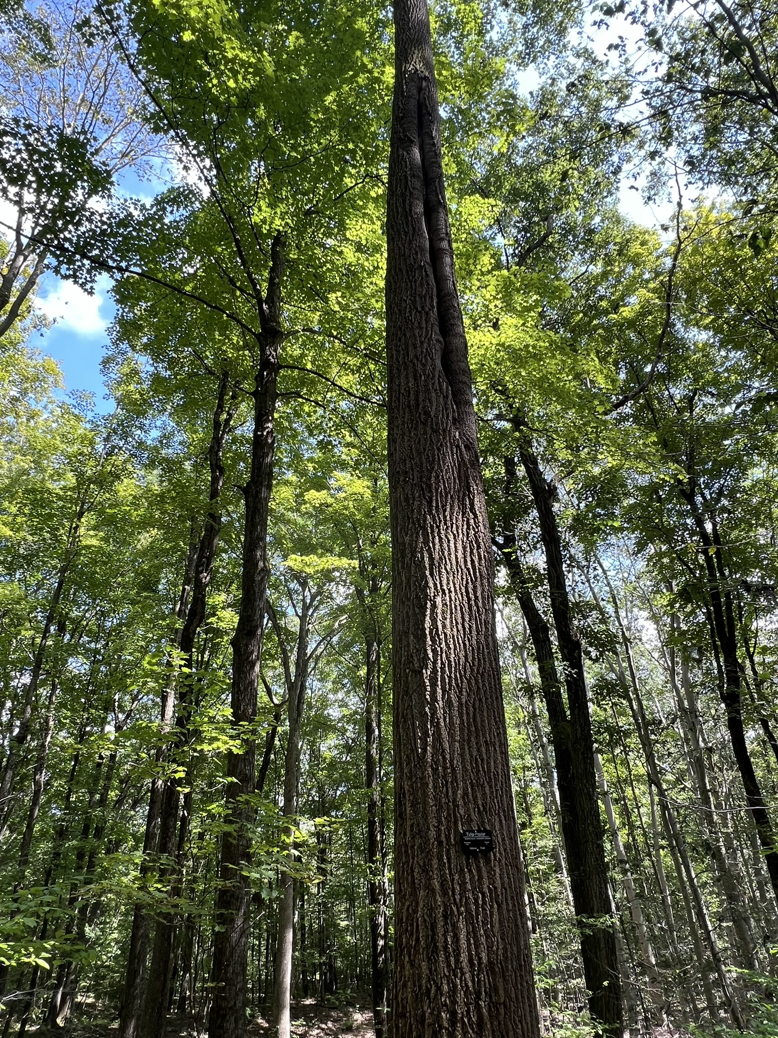

From left to right: the Sycamore on the dam; the Tulip Poplar; as you turn to put the Tulip Polar on your left look for the white blazes; all that remains of the Eastern Red Cedar marker.
Sessions Woods, Wildlife Management Area, Burlington. 1.5 to 4 miles.
We visited Sessions Woods eager to walk the advertised Tree ID Trail, only to find it was a BUST. I include it here to either save you the trip, or pique your interest in visiting to explore other features on the property. I recommend printing or downloading the property trail map and Tree ID Guide before you go. The Beaver Pond Trail is a 2.6 mile loop trail. This trail is a wide gravel path that is popular with dog walkers and runners. The Tree ID Trail is a cross trail that starts at the north end of the Beaver Pond Trail and runs .5 miles to the southern end. We chose a 3.25 mile hike (with approximately 418′ of ascent) that included the Tree ID Trail and continued west following the Beaver Pond Trail clockwise back to the parking lot, veering off to investigate a few features along the way, including a beautiful waterfall. I recommend referring to a trails app as well as the map (I use AllTrails), which will show some alternate trails that turn some of the out-and-back sections to see certain features into short loops.
(photo to right: the waterfall was one of the highlights of our visit to Sessions Woods)

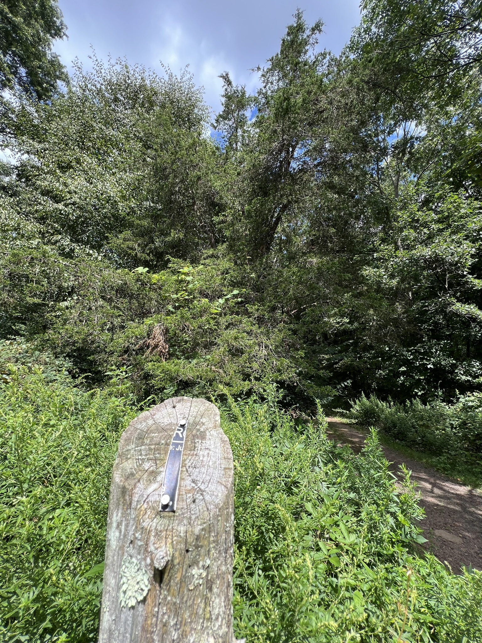
To start, we followed the entry road to the north (right) of the Education Center until we saw the very large sign indicating the start of the Beaver Pond Trail. Following that trail, we watched for the Tree ID Trail sign on the left. The sign calls it .5 miles although it is listed as .4 in the brochure. Things started off well. Although the brochure does not number them, it seemed to go in order from the top going down the column first, starting with Black Birch and Paper (White) Birch. I was concerned when I noticed the American Beech (the 6th tree in the pamphlet) on the right several feet into the woods off the trail. I worried that I had overlooked other marked trees so I retraced my steps to the Paper Birch and started again. Both my husband and I walked the trail slowly (it was rocky with many roots so it was hard to walk and search simultaneously) looking very carefully along the trail. The trail was certainly pretty, following a ravine with a bubbling brook. We saw other signboards that talked about stream management, but not a single tree ID sign until the very end of the trail where we saw the tag for Mountain Laurel, the last of 18 trees listed in the pamphlet.
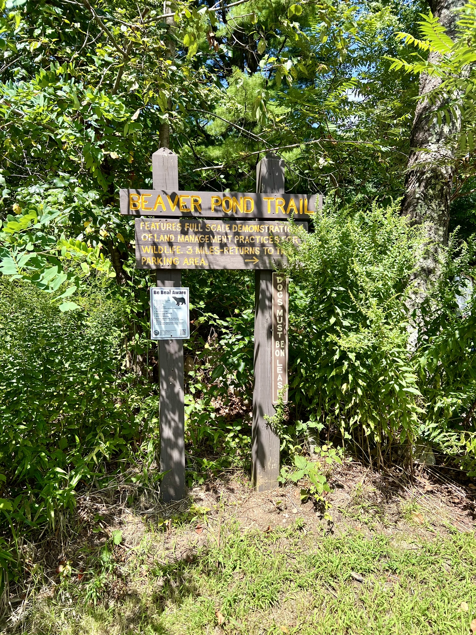
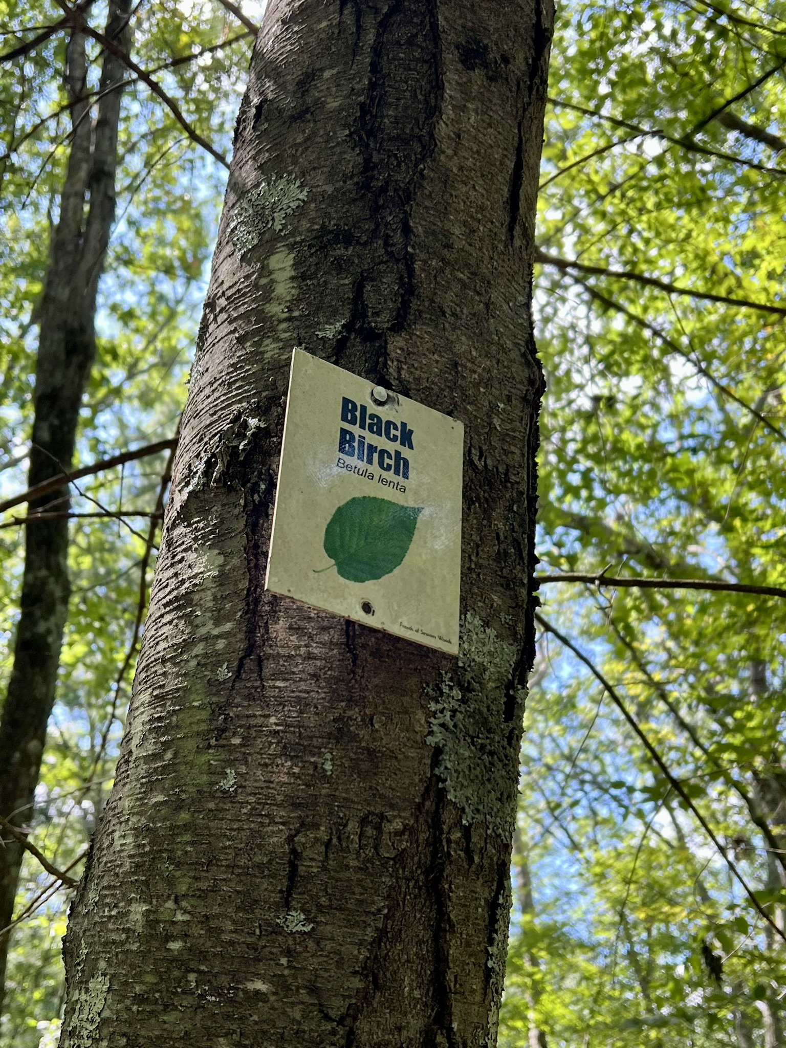
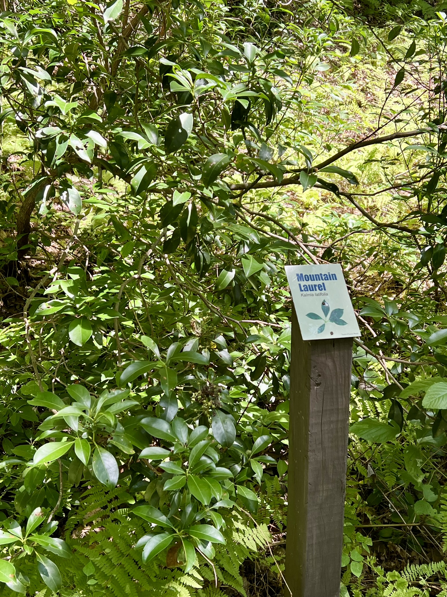
From left to right: the sign marking the start of the Beaver Pond Trail; a Black Birch – one of only 4 tags we found; the Mountain Laurel tag at the end of the trail; the Beaver Pond Trail is a wide gravel path
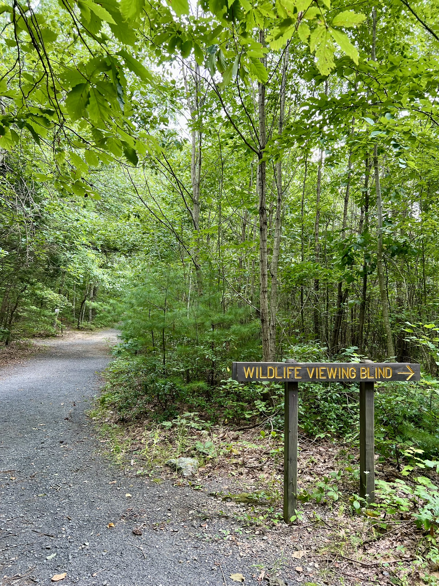
While disappointed in the Tree ID Trail, we decided to continue on the Beaver Pond Trail towards the marsh. There are several side trails to interesting features, all very well marked with large signs. The first one we came to was the waterfall trail on the left. This led to a scenic waterfall that was running strong for August, as we visited only a few days after the flooding rains that hit mid-month. Although it does not show on the map, there is a set of stairs that leads up from the waterfall that allows you to do a loop, merging with the Beaver Pond Trail further west. Next we came to the Lookout Tower Trail. This, too, shows as an out-and-back on the map, but it can be done as a loop. We stayed left to start, which led past some signs describing the interesting geologic features of the small ridge. You can climb to the top of the tower, which provides a partial view in summer. Based on the 3D signboard labeling the distant hills, the view should be much better when the leaves are off the trees. The loop back is shorter but steeper. Next, we followed the path on the left to the Viewing Blind – a true out-and-back trail. This led to a large blind at the edge of the marsh. Unfortunately the brush blocks any views. We skipped the Vernal Pool Trail, thinking this would make more sense to visit in the spring. We also skipped the last spur trail to the Waterfowl Blind, as I had read on the website that the boardwalk was closed for repairs. We then followed the Beaver Pond Trail back to our starting point, for a total of 3.25 miles. If you want a longer hike, you can check out the Forest Meadow Loop near the Education Center. Three secondary sections of the blue-blazed Tunxis Trail (the blue/black, blue/orange and blue/yellow) run through the Sessions Woods forest, so there are many options for an extended hike. For the Sessions Woods website click HERE.

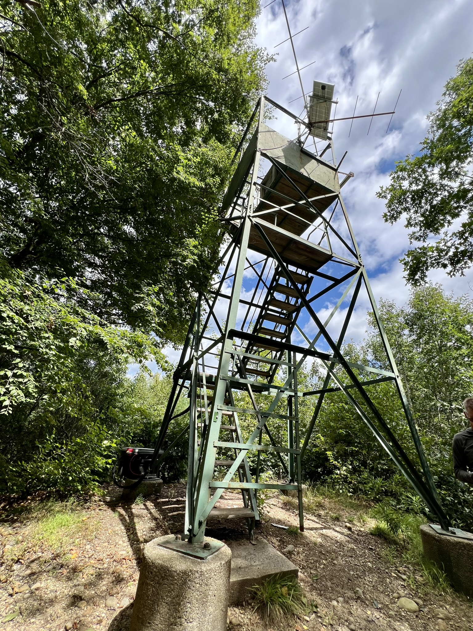
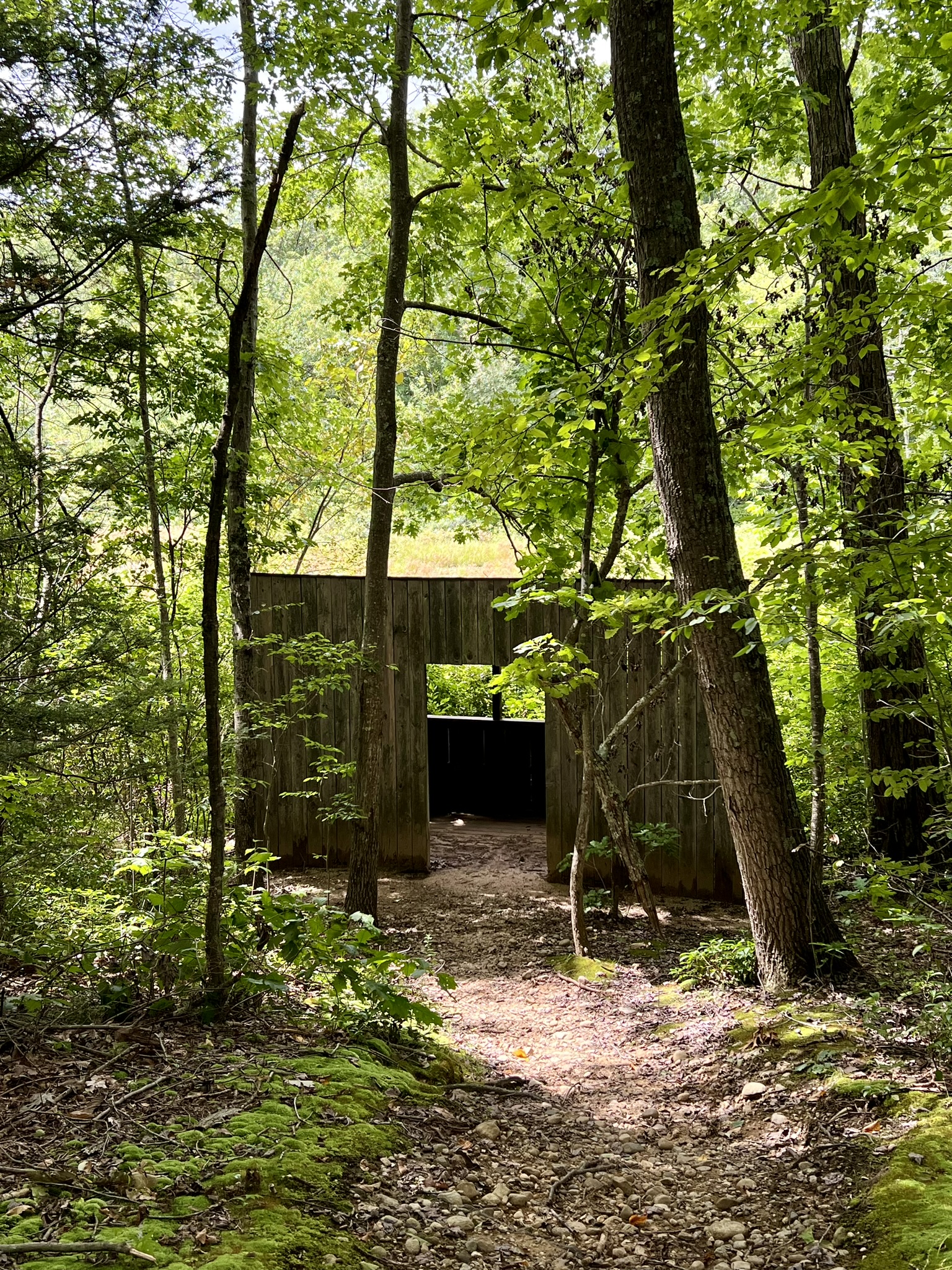
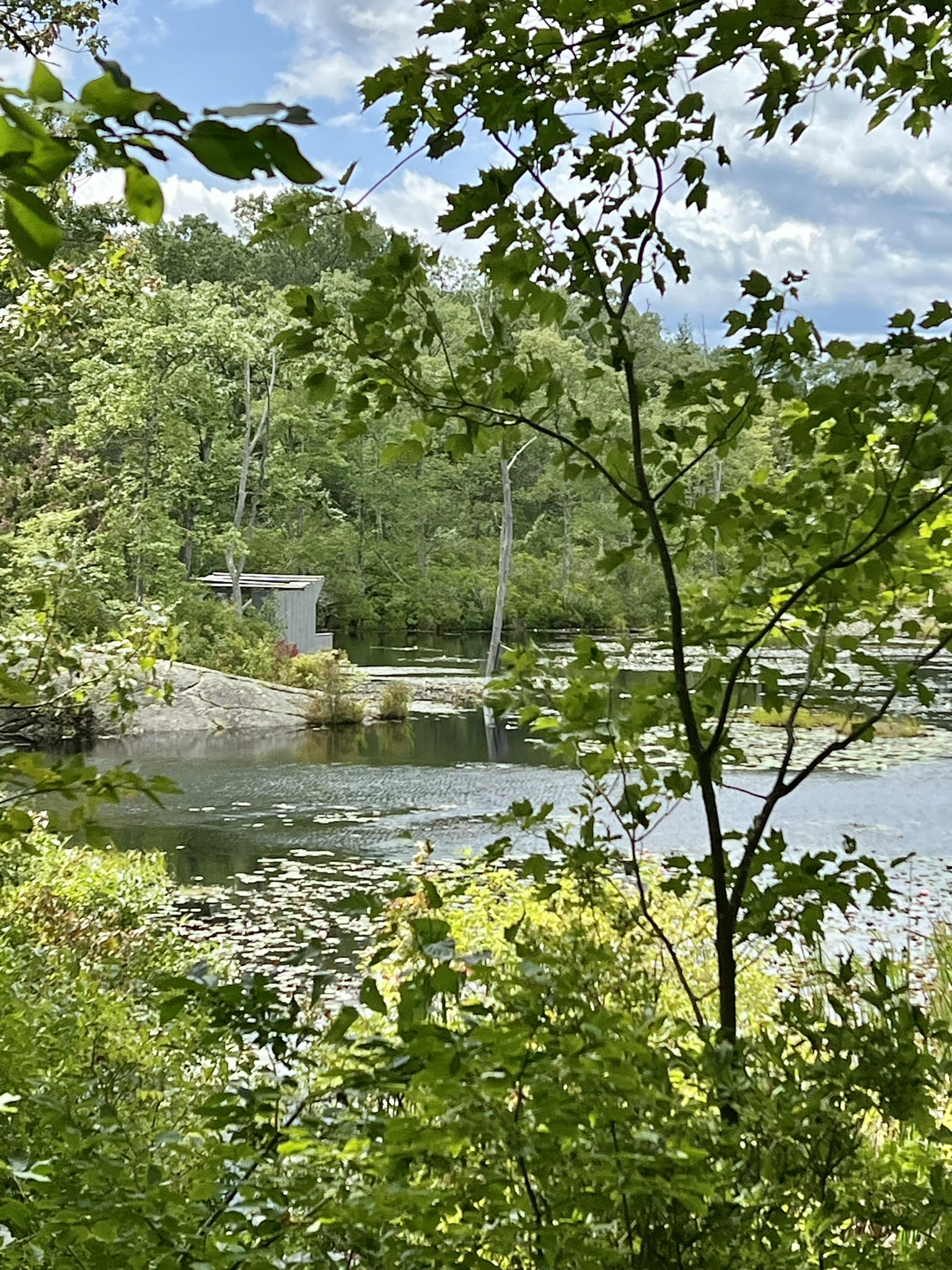
From left to right: the waterfall; the lookout tower; the overgrown wildlife viewing blind; the waterfowl blind at the Beaver Marsh — currently inaccessible until the boardwalk is rebuilt
Bibliography
Below are some of my favorite books about trees. Several of these authors have educational videos available on YouTube and/or Instagram pages.
The Songs of Trees: Stories From Nature’s Great Connectors, by David George Haskell (2017)
American Canopy: Trees, Forests, and the Making of a Nation, by Eric Rutkow (2012)
A Trillion Trees: Restoring Our Forests by Trusting in Nature, by Fred Pearce (2021)
Finding the Mother Tree: Discovering the Wisdom of the Forest, by Suzanne Simard (2021)
The Hidden Life of Trees, by Peter Wohlleben (2017)
The Nature of Oaks: The Rich Ecology of Our Most Essential Native Trees, by Doug Tallamy (2021)
Bark: A Field Guide to Trees of the Northeast, by Michael Wojtech (2011)
Field Guide to Trees: Eastern Region, National Audubon Society (2000)
Subscribe to Trail Talk
your next adventure awaits
Questions? Email me at naturenerdsramble@gmail.com or find me on Instagram @the_real_nature_renee.

