It is hard to exaggerate the importance of rivers and streams to New England’s early industrial history for both transportation and power. This becomes evident when you start exploring trails along Connecticut’s waterways. There is hardly a river or stream trail I have explored that does not pass the ruins of an old dam and/or mill. Often, when you live in a place, the things that surround you become “part of the furniture” (defined in the Cambridge online dictionary as “something…so familiar that you no longer notice it”). Sometimes you need an outsider to shift your focus, like when an English friend mentioned to me last year that she had visited Lowell National Historical Park (LNHP). I was gobsmacked! How did I not know about this National Park? Growing up in a Boston suburb, I associated “Lowell” with “depressed mill town”. My excuse for completely missing Lowell’s revitalization is that I moved to Connecticut in the 1980’s when those renewal efforts were in their infancy, and my attention turned towards important Connecticut things like becoming a UCONN women’s basketball fan.
I finally had my opportunity to visit on a perfect day in late June in between heat waves. That visit sent me into an exploratory tailspin which is showing no signs of slowing down. I started to wonder about our own mill history here in Connecticut. “Manufacturing took place wherever there was an adequate source of water for power, but especially in rural areas where entirely new communities were spawned”, wrote Ellsworth S. Grant in his book, Yankee Dreamers and Doers: The Story of Connecticut Manufacturing. Some of those communities grew into towns that still exist today, and others were abandoned with only remnants left to hint at their previous existence.
This Trail Talk will focus on LNHP and two nature preserves and an open space parcel in Glastonbury, CT, all former textile mill sites.
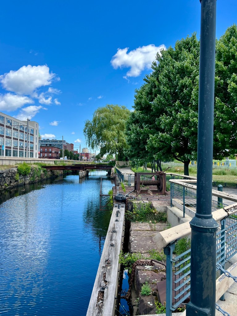
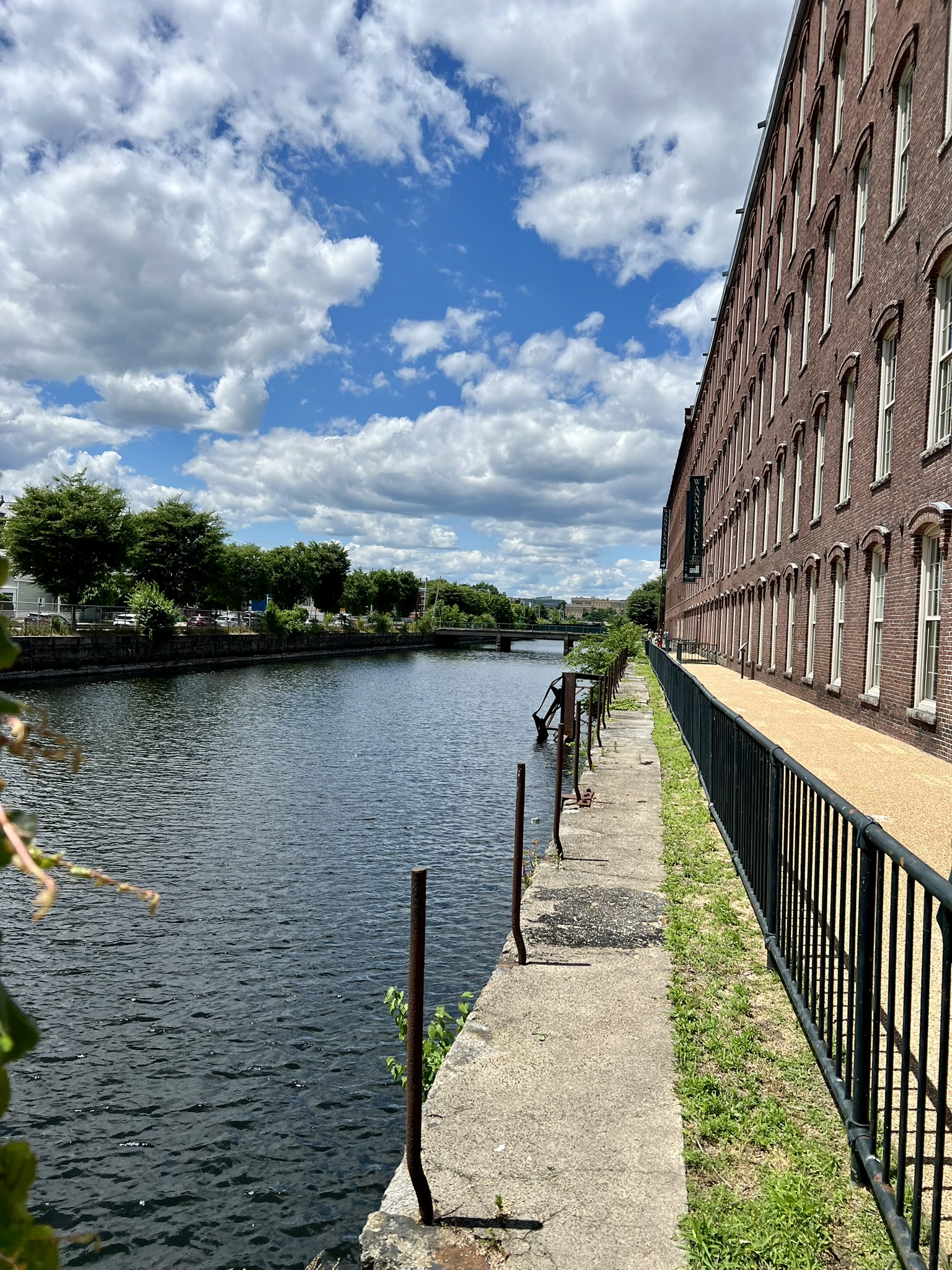
(photo: a view down the Merrimack Canal from the Swamp Locks in Lowell, MA)
Lowell National Historical Park, Lowell, MA.
Around 200 years ago the agricultural community of East Chelmsford attracted the attention of a group of businessmen from Boston (now referred to as The Boston Associates) who were looking for a suitable place to construct textile mills. A decade earlier, in 1813, under the leadership of Francis Cabot Lowell, these associates built two textile mills in Waltham, MA on the banks of the Charles River. These mills were unique in that they were some of the first operations that integrated all the aspects of production (such as carding, spinning and weaving) in one place. They utilized innovative technology smuggled out of England by Lowell himself. Peter Andreas, in his book, Smuggler Nation: How Illicit Trade Made America, explains “…Lowell is credited with truly transforming New England Textile Manufacturing into a mass-production and internationally competitive factory system. Doing so involved pulling off the most remarkable case of industrial espionage in American history….Lowell, who had studied mathematics at Harvard and possessed an exceptional memory, used his mind to smuggle out British industrial secrets”, having had the opportunity to tour several cotton manufacturing factories.
East Chelmsford appealed to the Boston Associates for two main reasons. First, the land was situated alongside the powerful Merrimack River which could provide sufficient hydropower. Second, there was already an existing canal, dug in 1796 by Newburyport merchants as a way to get around the mighty Pawtucket Falls which had stymied transportation of both boats and logs. At the time, logs were transported from northern forests mainly by floating them down rivers. Logs were in high demand at the time for shipbuilding, and finding a way around Pawtucket Falls allowed for the transport of logs all the way from New Hampshire to the river’s outlet at Newburyport. East Chelmsford was quickly transformed into an industrial mill town and renamed Lowell in honor of Francis Cabot Lowell, who died in 1817. Lowell experienced great economic success, followed by decline and then revitalization. Federal legislation officially created Lowell National Historic Park in 1978, and the NPS website has an informative summary describing this industrial city’s decline and recovery over time.
I planned our visit to LNHP as a day trip. In retrospect, I would recommend a two-day visit with an overnight stay. We managed to see much of what LNHP has to offer, but also missed out on several sight-seeing opportunities, and we skipped lunch altogether – getting by on a few snacks. The biggest downside to visiting Lowell is traveling on I-495 through Worcester, where you are likely to run into bumper-to-bumper traffic if you pass through at rush hour like we did.
I advise checking the events and exhibits on the website and planning your visit in advance. The one activity I pre-booked was an 11:00am Canal Boat Tour. This 1-1/2 hour tour is offered at 11:00am, 2:00pm and 3:00pm daily through Labor Day (and weekends through mid-October). We aimed to arrive at 10:00am to allow for traffic, parking and a walk through the Visitor’s Center. There is free parking for LNHP visitors in the Hamilton Canal Innovation District parking garage at 350 Dutton St, which is near the Visitor Center. The Visitor’s Center has several interesting exhibits, including one on Jack Kerouac, who I learned is one of Lowell’s native sons and who, according to the exhibit, set five of his novels in Lowell.
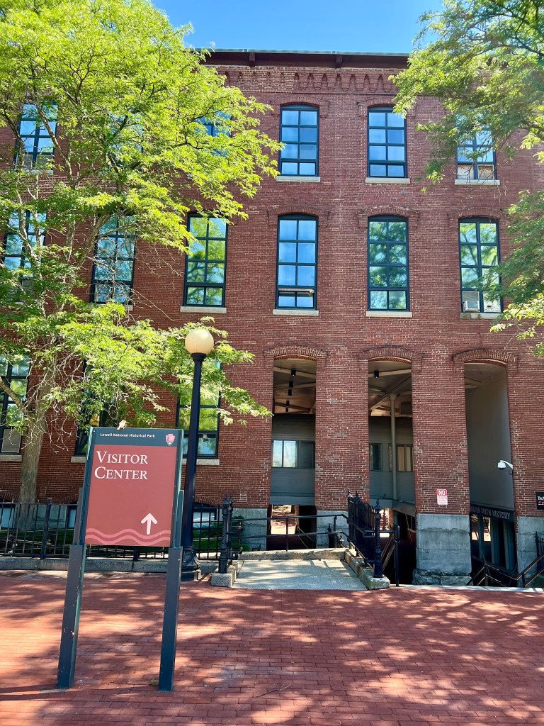
(photo: the LNHP Visitor Center is housed in a former mill building)
The Canal Boat Tour started with a short trolley ride to the Swamp Locks, where we boarded a small skiff that traveled along the Pawtucket Canal to the Guard Locks. Along the way, the Tour Guide explained the history of the canals, talked about how the locks worked, and pointed out different landmarks along the route. At the Guard Locks we left the boat and ascended a set of stairs to view the canal and buildings. The most intriguing tale was that of the “Francis Gate”, which his critics at the time called Francis’ Folly. James Francis was an engineer who was deeply concerned about the possibility of a major springtime flood devastating downtown Lowell. In 1850 he constructed a large (25’ x 27’) and heavy (21 tons) wooden “gate” that was suspended by an iron shackle. The theory was that under threat of flood, someone could quickly use a hammer and chisel to break the shackle and send the gate crashing down to block the canal. The first opportunity to test this theory came just two years later, on April 22, 1852, when the gate was successfully dropped and credited with saving the city. Somehow this 21 ton gate was raised back up. It was utilized a second time in 1936 when another flood threatened the city. According to a signboard at the site: “This monumental event so affected young Jack Kerouac that he invoked it as a symbol for nature’s power in his novel Dr. Sax (1959)”. While the gate was raised one last time, it was never used again. Instead, the city developed a method to block the canal using steel beams, which it had a chance to test during the Mother’s Day Flood of 2006.
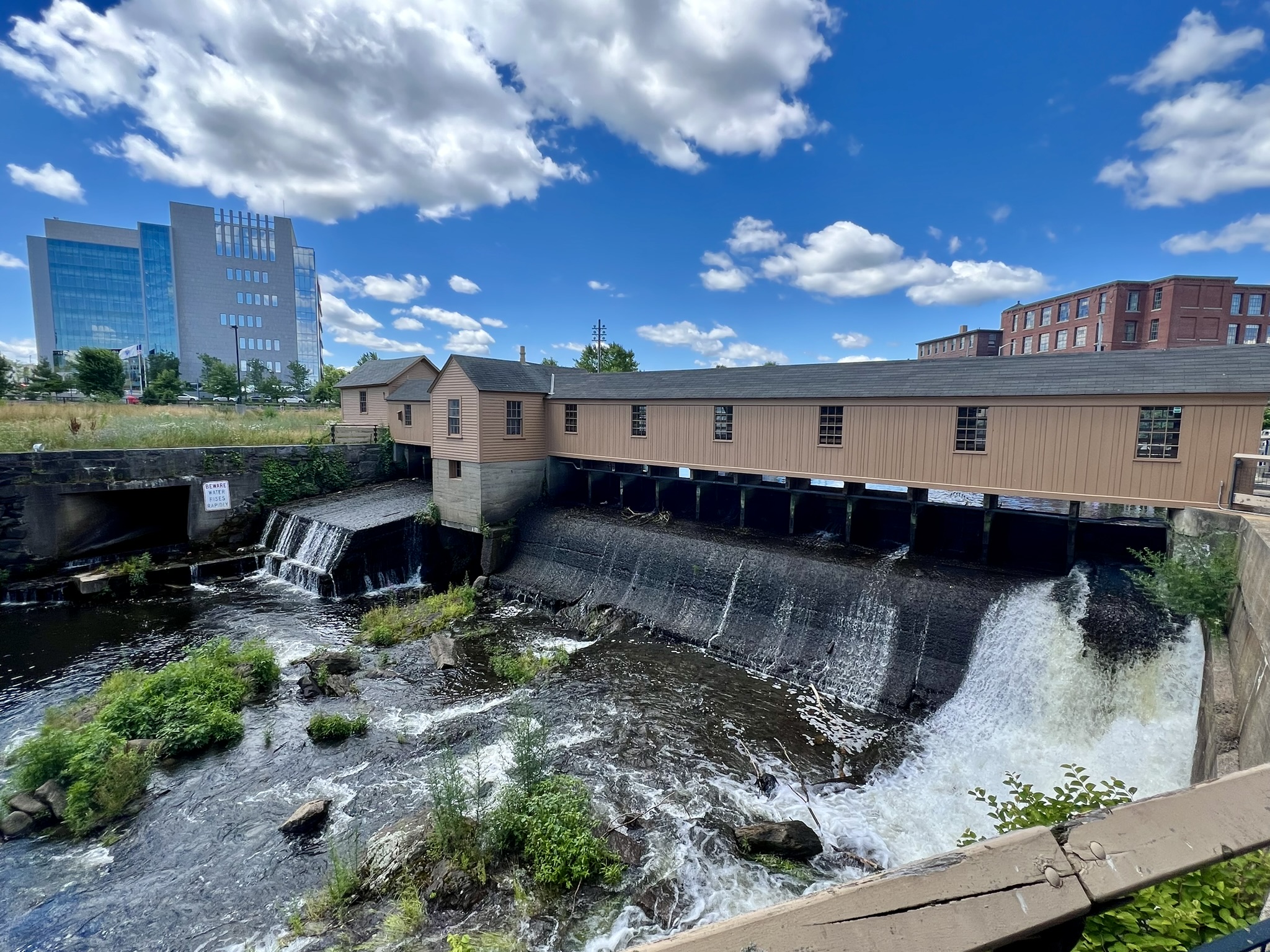
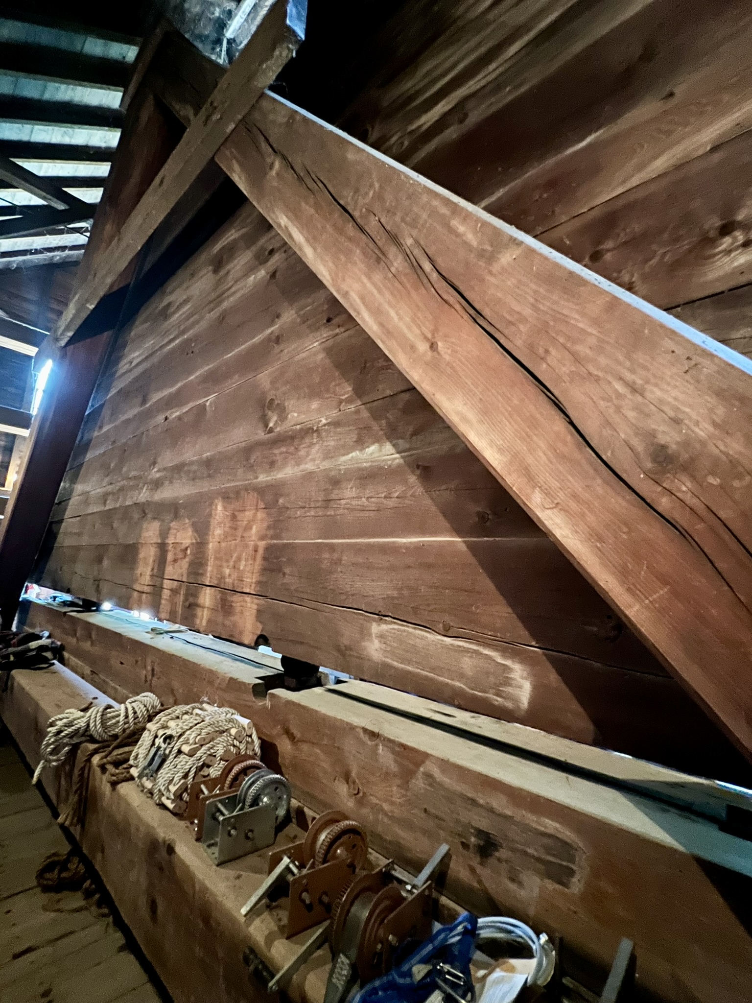
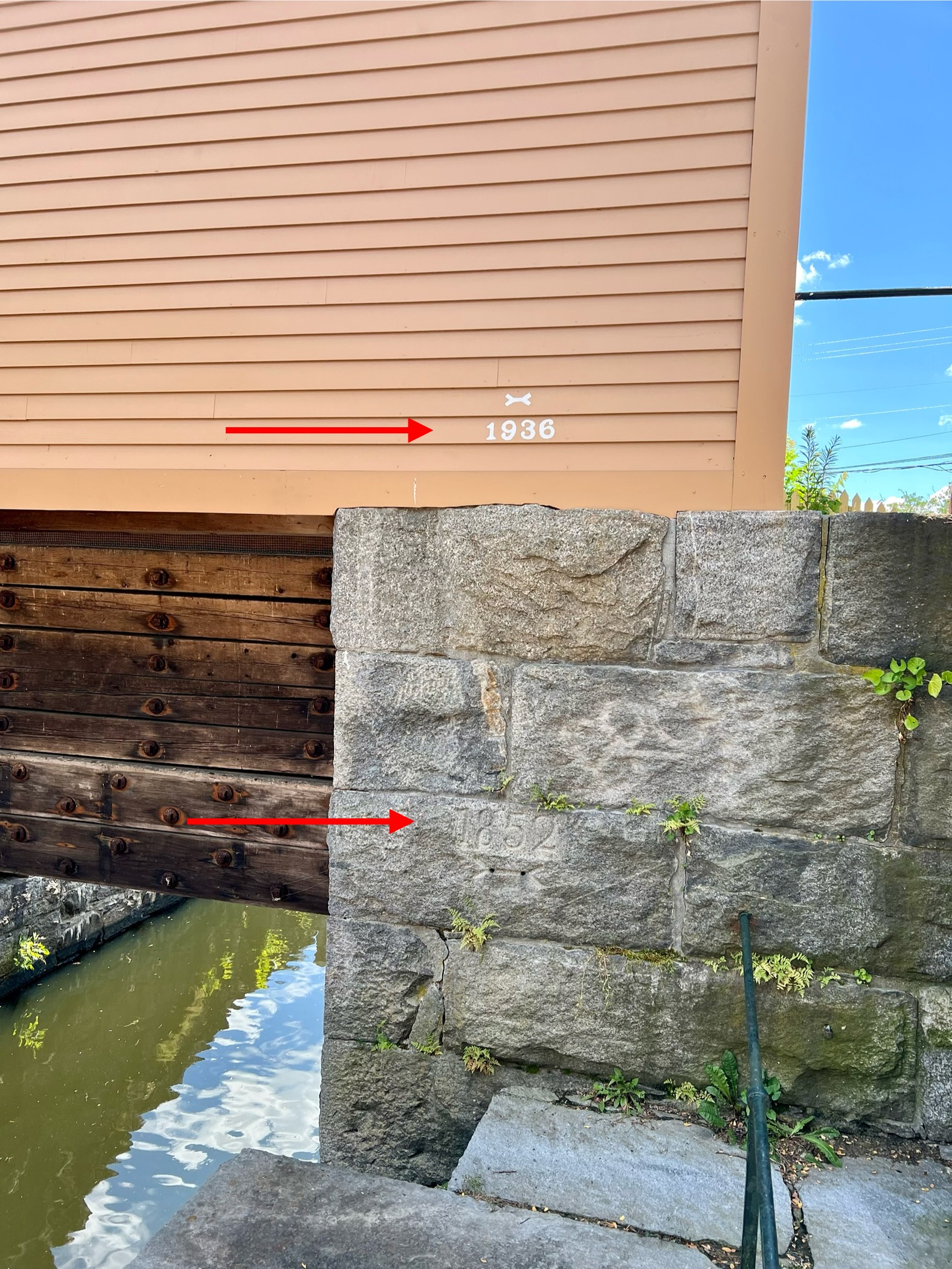
from left to right: the Swamp Locks; the Guard Locks; the great “Francis Gate” inside the Guardhouse; the red arrows (added by me) indicate the highwater levels during the 1852 and 1936 floods
The boat tour ended at 12:30pm with a trolley ride back to the Visitor’s Center. We chose to stay on the trolley, which continued on to the Boott Cotton Mills Museum, so we could catch the 1:00pm Suffolk Mill Tour. The tour is free and registration is not required. The website describes it as “a short trip through the historic city accompanied by a park ranger and a guided visit to the River Transformed Exhibit at the Suffolk Mill.” Our tour went by trolley from the Museum to the Suffolk Mill, but the website cautioned to be prepared for up to 1-1/2 miles of walking, so I imagine the tour sometimes is done on foot. This tour was well worth skipping lunch for. We got to see one of the turbines actually working, along with the associated belts and gears, as well as a demonstration of a power loom and flyball governor in operation.
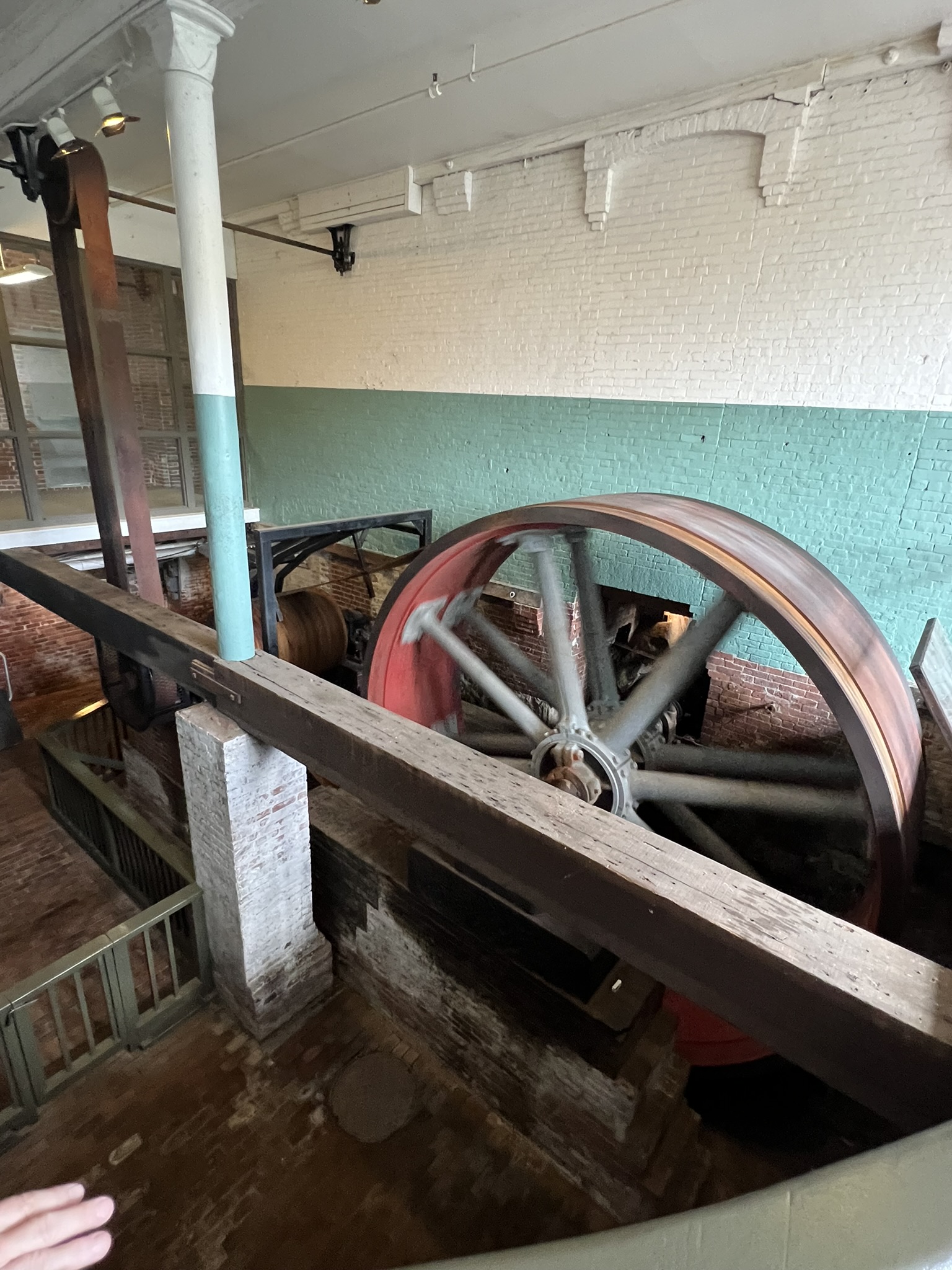
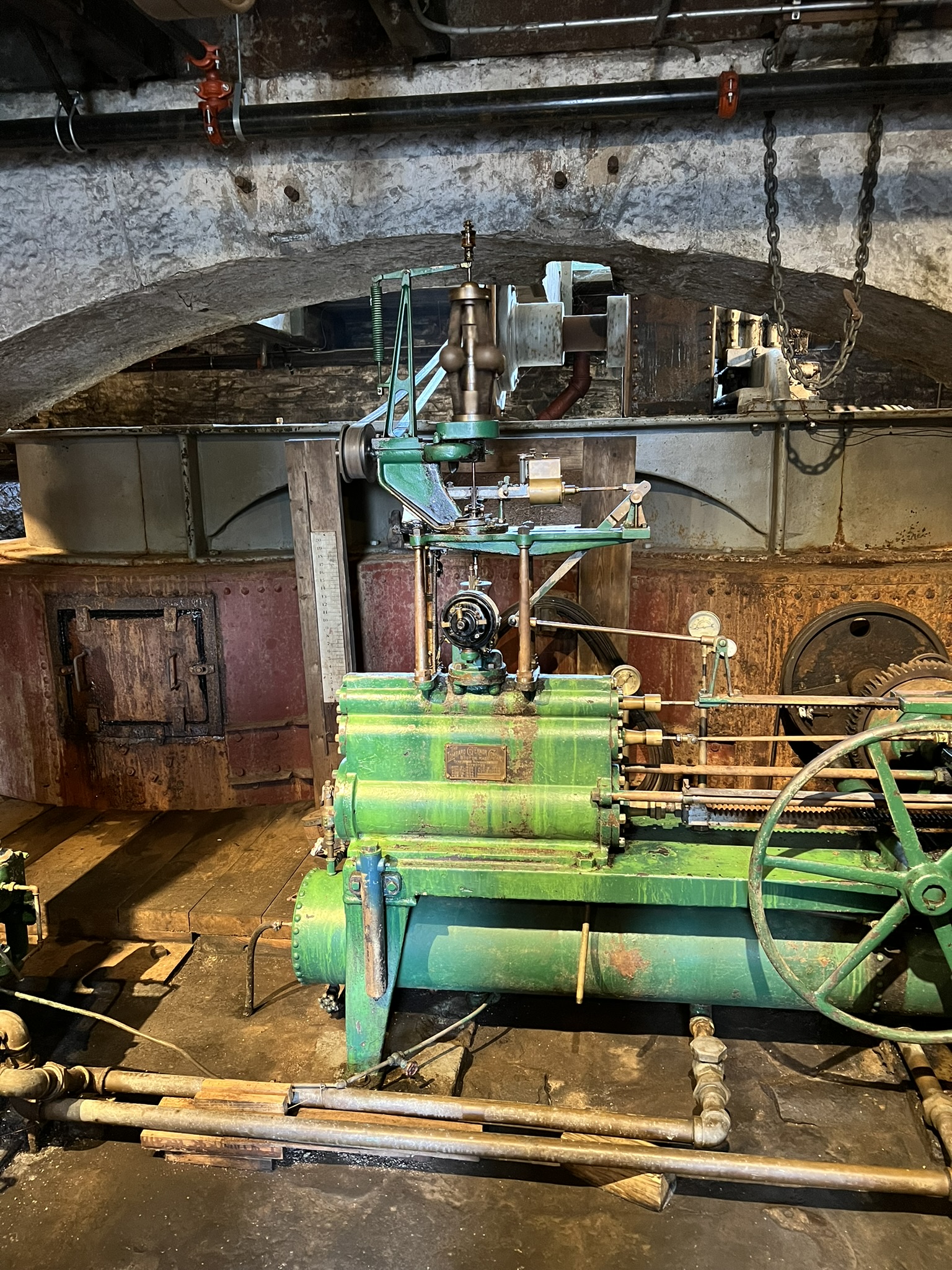
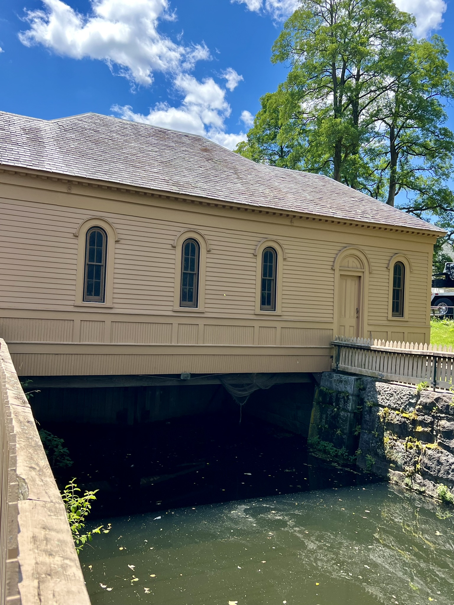
from left to right: view of the Northern Canal with the former Suffolk Mill to the right; a wheel and belt being powered by the turbine shown in the video above; the flyball governor which regulates the flow of water into the turbine.
After the tour we returned to the Boott Cotton Mills Museum. Entry is free with a National Parks Pass, or $6 for an adult pass (see the website for detailed pricing). The museum is very well done. The first floor is set up with looms as it would have looked when the mill was in operation and there are live weaving demonstrations. The second floor exhibits take you through the history of the city and textile production, the history of the workers, and a timeline of the revitalization efforts. As a final stop after leaving the museum, we visited an exhibit of what the original boardinghouse rooms may have looked like. The exhibit is housed within several rooms of one of the original Boott Cotton Mills boardinghouses. In its early days, the Lowell mills relied on “Mill Girls” – young New England farm girls who migrated to Lowell for wage work. Over time, the mills turned to immigrant labor, and the boardinghouses shut down as these immigrants moved into neighborhood housing. Many different immigrant communities sprung up in Lowell, including Polish, Irish, Greek and Portuguese. Their stories, as well as the stories of the original Mill Girls, are well represented throughout the Park. This summary just touches on the history of the place, and I encourage you to check it out for yourself.
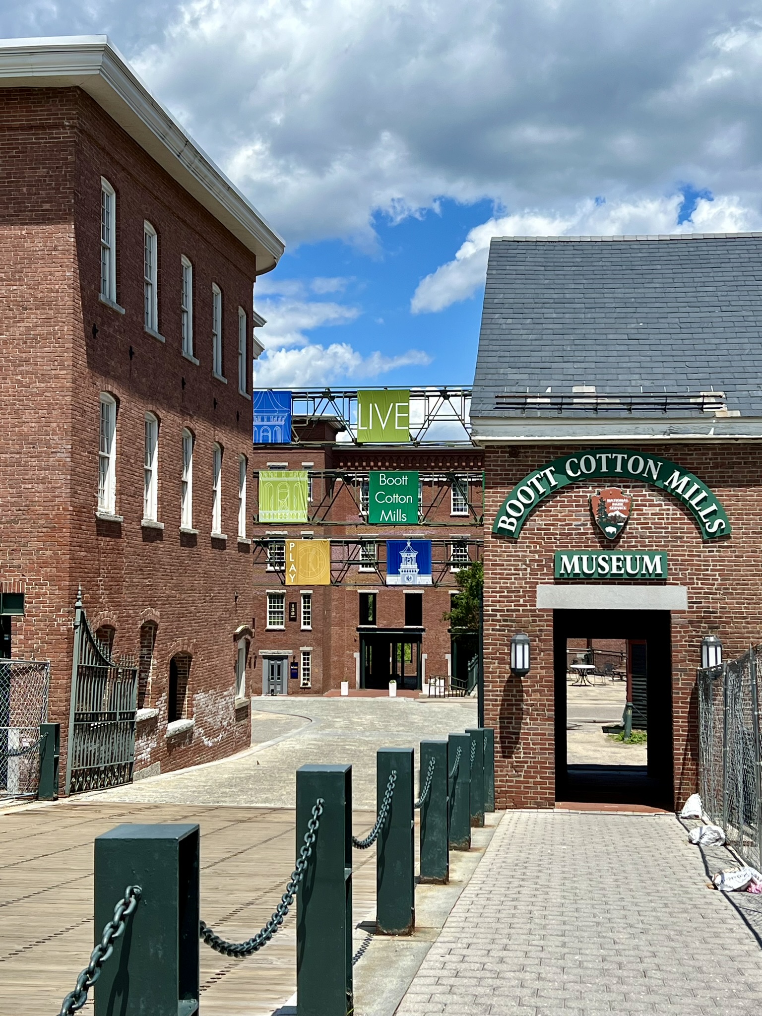
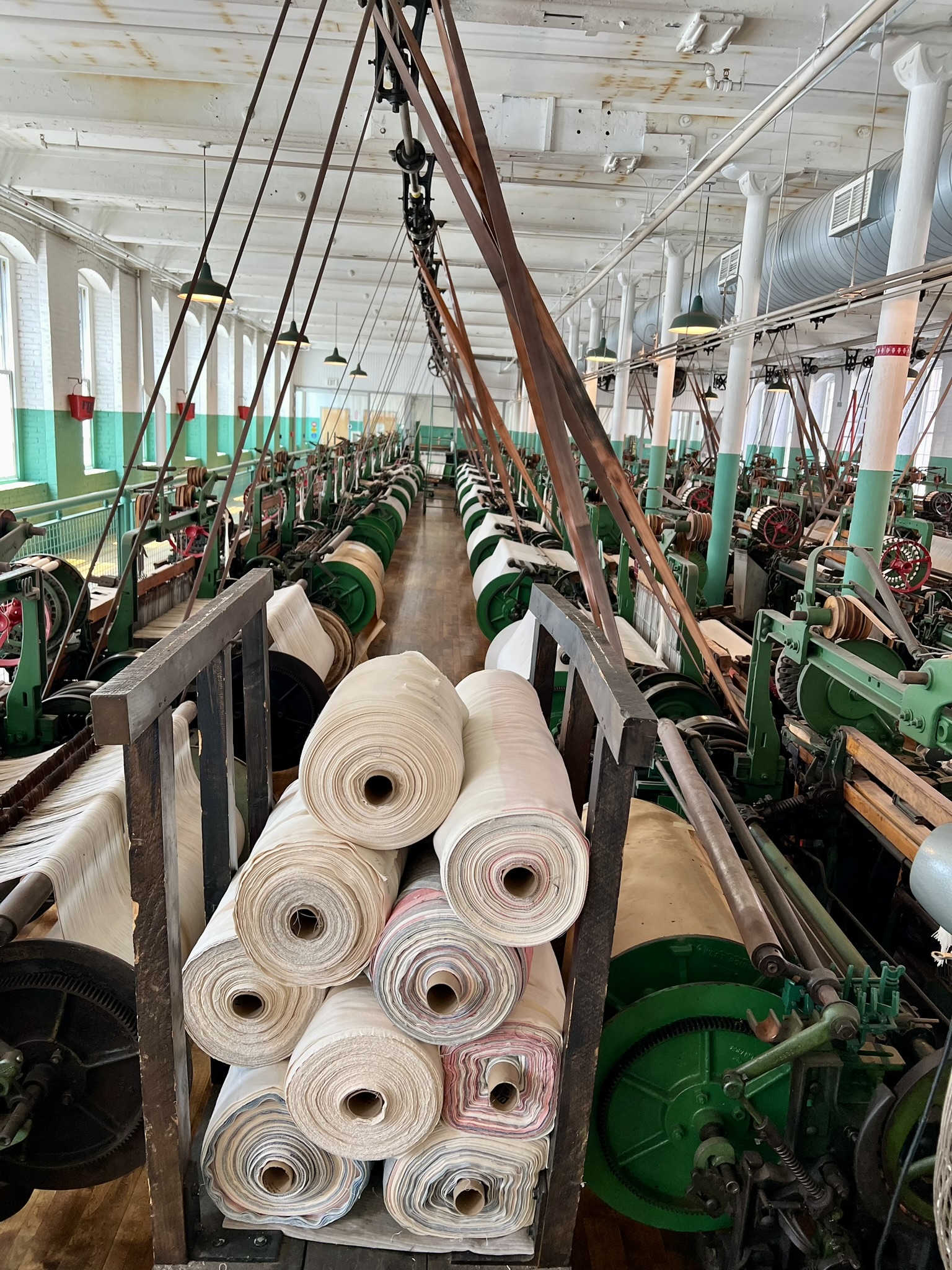
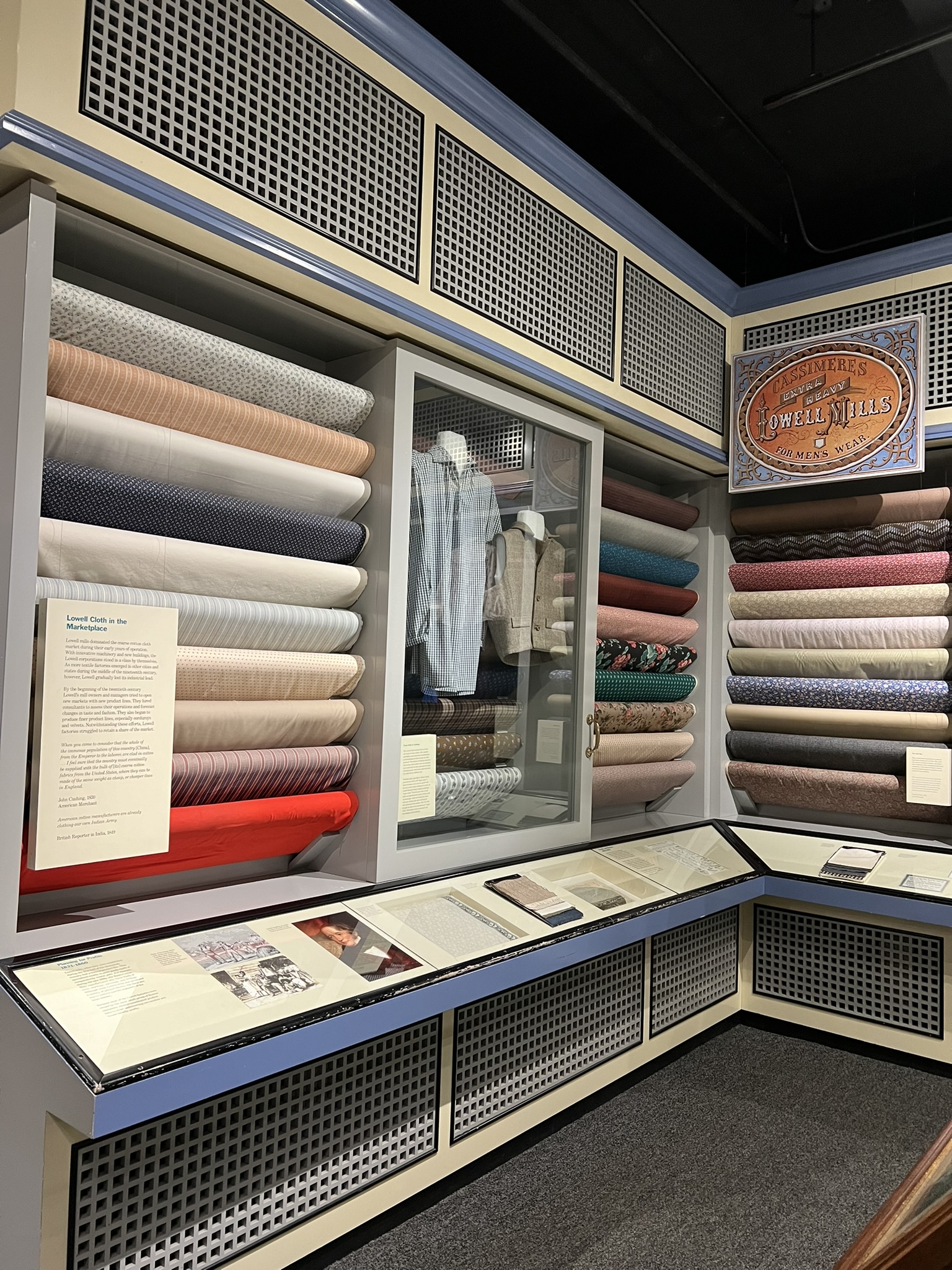
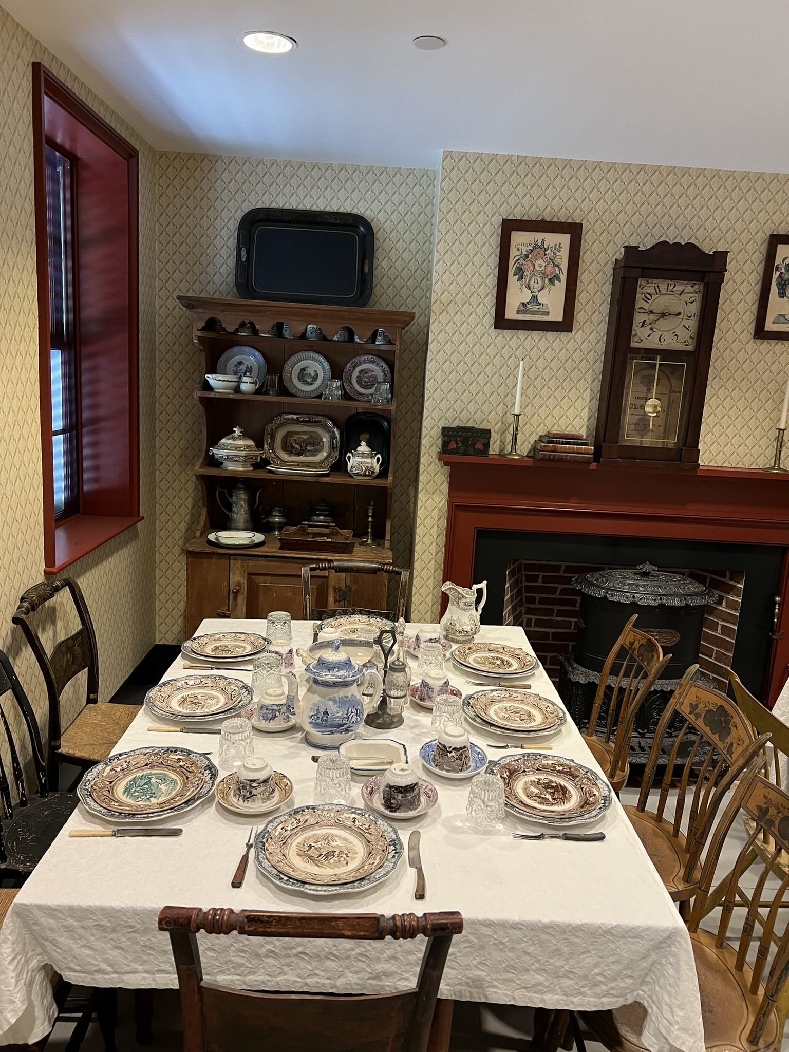
from left to right: Entrance to the Boott Cotton Mills Museum; the loom room; a museum exhibit about the types of textiles manufactured through the decades; the boardinghouse exhibit showing the dining room.
There are numerous Lowell landmarks I did not have a chance to explore on my first visit, including the Whistler House, the New England Quilting Museum, and several river and canal walks. Here are some AllTrails links for walking ideas in the area:
The Pawtucket and Merrimack Canal Walk
The Lowell Riverwalk (southern bank of the Merrimack)
The Merrimack Riverwalk (northern bank of the Merrimack)
Glastonbury CT Mill Sites
Across Connecticut there are many towns known for their history of textile production. I was drawn to explore Glastonbury first because of the existence of nature trails that skirted some of these old mill ruins. With the help of Google Maps, I identified three places to explore: Cotton Hollow, the Matson Hill Open Space, and the Shoddy Mill Preserve, which I visited in early July. When I sat down to write this Trail Talk in mid-July, I learned that the Town of Glastonbury had CLOSED COTTON HOLLOW PRESERVE as of July 16 until further notice. I gather that one of the reasons for the closure is the disappointing amount of trash we encountered. I have published the Cotton Hollow hikes in the hopes that it will reopen soon, but have added information about nearby Gay City State Park in Hebron as an alternative hiking location to combine with the other Glastonbury sites.
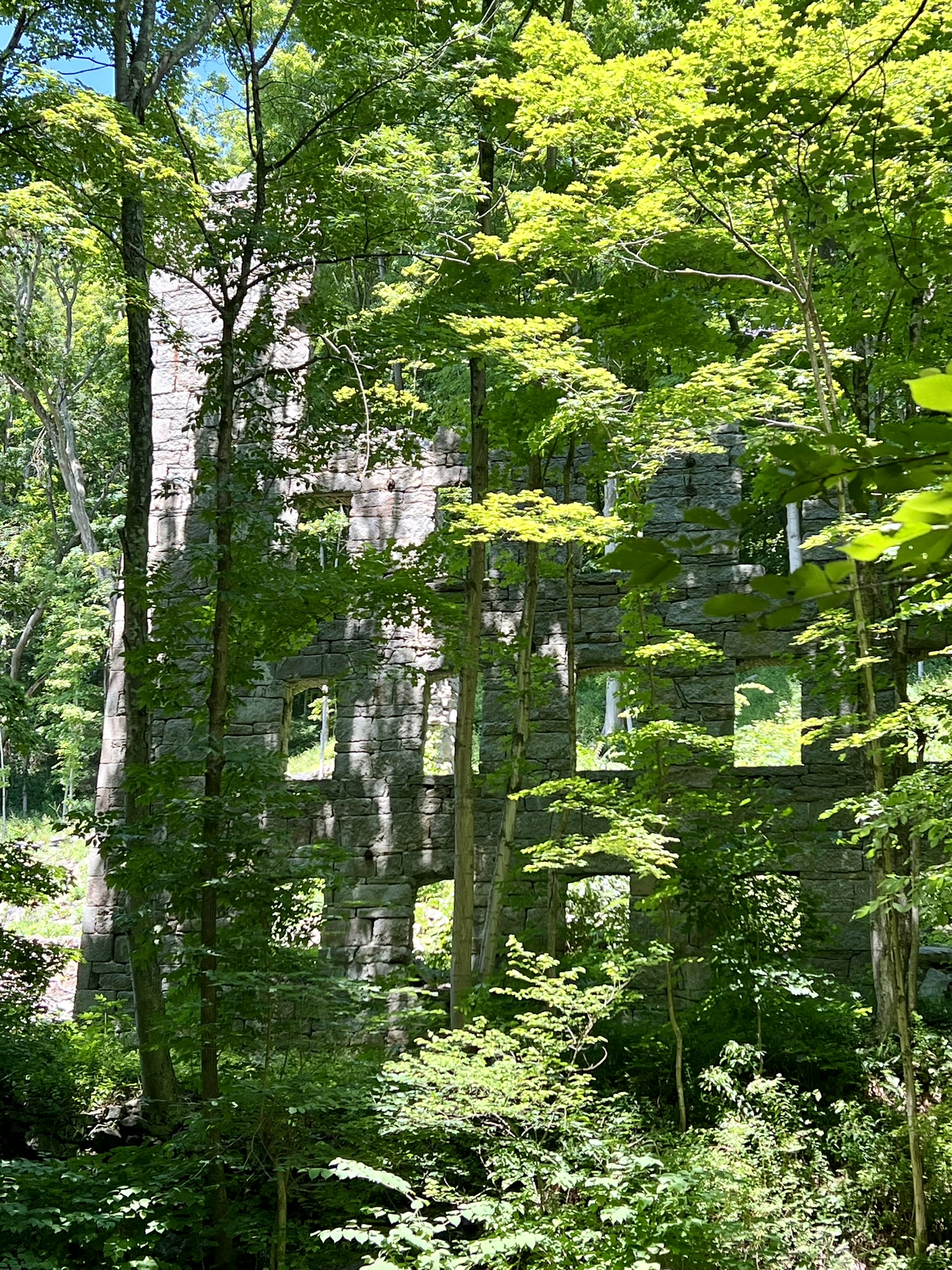
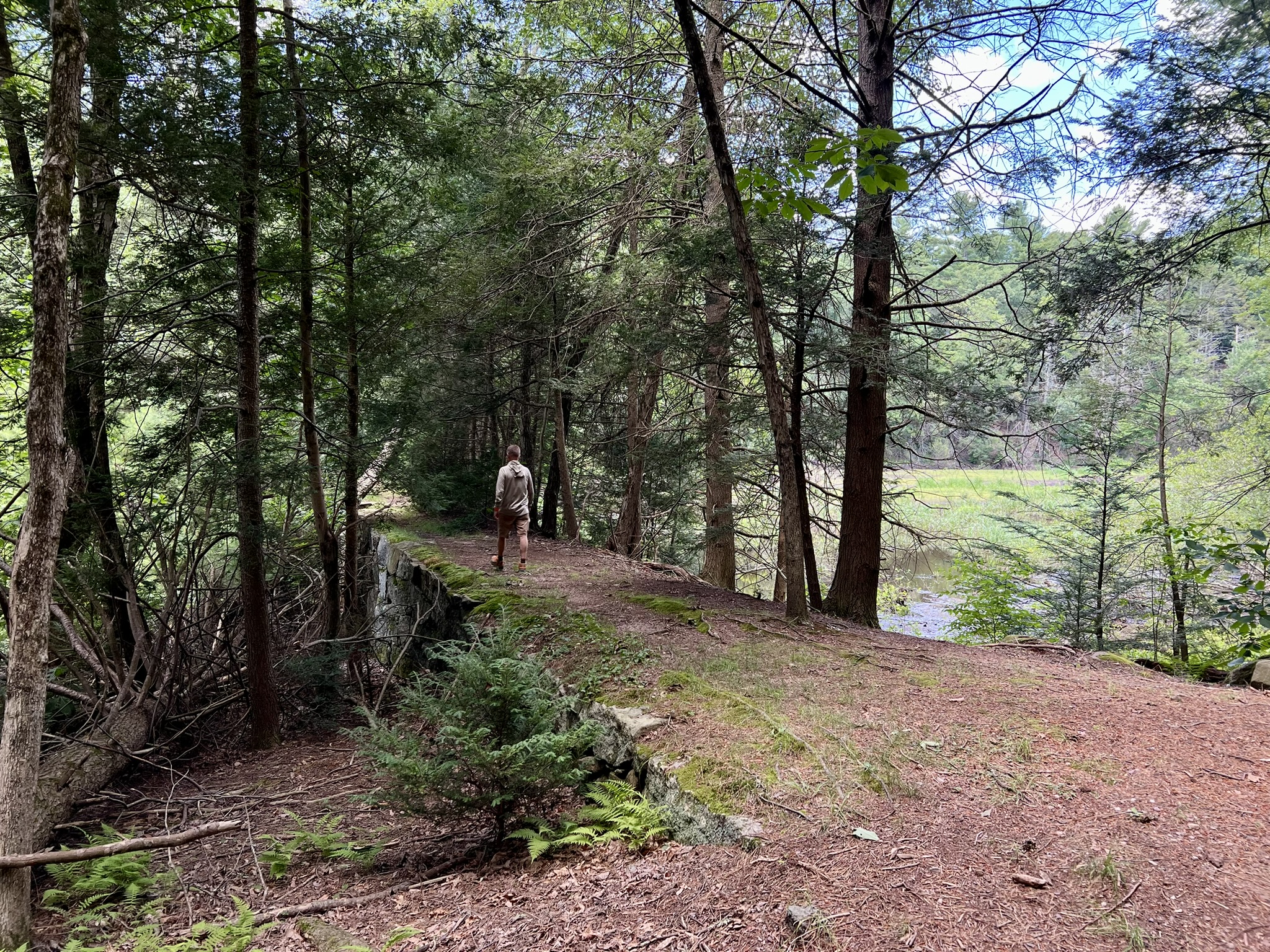
Cotton Hollow Preserve, Glastonbury.
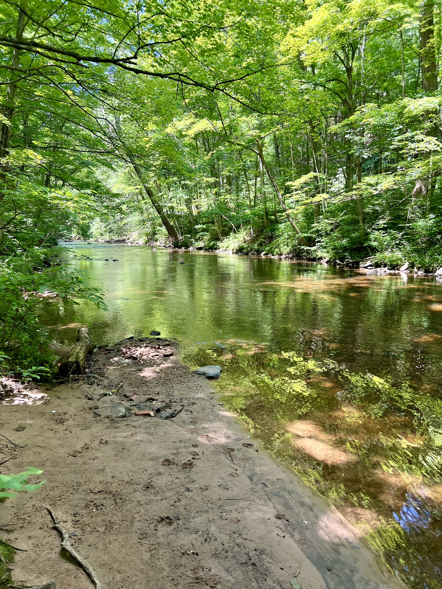
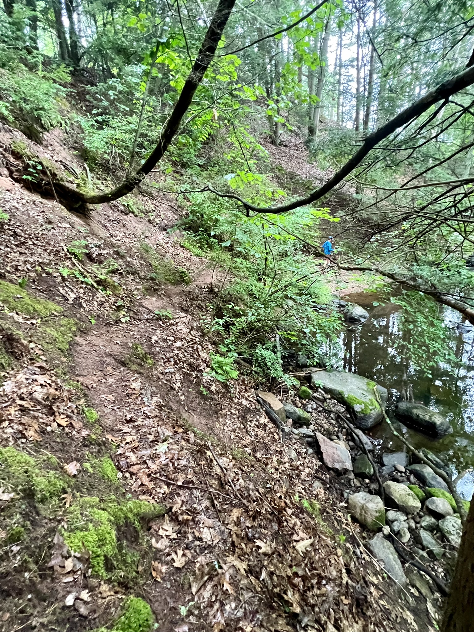
PLEASE NOTE THAT COTTON HOLLOW IS CLOSED UNTIL FURTHER NOTICE. To check on its status, go to the Town Website HERE. Cotton Hollow Preserve is divided into two sections (see the Trail Map HERE). The trail to the east is called the Cotton Hollow North Trail (marked in red on the map) and it goes along the northern bank of Roaring Brook. The trail to the west, marked in blue on the map, is called the Cotton Hollow Tree Trail and it follows along the southern bank of Roaring Brook. According to the Town’s website, “during the 18th and 19th centuries, the area was home to several grist mills, saw mills, iron foundries and a cotton mill.” This history is more visible on the Tree Trail, where you can see the ruins of a cotton mill built in 1814 by the Hartford Manufacturing Company.
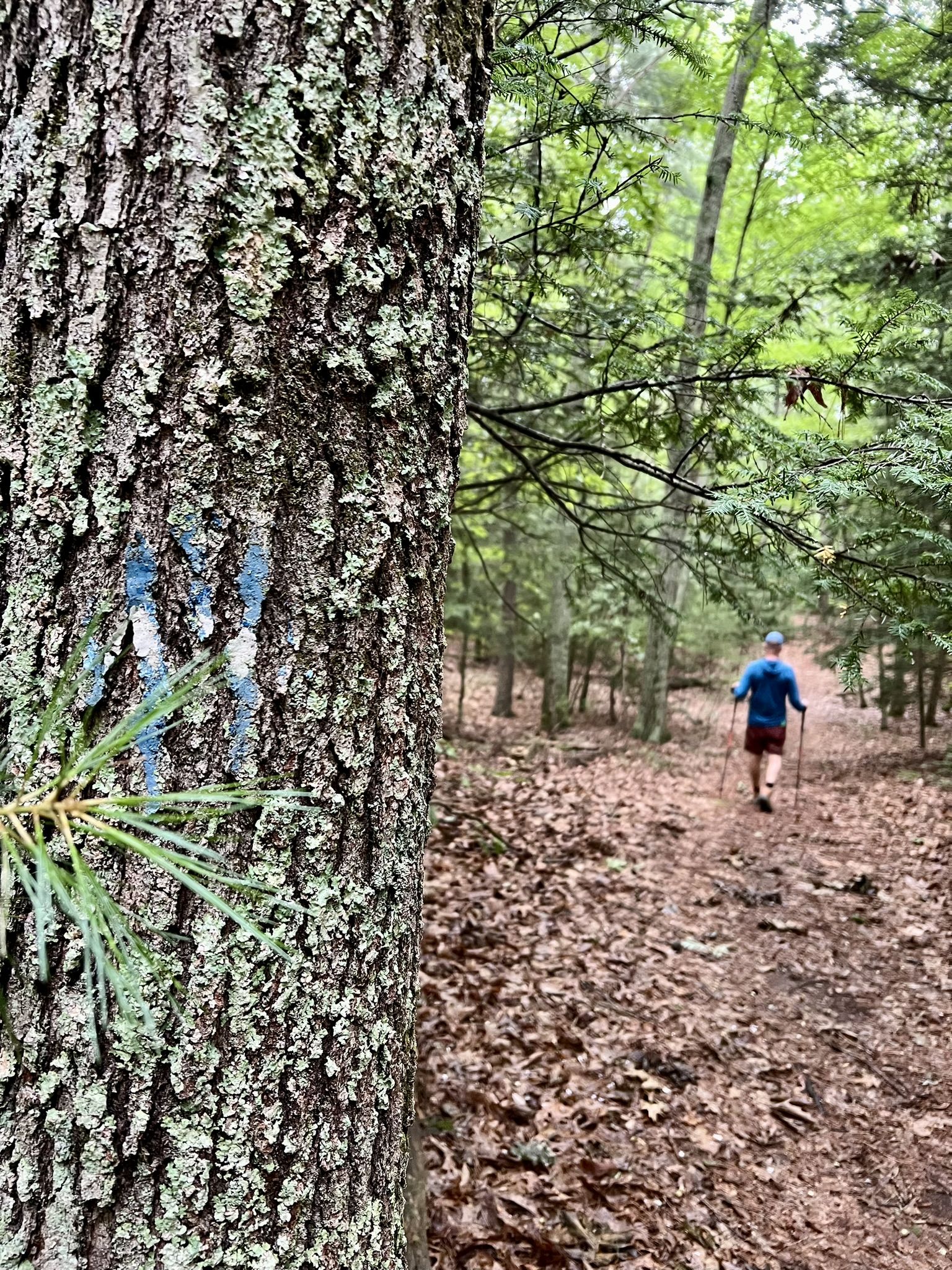
The North Trail. 1.25 miles out-and-back with approximately 160’ of ascent.
There is a parking lot on Hopewell Road next to the Grange Pool. The path starts by the sign listing the preserve rules and regulations. After a short descent to the brook, it goes along the water past a series of small falls and boulders. The trail is scenic and shady. There are places where the trail is cut into a steeper section of slope, and in combination with tree roots underfoot, please know that this trail is more moderate than easy. The trail dead ends at a higher rock cliff over a pool, which people obviously use as a swimming hole despite the Town’s discouragement. Unfortunately, this end point is also littered with a disappointing amount of trash, as is the short section of trail that leads up to it. This was a very enjoyable hike up until the turnaround point, and hopefully when it reopens people will be more respectful and practice Leave No Trace principles.
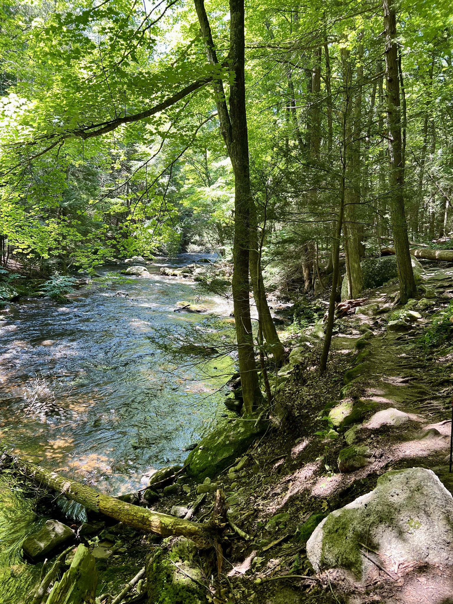

Scenes from along the trail, which was delightful with the exception of the final section
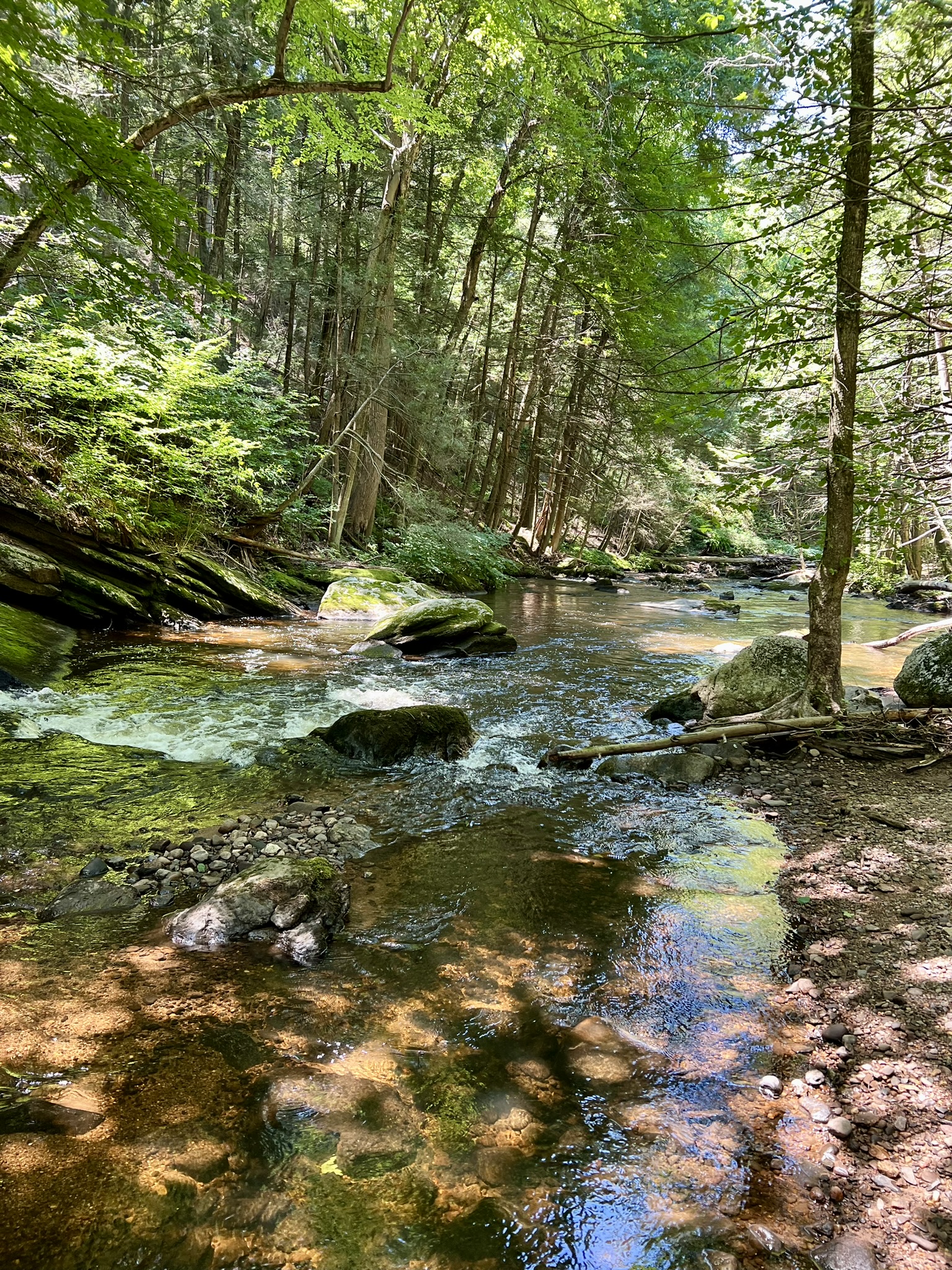
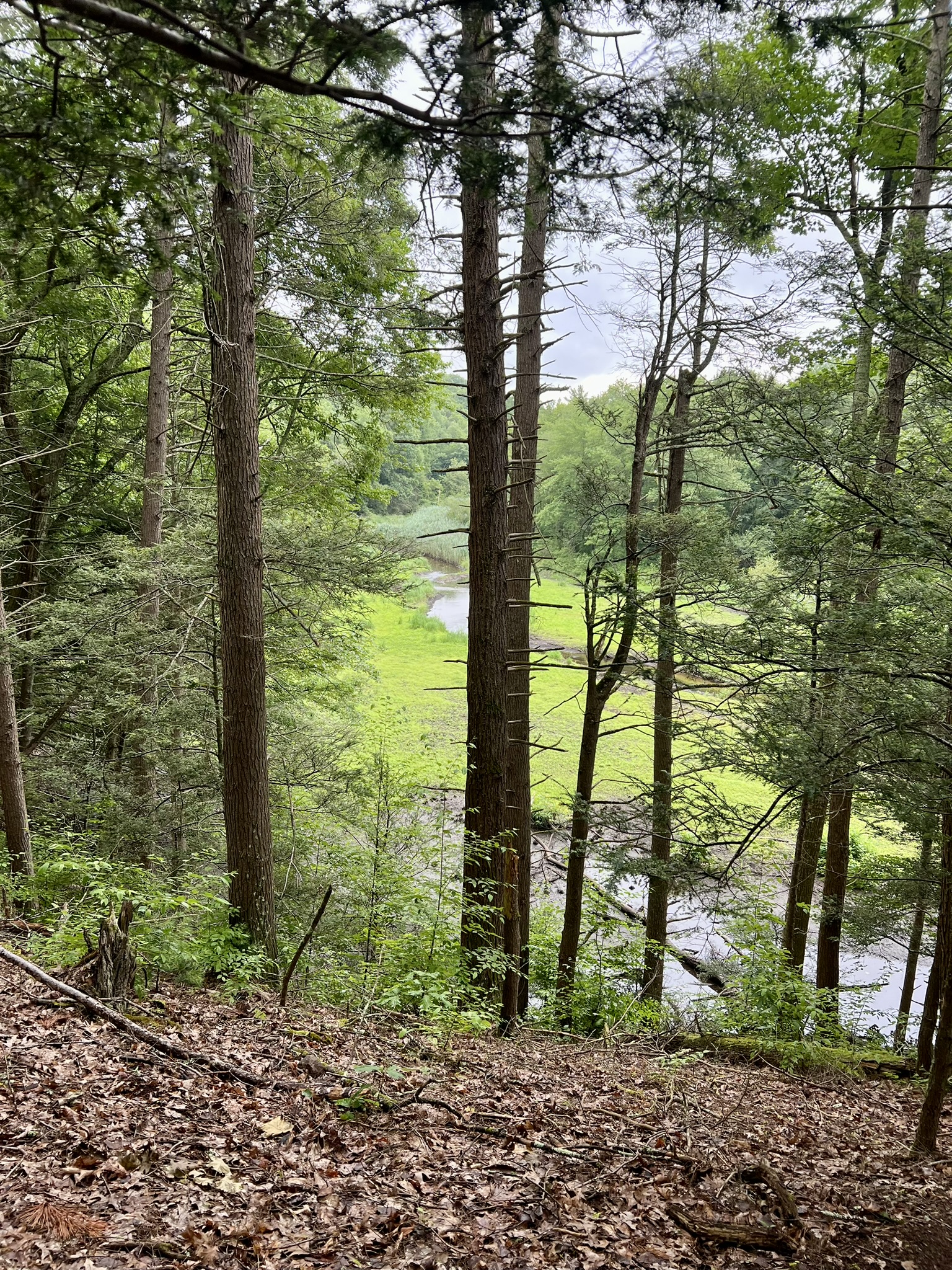
The Tree Trail. 1.25 miles out-and-back with approximately 135’ of ascent.
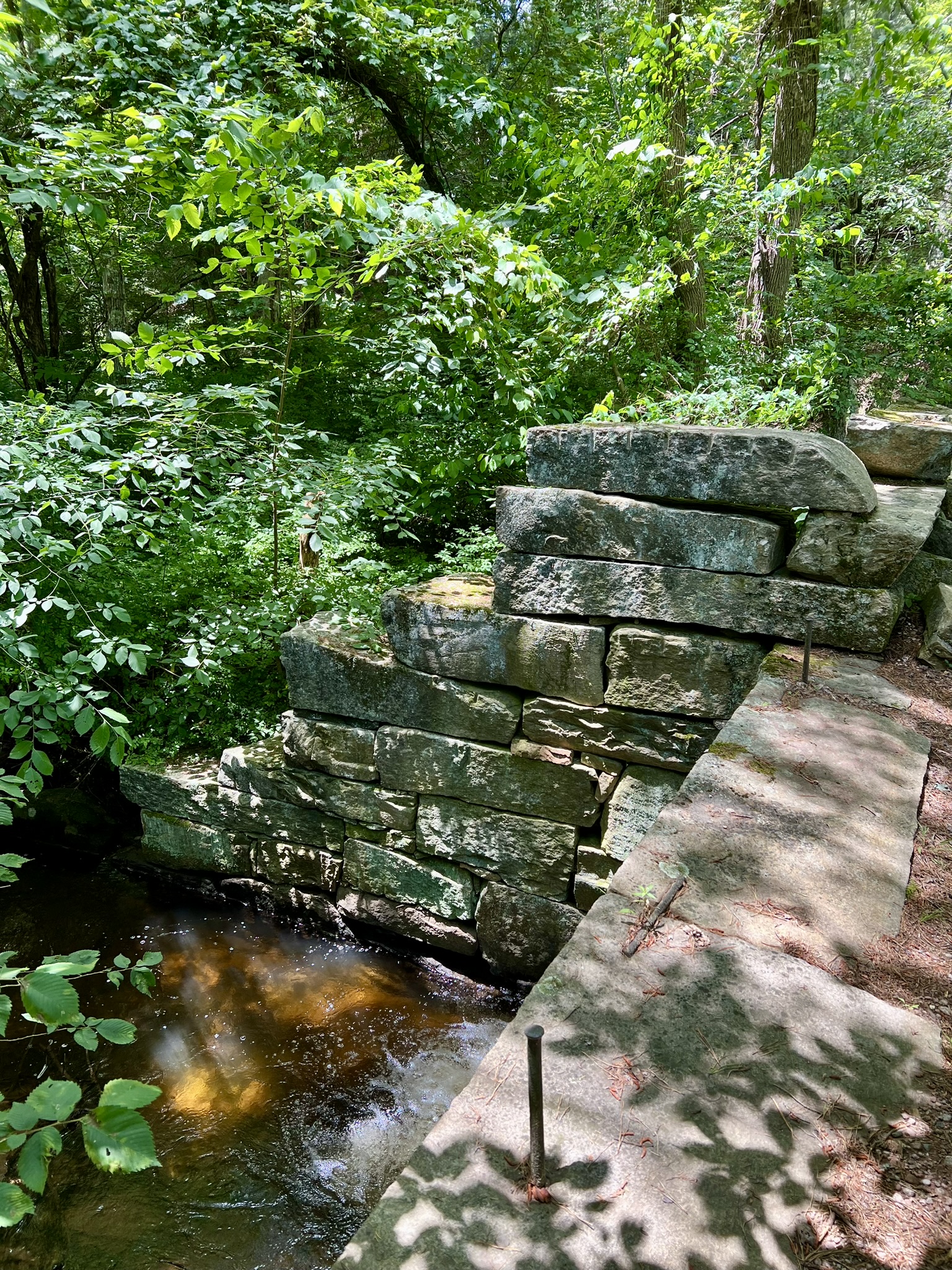
The Tree Trail starts from the back of the Cotton Hollow Kitchen’s parking lot on Sawmill Road where there is a dirt parking area that fits a few cars. This is an easier trail with one steep descent at the end to get to the stream bank on the opposite side from the mill ruins. The trail splits into a white and yellow section allowing for the chance to include a short loop in the midst of what is an out-and-back hike. There are several places along the yellow trail section that have excellent access to the brook. This ravine feels less remote than the North Trail because of the number of new homes built on the opposite (northern) bank, including one adjacent to the imposing ruins of the former Hartford Manufacturing Company mill which makes for quite the incongruous juxtaposition. In her book, Glastonbury: From Settlement to Suburb, Marjorie Grant McNulty writes:
“The company management had been drawn to the area because of a great stone dam, 50 feet high… This dam had been built by Pardon Brown, whose father-in-law, Col. Howell Woodbridge, owned land there. Pardon Brown, in the belief that Cotton Hollow had a great manufacturing future, built a brick mill on the brookside, where he made cotton sheeting. The tremendous force of the impounded water turned a wheel, supplying power for Brown’s mill with ample power to spare for the larger mill erected just above by the Hartford Manufacturing Company. Cotton Mill workers lived in a little community on both sides of Roaring Brook, occupying company-owned houses. They even had their own school and store.”
One of my favorite finds was a book by American artist John Warner Barber called Connecticut Historical Collections. Between 1834 and 1836 Barber spent the months of April to November traveling to every town in Connecticut to make sketches of ordinary life. During the winter months he used the sketches to create ink drawings and then engravings for his book. I found the entire publication online. Click HERE to go directly to the “Cotton Factory village” page. His original book describes the HMC mill as having “5,200 spindles and 135 looms in operation; 130 girls and 40 men and boys are employed.” As a bonus, I discovered a book in my local library entitled John Warner Barber’s Views of Connecticut Towns 1834-1836 published in 1990 by the Acorn Club. Each drawing includes an updated paragraph comparing what the scene looked like then versus in 1990. The Glastonbury summary was especially helpful to get a feel for the hollow in its heyday: “The two largest buildings are Pardon Brown’s woolen mill (c. 1804) and, to its left, the cotton mill (c. 1814) of the Hartford Manufacturing Company, the ruins of which still stand. Behind the cupola of Brown’s mill appears the rim of a fifty-foot dam…”
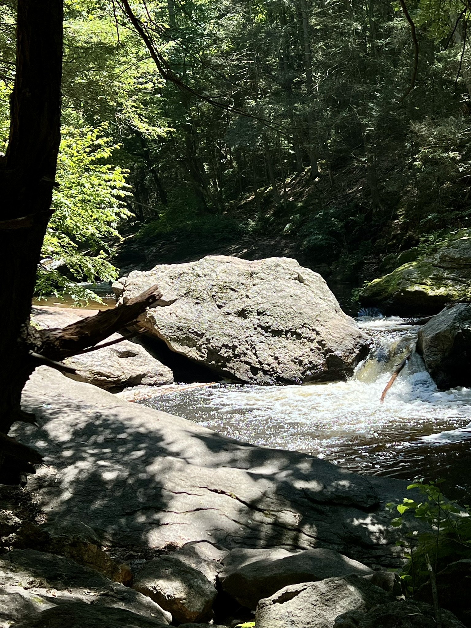
An informative site I found online is Lost Glastonbury. An article about the Cotton Hollow Dams explain that there were two dams – a 50’ dam with a 24’ dam built just downstream to “harness overflow water.” The larger dam was removed in 1904. The article links to this presentation about dams, with a focus on Glastonbury, by the CT Association of Conservation and Inland Wetlands Commissions, which includes several photographs (coincidentally there is a photo of one of the Merrimack River dams in Lowell MA). You can still see remains of the 24’ dam at the end of the Tree Trail opposite the mill ruins.
There is an active campaign underway to save the mill walls. According to the Save Cotton Hollow Mill website, a 1920 fire put an end to the business and the wall is all that remains.
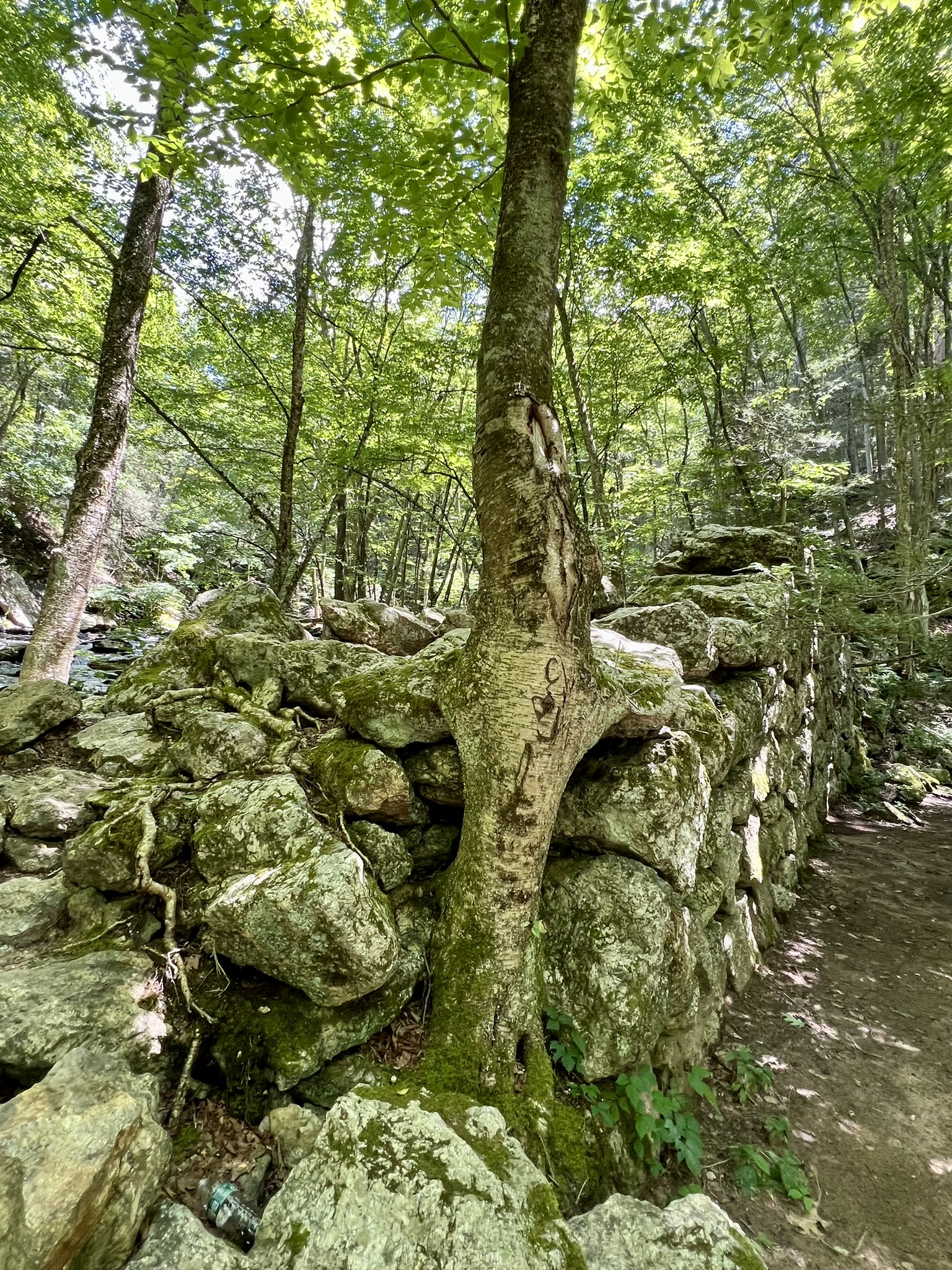
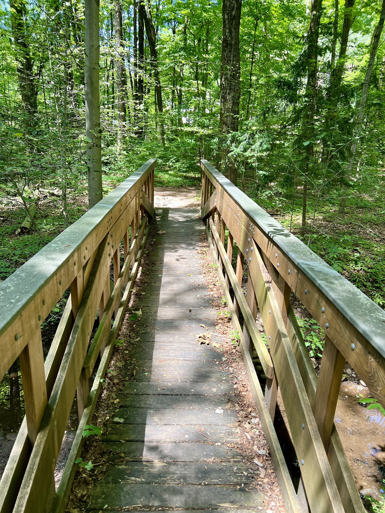
from left to right: the remains of the mill wall; remains of the dam; a footbridge along the trail; the yellow trail where it goes along the banks of Roaring Brook
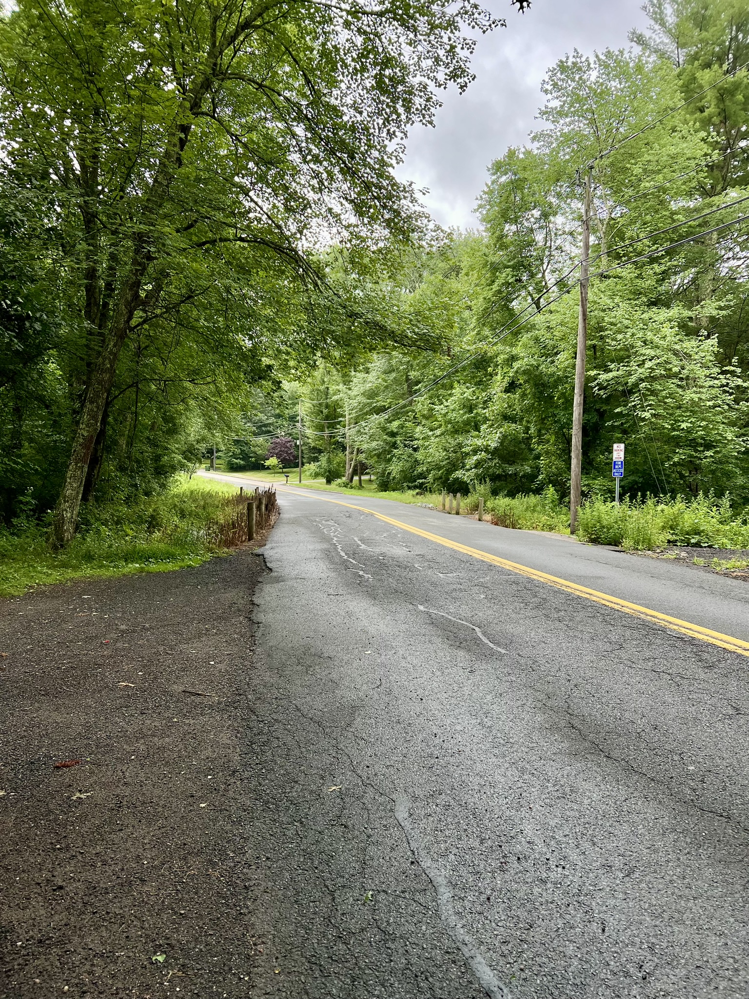
Matson Hill Open Space, Glastonbury.
This parcel of town land is just around the corner from the Cotton Hollow North Trail parking area and is the site of the former Glazier Manufacturing Company. At one time there were as many as 28 interconnected buildings on the property. The only remaining remnants are the granite foundation and brick chimney from the original mill built in 1836. Three storyboards scattered around the ruins describe the manufacturing history at this site. The dam on the Roaring Brook and the first mill were built by Amos and Sprowell Dean for producing satinet and woolen textiles. The mill ownership and management changed hands a few times and in 1909 was renamed Glazier Manufacturing Company. Through the years, Glazier kept up with the latest technology and moved from a water wheel to turbine power for increased efficiency which allowed for the production of higher quality garments. After the Great Depression there were a few more ownership changes until in 1956 it was purchased by J. T. Slocomb Company and used to build aerospace parts. In 2007 the Town of Glastonbury purchased the property. There are no trails, but there is a picnic table with two benches under the shade of a tree near the brook that offers a nice place for a picnic lunch between stops. For more information and for directions click HERE.
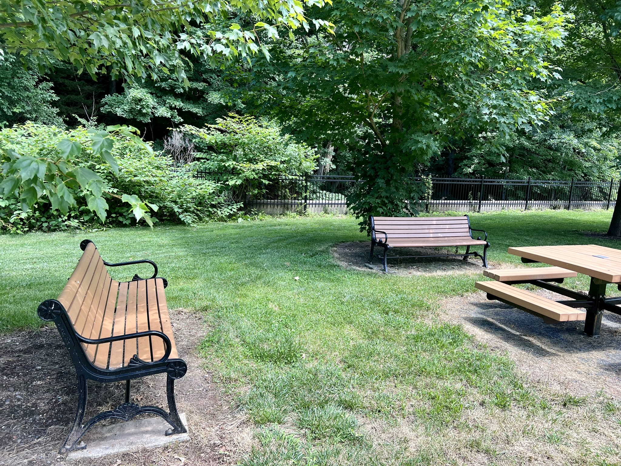
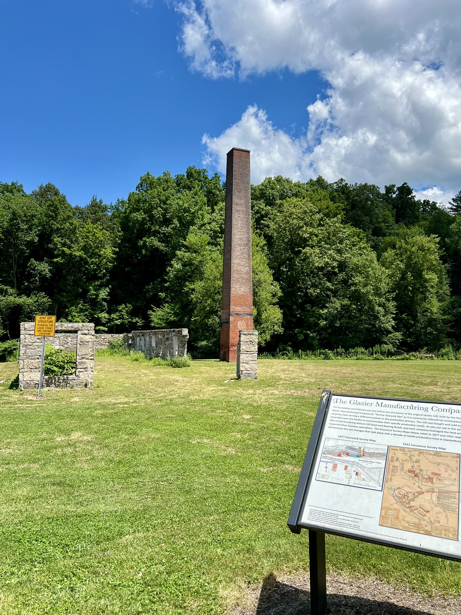

Picnic facilities along the banks of Roaring Brook; the remains of the original 1836 mill
Shoddy Mill Preserve, Glastonbury.
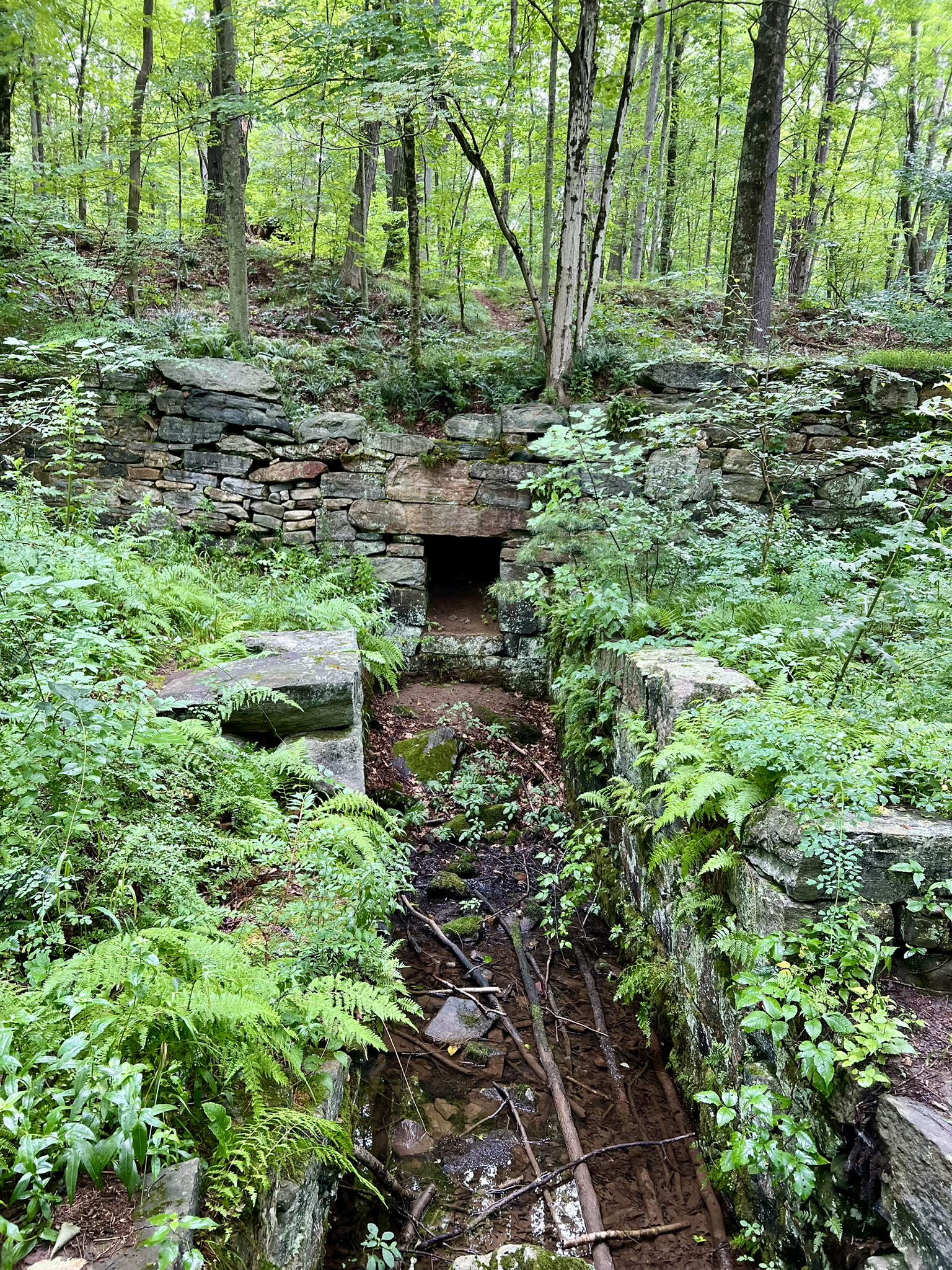
When I first discovered Shoddy Mill Preserve, my first thought was how odd that name was – like naming it “Bad Quality Mill”. I soon learned that the adjective that is so familiar today was based on an actual textile product called “shoddy”. According to the Town’s website, “the mill produced ‘shoddy’ – reclaimed wool, usually made from rags, which can be processed into felt or fabric of inferior quality.” The Preserve is 77 acres and was acquired by the Town of Glastonbury in the 1960’s. There are two trails you can explore. The shorter East Trail is less used, but is the best for getting up close to the dam.
East Trail. .6 miles, mostly flat.
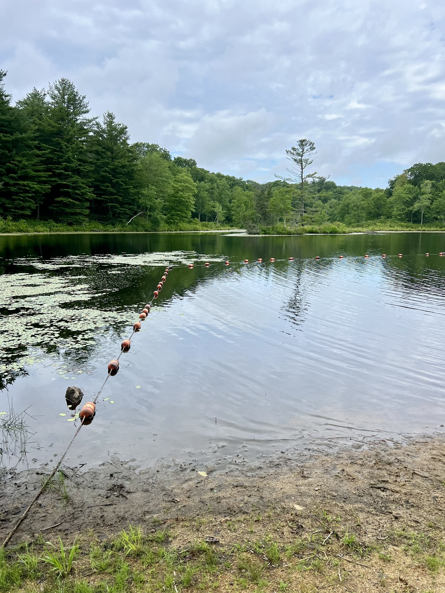
The trailhead is not well-marked and the trail blazes are too faded to be able to follow effectively. However, with the combination of the trail map and description and AllTrails, it is easy to find. From the parking pullout at 111 Shoddy Mill Road continue east over the bridge and watch for an overgrown trail entrance on the left. The trail is flat and bordered by ferns. There is a short section that is quite overgrown in summer, so long pants are advisable. The trail then opens up into a pine forest and veers left where you will see the dam. The dam is surprisingly well built and I recommend following it to its end where you can see the work of some industrious beavers who have helped keep the old pond intact.
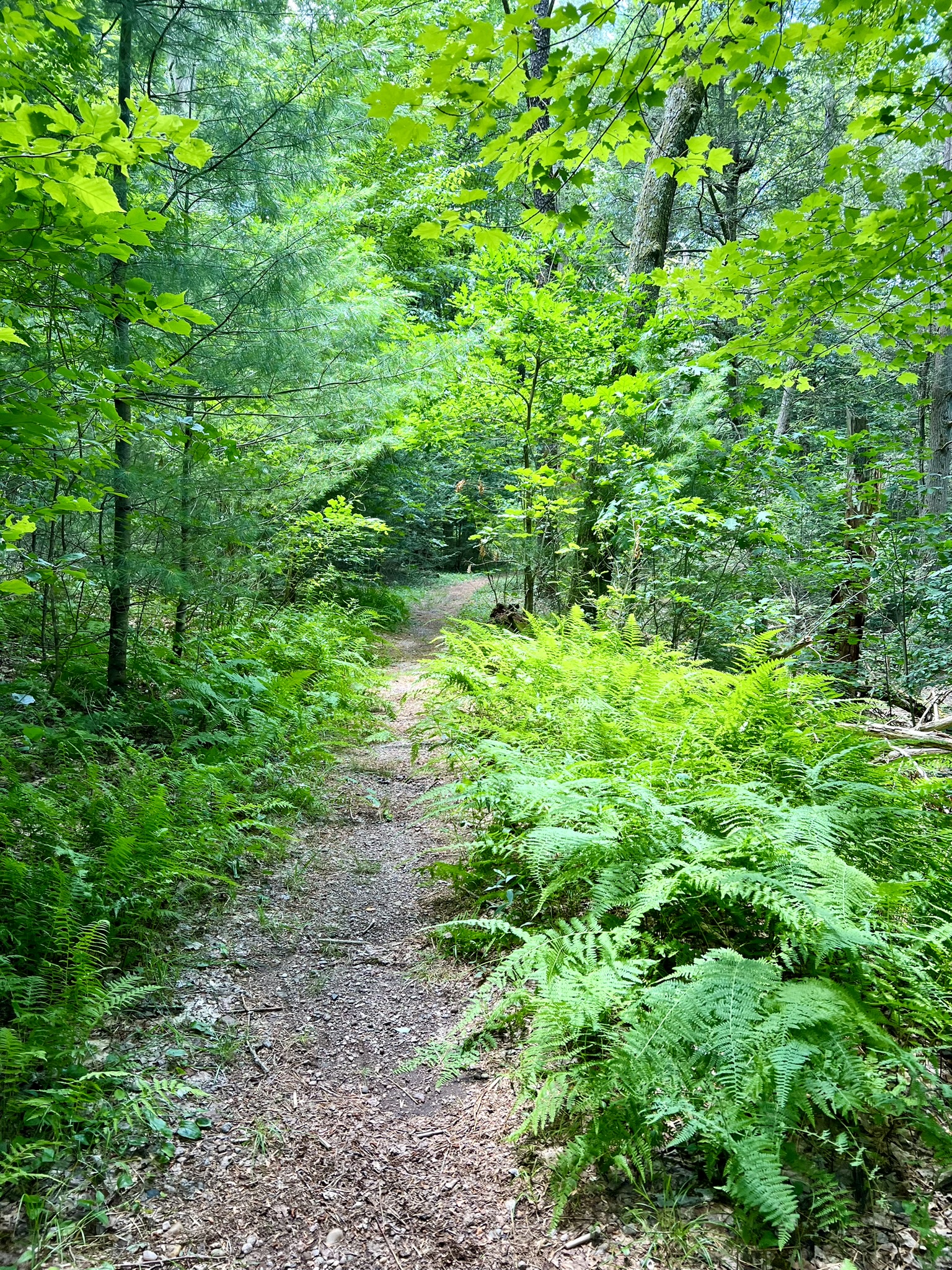
from left to right: the parking pullout on Shoddy Mill Road; typical section of path; heading out onto the old dam; the exceptional workmanship on the stone dam is evident
West Trail. Approximately one mile loop. Less than 100′ of total ascent.
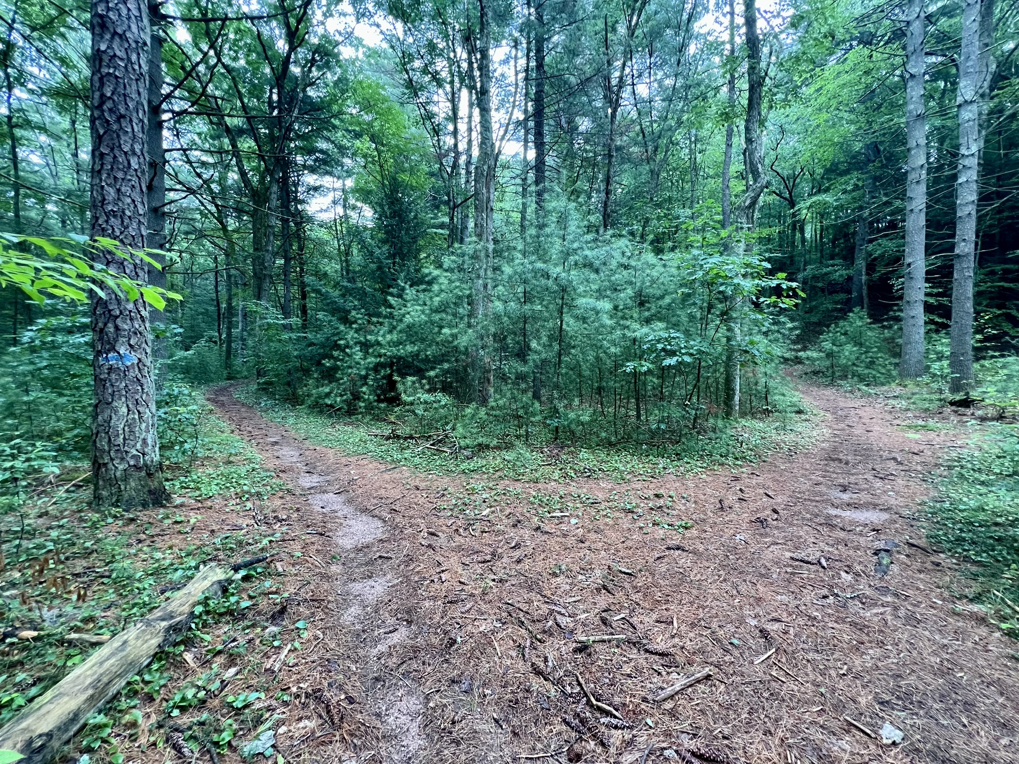
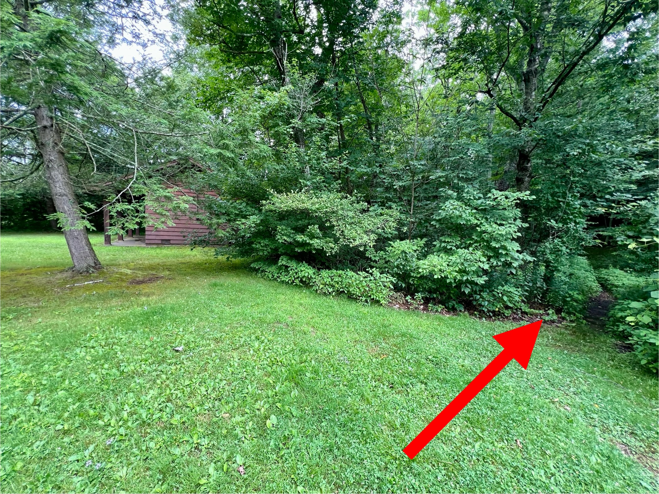
The West Trail starts at the parking pullout. The town description says the trail “turns left on the gas pipeline for about 70 paces before turning north into pine forest”, however, I don’t recommend this route in summer as the gas right-of-way is completely overgrown. Instead, continue straight and at the first fork, stay left. We made the mistake of following the path to the right, where it descends to the brook. This is a very sketchy section of trail due to its narrow and sloping nature. At the next trail fork you can go either way to complete the loop, but it may be easier to follow if you go clockwise (taking the path to the left). The blue and white blazes are faded and infrequent, so I found it helpful to also use AllTrails to double check the route. The trail goes through a lovely section of pine forest before climbing the ridge and heading back south. The AllTrails route does a slightly different loop at the northern end – we followed the path shown on the town trail map by turning right at the big blue arrow. There are some nice views of the old mill pond and brook from above as you get closer to the dam site.
From left to right: I recommend avoiding this sketchy section of trail; the split where the blue arrow points to the right; example of a faded trail blaze; view of the brook and old mill pond.
Gay City State Park, Hebron.
Only 9 miles away from Shoddy Mill Preserve, Gay City State Park has picnic facilities, a small swimming pond, and miles of trails to explore. It also has….MILL RUINS!
According to the DEEP website “The name ‘Gay City’ derives from a now-extinct mill town that once occupied the site.…[A] woolen mill … 1/4 mile below the present pond was a successful business until extreme pressures caused by the various blockades during the War of 1812 brought its closing. Once revived, the mill burned to the ground in 1830, beginning the town’s decline with the exodus of many people to urban factory jobs. [Construction of] a paper mill …again revived the town somewhat until the Civil War, when many of the town’s younger men were killed in battle. Soon after, the mill burned down, triggering the final demise of Gay City and nature’s reclaiming of the land.”
During our July visit, we did a two mile loop past the mill ruins and swimming pond, finishing with a short woods walk. We parked in the first dirt parking area on the right after passing the entrance guard shack. Before starting our hike we walked a short distance back toward the park entrance and visited the small cemetery at the edge of the woods near the shack. Several members of the Gay family are buried in this family cemetery. For our hike, we followed the park road and stayed straight on the blue-blazed trail where the road curves to the right. This wide cart path continues to a footbridge over the Blackledge River. Just before the bridge, take the white trail north past the mill ruins. When the white trail exits the woods by the pond we stayed right and walked up to the main parking area. From there, off the western (left) side there is a small outbuilding and an unmarked trail into the woods. This joins the white trail, where we turned right and followed it as it looped up and around to finish in the parking lot where we started. You can shorten your hike by turning off the white trail onto the red/yellow trail which comes out on the park road. You can plan a longer hike using the Trail Map. If you decide to do a longer hike, please check the kiosks for the status of the Red Trail footbridge over the Blackledge River, which was still washed out at the time of our visit.
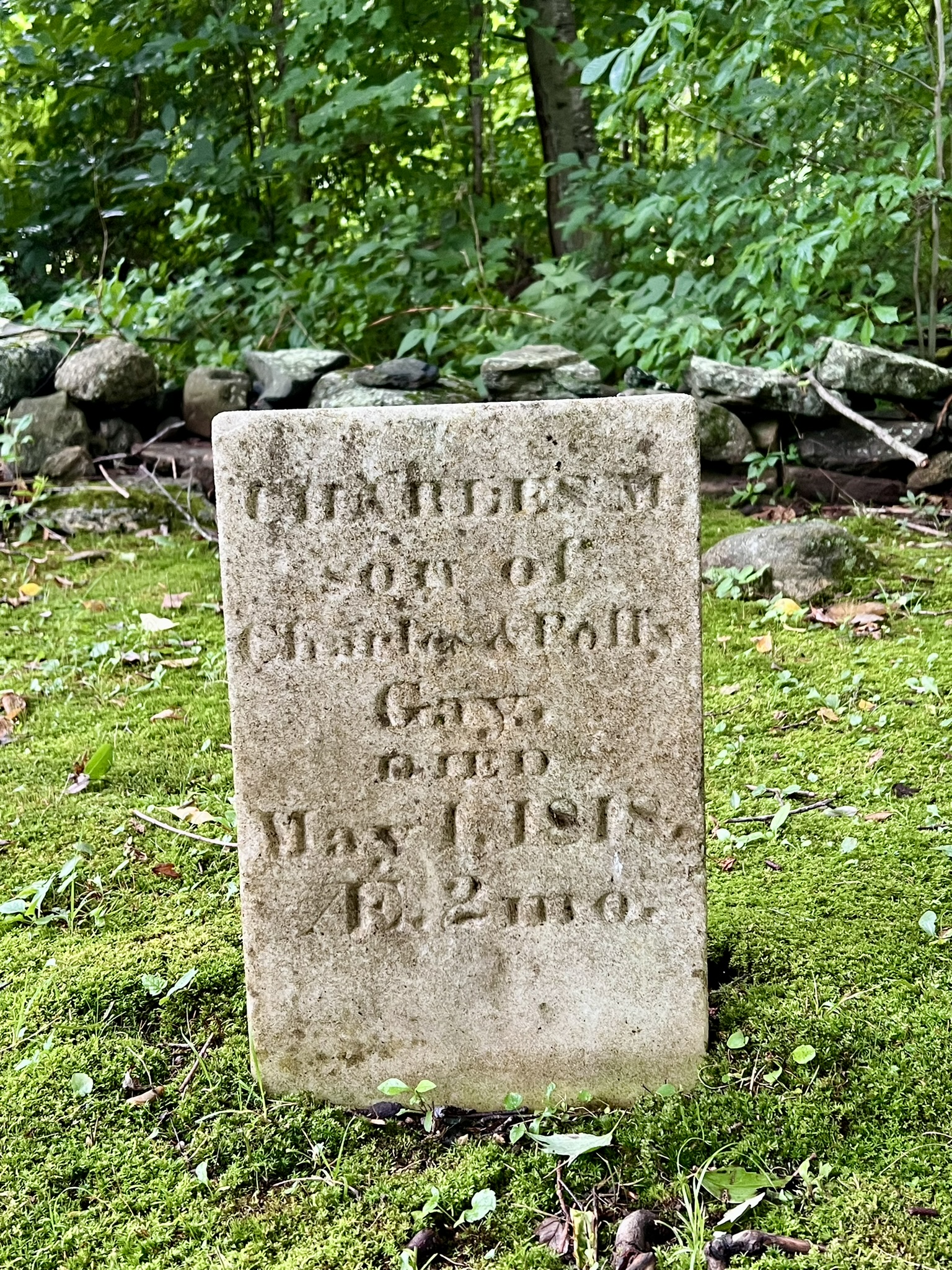
from left to right: one of the headstones in the cemetery; remains from one of the old mills; the swimming area at the pond; the location of the unmarked shortcut to the white trail
BIBLIOGRAPHY
Smuggler Nation: How Illicit Trade Made America, by Peter Andreas (2013)
Yankee Dreamers and Doers: The History of Connecticut Manufacturing, by Ellsworth S. Grant (a publication of the Connecticut Historical Society)
Lowell: The Story of an Industrial City (An Official National Park Handbook)
Glastonbury: From Settlement to Suburb, by Marjorie Grant McNulty (1970)
Connecticut Historical Collections, by John Warner Barber (1836)
Lost Glastonbury website, with information about numerous ruins in Glastonbury https://lostglastonbury.com/
Lost Glastonbury article about Shoddy Mill Preserve https://lostglastonbury.com/2016/07/15/shoddy-mill-preserve/
Explore CT article on Shoddy Mill Preserve https://explorect.org/shoddy-mill-preserve/
CTMQ article on Shoddy Mill Preserve https://www.ctmq.org/shoddy-mill-preserve/
Subscribe to Trail Talk
your next adventure awaits
Questions? Email me at naturenerdsramble@gmail.com or find me on Instagram @the_real_nature_renee.