Earlier this spring I decided to purposefully explore trails in Connecticut that had some river views or access. This endeavor has been both challenging and fun, and I have only just begun! When our first heat wave hit in mid-June, with temperatures creeping up into the 90’s with high humidity, I was glad to have started this project, as river trails seemed like the ideal topic for my July Trail Talk — a month when we could all use some soothing water therapy. In this post I share with you some of my findings to date, with the promise of more to come.
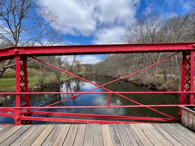
(photo to right: Historic red bridge in Meriden, CT)
Linear Gorge Trail, Meriden. 3 miles.
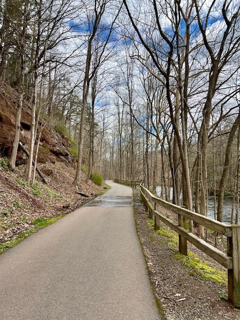
In 2006 construction was completed on an accessible paved trail that runs alongside the Quinnipiac River on the rail bed of the old Meriden, Waterbury and Connecticut River railway line. The trail starts at the iconic red bridge built in 1891 which is listed on the National Register of Historic Places. The bridge is one of a handful of surviving lenticular truss bridges in the state, and is open to pedestrian traffic only. Some parking is available on River Road by the red bridge. If that is full, there is a larger lot nearby on Oregon Road at Dossin Beach Park by Hanover Pond. From that parking lot the walk out-and-back is 3 miles. According to The Quinnipiac River Fund’s website, the “headwaters form at the Deadwood Swamp on the New Britain-Farmington border. The river then meanders south for 38 miles, through Meriden and Wallingford, and ultimately drains into New Haven Harbor and Long Island Sound.” A signboard along the river walk explains that “during the early 19th century, dams along the upper reaches of the Quinnipiac River and several of its tributaries powered budding industrial activity in the region.” The signboard goes on to showcase recent river restoration efforts involving dam removal and the installation of fishways around remaining dams to allow for migratory restoration. We visited on a warm, sunny Sunday in early April and there were many families out strolling. The early spring wildflowers had emerged with carpets of blooming trout lilies and a few bloodroot.
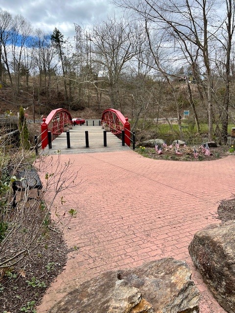
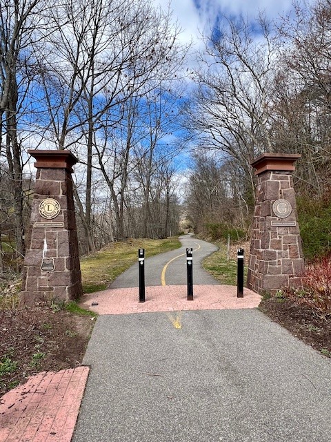
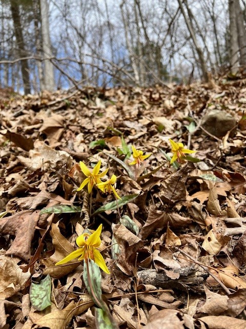

From left to right: the 1891 Red Bridge; the pillars marking the start of the trail; Trout lilies in bloom in April; Bloodroot on the trail
The entire path is tree-lined, which should provide welcome shade in the summer months. Eighteen of these trees have numbered signs with the name of the tree. For information about each tree species you can refer to THIS DOCUMENT on the Town’s website. The rock cliffs of the gorge are impressive, with reddish siltstone. Evidence of falling rock abounds. We admired a mallard duck pair in a small vernal pool near the end of the trail. There are places where you can walk down to the edge of the river, numerous benches for resting, and kiosks with historical information. Going in the other direction from the Dossin Beach Park parking lot is the Hanover Pond Trail, which we did not have time to explore. Even if you don’t either, it is worth reading about the history of the pond at the kiosk in the parking lot. In 2012, the CT Greenways Council recognized the River Gorge Trail as a designated Greenway. For more information about trail click HERE. There have been several other trails projects in neighboring towns along the Quinnipiac River. I have not yet explored them, but more information is available at THIS PAGE on the Quinnipiac River Fund website.
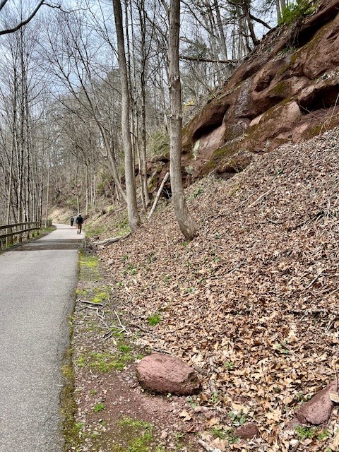

From left to right: Views in both directions showing the red sillstone gorge and loose rock; one of several resting places with benches and a kiosk with historical information
Blinnshed Ridge and Neck River Trails, Madison. 3.5 miles with approximately 210’ of ascent.

On a sunny, crisp morning in mid-June I set out to walk two contiguous Madison Land Conservation Trust (MLCT) trails – the Blinnshed Ridge Trail (click HERE for map and description) and the Neck River Trail (click HERE for map and description). Both properties are on a combination of State and Land Trust property. The northern section of the Blinnshed Ridge Trail is on private property owned by The Country School (TCS). If you are hiking on weekdays between the hours of 8:00am and 5:00pm please start your hike from the southern Neck River trailhead on Opening Hill Road and only go as far north as the TCS property boundary. TCS maintains a closed campus during school hours for the safety of their students. Outside of those hours, feel free to park in the TCS lot. The trailhead starts by the school driveway entrance on Blinnshed Road. Because I was hiking during school hours, I parked at the Neck River Trail trailhead where there is a pullout that accommodates 3 to 4 cars. The MLCT does a great job marking their trails for hikers and posting trail map kiosks at every junction with location keys.
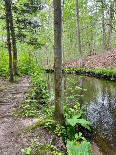
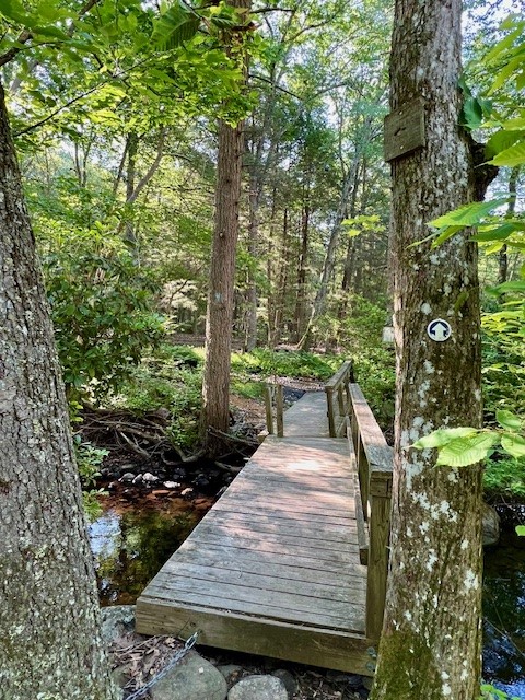
To start my hike I stayed straight at the first two junctions as my plan was to hike the Blinnshed Ridge section first. The woods were alive with birdsong and a tangle of summer plants. When I reached the 2C junction on the map I turned left to make my way down to the banks of the Neck River. At the time of my visit we were in a dry spell, but this section of wetlands can be quite muddy during wetter weather. The stretch along the Neck River was very tranquil. You can see where the high water line is when the river rages in the spring. This is also a pretty spot in April for spring wildflowers such as trout lilies. A pair of mallard ducks swam back and forth in the light current. The trail crosses the power line corridor. Be careful in this short section as there is poison ivy along the edges. After reentering the woods, at the next trail split I turned right and headed up a short steep section to access the ridge.

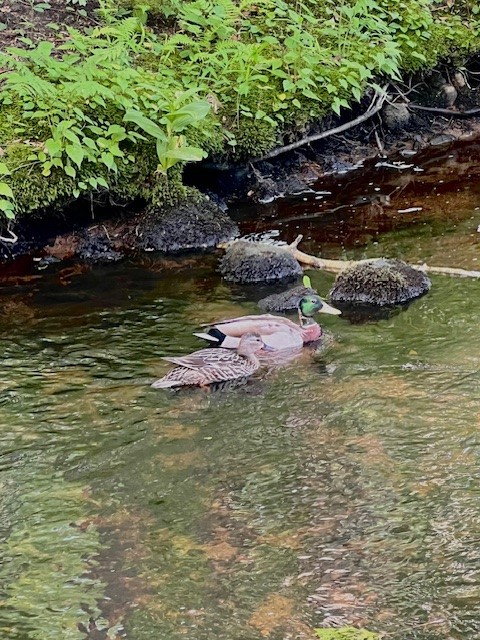
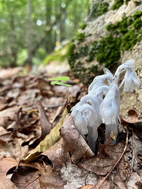
From left to right: the tranquil Neck River; a pair of mallard ducks; the trail rises steeply to get to the Blinnshed Ridge; Monotropa uniflora (Ghost Pipes) emerging.
I followed this through the woodlands and across several footbridges until I reached TCS property where a sign kindly reminded me to go no further during school hours. Retracing my steps, I took the far right path at the first junction to get back down to the river, continuing back to the power line corridor. At this point, the map description reads that “the trail splits—turning either south into the woods and along the river, or east into the woods and along a woods road trail to eventually join the Neck River Trail”. Since that was written, Eversource has widened the power line corridor so the trail now goes along the edge of the clearing. Watch for the turn onto a woods road on your right just before the power line road takes a sharp uphill turn to the left. I followed this road until the 2D junction, at which point I turned right to head back to the riverbank and completed a counterclockwise loop of the Neck River Trail.
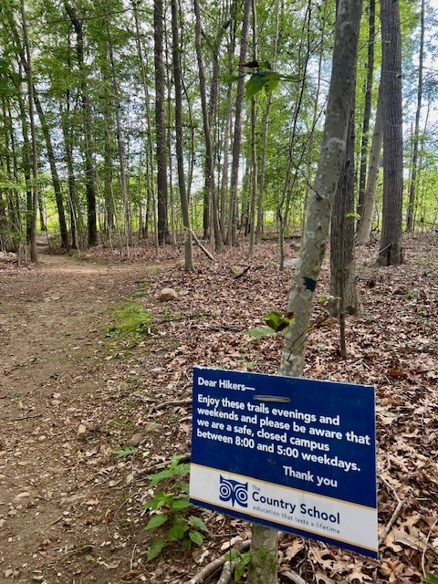

From left to right: The Country School property line; one of several footbridges over wetlands; the woods trail as it leaves the power line corridor; another trail section along the riverbank
Bailey Trail South, Madison. 3.75 miles
On another crisp morning in June my daughter was in town and joined me to explore this trail from the southern trailhead. Perhaps it was the early morning sun reflecting off the water, or the moss-covered stone walls, or the periodic great blue heron sightings as it made its way upriver just beyond our grasp, but we both agreed that this trail was a winner. The trail is generally flat, and follows the banks of the Hammonasset River. According to Mapcarta, the Hammonasset River starts about 4 miles southeast of Durham. It flows into Long Island Sound by Hammonasset Beach State Park. While the Bailey Trail South is generally easy, having good balance is important as there are several places where you will have to navigate tree roots and rocks. In several places the trail passes over river rocks that I imagine are flooded at high water. Watch for the remains of a sawmill dating back to the early 1700’s, highlighted in the TRAIL MAP AND DESCRIPTION. After the ruins we came to a junction where the main trail turns right over two wooden bridges that span a small stream, and the Cider Mill Spur Trail veers off to the left.
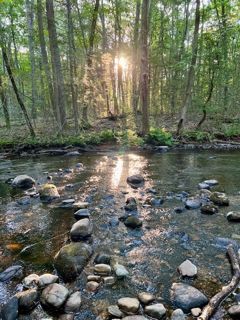

From left to right: the morning sun on the river at the start of our hike; one of many scenic spots along the riverbank; a relic of the mill ruins; the bridges at the Cider Mill Trail junction
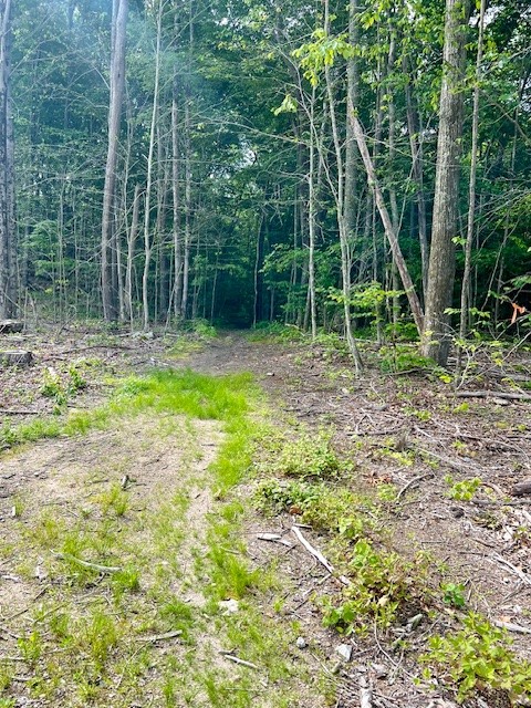
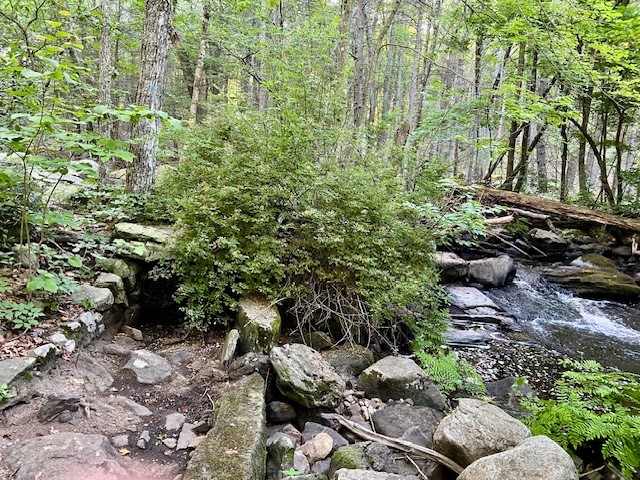
We continued to follow the main trail north as far as Trailhead 2 (TH2) where there is a large beaver pond. Parking for TH2 is at the Georgetown Circle cul-de-sac. The trail used to connect here to the Bailey Trail North, but the two trails no longer connect due to the beaver activity. Bailey Trail North is now only accessible from the TH1 trailhead on Route 80. While the river access is delightful, it is not a remote trail. For much of the route there will be homes and backyards in view, although with leaves on the trees it doesn’t feel awkward. You may notice an occasional white trail marker on the opposite bank. That is the Hammonasset Trail maintained by the Killingworth Land Conservation Trust. The KLCT trail is a lovely trail, which has more elevation changes. Parking is on Bar Gate Trail. You can find more information HERE.
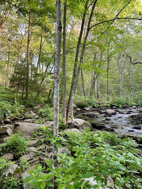

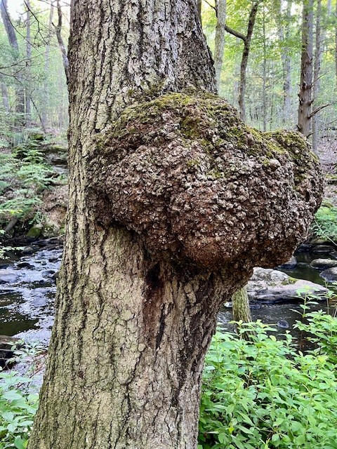
From left to right: the beaver pond near TH2; parts of the trail involve maneuvering across rocks; a colorful Ganoderma tsugae (a hemlock polypore fungus); a cool burl on a tree.
Veteran’s Memorial Park, Middletown.
Occasionally the thing you go in search of disappoints. But sometimes when that happens you find something completely unexpected that captivates you. I first noticed Veteran’s Memorial Park in the Middletown Trail Guide (page 46-48) . At the time, I was seeking out different river trails, and the description of the park included this intriguing tidbit: “A trail runs roughly around the perimeter of the park with a long stretch along the Coginchaug.” My husband, Tom, and I headed to Middletown in search of Veteran’s Memorial Park to check it out. The park turned out to be a welcome oasis hidden away in a residential area near the busy Washington Street/Newfield Street intersection. While the perimeter trail was a disappointment, we were awed by the beautiful Connecticut Trees of Honor Memorial. Officially opening in the fall of 2016, this memorial was conceived years earlier after September 11, 2001 as a way to honor the fallen servicemen and women who died in service to our country while deployed to Afghanistan and Iraq. The Memorial has many special features, the centerpiece being 65 flowering trees, each adorned with an inscribed granite monument and flag, along a circular brick walkway. There is a pond with a center fountain, a bronze sculpture entitled First Tear, a display featuring a section of subway rail that ran under the twin towers, and a statue of the WWI canine hero Stubby the Dog.
A new monument, installed and dedicated in 2018, features a Vietnam era Huey Helicopter and honors the Hmong and Laotian veterans that were part of the Special Guerilla Unit (SGU). Efforts are underway to acquire a National Monument designation. Click HERE for a link to a short video showing the monument. In 2019, the doors of the Greater Middletown Veterans Military Museum opened to the public. The museum is open weekdays 10:00am to 3:00pm. Their WEBSITE says to call for Saturday hours. While small, it is chock full of memorabilia from the revolutionary war to the present day. They also have a large collection of books. Admission is free but donations are appreciated. For July events, I learned that there will be a concert on the evening of July 6, and a Military Vehicle Show on July 20.
For some family fun, you can visit the Splash Pad which opened in 2023. It is free of charge, and open daily from 10:00am to 7:00pm until Labor Day. It will remain open on weekends until September 30. Visit the Middletown Recreation Department page HERE for rules and other details.
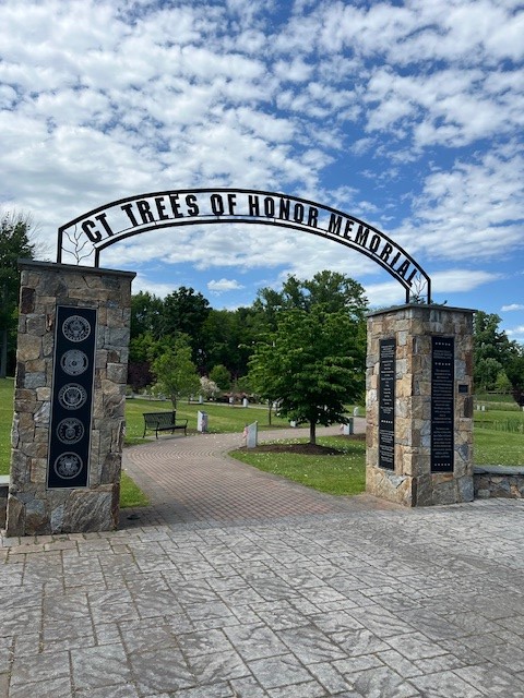

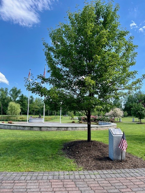

From left to right: The entrance to the Trees of Honor Memorial; the brick pathway around the pond; one of 65 trees dedicated to fallen soldiers with the First Tear statue in the background; the Stubby the Dog statue
Although the perimeter walking trail was a letdown, it still offered some exercise, so if you want to check it out for yourself, start by looking for the metal gate opposite the Memorial of Trees. Walk down a steep gravel path to the river. The best view of the river is from the pedestrian bridge that crosses over to Palmer field. The path goes through a grassy field with the riverbank to your left, which at this time of year is hidden behind plant growth. The view across the river is of Palmer field and the adjacent parking lot, and there is loud traffic noise from Washington Street. The path then goes back up a gravel drive and comes out behind the picnic pavilion. This area of the park is very scenic (and is accessible from the road) with a lovely grove of black walnut trees and a small playground. The trail crosses the road and continues through a grassy area dotted with large trees before entering the woods. At this point the trail goes along the border of the park with a fence looking into residential back yards on the left and a tangle of overgrown woods on the right. The trail loops around and emerges at the rear of the museum just above the Memorial of Trees. I clocked it at just under one mile. I recommend a visit to Vietnam Veterans Memorial Park for the Memorial of Trees, the museum and the Walnut Grove (and the Splash Pad although I did not check this out personally), but not solely for the hiking.


from left to right: the gate that marks the path down to the river; view of the Coginchaug River from the pedestrian bridge; the walnut grove with playground in the background; one of many trees in the grassy area
Subscribe to Trail Talk
your next adventure awaits
Questions? Email me at naturenerdsramble@gmail.com or find me on Instagram @the_real_nature_renee.