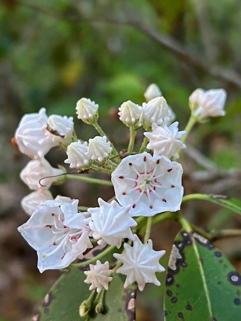
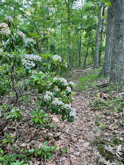
June is prime mountain laurel season – which tends to peak mid-month. I find there is nothing like immersing yourself in it on the trail – preferably one where the laurel grows like an arbor over the path so you are surrounded by these glorious blooms. Kalmia latifolia is the state flower of Connecticut, voted as such by the General Assembly on April 17, 1907. Pennsylvania also lays claim to it as their state flower, but that was done by executive decree by Governor Gifford Pinchot 1933. Dare I say we claimed it first? Is there enough to share? I think so.
Mountain laurel is so ubiquitous in the wild that until I started researching it I was not aware how popular it is as an ornamental plant for gardens and how many cultivars (cultivated varieties) there are. Please know that collecting laurels on state land is against Connecticut State Law, and all parts of the plant are highly toxic, so admire the flowers but be careful around them and do not dig them up. In his 1997 book, Kalmia: Mountain Laurel and Related Species, Richard Jaynes wrote “I encourage any and all who have the opportunity to search for unusual forms of laurel, whether in the wild, nursery or garden.” That got me curious, as the blooms all look the same to me. So this June I will pay closer attention to the individual flowers. Jaynes explains that the plant was named for the Swedish Botanist, Peter Kalm, a student of Carolus Linnaeus (the man who invented our current system of taxonomy) who came to the New World in 1748 as a naturalist in search of plants suitable for growing in Sweden. One of the plants he collected was mountain laurel, and Linnaeus named the genera Kalmia to honor him. There are seven species of Kalmia in North America.
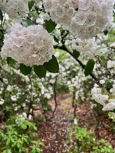
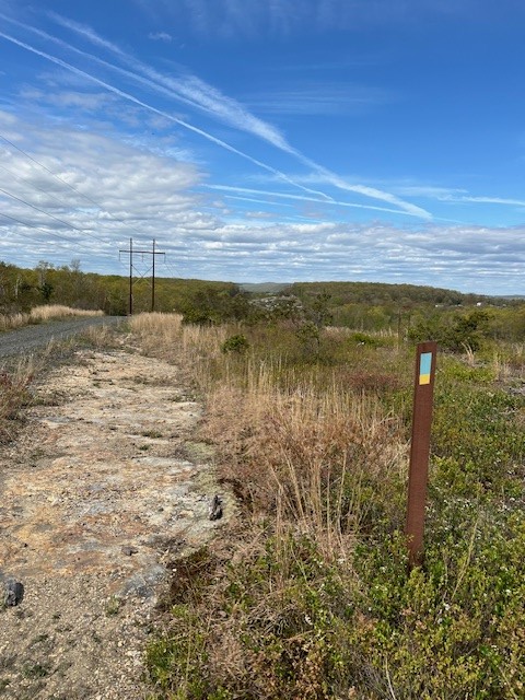
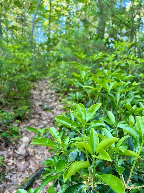
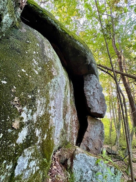
(photo to right, on the Wildwood Trail in Cockaponset State Forest)
Where can you go to hike amongst the laurel? In this Trail Talk I share details of several trails that have them in abundance, but there are many places in the northeast where you will have a similar experience. Click HERE to view my 2023 “Ode to Mountain Laurel” reel on Instagram. The videos and photos were taken on the Wildwood Trail in Cockaponset State Forest described below. (Disclaimer: you may need an Instagram account to open it)
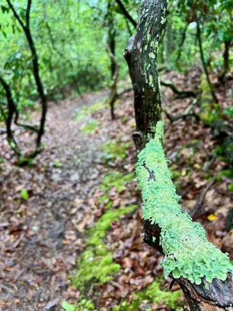
2023 was a banner year for mountain laurel. There is a dearth of information as to what makes some years better than others, but since the buds form the previous autumn it seems to come down to a combination of winter stresses and moisture. The bark of mountain laurel is a dark reddish-brown and as it ages it gets flaky and can become gnarly in appearance. The knots and blemishes can enliven the imagination. There was one laurel that looked so much like a face I started calling it “Hardy”. I would look for Hardy every time I took that trail, even introducing hiking friends to him. Alas, Hardy was taken down during some trail re-working. I particularly enjoy a mountain laurel walk after a rainstorm, as the lichen that affixes itself to the bark turns a vibrant green when wet.
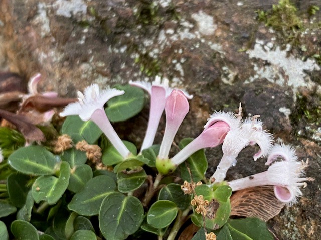
While you’re out there, look for blooming Partridge Berry (Mitchella repens), an evergreen trailing vine whose red berries are less popular with birds and animals so tend to be visible all winter. These delicate, tubular white flowers understandably get overshadowed by the showier mountain laurel.
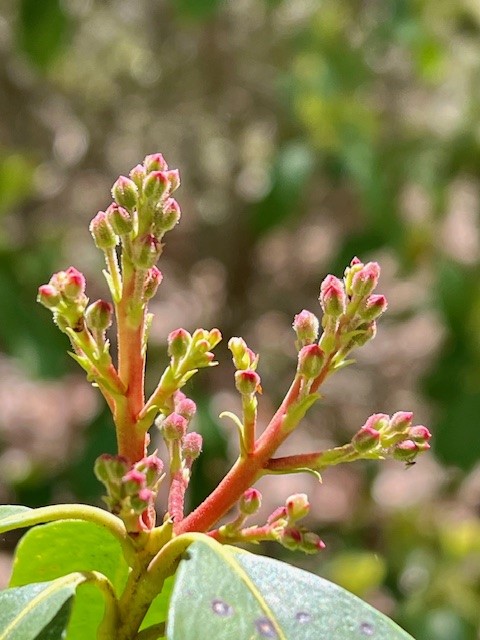
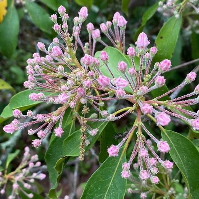
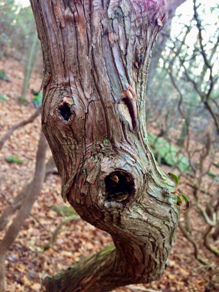
from left to right: early buds; flowers forming but not yet opened; my laurel friend “Hardy”; Partridge Berry blooms
Upper Three Mile River Preserve, Old Lyme. 2.7 miles with 450’ of ascent.
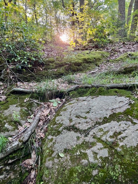
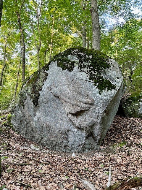
Like the dog in the movie UP whose head snaps around at the sight of a squirrel, my head snaps around at the sight of a trailhead. This happened to me in 2021 driving up Four Mile River Road every week on my way to Eastern Connecticut Ballet. I finally checked the map and learned the trailhead was for the Upper Three Mile River Preserve (UTMRP). The seeds for growing this 157 acre preserve were sown in 2004 with the purchase of a 16 acre land-locked parcel. Kudos to the Old Lyme Land Trust (OLLT) for believing in Member Mike Kiernan’s vision for a property that would be like the “Grand Canyon of Old Lyme”. In subsequent years additional contiguous parcels were acquired, but it was the 2014 purchase of a parcel with significant frontage on Four Mile River Road that allowed the vision to come to fruition with the completion of a loop trail that officially opened in 2017. The entrance to the UTMRP is on the western side of Four Mile River Road (Exit 71 off I-95) just north of the highway. There is a pullout for parking that accommodates several cars, or you can park in the commuter lot nearby. The white trail starts with a meander through a boulder-strewn woodlands and skirts a marsh where you can get seasonal views. The trail crosses two small brooks that feed the marsh. At the second brook there is a contemplation bench built by a local Boy Scout troop and hauled in last year. At the trail split I chose to go counter-clockwise, setting off to the right. While I had already passed several mountain laurels, it was at this trail split where the canopy closed in and I found myself in what I imagined would be a laurel fairyland when they are in bloom. After a short distance, a green cutover trail comes in on the left. According to AllTrails, the white-green-white loop is 1.4 miles and is an option if you are only going for the laurel. I recommend doing the full loop so you don’t miss some of the best features of this preserve. Continuing on white, the trail traverses a parcel of private property. This section is blazed with both white and red markers, and the OLLT asks hikers to please stay on the trail. The trail winds around an impressive glacial erratic that maintains a precarious perch. The laurels continue for a good half mile before you eventually reach the first Three Mile River crossing.

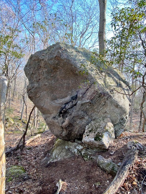

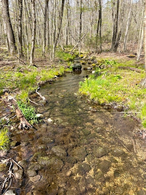
from left to right: I went off trail to get this view of the marsh in early May; a glacial erratic; mountain laurel on the green cutover trail; the Three Mile River
After crossing the river the trail winds through the old Denison Farm. There is a sign dating the farm to circa 1800. The stone walls that criss-cross the property are spectacular and aroused my curiosity. An article in the OLLT’s 2017 publication, Tributaries, posits that one of the farm uses was likely raising sheep, and that “Denison built an intricate network of pens and stone walls which surely required many years and much hard work to complete.” I was equally intrigued by a photo I saw in the book entitled Images of America: Old Lyme, Lyme and Hadlyme, by Kathryn Burton. The caption read: “This Native American mortar stands on the front lawn of the [Phoebe Griffin Noyes] library. It was used by the Nehantic Indians as a corn mill. The historic artifact was found on the Dennison [sic] Farm, on Four Mile River Road….it was brought to the library c. 1898 on a stone-drag drawn by oxen.” I thought it plausible that the stone walls were a blend of Native American and colonial work. I had the opportunity to return with Edie Twining, OLLT Trustee and Chief Steward. We looked at several interesting rock formations, including a series of cairns that prompted consideration of various origin stories. No matter the exact origins, the stoneworks are magnificent and worthy of our respect. After passing through the old farm land the trail reenters the woods and parallels a scenic ravine. The trail eventually crosses the Three Mile River again on a small footbridge, then starts winding uphill along a series of switchbacks until it levels out on a high plateau and ridge section before re-connecting with the trail that leads back to the road.
Click HERE for the trail map, and HERE for the OLLT property description. See the Bibliography for additional links.


from left to right: a section of stone wall; a collection of small stones at a rock overhang; one of many cairns dotting the landscape; the corn mill still stands on the library lawn
Katchen Coley Mountain Laurel Preserve, Middletown. 2.5 miles with 380’ of ascent.
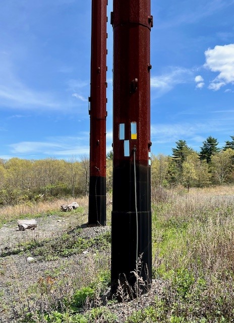
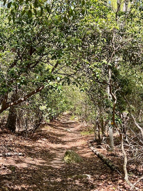
The second edition of the Middletown Trail Guide is dedicated to Katchen Coley, who is described as the “Middlesex Conservation Commission’s most vocal advocate for conservation.” Also dedicated to Coley is a 50-acre parcel of land that Middletown purchased from the Helfant family in 2013 and named the Katchen Coley Mountain Laurel Preserve. A section of the Mattabesett Trail’s Bear Hill loop passes through the preserve. Along Bear Hill Road there are several places to pull over and park. Look for the large sign that reads “Katchen Coley Mountain Laurel Preserve” and the blue blazes on the trees. Using “Bear Hill Trail” in Google Maps gets you closest to the trailhead. I did a loop incorporating a section of the blue-blazed Mattabesett Trail and the blue/yellow blazed New England Trail (NET). However, if it has rained recently, I recommend going out and back on just the blue trail, as this section of the NET follows old roads that see a lot of illegal ATV use and can be muddy even in dry weather. From Bear Hill Road follow the blue trail south until you reach the power line corridor. The trail blazes on the power pole make it appear that the blue trail turns left, but this is inaccurate. Go to the right of the pole and you will see where the blue trail continues straight across the right-of-way into the woods on the opposite side. After re-entering the woods I found myself in a mountain laurel corridor with a closed in arbor feel. While the arbor only lasts a short while, I passed many more laurel during my hike. In addition to the laurel, there were numerous blueberry bushes, pitch pine groves and knobby balds. There are some steep sections and places where the footing is challenging.

from left to right: the confusing blazes on the power line pole; a mountain laurel arbor; a knobby bald section; one of several short but challenging climbs
At the first intersection with the yellow/blue trail I continued straight on blue to go as far as the summit of Bear Hill. Don’t be fooled by the USGS survey marker with an arrow on it embedded in a rock on the trail. This marker merely points to the actual summit, which is a second USGS survey marker at a lookout just off the trail. From here, I chose to backtrack and take an obvious but unmarked trail to the right that connects with the blue/yellow trail. A few orange survey tape strands along the trail helped mark the way. I used AllTrails to find this route. When I reached the blue/yellow trail I turned left. This is a very nice section of pitch pine with seasonal views. When I reached the 4-way intersection with the blue trail I stayed on blue/yellow which follows a cart path back to the power line corridor. I was surprised at how muddy the trail was despite the recent spate of dry weather. I was able to pick my way through without an issue, but it would not be fun in wet conditions. The trail system here is extensive and you can plan a much longer hike, taking the Mattabesett Trail either further south toward Aircraft Road, or north to the Asylum Reservoirs. There is a map on page 19 of the Trail Guide linked above.


from left to right: the actual USGS survey marker for Bear Hill; a scenic pitch pine section of the yellow/blue NET; a muddier and less scenic section of the NET; the power line section of trail
Rocky Neck State Park, Niantic. 3.3 miles with 236’ of ascent.
When I visit Rocky Neck State Park I usually drive in the main entrance and park in the back lot by the marsh, but I had gotten a lead for an unmarked trail that showcased mountain laurel, so when a friend and I visited in early May, we parked in the lot on Route 156 diagonally across the street from the Divine Wine Emporium. From the gate and kiosk we took the blue trail south, then stayed to the left as the blue trail turns right. Very soon after, the red trail splits, and we went left. (The official trail map can be confusing because it looks like the red and blue trails meet at a 4-way intersection, but in the field, the red trail is a short distance beyond where the blue trail turns to the right. (Click HERE for the map). We followed the red trail for a short distance, looking for an unblazed trail on the right hand side. This unblazed trail is well-defined and runs north-south, in between and parallel to the red trails. This was a lovely trail laden with mountain laurel. It meandered past a tranquil vernal pool (we looked for frogs but did not see any) and along a small cliff. An odd feature of the trail was the occasional glow-in-the-dark star blaze nailed to a tree. We could only guess at the purpose of these. On two occasions we passed offshoot trails to our left. These connect with the eastern red trail. We stayed right both times, and eventually reached a T intersection. At this junction we went left and quickly reached the white blazed trail. (If we had turned right, we would have continued on an unblazed trail that connects with the western red trail.) At the white trail, we turned left and followed it to a junction with the red trail.


from left to right: a section of unblazed trail; a mysterious glow-in-the-dark blaze; landmark tree and rock where we popped out onto the white trail; the wider red trail bordered by laurel
From the junction, we headed north on the red trail. Upon reaching the purple cutover trail watch for the very impressive balanced rock in the woods. There is a short spur trail that leads to the boulder, but there aren’t any views from it. When we got back to our starting point on the red trail we were at about 1.8 miles. We decided to do another loop which is not a mountain laurel section but fun nonetheless. This time we did a clockwise loop heading south on red and back on blue, increasing our total distance to 3.3 miles. The blue trail back to the parking lot follows a series of switchbacks where there are log benches for a rest. The trail passes through a field that, while scenic, is edged with poison ivy, so be careful to stay on the trail. You can stay on blue all the way back to the parking lot, or look for the green trail on your left. We took the green trail, which also skirted a field edged with poison ivy. This trail looks like it can be very muddy in wet weather. You can visit these trails from the main Rocky Neck State Park parking lot. Park all the way in the back and walk through the picnic area to the trailhead. This is a nice option because there is a small boardwalk with great views to both sides of the marsh.
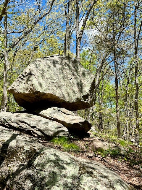


The balanced rock off the red trail; a stone border along the blue trail; the grassy section of blue trail — watch out for poison ivy
Westwoods Loop 5 – Mountain Laurel Forest, Guilford. 2.93 miles with 461′ of ascent
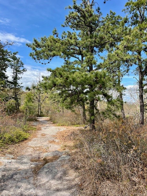
On May 31 I squeezed in one more mountain laurel hike before my self-imposed deadline. The Guilford Land Trust maintains approximately 32 miles of trails in Westwoods, which the website describes as the “largest recreational area for hiking in Guilford.” I set out to do the Mountain Laurel Forest Loop described in detail HERE. The basic description of the hike is a clockwise loop from the parking area on Dunk Rock Road heading south on the Blue Circle Trail then looping back north on the Green Circle Trail, completing the loop on the Green Rectangle Trail. There are many junctions and cross trails and a few places where trails co-exist. The trails are well marked, but it’s important to pay attention to the blazing. This is a moderate trail with a few steeper sections. The last portion of the Green Circle Trail is narrower and less used, judging by the number of spider webs across the path. While there are sections of mountain laurel, it is not as extensive as on some of the other trails described in this post. The laurels are most prolific in the power line corridor at the .7 mile mark and along the Green Circle Trail.
From left to right: the first flowers opening up; 2024 seems to bring much new leaf growth but fewer blooms; laurel blooming along the trail; a rocky section of trail
Along with some laurel, this hike has many other features including interesting rock formations, especially along the Green Circle Trail where the description reads: “Note the classic pink granite rock formation. There is a narrow rock fissure for the adventurous (and very skinny!) to squeeze through.” Also along the Green Circle Trail is the stump of The Great Hemlock described as “once over 125 feet tall with a diameter of 46 inches. It survived the 1938 hurricane, an ice storm in the 1970’s and gypsy moths in the 1980’s. It succumbed to the Wooley Adelgid bug brought into our area from Hurricane Gloria in the 1980’s.” For all Westwoods trail descriptions click HERE.

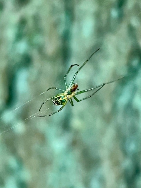
from left to right: boulder along the Blue Circle Trail; the “rock fissure for the adventurous”; the Great Hemlock stump; an orb weaver spider building its web across the Green Circle Trail
Wildwood Trail, Cockaponset State Forest, Haddam. ½ mile to 4 miles.
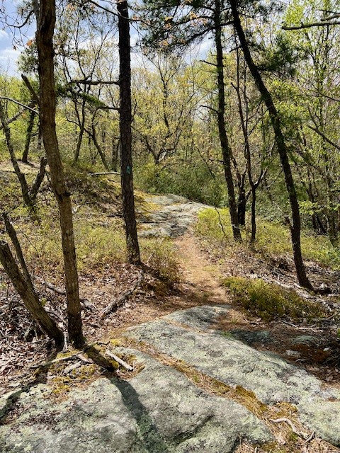
My favorite mountain laurel hike is the northern section of the Wildwood Trail, the name for the red/blue trail in the Cockaponset State Forest shown on this Central Section map . I wrote about this trail as part of a longer 4 mile loop hike in my December blog post about the Civilian Conservation Corp. To do just the mountain laurel section of this trail, park at the small pullout at the northern end of Beaver Meadow Road where there is room for one or two cars at most. From the trailhead follow the orange and yellow trails along a wide road bed. When these trails diverge, stay right to follow the yellow trail. After a short distance watch for the blue/red trail that comes in sharply on the right. This trail winds up through a spectacular section of mountain laurel. Follow for as long as you care to, then turn around and retrace your steps, or hike to full loop as described in my CCC blog post.
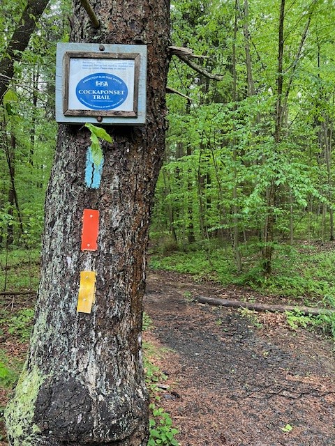


From left to right: the sign near the trailhead; the Wildwood Trail in early May of this year; the trail in mid-June of 2023.
Bibliography
Kalmia: Mountain Laurel and Related Species, by Richard A. Jaynes (1997)
Images of America: Old Lyme, Lyme and Hadlyme, by Kathryn Burton (2003)
OLLT Upper Three Mile River Preserve Opens to the Public. 2017 Tributaries ARTICLE
The Grand Canyon of Old Lyme. 2014 Tributaries ARTICLE
Subscribe to Trail Talk
your next adventure awaits
Questions? Email me at naturenerdsramble@gmail.com or find me on Instagram @the_real_nature_renee.