I first learned about Tyler Mill Preserve when I purchased Tom Wessels’ latest book, New England’s Roadside Ecology: Explore 30 of the Region’s Unique Natural Areas, back in 2021. The book included 3 hikes in Connecticut, and the Wallingford hike caught my eye both because I have spent the past 4 years exploring our state’s trap rock ridges, and because I spent many years traveling back and forth to Wallingford without ever knowing about this preserve. It took a while, but I finally visited on the last day of February this year. I liked it so much I returned 6 times in the past two months. Click HERE for the official Town Map, which will help you follow along as I describe my explorations.
I first became aware of Tom Wessels when my local librarian introduced me to his 2005 book, Reading the Forested Landscape: A Natural History of New England. It combines drawings of different forest scenes with commentary on how to look for clues as to how the land was used previously, such as logging or agriculture, and what events may have occurred such as fire or windstorms.
I enjoyed it so much I immediately purchased his follow-on book, published in 2010 – Forest Forensics: A Field Guide to Reading the Forested Landscape. It is sized to easily take with you on a hike, and includes a dichotomous key and plenty of color photos to help you identify certain features in the field. I admit I have not yet used it this way, but I enjoy looking at the photos.
I have spent the last several years hiking the trap rock ridges, including such notables as Mount Higby, Sleeping Giant, Chauncey Peak, Lamentation Mountain, Talcott Mountain and others, yet I had never seen the area described by Wessels on any of the trap rock ridge maps. Connecticut’s trap rock ridges are a unique geologic feature. Roughly 200 million years ago, after the millions of years of compression that created the Appalachian mountain range, the land started to pull apart, taking millions more years to form the continents we see today. As this occurred, the land in the central part of what is now Connecticut, what we call the central valley, started to sink along fault lines – rifts in the bedrock to the east and west, and running generally in a north/south direction. Volcanic activity beneath the earth’s surface sent hot molten magma shooting through fissures in the rock. The magma that broke through the earth’s surface, what we call lava, hardened to become basalt. The magma that cooled underground is called diabase. Both basalt and diabase are forms of igneous rock. As the central valley continued to subside, sediment flowed down from the eastern and western uplands, filling in the depressions and hardening. Erosion ensued over many more millions of years, speeding up during the numerous glacial advances and retreats that occurred during the past 2.5 million years. The glacier began its final retreat around 20,000 years ago, leaving in its wake the trap rock ridges, which were able to better withstand the environmental assault of the moving ice. (The name “trap rock” supposedly comes from the Swedish word for stairway, “trappa”, so named because the erosion of the rock over time created a landscape of what looks like stone steps or blocks.) Another feature of most of our trap rock ridges is that they tend to have gentler eastern “dip” slopes, and very dramatic western side cliffs with talus slopes – fields of fallen rock similar to scree but tending to be larger blocks. This has to do with the tilt of the subsidence in the central valley, with the eastern side sinking more.
YELLOW/ORANGE/RED TRAIL. 2 miles.
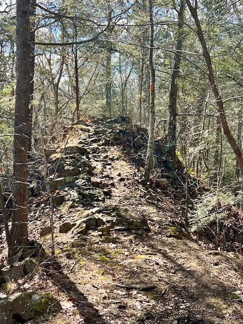
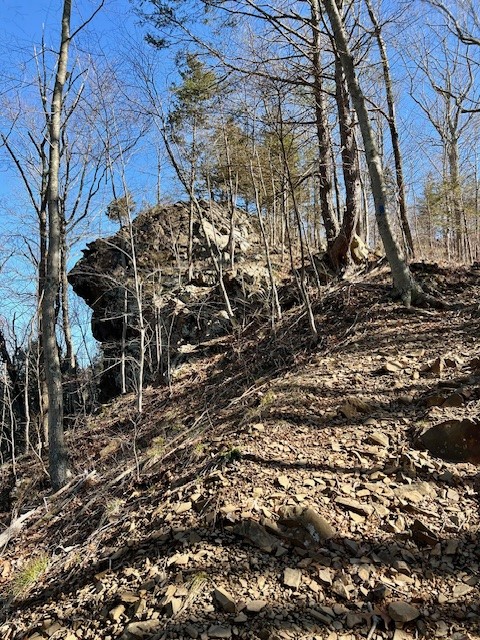
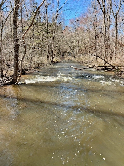
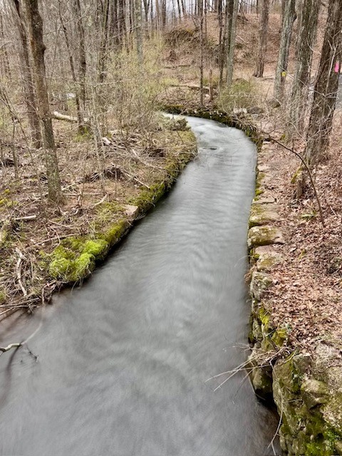
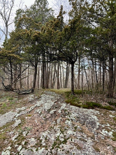
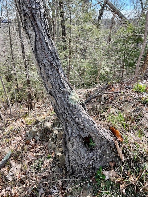
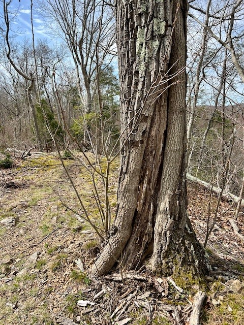
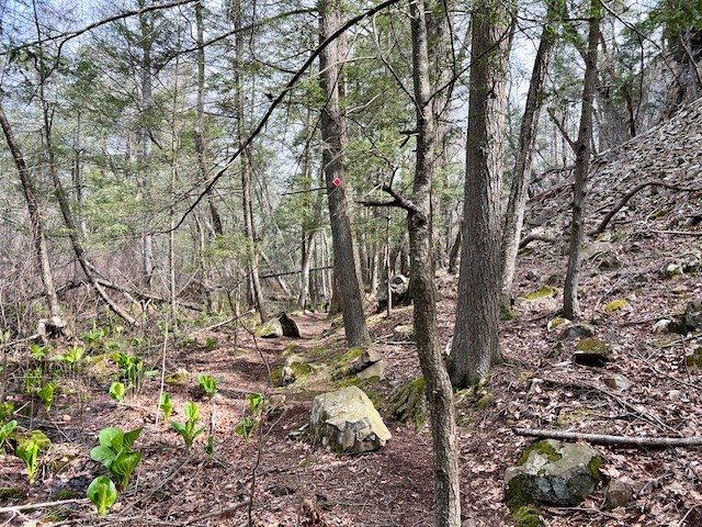
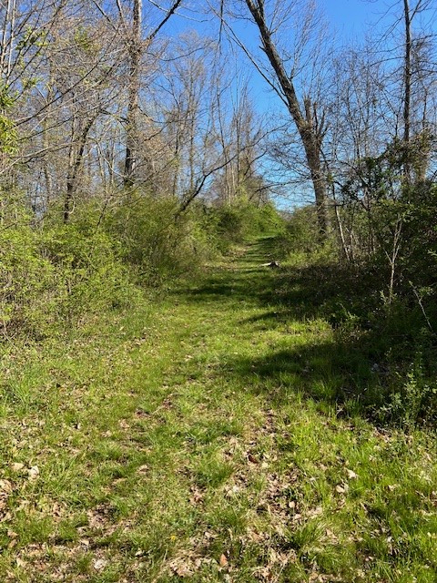
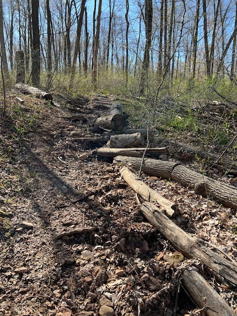
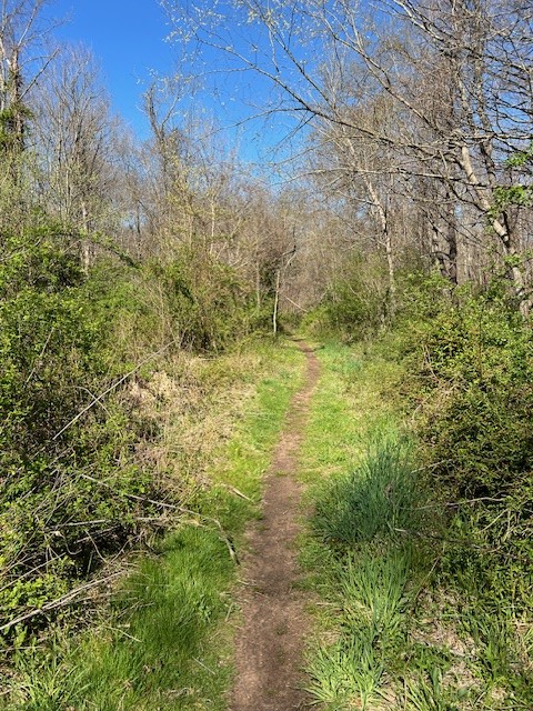
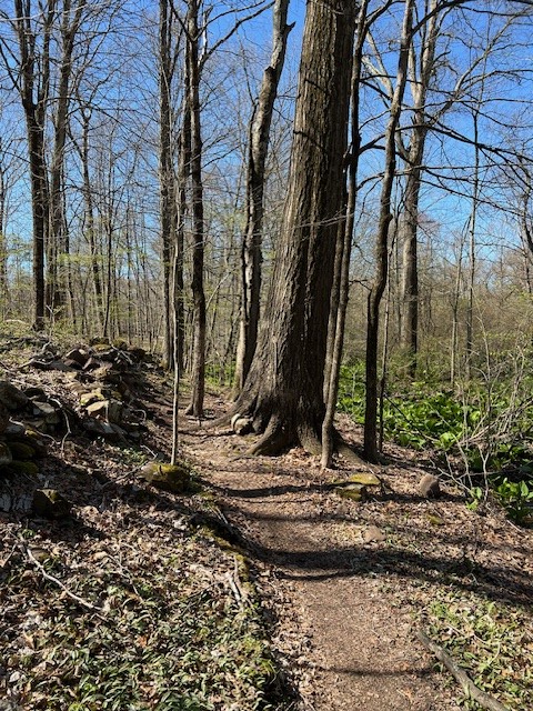
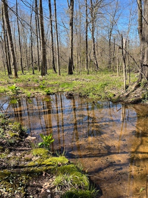
In New England’s Roadside Ecology, Wessels describes a 2 mile loop trail starting on the Lilac Trail (the official Trail Map calls it the Lavender Trail). Although he does not mention this, that trailhead is at the Preserve’s Main Entrance which is off Northford Road at the north end of the Preserve (typing “Tyler Mill Preserve” into Google Maps will send you there). When I got to Northford Road, I was confused by the large “Bridge Out – local traffic only” sign. I opted to drive the short distance to Vietnam Veteran’s Memorial Park and make my way to the trail from there. (I later learned that the turn for Tyler Mill Road and the parking area is just before the bridge construction and is still accessible, although there are more parking spots as well as seasonal port-a-lets at the park). From the kiosk, I started on the yellow trail, then quickly veered left to access the orange trail, following a series of switchbacks up the steep hillside. When I reached the Lavender Trail I detoured onto it so that I could see the trailhead and follow the directions in the book. Tyler Mill Preserve was one of the places severely impacted by the storms that ravaged the area in May of 2018 and closed down Sleeping Giant State Park for over a year. The Preserve was also shut down for several months. Evidence of this storm abounds, including a massive oak tree that split cleanly down the middle when its fork toppled into another oak. Retracing my steps back to the orange trail, I turned left and started up the trap rock ridge. As I made my way up and over several cols on what was often a very narrow path (one small section was only about four wide) I marveled at how it felt like I was in a miniature trap rock ecosystem. To my left I could see the gravel road and Muddy River below, and to my right I had a view to the Tamarac Swamp (Wessels refers to this as a red maple swamp). I stopped frequently to read passages from the book, and often had to retrace my steps to discover an overlooked feature. Wessels had me searching for/observing a wide variety of ecological phenomena, such as trees harmed by fire, lightning and wind; evidence of former uses such as pastures and tree-cutting; and more generally the types of trees and plants growing at the different elevations. As I looped back on the red trail I was struck by the variety on this short hike. To my left was the swamp, with the skunk cabbage buds just starting to appear, and to my right the imposing cliffs of the ridge with its talus slopes. I later learned that this particular ridge, which is described as a diabase dike (a vertical structure where hot magma shot up into a fault in the bedrock and hardened into igneous rock), is unique in that it has steep talus slopes on both sides.
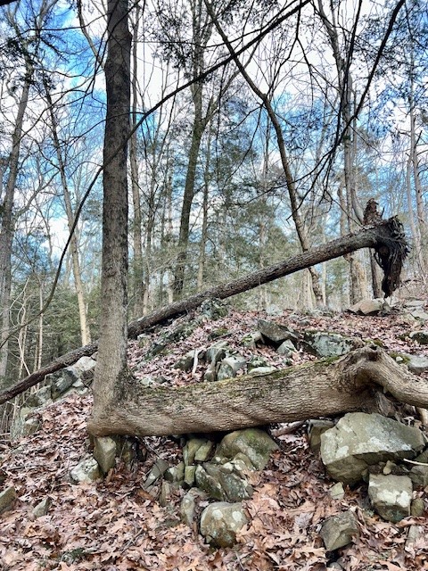
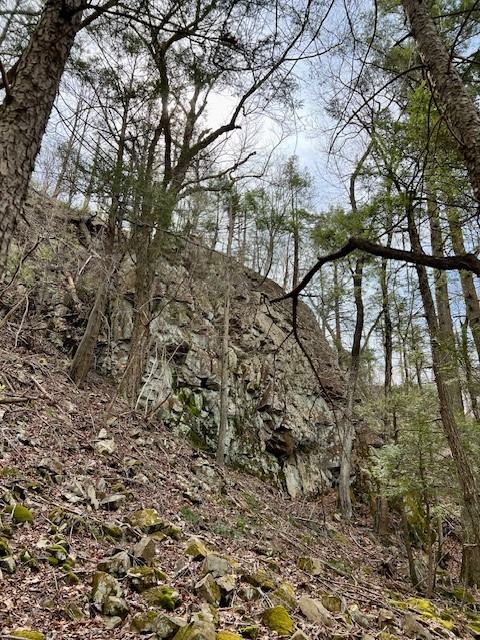
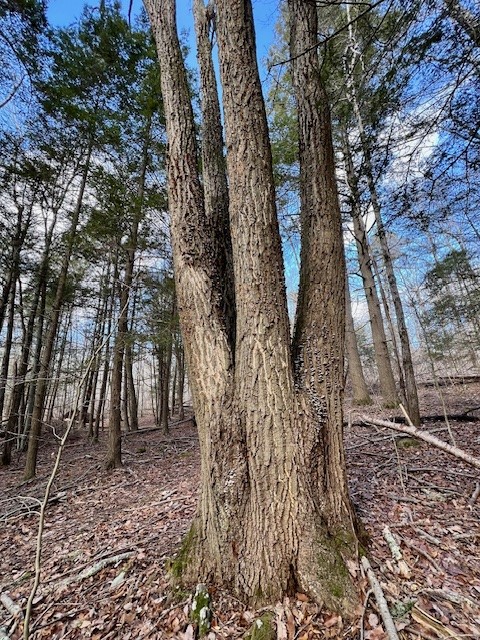
From left to right: a red oak split in the May 2018 storm; a sugar maple blown over by wind where a branch became the new trunk; a talus slope; a coppiced chestnut oak with four trunks
It was at this point that I had the idea to lead one of my Nature Nerds Hikes for the Connecticut Forest & Park Association here and introduce people both to Tyler Mill and to Tom Wessels’ work. So I did what any responsible hiker would do: I invited my friend, Sue, who’s afraid of heights (more specifically, steep edges), to do the hike with me to evaluate it. While she was cursing me out under her breath (but loud enough so I could hear), she agreed that it was a really interesting place. We tacked on a smaller loop to get to 2.5 miles by continuing on the red trail as it looped south, then heading back on white which skirts the edge of a town farm field.
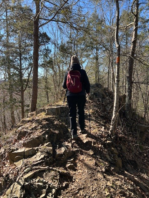
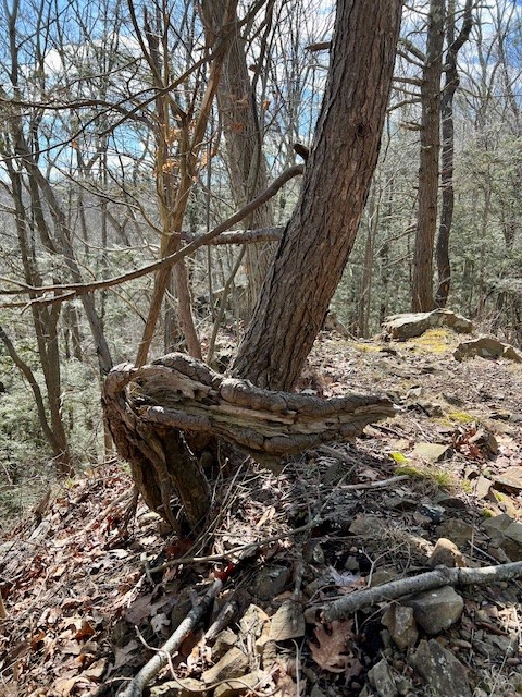


From left to right: my friend, Sue, making her way to the narrowest section of ridgeline; an old hemlock stump; a basal scar on a tree caused by fire; the Tamarac Swamp
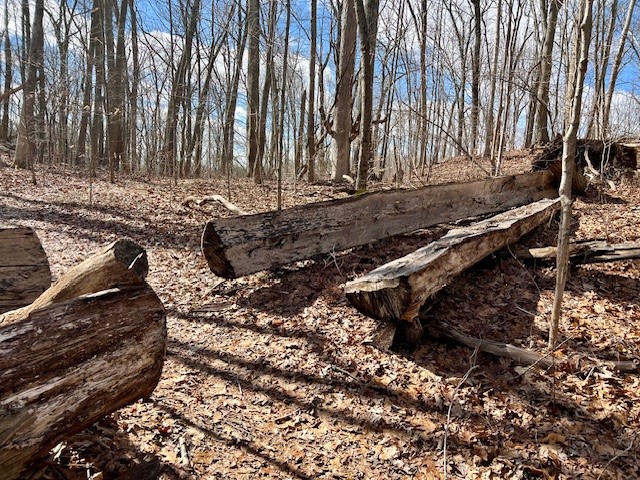
I became interested in exploring more the Preserve. Looking at the trail map, I saw that I had only scratched the surface, concentrating on the northernmost section of the Preserve. Online I discovered a 146 page Master’s Thesis written by Lisa Toman entitled Tyler Mill Trails: A Guide and Natural History (see link in the Bibliography). Jackpot! While 25 years old, much of the information is still relevant today. One change is that Toman describes the different trails by trail names, whereas now the Town of Wallingford differentiates the trails by color. So the reader must glean which name corresponds to what color by interpreting the clues in the description. For example, I determined the Owl Ridge Trail is the Orange Trail that traverses the ridge. The paper covers the geologic history, the human history and the ecosystems (flora and fauna) and I highly recommend checking it out. One of the key events that helped save this property from development was that the New Haven Water Company started buying up parcels (including from the Tyler Family, for whom the preserve is named, who ran mills along the Muddy River) from the late 1800’s through the 1920’s with the intention of possibly using the land for a reservoir. Ultimately, the Water Company did not construct a reservoir on the land, and instead sold it to the Town of Wallingford in 1979. There have been many conflicting interests, but it appears that the Town and its citizens have done an admirable job trying to balance those interests. One compromise is that from October through February there are designated hunting days (Monday, Wednesday, Saturday and Thanksgiving Day) and the general public is asked NOT to use the Preserve for safety reasons on those days.
I have read that Tyler Mill Preserve is a mountain biking mecca, and certainly saw tire tracks in places and once saw cyclists readying their bikes in the parking lot. But in my 7 visits to the Preserve I never once encountered a mountain biker on the trails, so don’t be dissuaded from visiting the Preserve for that reason. I also encountered remarkably few hikers, and many of the folks I saw were walking on the gravel roads – a wonderful option for experiencing the Preserve in an easier fashion. The walk from the main trailhead down to the bridge and back I’m guessing would be a little over 2 miles roundtrip and you would get to see the trap rock ridge from below as well as some of the Muddy River.
BLUE/GREEN/RED/YELLOW/BLUE LOOP, 3.25 miles.
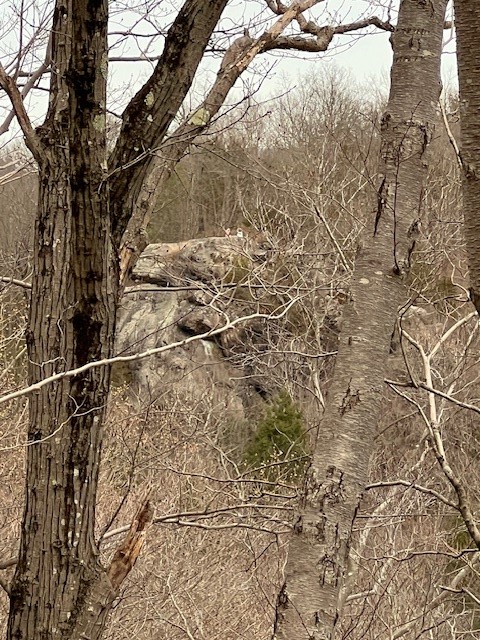
In late March I decided to explore the southern section of Tyler Mill Preserve. I set out the morning after steady downpours and was pleasantly surprised that the trails were relatively dry, aside from a few muddy patches. I parked at the soccer field on the west side of Woodhouse Avenue (Route 150). NOTE: The soccer field to the east of Woodhouse Avenue is in Google Maps as “Coyle Field”. The soccer field to the west (where I parked) is in Google Maps as “Woodhouse Fields” and the sign at the entrance says “William Coyle Field Woodhouse 2”. From the parking lot I crossed the street and headed uphill on the blue trail following the sign to Morris Rock (also known as Moss Rock.) The climb was short and steep, a tricky section of ragged trap rock that popped out onto an impressive overlook. From there I continued down the other side, staying on blue until it intersected with green. I turned right on green, traveling in a counterclockwise loop past vernal pools and open woodlands, doing almost a complete loop of green before turning right onto the short red/yellow cutover trail.
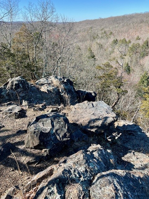

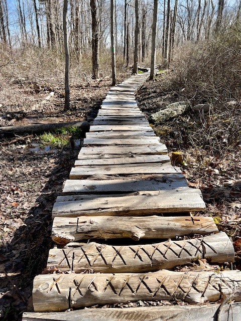
From left to right: the approach to Moss Rock; the Moss Rock overlook; an old tree on the green trail; a rough boardwalk on the green trail
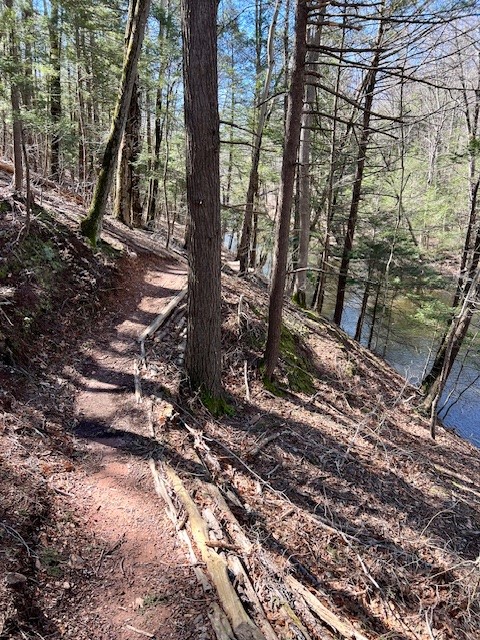
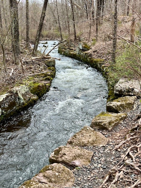
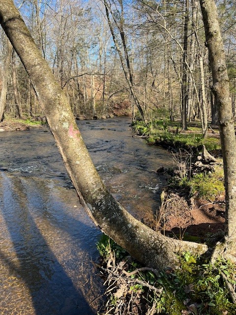
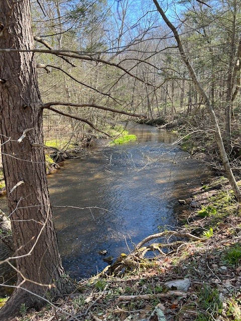
I turned left on red – crossing the Muddy River over a wide bridge. The water was raging from the recent storms and I could see how it got its name. I then did a counterclockwise loop on yellow, which went alongside the river to start, and then climbed uphill through a cedar grove. After finishing the loop I went back over the bridge and south on blue, this time staying right to go alongside the eastern bank of the river (instead of going over Moss Rock again).
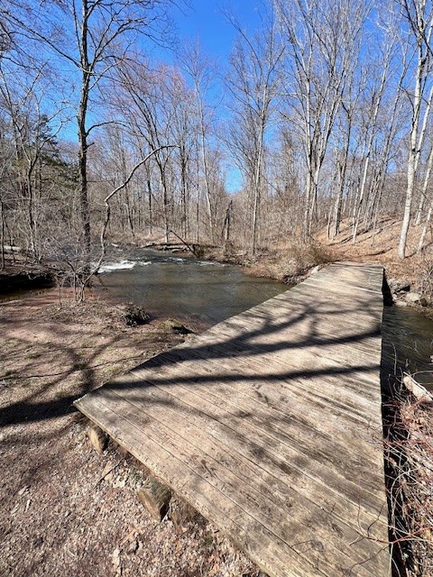
From left to right: The bridge over the Muddy River; the Muddy River after a big storm; taking a break in the cedar grove on the yellow/red trail; the blue trail above the river
PURPLE TRAIL/TYLER MILL ROAD LOOP. 2.75 miles.
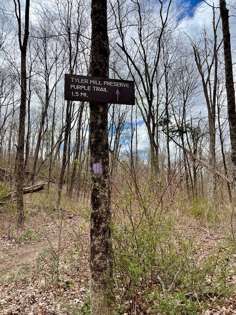
In early April I returned with my husband to explore further. We drove down Tyler Mill Road for the first time and I was amazed to see impressive talus slopes on the eastern flank of the ridge. We drove as far as the Tyler Mill Bridge, which is not accessible to vehicles, and parked in one of several pullouts. We crossed the bridge on foot, stopping to admire the stonework of the old millrace. Heading up the gravel road to a T junction we turned left and after a short distance took a right at the trailhead for the purple trail.
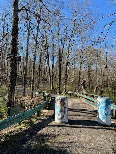
The Tyler Mill Bridge and the old mill race
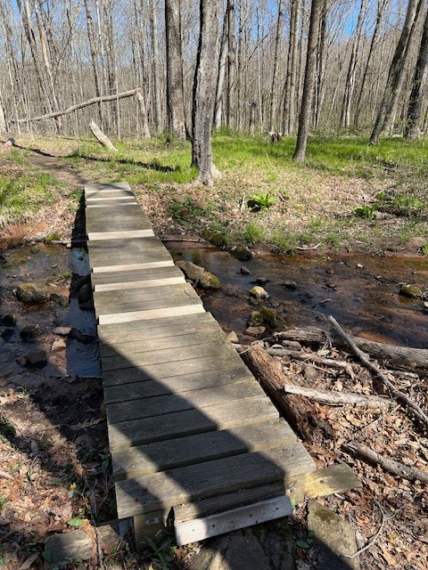
The purple trail winded through a thinly wooded forest thick with invasive plants like Japanese Barberry. The trail was muddy in places. Now that we were in April, the spring ephemerals were emerging, and we saw several patches of bloodroot and tons of trout lily leaves. The spicebush were flowering with tiny yellow blooms. The best part of the trail was the last half mile, a series of switchbacks that winded gently uphill, through an old cedar grove and down the other side. The trail exited onto the southern end of Tyler Mill Road, which we took back to the bridge. Before returning to our car we walked a short distance on the pink trail where I spotted my first trout lily bloom of the season.


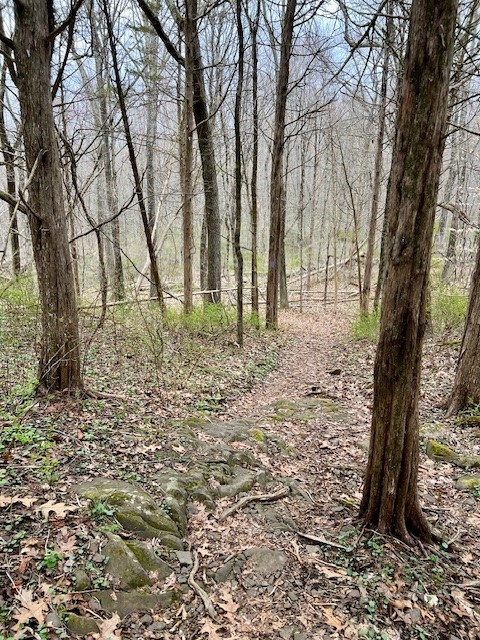
From left to right: the trailhead for the purple trail; sections of the trail were eroded and muddy; at the higher elevation the woods opened up; passing through a cedar grove
BERTINI PARK. 2 miles.
On April 8, the day of the solar eclipse, I opted for a short hike in Bertini Park. Bertini Park is technically not part of Tyler Mill Preserve, but is a town parcel adjacent to it on the southern end. The entrance is on West Dayton Hill Road. I approached from Woodhouse Avenue (heading north on West Dayton Hill Road) and missed the entrance for 2 reasons – the large green sign only has the park name written on one side of the sign, and a large dump truck was parked in the entrance with no way around it. I recalled from studying the map that I should be able to access the park from the soccer field on Woodhouse Avenue, so I detoured back. I parked at the field on the western side of the road (the one called Woodhouse Fields in Google Maps). From there I set out on foot taking a left onto Woodhouse Avenue and walking a short distance to the trailhead on the left. NOTE: This is a major road with fast moving traffic. There is a wide shoulder, but it is important to exercise caution. I followed the blue trail uphill, starting a loop in a counterclockwise direction. It was a fine woods trail, although nothing remarkable. That changed when I decided to loop back on green. The green trail went across the top of two different cedar glades. By this time the solar eclipse was underway, so the atmosphere became overcast and a little eerie. At one point I could see Moss Rock in the distance (although this view will be obscured once the trees leaf out). Completing the loop, I extended my hike by turning onto the blue trail as it paralleled the river. The trail was muddy but manageable. All of the downed trees and debris in the river provided ideal perches for birds, and I came across a great blue heron that flew away before I could get a picture. I backtracked to the parking lot where I noticed a couple along the edge of the lot gazing down at the river and I realized they were observing a great blue heron, perhaps the same one I had seen a short while earlier. After the couple moved on, I took my chances and descended slowly to the river’s edge, where I was able to get my picture after all.

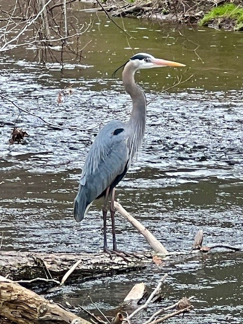
From left to right: one of two cedar glades along the green trail; a zoomed in view of Moss Rock with some hikers on top; along the banks of the Muddy River; great blue heron
YELLOW/ORANGE/RED/WHITE LOOP. 2.5 miles.
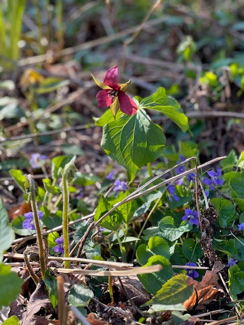
On April 14 I was back, this time leading a Nature Nerds hike for the Connecticut Forest & Park Association of the trap rock ridge/tamarac swamp loop. What a difference since my last visit in mid-March. Spring had arrived, and the woods were alive with spring wildflowers. Dutchman’s Breeches carpeted the slope on our first ascent, and were also in abundance on the slope along the white trail as we circled back to the parking lot later on. We saw Virginia Saxifrage, Plantain-leafed Pussytoes, and even a late-blooming Hepatica. Our group of 11 hikers included a Master Naturalist who had done her work on spring ephemerals so she was able to share her knowledge with the group. She and another hiker were also locals and well-acquainted with Tyler Mill Preserve, so we all benefited from an even deeper view into the history of the land. One interesting fact I learned is that the swamp, which is a peat bog that was formed by the glacier, was studied by the Yale School of Forestry in the 1990’s, and they measured the depth of the peat at over 30 meters in the deepest part (and it could be deeper, but their probes could only measure up to 30 meters).
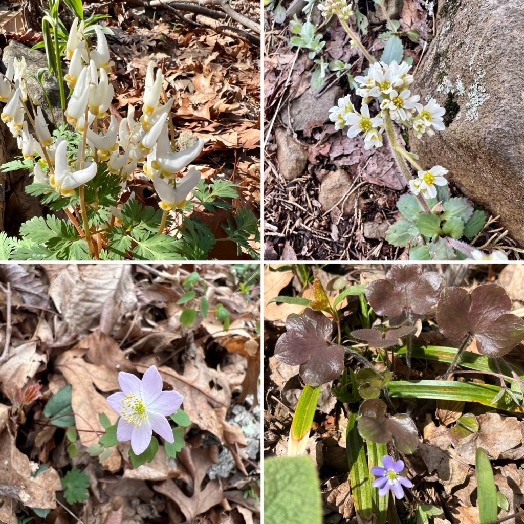
Clockwise from top left: Dutchman’s Breeches; Virginia Saxifrage; Hepatica; Rue anemone
Doing this hike for a third time and having many more pairs of eyes to help, I finally succeeded in spotting a couple of the features Wessels described in his book that eluded me on my previous hikes, including an old black birch tree and a chestnut oak struck by lightning. As we circled back between the Tamarac Swamp and the talus slopes of the ridge we saw the skunk cabbage leafing out. A tamarac, also called a larch tree, is a deciduous tree but with needles instead of leaves. Connecticut is at the very southern edge of its range, and it is thought to do well in this spot because of the cooler microclimate that occurs in the shadow of the ridge.
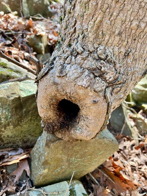
From left to right: a very old black birch and a lightning struck chestnut oak that somehow eluded me on earlier visits; the callous that has grown where the top of the windblown maple tree pictured earlier snapped off; the red trail with the cabbage skunk growing in the swamp on the left and the talus slope coming down on the right.
PINK TRAIL and RED TRAIL. 3 separate hikes totaling 4 miles.
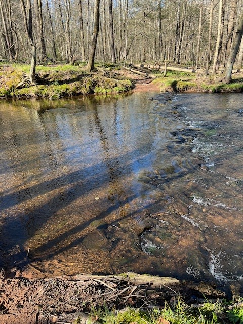
I visited most recently on April 23, a glorious blue sky morning. Once again I drove down Tyler Mill Road from the Main Preserve entrance. I looked for the trailhead sign for the pink trail on the left. There was a pullout just past the sign with room for one car. If this isn’t free, you can drive .1 miles further on to where another gravel road goes off to the right. There is ample parking along the roadside at the junction. The entrance to the trail has a wide muddy spot that was manageable, but could be very wet and muddy after a soaking rain. I had seen a note on the map that read “No Crossing” where the pink trail crosses the Muddy River, and I wanted to see it for myself. The wildflowers were on full display – trout lilies, violets, bellworts, and anemone lined the trail. Eventually the trail descended gently and paralleled the river for a while before reaching the bend in the riverbank where the trail ended. The water was clear and beautiful, and not too deep. On a late spring or summer day with proper footwear I would have felt very confident crossing (although I would not recommend any stream crossings when hiking alone). Instead, I turned and retraced my steps.

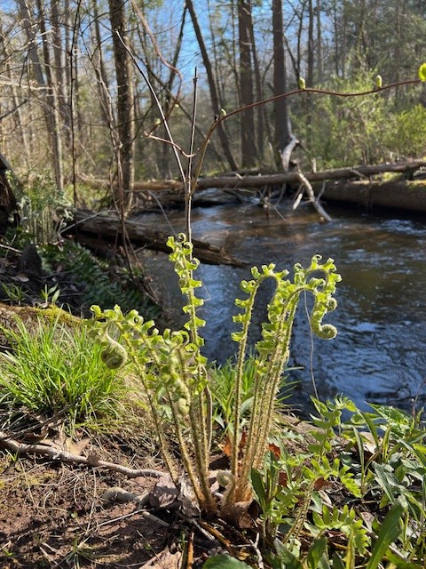
From left to right: the trailhead for the pink trail at the northern end; ferns growing near the bank; the crossing; a view downstream
Next I drove further south down Tyler Mill Road and parked by the bridge. Crossing the bridge I turned left onto the pink trail, which I intended to follow as far as the Muddy River on the opposite side of the “No Crossing” spot. The first section of trail, between the road and a small footbridge, was alive with wildflowers and it is worth visiting this spot even if you don’t do the whole trail. There were dozens of red trillium, trout lilies and violets all along the path.
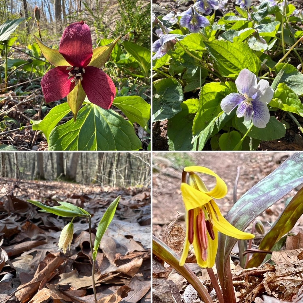
Clockwise from top left: Red Trillium; Violets; Trout Lily; Sessile Bellwort
After crossing the footbridge the trail dips south before turning north onto a wide cart path and skirting a town farm field. This may be a less desirable route during tick season. The trail re-enters the woods and descends toward the river. At times the trail is eroded and the footing tricky. Watch for an unblazed but well-trod trail that forks to the left (about one mile in from the trailhead). If you turn onto this trail (after a brief visit to the riverbank) you can do a loop instead of an out-and-back, avoiding the field on the return and cutting the distance from about 2.4 miles to 1.8 miles. The unblazed trail follows the river from a higher vantage point and meets the main trail near the footbridge.
From left to right; Flowers along the trail; the trail becomes a cart path; the descent to the stream has some tricky eroded sections; the stream from the opposite bank
With a little extra time in my morning I added one final hike of 1.2 miles. From the north side of the bridge I headed west on the red trail. The first part of this trail is through an area of dense shrubs and there is a sign about an Invasive Plant Control Project asking users to stay on the trails. The trail itself was wide and clear. After a while I came to a trail on the right blazed with yellow/blue markers. This is a newer trail that does not appear on the map. I decided to try it. The trail climbed gently uphill and out of the shrubby area into an open woodlands. I noticed a spur trail on the left that connected to the red/black dot blazed trail and decided to take that back down, although I am curious to visit again and see where the blue/yellow trail ends up. When I got back to the intersection with the red trail, I opted to cross over onto an unblazed trail that showed on AllTrails. This short, meandering trail went past a stone wall and down alongside a pretty wetlands stream before returning to the red trail. Continuing along the red trail towards my car I took one last detour on the right, also a red/black dot blazed trail, which circled down to the riverbank before returning to the bridge.
From left to right: the start of the red trail is through thick invasive shrubs; unblazed trail with stone wall and small stream; the stream was very clear; a footbridge over a creek on the red/black dot trail
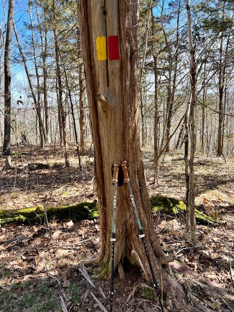
I have only just begun to explore Tyler Mill Preserve! Before you begin your own explorations, I suggest reviewing the rules and regulations that are listed on page 2 of the Official Trail Map. The Town has instituted a numbering system, posting small red numbered diamonds from 1 to 100 around the park. The idea is that if you get lost or have an accident and need to call for help this can assist the first responders to locate you. They are placed about 8’ off the ground, which in my opinion is too high up to notice unless you are actively looking. However, the numbers are also noted on the map, which I found quite useful if I wanted to figure out where I was on a particular trail.
BIBLIOGRAPHY
Books
New England’s Roadside Ecology: Explore 30 of the Region’s Unique Natural Areas, by Thomas Wessels (2021)
Reading the Forested Landscape, by Thomas Wessels (1997)
Forest Forensics, by Thomas Wessels (2010)
The Traprock Landscapes of New England: Environment, History and Culture, by Peter M. LeTourneau with photographs by Rogert Pagini. 2017.
Stories in Stone: How Geology Influenced Connecticut History and Culture, by Jelle Zeilinga de Boer. (2009).The chapter entitled “The Metacomet Ridge: The Scientific, Political and Cultural Impact of an Old Lava Flow”
Online Resources
New England’s Roadside Ecology with Tom Wessels YouTube video. https://www.youtube.com/watch?v=UVvDByTRurA&t=2s
Connecticut Insider article by Peter Marteka article: https://www.ctinsider.com/living/article/Tyler-Mill-Preserve-boasts-variety-and-challenges-17046439.php
Tyler Mill Trails: A Guide and Natural History, Master’s Thesis by Lisa Toman (1999) https://tylermill.org/wp-content/uploads/2022/03/Tyler-Mill-Trails-Toman-1999.pdf
Bulletin No. 41: Trap Rock Ridges of Connecticut: Natural History and Land Use, 2013. This 69 page PDF covers the geology of the trap rock ridges, as well as the ecology – the wildflowers, trees, insects and wildlife that inhabit the ridges. It even covers the land use history – quarrying, recreation, preservation and more. https://digitalcommons.conncoll.edu/cgi/viewcontent.cgi?httpsredir=1&article=1041&context=arbbulletins
Article on Bertini Park on the CTMQ.org website https://www.ctmq.org/william-d-bertini-park/. I had to laugh when blogger Steve Wood described the landscape “like a mini-Metacomet. (And by mini, I mean really mini. There are no views or anything here, just some nice trail and calming scenes.” That is exactly how I felt about the trap rock ridge walk in Tyler Mill Preserve – I kept describing it as Mt. Higby in miniature.
For the official Town Trail Map (along with rules and regulations) click HERE
Subscribe to Trail Talk
your next adventure awaits
Questions? Email me at naturenerdsramble@gmail.com or find me on Instagram @the_real_nature_renee.