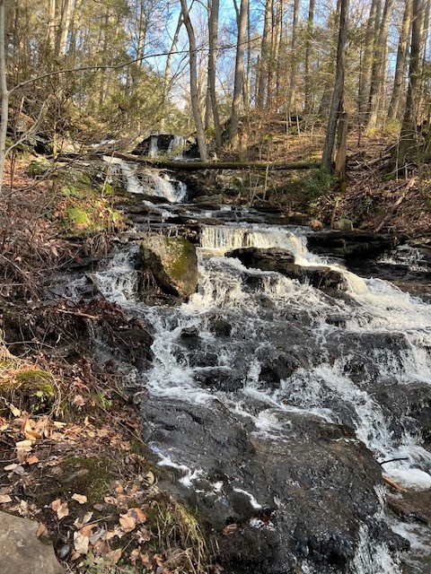
While I enjoy a pretty waterfall, especially one with a pool to swim in on a sweltering summer day, I have never considered myself a “waterfall chaser”. But after deciding to highlight waterfalls in my March Trail Talk that may no longer be true. It all started innocently enough, as most things do. It was a sparkling blue sky day in early January and I decided to kick off 2024 by visiting some State Parks on the east side of the Connecticut River that were new to me. After some deliberation, I settled on Day Pond State Park in Colchester to start. I downloaded both the DEEP Park Map and the AllTrails link for a suggested hike and decided on the Salmon River Trail Loop from Day Pond. It wasn’t until I was hiking that I noticed a short spur trail to a waterfall (photo at left). I was so enthralled with this cascade I scrambled up and down the bank taking pictures and laughing.
A week later I visited Gay City State Park, and in researching trail options, I realized I could create a loop hike that incorporated another waterfall I had heard about – Blackledge Falls. That was it. I decided I had to write a post on waterfalls for March. Waterfalls can be beautiful at any time of year, but spring is an ideal time to see them at a higher flow volume, depending on rainfall.
Once I started exploring I was surprised by the number of waterfalls in our state. The website New England Waterfalls lists almost 100 different waterfalls in Connecticut. I didn’t make up the term “waterfall chaser”, either. On Instagram there are over 42,000 posts with the hashtag #waterfallchaser; and over 483,000 posts with the hashtag #waterfallwednesday.
Here I share information on 9 different destinations, mostly in central Connecticut, with a wide range of hiking difficulty. Almost all of these locations have multiple options for shorter or longer hikes. Several of them can be viewed without requiring any hike. All distances and ascent totals are based on my Garmin recordings and may vary from official reports.
NINEVEH FALLS, Killingworth
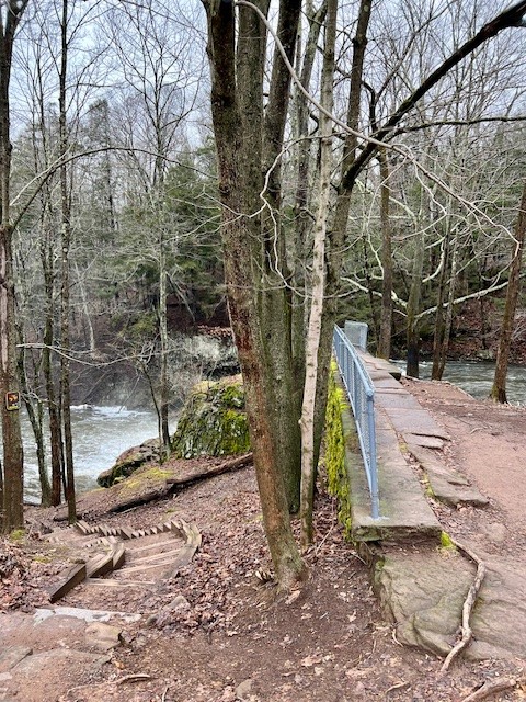
I discovered these falls for the first time in 2020 when I hiked a 7.5 mile loop of the Hammonasset Reservoir, but it wasn’t until I returned last month with my husband, Tom, that I discovered some new information. To hike the trails, you are supposed to have a permit from the Regional Water Authority. You can purchase a permit at the RWA website HERE. The Killingworth Library has an RWA permit available to borrow. For falls access without incorporating a hike, the Connecticut Waterfalls guidebook describes a set of stone steps that descend to the falls at the northwestern end if the bridge on Route 80 separating Madison and Killingworth. There are a few pullouts for parking along this busy two lane highway. As a permit holder, we opted to park in the gated lot on Route 80 and do a modest hike looping in on the green-blazed Hemlock Trail, continuing on white to the falls, then back on white. I recorded 1.6 miles and 207’ of ascent. The green trail goes along the banks of a peninsula that juts into the reservoir and has some tranquil views of the water and nearby islands.


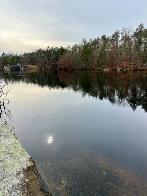
From left to right: a view across to an island in the lake; trees sprouting from a rock; a view from the shore with the dam in the distance.
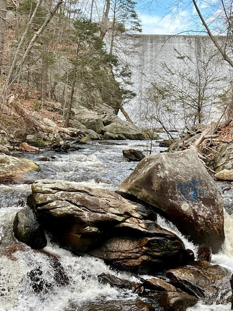
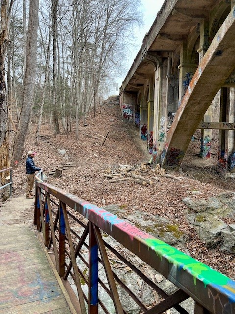
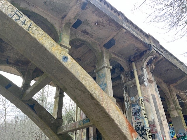
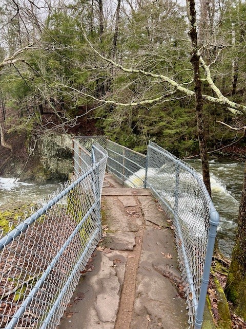
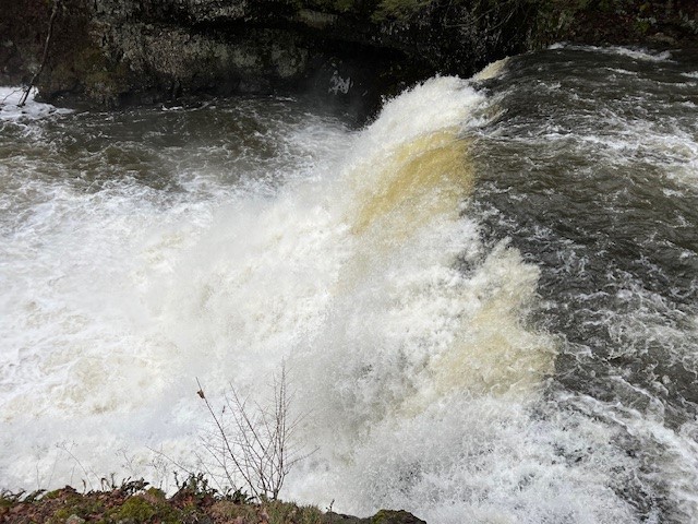
Numerous legends abound about various ghosts that haunt the falls which I won’t relate here. See the bibliography below for a link to an article that lists several. The approach to the falls feels otherworldly. The Hammonasset River flows over an immense dam, then rushes into a gorge, passing underneath a footbridge and a wide arched bridge that carries vehicular traffic along Route 80. Both bridges are covered in colorful graffiti (be forewarned that some is “R” rated) that gives the scene a dystopian effect. I ran ahead, taking in the sights and sounds of rushing water, framing photos and videos of the falls. Looking back, I saw Tom had stopped at the far end of the footbridge and was gazing up at the big bridge. Hello!! The falls are over here! Why was he not as excited as I was?


Well, it turned out he was, just not about the falls. Where I saw graffiti, he saw stunning architectural detail and had to know more. It turns out this bridge, which connects the towns of Killingworth and Madison, was listed in the National Register of Historic Places in 2004. Bridge No. 1132, as it is called, was built in 1934, and according to Wikipedia “is one of a small number of open-spandrel concrete bridges in the state, and was noted for its aesthetics at the time of its construction.” This is the type of place that I look forward to revisiting in all the different seasons. For a trail map click HERE.


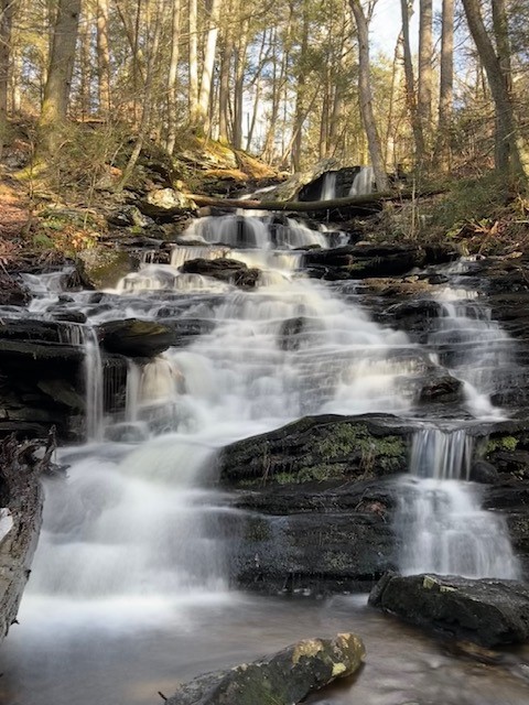
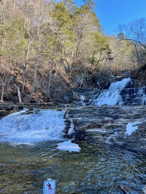
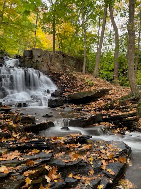
DAY POND FALLS, Colchester
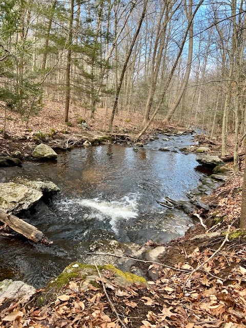
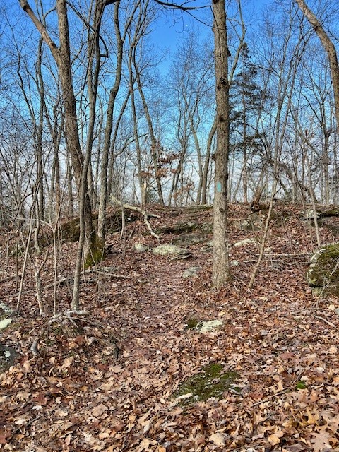
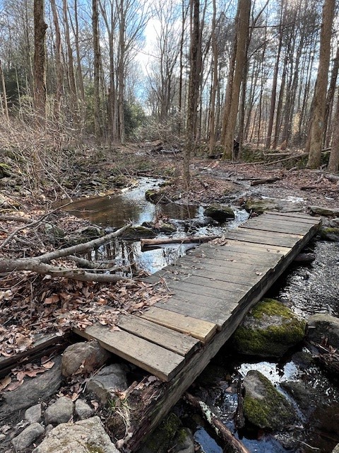
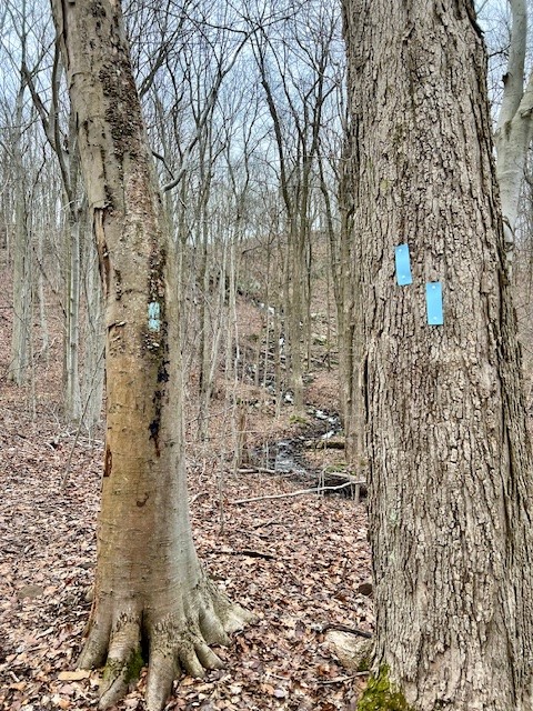
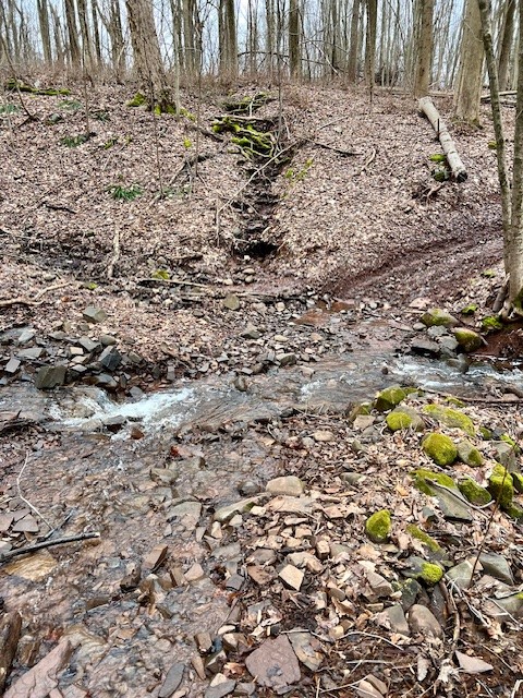
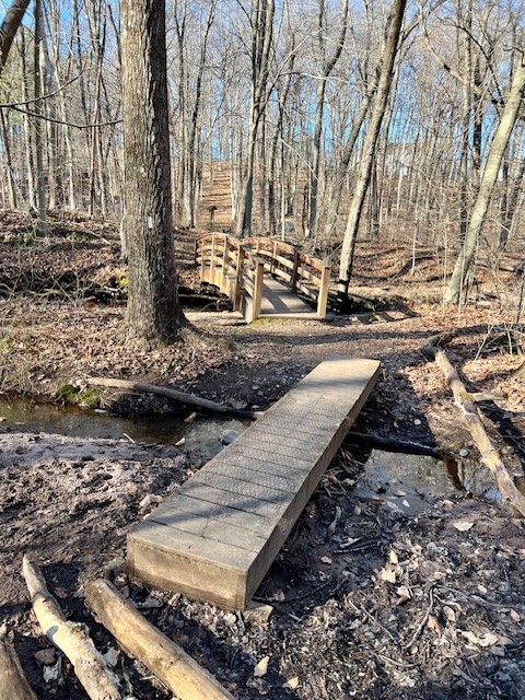
I visited Day Pond State Park on a seasonably warm, sunny day in early January. The northern parking areas are closed in winter, so I parked on the southwest side of the pond off Day Pond Road. I took the blue-blazed Salmon River loop trail counterclockwise starting with the northern loop, recording 3.5 miles with 604’ of ascent. There is a shorter option to get to the falls by doing an out-and-back on Day Pond Road. I have not done this so cannot share information about it. The trail parallels Day Pond Brook for a while before rising into an uplands forest with a smattering of boulders. As it comes back down there are some muddy spots. After crossing a stream on a small footbridge the trail follows Day Pond Road for a while.

From left to right: Day Pond Brook; the uplands trail; crossing a small stream; the remains of a vehicle on the old Day Pond Road
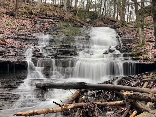
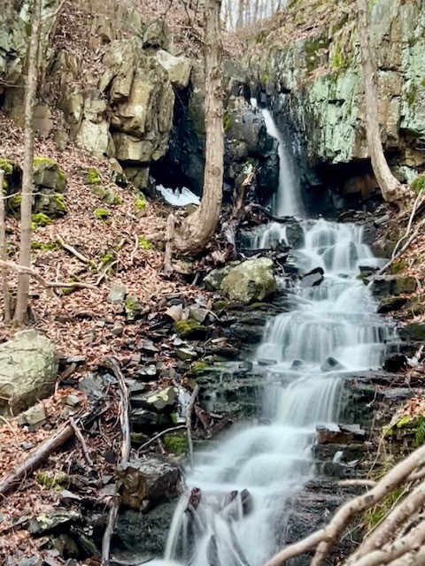
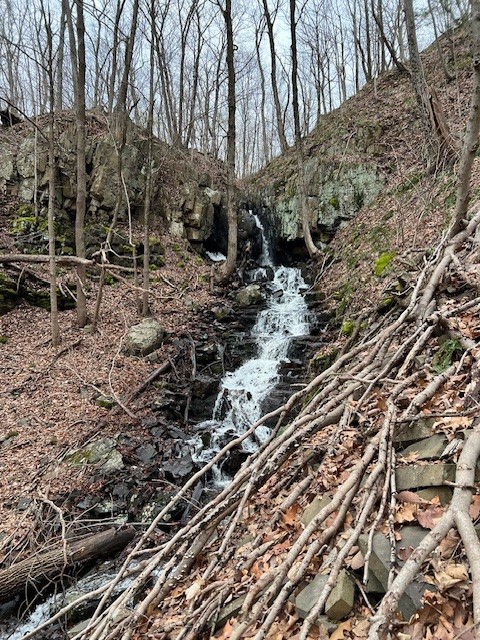
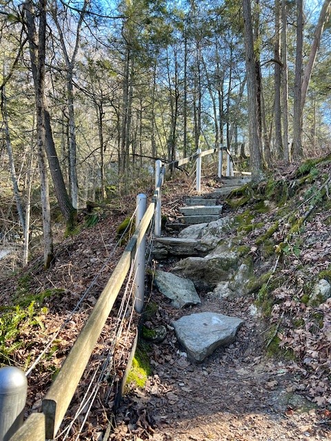
Watch for the blue blazes to veer off the road to the right. When I reached the blue/red spur trail junction I took this short .2 mile trail to Day Pond Brook Falls. The trail to the falls was a 2010 Eagle Scout Project and is now maintained by the Connecticut Forest & Park Association. I was in heaven! I scrambled down the trail to the bottom of the falls taking photos from every vantage point. From there I continued along the southern loop through more woodlands. At one point the blue trail connector to the Comstock Bridge comes in on the right. I stayed left to go back to the parking lot. Along this section there is an impressively large glacial erratic. For a trail map click HERE.


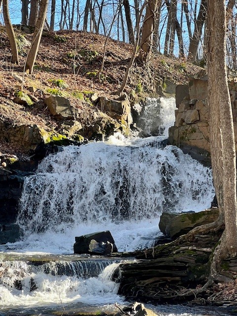
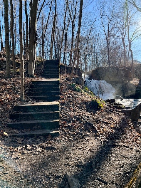
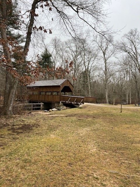
BLACKLEDGE FALLS AND GAY CITY STATE PARK, Hebron and Glastonbury
For my visit to Blackledge Falls I mapped out a loop starting in the parking area by the entrance to Gay City State Park, as there is no vehicular access into the park in winter. I recorded 6 miles with 753’ of ascent. For a shorter hike there is an option to park on Hebron Avenue on Route 94 and do the blue and white trail loop to Blackledge Falls. AllTrails describes this option as 1.1 miles. A friend and I did a clockwise loop starting by following the red trail south. After crossing the Blackledge River we looked for an unmarked trail on the left. While unmarked, it was well trod and easy to follow. It passes through Meshomasic State Forest, which allows hunting, so take precautions during hunting season and wear fluorescent orange. NOTE: The bridge was in very bad condition and looked like it was close to being taken out in the next storm. I would recommend doing this hike in reverse, starting on the yellow trail, in case the bridge is not usable. After a while the unmarked trail connects with the blue and blue/white blazes that lead to Blackledge Falls. The falls are a wide bowl drop with several flows over the top. It is a steep but very short walk from the main trail to the base of the falls. From there we continued on the trail, looping back onto the same unblazed trail. Once reconnecting with the red trail we went left and merged onto the yellow trail and then to the blue trail and park road to get back to our cars. The yellow trail goes along a large beaver pond.

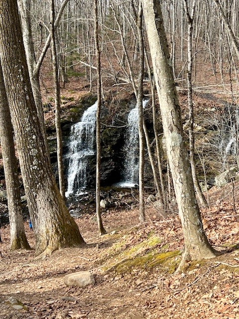

From left to right: the damaged bridge over the Blackledge River; Blackledge Falls; the beaver lodge and pond along the yellow trail
The town of Glastonbury has information on their website HERE. However, the map they have is confusing as it shows the trails in red, but in the field they are blue, blue/white and unmarked. The AllTrails Map can be helpful to make sure you are on the right trail. For the link to the Gay City State Park map which includes the falls click HERE. According to the website “the name ‘Gay City’ derives from a now-extinct mill town that once occupied the site,” which was abandoned shortly after the Civil War and turned into a State Park in 1944.
WADSWORTH FALLS STATE PARK, Middlefield/Middletown
Within the park there are two waterfalls. The easiest way to visit them both is to park at the Cherry Hill Road lot. For the Big Falls there are multiple viewing options. The best view is from the base of the falls, which you can get to either by taking the gravel path at the far left of the parking area or climbing down the stairs built into the bank by the falls. You can also walk out onto a fenced in viewing platform that allows you to get to the edge of the bank for a close look at the water as it spills over the edge. While protected, this option still gives me a touch of vertigo. There is no swimming or picnicking allowed at the Big Falls.
From left to right: The Big Falls from below; the stairs leading to the base of the falls; the walkway out to the viewing platform; the falls from the viewing platform
After admiring the Big Falls I hiked to the Little Falls, which I recorded as 1.4 miles with 162’ of ascent. Follow Cherry Hill Road south over the bridge for about .1 miles. After crossing the railroad tracks look for the trailhead on the left. This is very well marked with orange blazes and signs. Follow a wide path gently uphill and watch for blue blazes on your left. If the water is flowing you will probably hear the falls before you see them. Follow the blue blazes to a rocky outcropping where you get your first view of the falls from above. Be extra careful here! Staying on the blue trail, it is a steep descent down the slope to reach the bottom of the falls. You can make a longer hike by continuing on the blue trail. For all your hiking options, click HERE to see the trail map.


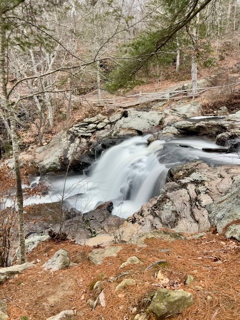
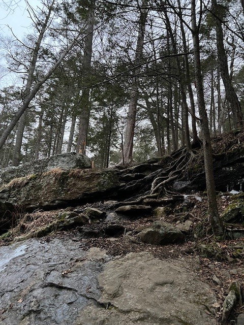
STAIR BROOK FALLS, Durham
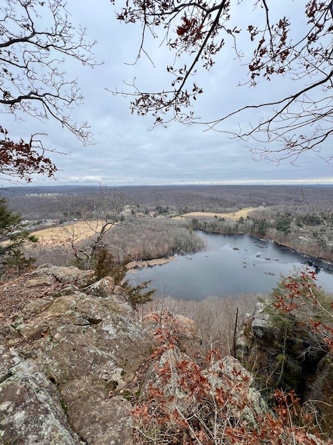
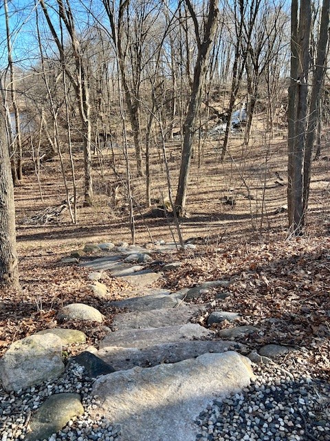
This is one of the more challenging waterfall hikes, even if you are just visiting the falls, which is an out-and-back of approximately one mile. I did a longer hike, recording 6.3 miles out-and-back to Bluff Head in Guilford with 1,007’ of ascent. Start at the trailhead on the southern end of Stage Coach Road off Route 17. On Google Maps there is a hiking pin labeled “Bluff Head from New Haven Road” where there is a pullout with room for a few cars by the trailhead. This is a section of both the blue-blazed Mattabesett Trail and the NET (New England Trail). I used AllTrails as a helpful navigation tool because it shows the location of the falls on the map. The hike is called “Bluff Head from New Haven Road via Mattabesett Trail” and you can find the link HERE. I convinced a friend to join me and we headed out on a wet morning in late January. The first section of trail is not particularly scenic. There is a lot of mud and water run-off along the trail as it ascends a fairly steep slope. We came to Stair Brook at about the .4 mile mark. While you can get a glimpse of the waterfall through the bare trees, to get the best view you need to bushwhack up the steep talus slope on the far bank. To do this we crossed the stream at the bottom – use caution and good judgment as conditions will vary. Talus is loose, angular rock that accumulates over time at the base of steep rock slopes, so you will be encountering loose rock. In combination with slippery leaves this is difficult and potentially dangerous so only explore this section if you feel comfortable in this terrain. It was only later that evening that I confessed to my friend that the author of the waterfall book wrote that this section is “very difficult” and “not recommended”. I assured her he probably wrote that for liability reasons. So let me be perfectly clear – I do not recommend climbing the talus slope!
from left to right: first glimpse of the falls from the trail; the stream crossing; the falls from the opposite bank further up the talus slope
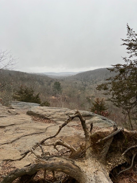
After taking in the majestic falls we retraced our steps and continued on blue. At the top of the bluff we encountered a kiosk at the Guilford line with a map of Guilford’s North Woods. We stayed on blue, which follows an old roadway with lots of puddles to maneuver around. The trail eventually turns into a nicer single track and is fairly level with some ups and downs as it head out to the edge of the trap rock ridge. The trail then winds along the ridge with views through the trees until finally reaching the first of many overlooks above Myer Huber Pond (photo at right). We made this our turnaround point.
This map on the Southern CT Regional Council of Governments website has useful commentary and is easy to read, but lacks good topographical information.
This map, which is also on the kiosk, has much more detailed topographical information and covers a wider area, but is more difficult to read. I found it helpful to refer to both.
The blue-blazed trail system offers 825 miles of hiking trails maintained by the Connecticut Forest and Park Association and its team of volunteers. For more information about CFPA and the trail system click HERE.
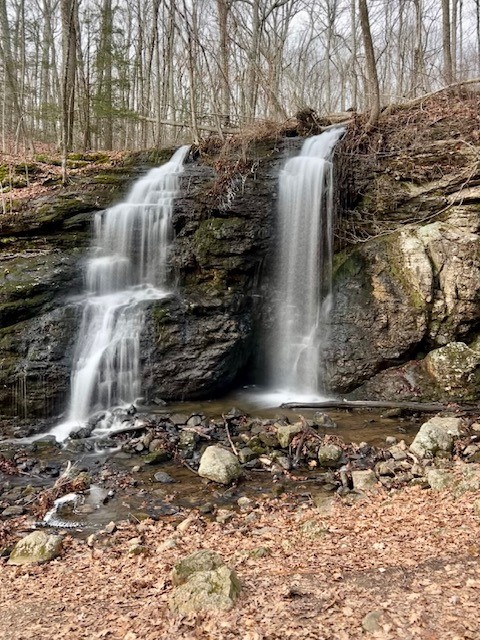
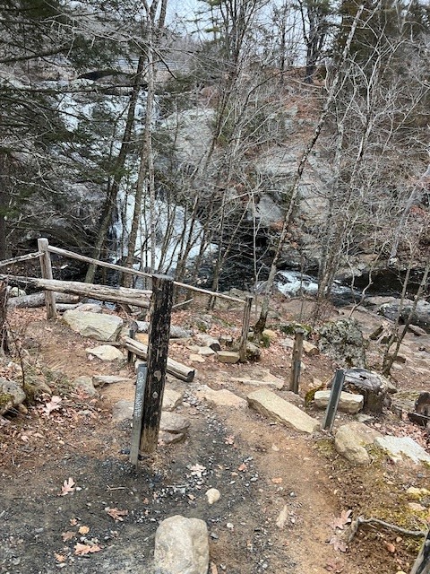
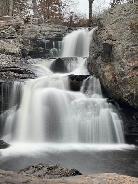
ROARING BROOK FALLS, Cheshire
The out-and-back trail to Roaring Brook Falls is maintained by the Town of Cheshire. Online I read about a loop option that connects onto a portion of the Quinnipiac blue-blazed trail. The loop trail is described as steep with loose rock, and since I was hiking solo on a very wet day I opted for the more moderate out and back. I recorded 1.25 miles with 294’ of ascent. Parking is at the end of Roaring Brook Road where there is a pullout for two cars. Overflow parking is on the road and nearby cul-de-sacs. The town website tells GPS users to plug in “827 Roaring Brook Road, Cheshire” for the address. The trail begins on a wide dirt road that passes between two private ponds with posted “no trespassing” signs. Further in there is a welcome sign and bench. At this point, the red trail leaves the road on the left. The painted red blazes are faint, and the round metal disc blazes have faded to white, but the trail itself is well worn and obvious. Just before crossing Roaring Brook look for an interesting and enormous chimney on the left hand side. There are some plank bridges for crossing, but if the water is high you may need to do a little rock hopping. It starts going steeply uphill, continuing for about .2 miles. As the trail levels out you will hear the falls. Follow the trail until it comes out at a dramatic and picturesque gorge. You will see the waterfall further up the hill, plunging down a total of 80’ into the ravine. Follow the path further up for the best views.
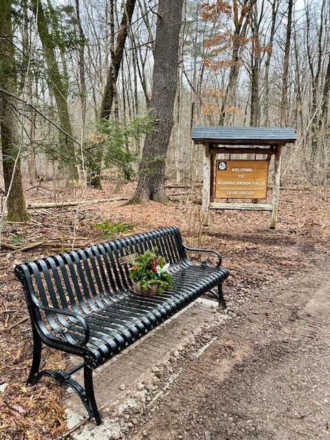

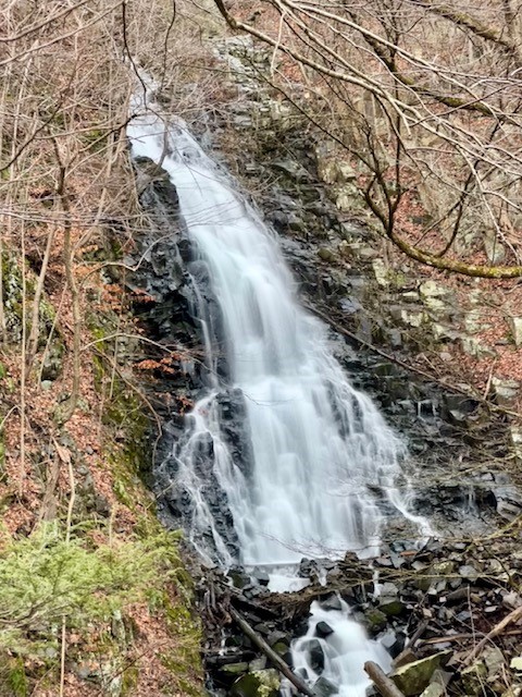
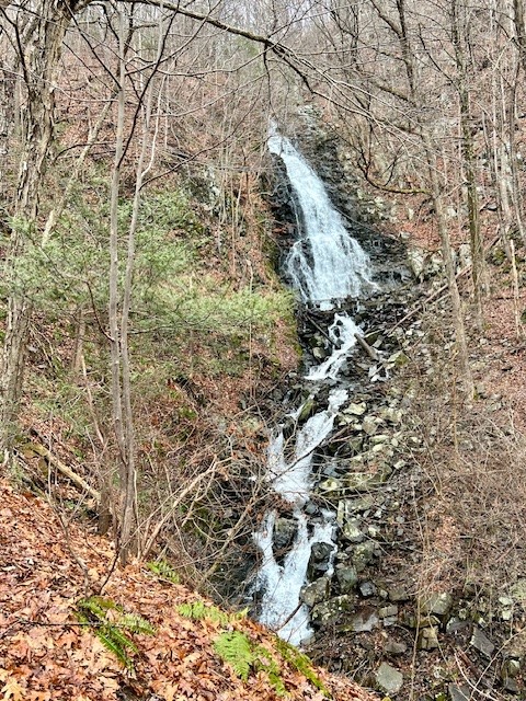
From left to right: Welcome sign and bench; the brook crossing; zoomed in on the top cascade of majestic falls; a more complete view of the falls
KENT FALLS, Kent
Tucked into the northwest hills, I had always wanted to visit this State Park, and had my opportunity recently while on my way home from upstate New York. Of the 9 waterfalls described in this post, this one is the most accessible, at least for viewing the lower waterfall. From the parking lot you can take a wheelchair accessible paved path across the covered bridge and get all the way to the base of the falls. This lower section is spectacular in and of itself.
I chose to do a longer hike, recording .85 miles with 237’ of ascent. By the base of the falls, I climbed the stairs that are built into the right side bank. Along the way there are several wooden deck viewing points where you can admire the numerous cascades. Perhaps the most dramatic one is at the top. The rock formations and potholes are amazing. At the top, the trail comes out on a road. I followed the road across the stream and took the red blazed trail immediately on the left. I followed this back to the parking lot. According to the map you can extend your hike by taking the yellow trail which veers off from red and reconnects further down. The map describes it as .67 miles and my guess is that is offers a gentler grade down. The red trail passes a very impressive stone wall and at times is quite steep. I had to climb over several downed trees and pick my way through some muddy sections. At the bottom where the trail opens onto a grass strip by the parking lot I was unable to get through without getting my boots quite wet. You won’t find much solitude here, especially on weekends, but the falls are spectacular and I had fun talking with other visitors, including one who reminisced about the days when he could scamper up the rocks and swim in all the holes. There are bathroom facilities seasonally, a compost toilet year round, and several picnic tables in the field between the parking lot and the falls. For a trail map click HERE


From left to right: the covered bridge with paved path to falls; the lower falls; a section of the stairs leading to the top; one of many cascades that make up Kent Falls
DIVIDEND POND FALLS, Rocky Hill
I first discovered the Dividend Pond Trails and Archaeological District when I was researching Connecticut’s glacial history. This area was the southern terminus of glacial Lake Hitchcock, which at one point extended all the way north to St. Johnsbury, Vermont. During the area’s more recent history, much industry developed around Dividend Brook, which flows into the Connecticut River. One of those industries, Bigelow-Sanford Inc, sold a 68 acre parcel to the town of Rocky Hill in 1973 for one dollar and tax relief. In 2006 the property was declared a State Archeological Preserve and after much work the Dividend Pond Trails and Archaeological District held its grand opening in 2012. There are 3 miles of trails and 10 signposted archaeological sites dating from 1667 to the 1900’s. The parcel includes 4 dams and two mill ponds. The dam at the base of the upper pond features a scenic waterfall where it flows into the lower pond. This is a gem of a spot in the middle of the Rocky Hill Industrial Park. The first time I visited was in mid-October of 2022. It is a very scenic spot when the leaves are changing color.
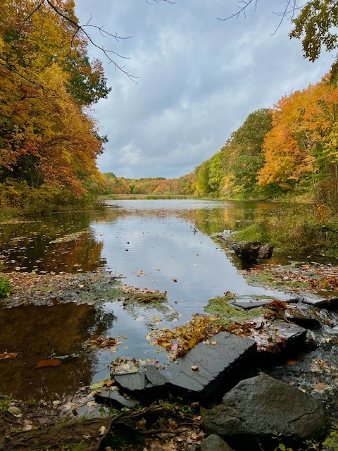
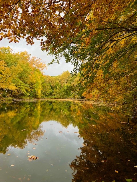

From left to right: the Upper Pond from the dam; the Lower Pond; the Falls
I returned in early February of 2024, and with the leaves off the trees I could see the waterfall from the parking lot. At the back of the lot there is a set of stone steps leading down to the white trail. Alternatively you can take the trails to the left or right. I took the steps and followed the path to the base of the falls. The stream was not passable, so to get to the other side I backtracked and did a clockwise loop on the white trail, starting around the Lower Pond. At one point I popped out onto the road briefly and then reentered the woods. After going around the lower pond I descended a flight of steps to admire the waterfall from the base of the falls on the opposite bank. Taking photos was tricky in mid-afternoon with the low southern sun in the background. At the top of the falls there is a dam that creates the Upper Pond. There is a path to cross here, but the water was quite high and I didn’t want to chance getting my feet wet. I chose to do a clockwise loop of the Upper Pond and wetlands. The eastern bank of the Upper Pond is a single track that undulates gently up and down through the woods. The pond becomes swamp, then boggy wetlands. To extend your hike you can keep going straight on the white trail to intersect with a yellow trail loop. I chose to take the white trail in a loop to the right where there is a footbridge. There is one muddy section where there are stacked up small logs to help with the crossing. The trail back on the western bank is a wider dirt road. I recorded 1.5 miles with 147’ of ascent.
The steps from the parking lot with falls in distance; The falls from the left bank; the steps down on the right bank; logs and footbridges to cross the mucky sections
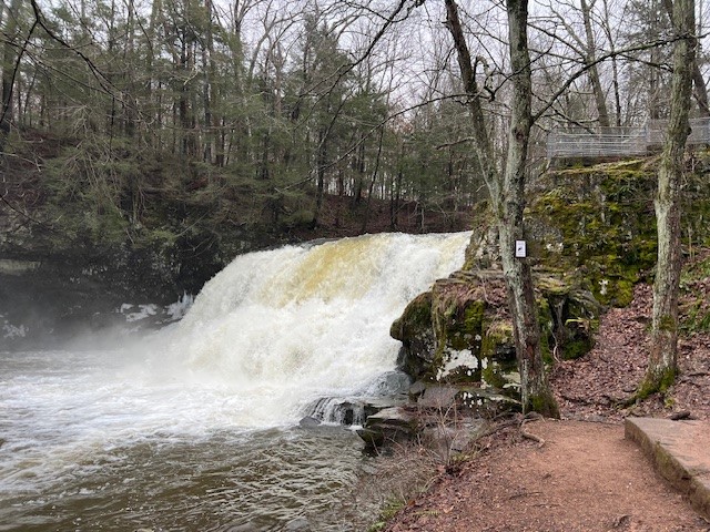
CHAPMAN FALLS, East Haddam
Chapman Falls, on a section of the Eight Mile River, is both one of the most accessible and photogenic of our state waterfalls, and is located within Devil’s Hopyard State Park which offers miles of hiking trails. You can either park above the falls in the lot on Foxtown Road near the junction with Hopyard Road, or in the Pavilion Parking below the falls off Hopyard Road. I chose to park at the top. If your mobility is very limited, you can get a feel for the drop by going along the sidewalk of the bridge above the falls. From the opposite side you can enter the pine needle strewn fenced-in area to get a glimpse from the side. Back on the parking lot side of the falls you can take the gravel path as it winds down the slope, catching glimpses of the falls through the trees. The best views are from the base of the falls, which requires a short but steep walk down a well-worn path.

From left to right: the steps to the base of the falls; the best view of the falls is from the bottom; view looking over the bridge rail; view from the left bank
There are so many trail options at Devil’s Hopyard. I was there early on a mid-February morning and decided to try a new trail for me — the orange loop on the far side of the river. Going past the falls into the picnic area, I crossed the stream at the covered bridge and got on the orange trail. Approaching the fork in the trail I saw an animal streak by in the distance. It was too low to be a deer and too large to be a fox. As I continued I saw movement out the of corner of my eye, and closer in front of me a second animal streaked across the trail – heading from the river up into the hills. This time I was close enough to see that it was an enormous and healthy looking coyote. While I had already planned to start alongside the river and come back over the hill, this cemented the plan in my mind. This loop is a short but challenging hike with some rock scrambles and steep inclines. It passes a feature called the Devil’s Oven which is a short spur trail up to the cliffs where there is a cave. I took this trail, but stopped well shy of entering the cave. Having seen those coyotes, and knowing it was the start of coyote denning season, I felt safer not approaching the caves. At the far end of the loop at the top of the ridge there is another spur trail to a lovely vista, although on this particular morning everything was a dull gray. I recorded the loop, including the exploration of the falls, at 2.5 miles with 585’ of ascent.
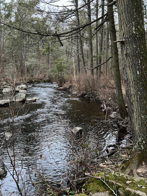
From left to right: the bridge to get to the orange trail; in some places the trail is steep with rock scrambles; the Eight Mile River; the vista on a drab morning
BIBLIOGRAPHY
Connecticut Waterfalls: A Guide, by Russell Dunn. Photos by Christy Butler (2013)
These two websites are associated with the book New England Waterfalls and have a wealth of information. The first link is for all of New England https://newenglandwaterfalls.com and the second is for waterfalls in Connecticut https://www.newenglandwaterfalls.com/connecticut.php
Article about the legends of Nineveh Falls by Thomas D’Agostino on the Yankee Express website https://www.theyankeexpress.com/2021/05/12/356178/nineveh-falls
Subscribe to Trail Talk
your next adventure awaits
Questions? Email me at naturenerdsramble@gmail.com or find me on Instagram @the_real_nature_renee.
