November may seem like a dull month – leaf-peeping season is over and the bare branches against the often drab skies create a somewhat colorless effect. Usually there isn’t snow yet to sparkle things up a bit. In my opinion, however, November has many positives to commend it as a good hiking month. First, I don’t have to worry about pesky insects like mosquitos, gnats and all manner of flies. And while ticks tend to stick around all year when there is a mild winter, they are much less of a problem. Second, with the greenery gone, I can see farther into the woods and appreciate the rocks, cliffs and boulders in a different way. It is also much easier to bushwhack, although it is important to only do this on parcels where going off trail is permitted, and I only recommend it if you are comfortable with exploring the woods and your ability to find your way back out. Finally, I find November a perfect month for a longer hike. The temperatures tend to be just right for moving at a fast pace without overheating, and there aren’t as many plants, mushrooms or creatures like efts to distract me. While I often go to Chatfield Hollow or Cockaponset State Forest for long hikes, in this Trail Talk I share two other nearby places that are great options for longer loop hikes.
NOTE: Please educate yourself on hunting seasons in Connecticut and wear orange to make yourself visible. For a summary of 2023 season dates click HERE. For the 2023 Connecticut Hunting and Trapping Guide click HERE.
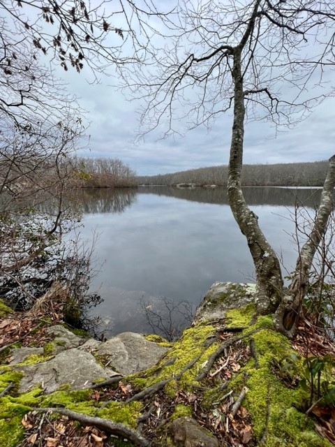
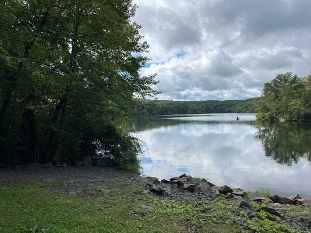
MILLERS POND, Durham.
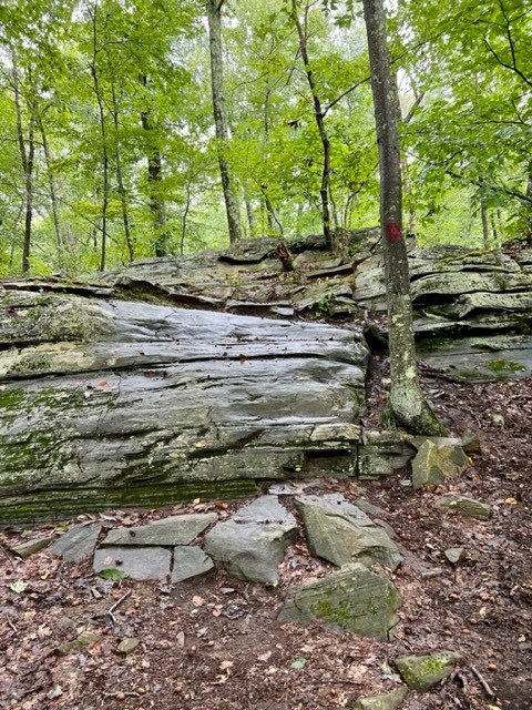
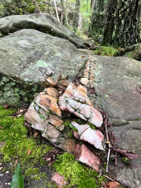
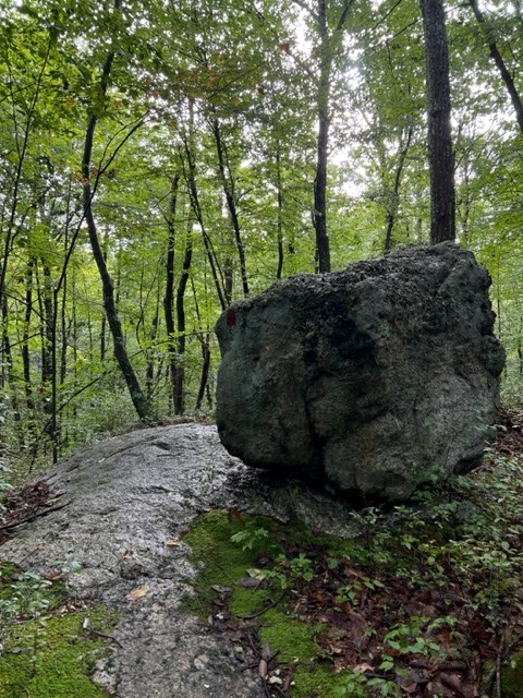
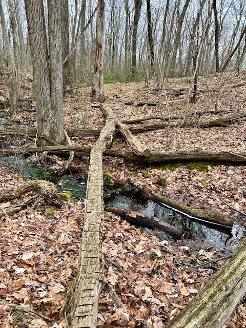
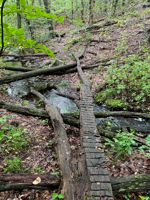
I imagine Millers Pond can get very crowded in the summer, but in the off-season it is generally quiet. The red trail covers over 9 miles, and while there are no overlooks it is a good woodlands hike. I first visited in January, and chose to break it up over 2 days. The first day I did the western loop starting north right from the parking lot. The trail takes you past some old ruins early on, and then winds through the woods. At times you are fairly close to homes. This loop has an easy stream crossing and goes along a scenic ravine. When I got close to the pond, I diverted onto the blue and white trails, returning to the parking lot along the pond’s western banks for a total of 5.5 miles. Later that week I did the southern loop totaling about 5 miles, coming back along the southeastern shore on blue/white then white. The southern loop twists and turns taking you over numerous rocky outcroppings with quartz studded rocks and sparkling mica. This route also has more challenging stream crossings. The water was flowing strong in January, and there was one place where I crossed on a notched log, so I was glad to have my poles with me. Evidence on the trails shows that this is a popular destination for mountain bikers, but I only encountered two. I returned in mid-September to see what the trail looked like still swathed in greenery, repeating the southern loop of the red trail but this time looping around the pond on the northwestern trails. With recent rains the mushrooms were fruiting everywhere, but it was also extremely buggy. Since these trails have such great rock formations, my preference is for fall to spring hiking at Millers Pond. Hunting is allowed here, so be sure to wear orange if you go during hunting season. I also recommend bringing a trail map, as there are numerous trails, including several that are not blazed.
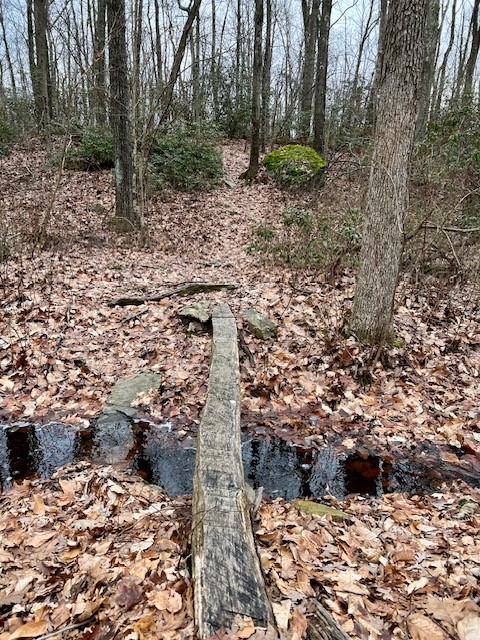
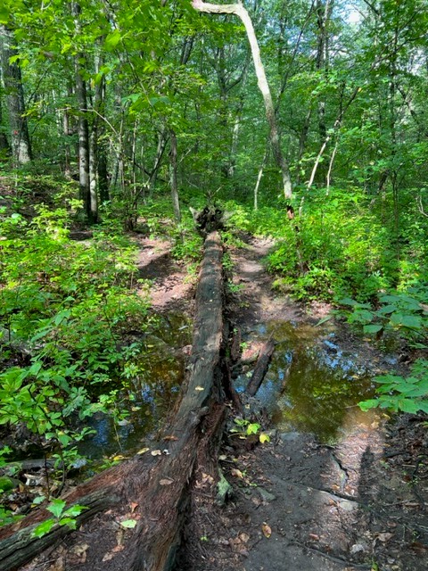
To give you a clearer image of the stream crossings you will encounter on the southern red loop, the photos below show them in winter and in summer. If this type of crossing makes you uncomfortable, you can opt for doing just the western loop, or you can do a shorter southern loop by turning at the stream crossing and taking the yellow trail back.
Another option is to hike around Millers Pond adding an out-and-back on the Mattabesett Trail to Bear Rock. I did this as a sunrise hike in January of 2021 and wrote about it in my March 2021 Trail Talk column in the Killingworth Krier. I first learned about it from a Rockfall Foundation blog post (see link below). The Mattabesett Trail is a 62 mile section of blue-blazed trail maintained by the Connecticut Forest & Park Association and it cuts through Millers Pond State Park. For this hike I started at the trailhead on Harvey Road in Durham. Due to luck of timing and topography I watched the sun rise both from the ridge above Bear Rock and again, 35 minutes later, from the shore of Millers Pond! (Bear Rock itself faces west, and I have since returned for a sunset hike here). Starting at Harvey Road it was a 5.5 mile hike. If you start at Millers Pond, eliminating the section between Bear Rock and Harvey Road, the hike would be closer to 4.5 miles.
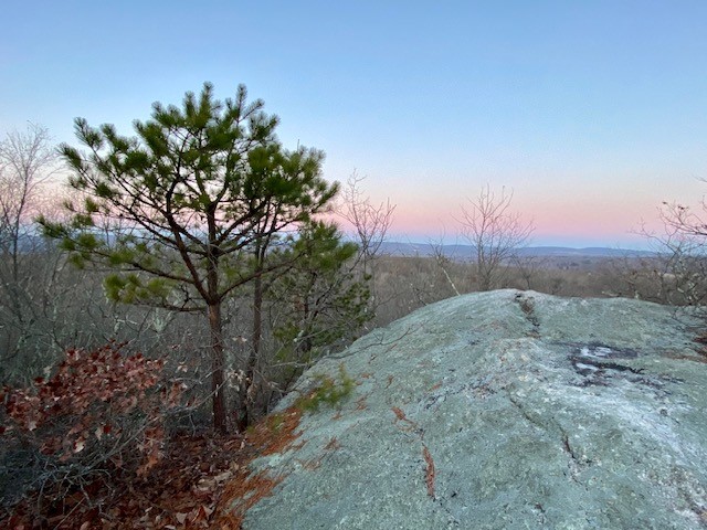
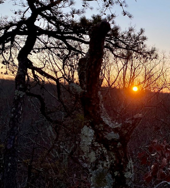
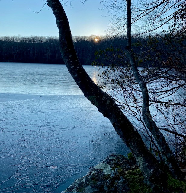
From left to right: dawn at Bear Rock; sunrise from the ridge above Bear Rock; the Mattabesett Trail; sunrise from the shores of Millers Pond.
For a trail map of Millers Pond State Park, including the trail to Bear Rock, click HERE
For the Rockfall Foundation’s Off the Beaten Path blog post click HERE
For more information about the Mattabesett Trail visit the Connecticut Forest & Park Association link HERE
HADLYME HILLS, Lyme.
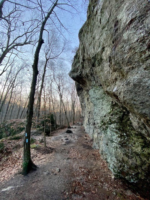
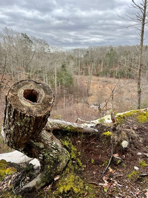
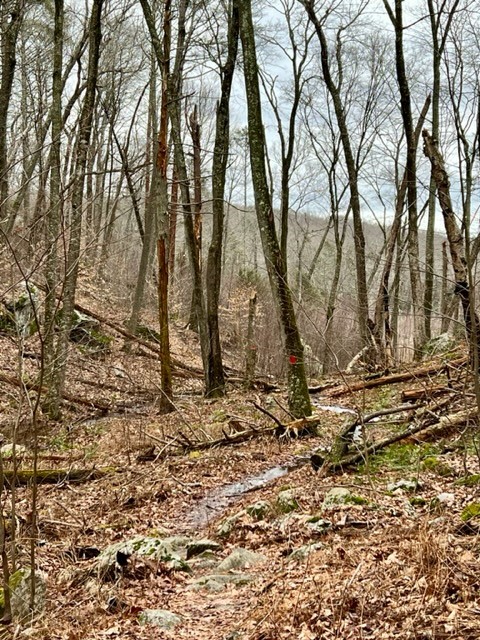
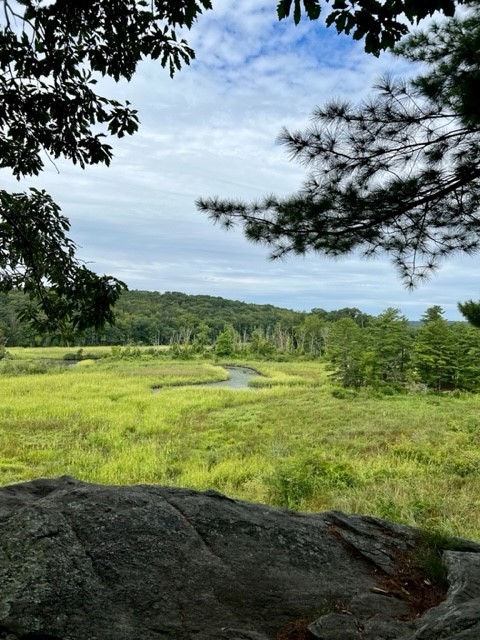
There are three adjoining preserves that make up the Hadlyme Hills: Brockway-Hawthorne Preserve, Ravine Trail and Selden Creek Preserve. I first visited on a bleak January day after a major deluge. If I had had any expectations I think they still would have been exceeded. These 3 parcels offer over 6 miles of trails on 382 acres. I started at the Ravine Trail parking pullout on Mitchell Hill Road. My route followed a 5 mile loop of the Ravine Trail and Selden Creek. If you like overlooks with scenic views this is a great destination, as there are 4 of them. My route through the Ravine Trail property was red to yellow to white. The red trail has some steep sections and creek crossings. The path through the ravine is enchanting. There are two blue spur trails that are worth the detour. The first is a very short path to a breathtaking open view to the marsh below. The second spur trail adds about a half mile to your hike and the views are of the same marsh from a different vantage point, and because of the trees I imagine the view is obscured once the leaves emerge (I confirmed this during my summer visit!) It was here where I encountered a pileated woodpecker. I had been making all kinds of noise sitting on the bench, having a sip of water and snack. I picked up my camera and approached the cliff edge, startling the bird, which had been quietly perched on the large branch of a dead tree that was leaning over the abyss. As soon as I appeared in its sight it flapped its wings and flew away. The white trail crosses Joshuatown Road and continues onto the Selden Creek property. I took the white trail to the end, then followed orange to get all the overlooks, which look out onto Selden Creek and the island of Selden Creek State Park which is only accessible by boat. I followed the blue trail back. The Selden Creek woods have a nice wide open feel with rolling hillsides and some impressive trees. Once back on the Ravine Trail side I took white to an orange crossover trail to catch the purple trail back to my car.
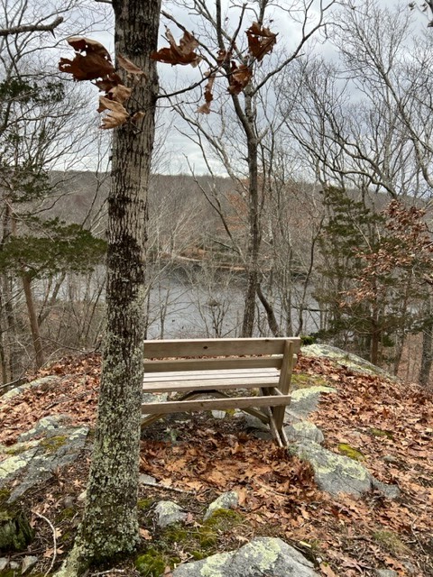
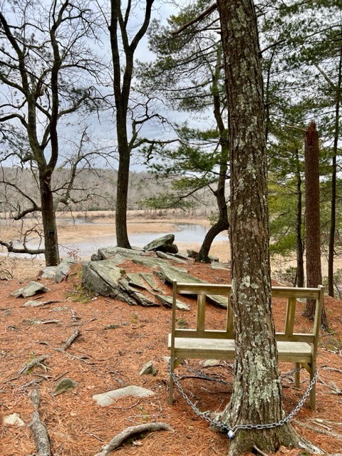
From left to right: The view from the short blue spur trail; the bench where I encountered the woodpecker; the red trail through the ravine; the Selden Creek overlook
I returned again in June, this time meeting a friend at the Brockway Hawthorne parking area on Brush Hill Road. We hiked a loop of purple and white, extending our journey to include the overlook on the Ravine Trail parcel off of the yellow trail. The trails were generally well marked, although we had to pay attention a few times to stay on track. The mountain laurel was in bloom and we encountered many tantalizing fungi. We clocked almost 4 miles and a total ascent of 619’.
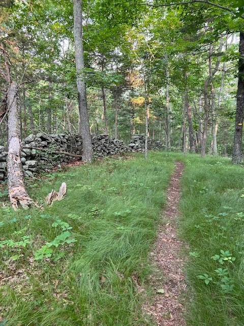
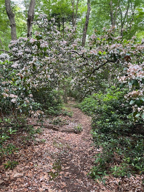
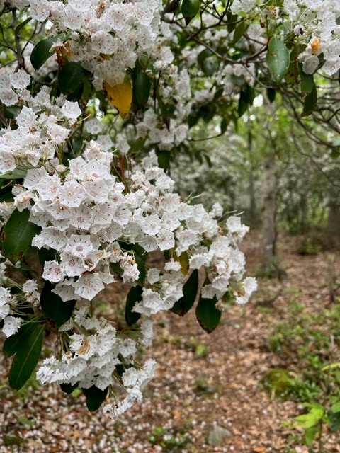
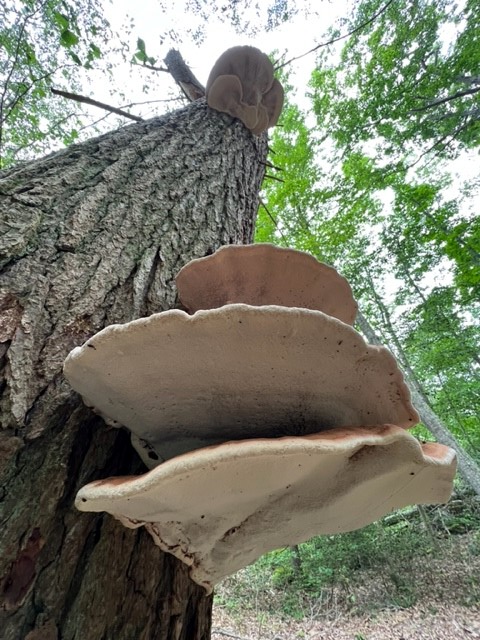
Stone walls, grassy paths, mountain laurels and polypore fungi in the Brockway-Hawthorne Preserve
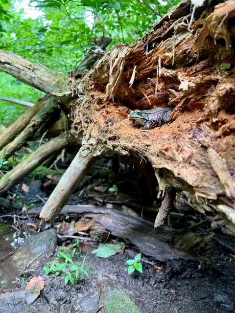
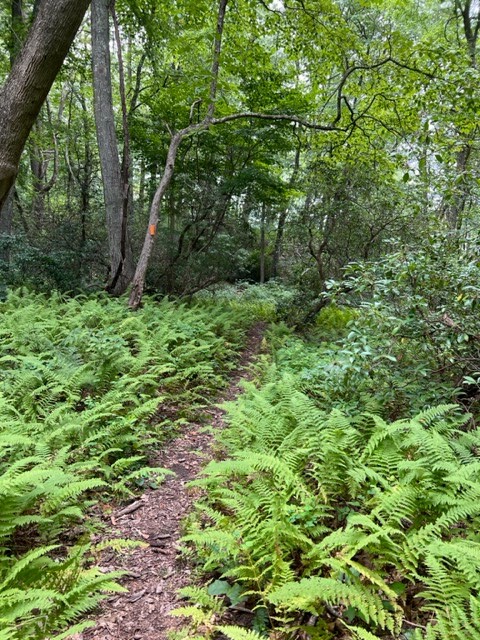
I returned once more in August to hike the Selden Creek Preserve with friends. We did the same route I had done in January, adding in the short yellow trail, which presumably doesn’t get much traffic as it was quite overgrown. We covered 2.75 miles. I enjoyed seeing this parcel in a different season. While I could still get a sense of the rolling hills and boulders, the tree cover and lush ferns gave the hike a different feel. Below I share some frog photos, but it is the STORY behind this frog that makes me laugh and illustrates the truism that sometimes you don’t see what’s right in front of you.
While going along the blue trail we passed a small puddle and heard a big splash. I immediately crouched down to search the water for a frog. Being a bit wobbly, I reached out my hand to steady myself by holding onto a rotted fallen log. My friend was also peering down, and her dog started to splash in the water.
Suddenly her husband cried out “Look!” And “right there!” So of course we kept looking in the water since we had heard the splash. But NO — he meant on the rotten fallen log – the one I had just been holding onto. I had practically grabbed the frog and didn’t even know it! Luckily it stayed very still for me as I excitedly began taking photos.
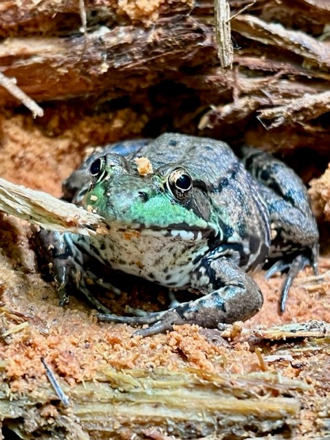
From left to right: the protagonist of my frog story sitting on his log; Selden Creek in summer; lush ferns along the trails
I recommend parking on Joshuatown Road. There is a larger parking area and you’ll have easier access to all three preserves.
For a trail map and detailed description of the preserves making up The Hadlyme Hills click HERE. Ownership of the preserves is a combination of the Lyme Land Trust (Brockway-Hawthorne and Ravine Trail) and The Nature Conservancy (Selden Creek and Ravine Trail).
Questions? Email me at naturenerdsramble@gmail.com or find me on Instagram @the_real_nature_renee.
Subscribe to Trail Talk
your next adventure awaits
