It is the year 1760 or thereabouts. The hillside of Mount Tom looms over the Salmon River in the village of Moodus. From an abandoned blacksmith’s shack near its base, reverberations from a clanging anvil cause the villagers nearby to exchange wary looks. Even if they were to creep close enough they would not be able to peer in, as the windows have been covered over by the occupant – a stranger to these parts – an alchemist who goes by the name of Dr. Steal. He claims to have been sent by King George III to discover the source of the mysterious noises that have been reported back to England since the first European settlers arrived a century earlier. The Indigenous Tribes of the area – Wangunk, Pequot, Mohegan and others – call the place Machit-Moodus – the place of many noises. They attribute the ominous explosions, rumblings and vibrations to the spirit Hobbomacko. The villagers, on the other hand, believe the Noises to be the wrath of God imposed from on high for any number of misdemeanors. For days now Dr. Steal has climbed the mountaintop, sledgehammer and pickaxe in hand, to explore the rocky cliff and search for caves, returning to the ramshackle abode below to experiment with his extractions. Will he be able to literally dig out the root cause of the Noises once and for all? Suddenly, the door to the shack bangs open and the disheveled wizard steps outside, shading his eyes, which are unaccustomed to the bright sunlight. He announces that he has discovered the source of the noises – two giant, luminous white pearls he calls “carbuncles” that have grown too large for their rocky encasement. He warns the villagers that although the noises will temporarily diminish, other small carbuncles will inevitably grow bigger and the noises will eventually resume. Then he packs the extracted stones in a leaden case and sets sail for England, never to be heard from again.
The above is my own imagining and interpretation of a local legend. How much truth is there is in the tale of the mysterious Dr. Steal (or Steel or Steele)? I have no idea. The legend has been circulating at least since the early 1800’s when the poet John Brainard published his popular poem “Machit-Moodus”.
“O'er Moodus river a light has glanced,
On Moodus hills it shone;
On the granite rocks the rays have danced,
And upward those creeping lights advanced,
Till they met on the highest stone.

O that is the very wizard place,
And now is the wizard hour,
By the light that was conjured up, to trace
Ere the star that falls can run its race,
The seat of the earthquake's power.”

(See additional resources below for a link to the full poem and accompanying story).
Whether or not there is any truth to the carbuncle legend, it is true that there are numerous tales about the existence and source of the mysterious noises. It is also true that the prophecy came to pass. A magnitude 4.5 earthquake in 1791 was felt for miles around, and in the centuries that followed several more earthquakes were registered.
As the years passed, religious and spiritual explanations gave way to more practical theories formed from scientific discovery. When considering local geology I always first turn to Stories in Stone: How Geology Influenced Connecticut History and Culture, by Jelle Zeilinga de Boer (2009). De Boer, who passed away in 2016, was a Professor of Earth Sciences at Wesleyan University for over 40 years. He shares numerous theories behind the Moodus Noises, one being the glacial rebound theory where “the slow process of unloading after the ice melted slowly raised the land and intermittently released the ‘fossil’ strain’ ”, resulting in the seemingly random pops and rumblings. The development of plate tectonics theory in the mid-1900’s further suggests that additional pressure, caused by the force of the Mid-Atlantic Ridge as it pushes against the North American continent, contributes to the erratic seismic activity.
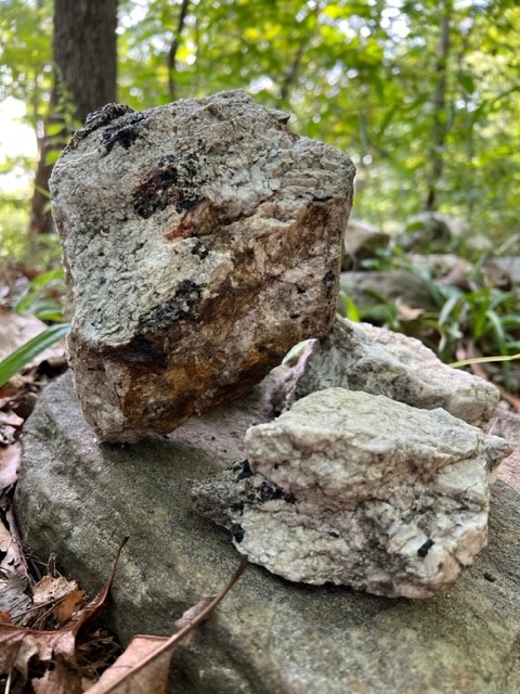
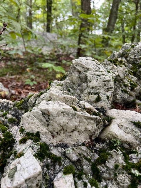
I was fortunate to have the opportunity to walk in Machimoodus State Park with Alison Guinness, a resident of East Haddam. Alison is a naturalist, historian, and educator who coincidentally did her Master’s Thesis on the Moodus Noises under Jelle de Boer at Wesleyan University. I had read in Stories in Stone that the underlying geology of the area is metamorphic rock (gneiss and schist) layered with pegmatite, a type of igneous rock that is known to contain large crystals of minerals. I also knew from some of my reading that two minerals sought after in the Mount Tom quarrying operations in the past were beryl and schorl tourmaline, but I was struggling to understand just what pegmatite was. Alison gave the most wonderful analogy for the neophyte layperson: “In the recipe for pegmatite, you always have the quartz and the feldspar – they are like the flour and sugar.” She went on to describe the magmatic activity below the surface – a “big hot melted pool of stuff” – and how the cracks that open with the seismicity provide a route for the melt to travel. As the melt rises, the pressure and heat change causing different minerals to “drop out” of the melt. As to the phenomenon of the Moodus Noises, Alison brought up the Eastford fault. She explained that as energy rising through the ground connects with the atmosphere it creates the sounds. (For anyone wanting to take a deeper dive, see my note in Additional Resources below).
If you are interested in sample collecting the best way to pursue this activity is to join a mining club. The Mindat.org link in Additional Resources below talks more about the mining history on Mount Tom and includes links to the nearest mining clubs.
In researching this article perhaps the most fun find was a student paper written in 1979 for a History Class (presumably at Wesleyan University) taught by none other than Jelle de Boer. Being a college graduate myself from around that time perhaps I was just nostalgic for old type-written papers, but I truly enjoyed reading the hypotheses of these engaged students. They considered all kinds of theories, including looking at whether the population of the town fluctuated with the Noise clusters that occurred, which may have indicated fear of the Noises (it did not). In their paper, they identified several time periods with heightened earthquake clusters: “One such period, dates approximate, was 1650-1670. Others were 1725-1745, 1750-1760, 1782-1795, 1892-1900, 1912-1919, 1940-1946.” So you can see there was an uneven pattern of clusters, which continued into the 1980’s.
Measuring seismic activity in the area ramped up in the 1960’s with the building of the Yankee Nuclear Power Plant on the nearby Connecticut River. According to the Northeast States Emergency Consortium, “scientific data confirmed that the Moodus noises are the sounds of small earthquakes that are taking place less than a mile below Mount Tom….During the 1980s, several earthquake swarms….each of which lasted a few months….were documented to consist of well over 100 small earthquakes.” The funding for intense monitoring dried up after 1989, and things have been mostly quiet since then, although there was a magnitude 1.3 earthquake on March 24, 2011.
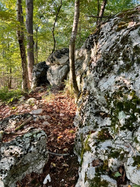
It is generally accepted that the epicenter of the Moodus Noises is the Mount Tom –Cave Hill area. One reason for this may be that the rumblings that rise from the ground are amplified as they pass through the Cave Hill cave, and then reverberate as they encounter Mount Tom.
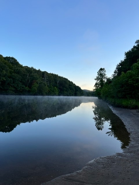
Fortunately, Mount Tom is located within Machimoodus State Park in East Haddam. While the cave is on private land owned by Cave Hill Resort, there is a town-owned loop trail that traverses the summit and ledges of Cave Hill. A friend who lives nearby gave me a personal tour of Machimoodus. Of course my first question was “have you ever heard the Noises?” The fact that she has never heard the Moodus Noises during the 30 years she has lived there did NOT dampen my enthusiasm!

MACHIMOODUS STATE PARK, East Haddam
Once known as Echo Farm, this property was owned by local industrialist Ray Schmitt. One of Schmitt’s ventures was purchasing the abandoned village of Johnsonville (now privately owned) and turning it into a tourist attraction. Upon his death in 1998, the State of Connecticut purchased the 300 acre property, creating Machimoodus State Park.
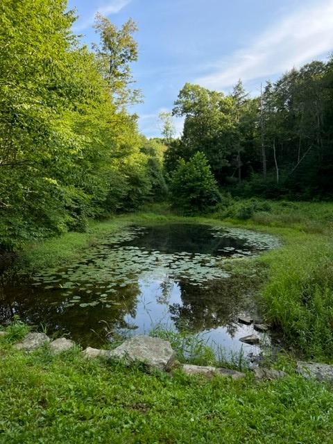
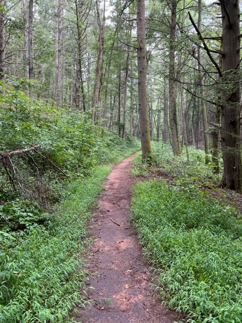
We visited on a pleasant August morning and did just over a 3 mile loop hike. From the parking lot we followed the main trail, an old farm road flanked by beautiful trees in many varieties (pin oak, maple, pear). After passing a pond on our right, we turned and walked down a mown grassy path through a field crossing into Sunrise State Park (more on that later). Turning left onto an unmarked path we passed through a stately hemlock forest that met up with the blue/yellow then blue trails. At the next junction we followed the yellow trail as it curved south. My friend explained that the blue trail heading north descended to the kayak launch along the Salmon River, but that she doesn’t like to walk that way in the summer as the grass can get high and you have to worry more about ticks. (I returned at a later date to do this route and it was lovely but indeed overgrown in places). The yellow trail wended its way along with views through the trees to the Salmon River below. At the end, we continued on a loop that met up with a gravel road blazed in purple (the Lower Vista Trail). We followed this south (to the right) all the way out to the Lower Vista viewpoint. From there we located the purple trail which led uphill to meet the Upper Vista trail. This past summer a group of young people rebuilt this trail so that it now has a series of switchbacks instead of climbing steeply uphill. This was a lot of trail work and it looks great. From there we took the Upper Vista Trail back to the parking lot. We stopped at the unmarked viewpoint loop which has seasonal views but in August did not have any. (On another occasion I took the orange trail which passes through a pretty woodland before connecting with the Upper Vista trail). Beyond a port-a-let there are no facilities. There is a kiosk with a property map.
For park information and a trail map, click HERE

SUNRISE STATE PARK, East Haddam
For bonus SPOOKINESS, venture onto the unmarked trails in the northern section of Sunrise State Park, adjacent to Machimoodus. A century ago the property opened as a getaway resort that changed hands several times and was most recently Sunrise Resort. My husband and some friends have told me stories of their high school senior class trips here. The State of Connecticut bought the property in 2009. While you can hike between the two parks, when I visited for sunrise I drove down to park at the kayak/canoe launch area (The address is 121 Leesville Road, East Haddam — there is a boat launch sign at the turn). I headed north out of the parking lot on a crumbled asphalt path that goes along the river before curving around to the right and climbing the hillside. At the top I turned right and found an old tennis court and slabs of former buildings. I was able to loop back to the entrance road by way of a path through the weeds into the old shuffleboard and basketball courts. I imagine the surroundings will get even spookier as the leaves start to turn. I clocked this walk at just under a mile. All the paths are unmarked.
For the DEEP Sunrise State Park information page click HERE


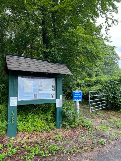
DAVISON WALKING PARK, East Haddam
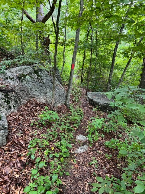
This town-owned property, donated by the Davison family, has a .77 mile lollipop loop trail that circles the top of Cave Hill. There is an information kiosk at the trailhead with maps. I suggest downloading a map HERE in case the box is empty.
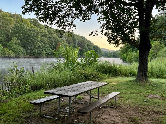
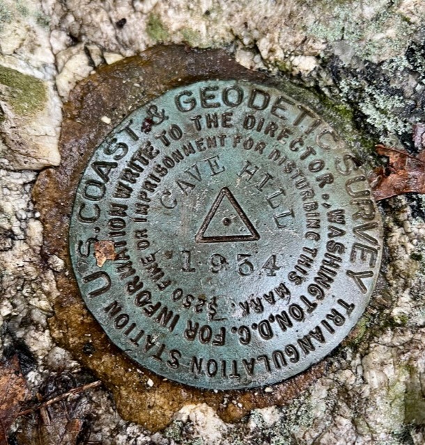
The trail heads steadily up a wide cart path (during WWII there was an observation tower at the top). As you near the top, there is a viewpoint with two picnic tables on your left, although when I visited in August they were quite overgrown. As the path levels out at the top there are rock formations of the same pegmatite material found on Mount Tom, and embedded in a rock in the middle of the trail is the US Geodetic Survey marker for Cave Hill. From this point the trail becomes single track and loops around, following the contours of the ledges with views down to Cave Hill Resort below. It is a generally easy hike with approximately 180’ of ascent. I hope to return in the winter for the views with the leaves off the trees. And who knows, maybe the Moodus Noises will rumble once more.


ADDITIONAL RESOURCES
Recommended websites
Friends of Machimoodus & Sunrise State Parks https://machsunwebsite.wixsite.com/mysite
American Verse Project at the University of Michigan. Read the poem Machit-Moodus by John Brainard in its entirety HERE
Northeast States Emergency Consortium https://nesec.org/connecticut-earthquakes/
Spooky Geology Blog post https://spookygeology.com/moodus-the-place-of-bad-noises/
Article entitled The Industrial Might of Connecticut Pegmatite on the Connecticut History website https://connecticuthistory.org/the-industrial-might-of-connecticut-pegmatite/
Information about Mining on Mount Tom https://www.mindat.org/loc-213294.html
New England Historical Society article https://newenglandhistoricalsociety.com/the-mysterious-moodus-noises-of-connecticut/
Information about the Wangunk Indians https://chathamhistoricalct.org/wangunk-indians/
Connecticut Insider article https://www.ctinsider.com/opinion/article/LOOKING-BACK-Moodus-the-little-town-that-makes-16959111.php
Friends of the Office of the State Archeology. Cave Hill: Noises in Moodus Connecticut https://www.fosa-ct.org/Reprints/Spring2012_CaveHill.htm
Recommended Books and Papers
Stories in Stone: How Geology Influenced Connecticut History and Culture, by Jelle Zeilinga de Boer
Geology of the Connecticut Valley, by Alison Guinness. Estuary Magazine, Winter 2022
Spooky Trails and Tall Tales Connecticut: Hiking the State’s Legends, Hauntings, and History, by Stephen Gencarella, 2019. (Gencarella is a professor at UMass Amherst with a focus on New England folklore)
Legendary Connecticut: Traditional Tales from the Nutmeg State, by David E. Philips
Moodus Noises, by Jocelyn Gorham, Paula Weiss and Steven Zendell, for History 181 with S, Byson and J. de Boer. 12/18/1979. Unbound paper, Brainerd Memorial Library.
For a deeper dive into the geology, I located an abstract for a book online. The book (2013) is titled “Recent Advances in North American Paleoseismology and Neotectonics East of the Rockies.” The relevant chapter is titled “Evidence for post -Triassic brittle faults in eastern Connecticut and south-central Massachusetts using LiDAR, geomorphic, and geophysical data combined with field observations: Implications for the origin of the Moodus area seismicity”, written by Ronald T Marple, Robert J. Altamura, Shelton S. Alexander and James D. Hurd.
Questions? Email me at naturenerdsramble@gmail.com or find me on Instagram @the_real_nature_renee.
Subscribe to Trail Talk
your next adventure awaits
